Washington – Thursday, August 8
Tula and I took a short walk around the campground, then I made some oatmeal (complete with blueberries, walnuts, cinnamon and nutmeg) and packed up. We walked another mile down by one of the beach area before leaving the state park. I wanted to find out a little more about the ferry system throughout Puget Sound, and managed to get a human being on the phone, and he explained the different routes and times. I made a reservation to take the ferry from Whidbey Island to the Olympic Peninsula part of Washington mid-afternoon, knowing there were later ferries in case I missed my time.
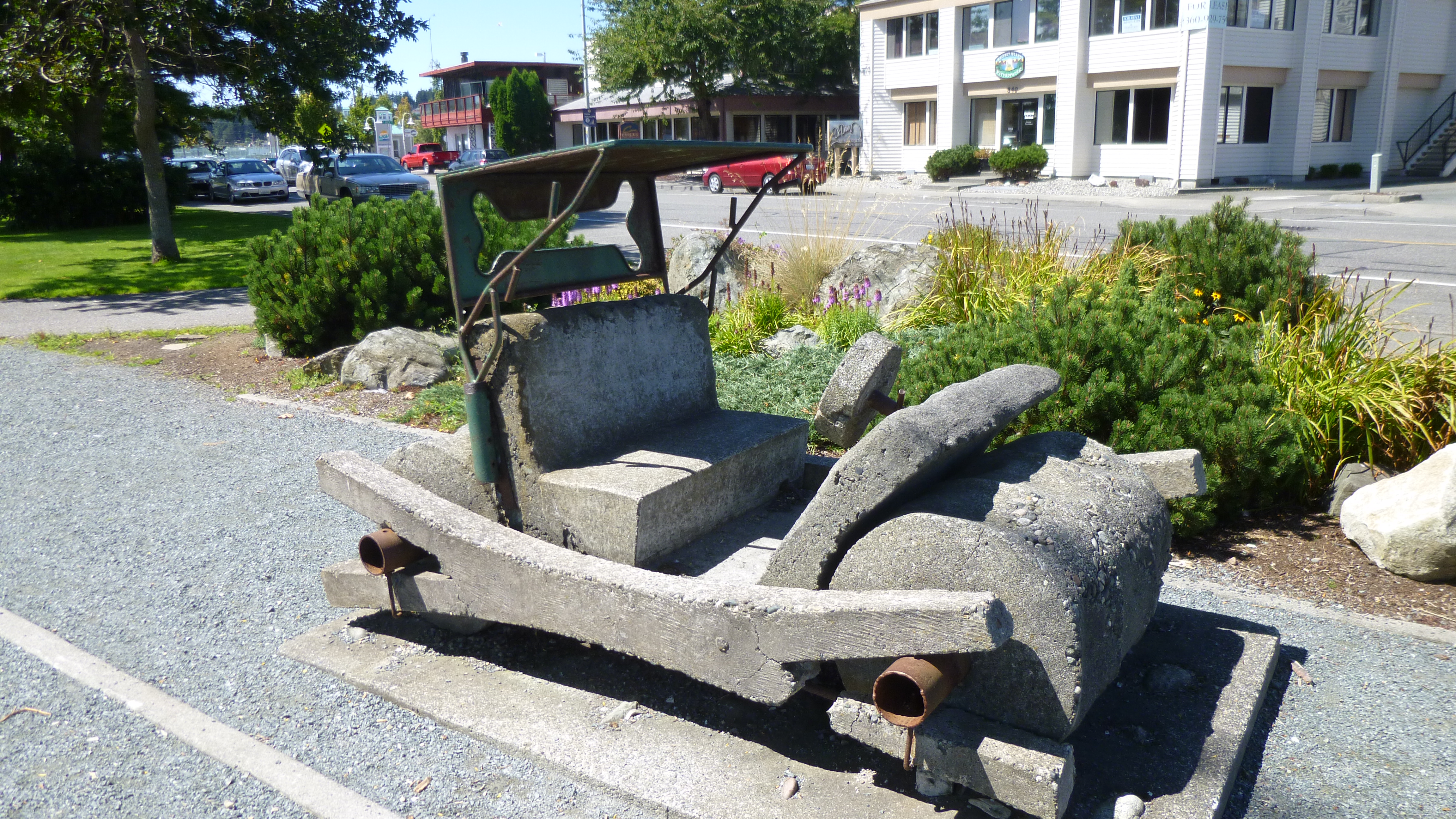
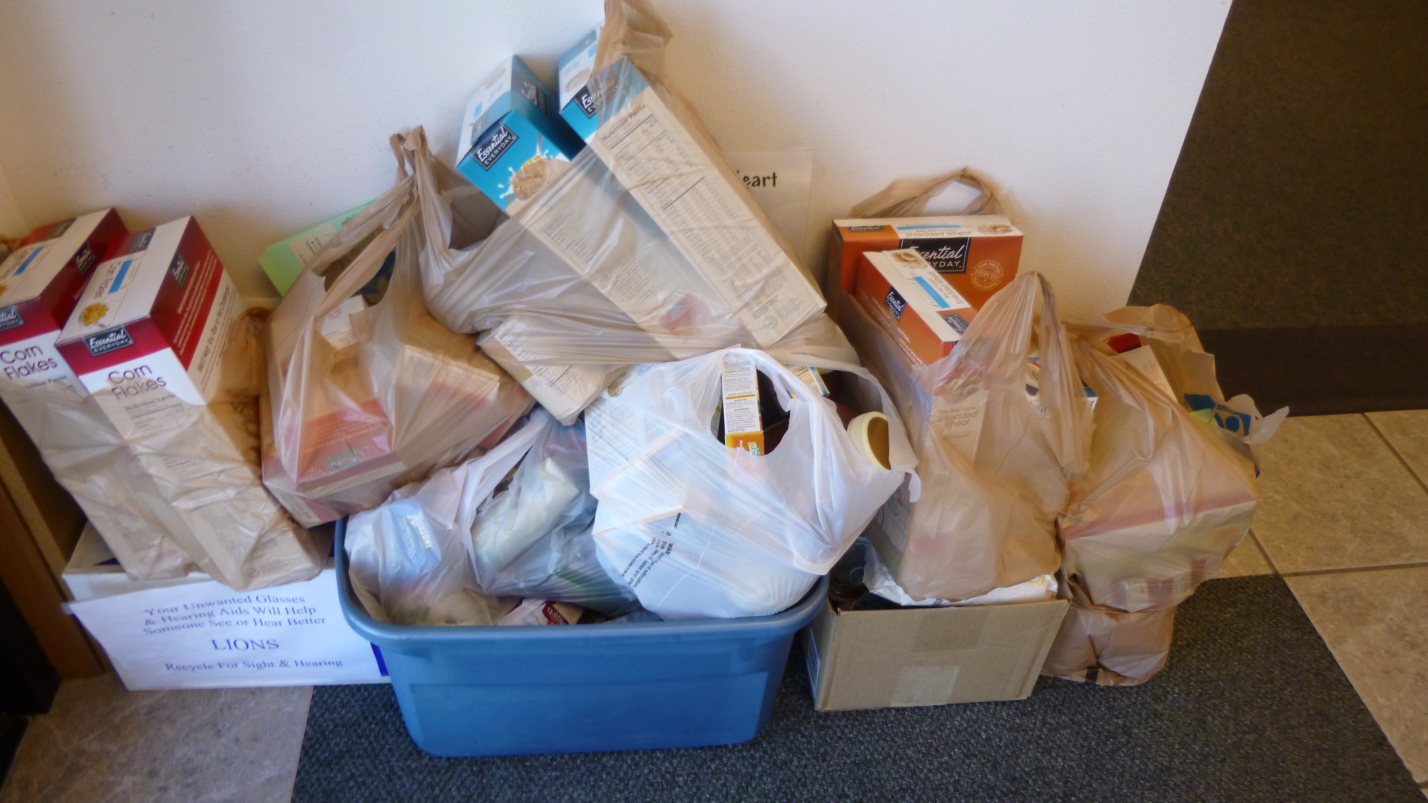
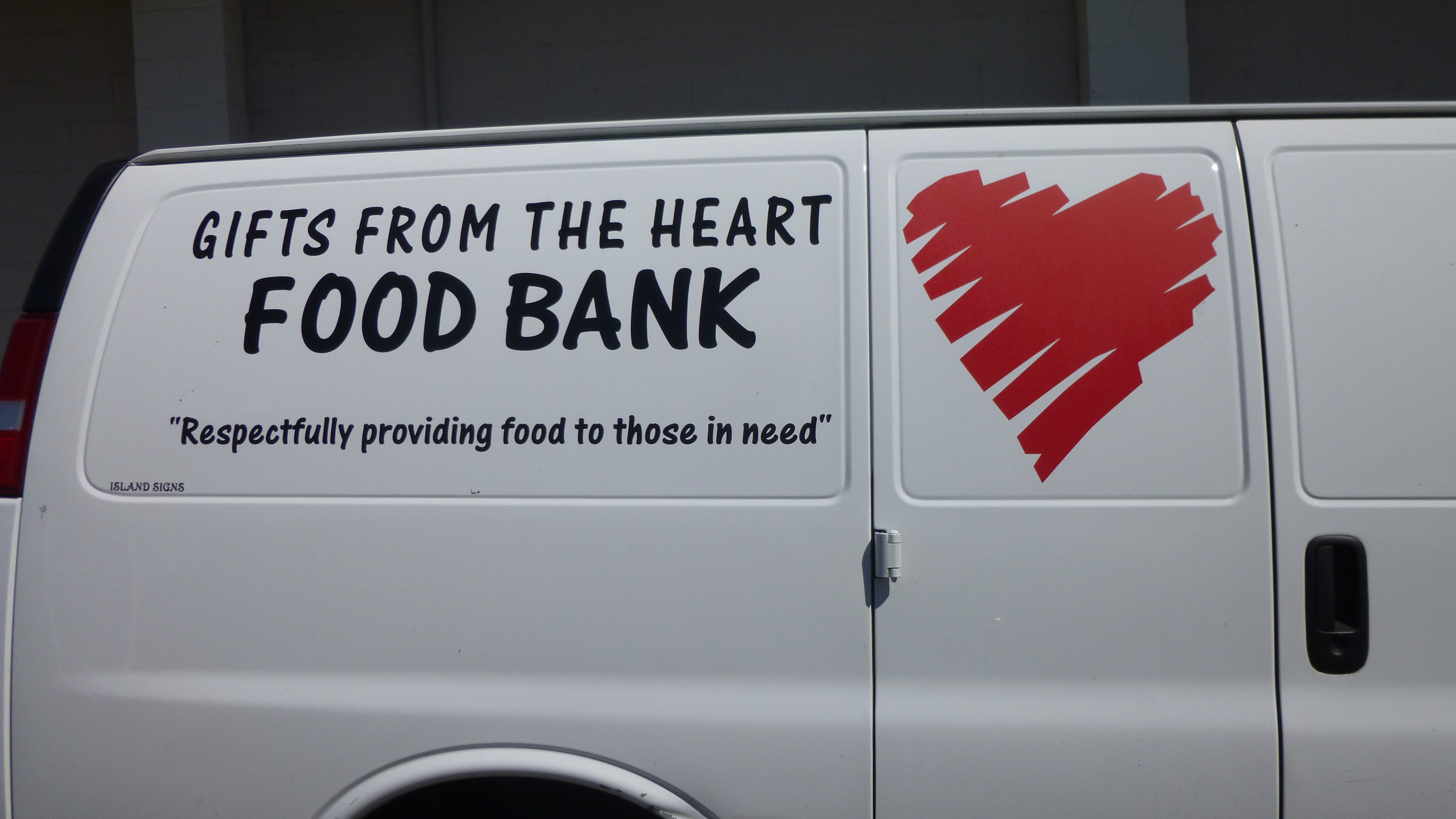
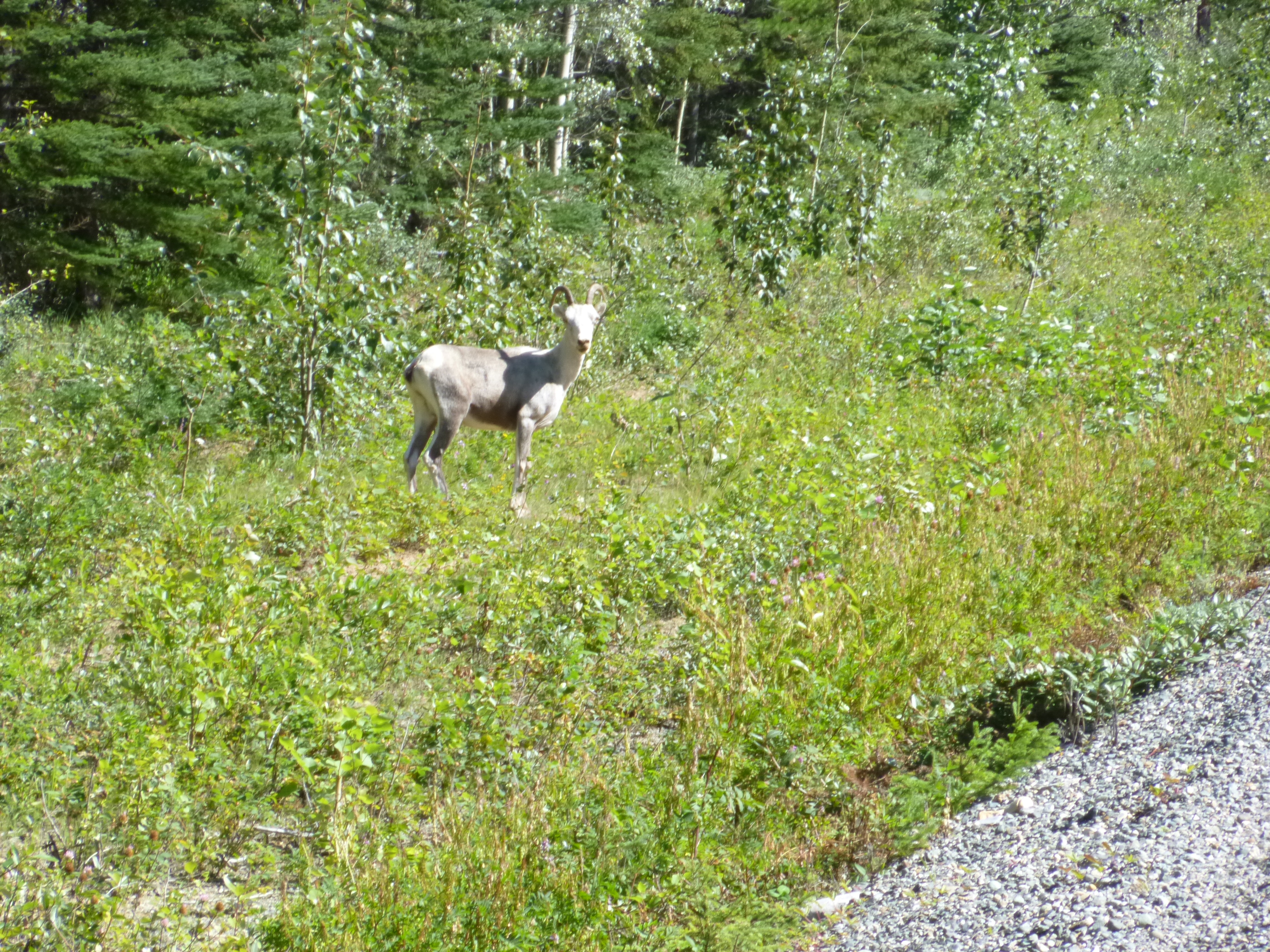
After I was set with that reservation, I headed south on Whidbey Island toward the town of Oak Harbor, where we got out for 2 1/2 miles of walking by the water. Oak Harbor was settled by the Dutch, and there’s a windmill in one of the parks. I walked along a boardwalk, and then came across a concrete version of a Fred Flintstone car – hmmm! I continued on to Coupeville, where I was going to make my donation to the Gifts from the Heart Food Bank, which serves central Whidbey Island. They are not open every day, but their website said non-perishable foods could be dropped off any time at one of 5 different places in town. So I went shopping for non-perishable goods and got cereal, oatmeal, spaghetti sauce and pasta, canned pasta, mac and cheese, and canned chicken and tuna. Then I found the Whidbey Island Bank, and one of the ladies showed me the box that was set out for donations. It only had a couple things in it – I added all my shopping bags and overflowed the box!
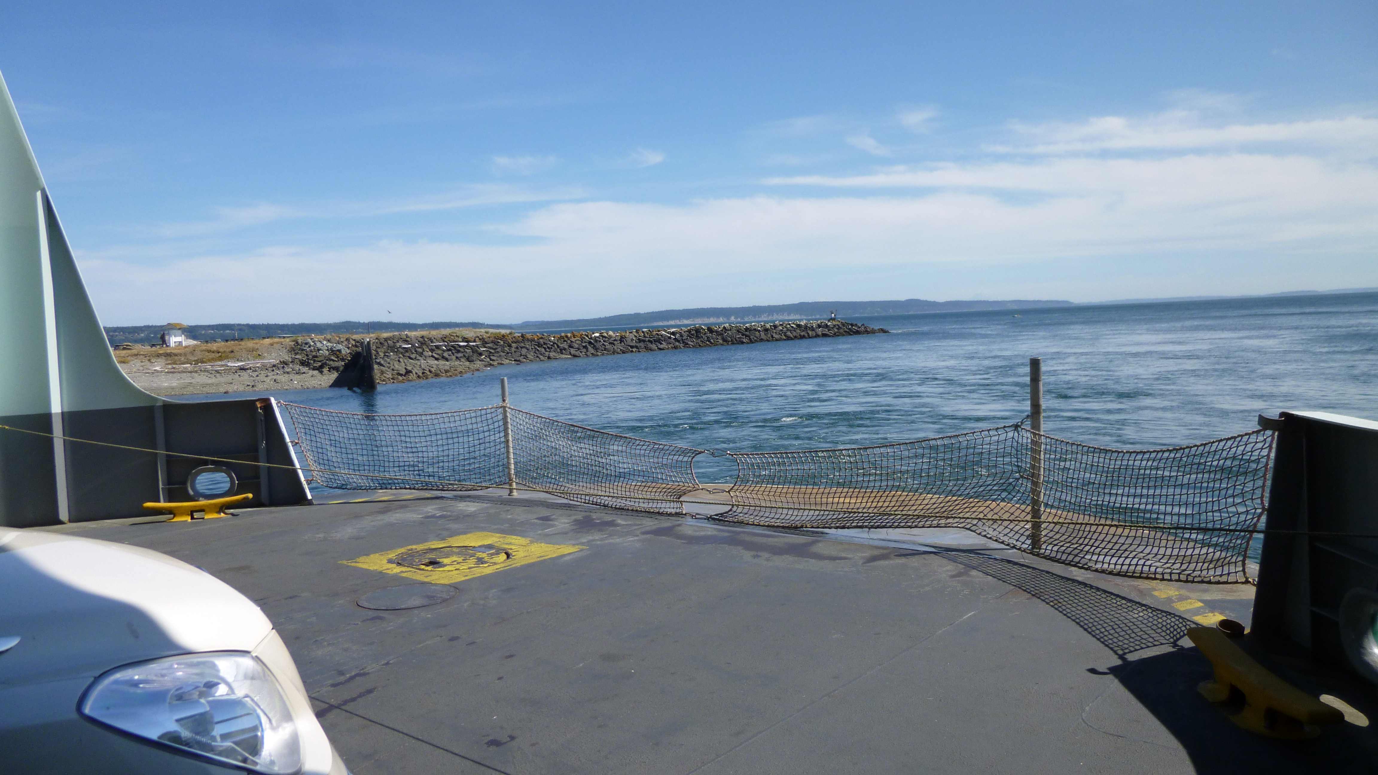
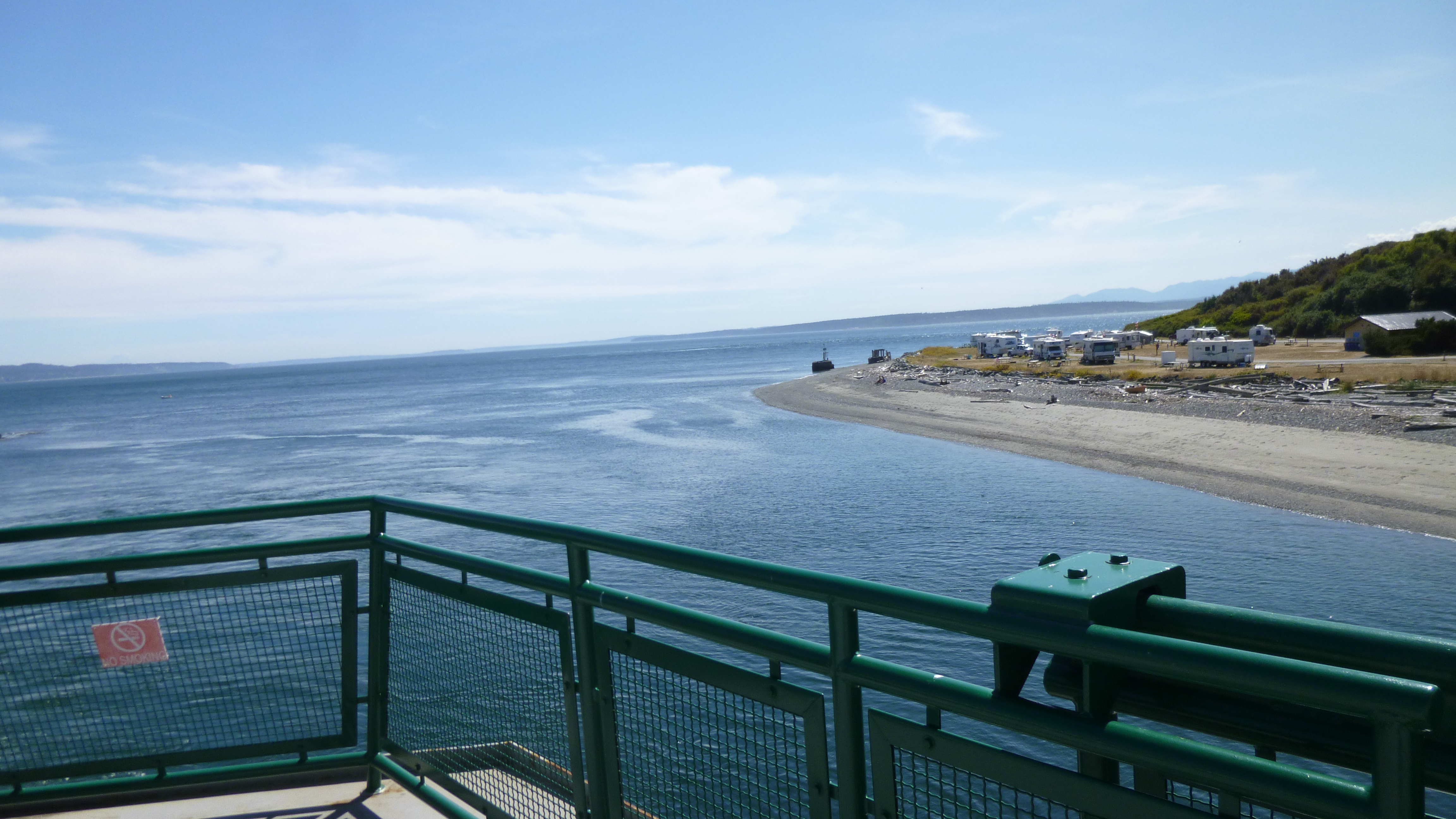
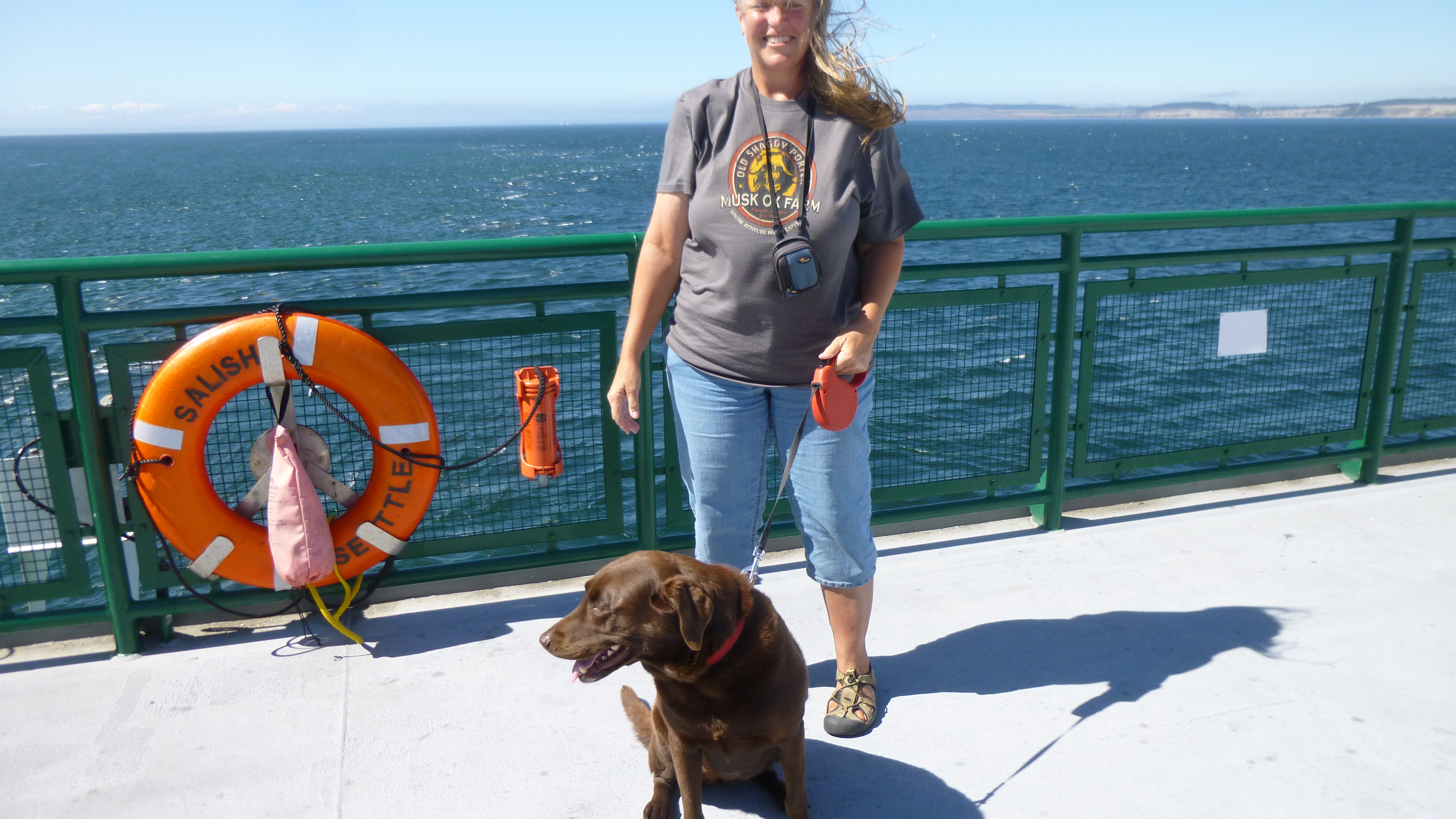
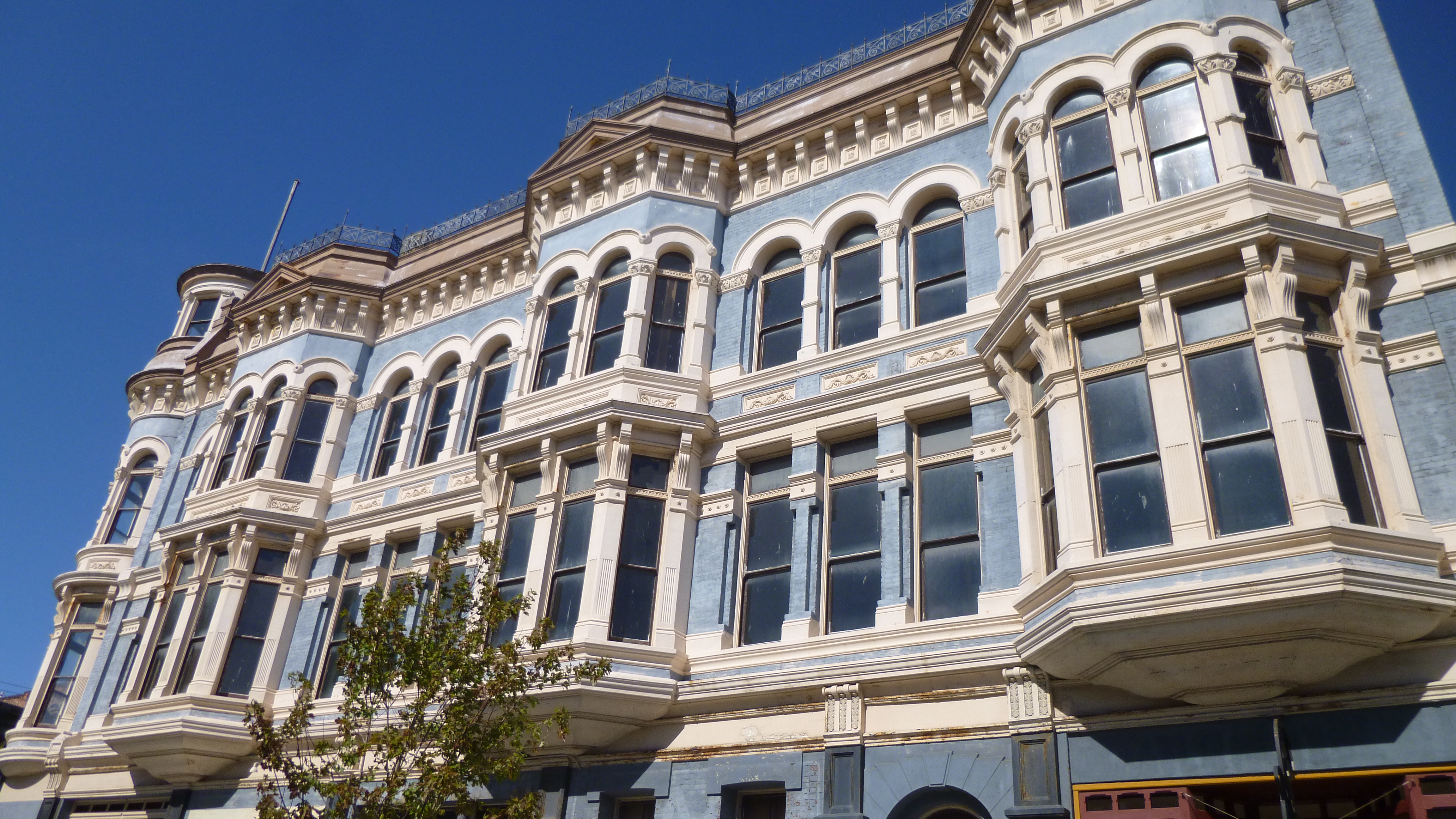
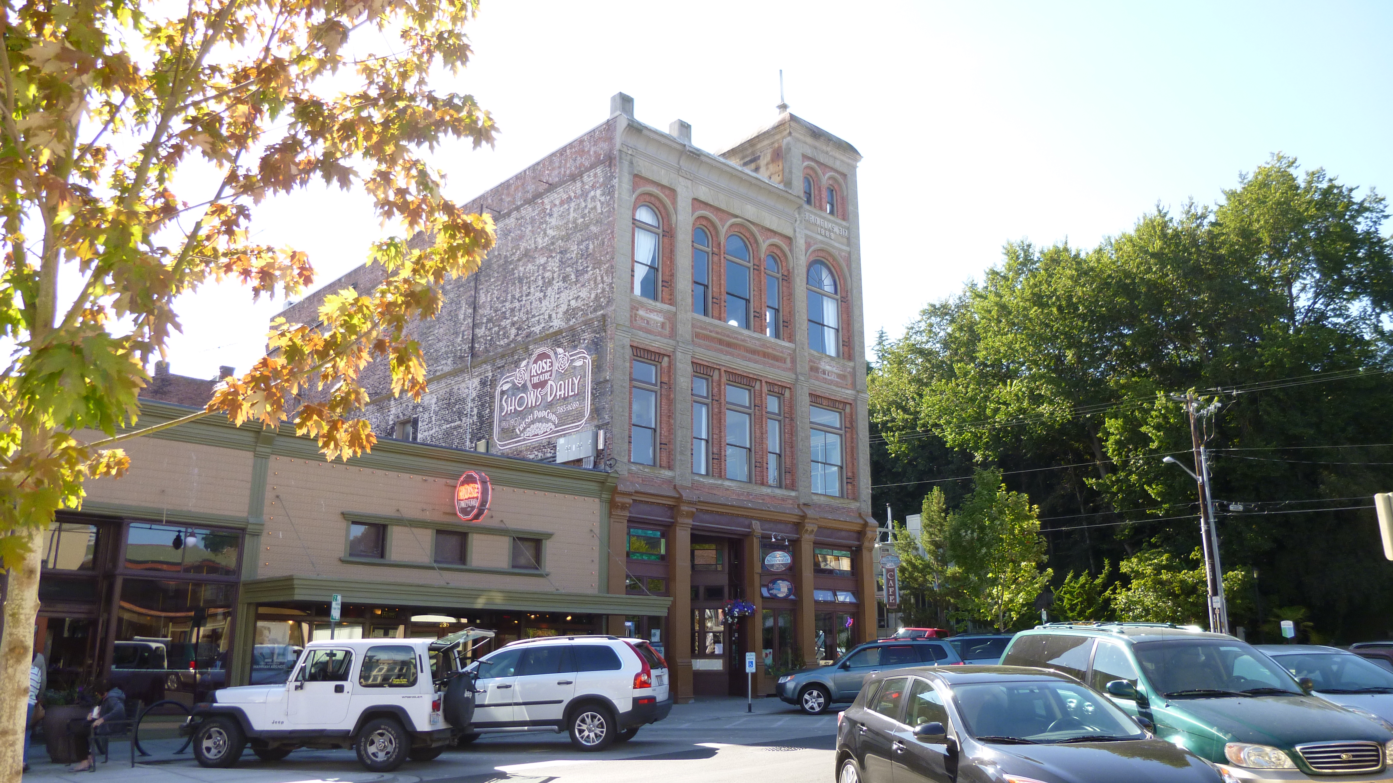
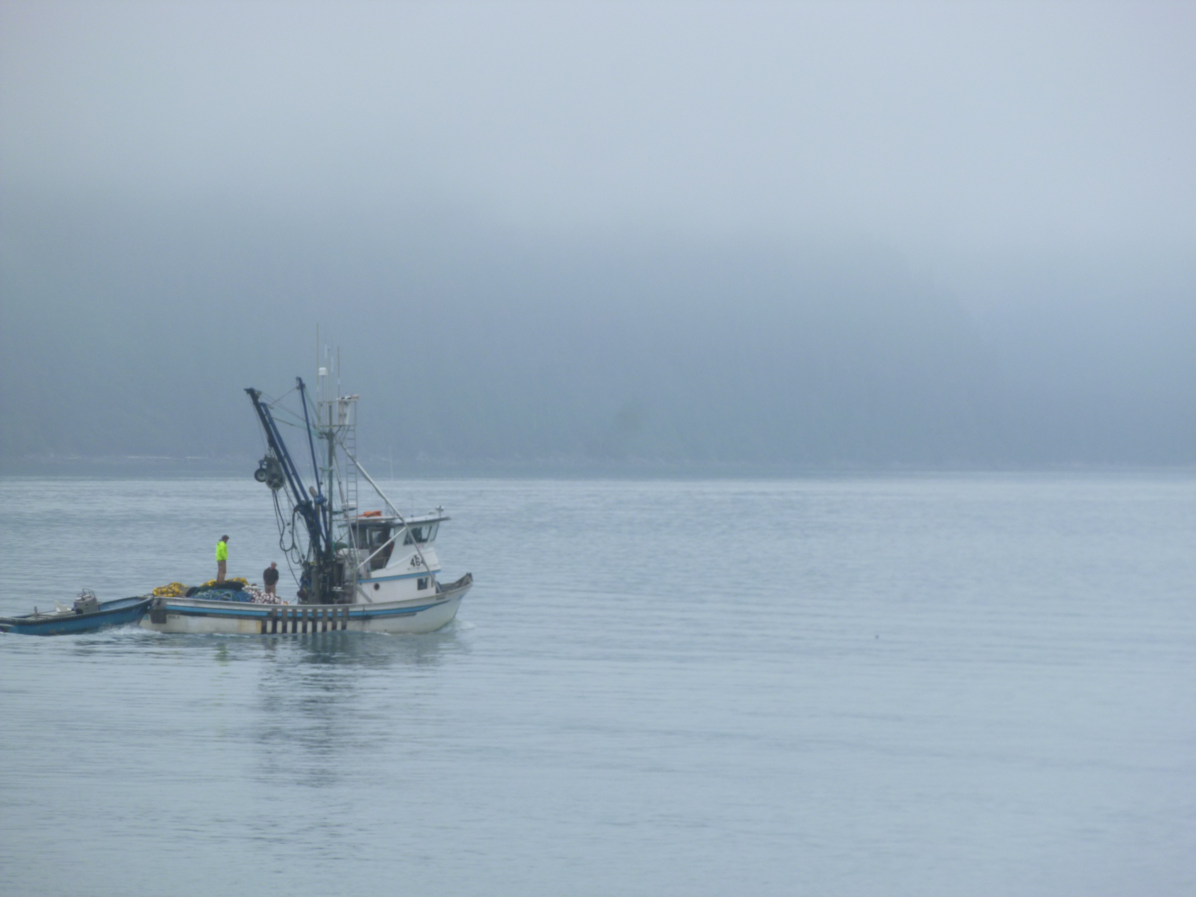
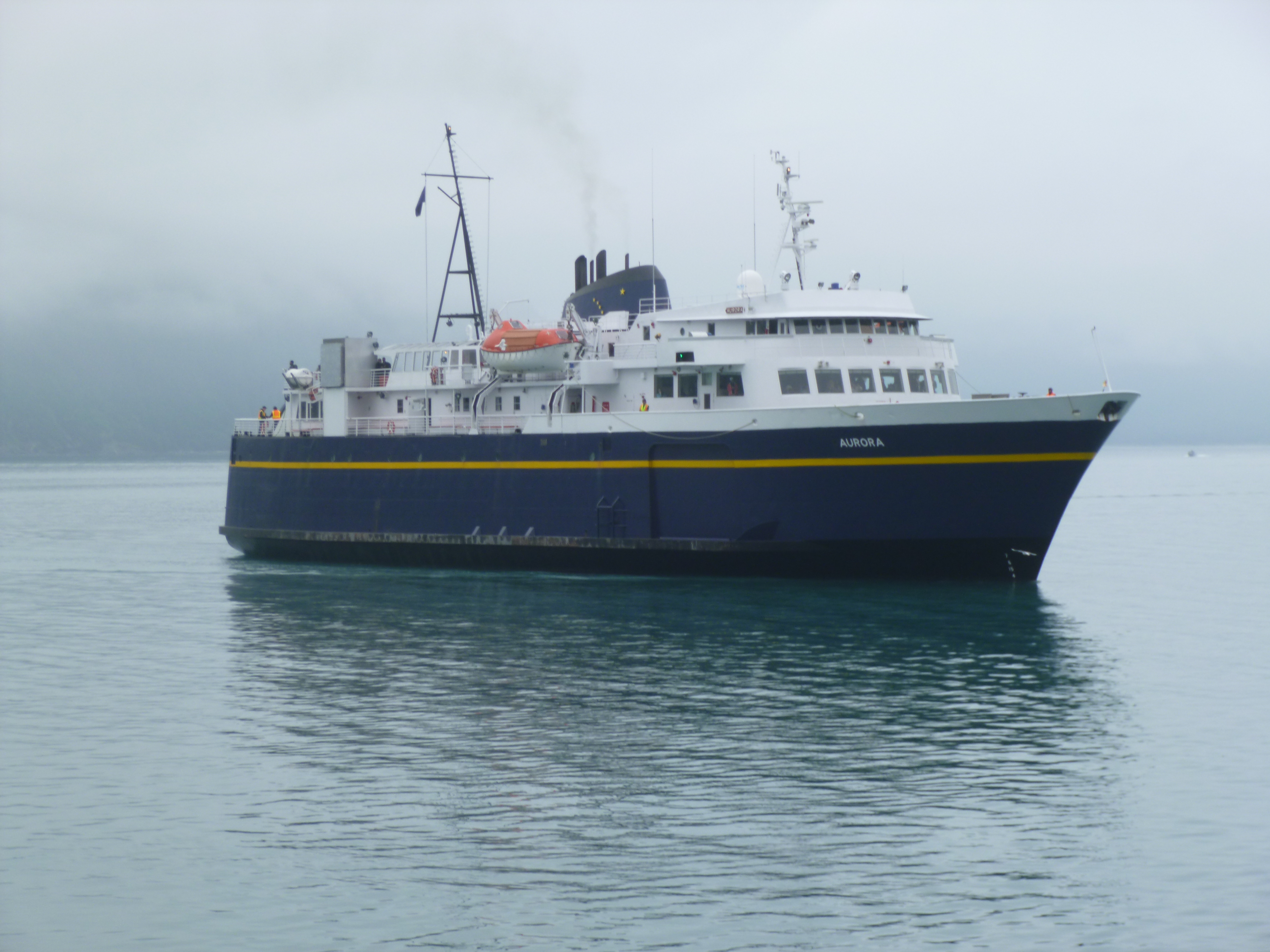
At this point, I figured I was going to miss my ferry, especially since the ferry dock was quite a ways outside of town, but I drove down there anyway, and squeezed on at the last minute – if I hadn’t had a reservation, I would have had to wait for the next one. They’re very efficient at loading the vehicles onboard, and it’s a wonderfully convenient way to travel around some of these towns that surround the Sound – very reasonably priced, and it saves many miles of driving around the long way. The ferry I was on was taking me to Port Townsend, and it was about a half hour trip. Dogs are allowed in most areas on the boat except the enclosed level that serves food, so I took Tula up to the sun deck and she was a little unsure of the rocking motion, but found her sea legs quickly. The trip was over quickly, and I drove off the ferry into the town of Port Townsend, where we got out and walked about 1 1/2 miles through the historic part of town, and out by yet another marina. Port Townsend was one of the biggest towns in the area in the 1800s, and there were lots of big old Victorian homes and buildings to look at as I walked around.
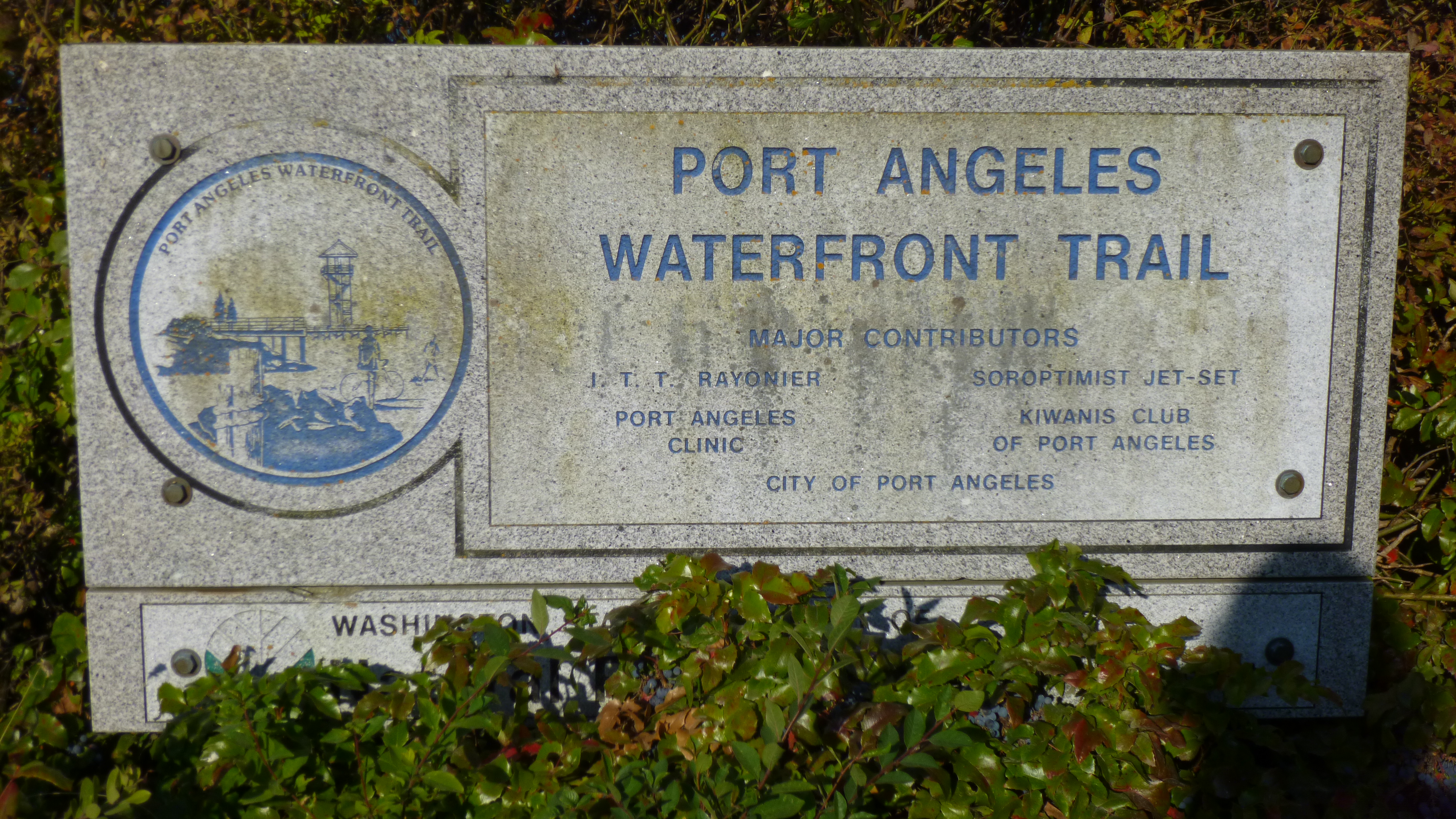
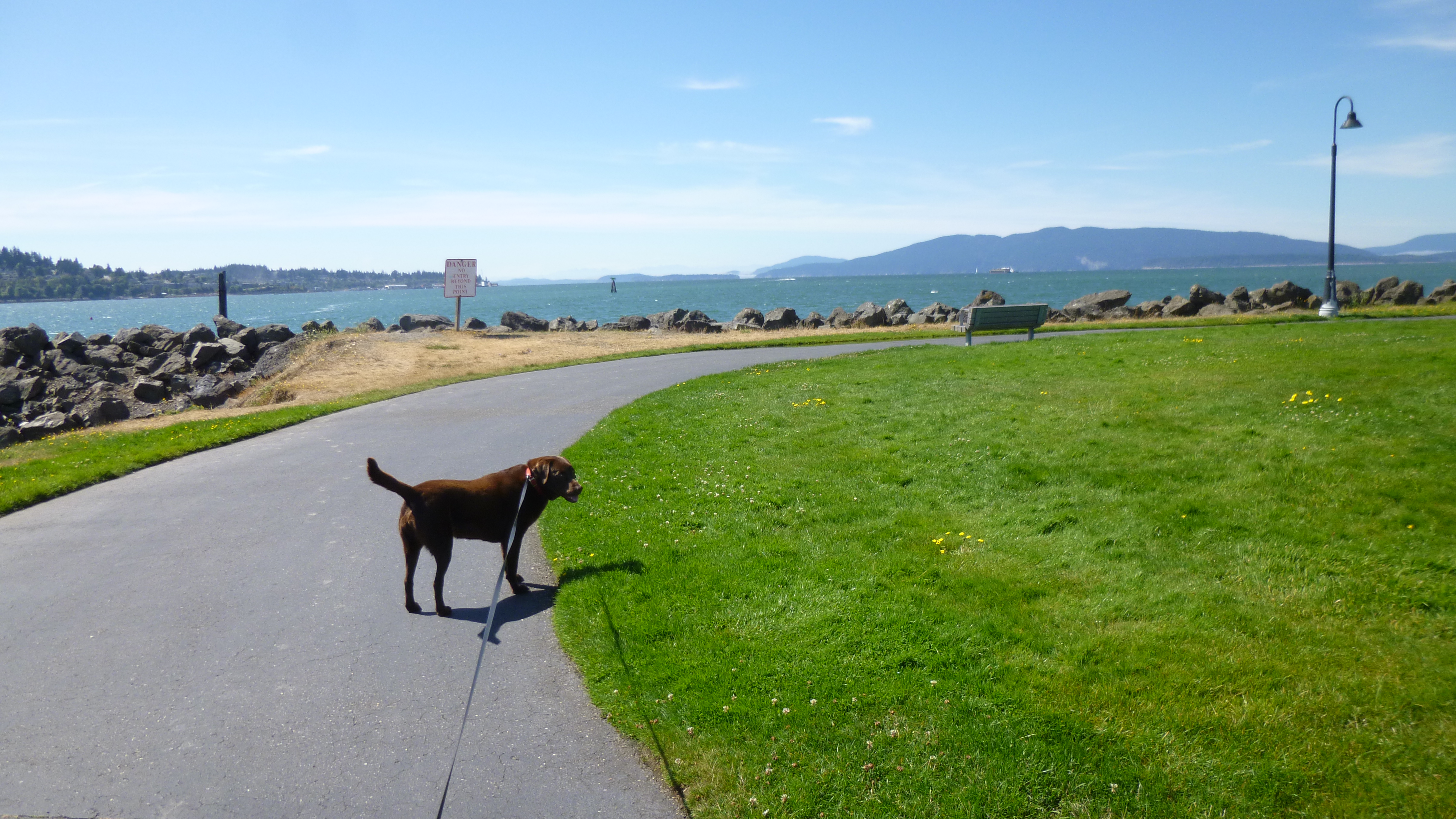
Then I headed west along the waterfront to the town of Port Angeles, where I decided to stop for the night. The next small town was far away around the peninsula, and both the motel and campground there were full, so I figured I better stop while I could find a place. After I got checked in, Tula and I headed down to the waterfront, where we found a bike trail, and walked 3 more miles to finish off our walking for the day. Port Angeles can be a busy place – it was quiet this time of day – but the ferries run back and forth between the U.S. and Canada, so there are customs and immigration offices by the docks, and a number of freighters and pleasure boats out – it’s all about the water in this town!


Washington – Wednesday, August 7
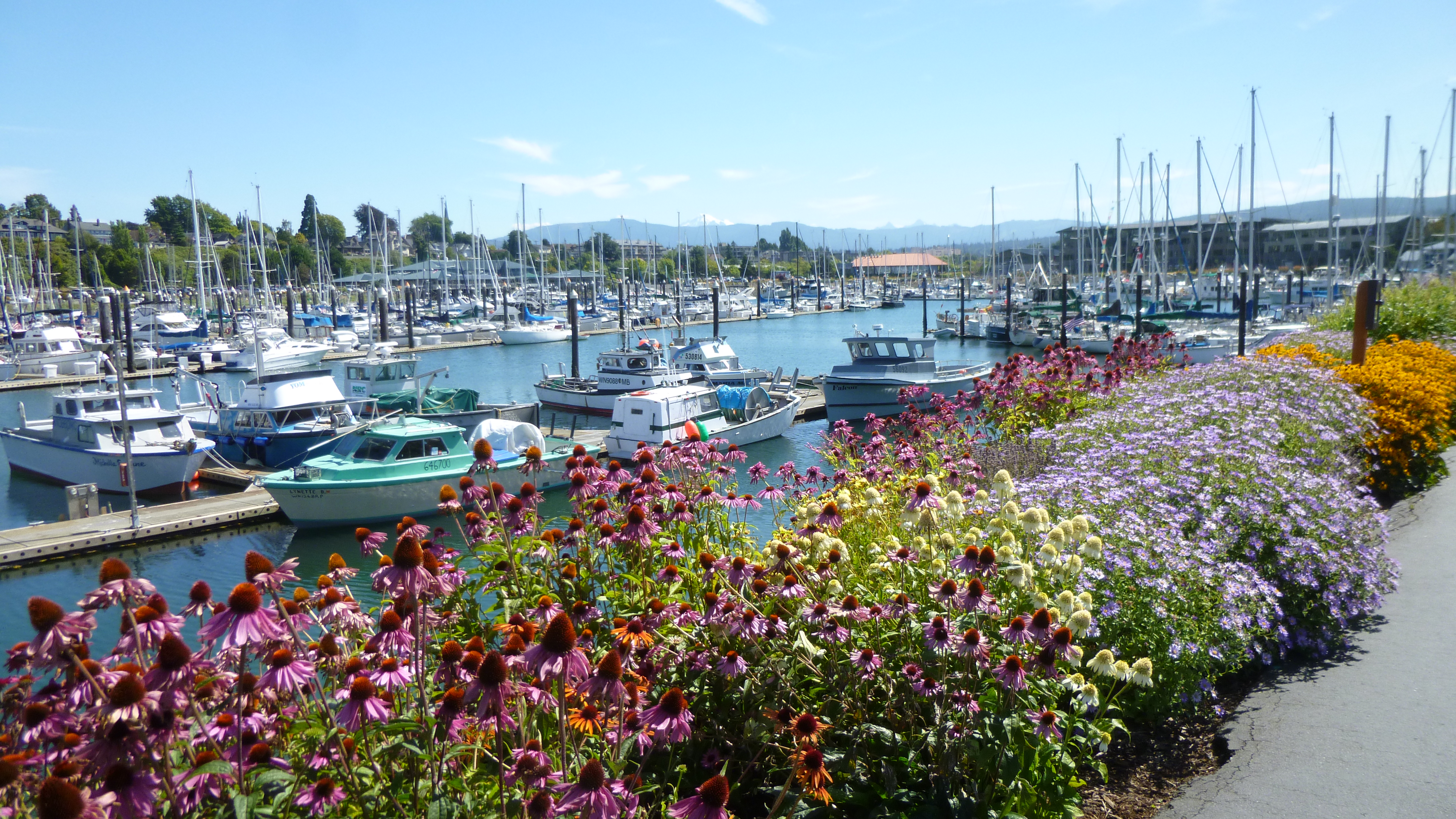
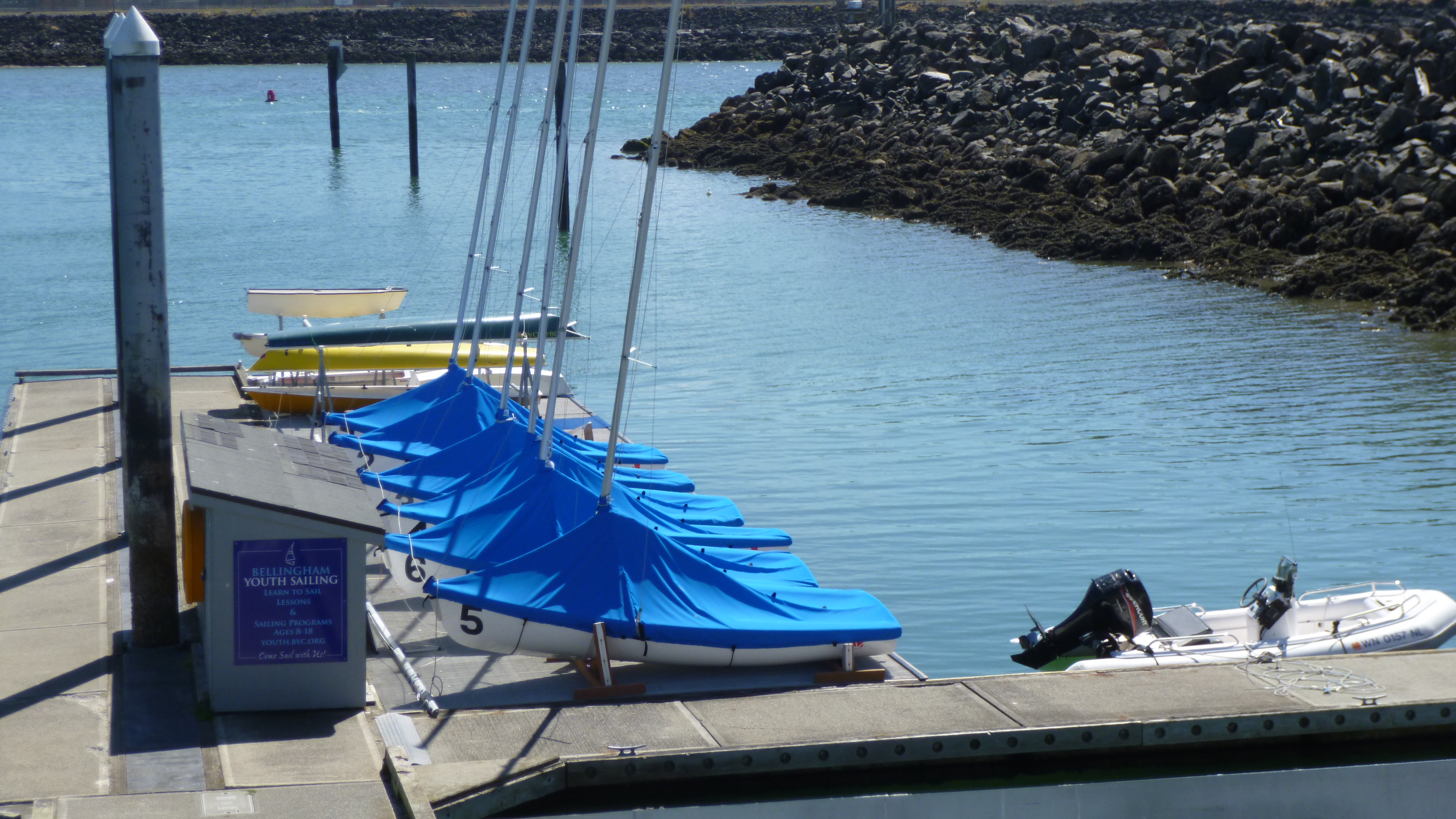
I ended up in Bellingham last night, which is on the water – part of the many inlets, coves and bays of Puget Sound. After I had packed up, I headed toward the water, hoping to find some good walking paths, and I was not disappointed! Tula and I walked almost 4 miles along the water – past a couple marinas, and colorful flowers galore, and around a park on a little peninsula. There was also a memorial to the fishermen who went out to sea and never came back, and I saw the area where the youth sailing program takes place, with about a half dozen little sailboats all lined up for the next class! It was a perfect summer day, and there’s nothing like a good walk by the water on a sunny day!
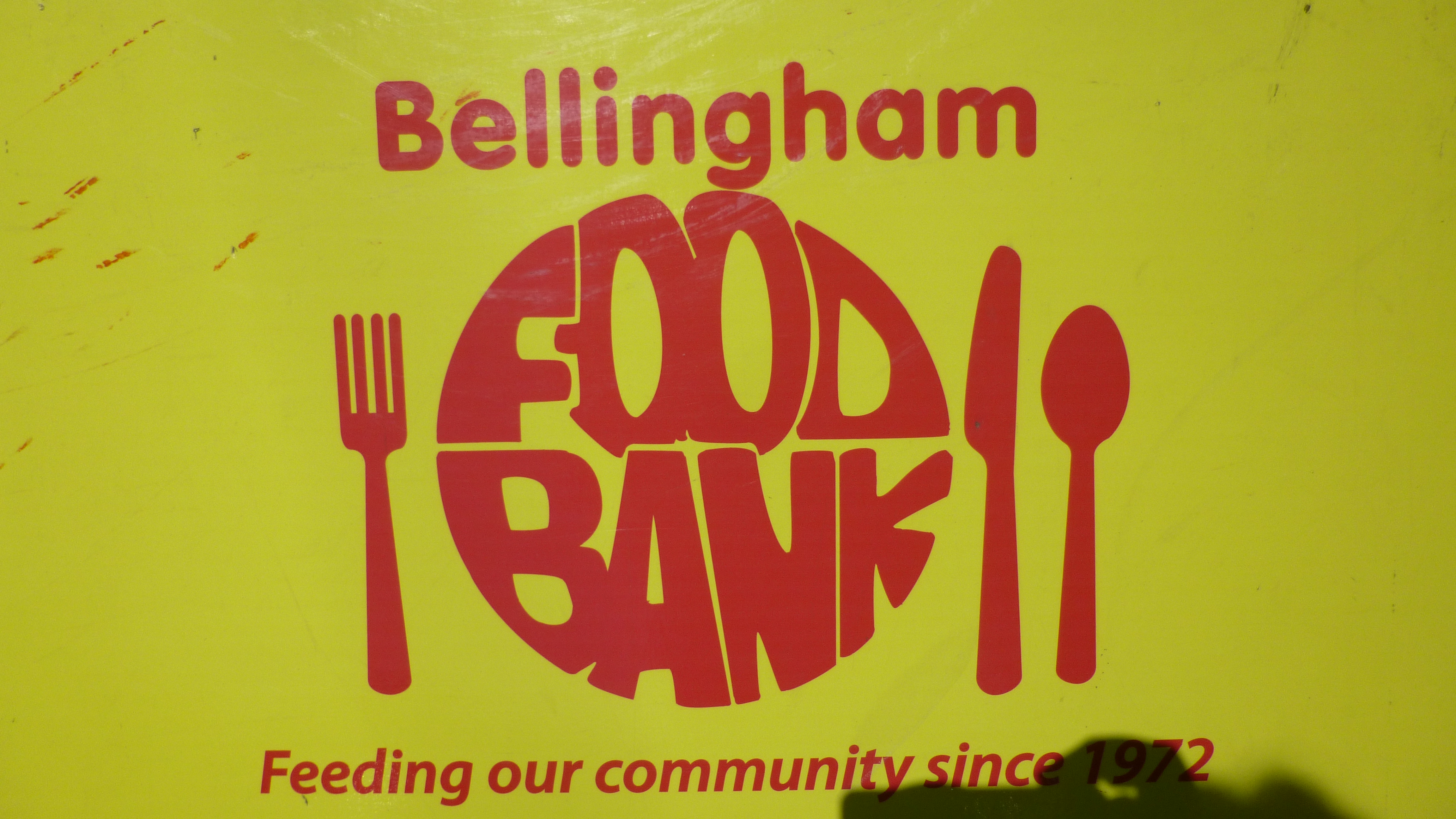
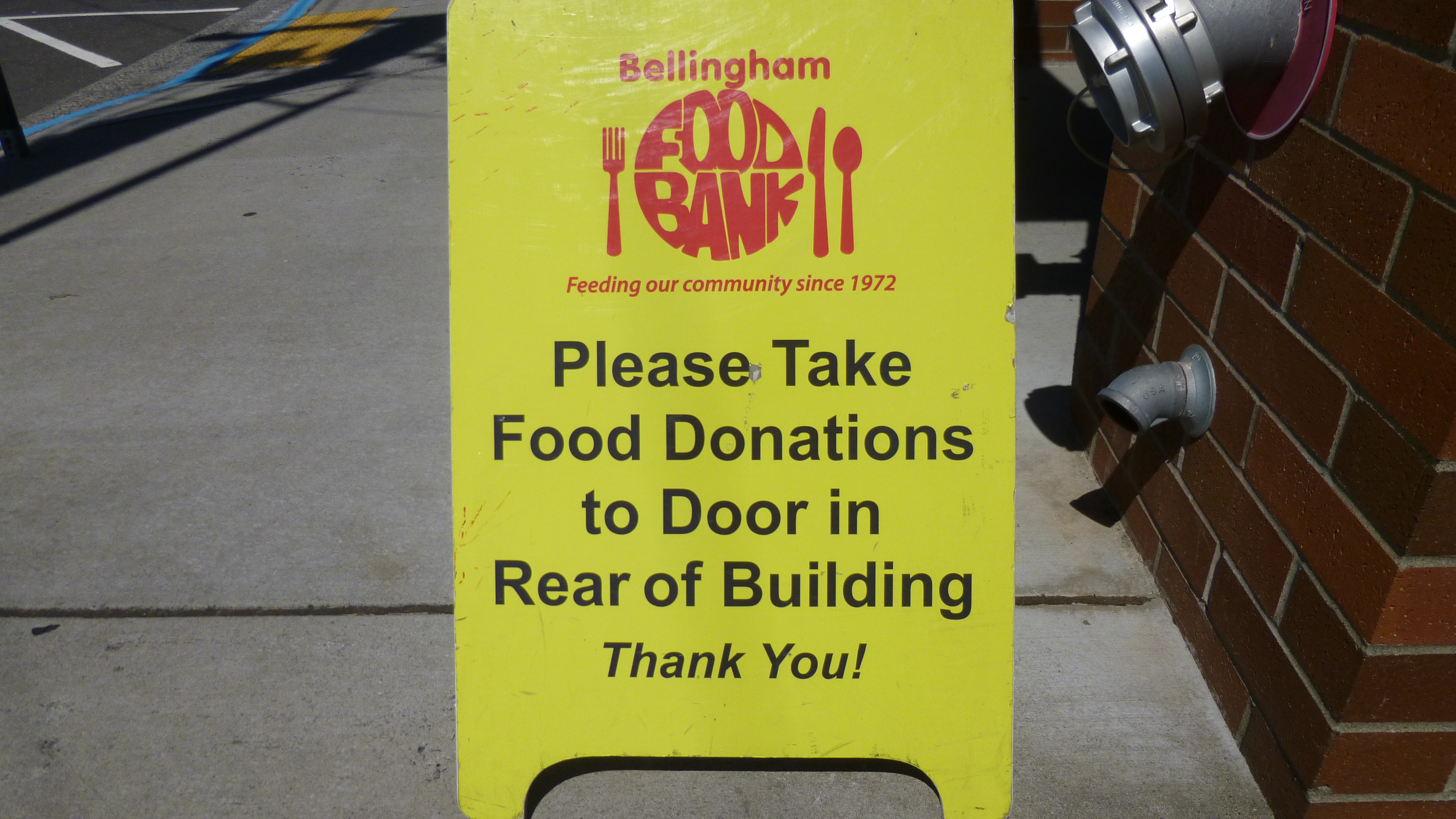
Then it was time for my donation-of-the-day. I had researched some possibilities on the computer, and read about several programs which are run by the Bellingham Food Bank. I called them and spoke to a lady who told me a bit more about the different programs, and I couldn’t decide which one to support, so I took her suggestion, and made 1/2 my donation to the Milk Money program, and the other half to the Food4Tots program. I drove over to the food bank, and met Nina. She told me that last month over 12,000 people had visited the food bank, and statistics show that roughly 35% of the people in need are children, and they feel strongly about giving milk to as many clients as they can. Sometimes they go through 700 half-gallons a week. They get milk from locally-owned dairies, and get a better price through them than I would be able to get at a store, so my donation was a check, instead of shopping for milk. And the Food4Tots program concentrates on getting baby food, something that is often overlooked in food drives. So I was happy to be able to help a little with those 2 programs.
Then I drove south a bit and headed out to Anacortes, a seaside town on one of the many little islands that dot Puget Sound. Anacortes was a cute little town to walk through, and there was a farmer’s market going on, and I bought some more blueberries and some of the biggest blackberries I’ve ever seen. Yum! I walked another 2 1/2 miles around town – there was a marina here too of course. Anacortes calls itself the salmon canning capital of the world, and even the garbage cans in town are painted like replicas of old-style cans of salmon. I also saw a snagboat, which I’ve never heard of before. In the early 1900s when there were a lot of sternwheel paddleboats in the Puget Sound and its rivers, many of them could navigate through very shallow water. However, there was frequently a lot of debris in the river like sunken logs and rocks and that sort of thing, and those could pierce the hulls of the sternwheelers. So the US began to build snagboats, and their job (with crews up to 14 people) was to keep the rivers and waterways clear of debris, and they had equipment on them that could deal with logjams and any other stuff they night find (including an occasional cow that would wander into a river and not be able to get back out!). I also did a little shopping for some groceries and dog food and ice – I was going to be camping again!
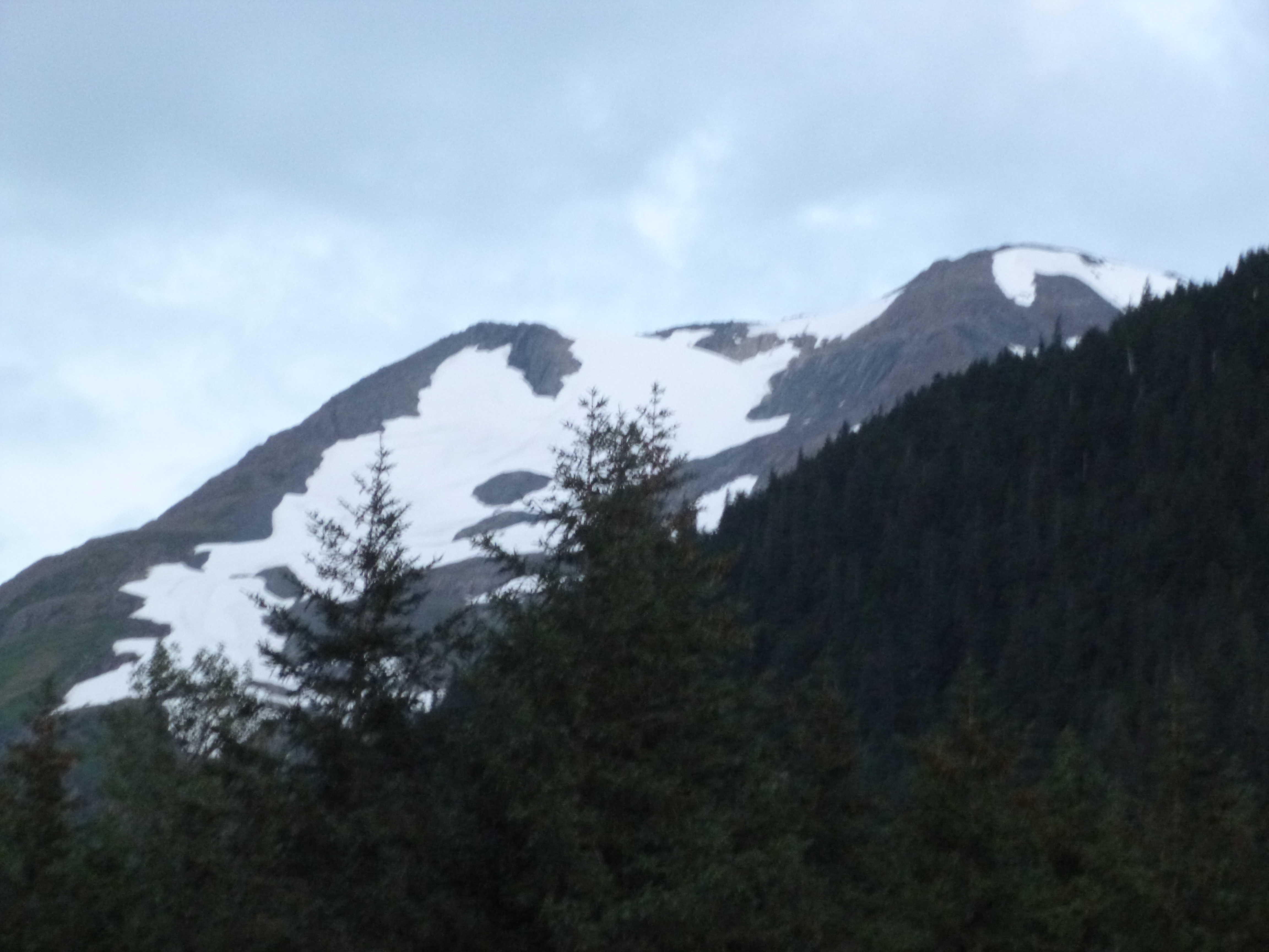
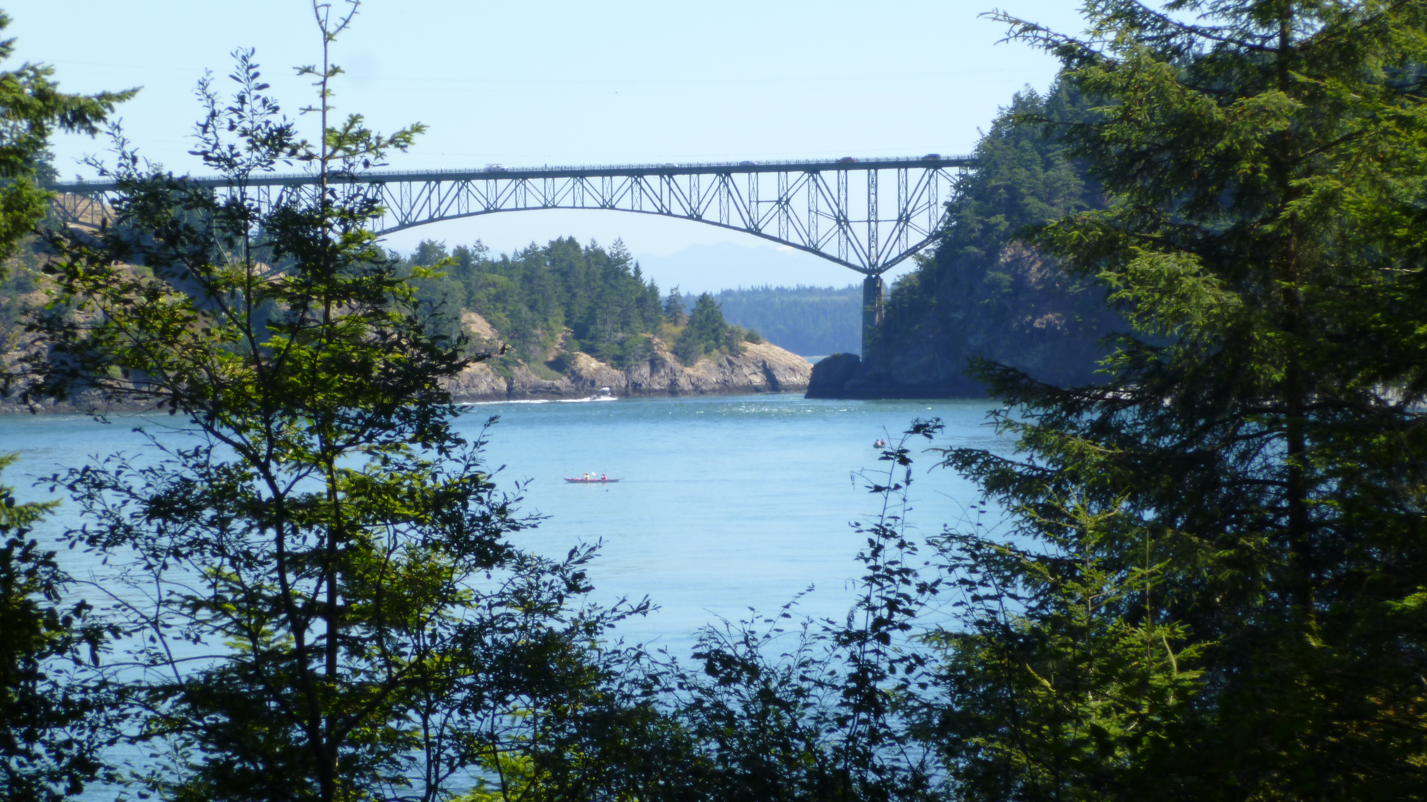
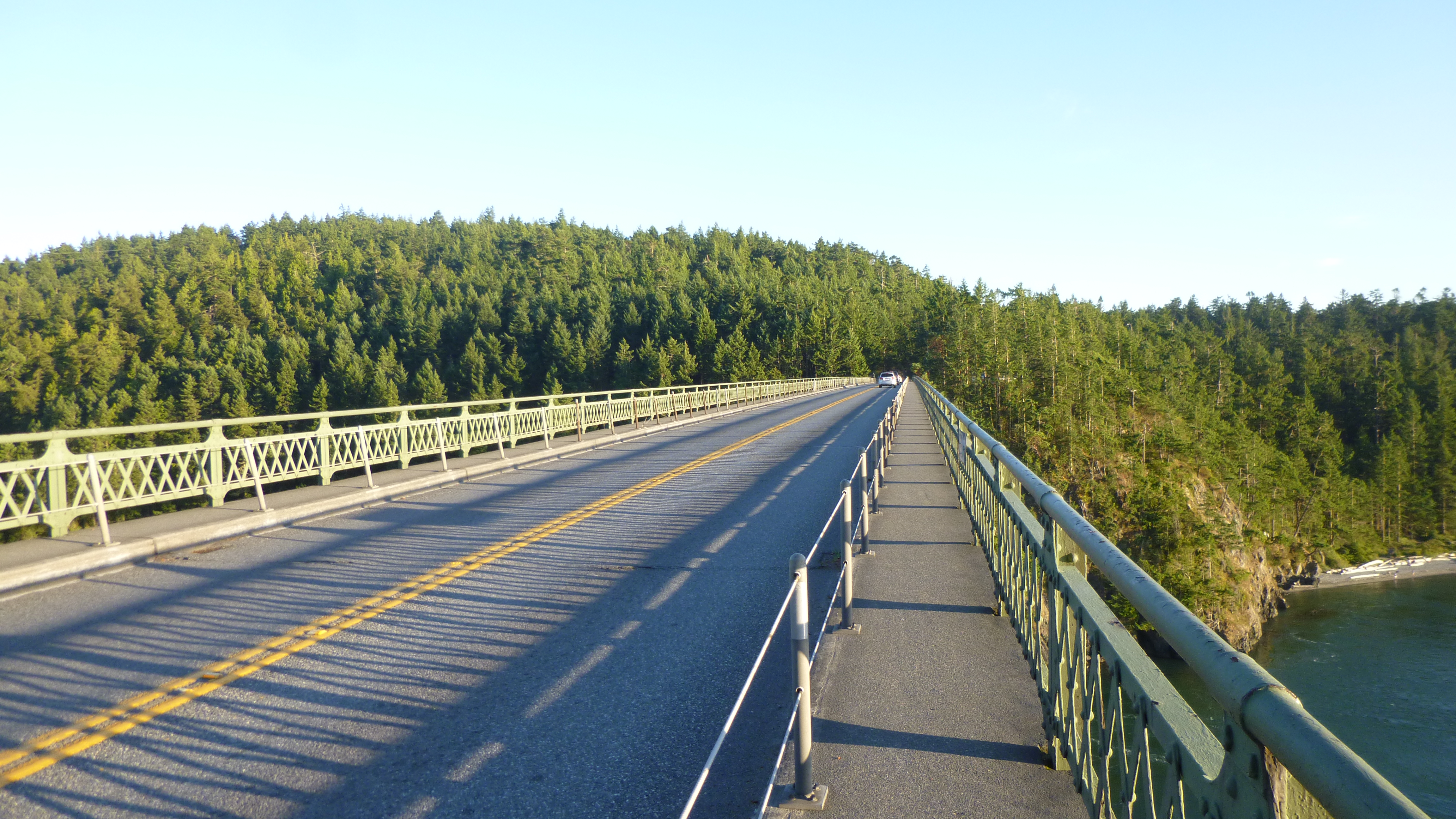
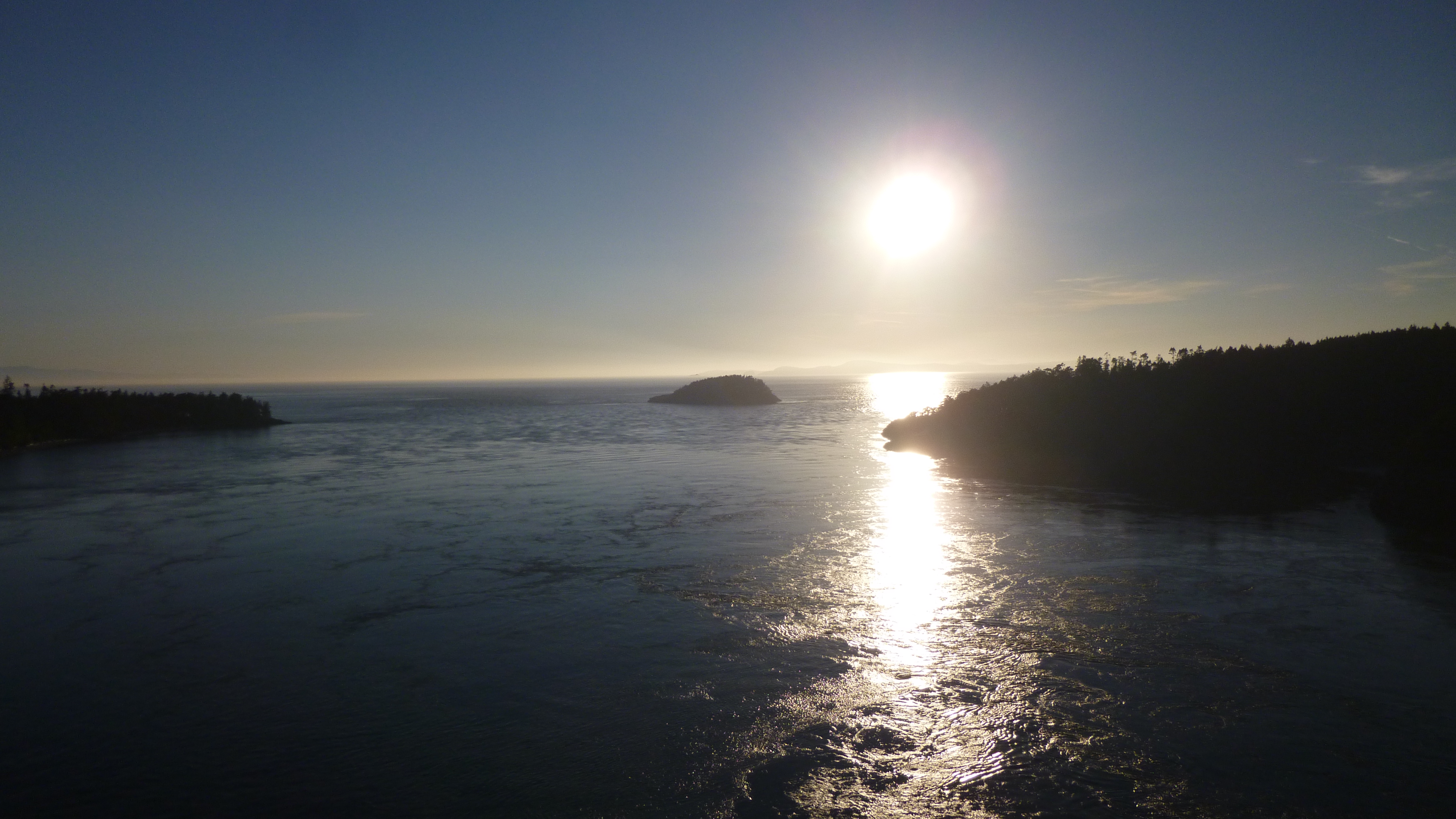
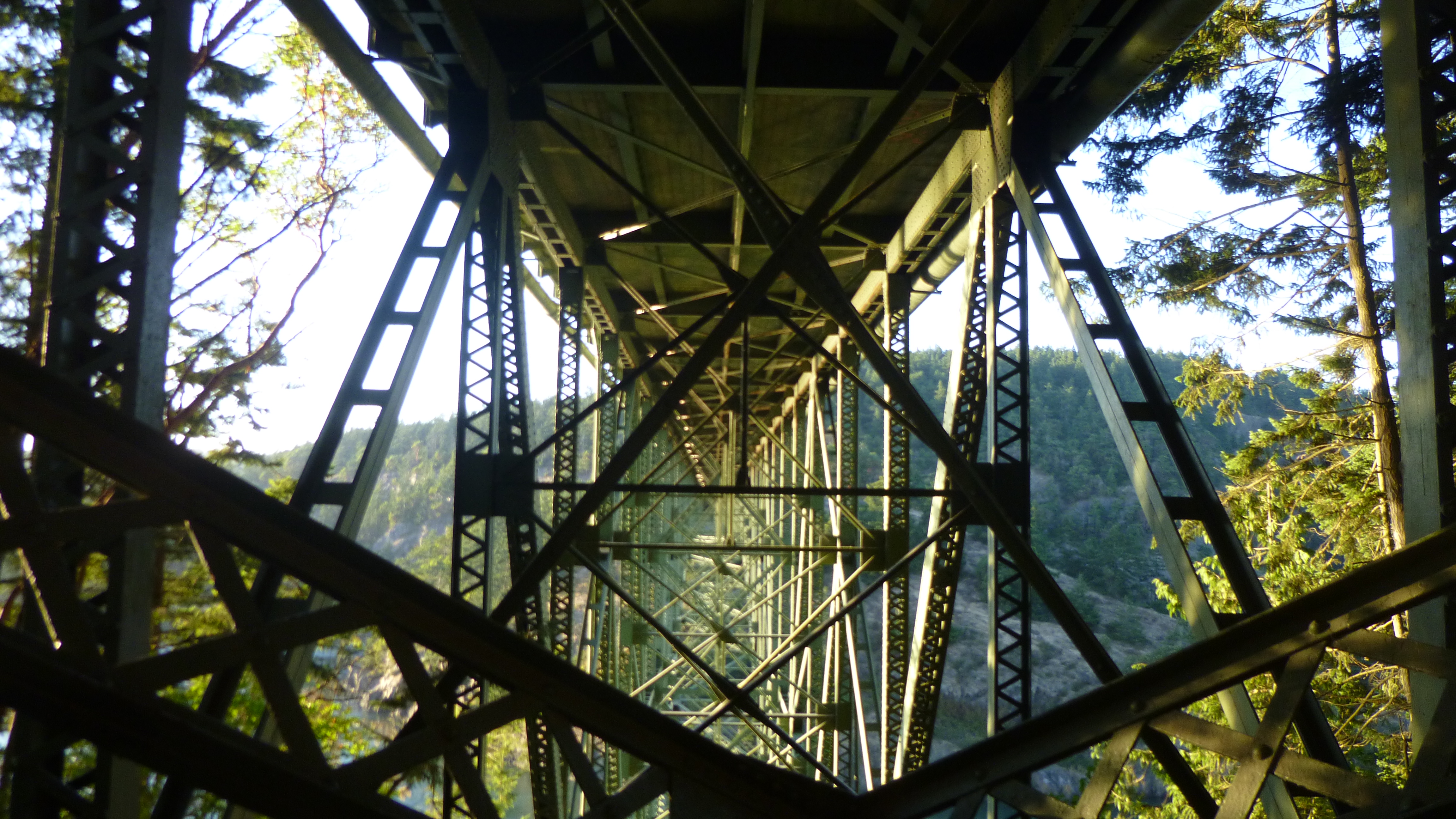
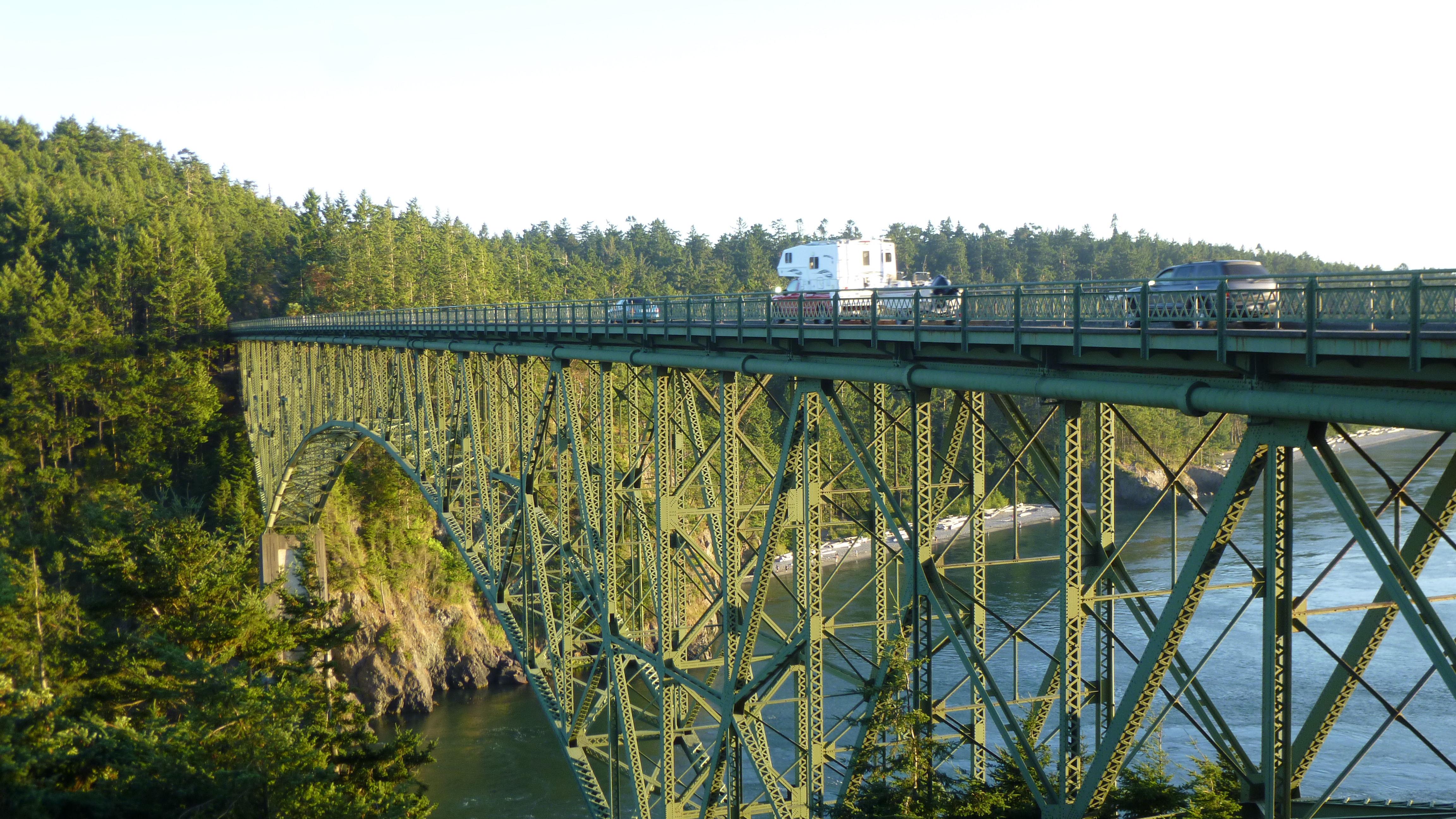
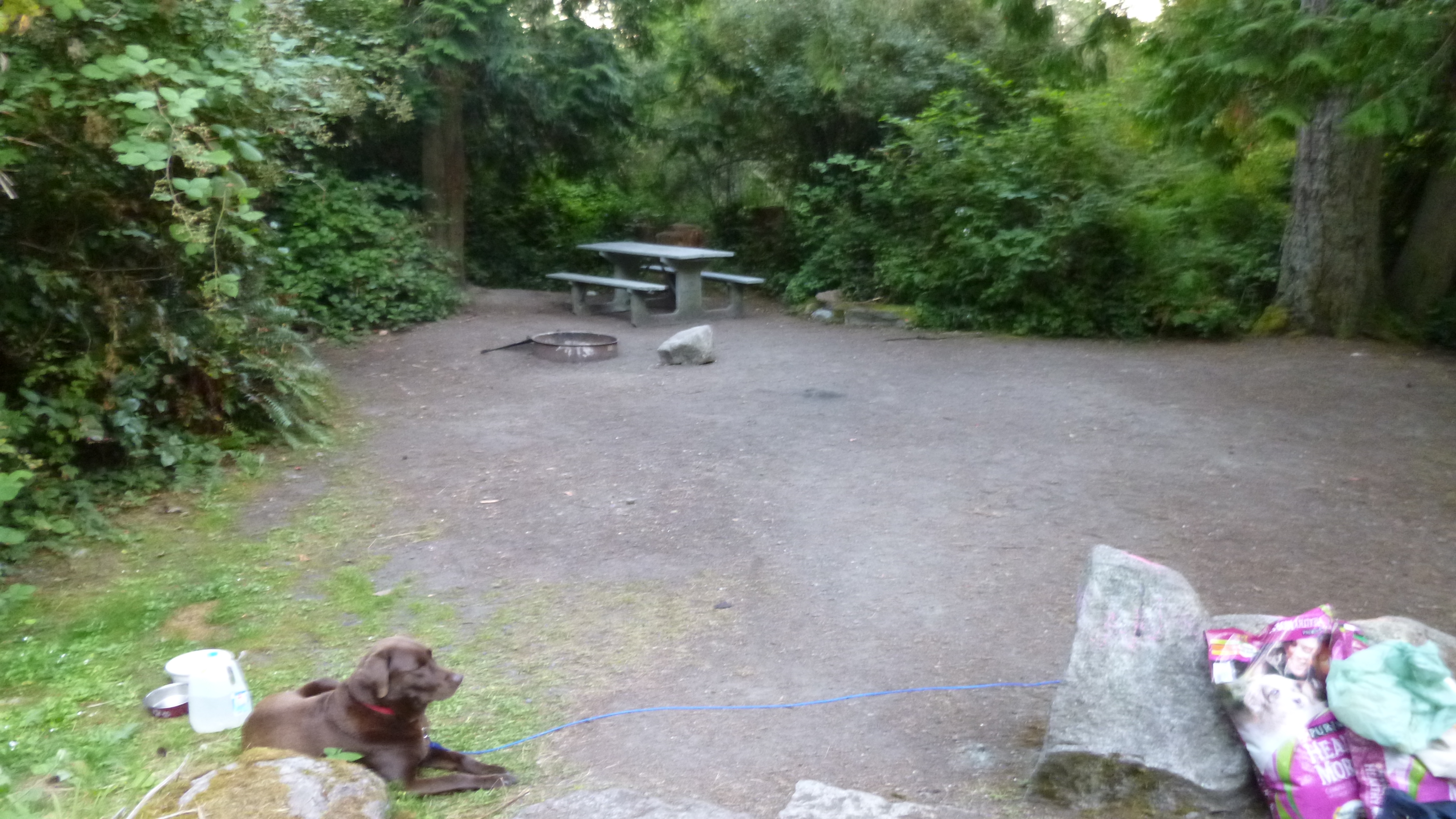
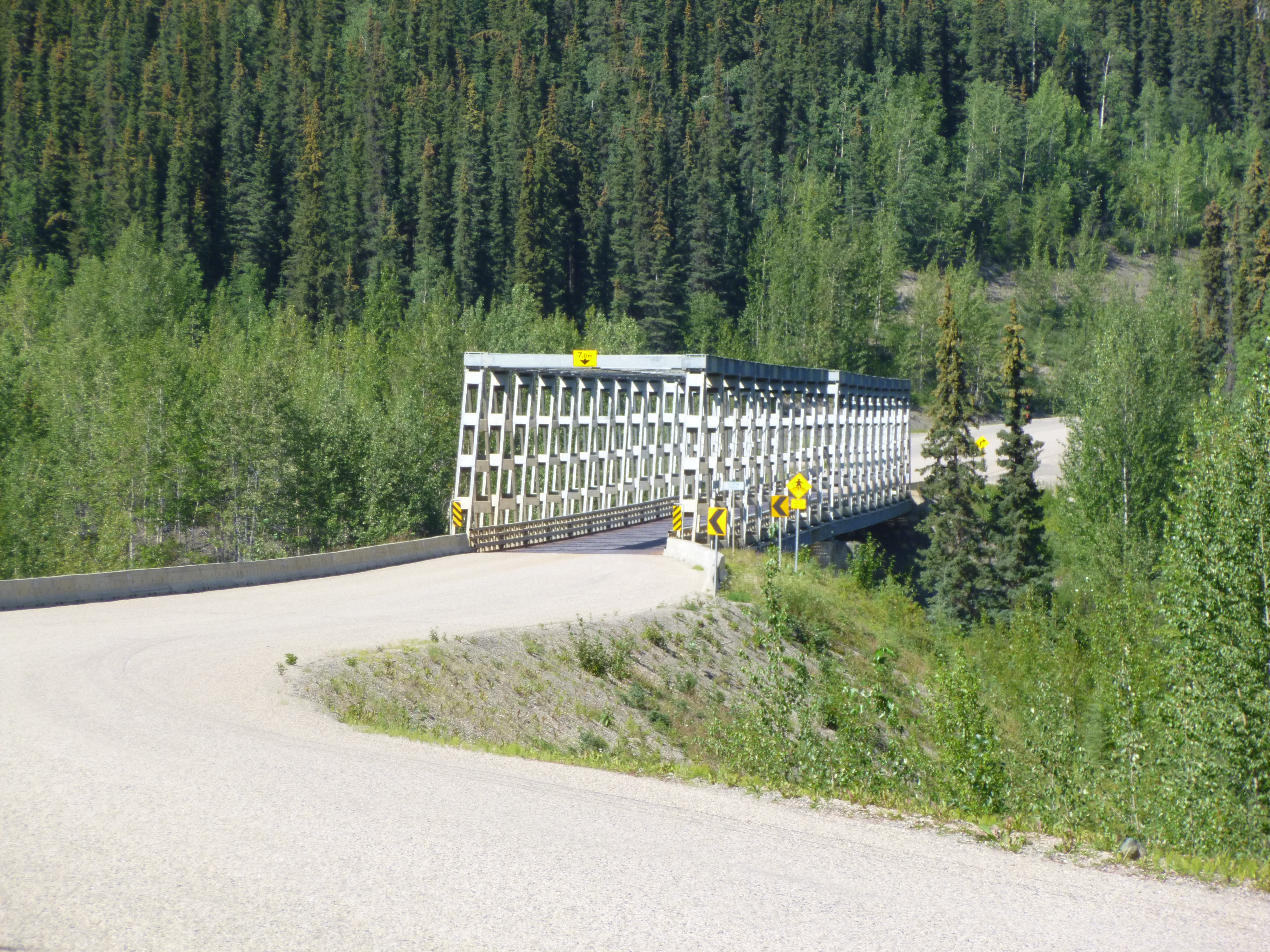
Then I headed for Deception Pass State Park, where I had reserved a campsite a couple hours ago. To get there, I had to cross a couple really high bridges, and I noticed people walking across them, so I figured I would get out and enjoy the view too. The bridges were pretty high up, and the height bothered me a little. I couldn’t enjoy the view and walk at the same time, so I would have to stop every now and then to enjoy the view while clutching the railing! The island was originally said to be a peninsula, mapped out incorrectly by Joseph Whidbey (of Whidbey Island fame) and it was George Vancouver who named the strait Deception Pass because Whidbey’s maps misled him. But, it was a very rocky and dangerous strait, which appeared to be a dead-end, so both men felt the pass had deceived them. After walking across the bridges, and underneath them, and back again, I drove across and the campground was right there on the north end of Whidbey Island. The island is rocky, but is full of tall, beautiful pine trees, and my campsite was nestled in among all the trees. I loved it. Tula and I took a walk around the rest of the campground, and everyone seemed to have nice, spacious sites in the trees. I actually made some pasta with my Jet-Boil for a late dinner, and had a piece of string cheese that melted on top. It seemed to get dark so early, but it was the first night that I’ve camped in total darkness for a long time – I had to pull out my headlamp, lantern and flashlight again!


Canada and Washington – Tuesday, August 6
When I woke up in the morning, I discovered that 3 other people with campers had also used this pull-off as a rest stop for the night – apparently it’s a popular stopping place, and there are people who drive even later than I do!
We were back on the road in no time, and I soon came to an old ranch from some of the early days that had been turned into a historical site. There was a big, beautiful log cabin barn, and a log church and log schoolhouse and all, and some old gold mine equipment.
Then it was time to put on some miles. After the ranch country, I went through some pretty arid land, covered in sagebrush, and not quite as pretty as what I’d been driving in. And then I was back in the mountains – some of them were steep and there were canyons and pretty blue lakes. We stopped at one of the lakes to walk around and stretch – it was a steep walk down to the beach, but that didn’t stop people from heading down there with all their inflatable toys! I went through the Hell’s Gate area which was really steep, and there was a tram to take visitors up the mountains for scenic views. I didn’t go on it, but the place was crowded. By now I was actually getting closer to the Canadian/US border, and the road changed from a 2-lane road to a 4-lane highway heading to Vancouver, and the traffic got heavier and there were lots of people.
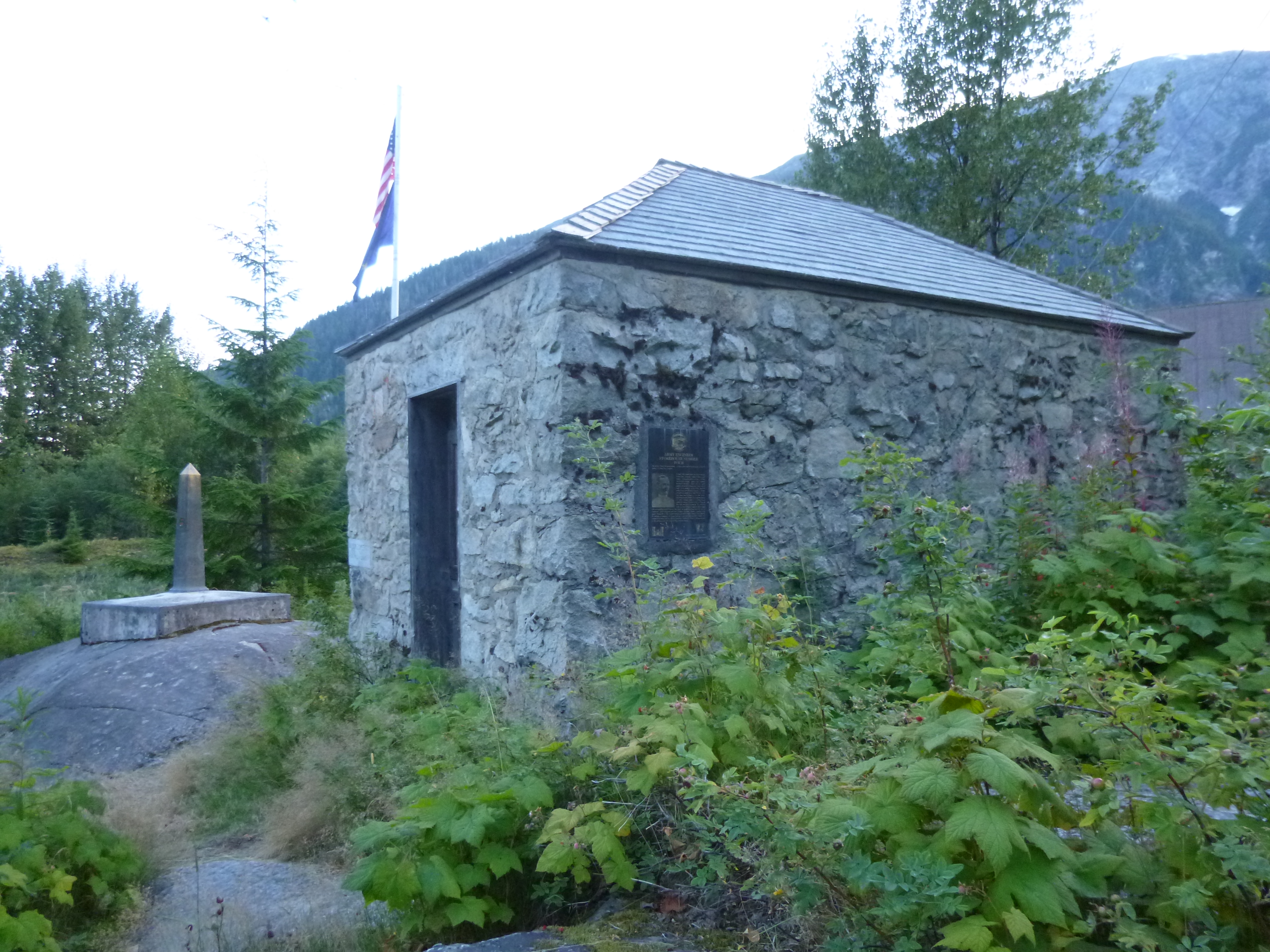
After driving a bit more, I was getting close to the border, and there were several crossings to choose from. There were signs saying how long the wait was at each of the crossings, and I was just going to take the one into Washington that was closest – I didn’t want to go into Vancouver at all. Despite all the time I’d already spent driving in British Columbia, it was still getting to be late afternoon before I was finally in line to cross the border. There was a bit of a wait, but I got through just fine – no one ever asked questions about having a dog, and I hadn’t done any shopping in Canada so I breezed through.
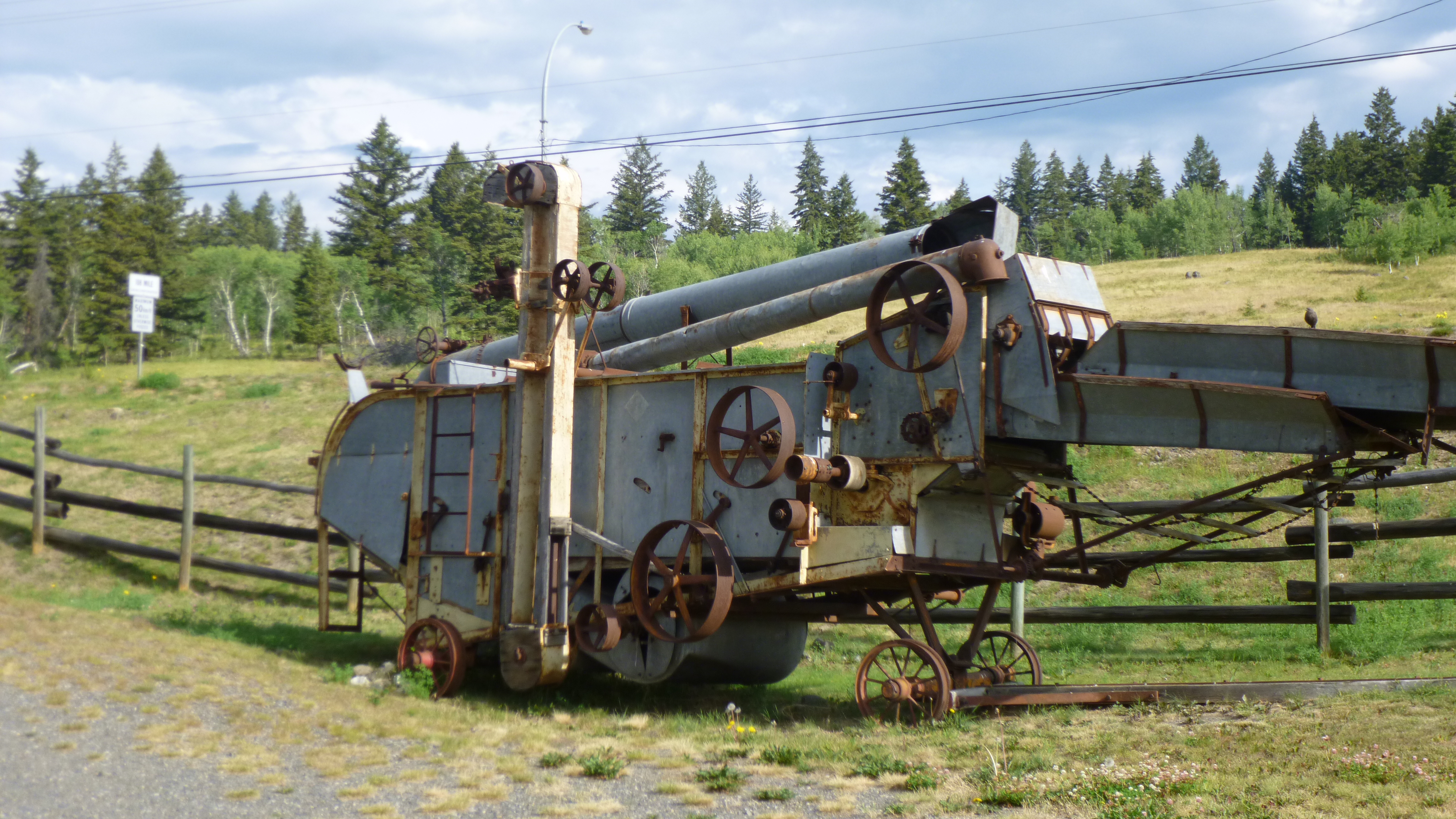
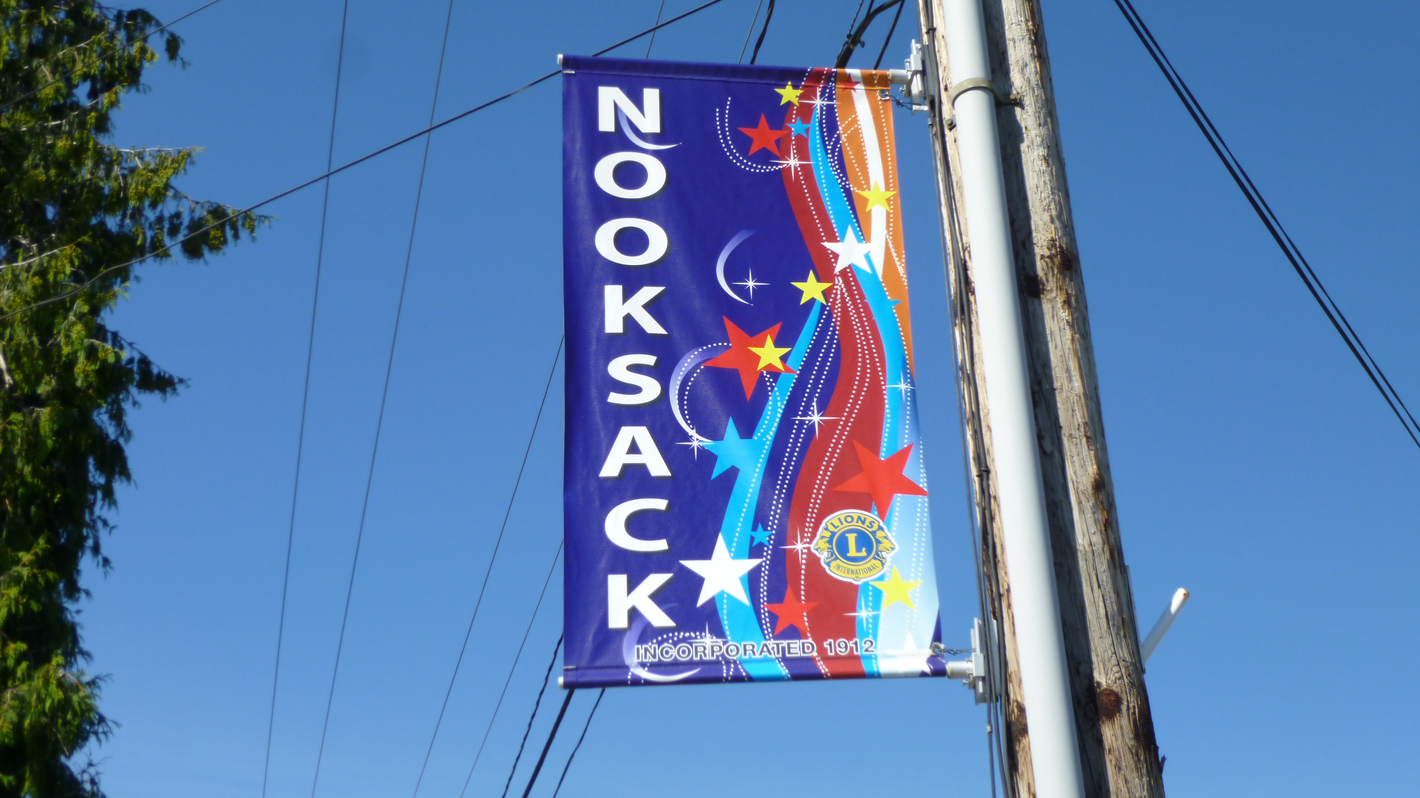
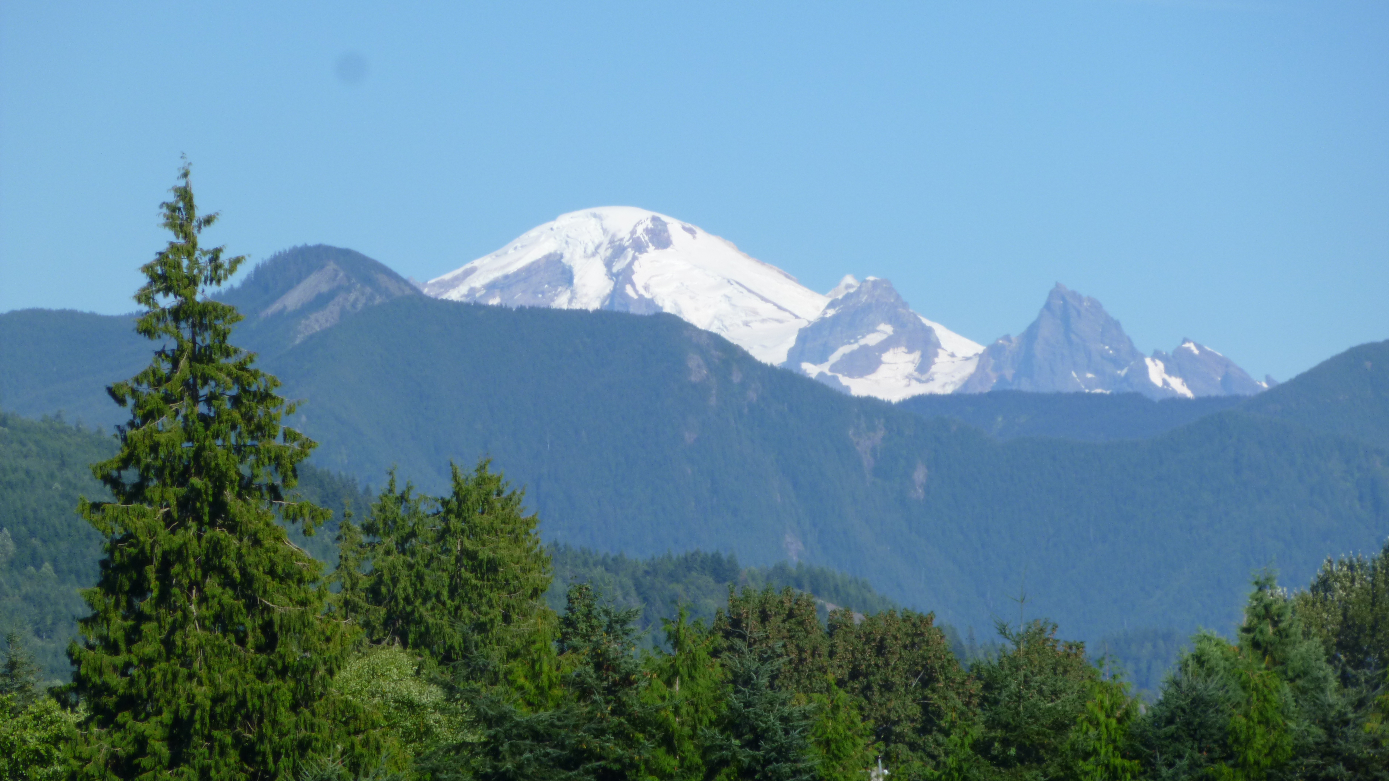
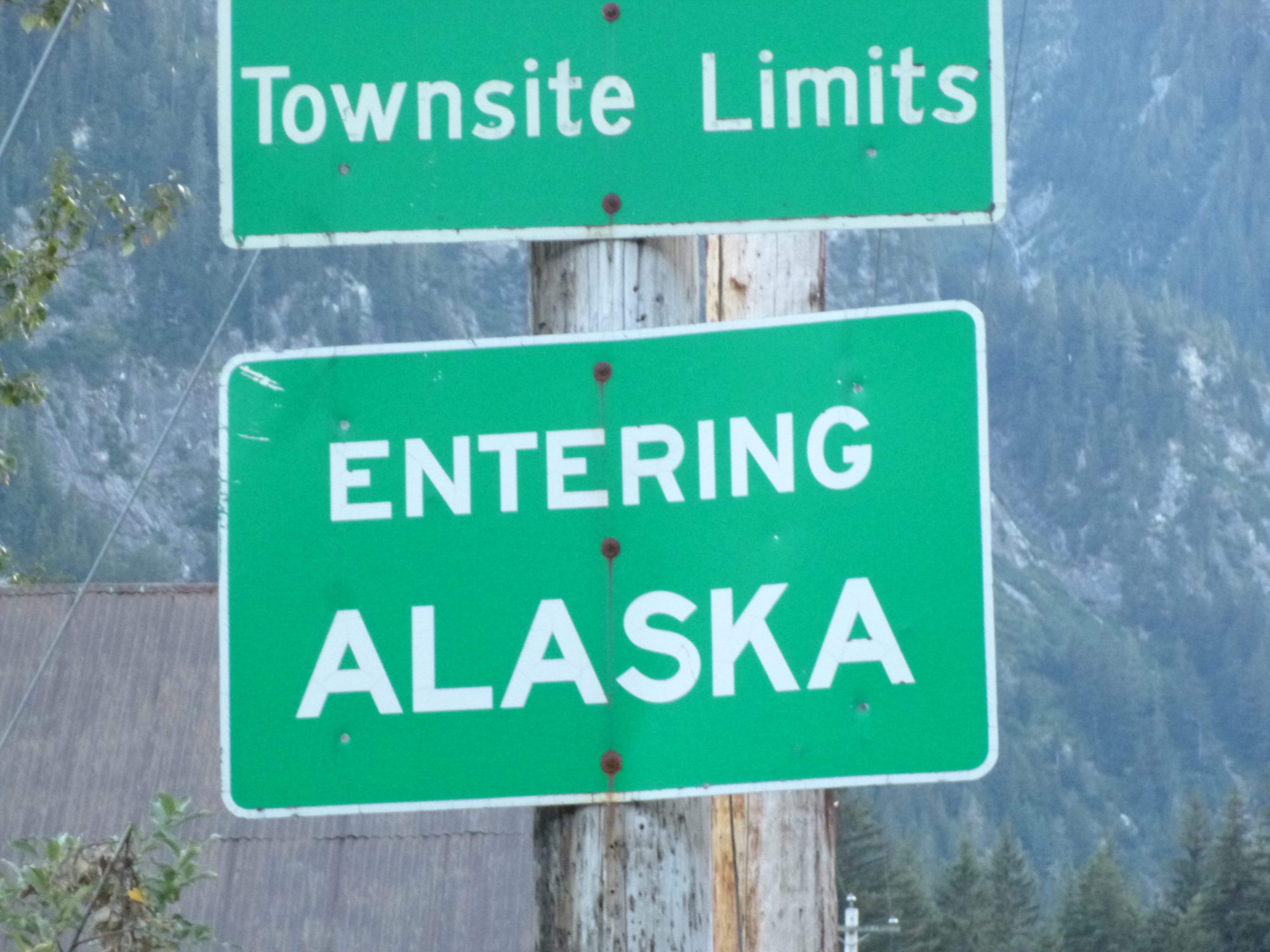
And then I was in Washington – State #43! I’d had plenty of time to soak in my Alaska and northern Canada adventures, and was really excited to be back in the States – I can’t wait to resume my normal days of donations and walking. With only a quarter of my journey left, I will be savoring every moment. But first things first – there were suddenly berry stands all around me, and I stopped to get a half-pint of fresh blueberries. What a treat! It was too late today for a “normal” day, and I hadn’t been able to start any research about donations or anything, so I will “officially” resume the journey tomorrow. But I stopped in the town of Nooksack (because I liked the name!) and Tula and I did our first mile and a half of Washington walking. This area seems to be some good agricultural land, and there were all kinds of fruit and veggie stands, and after walking I drove around a little, and saw a really unusual piece of farm equipment with stacks of crates on the back. Nooksack was the name of an Indian tribe which had lived in the area for ages, and now there also seems to be a big Hispanic population up here – many of the little shops in Nooksack had signs in both English and Spanish. With all the big farms in the area during harvest season, I’m guessing there’s a good-sized migrant population. I was able to see Mt. Baker clearly, in the Cascade Mountains, but it was too far away to drive toward today.
Eventually I headed toward Bellingham, where I was going to stop for the night. After camping all through Canada and Alaska – 19 of the past 20 nights – I was ready for a motel room to get cleaned up and back into a more civilized mode! With all the camping (and a handful of free nights at NOLS and at pull-offs) and relatively simple eating, my visit to Alaska was completed on a shoe-string budget – it is possible! I was looking forward to some computer time to plan my Washington week and look into donation opportunities, and my sister lives in the Seattle area so I knew I’d be seeing them in a few days – I can’t wait to kick off the final quarter of Expedition 56!!
British Columbia, Canada – Monday, August 5
Tula and I took a walk around the pretty campground to stretch our legs before a long day in the car. I figured I would be crossing into Washington late today, but I figured wrong! British Columbia is huge, and I still had hundreds of miles to go – both east and south. On the signs, the distance to various cities is always in kilometers, but sometimes I would do a double-take when I saw how many “miles” there were between towns, and then I would realize it was only about 2/3 of what was posted. All the speed limit signs are in kilometers too, but luckily the speedometer shows both miles and kilometers per mile. After a while I came to the town of Vanderhoof, a little west of Prince George, and it’s the geographical center of British Columbia. That’s when I figured I might not make it into Washington. But, I also made kind of a long stop for some computer work at a Tim Horton’s – their free wi-fi was kind of slow, but I always feel a little better after catching up just a little.
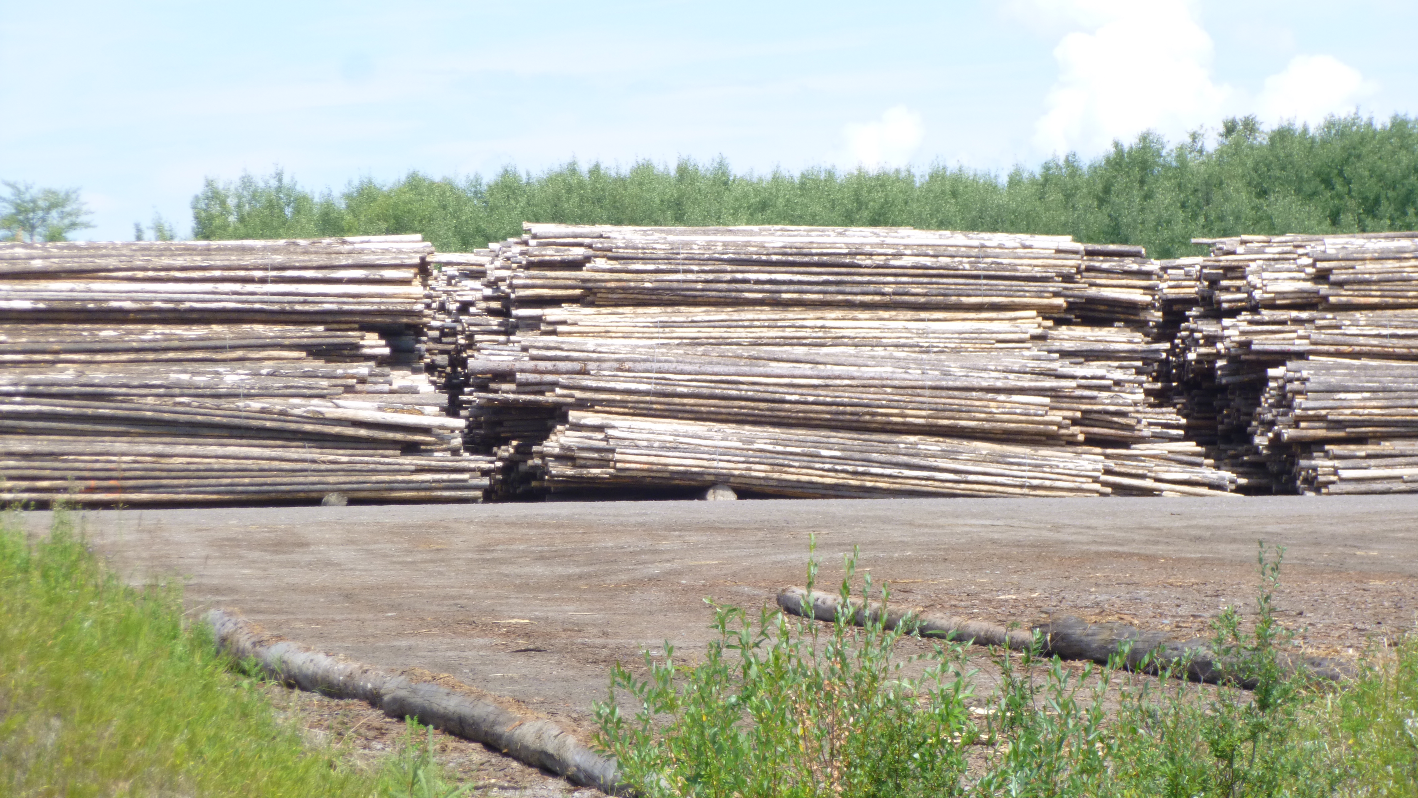
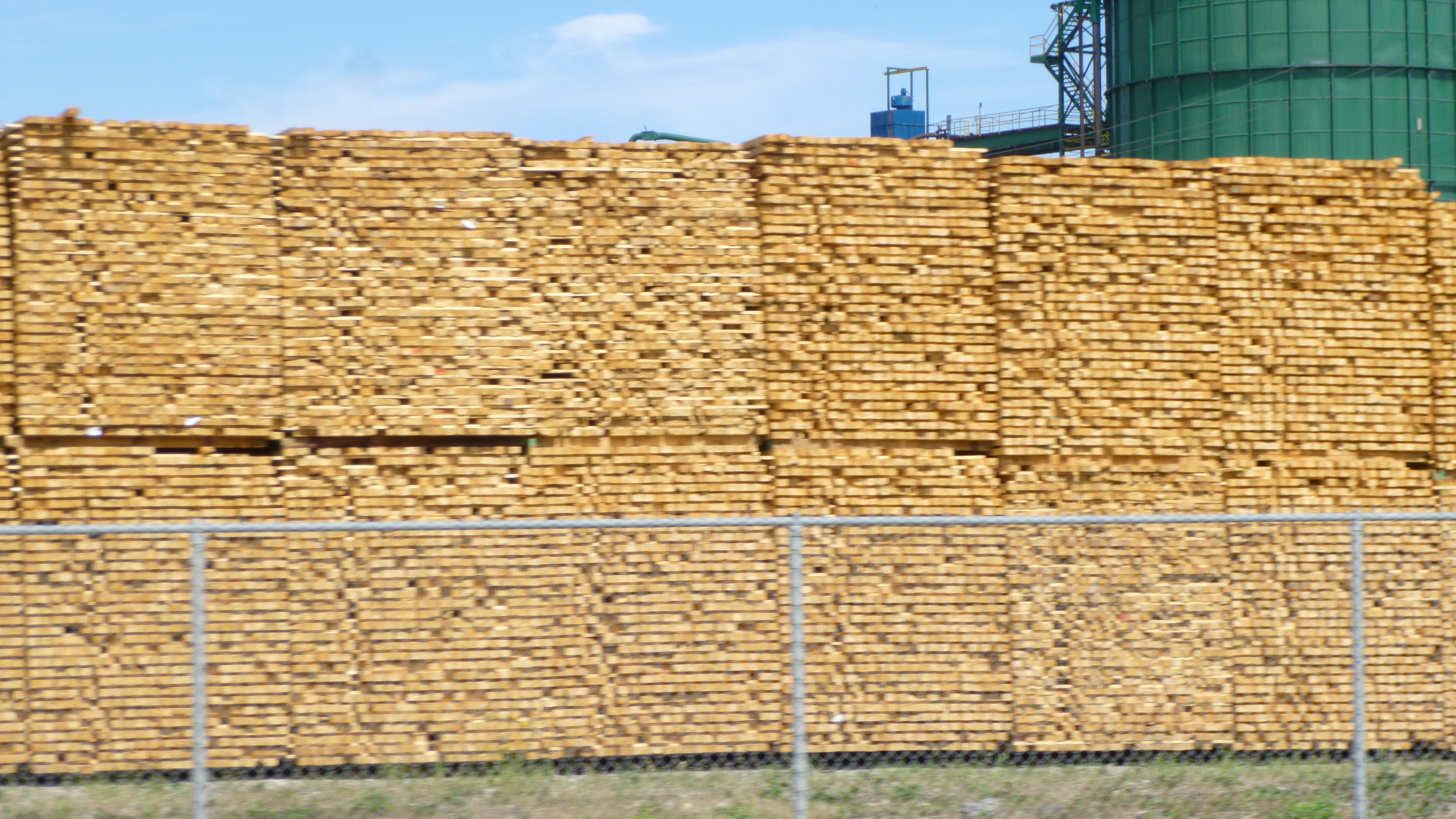
For a while the Coast Mountains were still visible in the west – they’re as ruggedly beautiful as the Rockies. Then I came into logging country, and saw pile after pile of cut trees, and then stacks and stacks of lumber. I covered a couple hundred miles, and came to the town of Quesnel, an old gold mining town. After more driving, I began to see signs for towns with names like 150 Mile House, 108 Mile House, 100 Mile House etc. I thought those were kind of strange names for towns to have, but later in the evening when I pulled into a historical marker pullout, I read about the houses. Back in the gold rush days, thousands of prospectors made their way north to seek their fortunes. Many were on foot, and some were pushing wheelbarrows with their belongings. Houses were built for shelter every 10-20 miles along the way, and the names of some of those stopping places stuck. I figured if the historical site I was on was good enough for gold prospectors back in the day, it was good enough for me to stop for the night, so that’s what I did. But, since it was a pull-off (a big one though), I didn’t set up the usual sleeping arrangements, and decided to just sleep in the reclined seat, which worked well enough with all the pillows. I did have a bit of a fright though – it was dark and I was walking Tula just a bit when I suddenly heard a loud snort nearby. After being in bear country for so long, my immediate thought was that I had startled some sort of wild animal, so I practically shoved Tula back into the car and jumped in myself while slamming the door, and was going to leave immediately with my racing heart. As I turned the van around, I shone the headlights into the land adjacent to the pull-off, and saw a couple horses in a pasture about 20 feet down a hill. They had no doubt seen me and Tula and were coming over to investigate – I think that’s the first time I’ve ever been frightened by a horse! With a sigh of relief, I decided to stay after all, and no wild animals came after us!


Alaska – Sunday, August 4
As I was packing up, a young lady on a 4-wheeler came by and asked me if there had been any bears in the campground last night. I told her I hadn’t seen any, although the guy last night said there’s a small one that wanders around sometimes, but he says it’s harmless – hmmm. (The couple who run the place are older, and they’re from Maine – they’ve been driving from Maine to Alaska for years to run the little campground – that’s a long haul!) The young lady told me she was up here with her husband and kids for the second summer in a row while her husband works on the big hydro-electric project in the area, and they had stayed in a trailer in the campground last summer, and had seen bears in camp, and one had even walked right up to their rental house in the village recently and done some damage. Bears might be an extra problem this time of year since the river is so near, and the salmon attract them, but at least having all the salmon available might distract them for a while from other food.
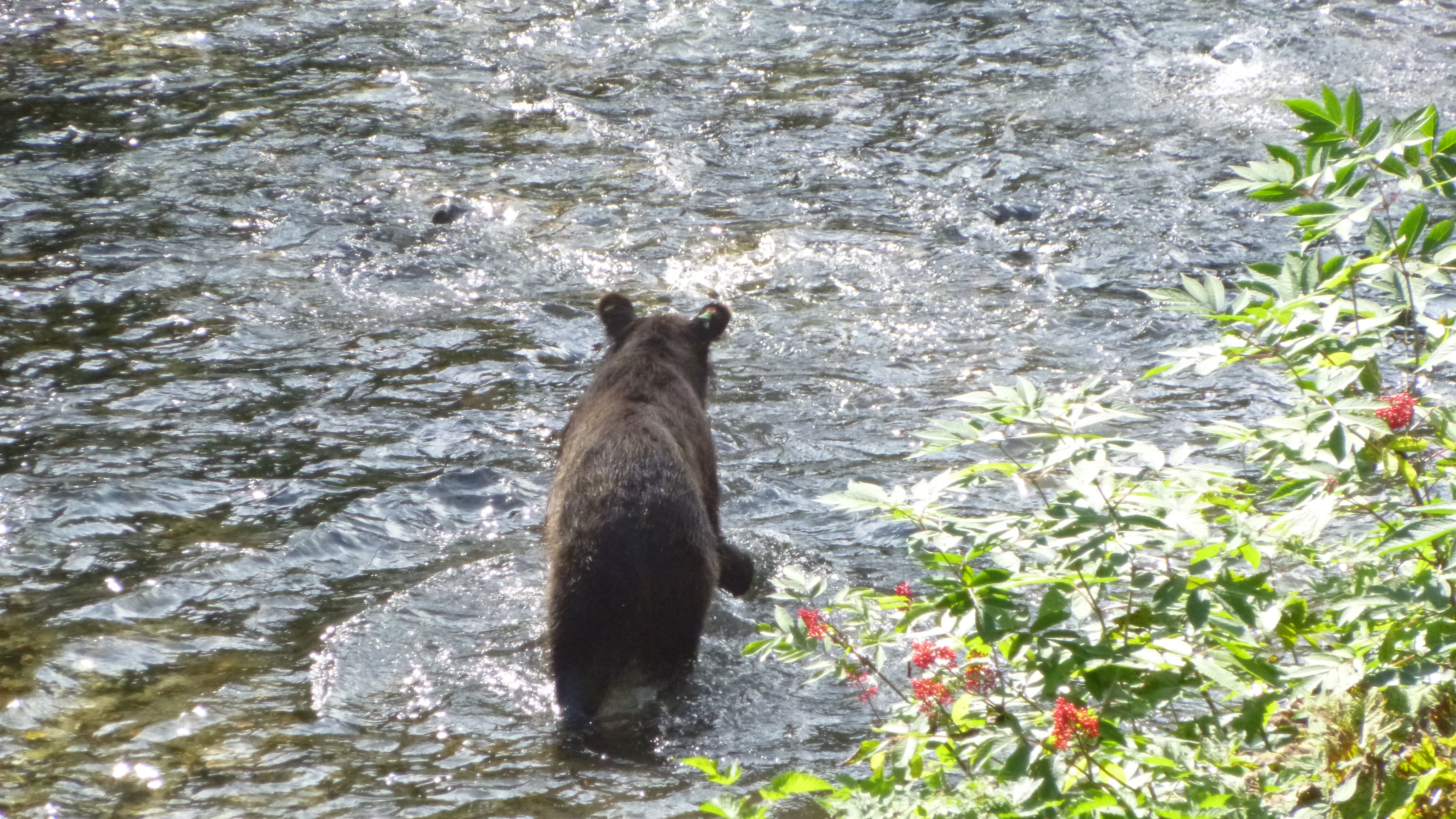
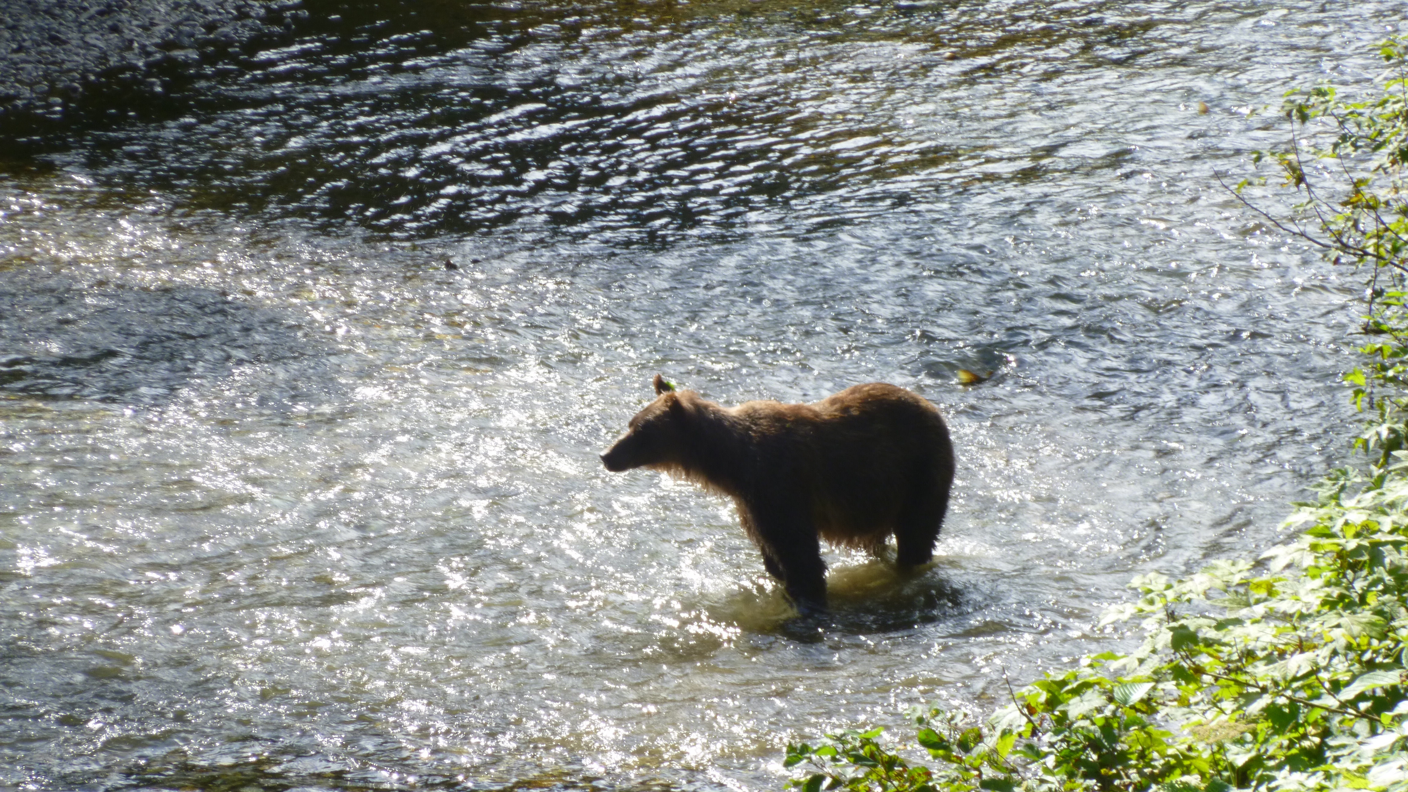
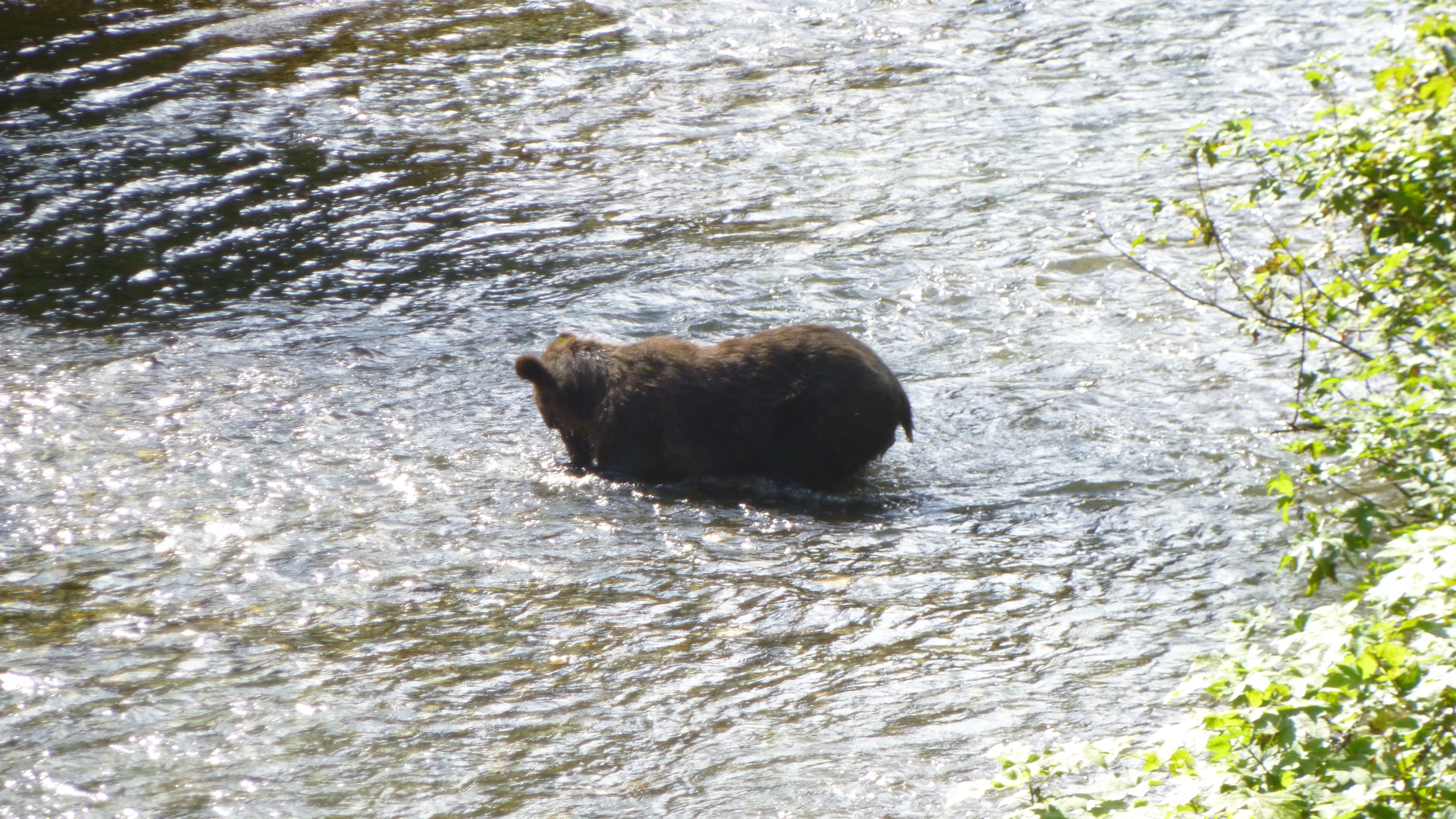
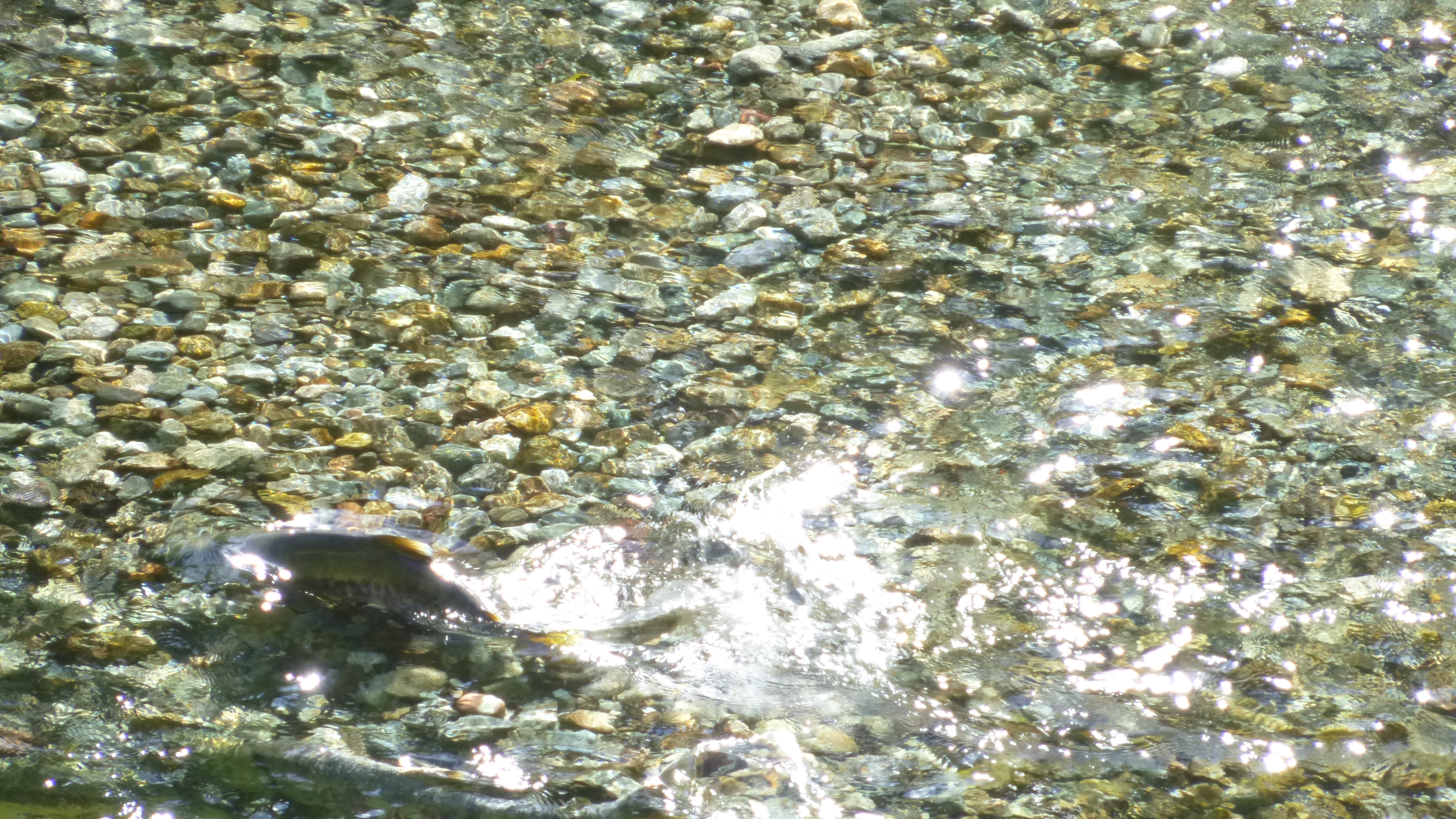
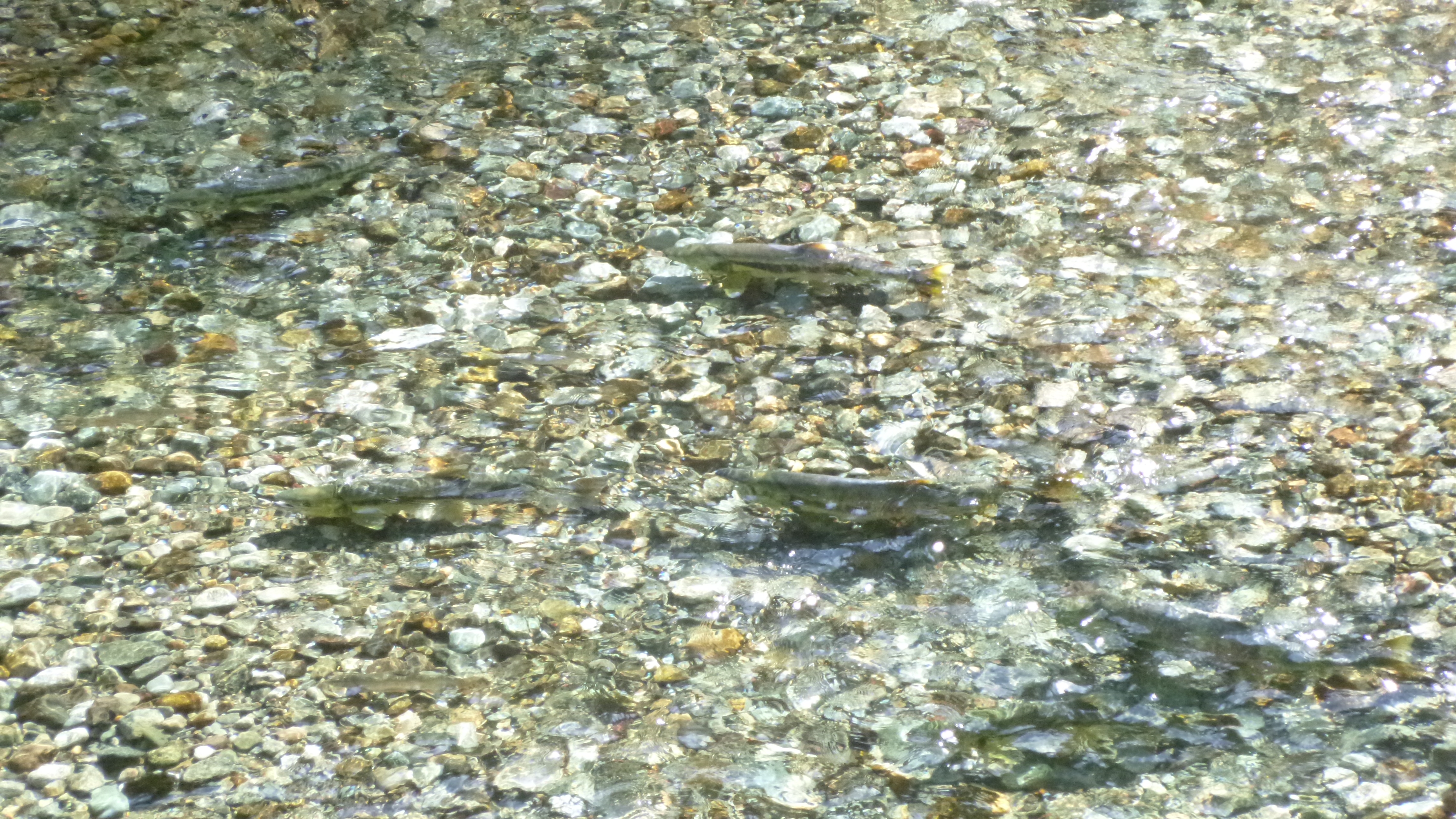
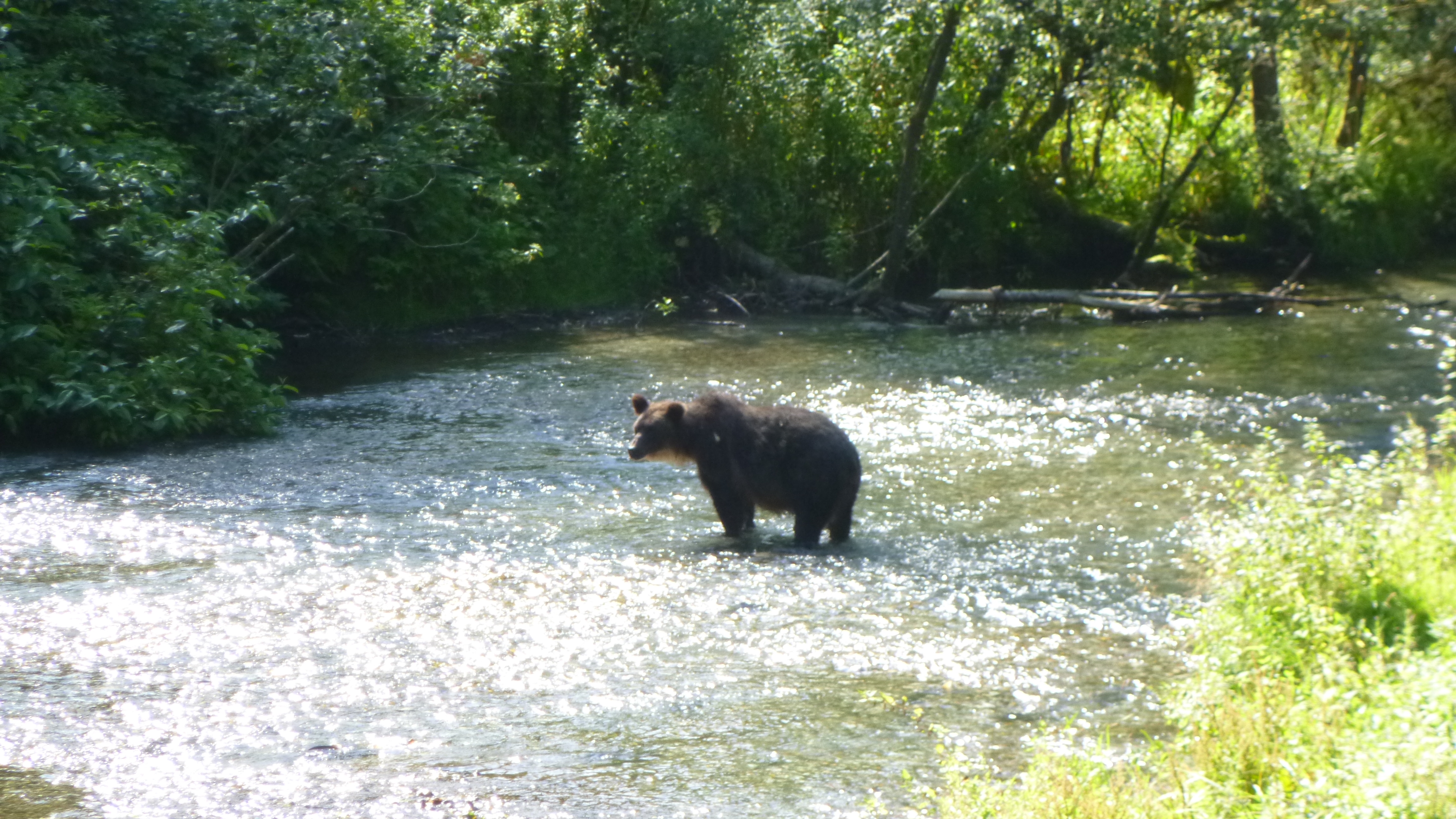
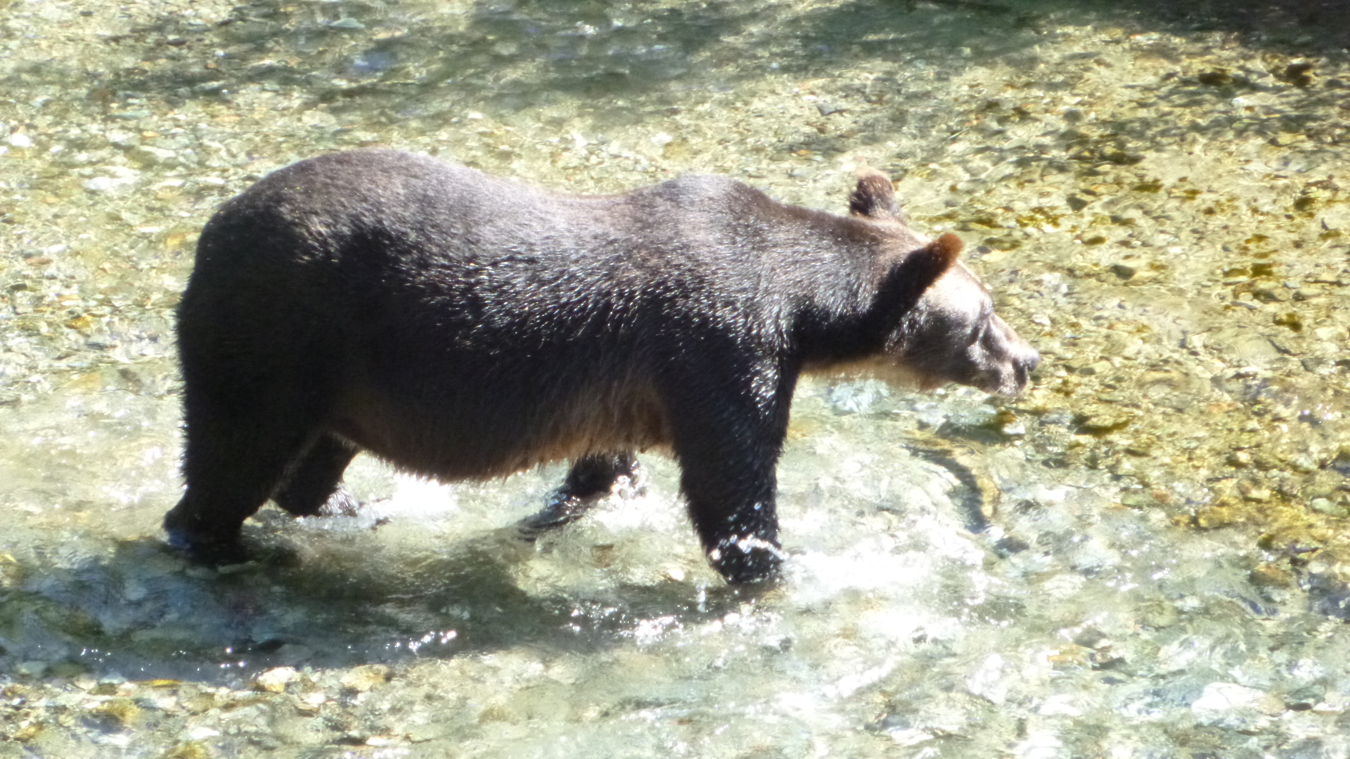
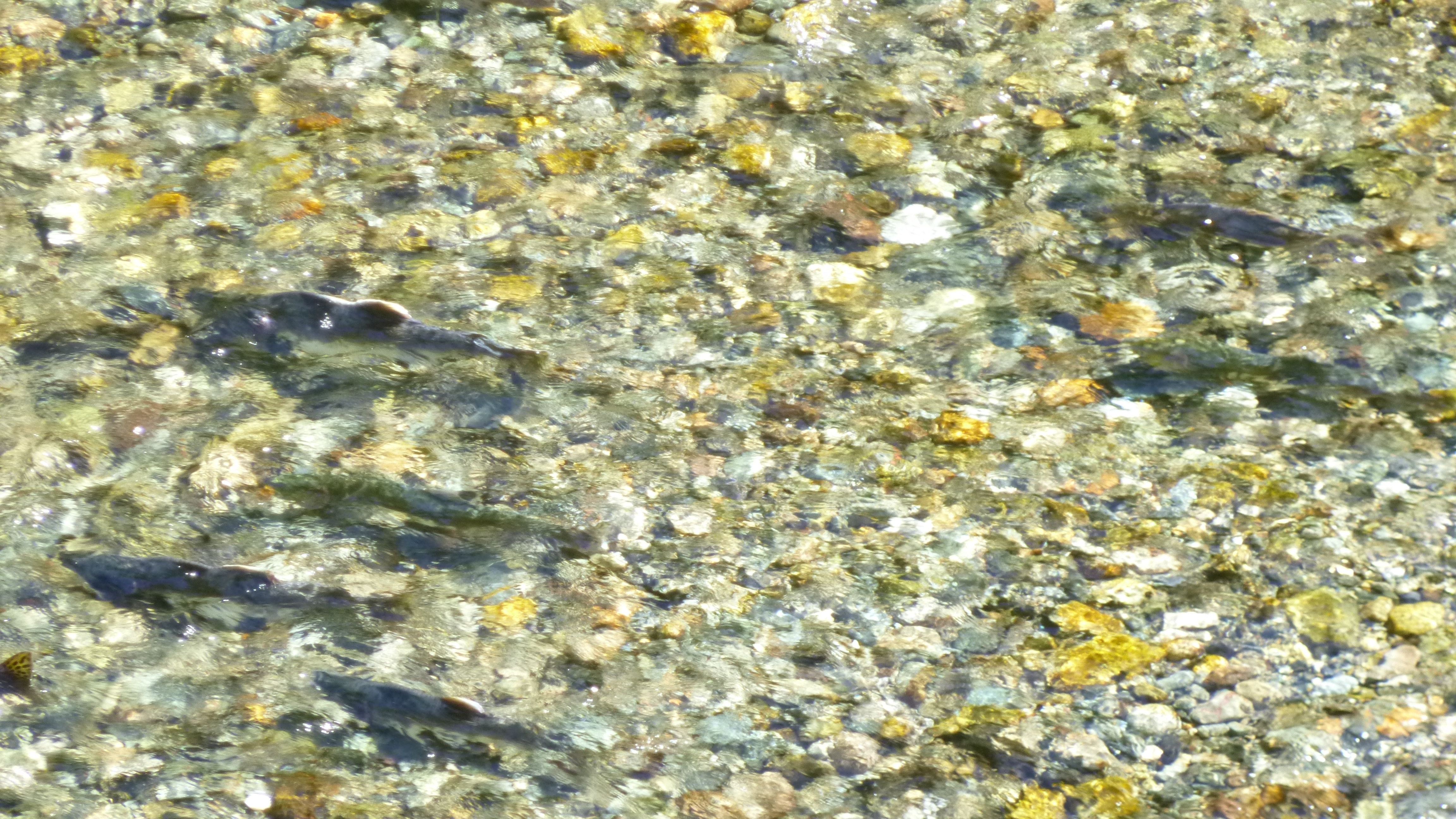
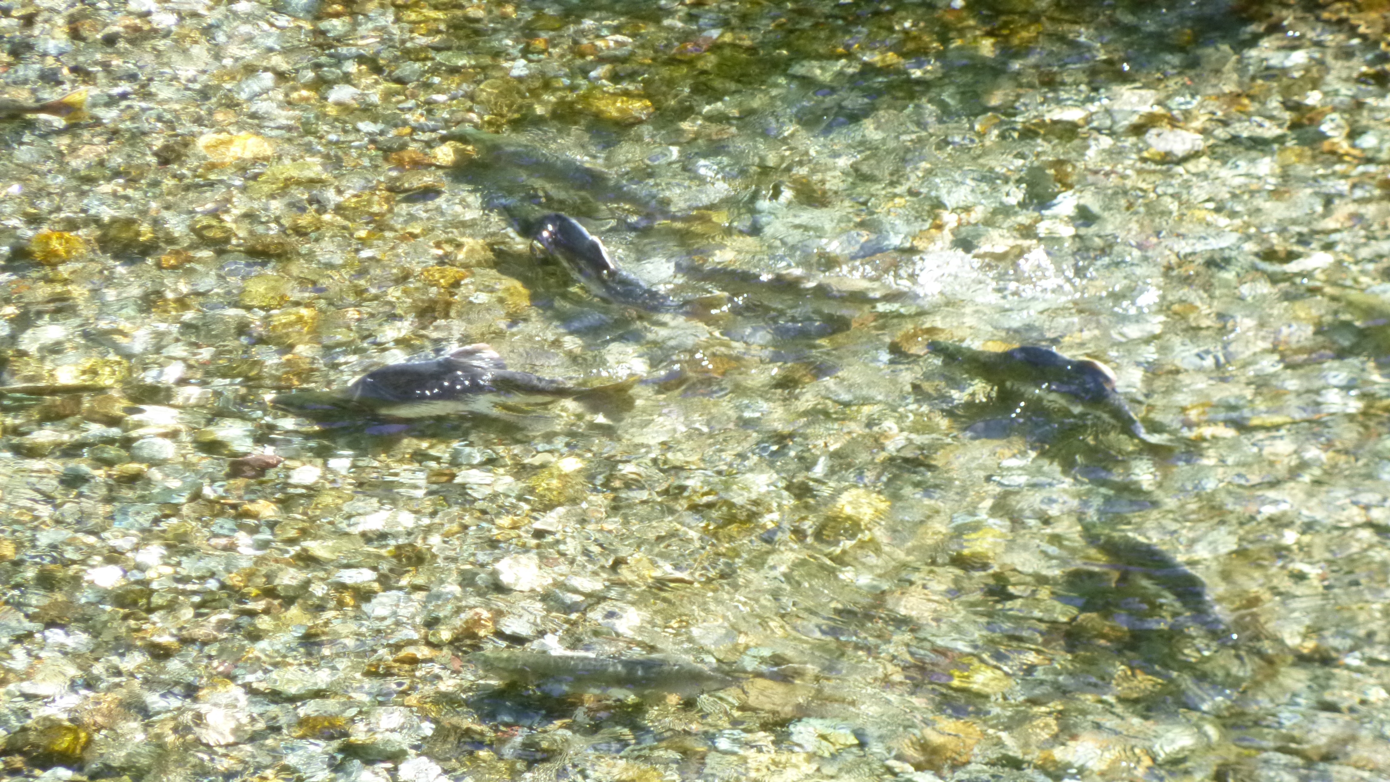
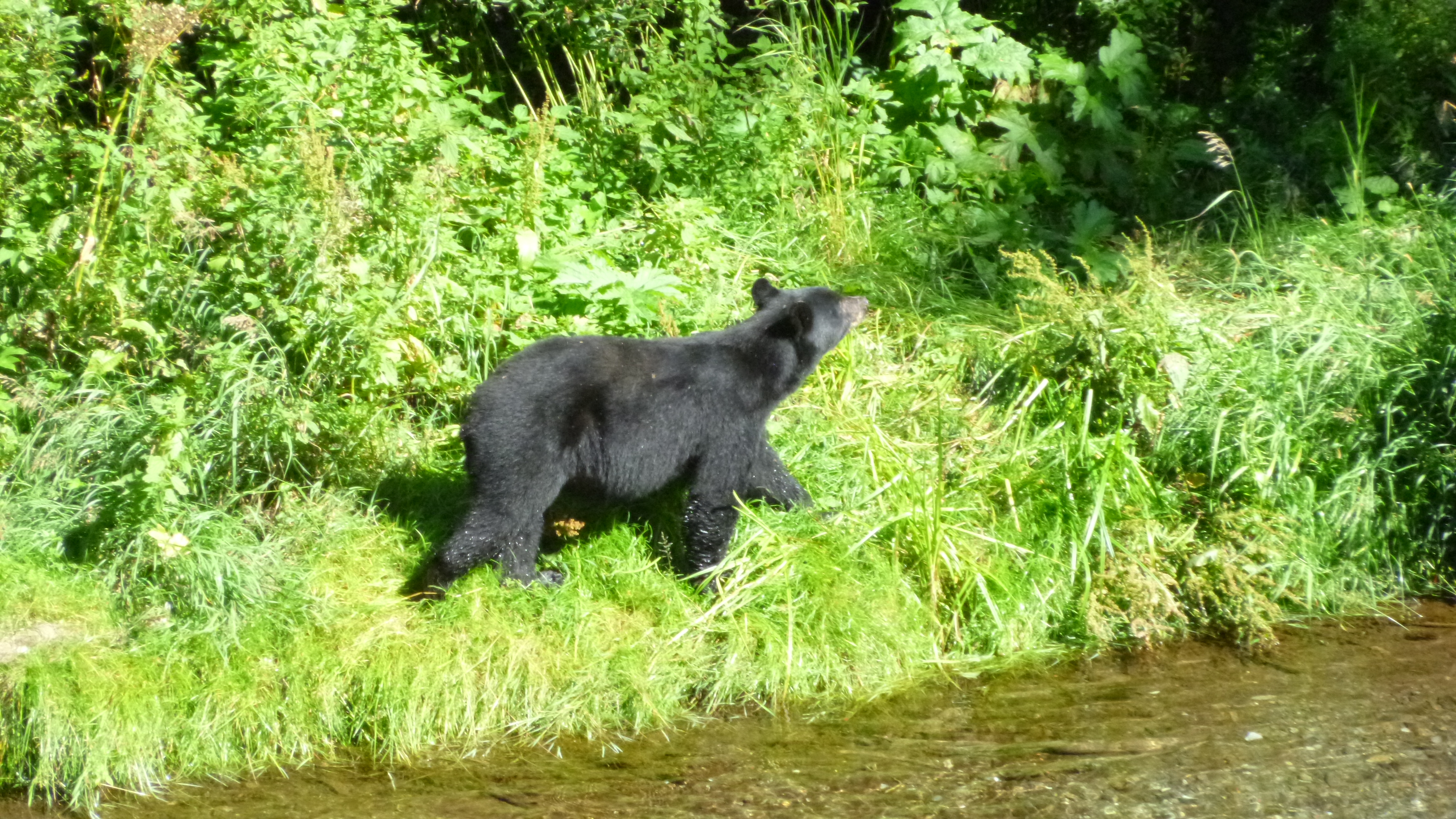
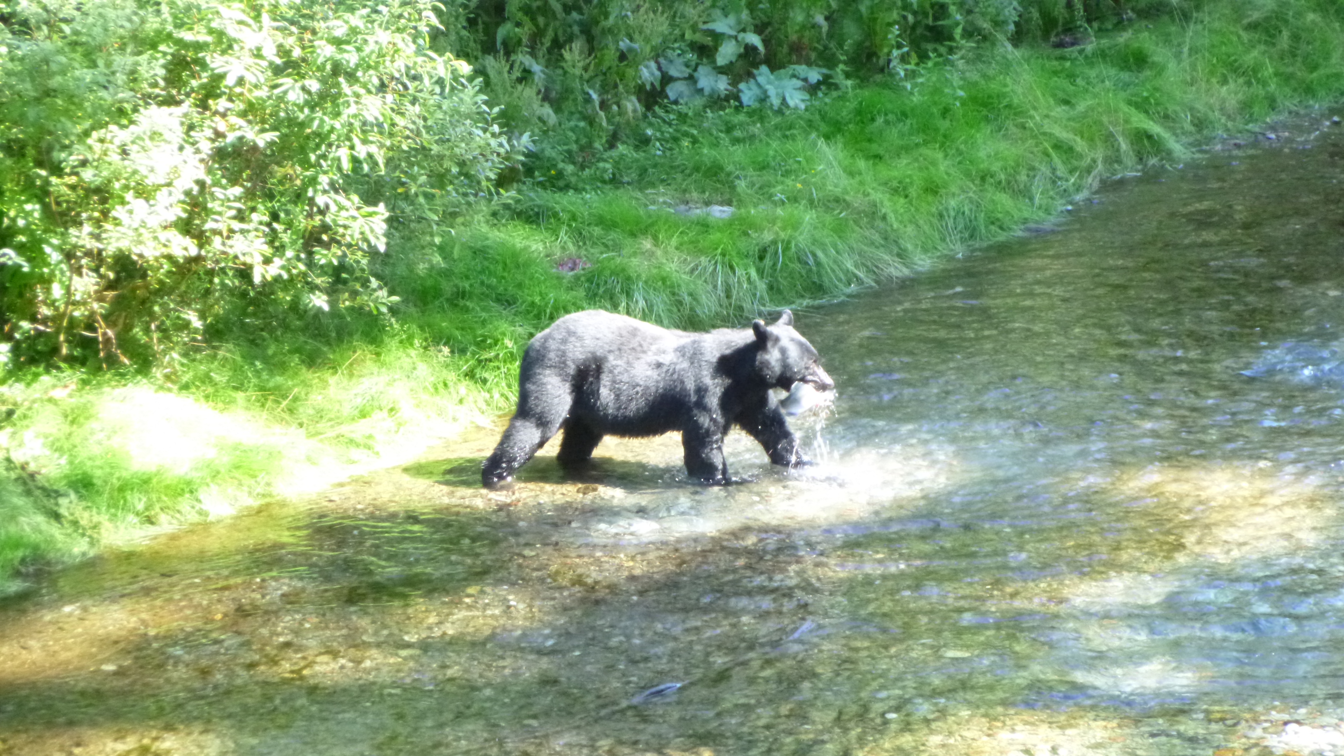
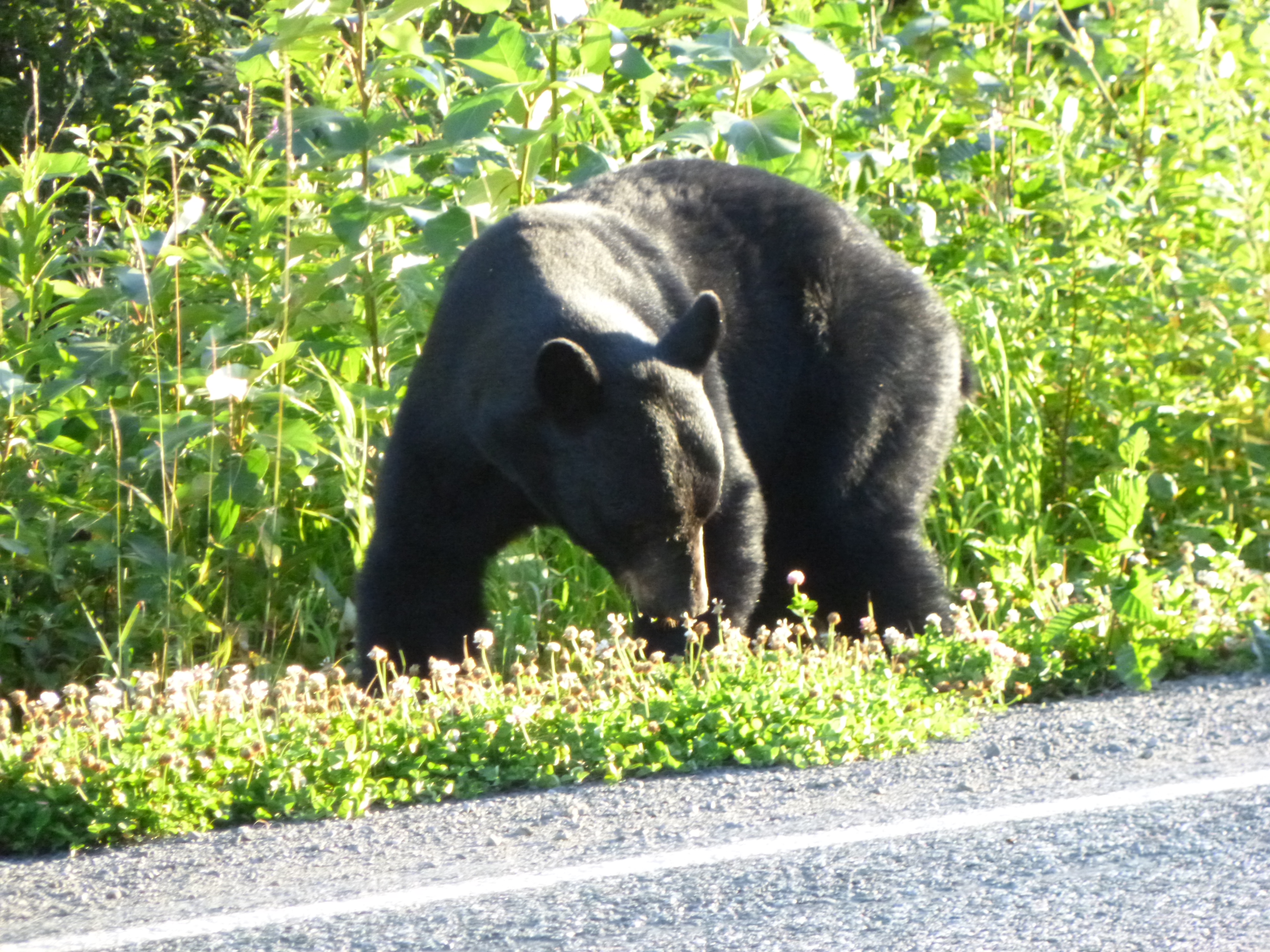
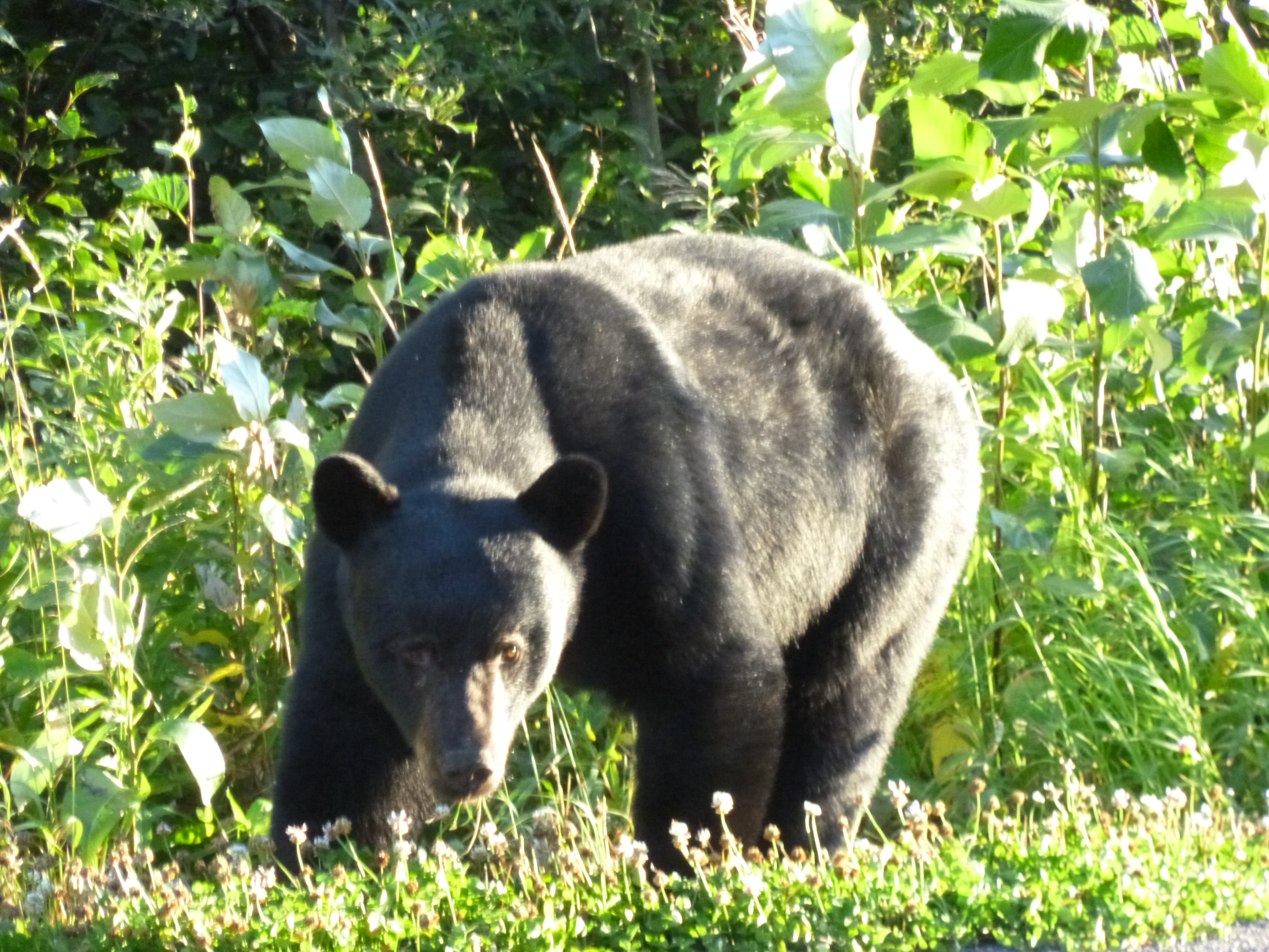
My goal today was to drive the 17 miles up the mountain to look at the big glacier, but I was going to go back to the bear-viewing platforms first. Things were much clearer in the broad daylight, and once again I was struck by the clarity of the water – it was so easy to see the different markings on the fish. The ranger told me the salmon were mostly chum salmon (the bigger ones) and pink salmon, and that they had swum from the Bering Sea and the Sea of Japan. Most of them were still pretty silvery/gray, which are their ocean-swimming colors. They start getting more pinks and reds on them once they enter the spawning grounds. One of the signs explained that the combination of clear water and clean gravel made for ideal spawning grounds, and it was pretty easy to make out the many “nests”. This was kind of the end destination for them, so most of the fish were kind of stationary in the current – all of them facing upstream. There was a little chasing-around activity over the nests, and sometimes one fish would chase another off. The water was so shallow that the backs of some of the fish were out of the water, especially when they were trying to make their way through an extra shallow spot. They were pretty mesmerizing to watch. And then a couple bears came out to fish. Like last night, they just kind of wade and watch – I wonder how they choose the fish they’re going to get. Then they quickly pounce and come up with their breakfast. The first bear didn’t even get its hind end out of the water before feasting, and we could hear bones crunching – the guy next to me said he was happy that wasn’t his leg or something!
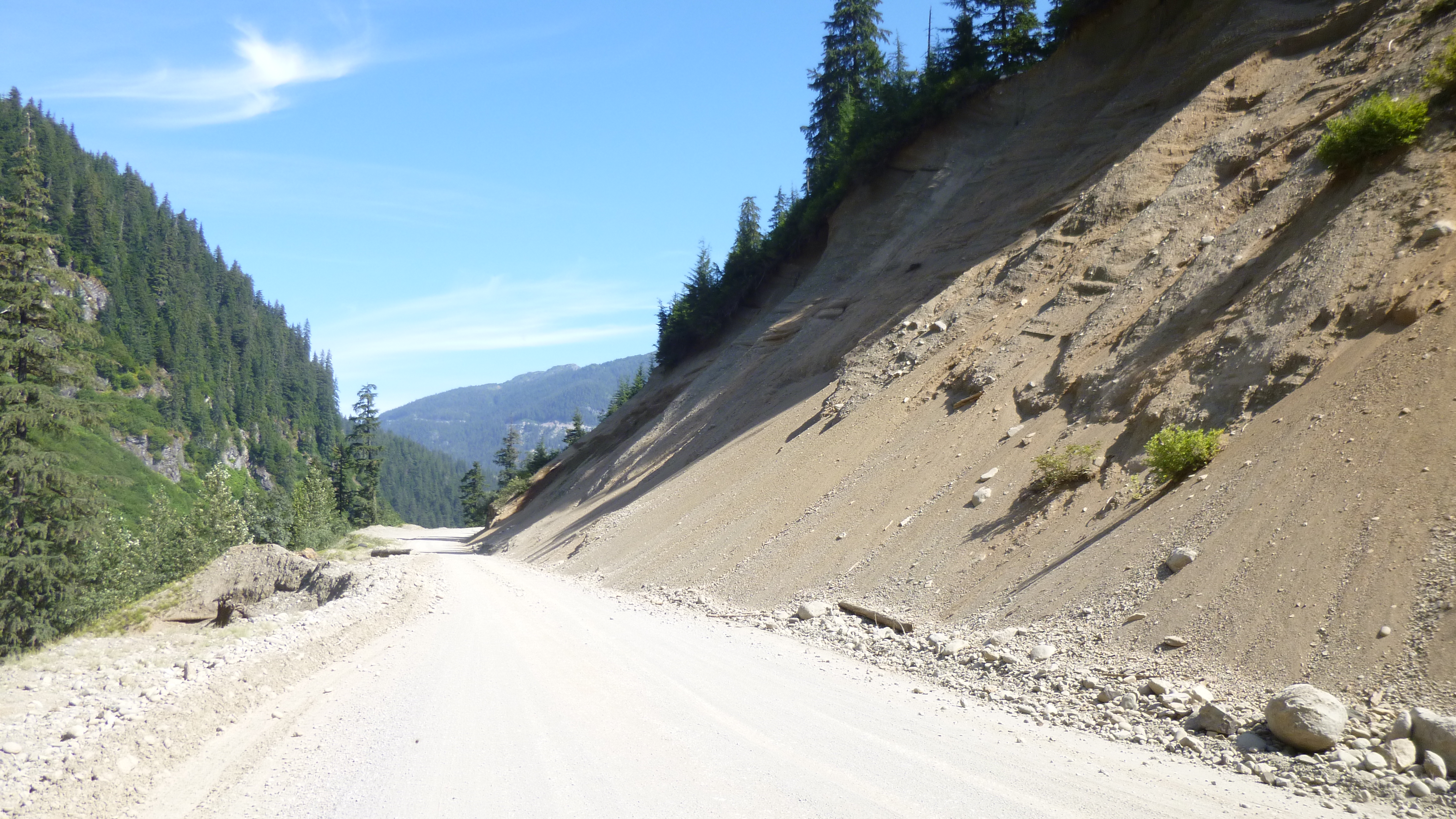
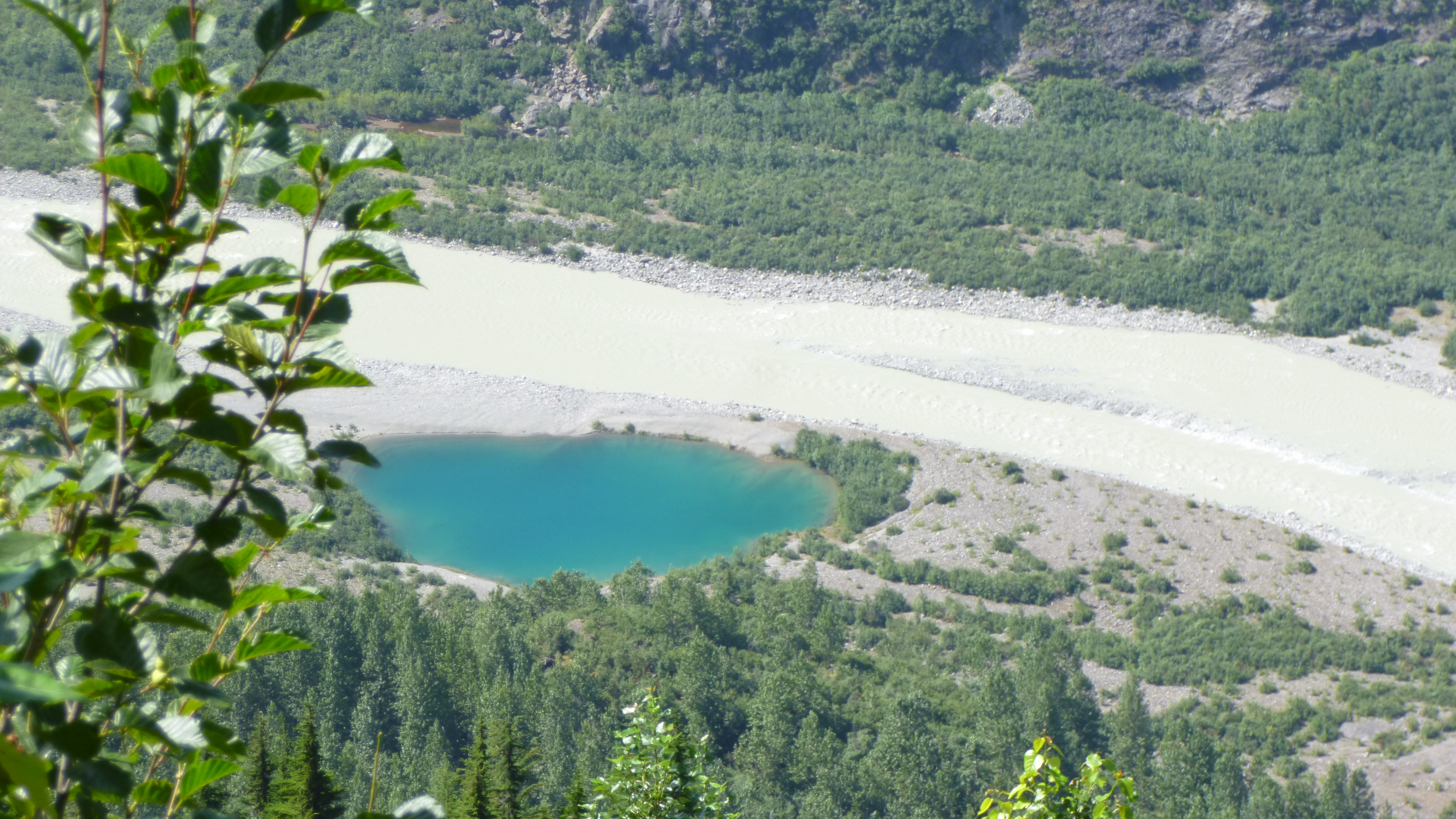
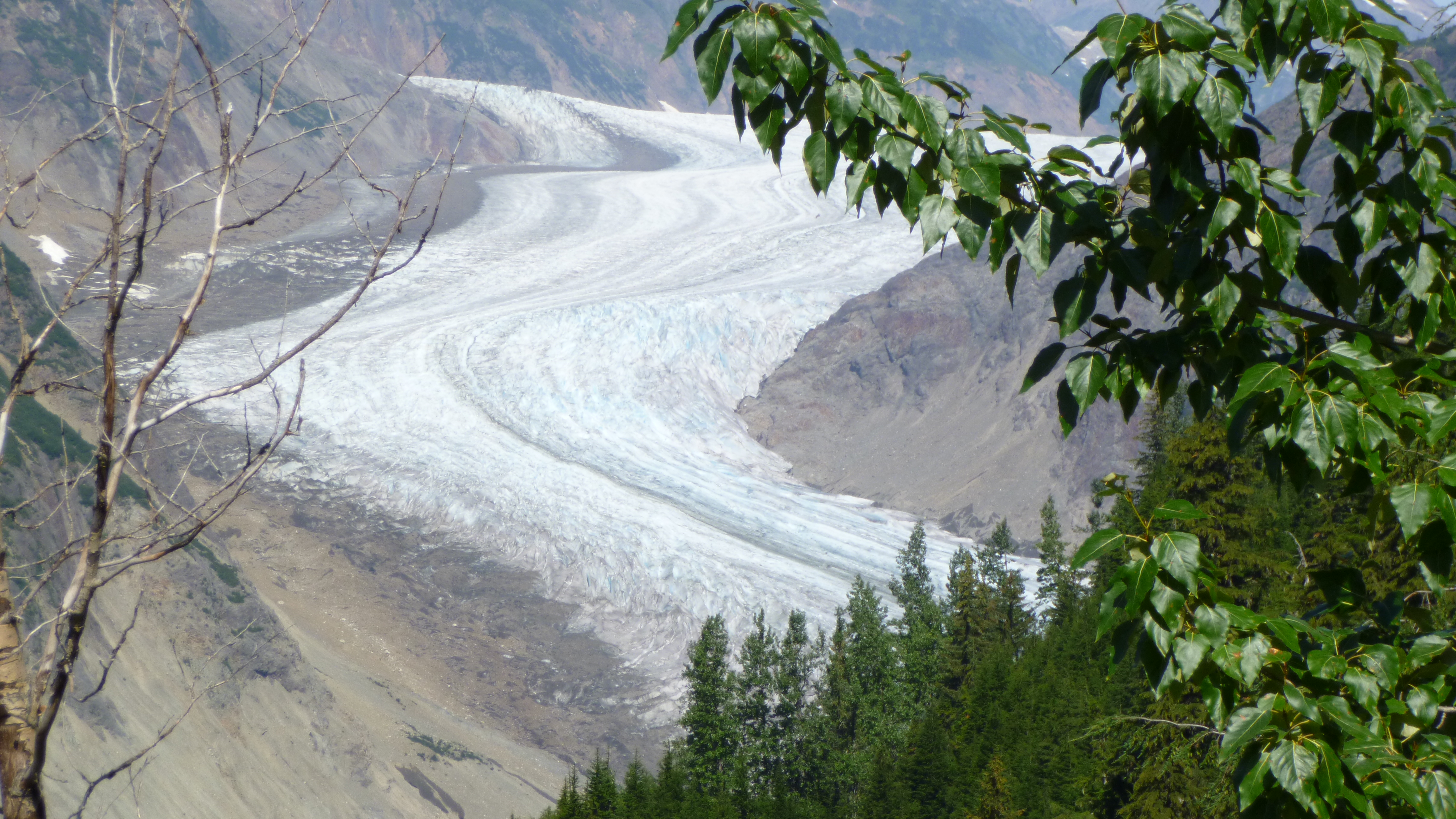
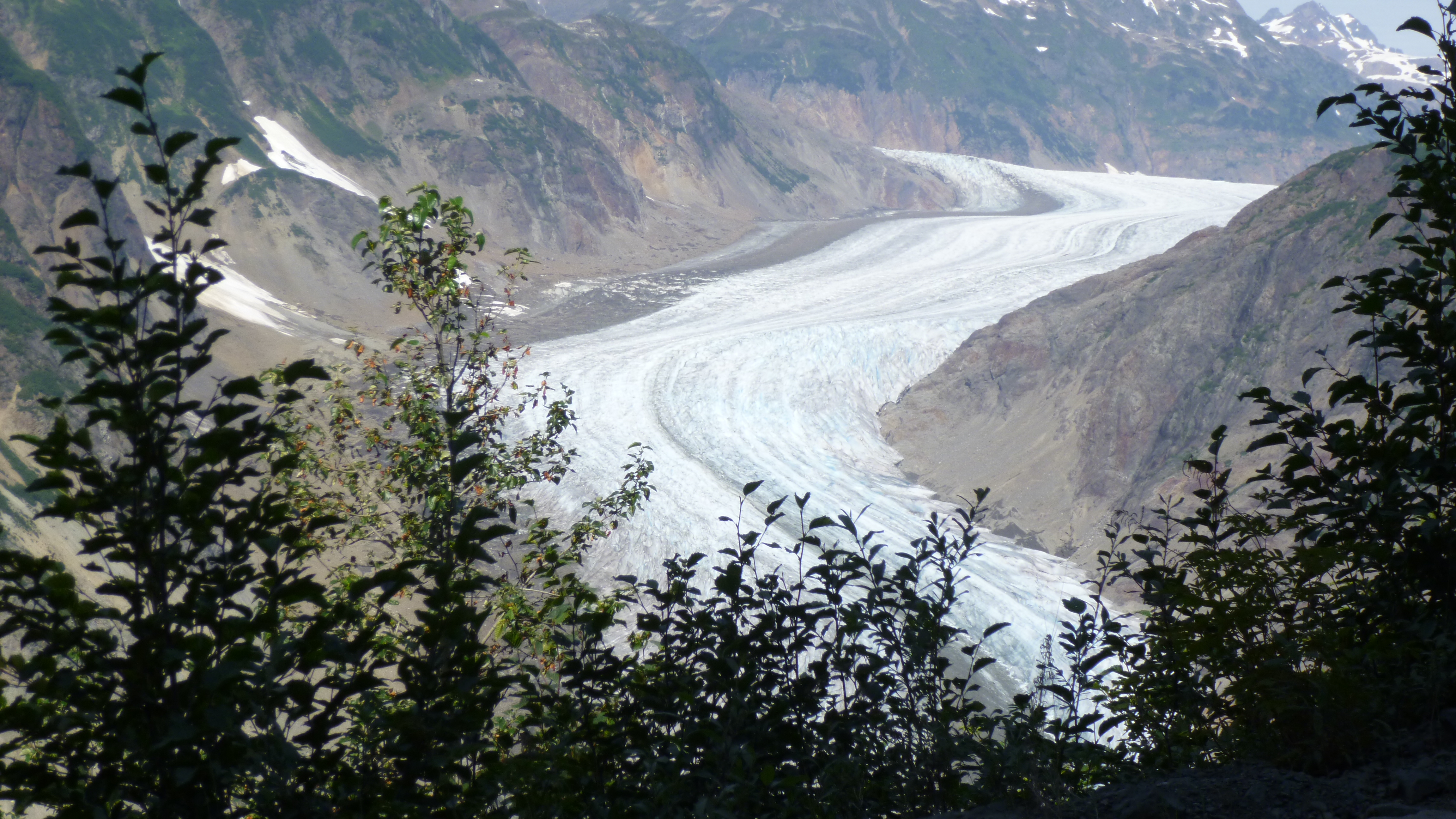
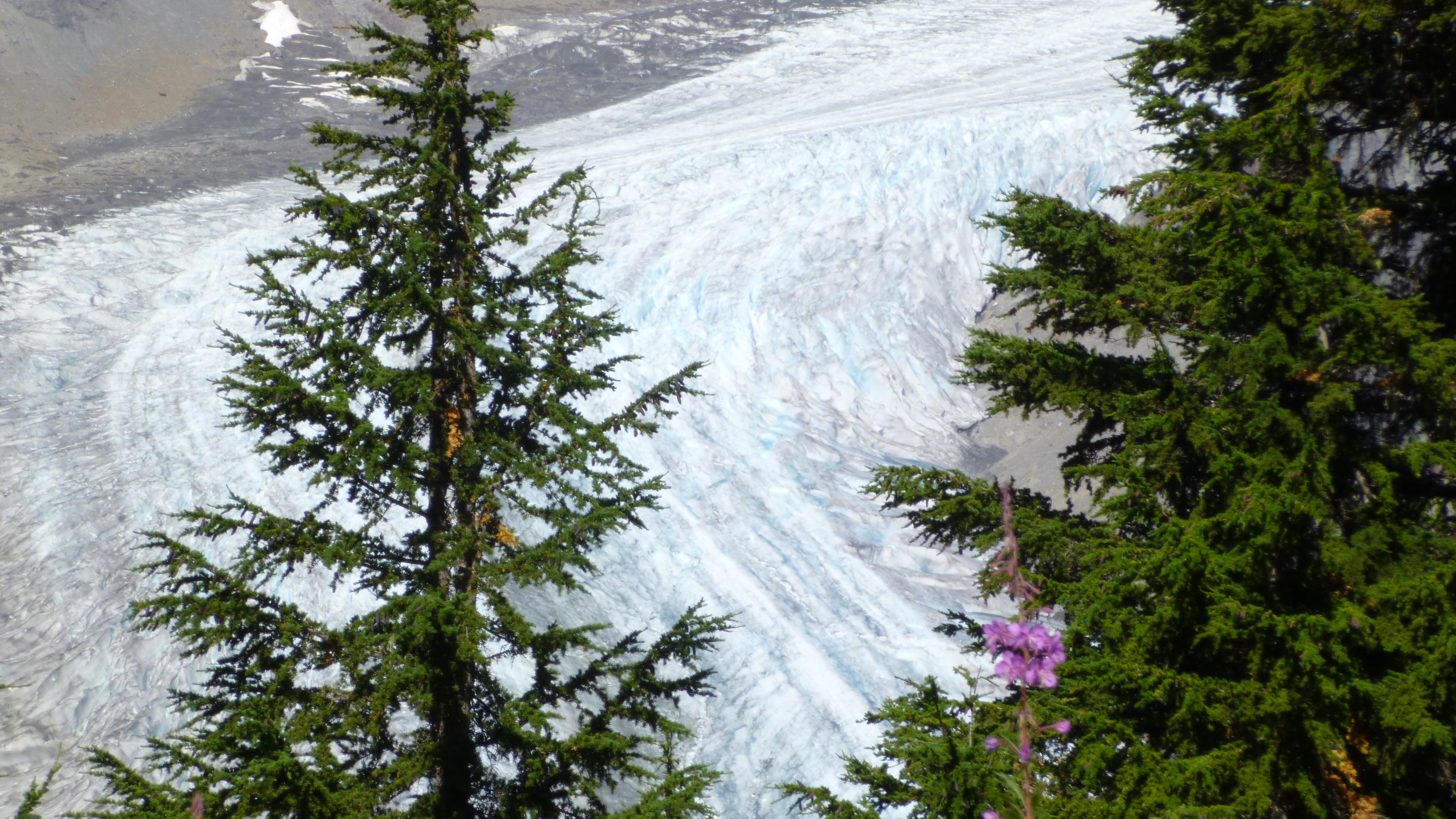
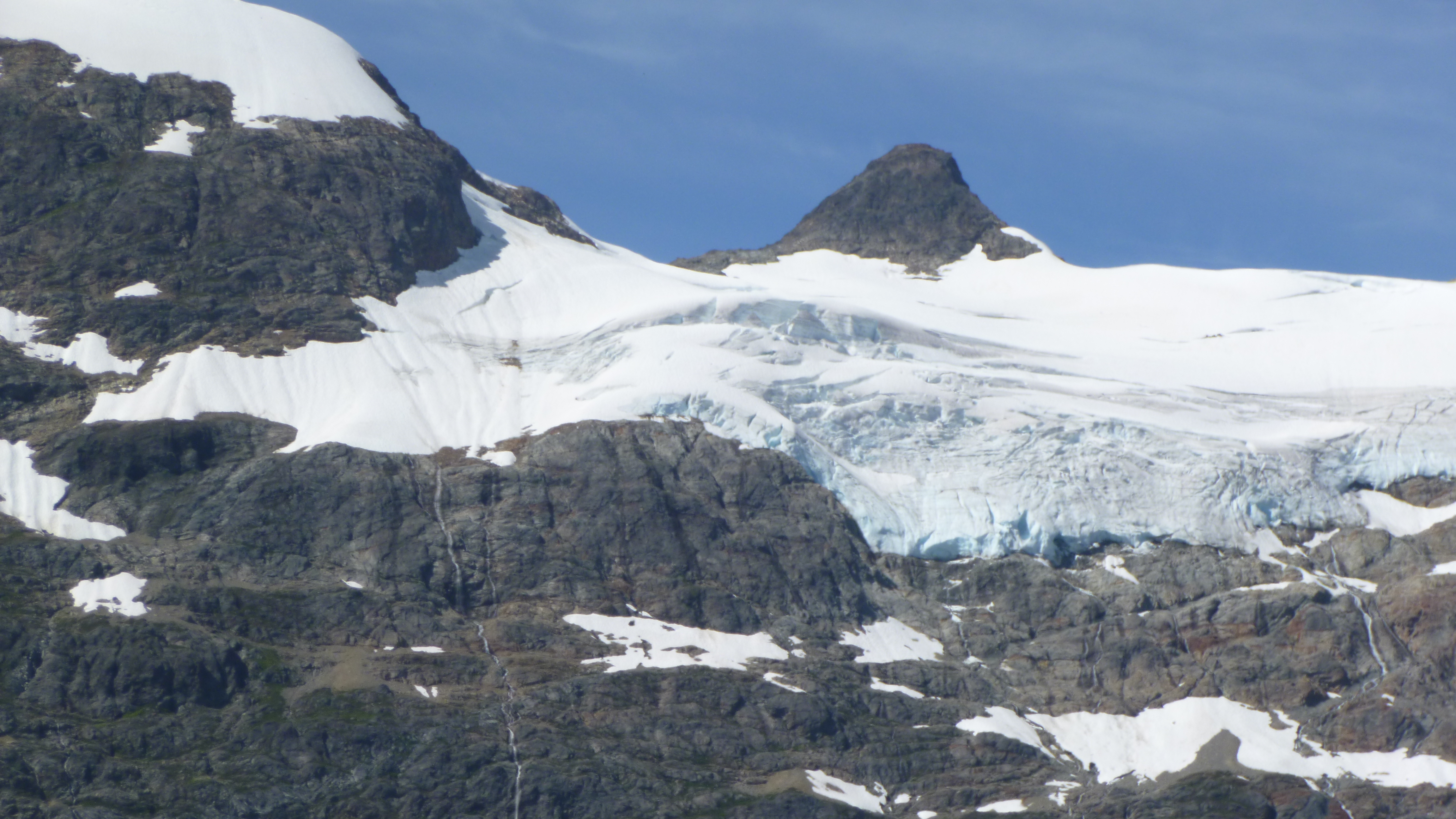
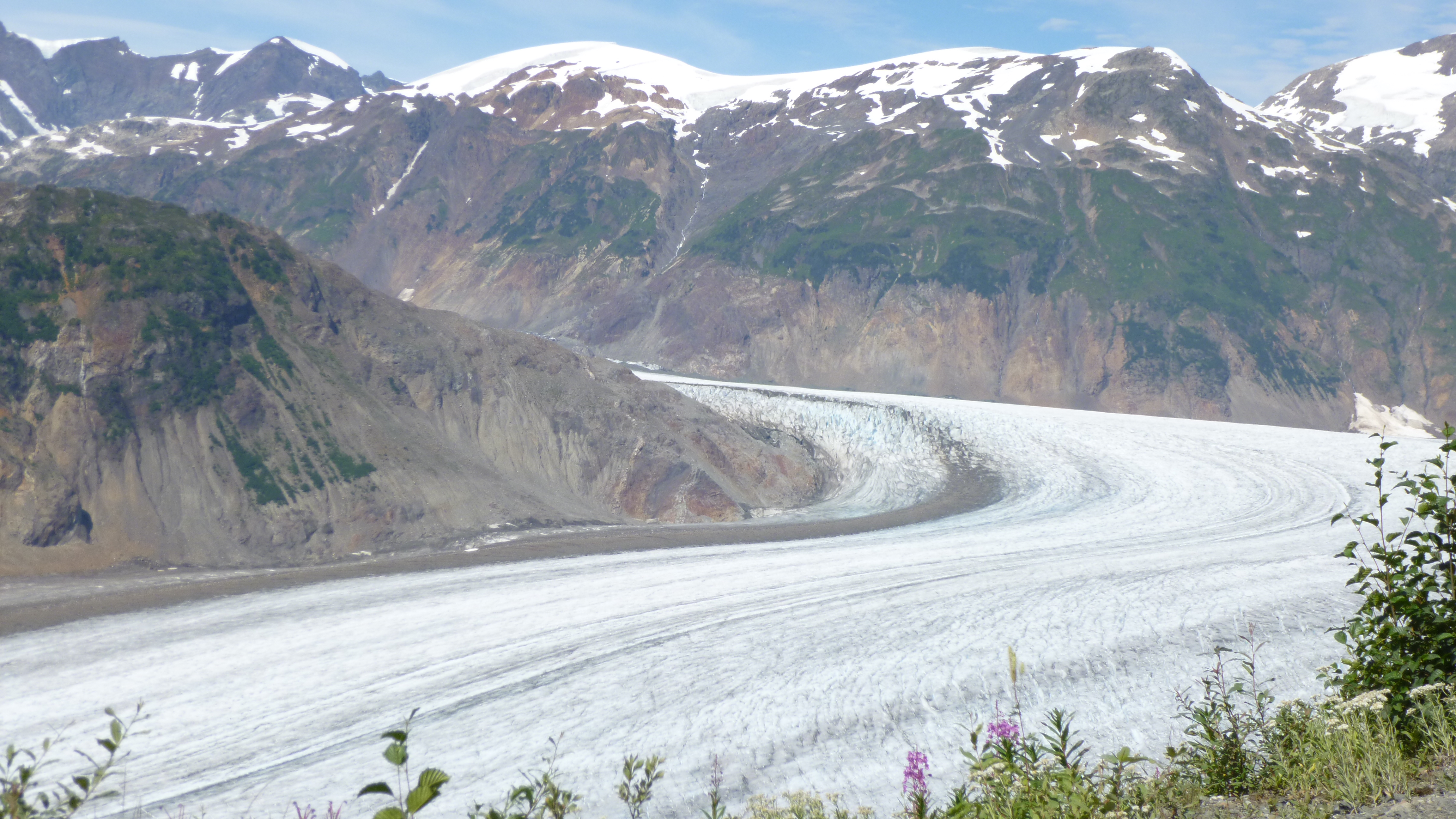
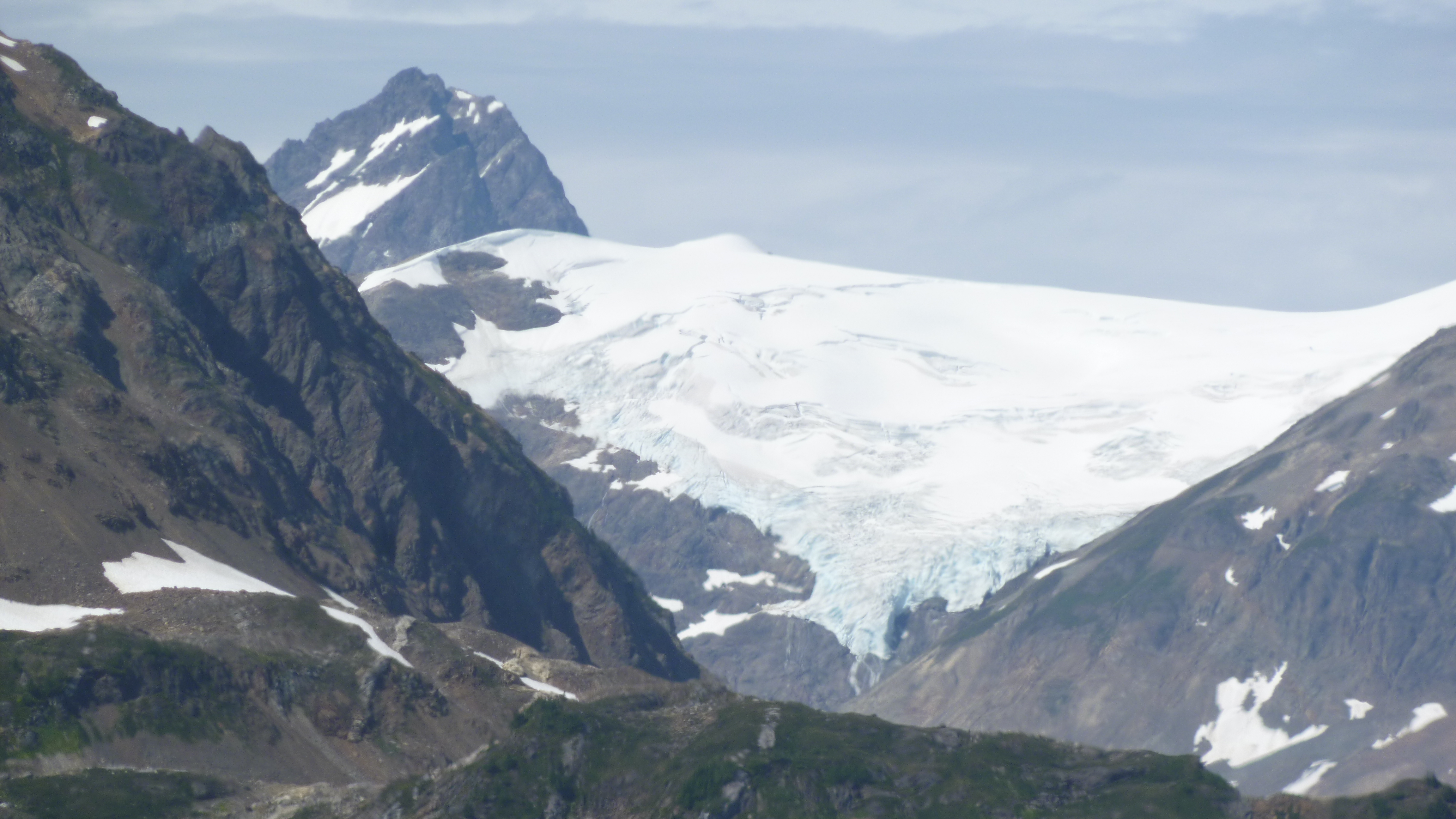
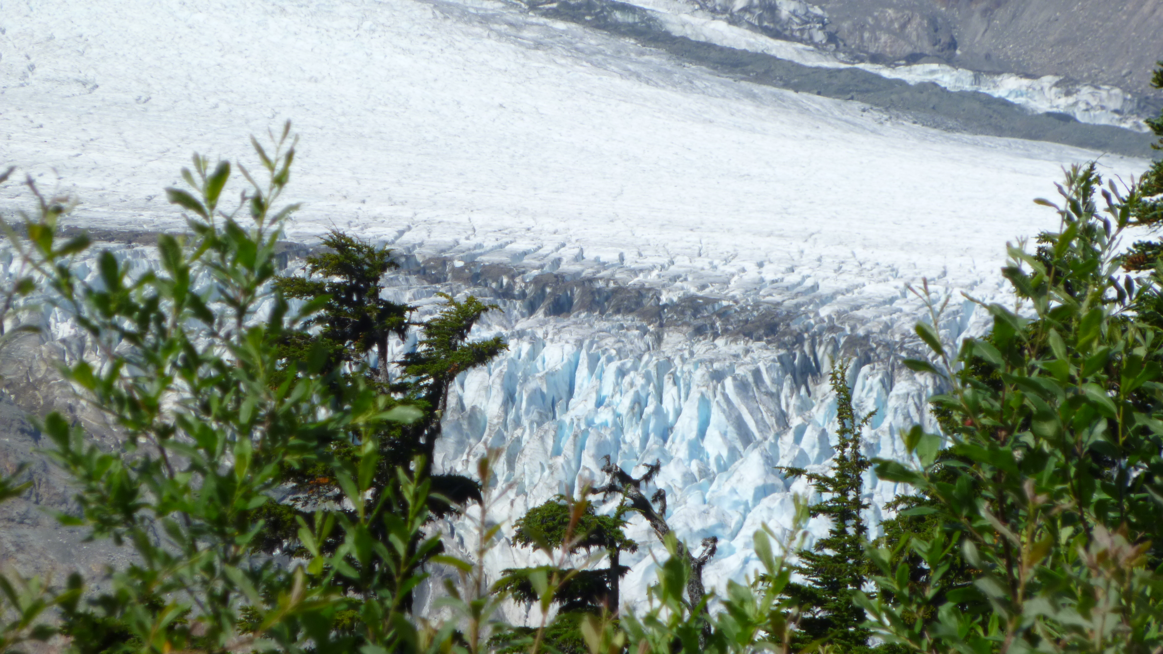
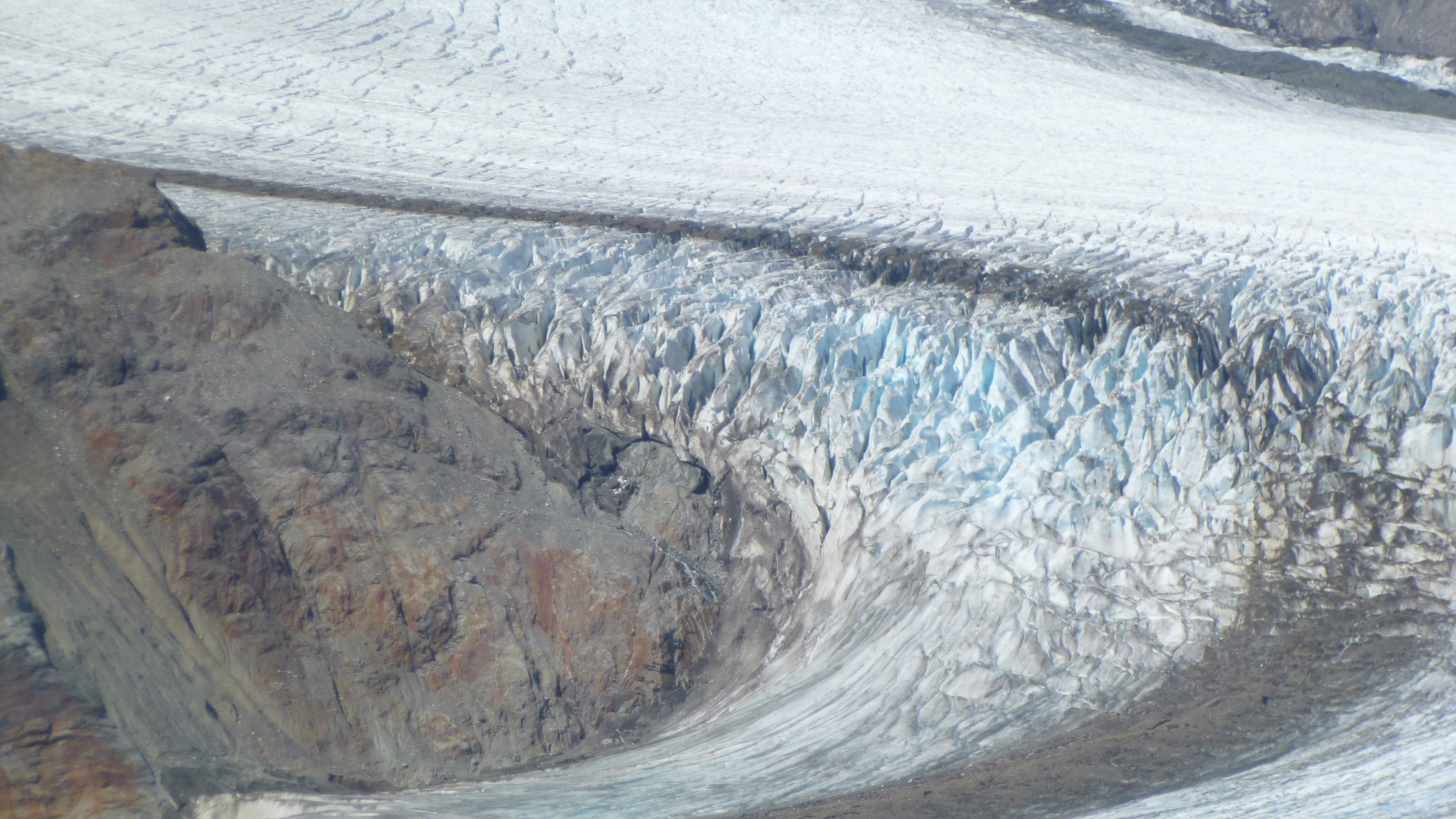
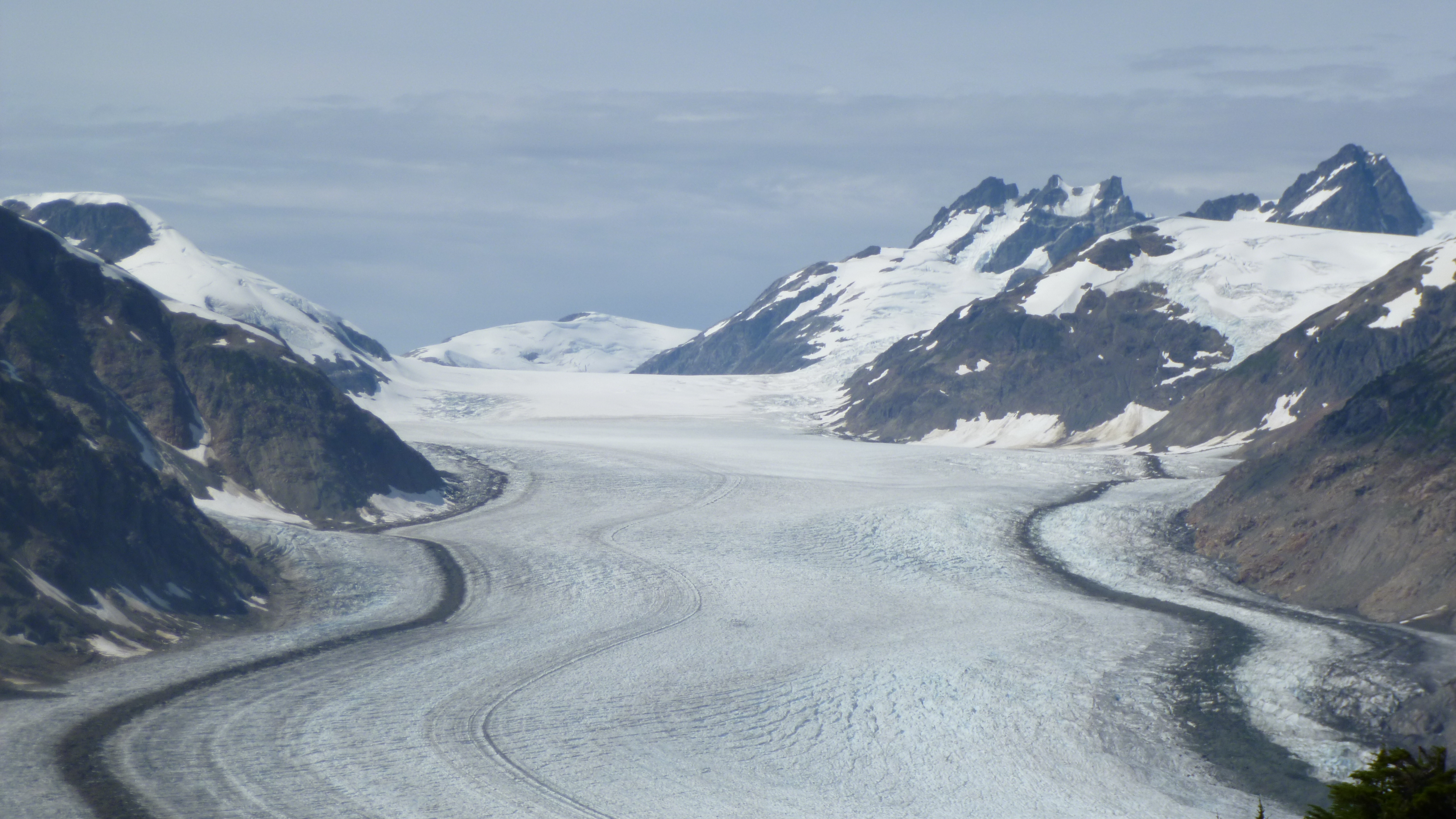
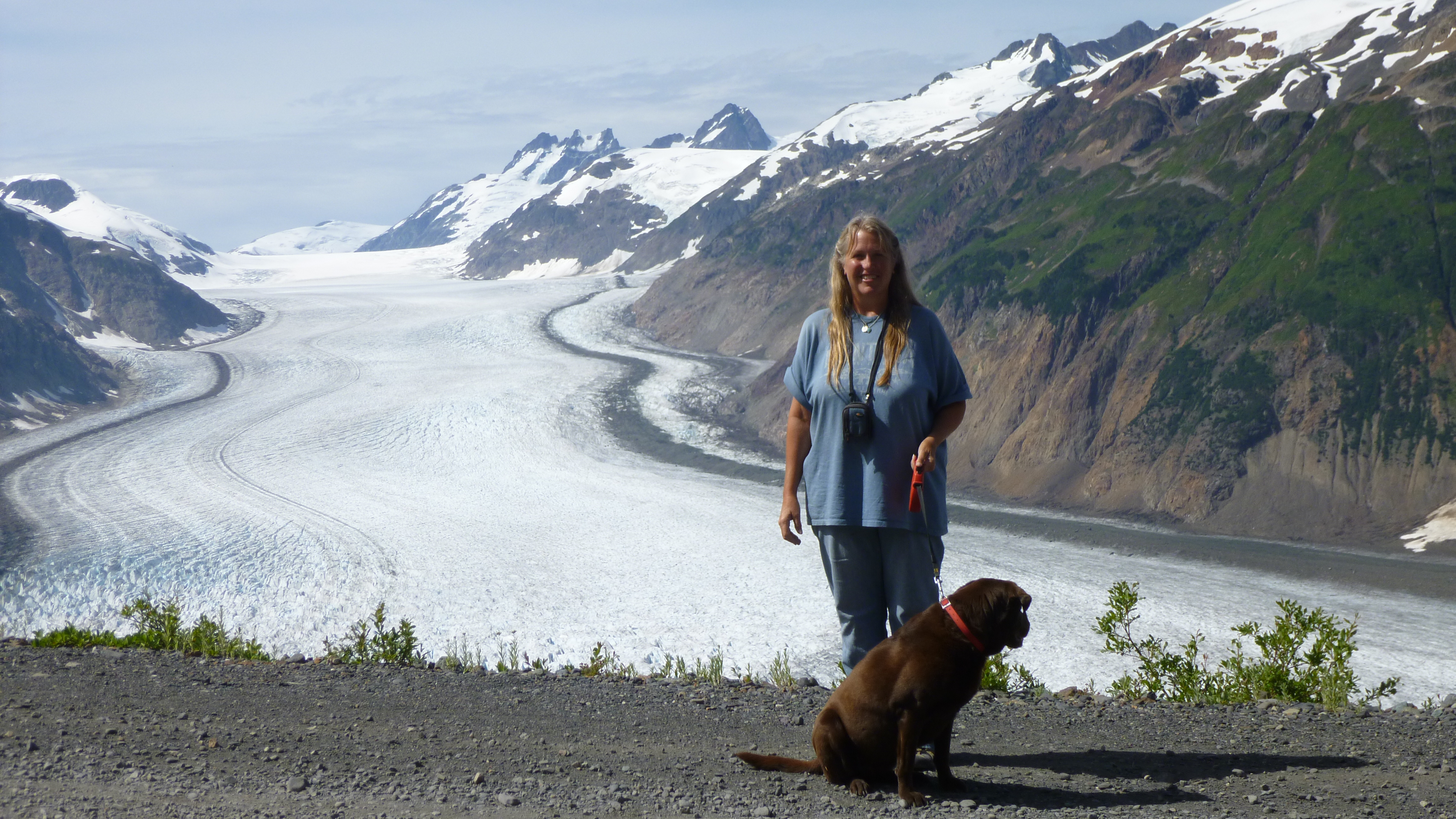
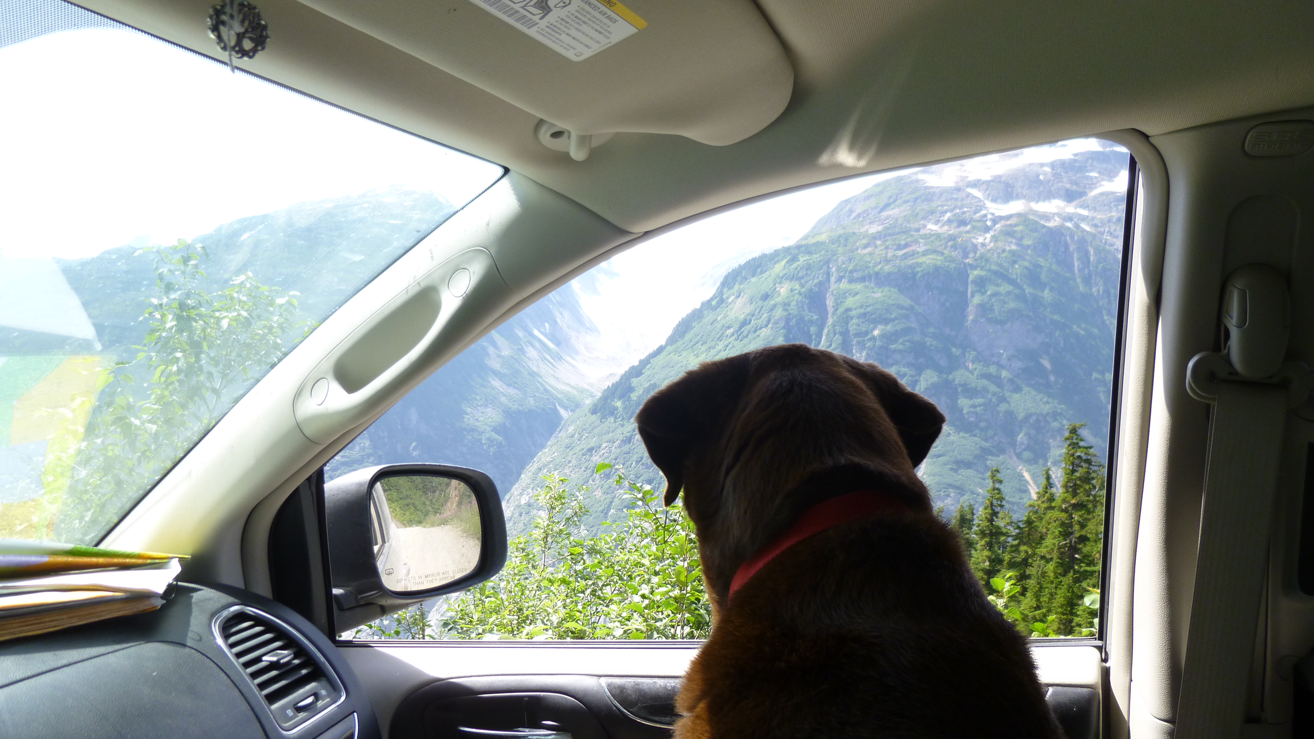
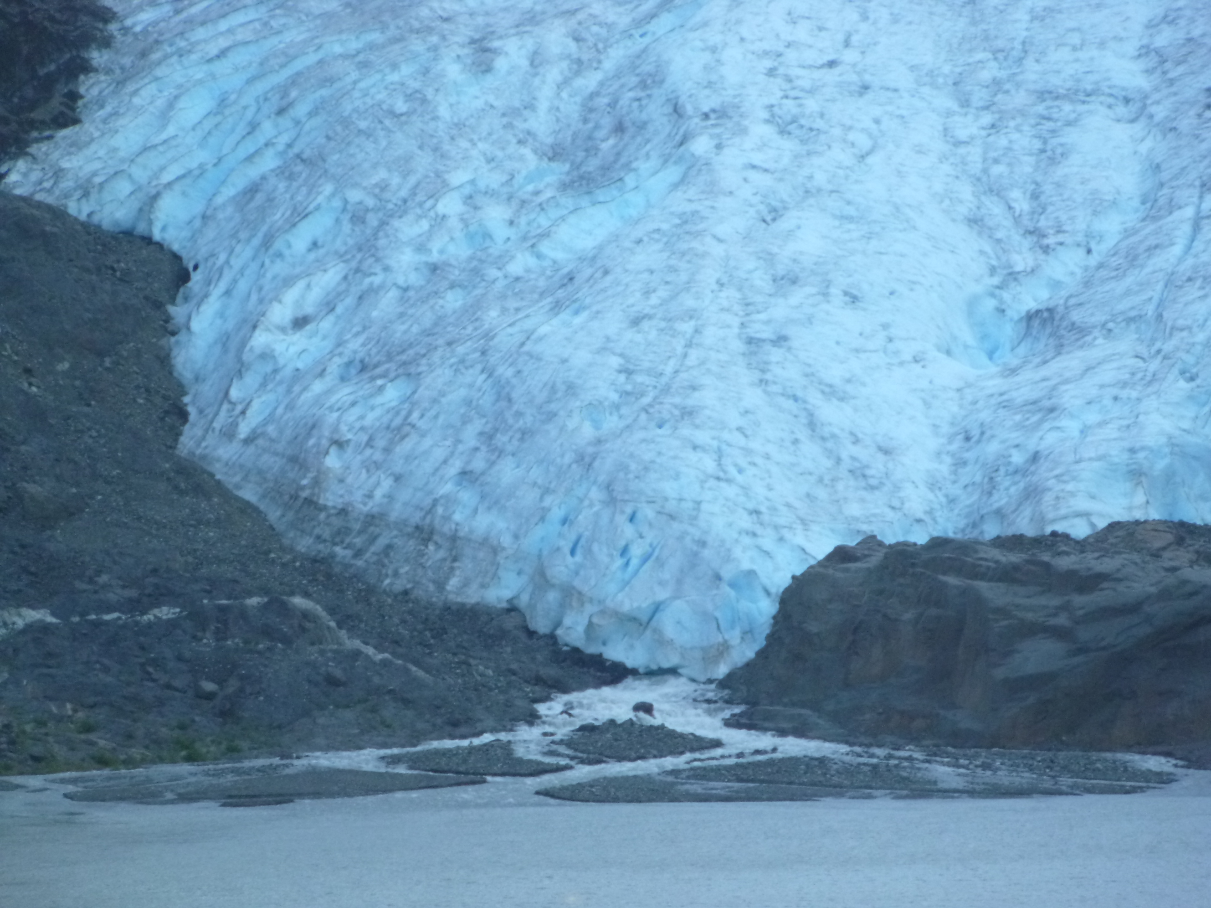
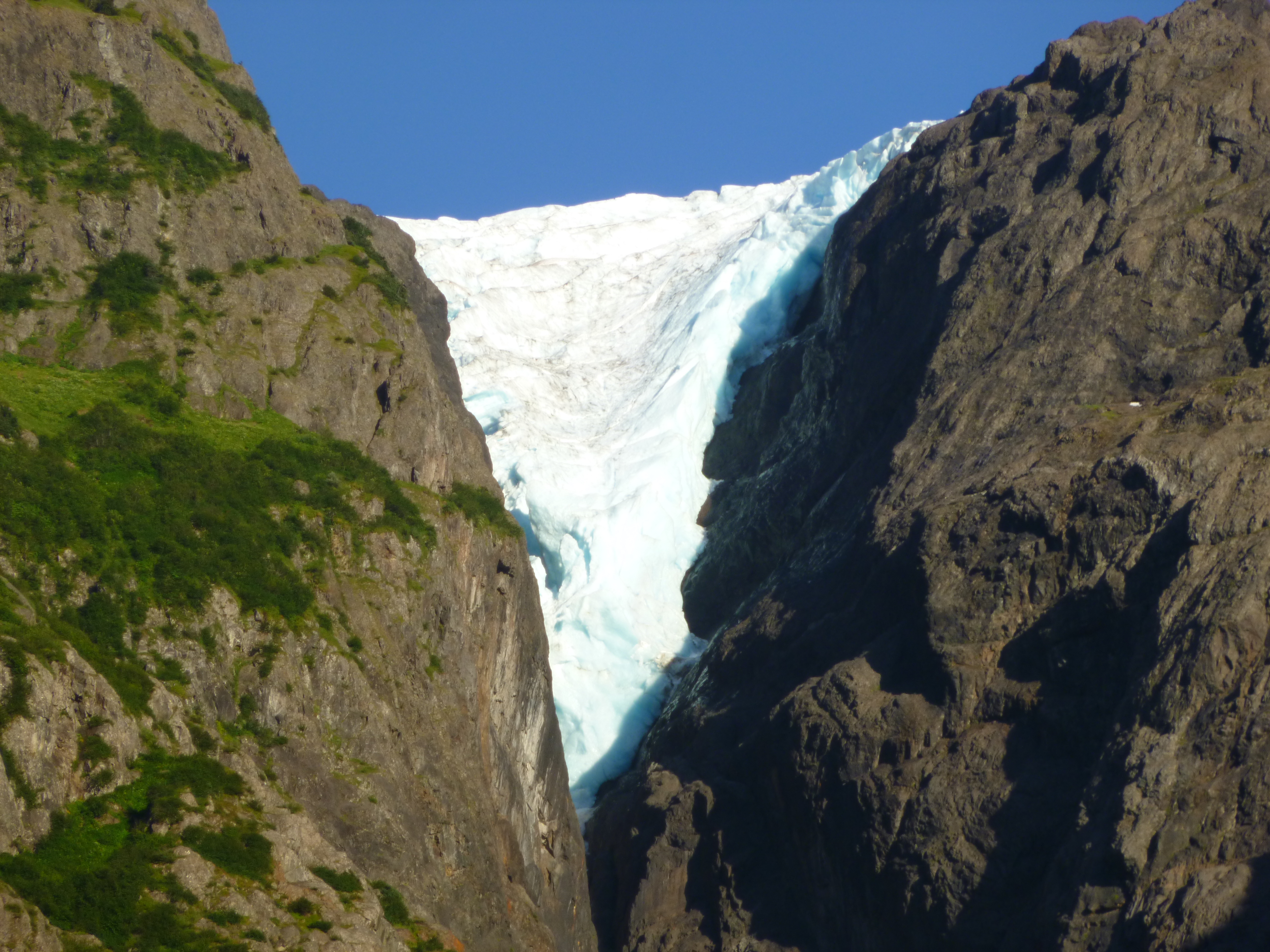
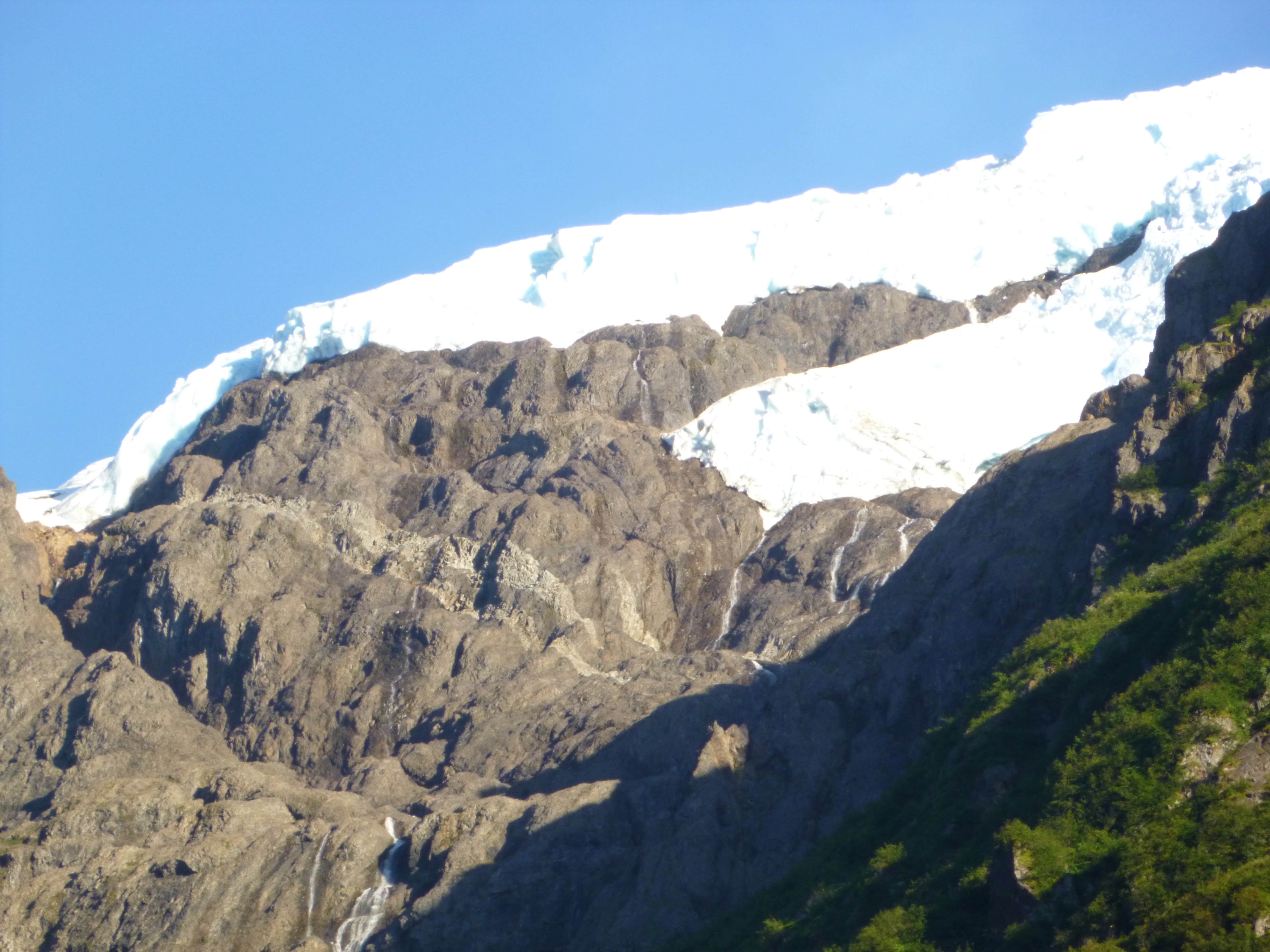
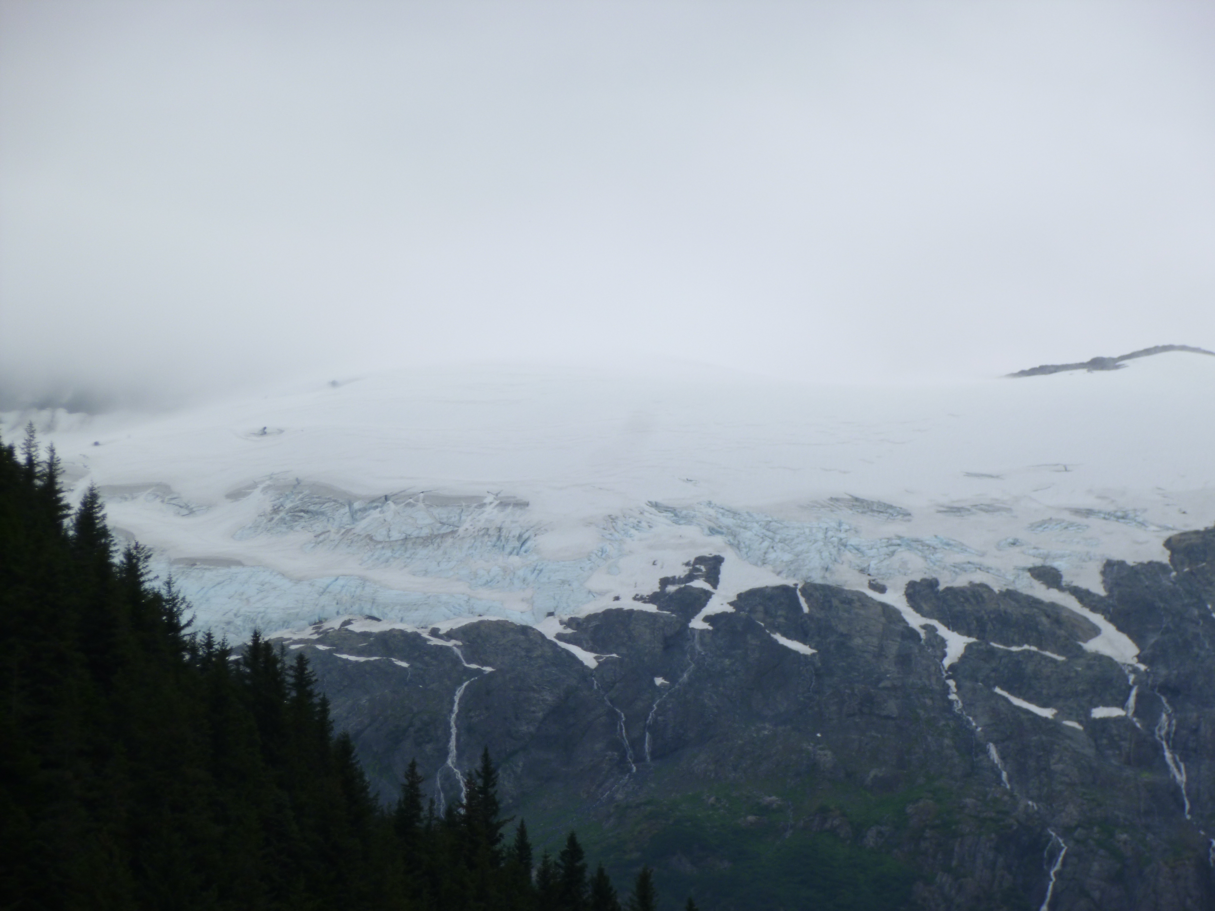
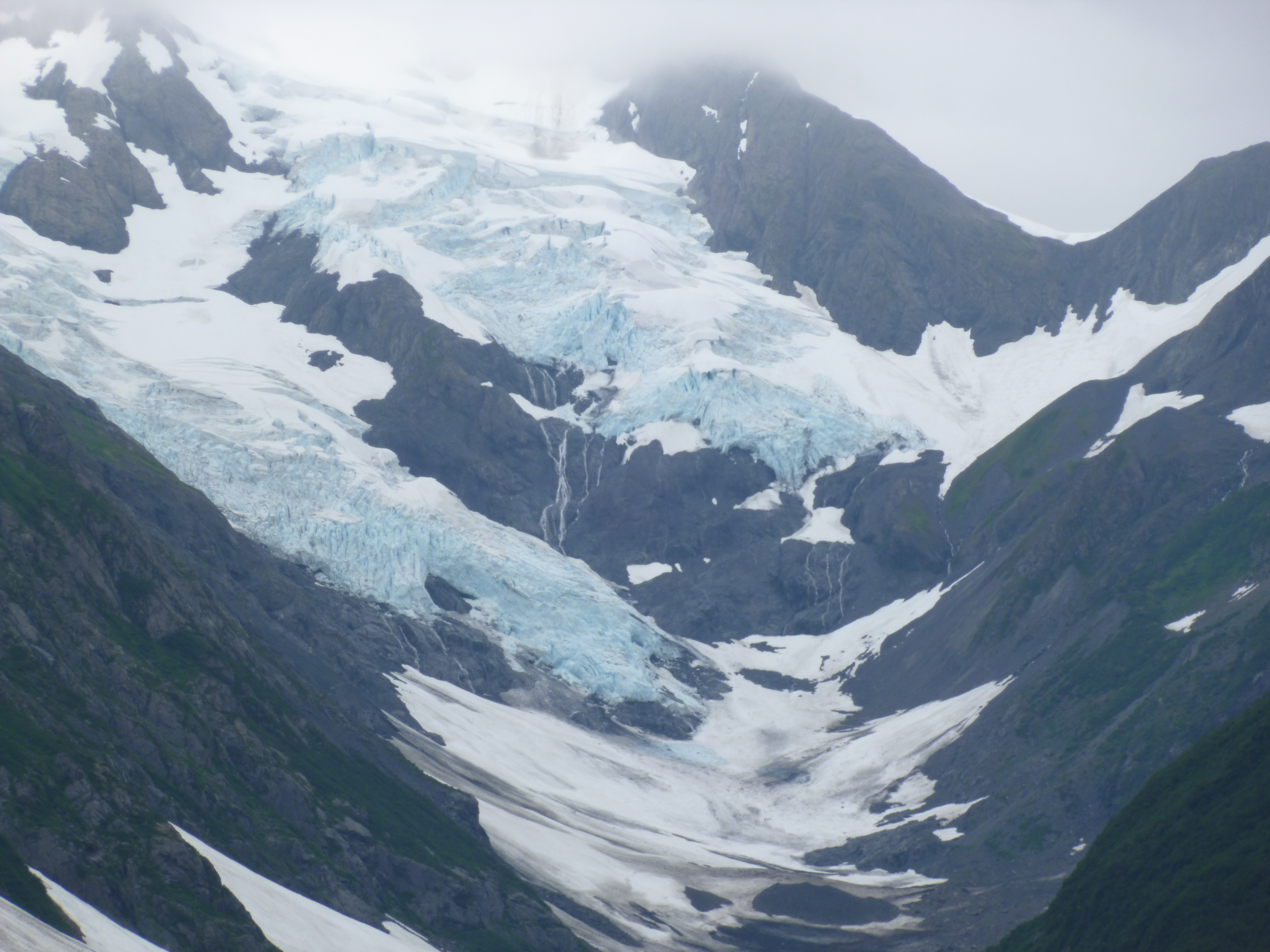
Once the bears wandered off, I tore myself away and headed up the mountain to see Salmon Glacier. The drive up was a very rugged gravel road, and it was steep and rocky. The 17-18 miles took a long time to drive, partly because I stopped frequently. I passed an old gold mine, which is no longer an active mine, but something else is going on there because there was more road work in that one section. And then the glacier became visible and it was huge. The road kept climbing and climbing, and I stopped several times for scenic views of the glacier, but it just got better and better the higher and higher I went. It was a fascinating view of a glacier from above, and when I got to the top of the road there was a little parking area, and I could see all the mountain peaks and the ice fields that the glacier came out of. It made me feel like I was on top of the world! Truly spectacular. I was sooo glad those people in Whitehorse told me about this – I wish I could thank them, but I have no idea who they were. I spent quite a bit of time at the top, soaking it all in. I just love the shades of blue in the ice. I got Tula out and we walked for a while. Other people set up chairs and just sat and gazed at the beauty of it all. I don’t think there are sufficient words to describe how spectacular it was!
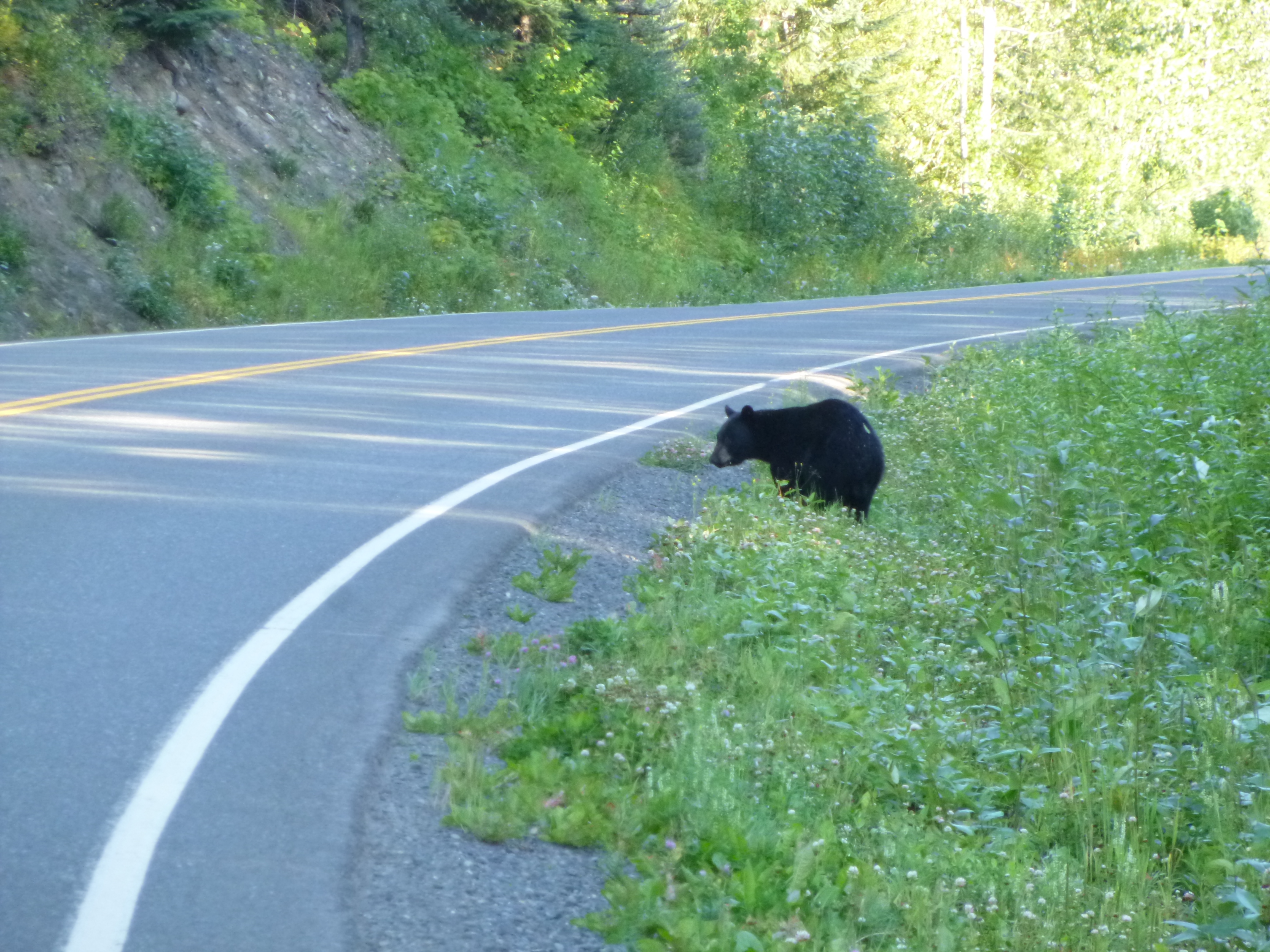
Eventually I began to make my careful way back down the mountain. Every vehicle that goes by kicks up a cloud of dust, and the van was filthy – I could use the wipers on dry dust! I stopped at the bear platform one more time, and just stood there watching all the fish. And then the lady I had met in the gas station yesterday came up to me – they had decided to check out the bears too! They hadn’t driven up to the glacier yet – her hubby doesn’t like to get their truck dirty! But I told her it was definitely worth the dust! They hadn’t seen any bears yet and were going to come back in the evening, when they were more likely to be around, but about 5 minutes after they left, another hungry bear appeared. Most of them are usually napping in the heat of the day, but this one didn’t take long to catch his prey, which he quickly ate and then wandered off upstream. Then it was time for me to head out, and continue heading south.
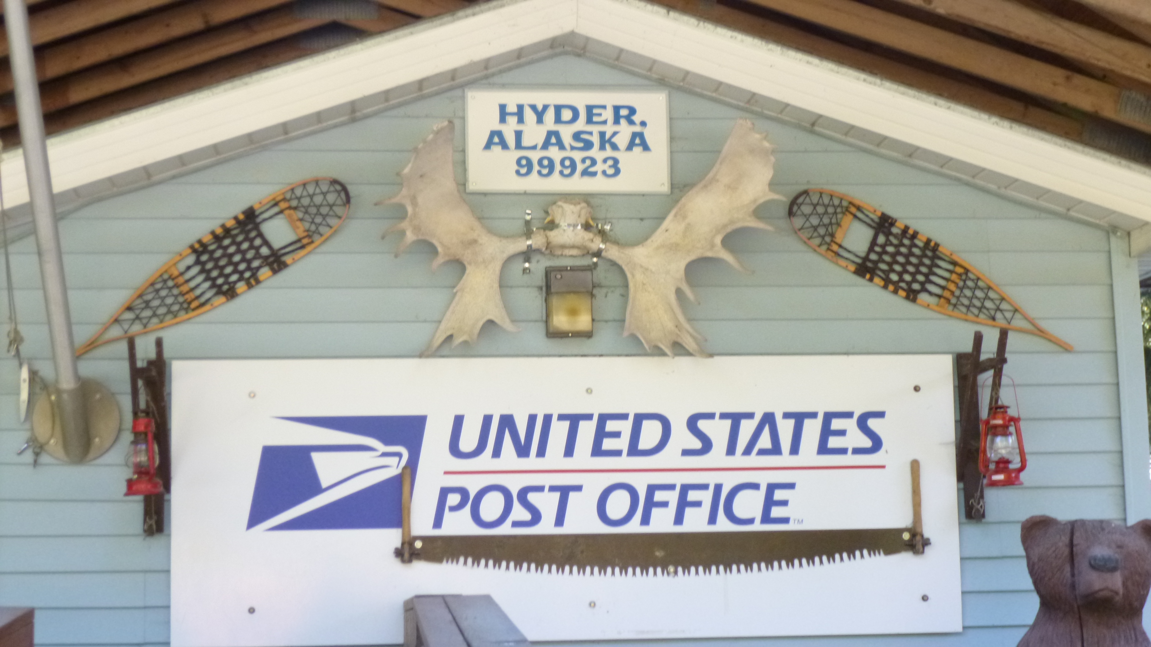
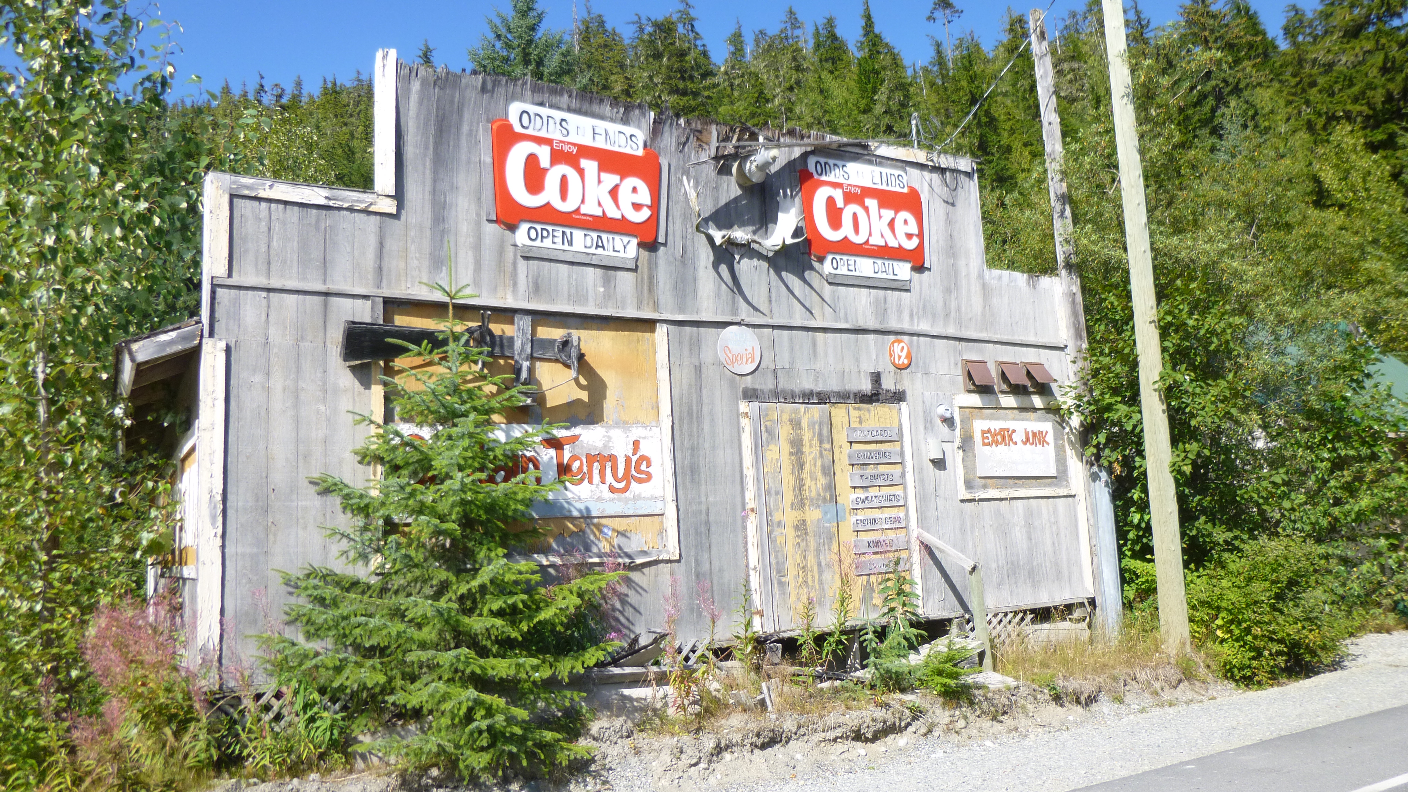
I drove down the little main street in Hyder and took a couple of pictures, and then I’d pretty much seen everything there was to see in town. It’s hard to believe people actually live here year-round. The general store didn’t even seem to have a lot of food and supplies, but I imagine they’re pretty careful about quantities of things that are brought in. I got through Canadian customs and drove for several hours – mostly south, and a little east, past the town of Smithers to the little town of Telkwa, at which point I began to get back into civilization. I was noticing the falling darkness (no more setting up late at night in natural light!), and had seen signs for a campground in Telkwa that sounded pretty nice, but when I found them, the place had already closed for the night. So I backtracked to where I had seen a small sign and an arrow pointing to another campground, and I wasn’t sure what I would find down the road. I met a lady on a golf cart, and she said they had one spot left, and it ended up being one of the prettiest, most spacious campsites I’d stayed at. Tula and I took a walk around after I was set up, and all the sites were large, and set back in the pine trees. Some of the sites had so much equipment in them – an RV, several tents, trailers, boats, cars, bikes, kayaks, etc. It’s still fun to see how some people decorate their sites with rugs, lights, signs and little knick-knacks – they’re the ones who are there for a while! It was kind of cool out, and I slept like a rock after my amazing extra day in Alaska!


British Columbia, Canada – Day 3 of trip south – Saturday, August 3
Tula and I took a short walk down by the river before we left our campground, then we started on our south-bound day. I wasn’t too far from the junction where I needed to turn to start heading south, and there was a gas station at the intersection, so I filled up. Gas is sold by the litre in Canada, and it’s definitely more expensive than in the U.S., especially at these remote stations. Nearly everyone driving by stops though – gas stations can be at least one or two hundred miles apart, and this isn’t the place to be running out of gas! Usually I can figure out how the pumps work, but this one had a weird central payment pump, and I was having a little trouble figuring it out, and ended up getting help from the 10 year old Alaskan boy in the truck next to me! And then he showed me his “pet” baby bird.
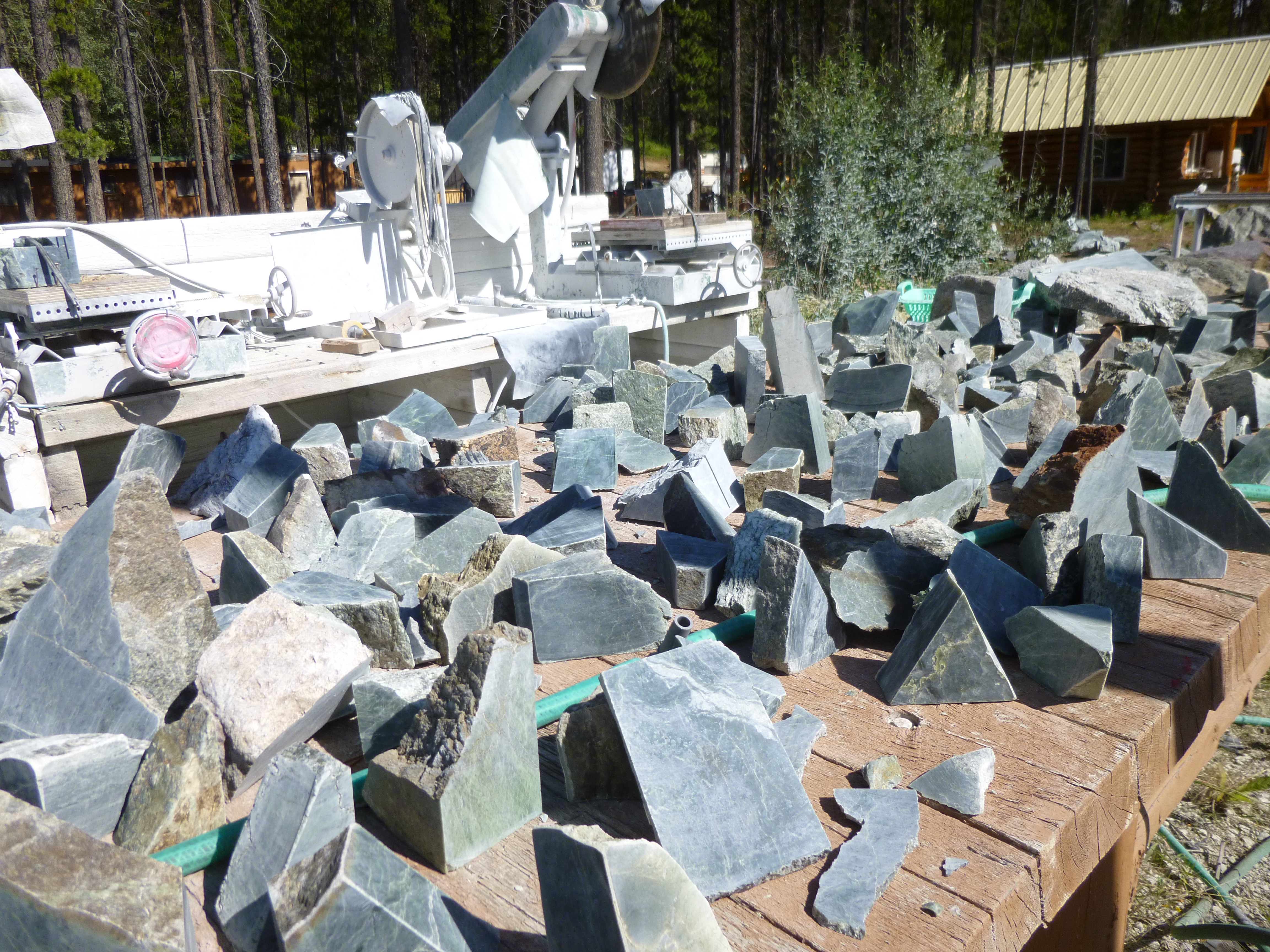
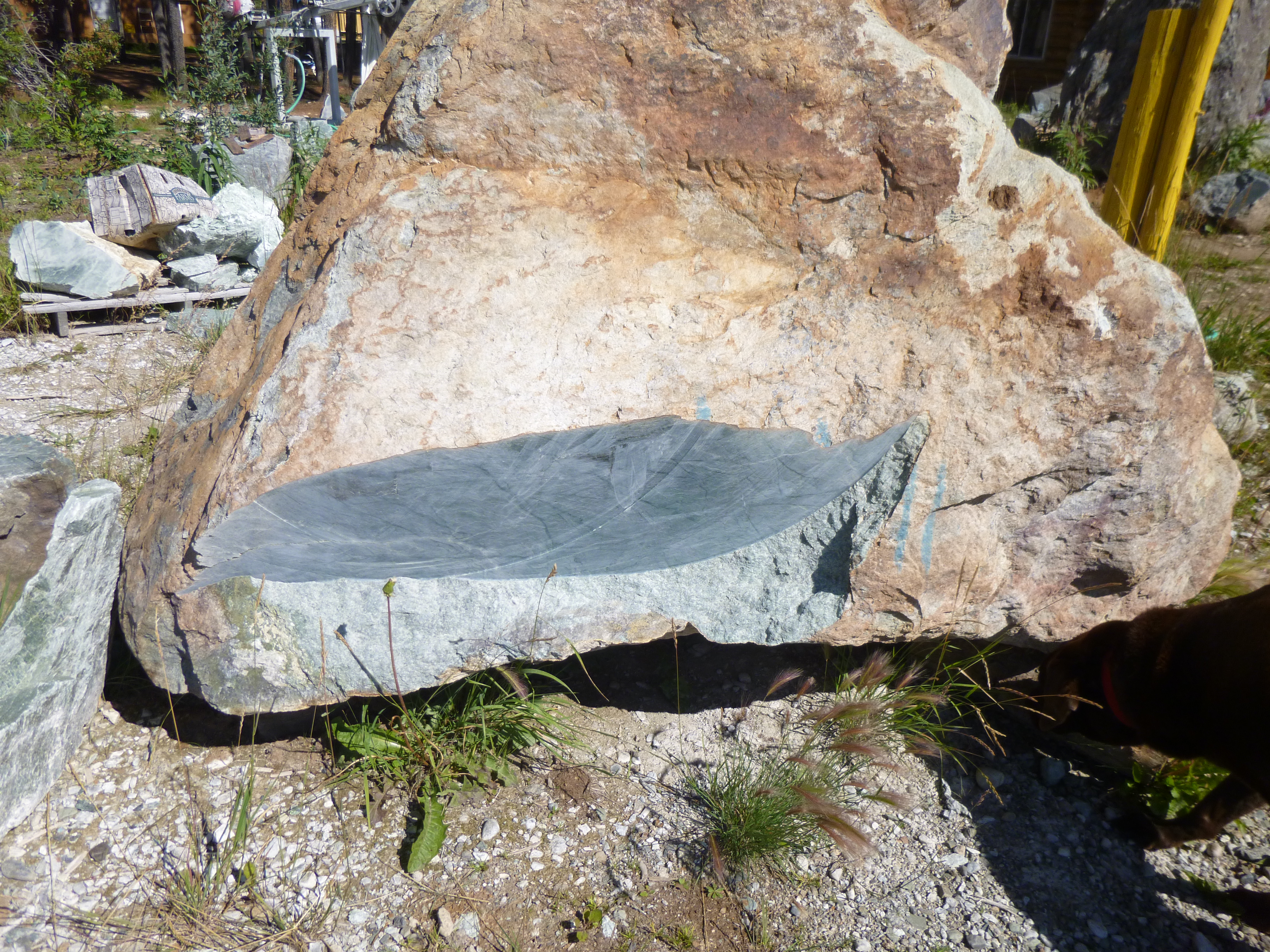
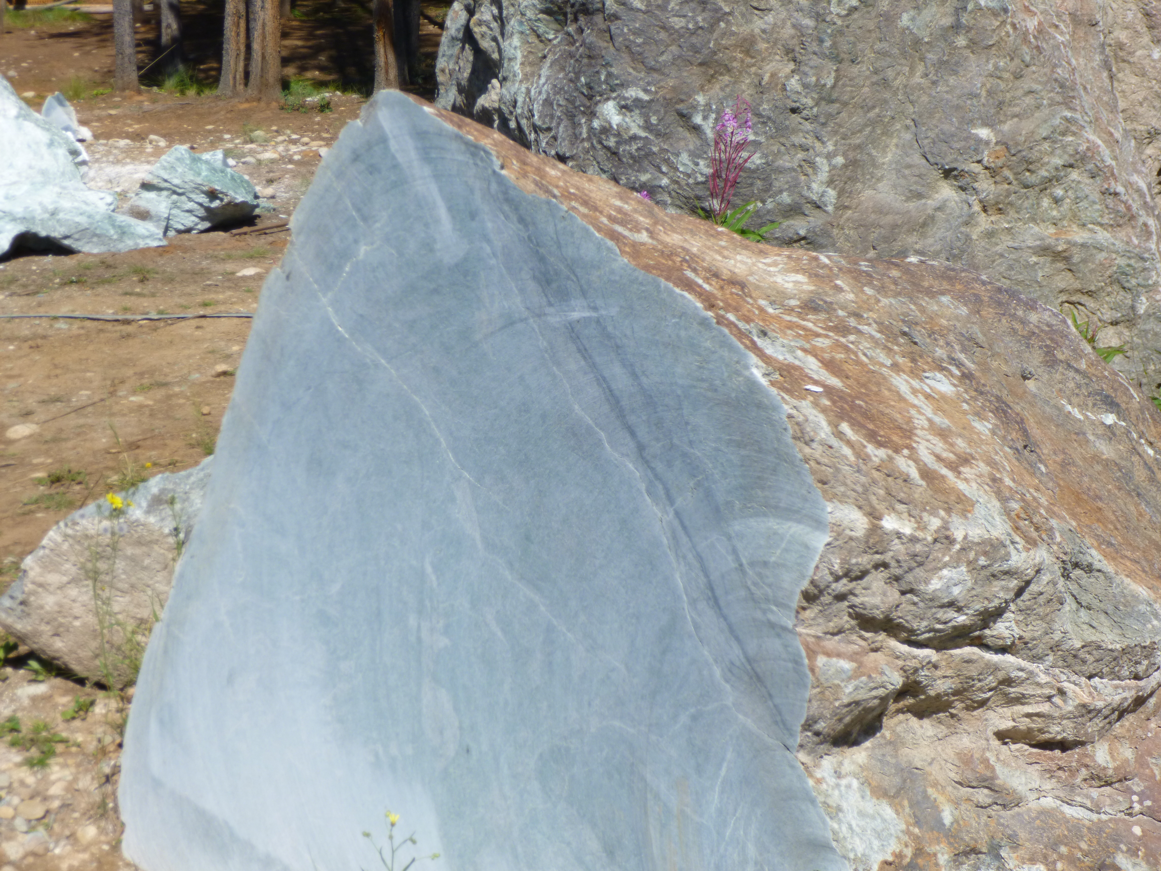
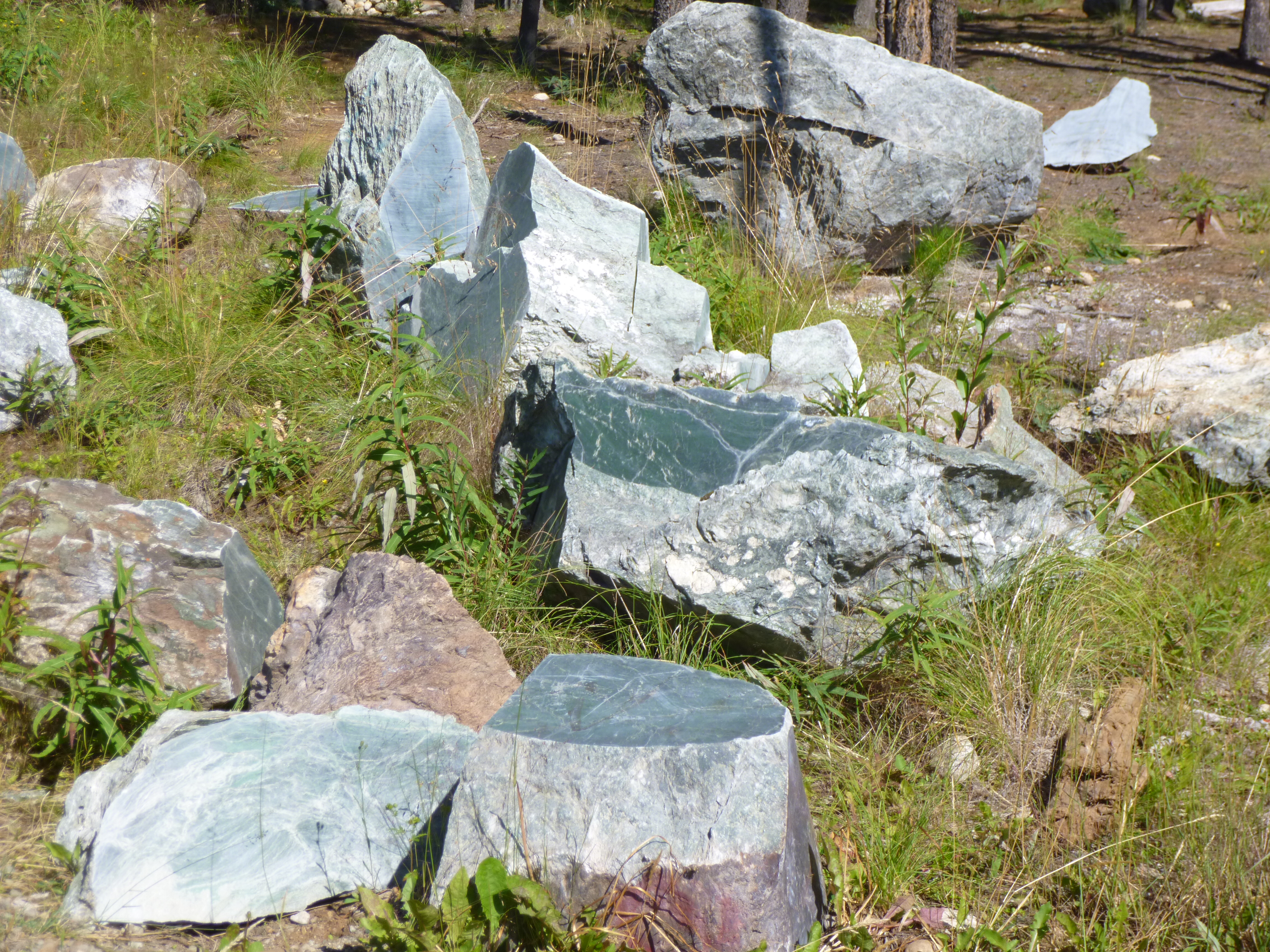
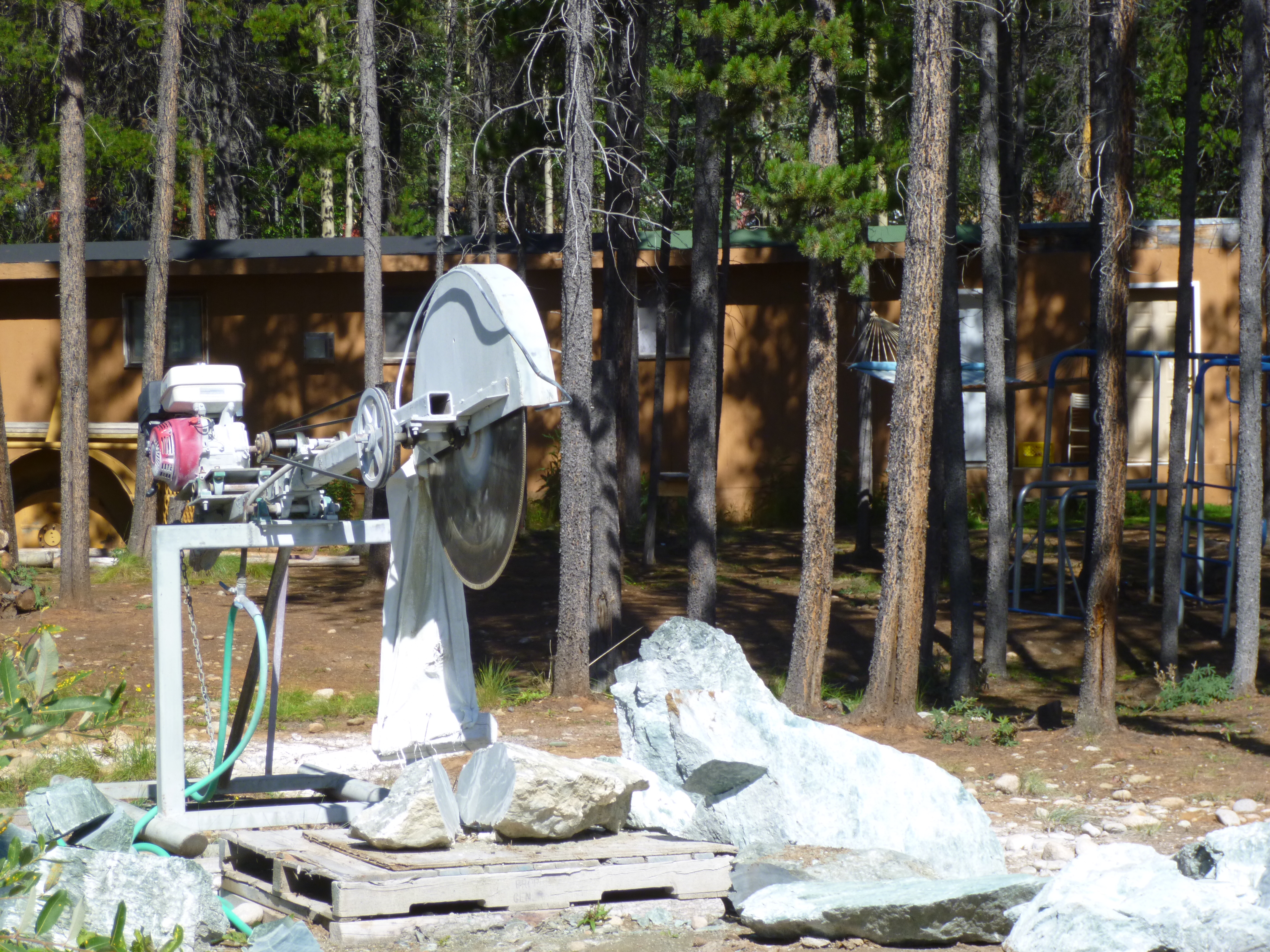
My road south was more like a narrow neighborhood street than a highway, and once again it was a bit of a slow go. There were no markings on the road – no center lines or fog lines, and it went through some pretty thick forests. I felt like I was only person out there! Then I passed miles of burned trees, but I would guess the forest fires had been a few years ago, because there was quite a bit of green on the forest floor. And then I came upon a mountain goat munching grass on the side of the road. After a couple hours, I came to Jade City, which isn’t really a city, but a family-owned jade mine and gift shop, and my mom and I had stopped here on the last drive down from Alaska. There were jade rocks and chunks all over the place, and slabs of it sitting on wagons and other little pieces that were for sale. There was some mining and cutting equipment to look at, and their gift shop had hundreds of jade figures for sale, along with jade jewelry and other things. It was fun to browse around a bit – I don’t think I’ve ever seen so much jade in one place!
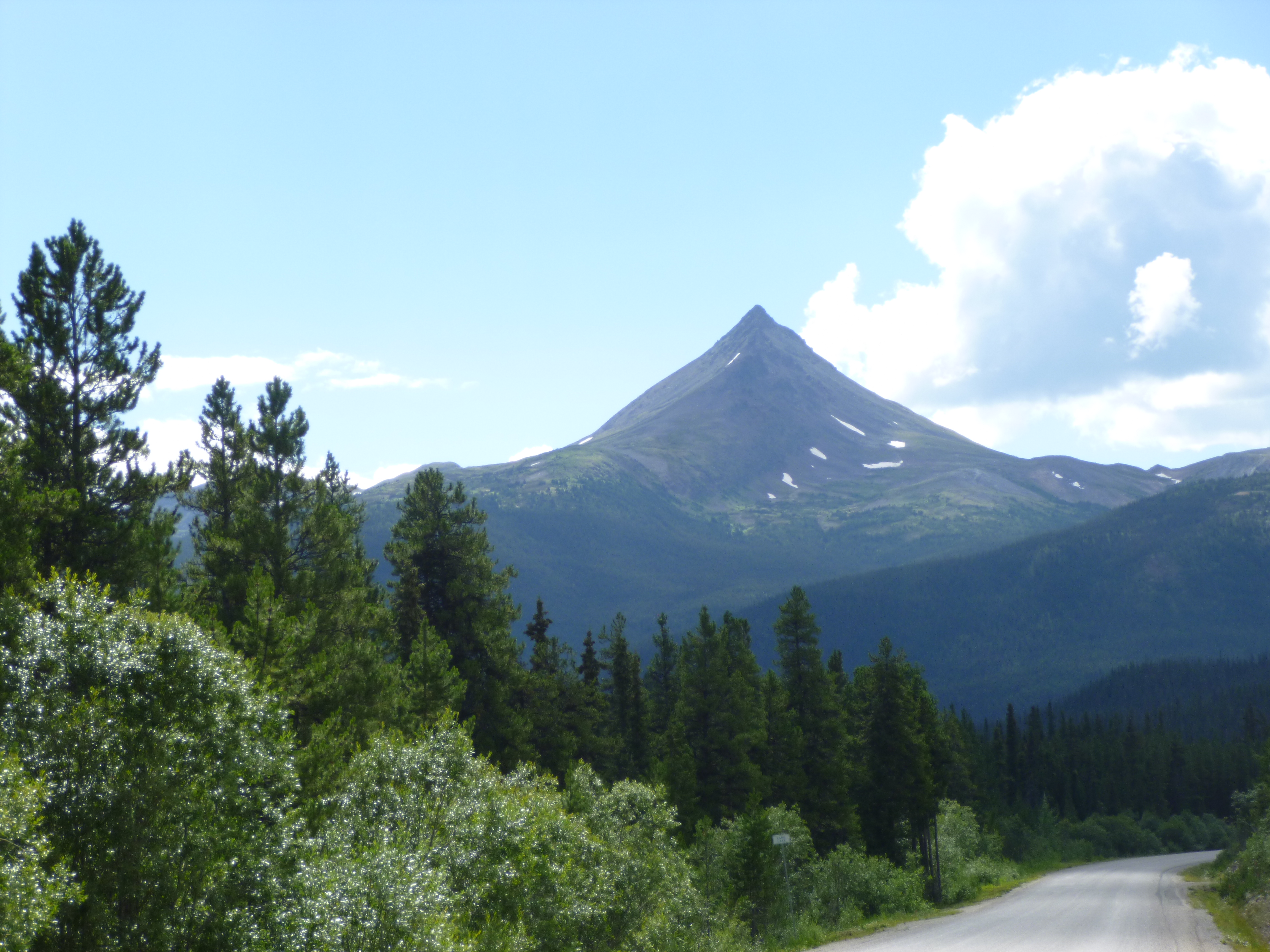
As I drove farther south, I began to see the Coast Mountains off to the west. It’s a spectacular mountain range – with snow and ice up in the peaks, and it made for pretty driving. After about 250 miles of driving, the road finally became more like a “normal” road, and I was able to move along a little faster. I came to another gas station in the middle of nowhere, and I stopped, along with other travelers. I was walking Tula, and met another lady walking her dog, and she was headed down to Washington too. She’s another person who told me how pretty the Valdez drive is in Alaska, and I told her about the bears and glacier in Hyder – she was very interested.
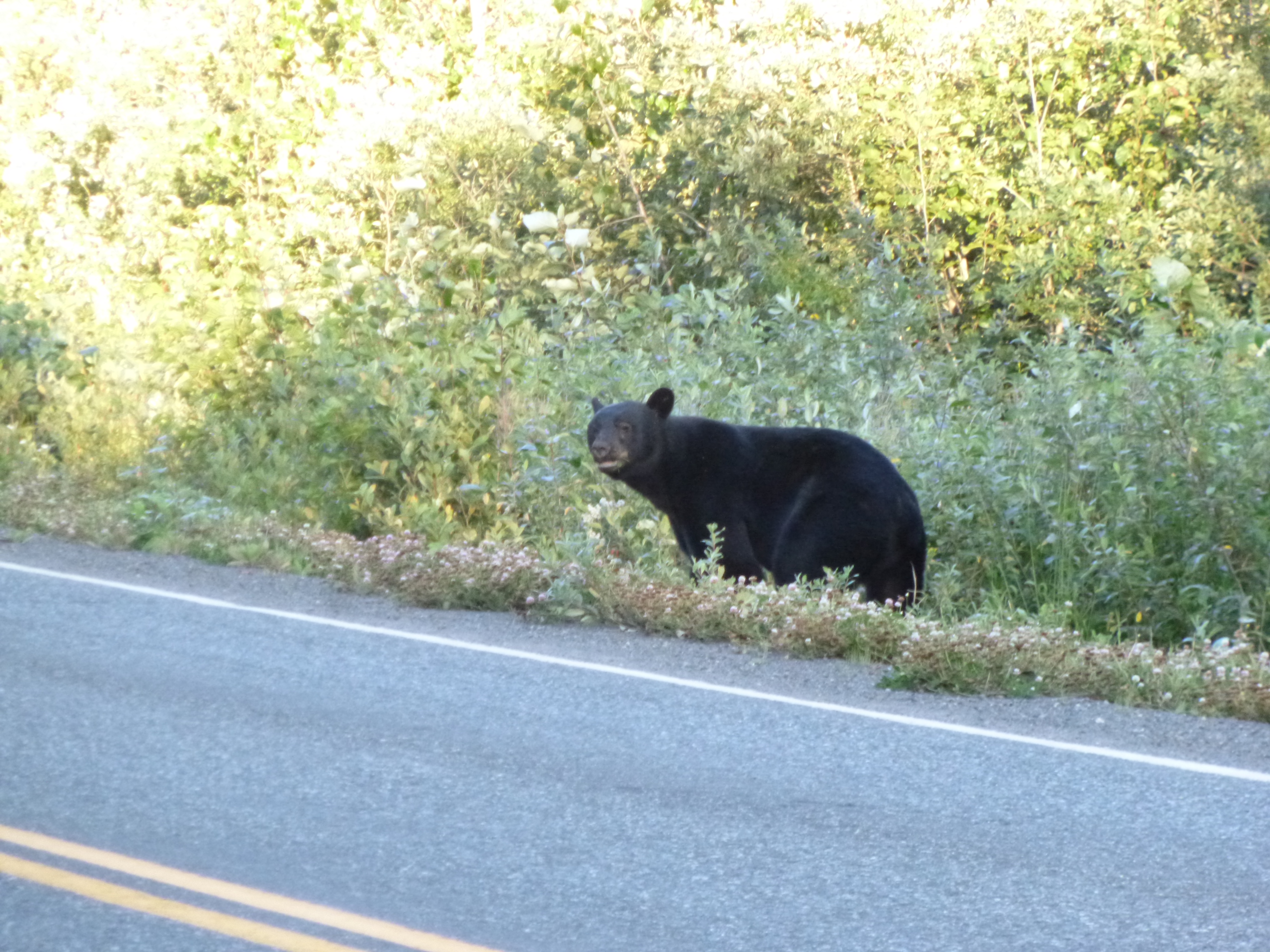
I continued along my way, and rounded a curve and saw a bear on the side of the road, and then it walked across. I was even closer to the mountains by now, and it was gorgeous – glaciers and ice all over the place. Then I passed another bear, and turned around for another look – Tula was napping on the floor of the van or I wouldn’t have been able to get some of the pictures I did! I just stayed in the van. I admired the mountains, snow and glaciers some more, and then I crossed back into Alaska, which I certainly hadn’t expected to be doing again so soon! There were border guards for the people coming back into Canada, but not for those who were going into Alaska (probably because there’s only one main road, which eventually ends, so one can’t really go too far by car in that part of Alaska!) It was starting to get dark, but I asked some people about the bear-viewing platforms and I wasn’t too far away so I drove up there. The rangers were only going to keep the area open for another half hour or so. I walked out onto the long platform and was astonished to see all the salmon in the very shallow stream. Even though it was getting a little dark, I could see the water was crystal clear, and there were lots of sizes of fish. And then a bear waded right into the stream in the midst of all the fish. It walked back and forth for a while, and then all of a sudden it pounced, kind of like a big cat, and hunkered down over its prize, and then it stood up with a big salmon flopping around in its mouth. The bear carried the fish into the woods right by the stream, and we could hear some thrashing around, and the bear apparently enjoyed its meal, and then came back out and got a drink from the stream. That was pretty amazing!
When I was finding the bear-viewing place, I had passed the only little campground in Hyder (which is a very small village), so I drove back and there were still had a couple sites available even though it was kind of late, so once again I was camping in Alaska! It was almost dark by the time I was set up – I was about 600 miles farther south tonight than last night, and it does make a difference.


Canada – Day 2 of drive back to Lower 48 – Friday, August 2
I went over to the campground office and registered since they had been closed last night, and then Tula and I took a little walk around the campground by the lake. The owners of the campground live in Ontario and drive west each summer for June, July and August to run the campground. They’ve got a beautiful waterfront location. The camp office had wi-fi and I got on the computer for a few minutes and found out that niece Erin had a healthy baby boy yesterday! So I’m a great-aunt for the third time – and will have one more great-nephew in September. This generation is starting off with all boys; yet when my girls and their cousins were born, it was all girls at first. I guess it all more or less evens out in the end!
Then I continued my drive through southern Yukon, passing the very tempting turn-offs for Haines, Alaska and Skagway, Alaska. They’re too far away to make a little side trip back into Alaska, so will have to be added in to my next journey north! After driving 160 miles or so, I came into Whitehorse again, which is the capital of the province, and I like the city – even though it’s the capital, it still has kind of a small town feel. I decided to go back into the visitor center to talk with them about the 2 possible routes I can choose from for my southbound drive through British Columbia. When I drove up to Alaska, I came from Montana, but on my southbound trip, I’ll be heading toward Washington, so in a couple hundred miles I’ll be parting ways from the route I took on the northbound journey. The 2 “highways” are about equal in length – both will have some roadwork and construction going on – but she did say I might see some bears near Stewart if I took the western route, which I was leaning toward.
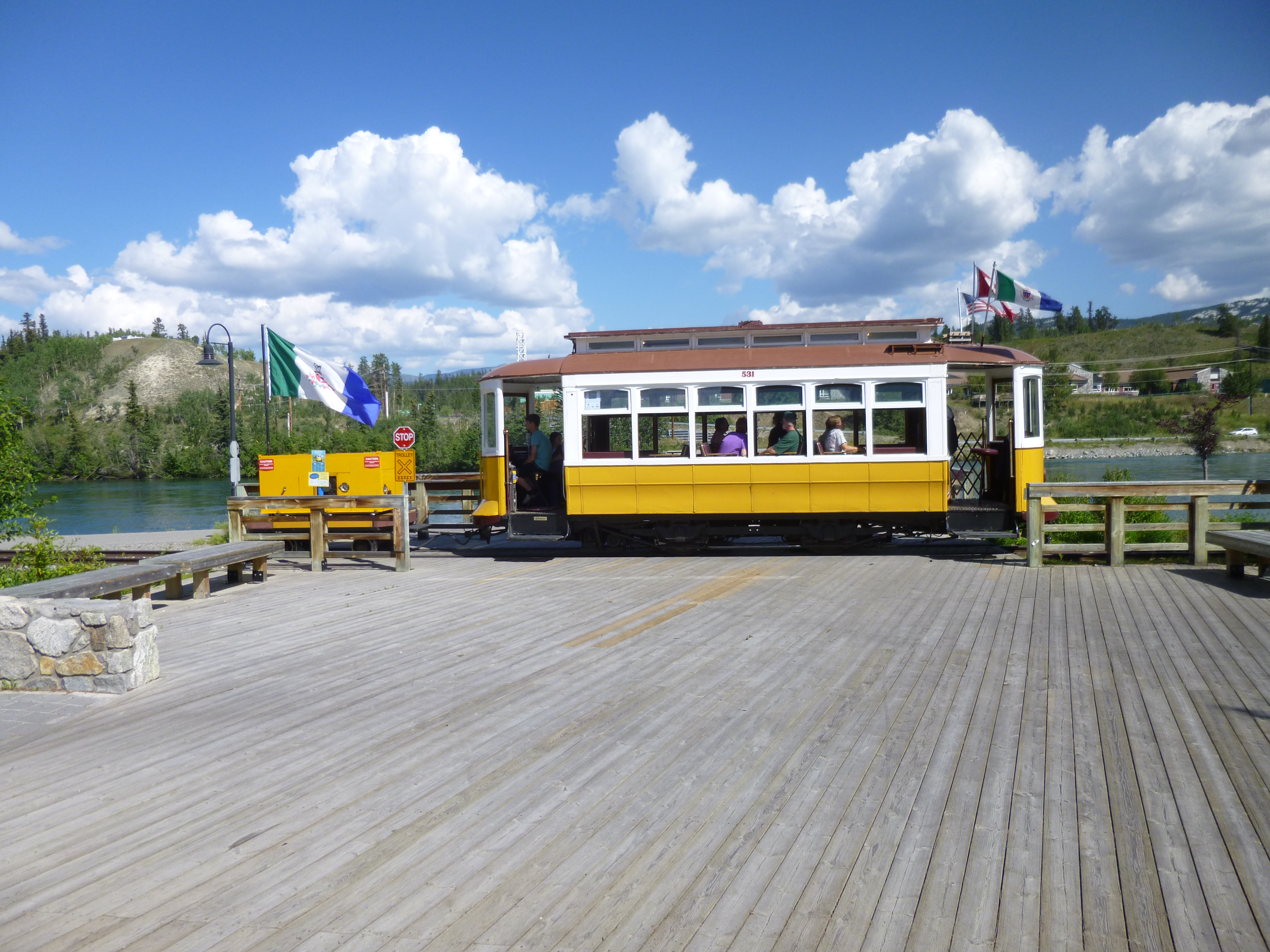
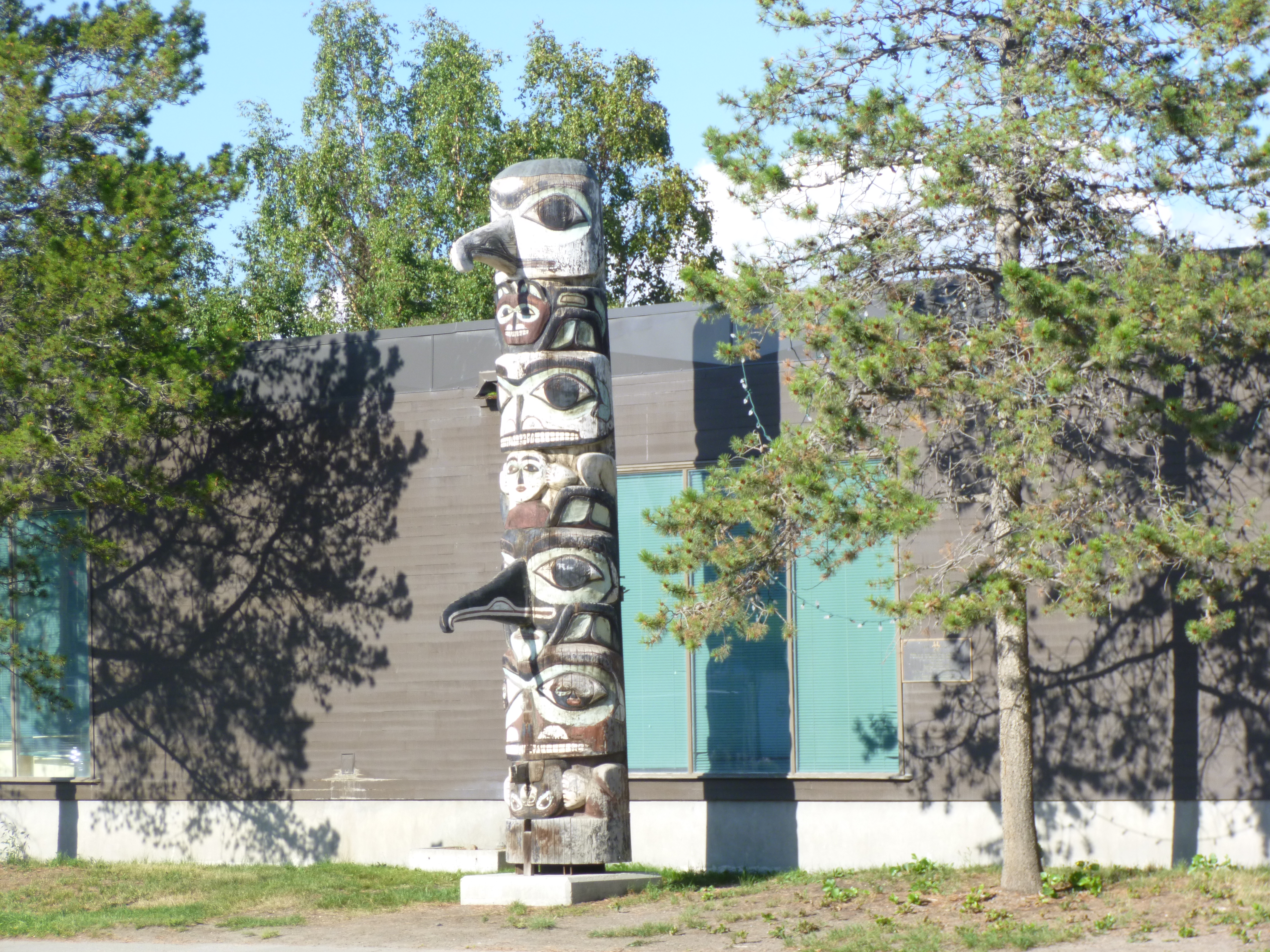
It was a beautiful day out, and I saw the river walk by the Takhini River, so Tula and I set off for a walk to stretch our legs a bit. I can’t help but seek out good walking places! There was a cute little trolley taking other visitors around town. We took quite a long walk, and then I ran into a couple of people about my age who were trying to figure out whose turn it was to take a picture by a totem pole. I offered to take one of both of them, so they gave me 2 cameras and then we got to chatting. I was heading southbound along the route they just came up, and they were heading northbound along the route I have been on, so we compared notes. I asked them if they had seen bears in Stewart (I didn’t really know why bears were around that place in particular), and I got a very surprising answer. The good bear viewing isn’t necessarily in Stewart; they’re just over the border in Hyder, Alaska, which was practically right on my way! The bears come to Hyder because the salmon have just started their upstream swimming to spawn, so the fishing is good! They mentioned wooden viewing platforms for people to quietly watch all the salmon, and the bears that go fishing for them. They had waited in Hyder for 2 days without seeing anything, because the salmon were a little late in starting their run, and then they had to leave, but they’ve since heard that the salmon have appeared. Plus Hyder was the take-off point for a drive up a mountain to see the 5th largest glacier in North America. Talking to them absolutely cemented my decision as to which highway to take south! I had no idea there was a very remote Alaskan village that I could see in a day or so! Driving through British Columbia is the only way to get to that little Alaskan village by land.
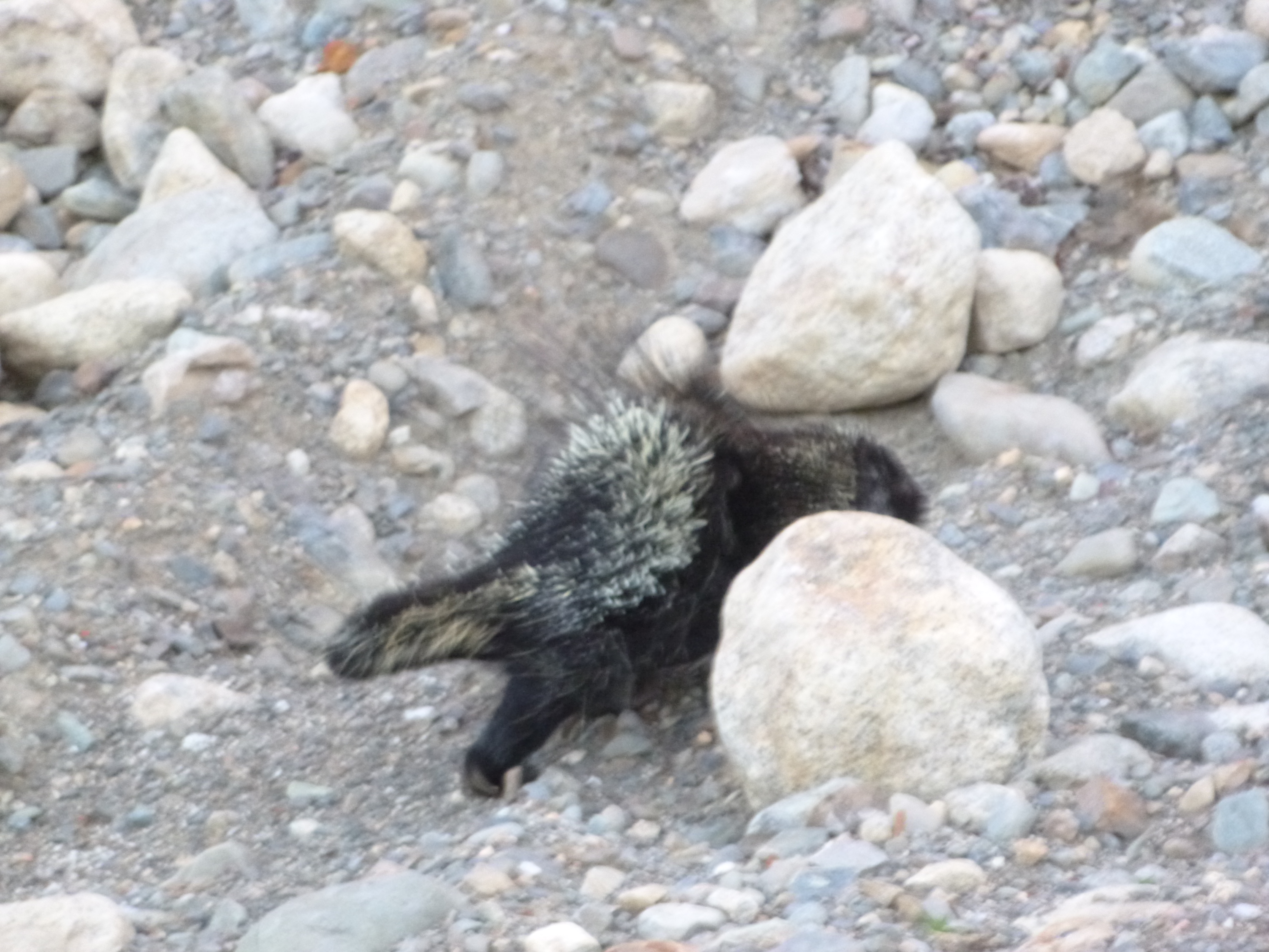
After our walk, and talking with those people, I decided to sit down in a Starbucks for a while to add another post or 2 to the blog while I was in civilization – I’m very aware of falling behind, and even though I shouldn’t have “wasted” good driving time, it’s important to me to try to not fall any farther behind than I already am. So I made a little headway with computer stuff, and then Tula and I drove about another 300 miles or so on roads that were a little better than yesterday. I saw another porcupine near a gravel area by the road, and got out for a little closer look. It’s only the second one I’ve ever seen, and they’re kind of bizarre looking. It waddled off, and I followed it a little ways at a distance – I have no idea how far they can shoot their quills and I didn’t want to annoy it too much. The quills are kind of formed in a circle around their hind end, and their entire body looks bristly. It makes me wonder what kind of natural predators they have. After a little more driving, I came to Big Creek Provincial Park, which had a campground, and stopped for the night. The campsites were by a river and some woods, and the mosquitoes were a little worse than usual, so I got set up in record time – I would like to have left the back vents open to listen to the river at night, but I had to defer to the mosquitoes. I’ve mostly been driving east these last couple of days, but I’ve also come far enough south to notice a little more darkness around midnight. I’m guessing by tomorrow night, there’ll actually be a couple hours of darkness at night!


Alaska/Yukon – Thursday, August 1
I had stopped sort of close to Glennallen last night, and it didn’t take too long to get there, although there was a lot of road repair work going on, and we had to wait for a pilot car to lead us through the zone again. I started to hear a loud screeching noise, and thought it was the truck ahead of me. But then I realized the racket was coming from my right front wheel. I knew I’d have to stop in Glennallen to see what that was. So I made my noisy way to the visitor center to ask about repair shops, and found out that I’d already passed through town – there wasn’t much to it, despite the fact it looked like a bigger one on the map! But I found out where a repair place was, and made a sharp turn out of the visitor center, and all of a sudden the noise stopped. I wondered if something had been stuck in the wheel that fell out when I turned. Just to be sure things were okay, I stopped by the shop and mentioned the noise to the guy, and he said it’s not uncommon for a stone to get stuck between a bearing and something else, and create a noise, and then it often falls out. The van seemed fine, and I was pretty much reassured I could safely set off the next 140 miles of wilderness. Along the way, I passed the turnoff for the other little segment of road I haven’t driven in Alaska, and was tempted to drive those 60 miles. But it would be slow going, and I’d have to come back 60 miles, and I just needed to continue on – it will be on my list of roads to drive when I come back to Alaska sometime in the future. I made it up to Tok, and then finished the final 100 miles to the Canadian border. It was kind of hard to leave.
Shortly after I crossed the border and went through customs, I passed through the town of Beaver Creek, which is the westernmost town in all of Canada. This area around the border has the worst stretch of roads as far as potholes, frost heaves and pavement frequently changing to gravel. Typical speeds were 30-40mph, so it was kind of a slow go for a while through the Yukon. But I covered a couple hundred miles in a southeast direction, and passed the nice campground that had the helicopter, and drove by the familiar mountains and alongside lakes. I came to the Kluane Lake area, and then I saw a really nice-looking campground, and figured I better stop for the night. I didn’t want to spend 2 nights in a row alongside the road! The office had already closed, and a sign said to just take care of registration in the morning. Tula and I took a walk around the campground after I was set up, and there were mountains everywhere I looked. The campground is on the huge lake, which seemed to be a big recreation area, and even though it was pretty full, but it was very peaceful and quiet


Alaska – Wednesday, July 31
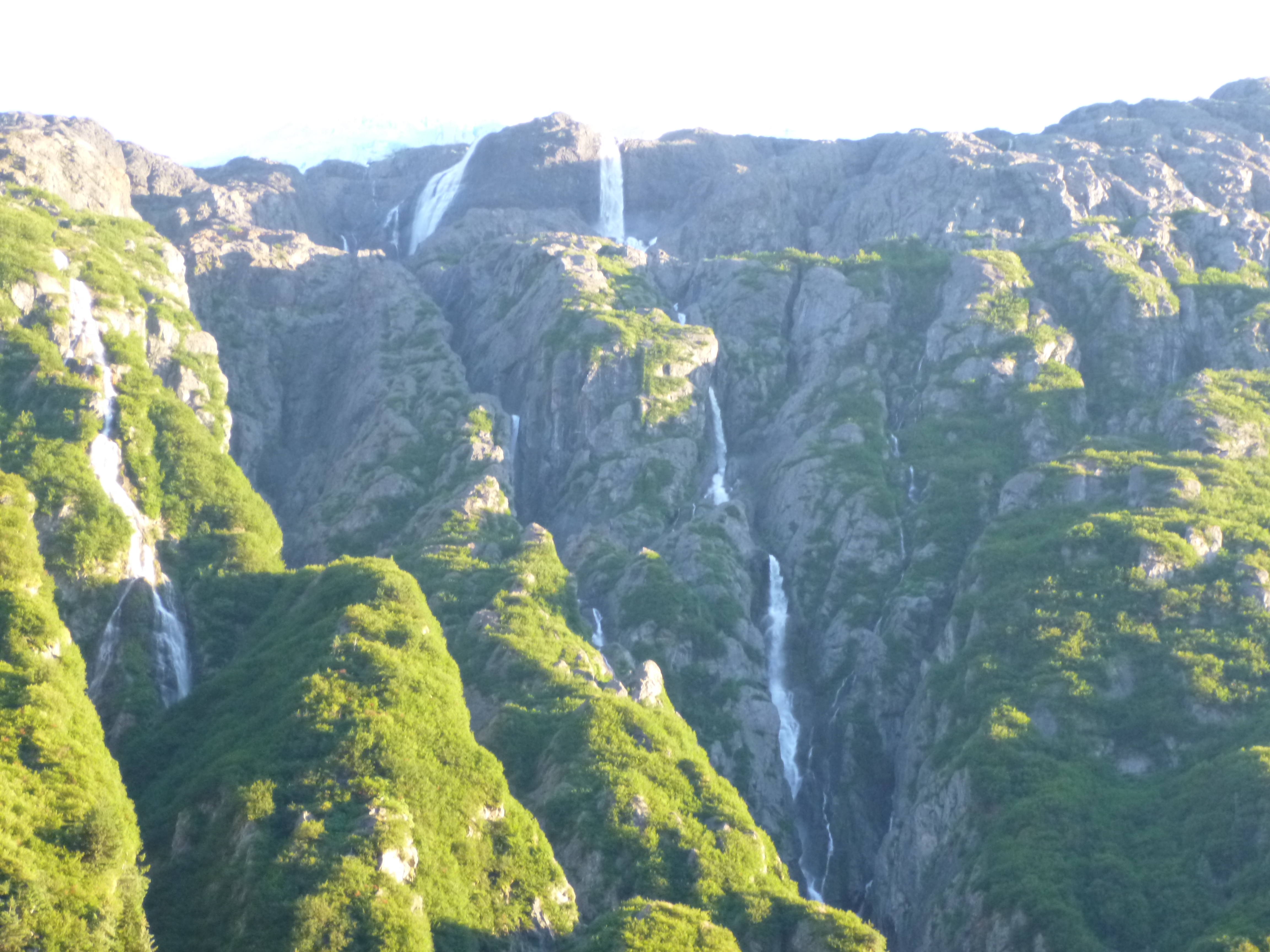
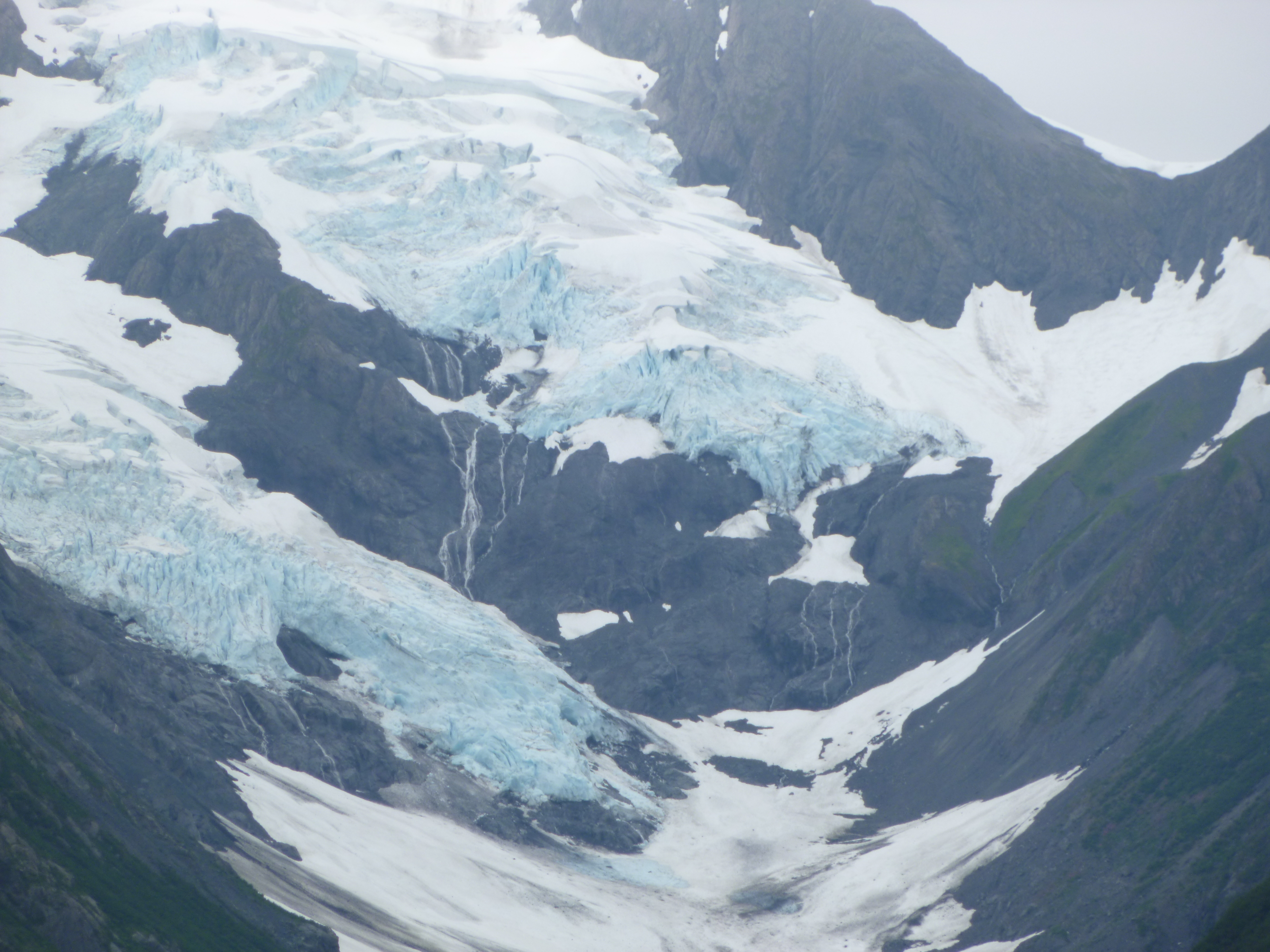
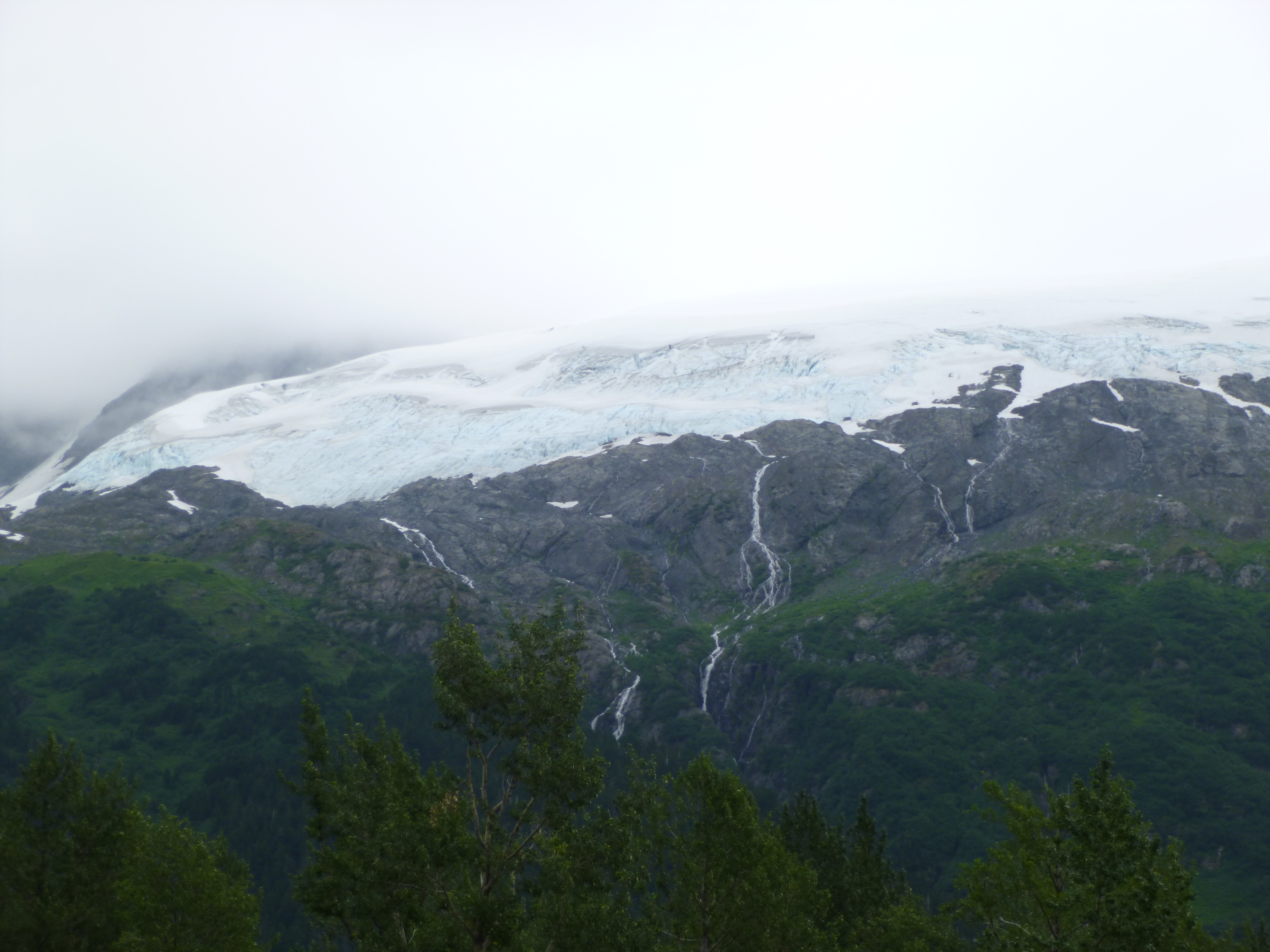
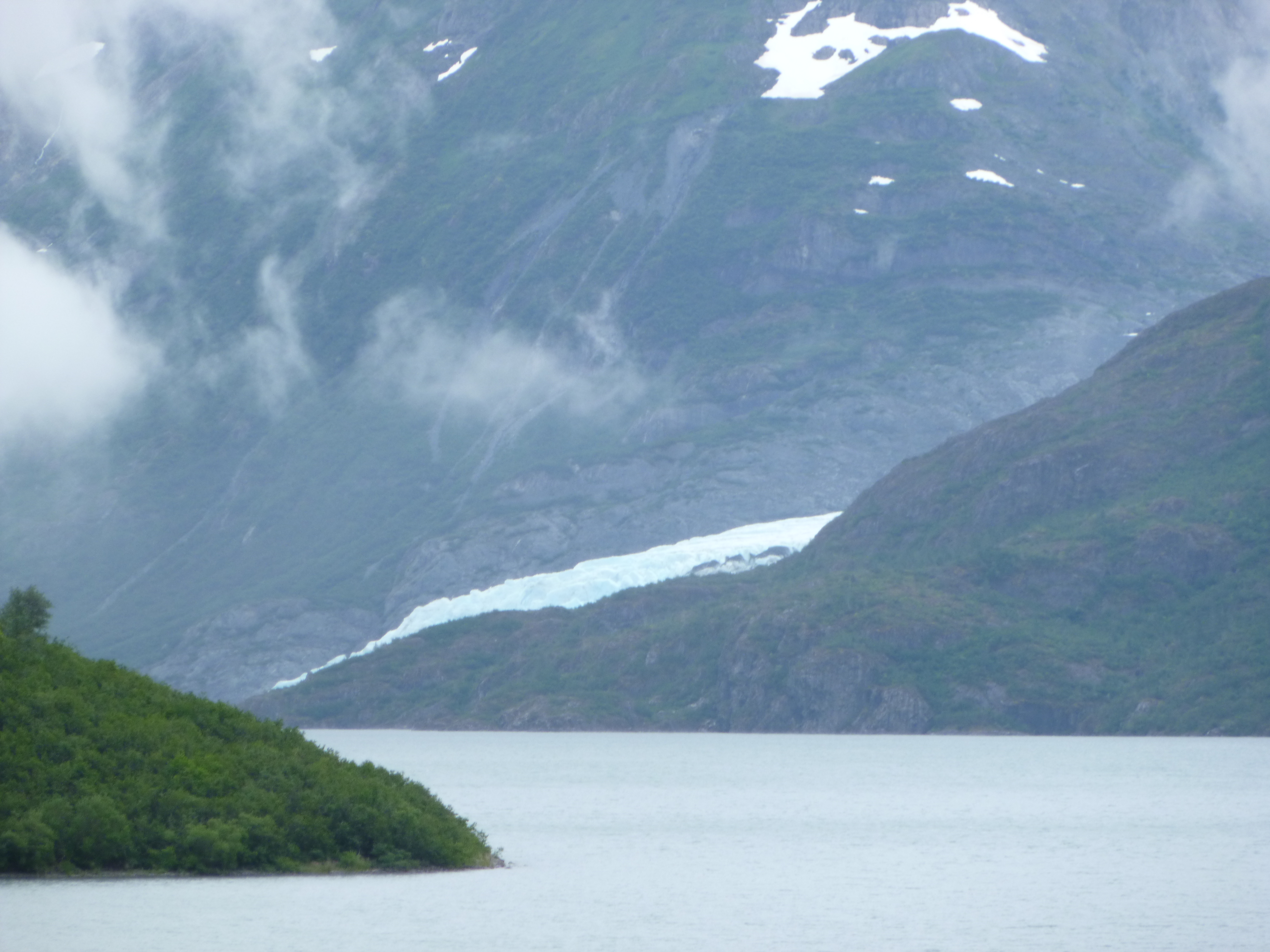
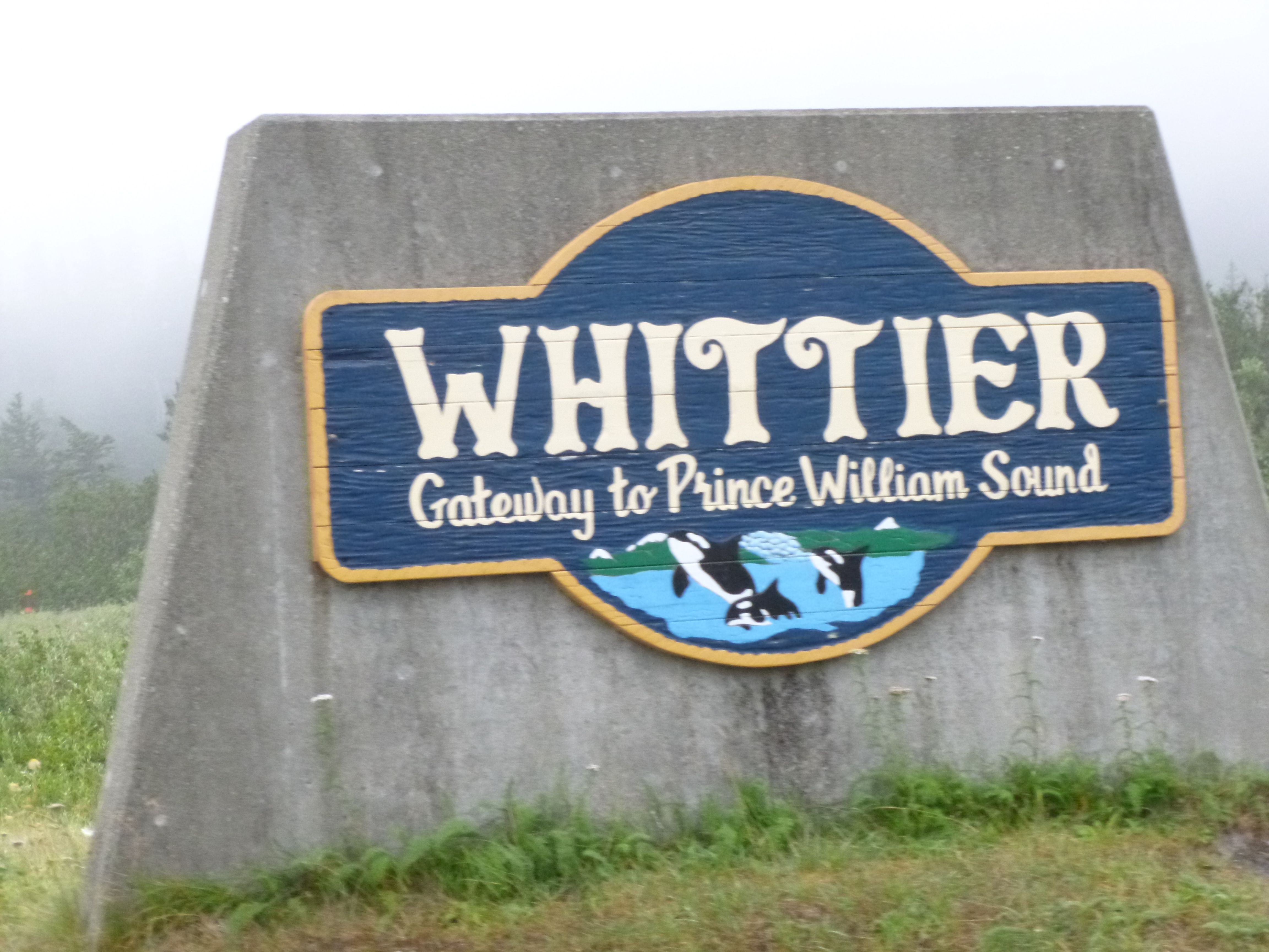
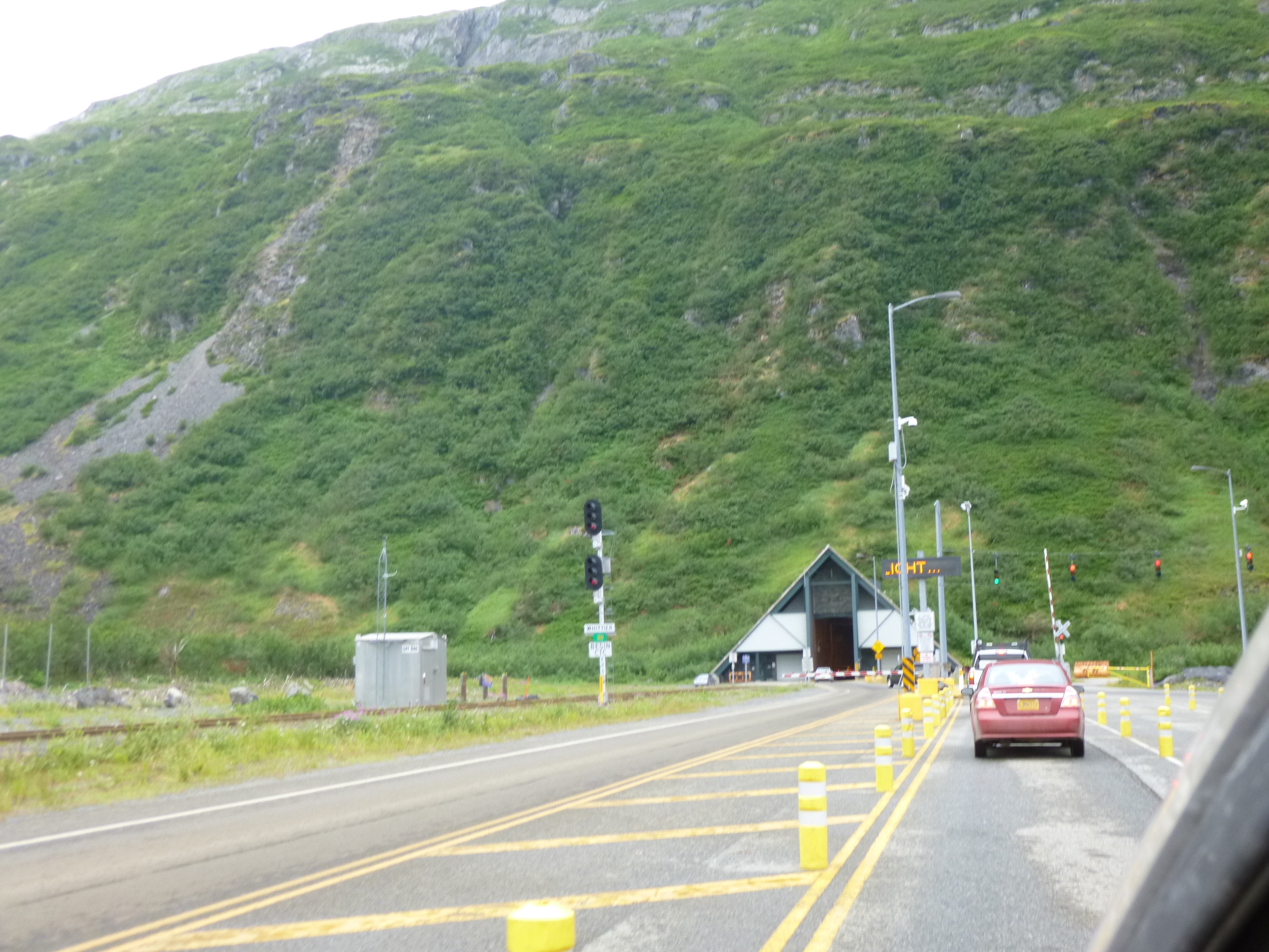
The first thing on the agenda this morning was a visit to Whittier, which is a town that wasn’t really open to tourists until about 2000, because the only access into town, other than coming in by sea in the Prince William Sound, was the railroad, which had to go through a 2 1/2 mile tunnel under all the massive mountains. There were no roads into town. But around 2000, they decided to make the railroad tunnel a combined auto/train tunnel, so that tourists and residents could drive in (Whittier is also one of the stops on Alaska’s Marine Highway). The tunnel is only one lane, and obviously the train schedule has top priority. Cars have to pay a fare and be assigned a lane in the staging area, and groups of west-bound and east-bound vehicles alternate. I wanted to see all of this, and it wasn’t too far from my Alaska exit route. So I had only driven about 10 miles toward Whittier, and was near the tunnel staging area, when I came around a bend in the road, and then was almost completely surrounded by mountains and glaciers. It’s a good thing there was a big pull-off, because it was a dramatic, scenic view – blue/white glaciers in every direction. It was a little misty, which just kind of added to the charm. And someone pointed out an eagle on a log in the river.
After I had spent some time gazing around, I got my tunnel ticket, and got in line. They have big road signs up, letting drivers know when the next group of cars will be “released.” The tunnel entrance looked like a little A-frame house, and was long and a little damp. I don’t like to think about the tons of rock, snow and glaciers that I’m driving under. It was fairly well lit, and signs pointed out the locations of 5 or 6 ventilated safety chambers that could be used in case of emergencies or fires. It’s just a single lane road, with the train tracks running down the center, and it’s narrow – the tunnel isn’t much taller or wider than the trains that first used it. After 2 1/2 miles, I came out the other side to a small, older sea-going town that was covered in fog. I could hardly even see the water. It’s not a big town, but it is a bit of a transportation hub, with ships bringing in freight for trains, and the passenger traffic for the ferry system. I hadn’t known much about the Alaskan Marine Highway, which is probably a good thing – I didn’t need to be cramming anything else into this particular visit. But it has sure given me some ideas for the future (the Aleutian Islands are calling!!) I picked up some literature, and asked about a ferry to Skagway on the off chance I could do that instead of driving back up to the Alaska Highway and down into Canada – Skagway is accessible by road, but one has to get into Canada first. A lot of towns on the Alaskan panhandles have no road access – one can’t even drive into Juneau, the state capital! I went into the ferry offices and got some schedule info – it was a little hard to figure out at first. Later in the day when I looked at it more closely, I was kicking myself for not taking the ferry to Valdez, and enjoying the glacier-filled drive up to the Alaska Highway by a partially different route than what I was doing. That would have allowed me to cover one of 2 little segments of roads in Alaska that I have not yet been on, plus a couple people have told me it’s one of the prettiest drives. But I’m not 100% sure that route was covered on Wednesdays, and I have an excuse to go back to Alaska at some point in the distant future to drive the few segments of road that I haven’t already done – plus maybe get out to the Aleutian Islands by ferry. So I’m pretty sure I’ll be back somewhere along the way!
I drove around Whittier, and there wasn’t much to see. There was a big seafood canning plant, and an old windowless hulk of a building that is on a hill overlooking town. There were a few tourist shops and restaurants, and it’s the take-off point for a lot of fishing charters and sight-seeing trips in the Prince William Sound, which is on my list for a return trip. One excursion brags about seeing 26 glaciers in one trip! There were people fishing by the docks, and it was just kind of a damp gray day. I didn’t stay too long. Then I headed back out, and hardly had to wait to go through the tunnel again, and I continued on my way north to the Alaska Highway. I enjoyed the drive along Turnagain Arm again, but didn’t see anything unusual. I got through Anchorage, and went back through Palmer, where I stopped to shop for a few groceries, and then spent some time in McDonald’s to use the free wi-fi service to get some stuff done on the computer before heading into Canada for a few days.
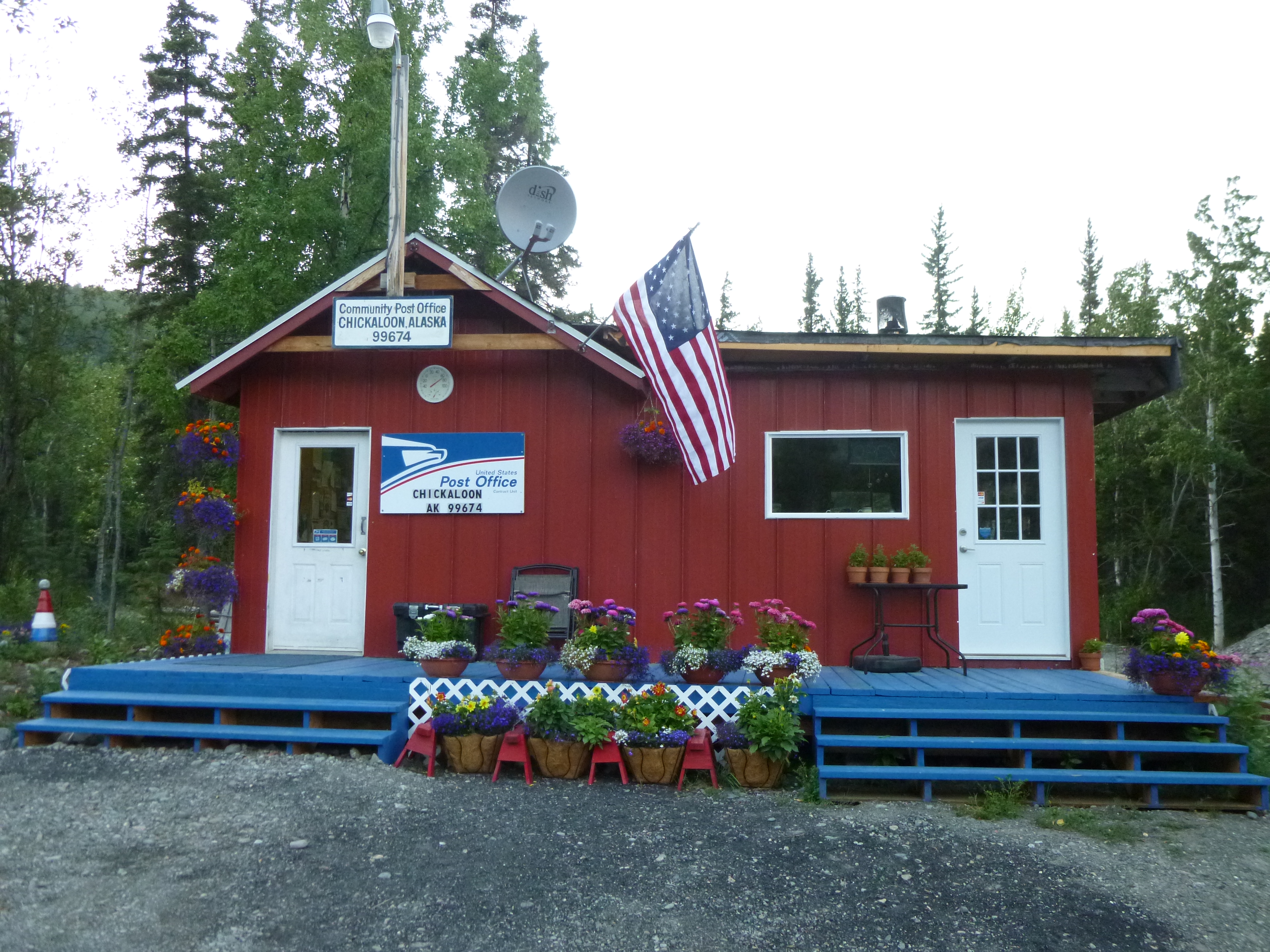
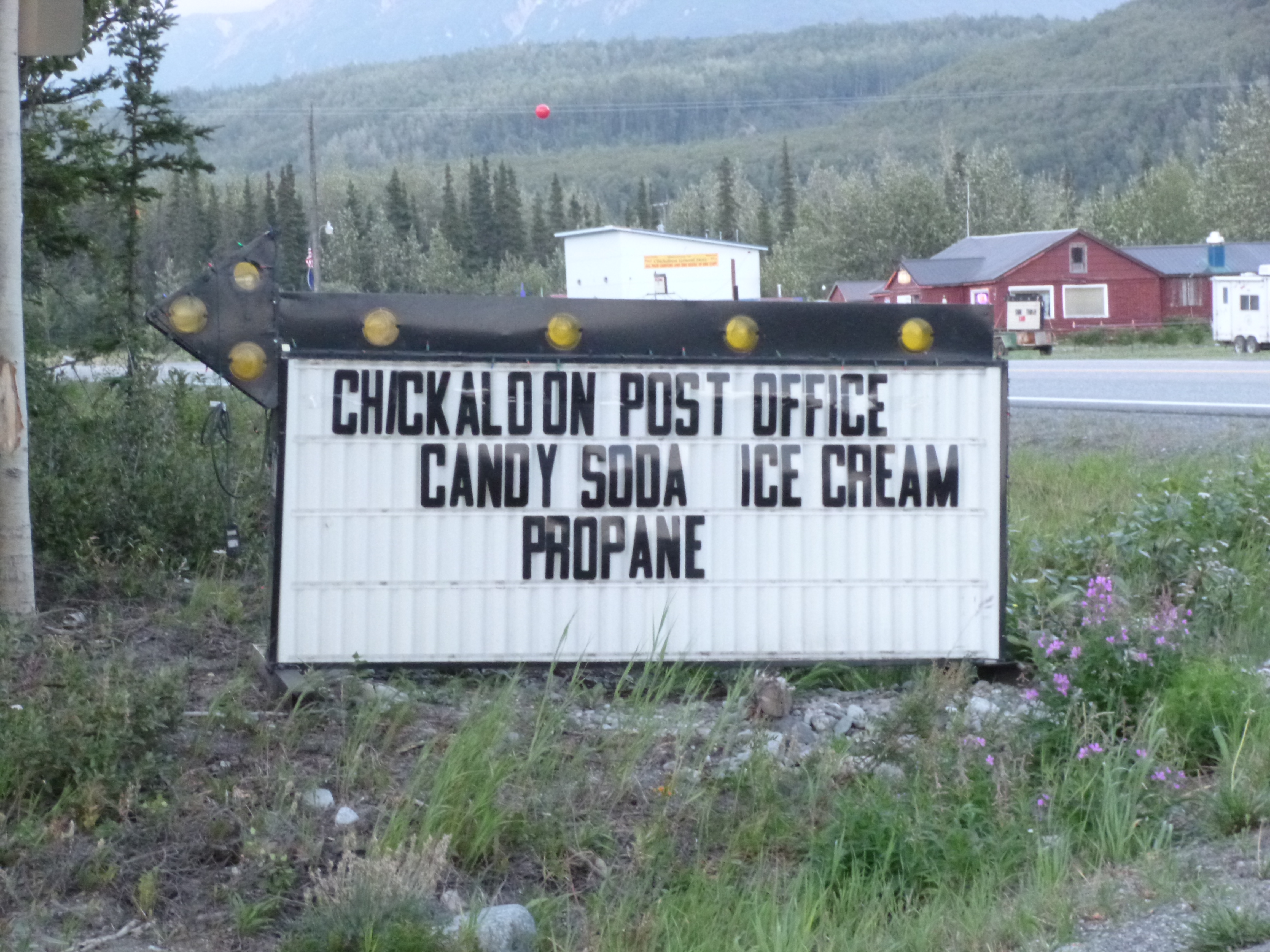
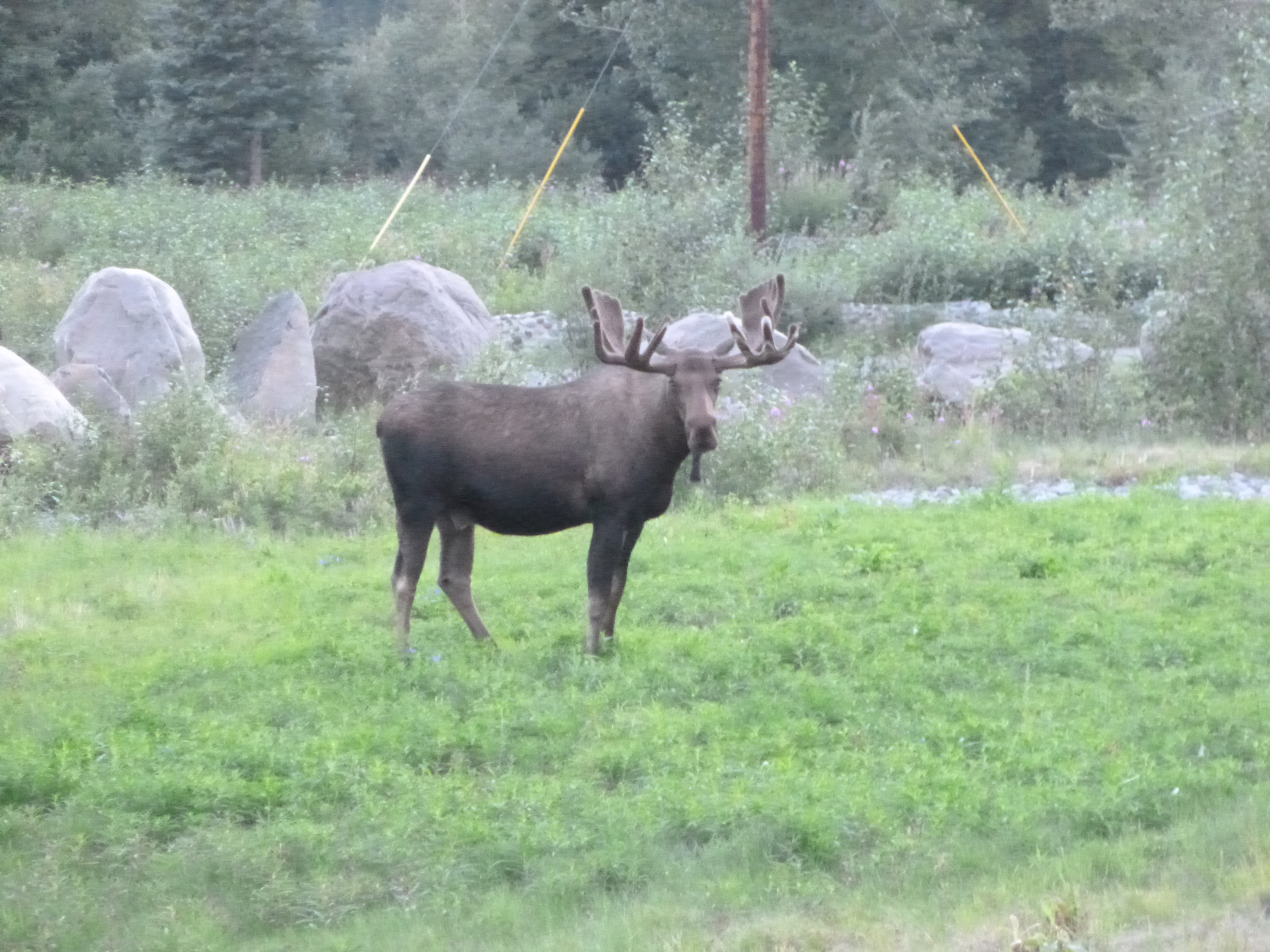
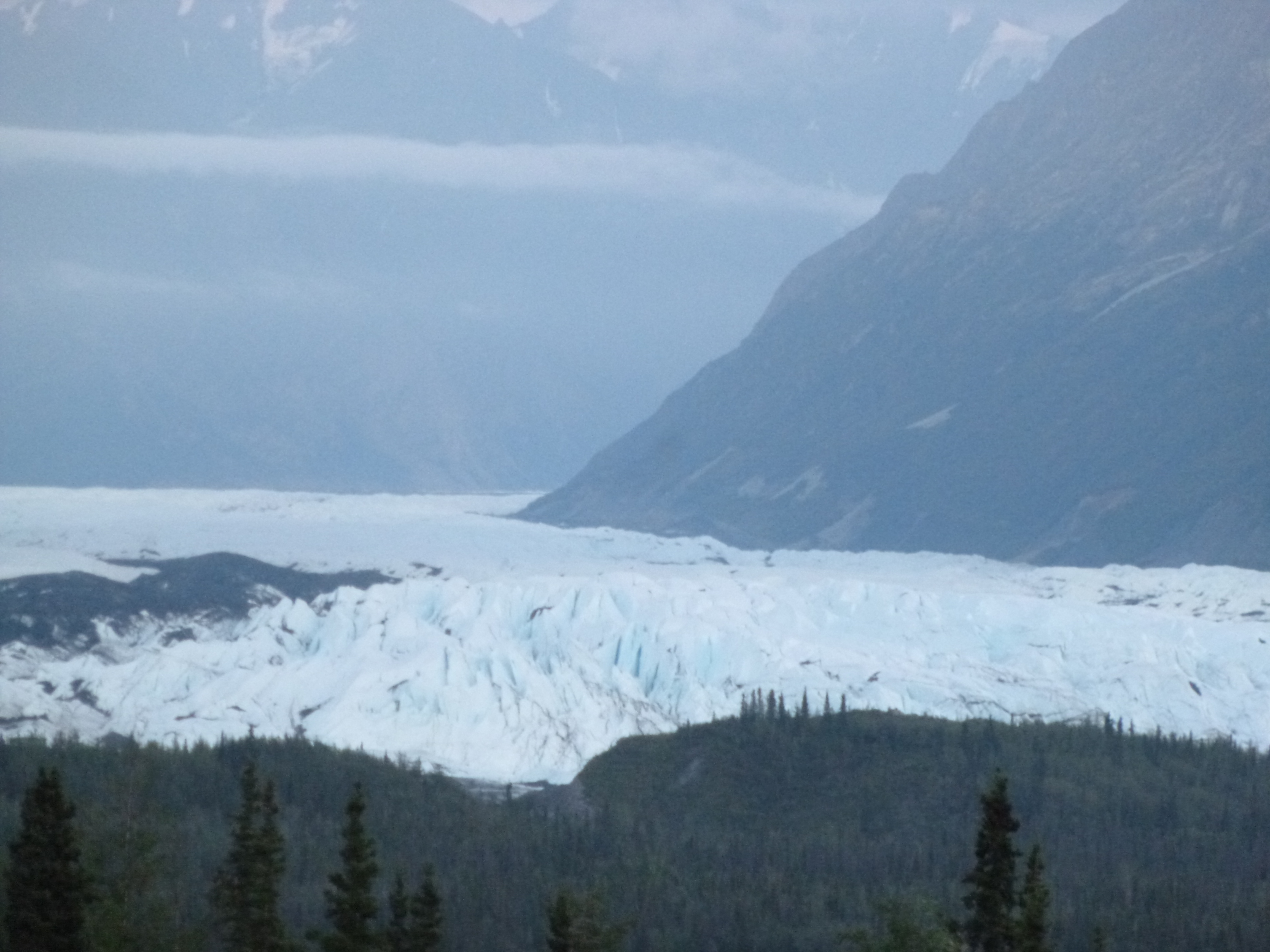
Then I drove through the evening and late evening hours along the Palmer-Glennallen Highway. That was another scenic mountain drive, and I was surprised to see some low-lying glaciers that seemed to be flowing from the bottoms of mountains. So I stopped and admired some of those. I passed through the town of Chickaloon, which is my favorite name of a town in Alaska. Like many small villages, Chickaloon only consists of a couple multi-purpose businesses, and a post office which also doubles as a candy, soda, ice cream and propane shop. (For my next job, I would like to manage a post office/ice cream/soda/candy shop/library!!) And then, finally, I saw a big bull moose along the side of the road. By this time I had seen quite a few female moose, but never a bull, and I stopped and watched him for quite a while. He was just munching on grasses alongside the road. I continued on, and then saw a porcupine, which I’ve never actually seen before. When it got to be 11:30 or so, I simply found a pull-out with a couple RVs and stopped for the night. I had thought I would be in Canada tonight, but there’s just too many miles! Alaska is complete as far as my journey – I walked more than 56 miles in the end (although I had a couple extra days to do so!) and all 7 donations were done – the North Pole Senior Citizen Center, the Fairbanks Foodbank, the Sled Dogs of Denali, NOLS, the Musk-ox Farm, the Alaska Veterans and Pioneer Home, and the Homer Food Pantry. Tomorrow I’ll cross into Canada for sure – I must have been dragging my heels in Alaska a bit – reluctant to leave!


Alaska – Tuesday, July 30
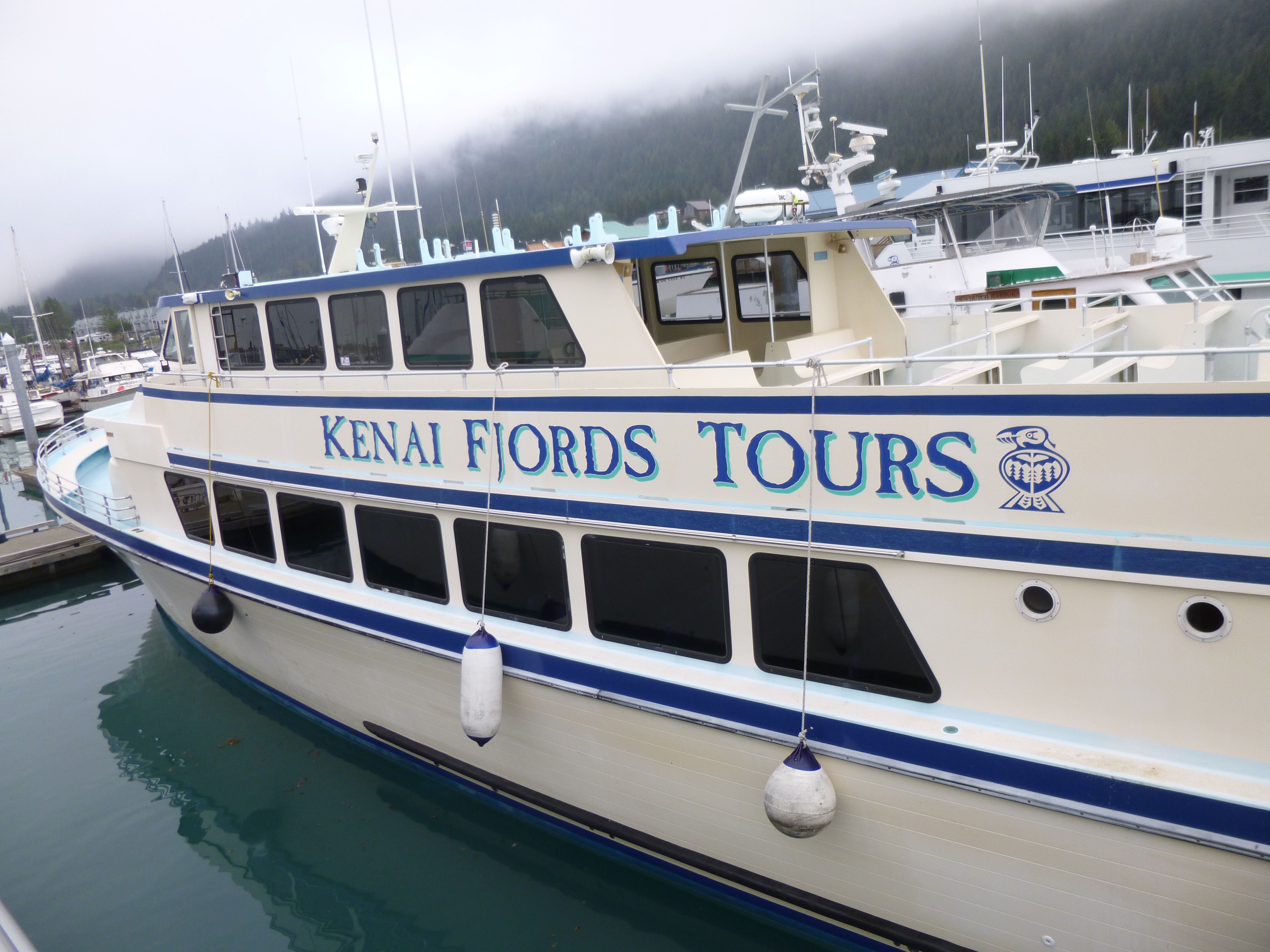
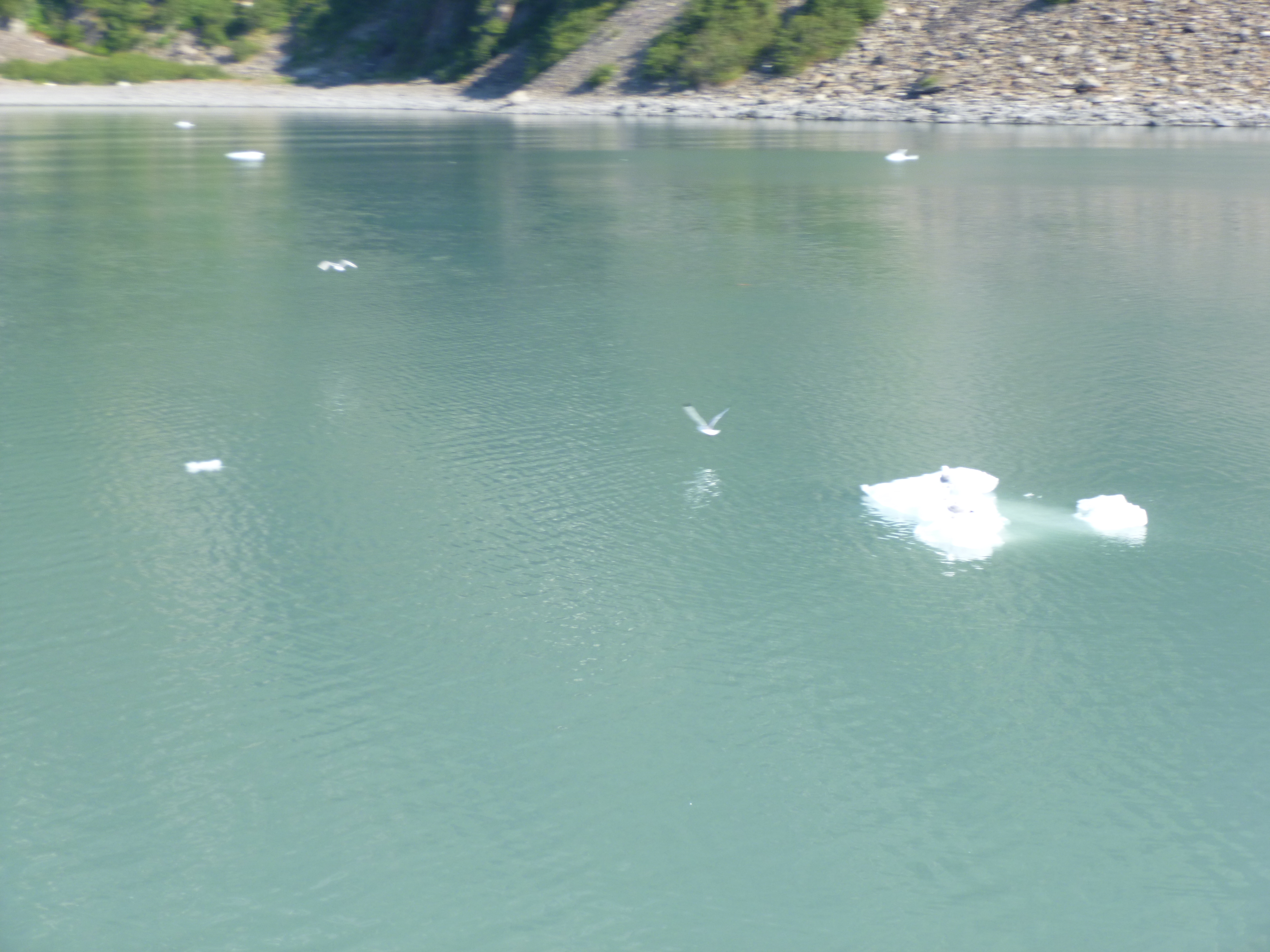
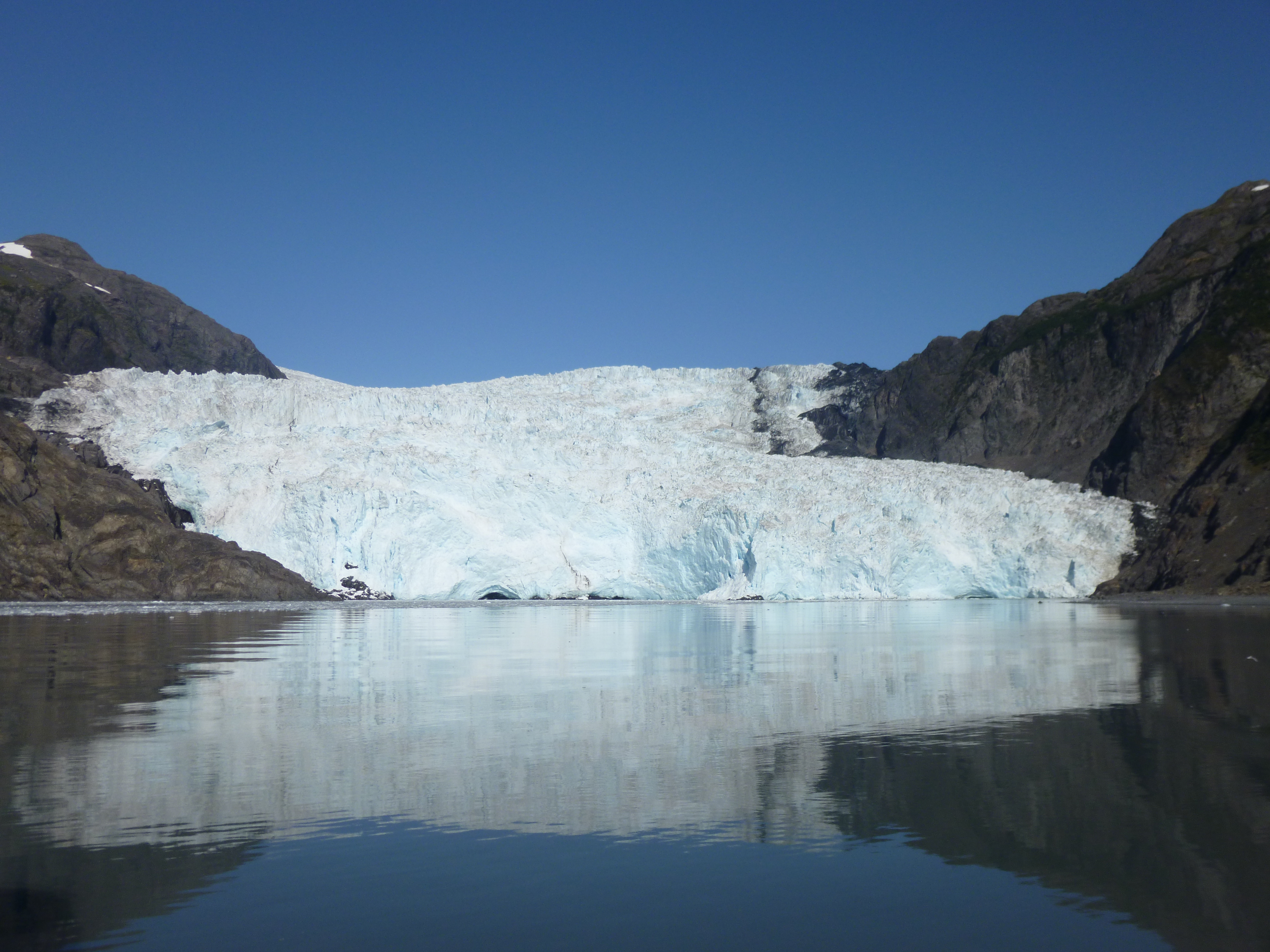
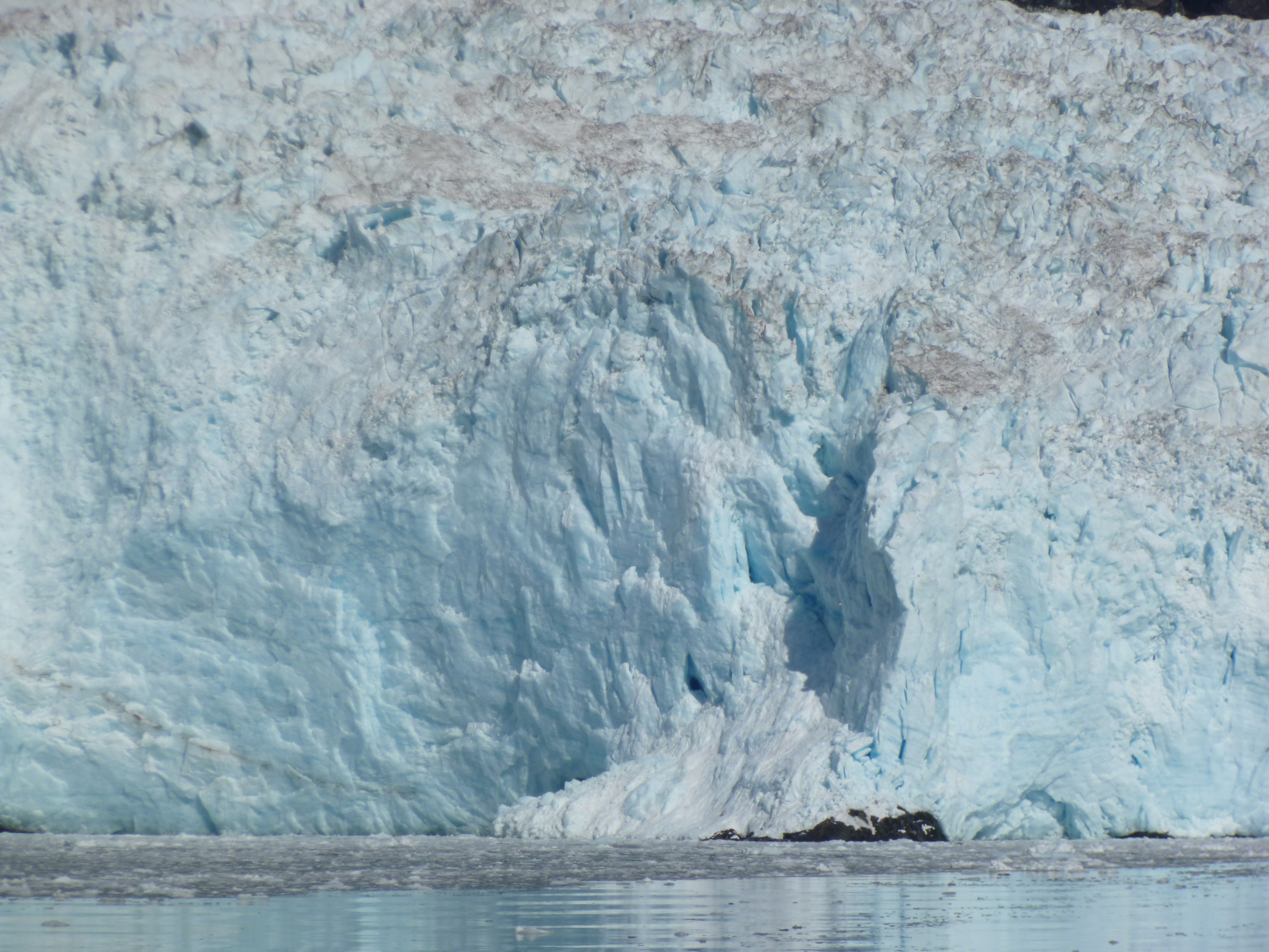
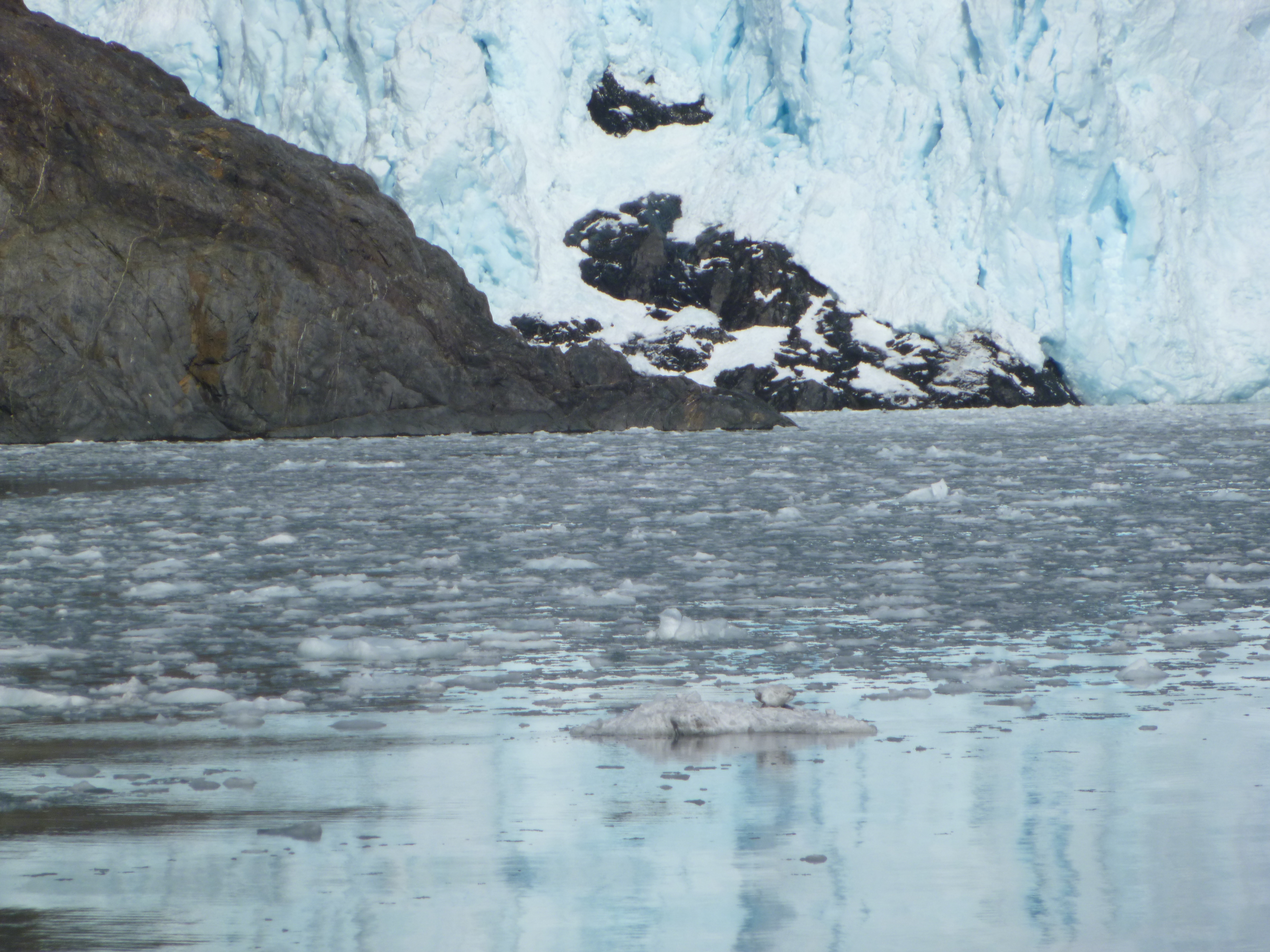
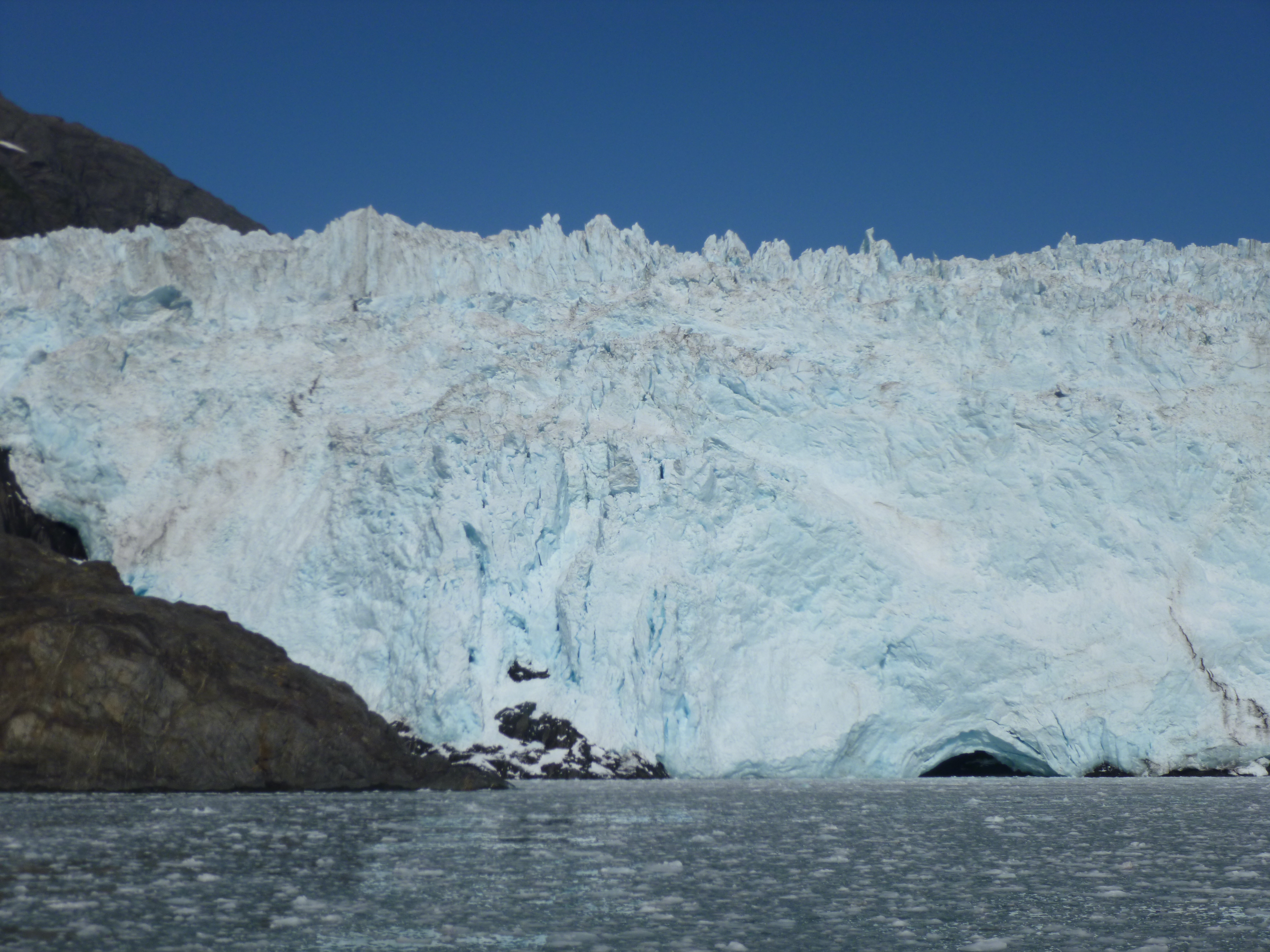
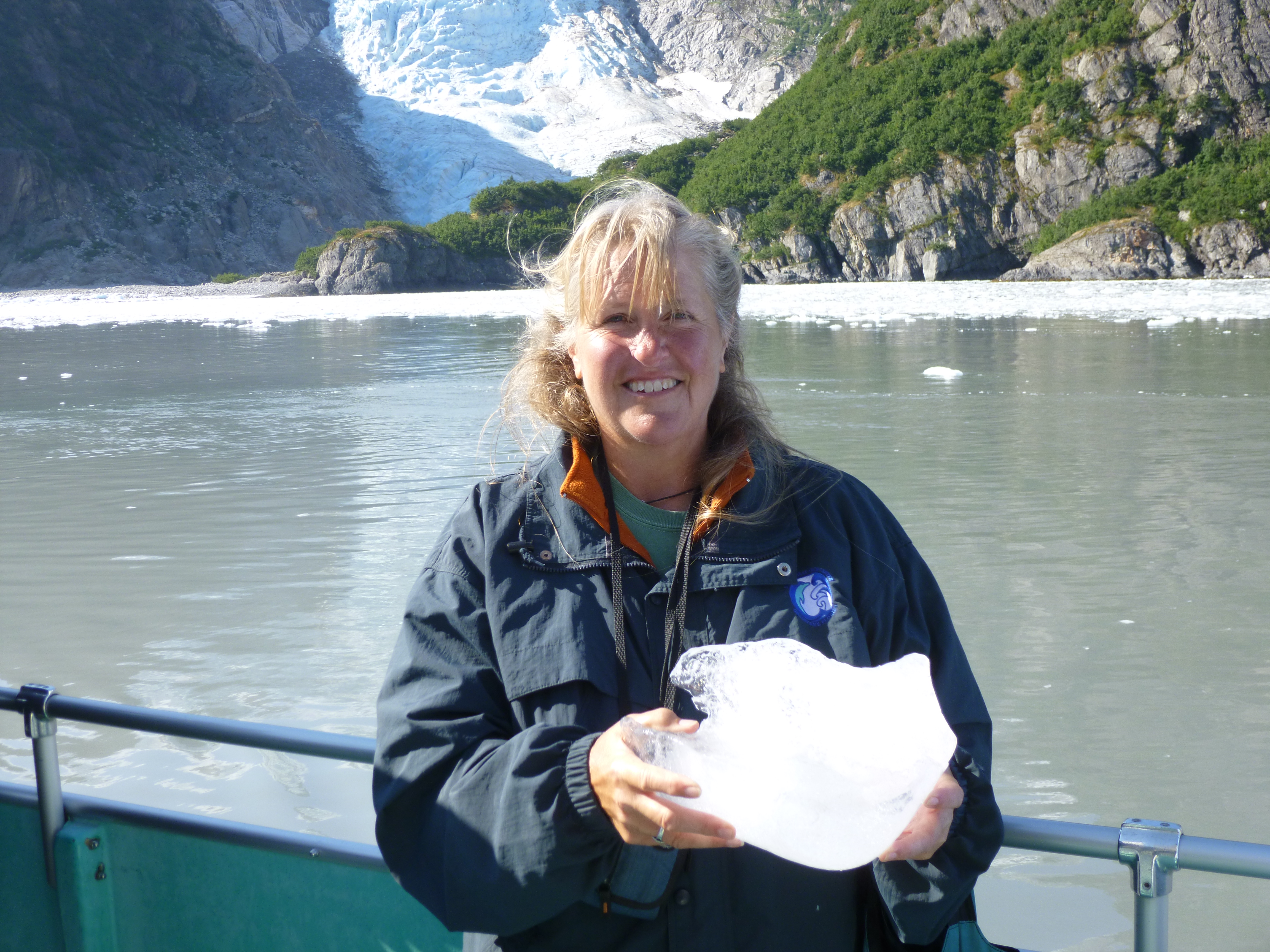
I got up early and was out of the campground a little before 7. It was a very chilly morning, but that was good – Tula will be perfectly comfortable in the van for several hours while I’m out on the boat. I packed some snacks and water, and a hat and gloves – it was going to be even chillier on the water. This boat trip was headed for Holgate Glacier, and it was a small enough boat that it was going to be an up-close visit. And there is always the hope of seeing whales and dolphins and other marine life on the way!
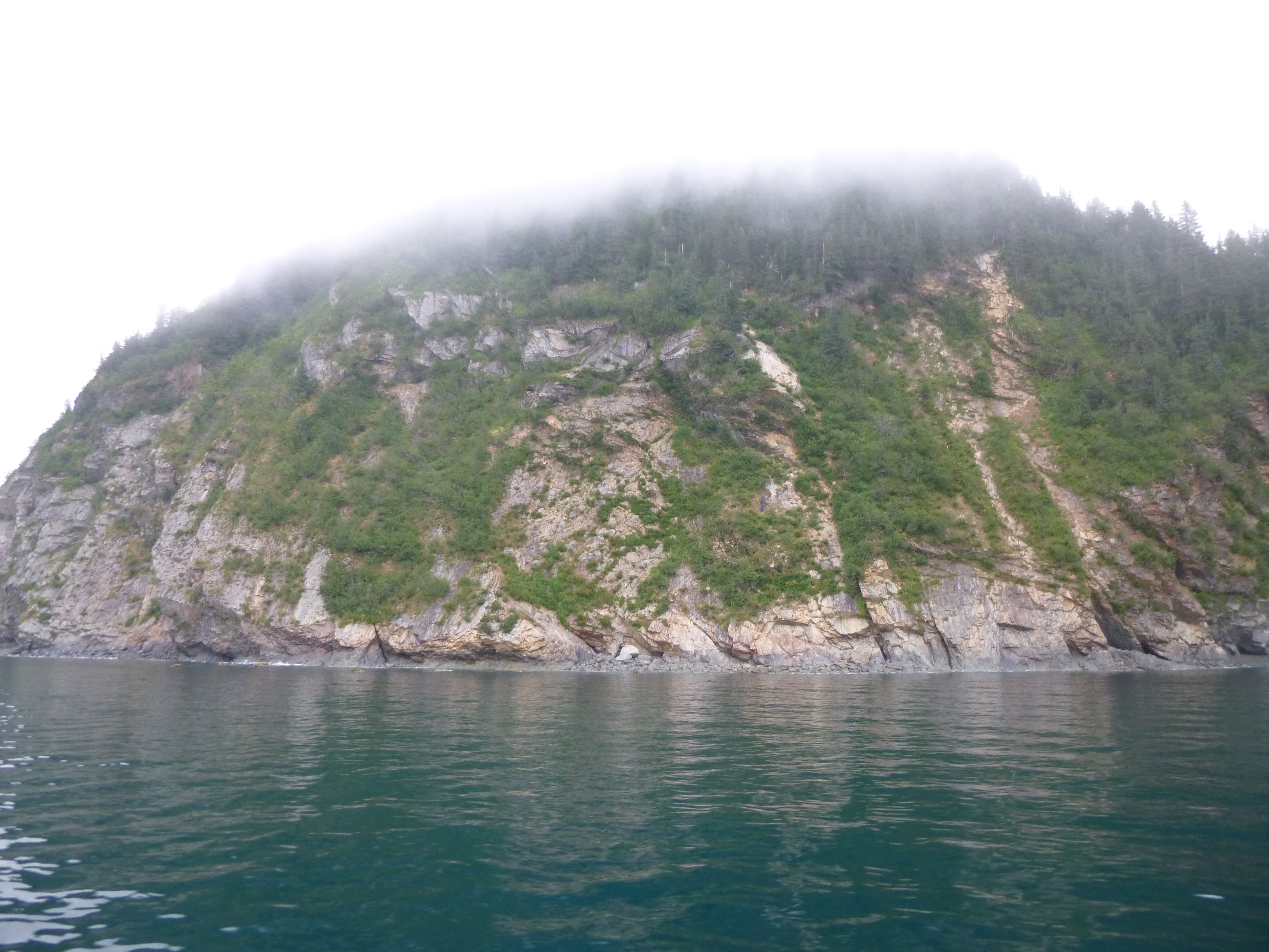
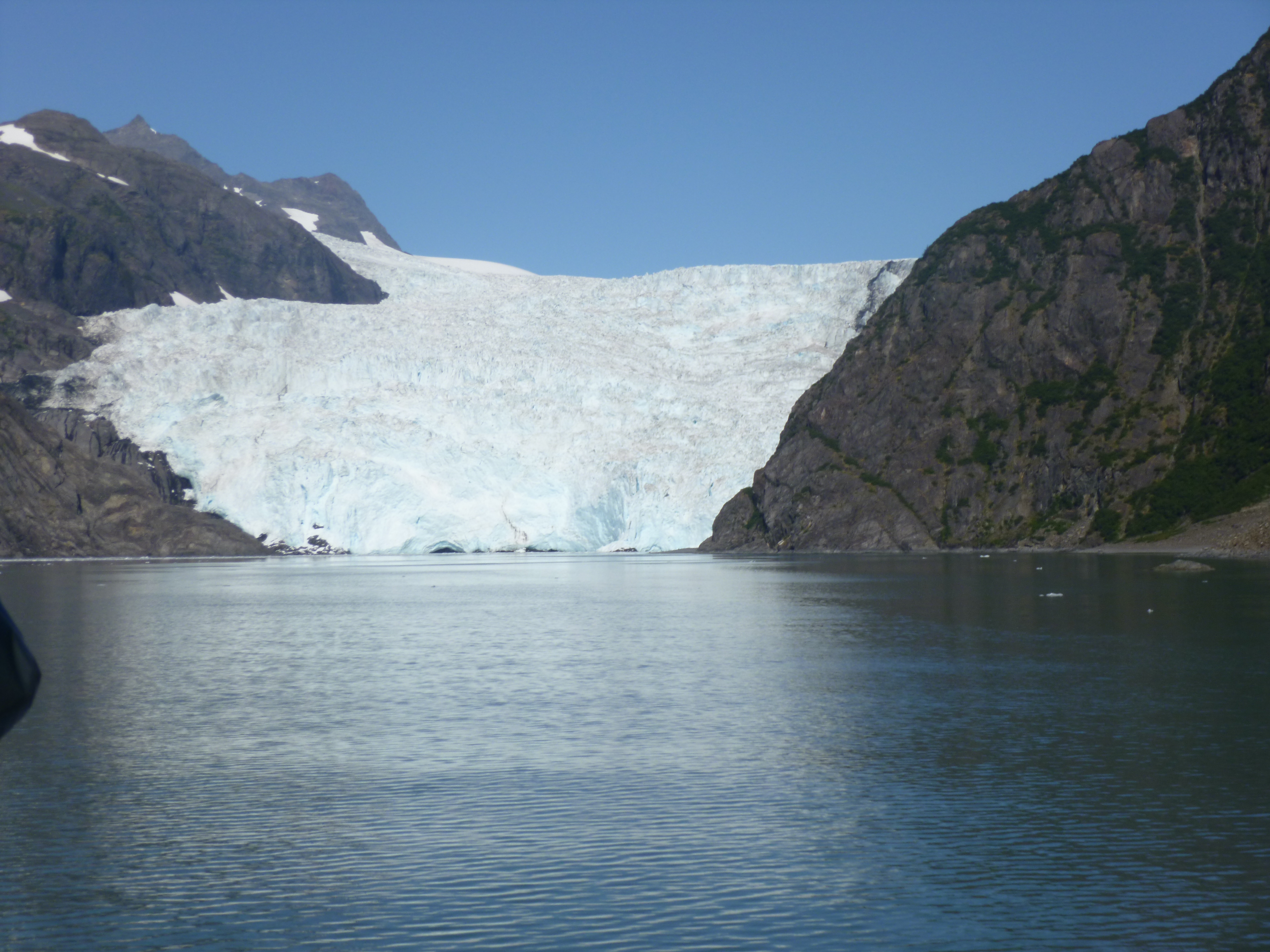
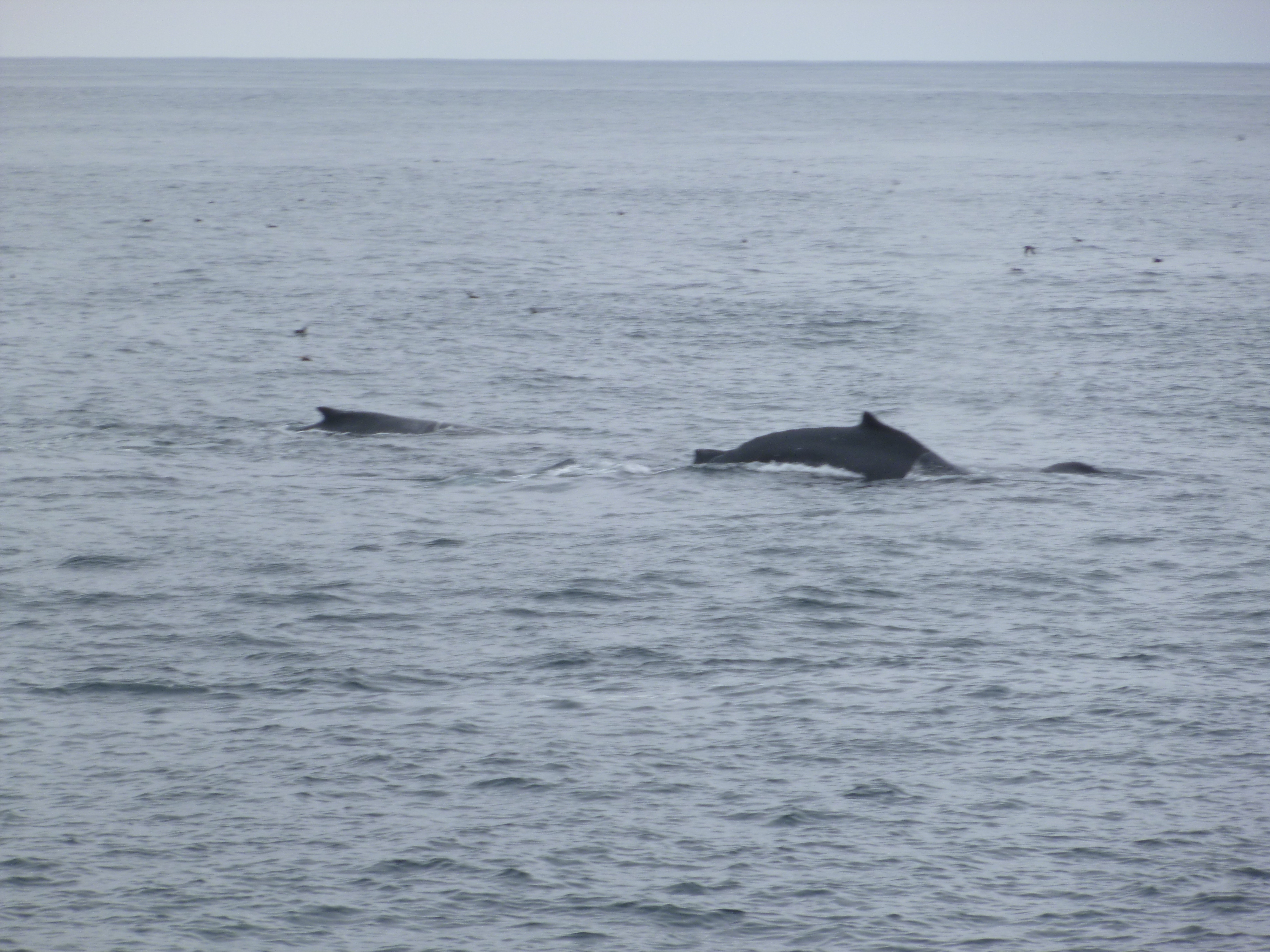
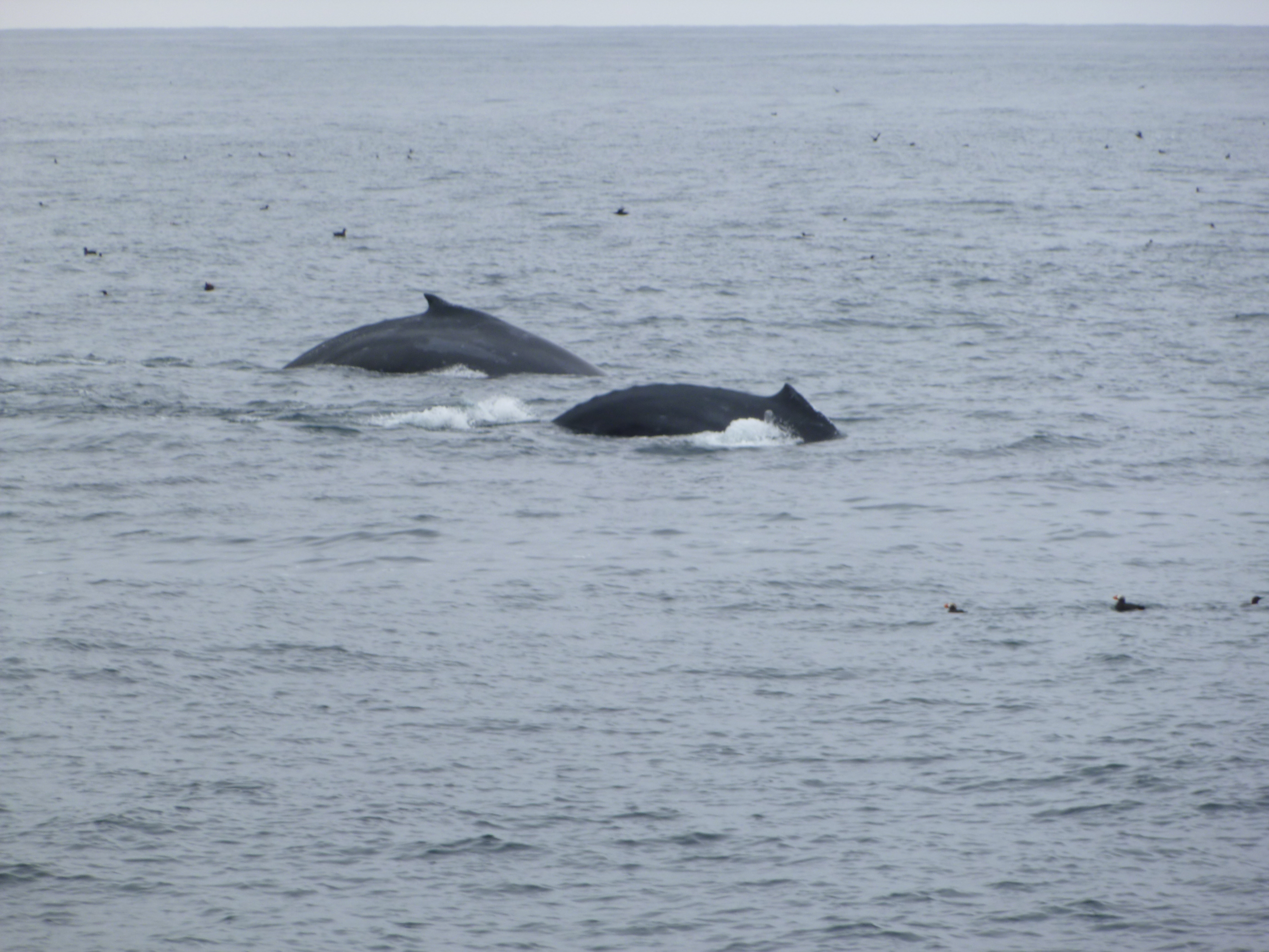
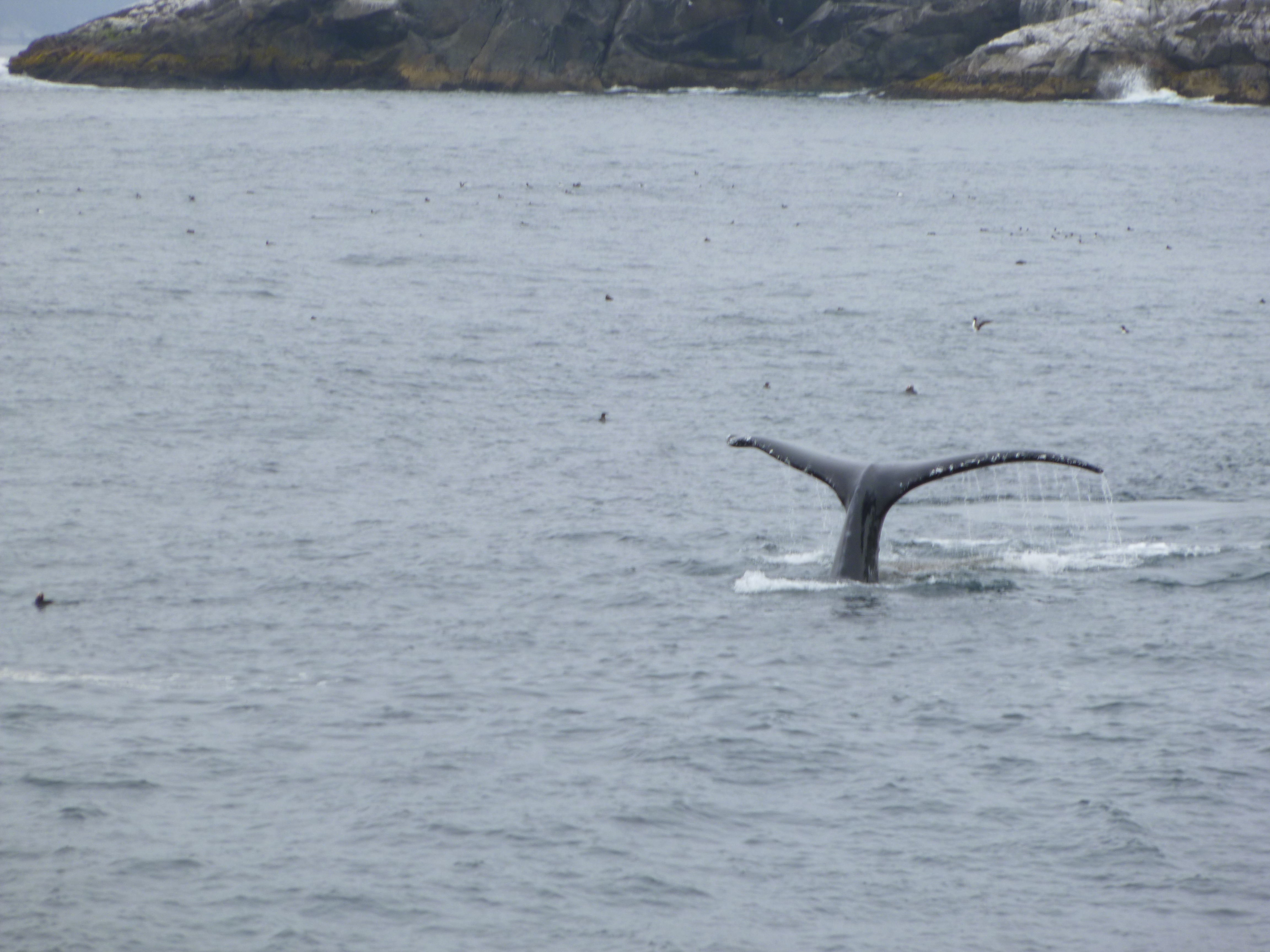
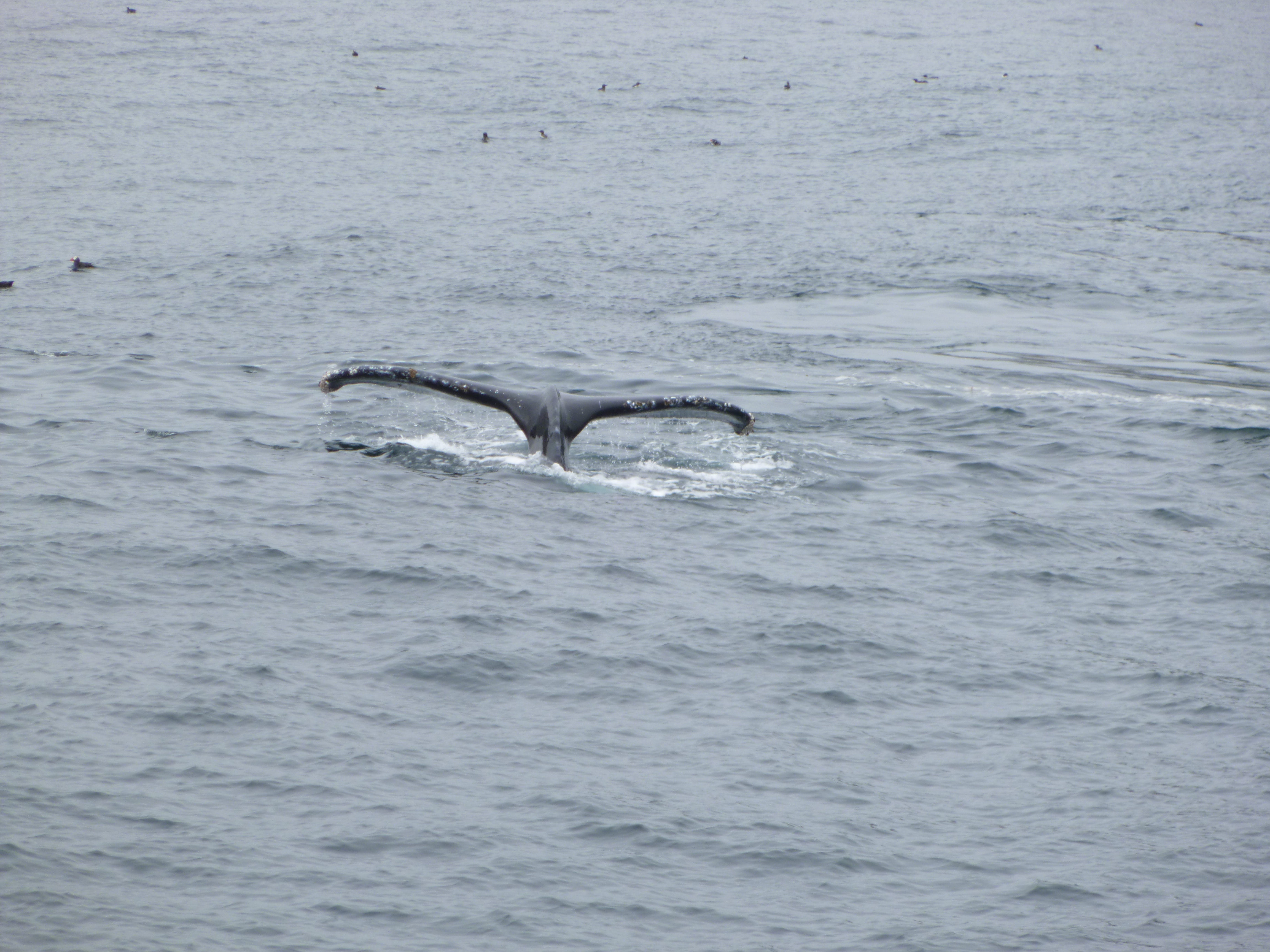
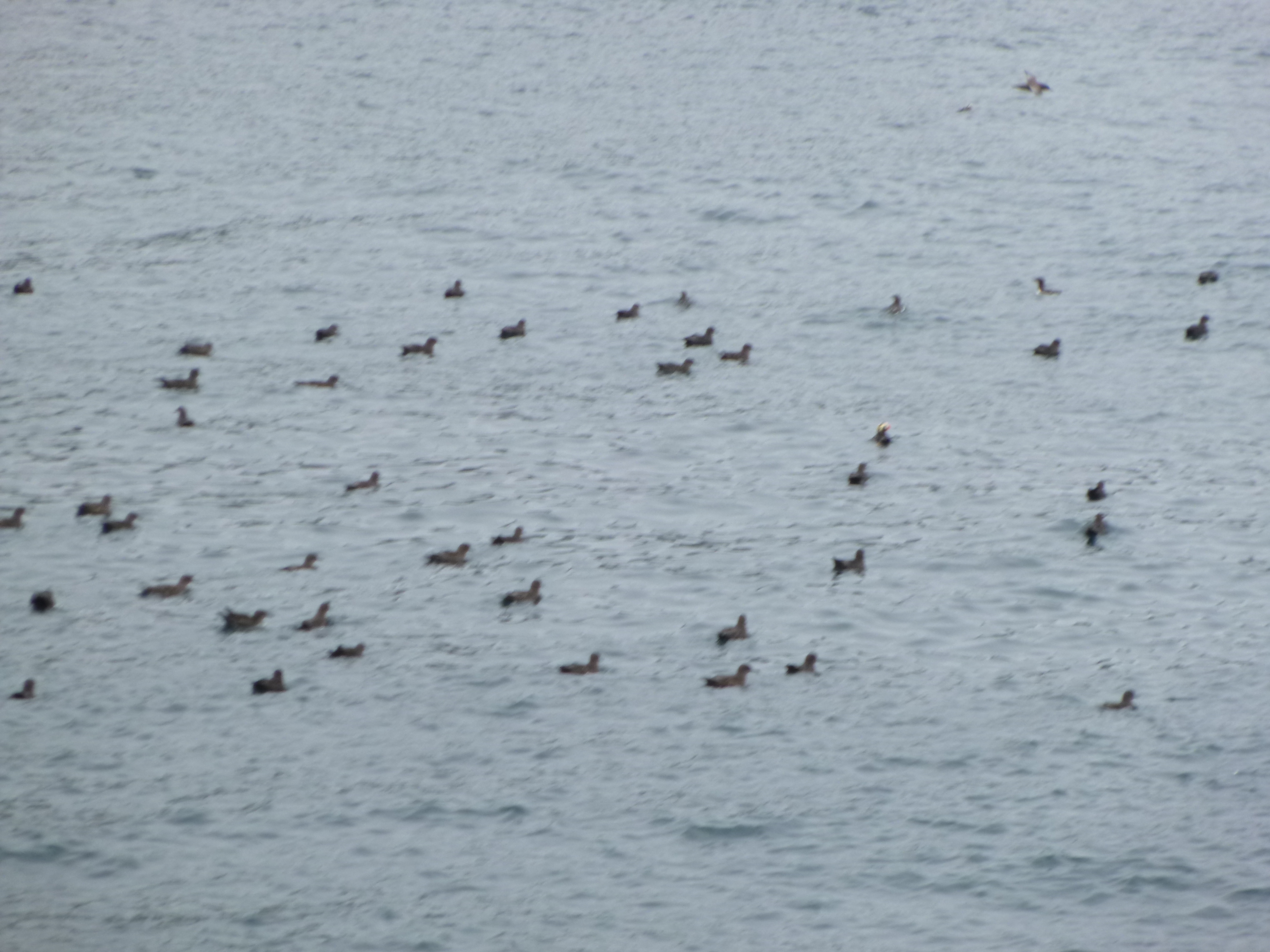
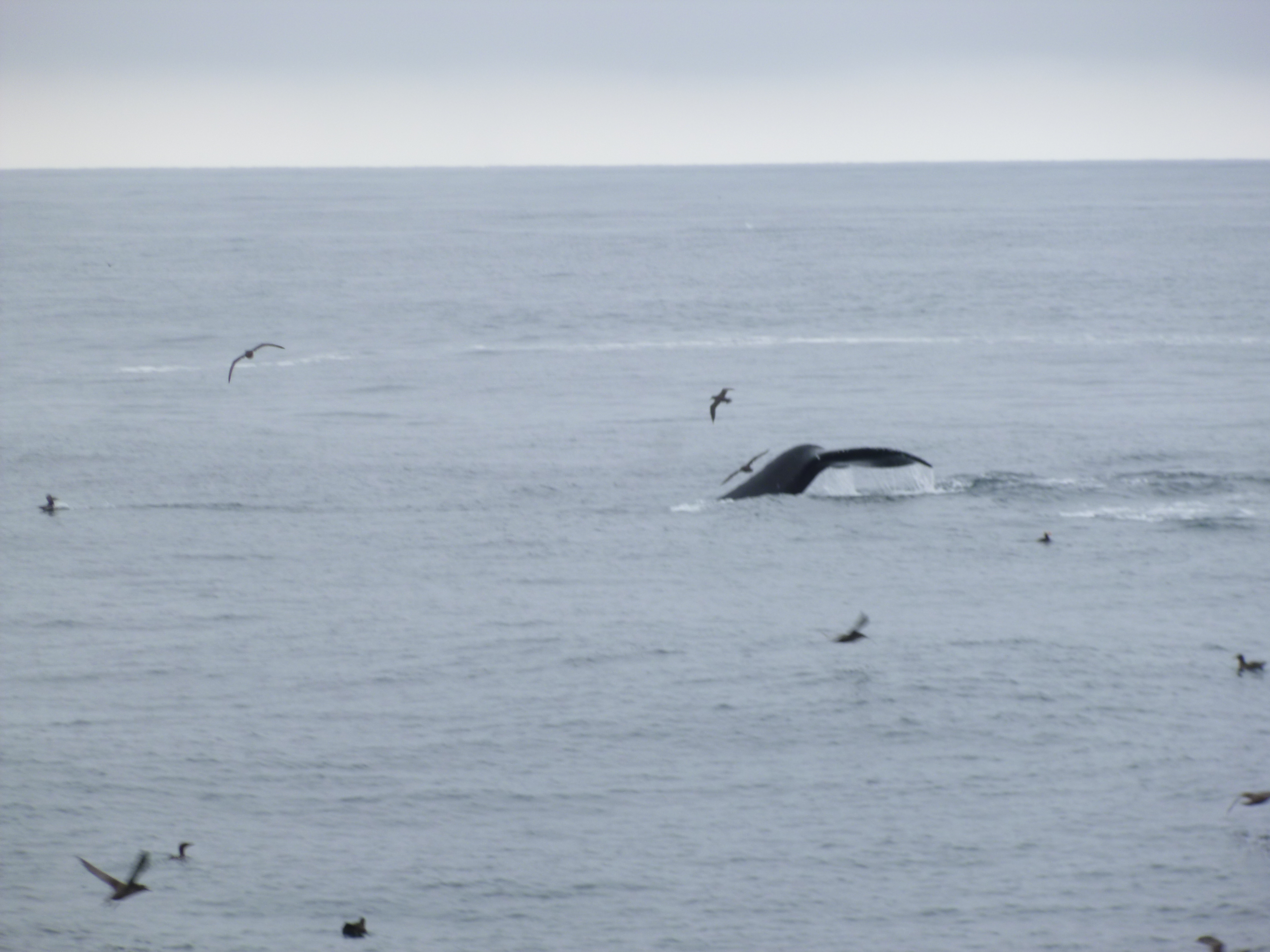
We left the harbor in fog that was just beginning to rise. The first thing we saw were a couple sea otters, and then some harbor seals – the captain said there are a lot of them around. And then some Dall’s porpoises appeared – they’re very speedy swimmers, and look like miniature Orca whales with their black and white markings. They can swim at speeds up to 30 knots, and the boat was moving along pretty good at 22-24 knots, so those little porpoises can sure cover some ground! The captain said whole groups of these porpoises sometimes follow the boat for a ways, but these ones seemed to be on another mission, so they vanished pretty quickly. And then we came across something they don’t see very often – a huge, thick group of clear jellyfish – so many of them that the color of the water was noticeably lighter where they were all clustered together. That was kind of unusual. We made our way farther and farther out – and passed a bunch of rocks where sea lions were sunning themselves. And then we saw a couple humpback whales and they surfaced a couple times, blowing water out of their spouts, and then with a flip of their tails they dove deep and we moved on. We were passing snow covered mountains, and we could see glaciers up in the far reaches of them. We passed by several fjords where some of the glaciers were getting closer to the water, and then we turned into one of the fjords. We began to see ice chunks in the water, and the closer we got to the glacier, the more ice-choked the water got. And then we were there – right up close by a magnificent glacier. The morning sun was beginning to warm things up a bit, and there was a lot of cracking noise, and rumblings, and pieces falling off and splashing into the water, and everything was kind of echoing. The captain simply turned the engines off and we listened to the glacier “talk” and watched the shifting ice. It was almost magical. A couple really big sheets of ice cracked off with booming sounds, and they made big splashes and the resulting waves rocked the boat. It’s a very unstable world up on that glacier! The crew used a net to haul in a big piece of glacier ice, and passed that around for whoever wanted to see it – it’s very clear ice. Then we started to head back and began to see hundreds and hundreds of sea birds floating in groups on the water – gulls, tufted puffins, cormorants, and sheerwaters – they’re all called “whale birds” because they feed on the exact same food that the whales do, despite the enormous size differences. And if all these birds have found a good feeding place that’s a sign for the whales that there’s also good feeding for them. (And these flocks of sea birds were good indicators for the whale hunters of the past too – otherwise how do you find a whale in the big ocean?) So we slowed down, and sure enough, there were whales all over the place – some nearby, and some out in the distance. I began to lose count of how many we saw – there would be 6-8 spouts off in the distance, and then a couple would surface near the boat, and it was hard to know where to look! There was also a bit of a bad smell in the air, and it was from all the whales expelling their fishy breath – as the captain said, if we consumed tons of anchovies and stuff and never brushed our teeth, our breath would be pretty bad too! The whales were absolutely gorging themselves in the rich feeding grounds. So we saw lots of humpbacks, singly or in pairs, and their movement looked so fluid and effortless. They seem to surface 5-6 times, and then they do a deep dive with their tail in the air, and then they’re usually down for a good 10 minutes. A couple of them were rolling around and sticking their side fins in the air, almost like they were waving. It was an awesome tour, and they gave us a light lunch, and it was a wonderful way to wrap up my Alaska visit.
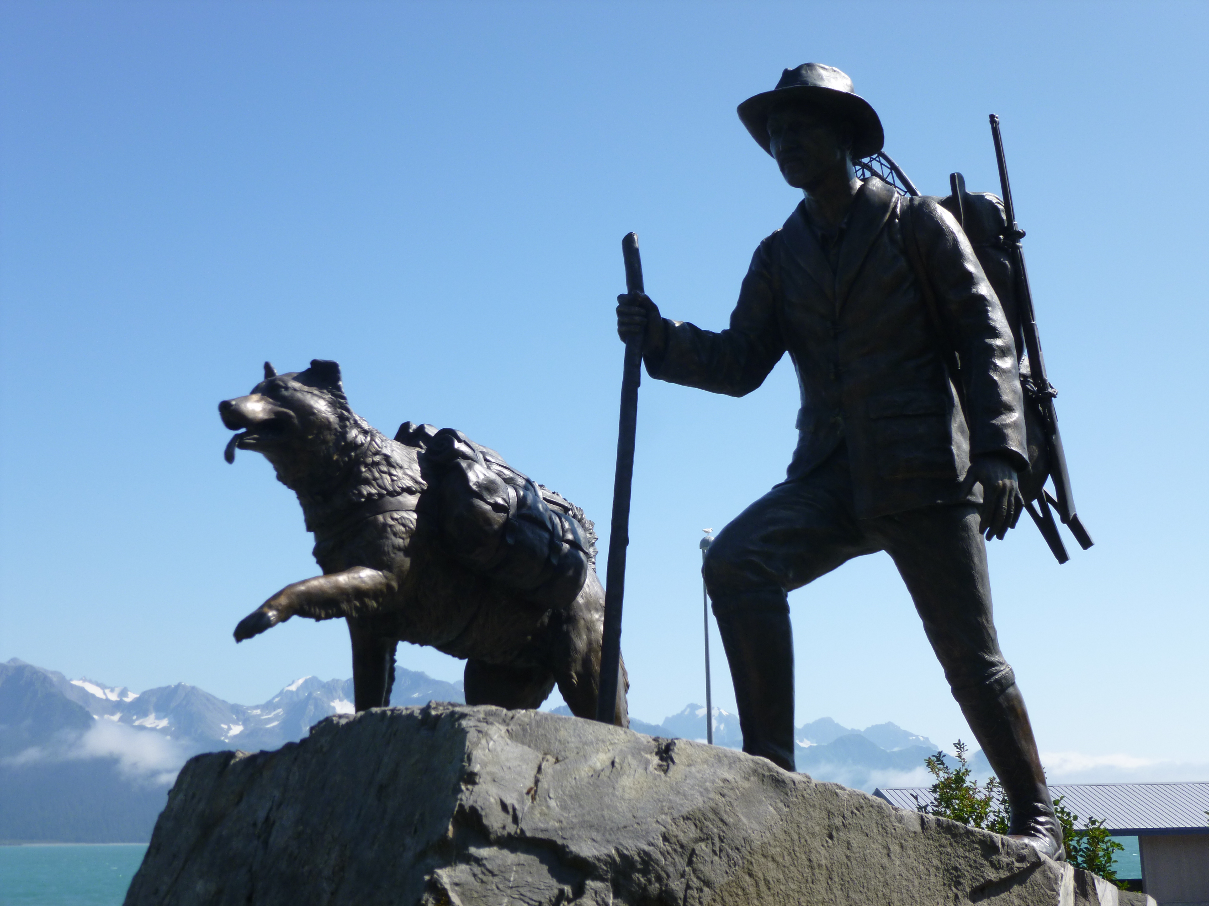
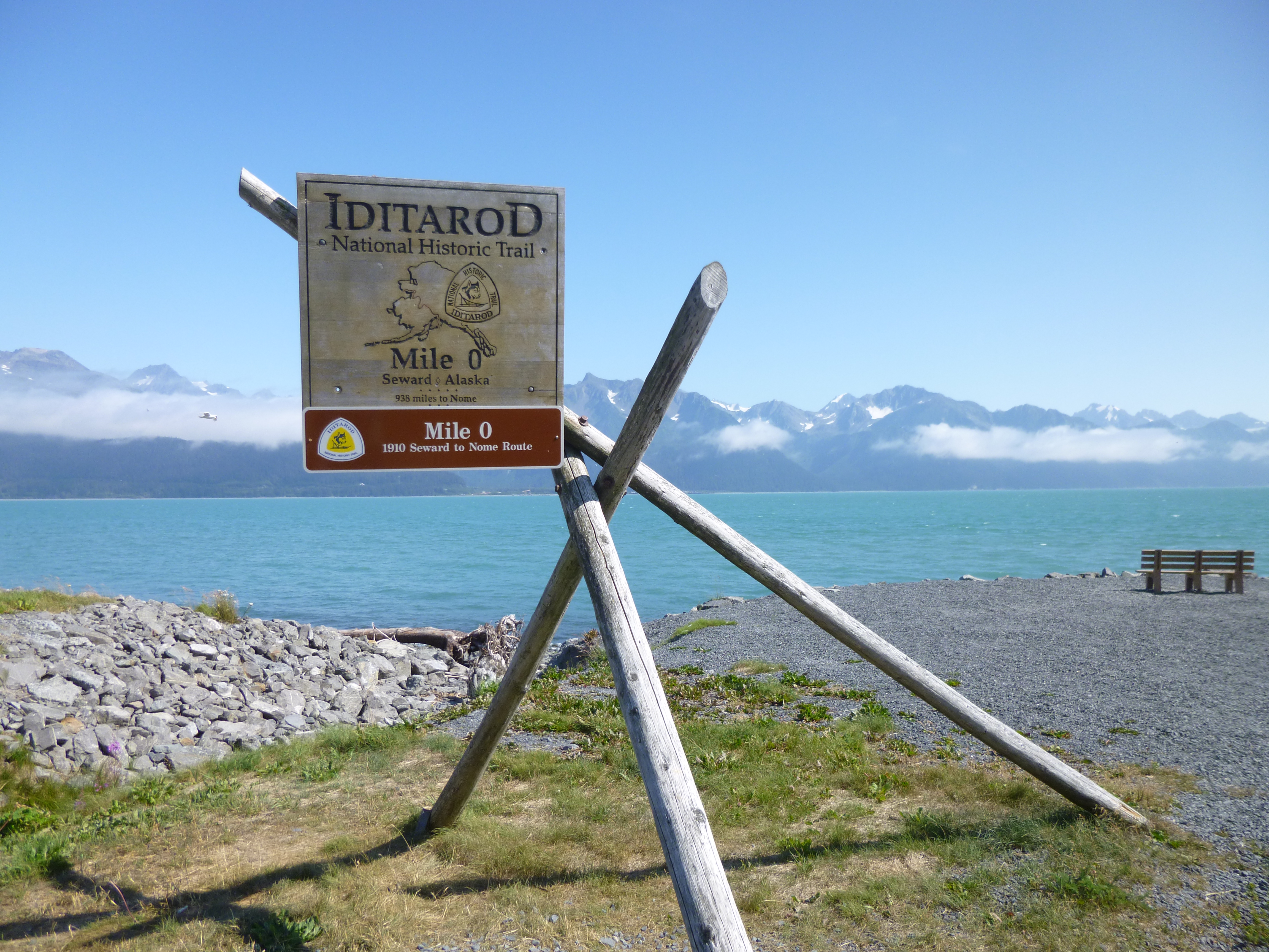
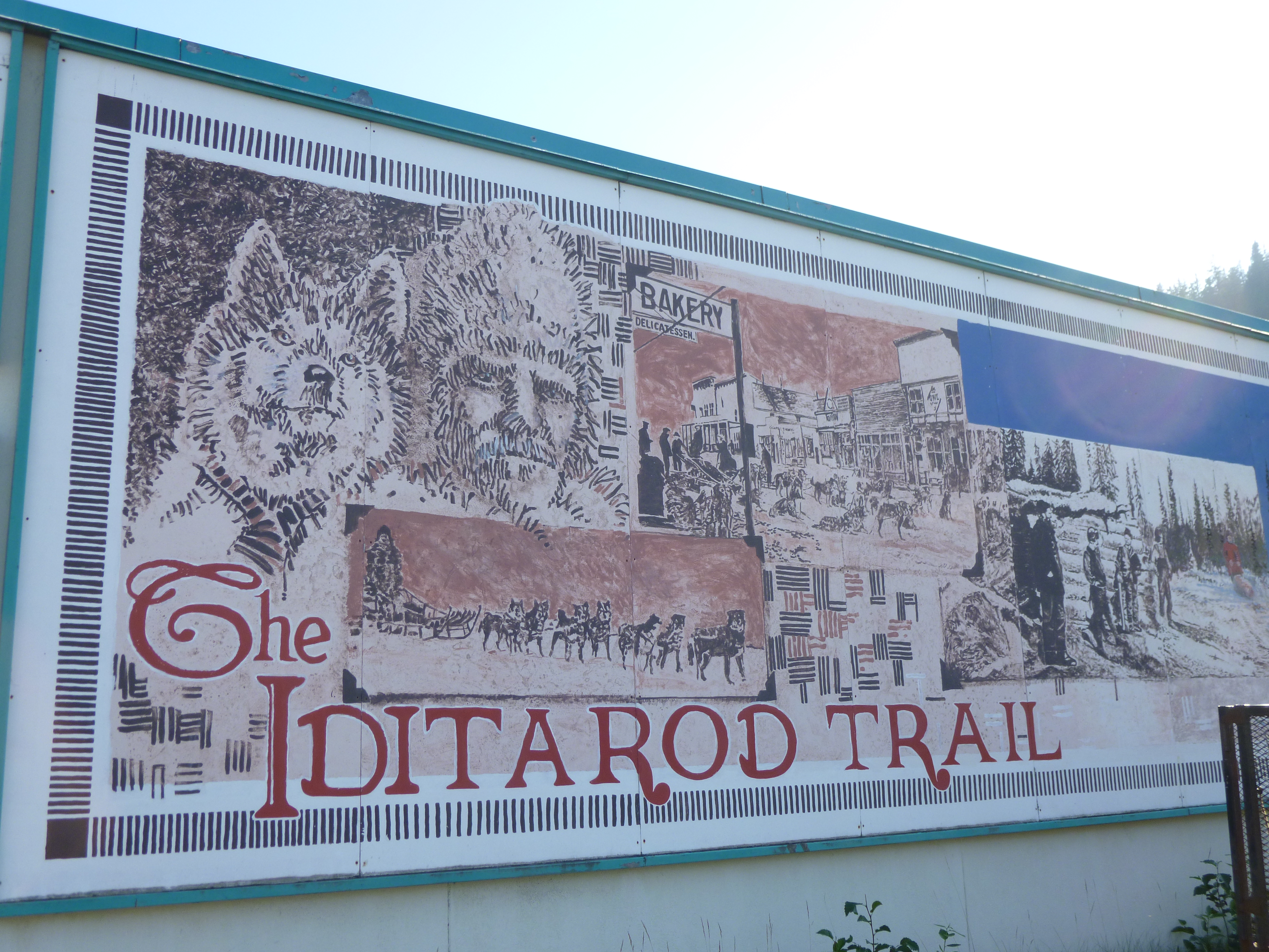
Tula was ready for a walk when we got back, so we enjoyed a mile or so on a boardwalk by a river just outside of Seward, and then went into the town itself, where I found the memorial marking the start of the original Iditarod sled dog run, which happened one winter in a desperate attempt to quickly get some medication all the way up to Nome. Seward is a fun little town with a lot of character and a lot to see. We walked for a while on the bike path along the sea, starting at the Mile 0 marker for the Iditarod race, and then continued all through town. By then we had a good 3 miles of walking done. I didn’t make a donation today, because all of the Alaska donations are done.
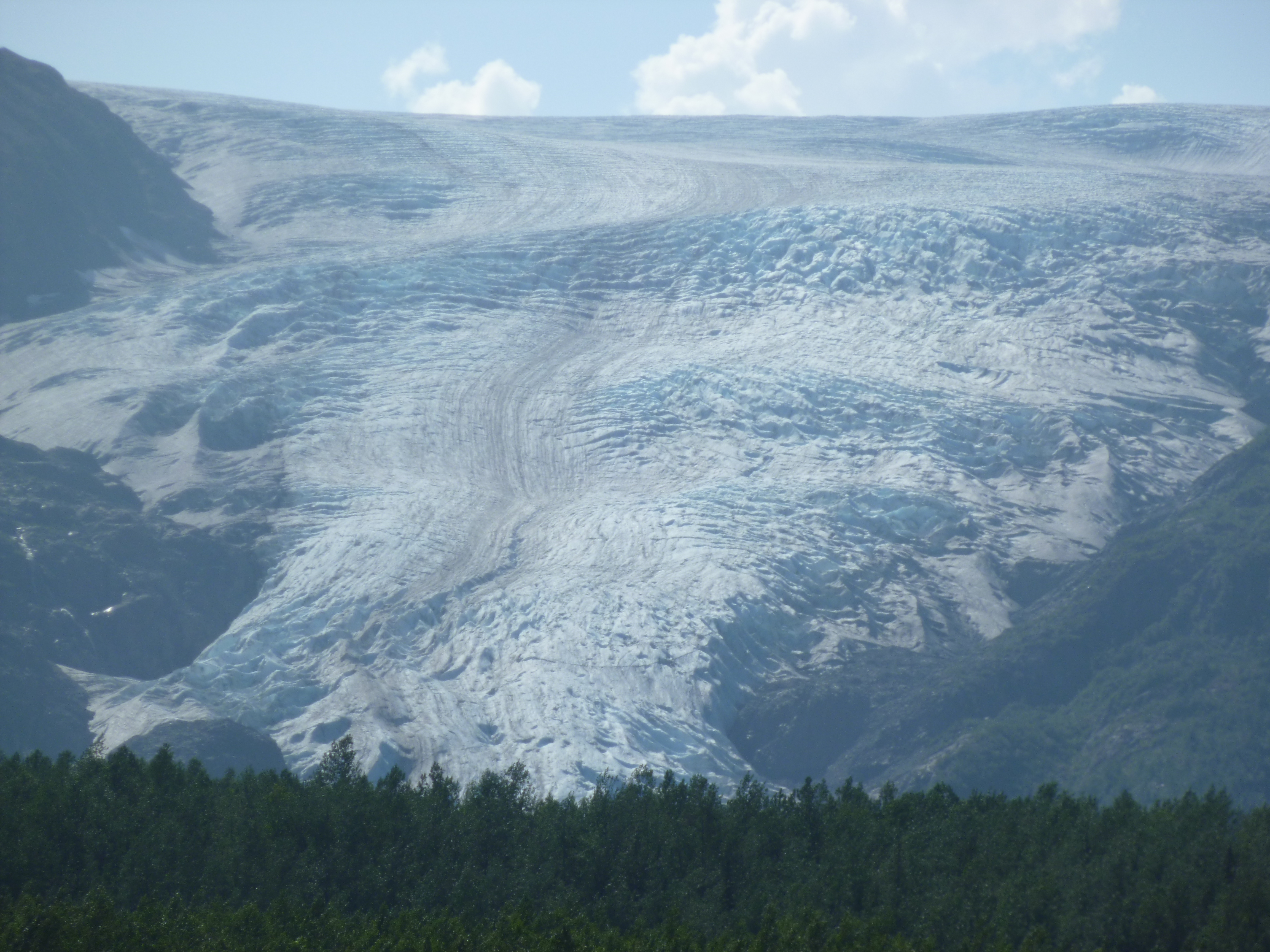
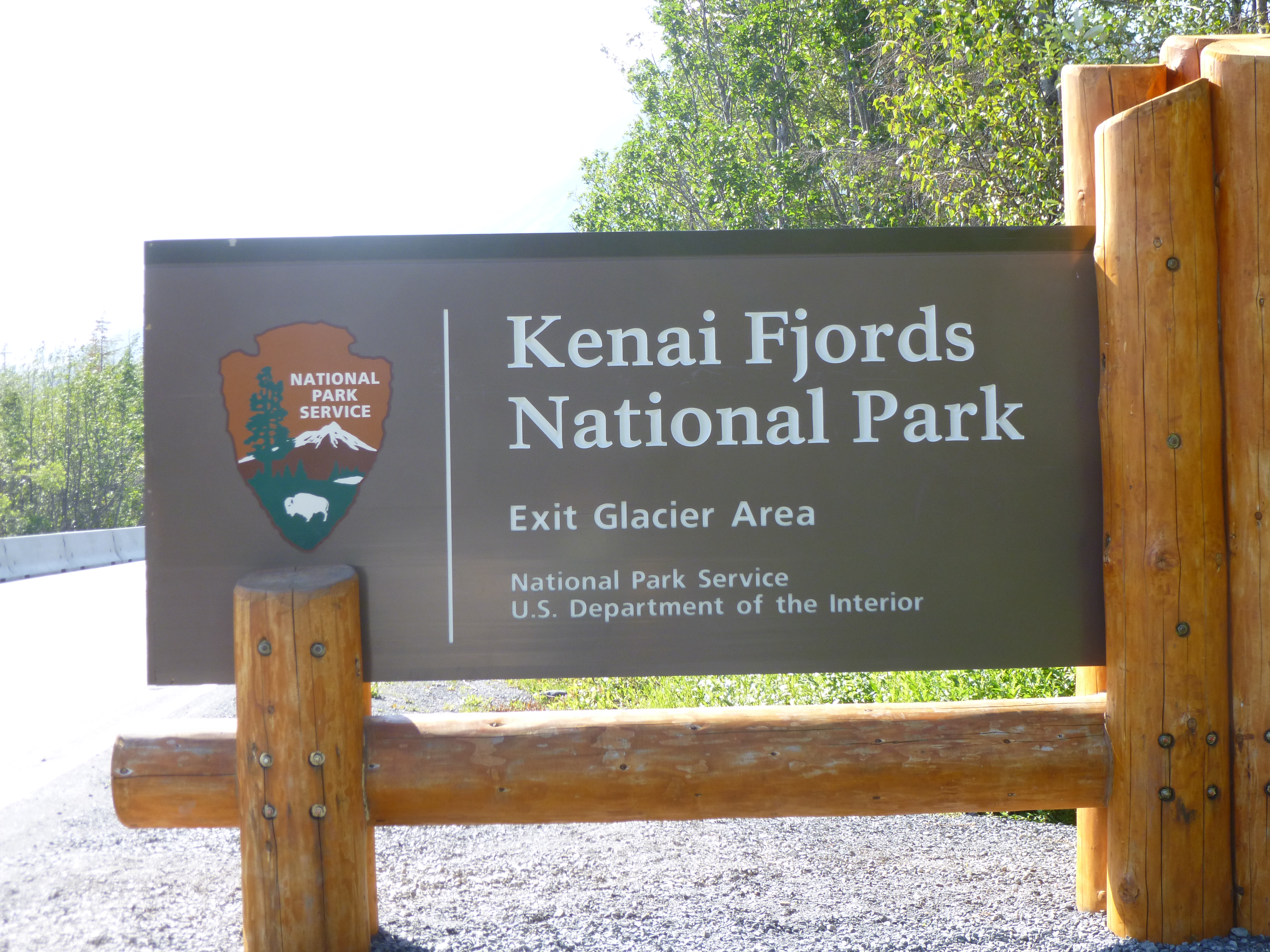
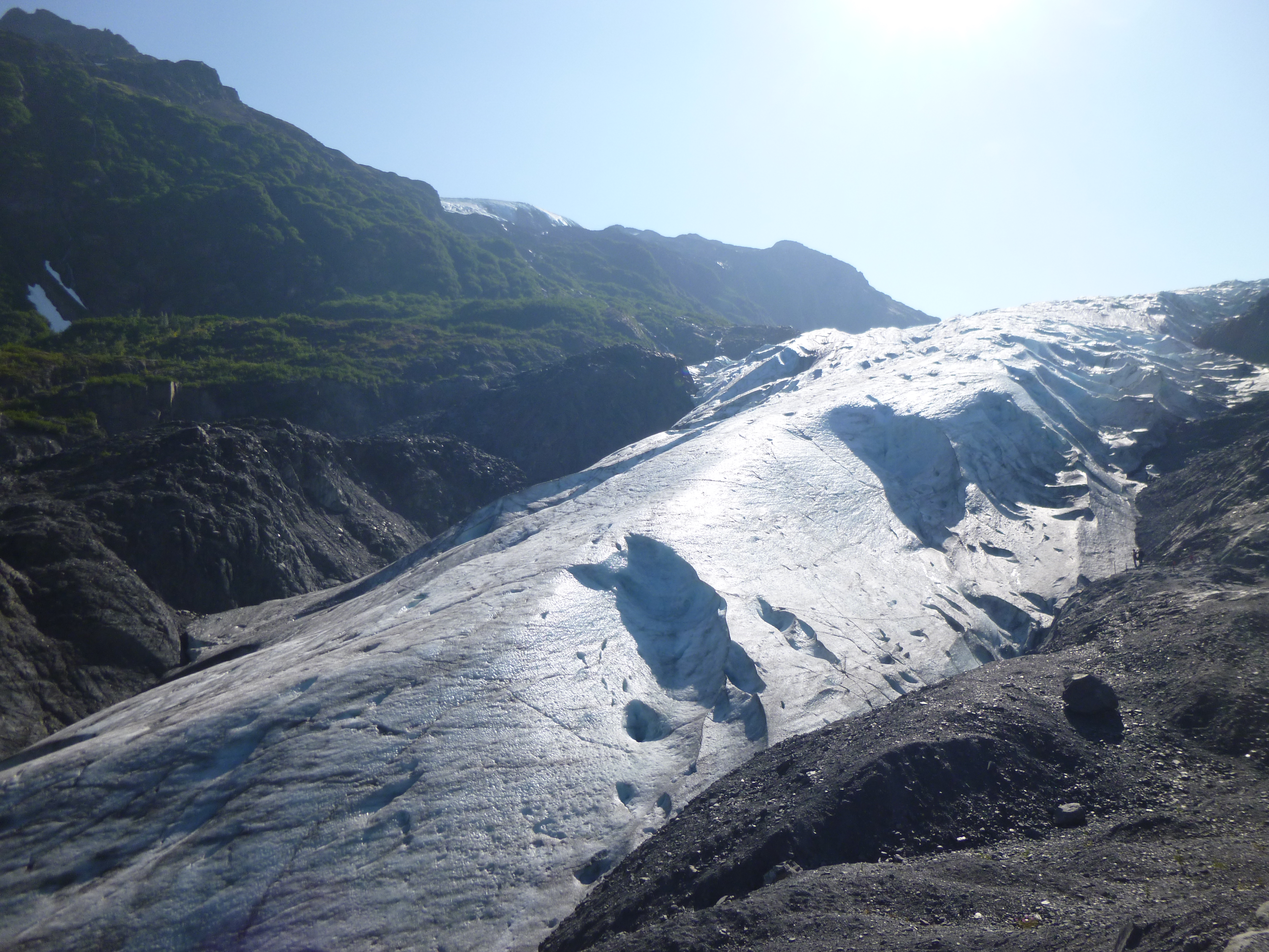
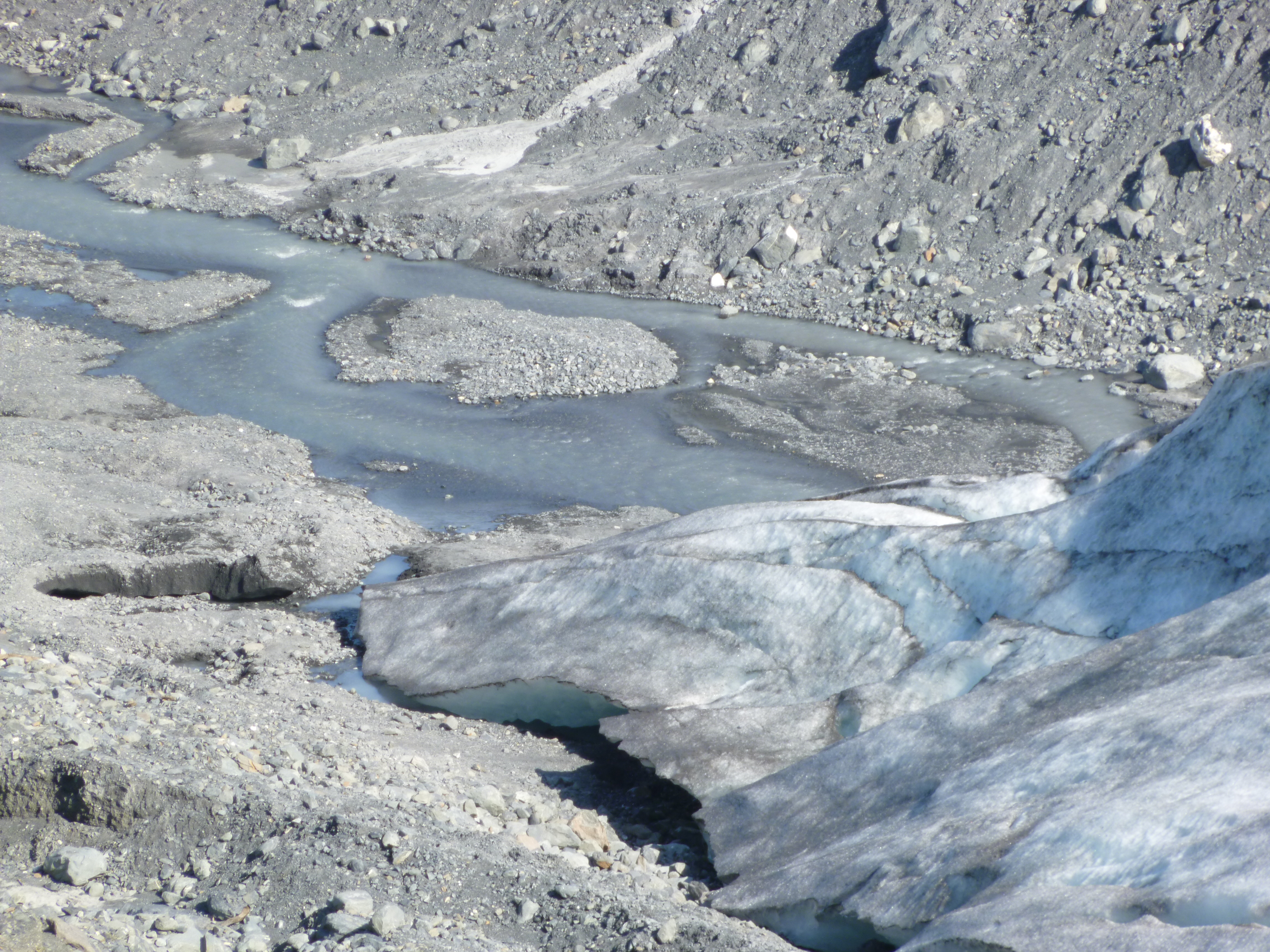
I was close to the Kenai Fjords National Park, so I drove up there toward Exit Glacier, and had some beautiful views of it on the way up. I stopped in the visitor center to ask about short hikes, and decided on the 2 1/2 mile hike that would bring me close to the foot of the glacier. The bugs were pretty bad until I got closer to the cool air coming off the glacier, and when I got up to the viewing point, there was a sign showing where the glacier had been just 15 years ago. It was astonishing how far it had retreated in such a short time. Up close, the glacier looks a bit dirty from all the sand, dirt, and stones it picks up, and there were little rivulets of water flowing off into a very cold, fast-moving stream. It was interesting to see the actual toe of the glacier.
Once I was back from that walk, I went back into Seward one last time to go into a couple of shops that looked kind of interesting, and I actually found some gifts for a couple special occasions coming up. Then, it was simply time to leave, and time to start the journey out of Alaska. There are only 2 roads out of Alaska, and they were both hundreds of miles away, and I knew I wasn’t going to get real far tonight. I drove about 80 miles and then saw a sign for a state park campground near one other town I wanted to drive through in the morning, so I called it a day, and set up camp in a beautiful little campground nestled in the pine trees under the majestic mountains. Tula and I took a bedtime walk on a long boardwalk and finished off our walking for the day.