Wyoming – Wednesday, July 10
Tula and I started our morning off with a walk through some of the different campground loops. I noticed a lot of the sites had bear boxes to store food in, and wondered why I was at a site that didn’t have one. I’m guessing it was because I was there for just one night, and wouldn’t have brought as much food in, although I do have a rubbermaid bin full of stuff! When we were a few loops down, one group of campers told me a bear had been by about 40 minutes ago – I decided to go no further! I read a sign somewhere that despite all the near precautions, an average of 17 people are killed in the 2 parks each year. Then I tried to get Tula cleaned up a bit – she got some pine sap on her from laying in the pine needles last night.
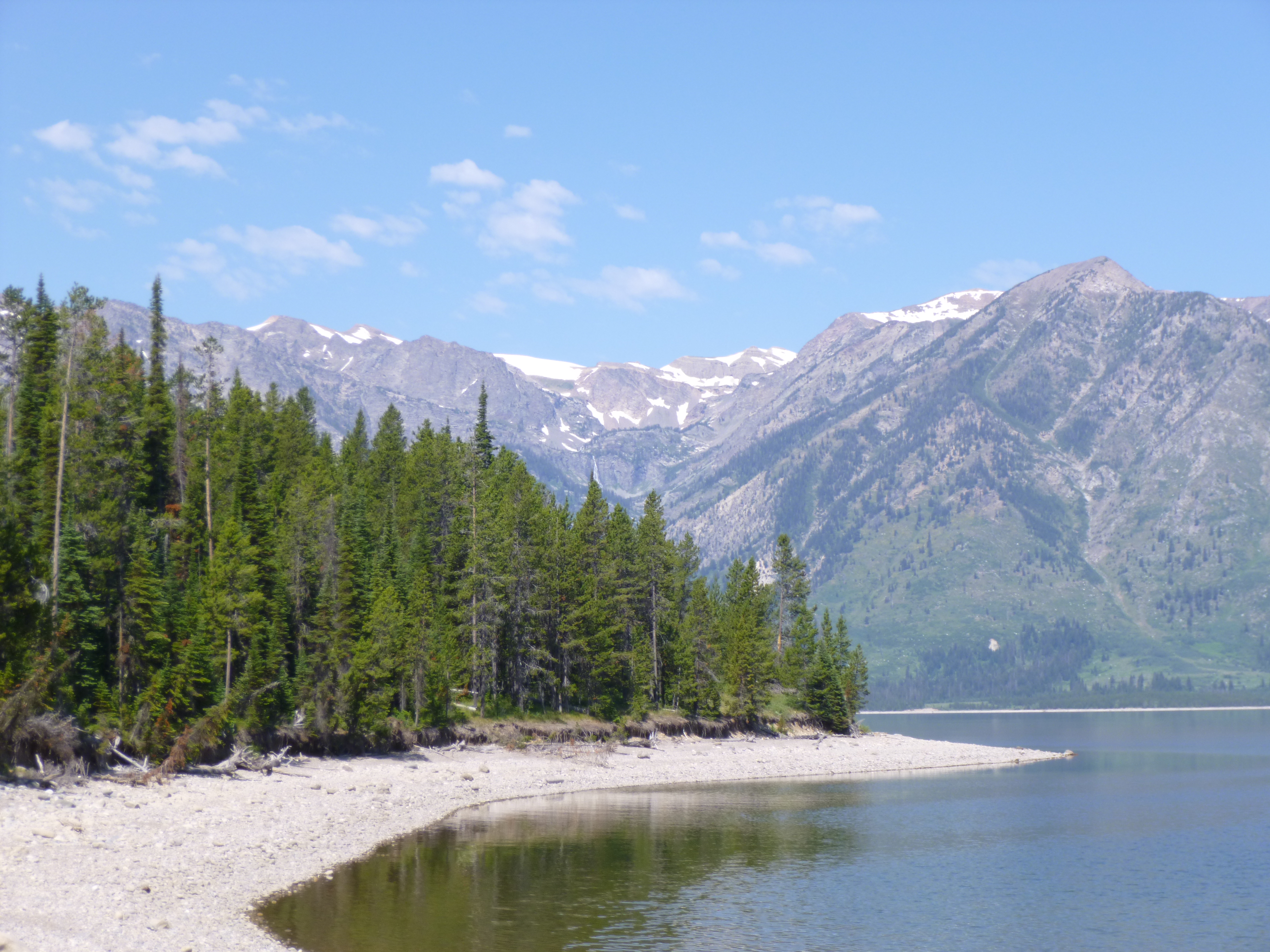
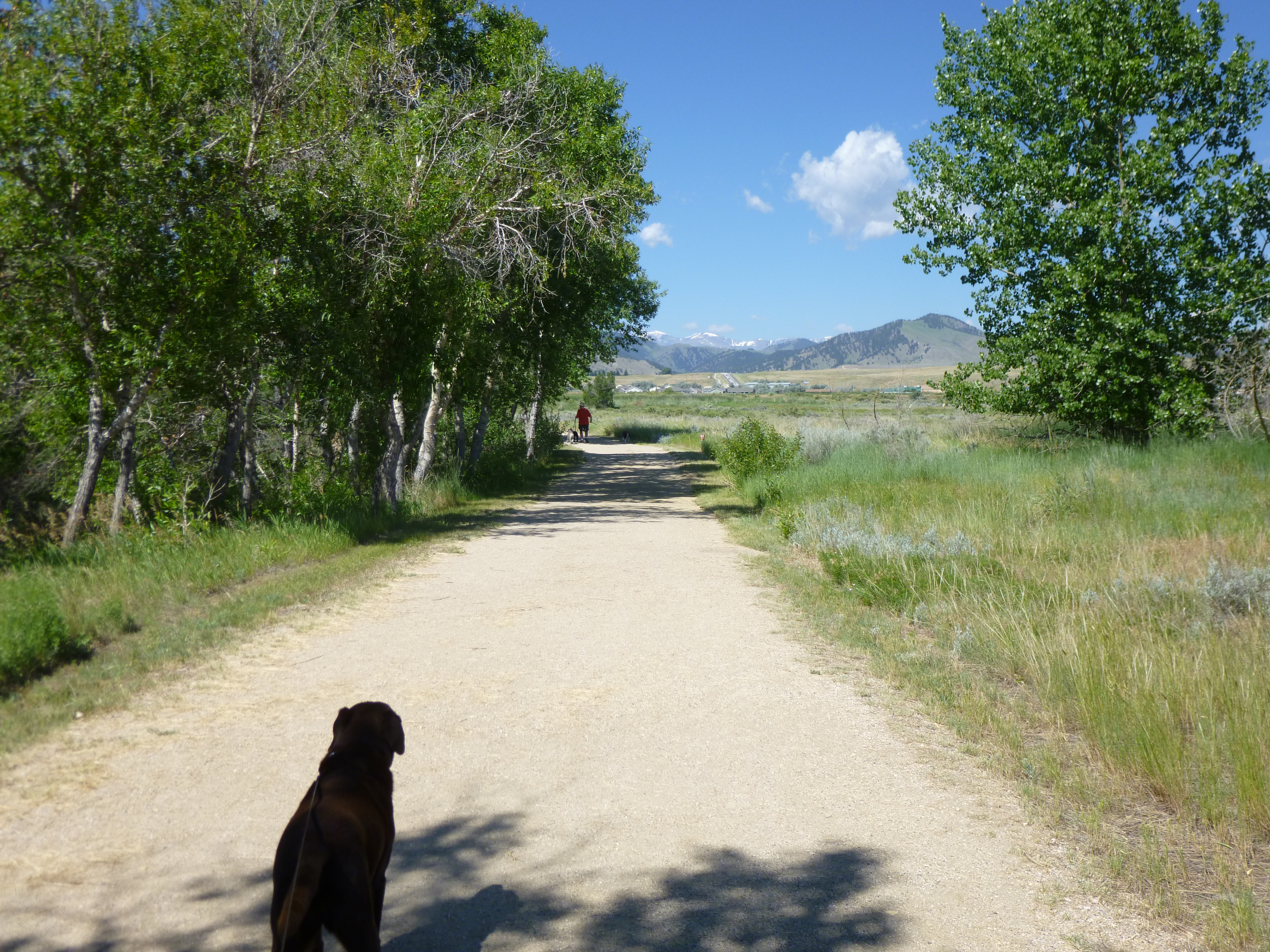
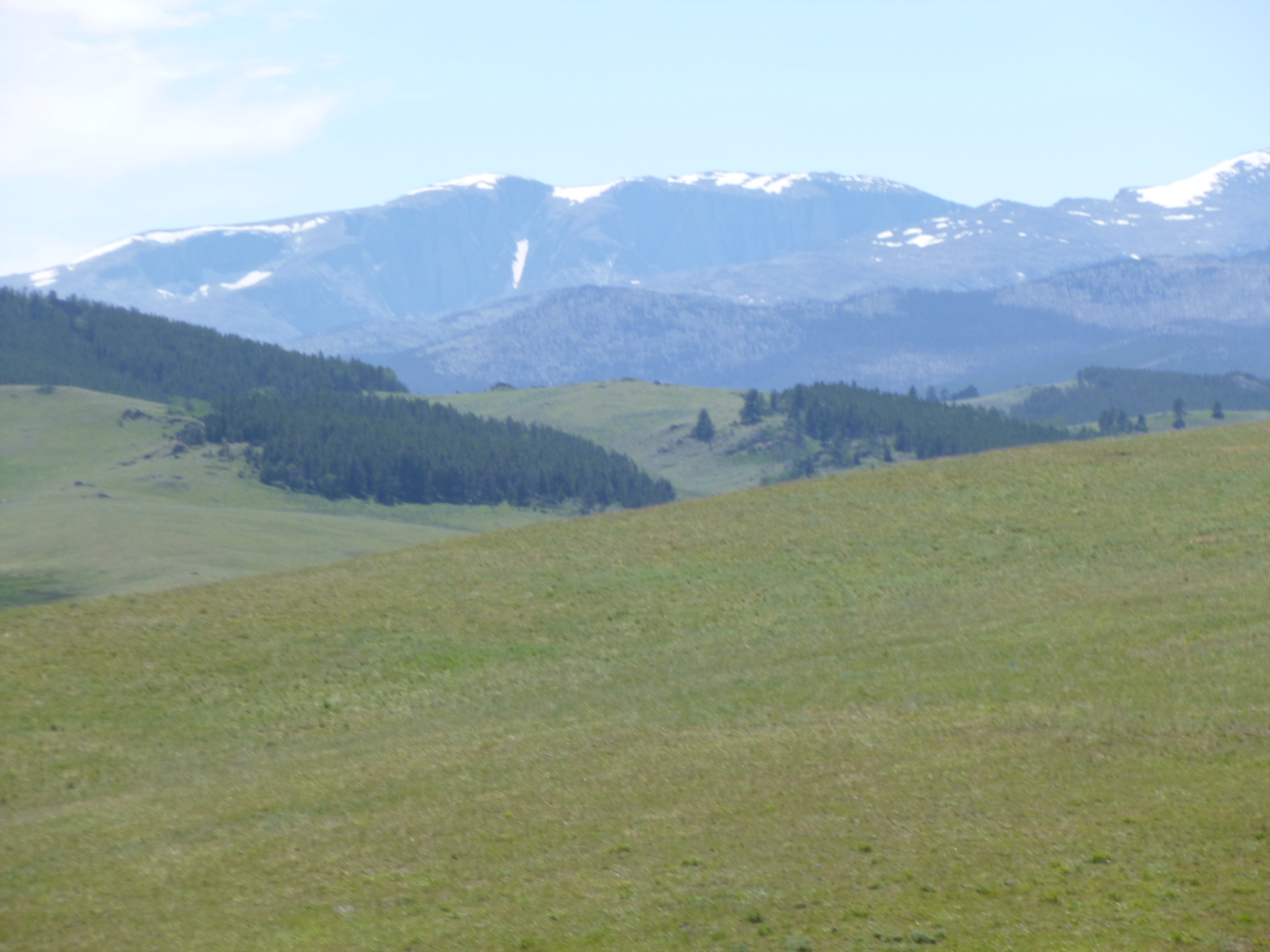
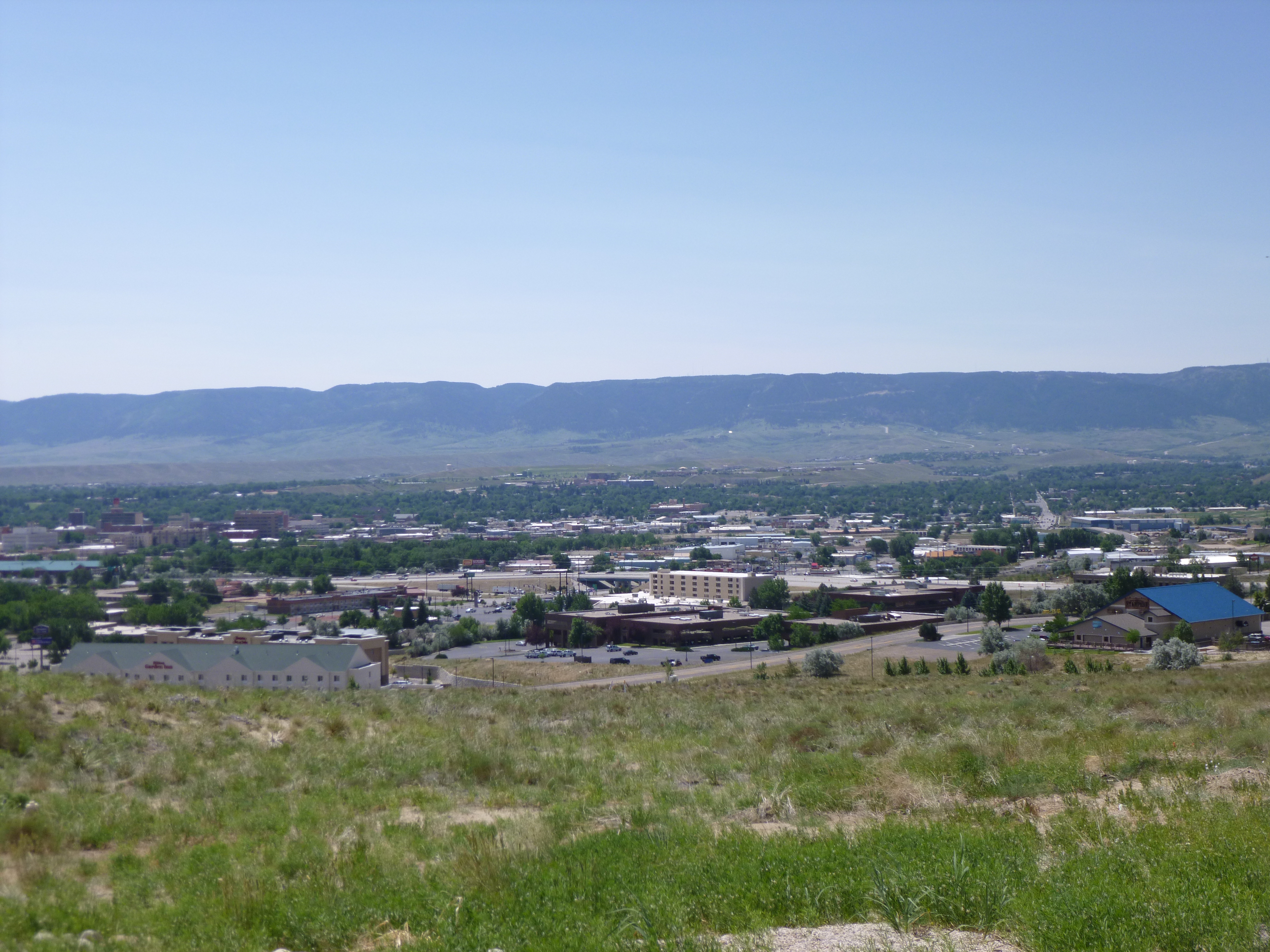
Then I drove to the visitor center and was immediately hit by the glorious mountain and lake view. I wanted to walk on one of the trails, but wanted it to be relatively short and well-used because I wasn’t going out into bear country on my own! I asked one of the rangers about trails, and after an initial sarcastic remark (yes, I realize the bears don’t hand rangers their daily schedule!) he had a nice suggestion of a place to walk, and I covered 2 1/2 miles in the woods, and there were enough other people out and about that I felt comfortable. Plus the lake was by part of the trail, and in a pinch I could have made a dash for the lake, but that made me wonder if bears can out-swim humans! Then Tula and I walked almost another mile on the sidewalks in the area; admiring the mountains the whole time. I drove down to Moose Junction and went to the visitor center, then began the pretty drive north again with the mountains in view the whole time.
I didn’t make a donation today since I had made 2 on my first day in Wyoming.
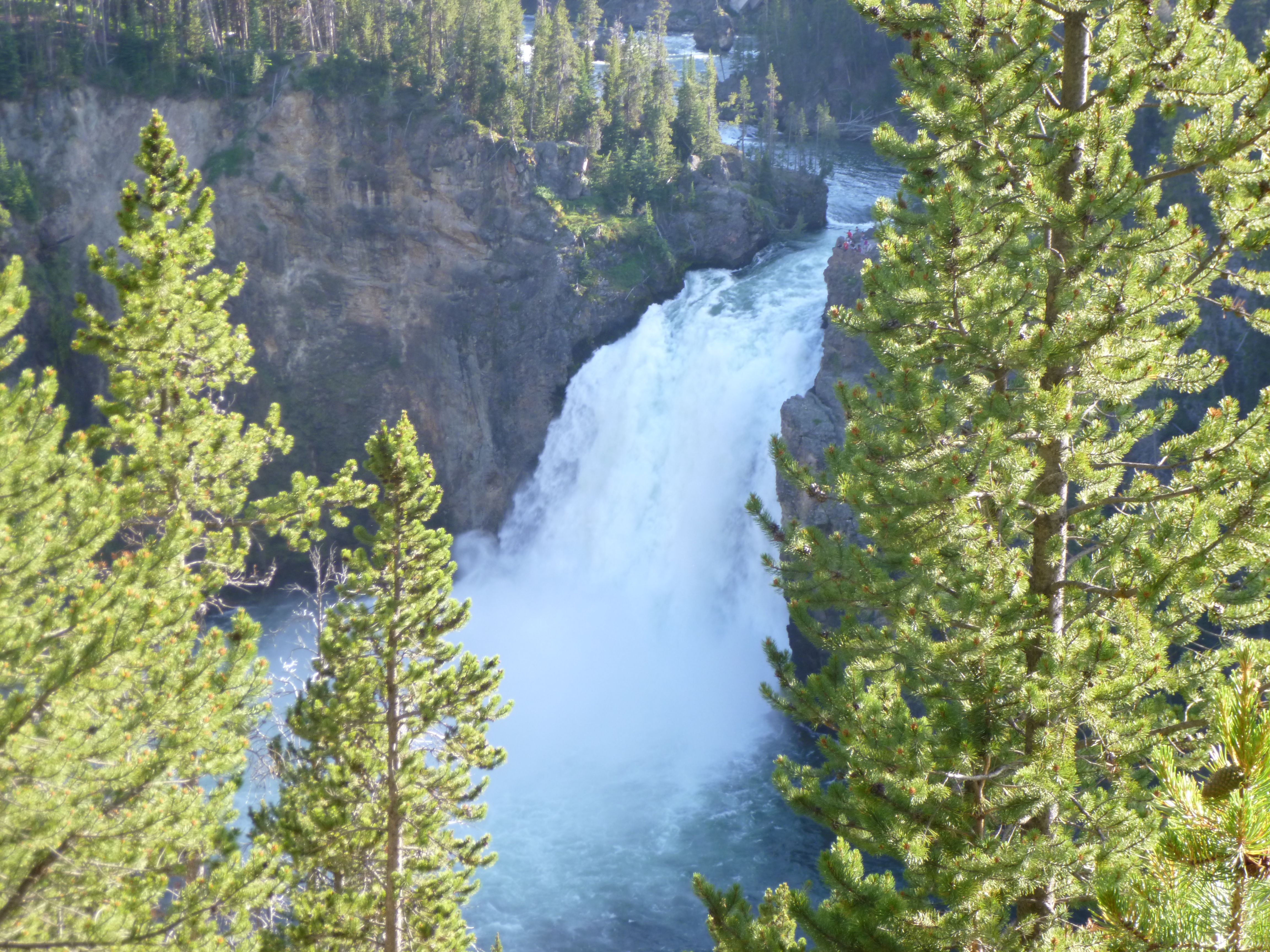
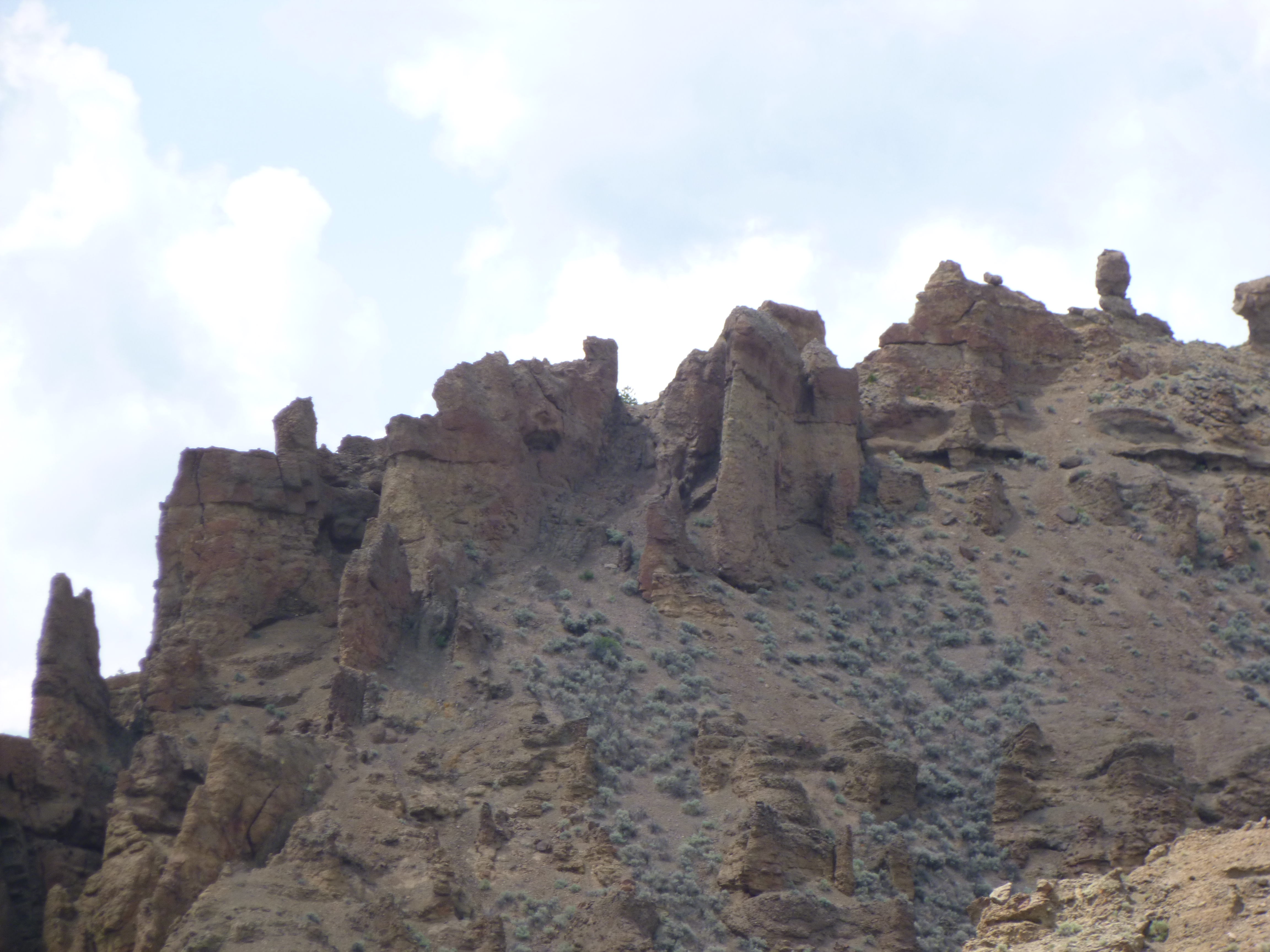
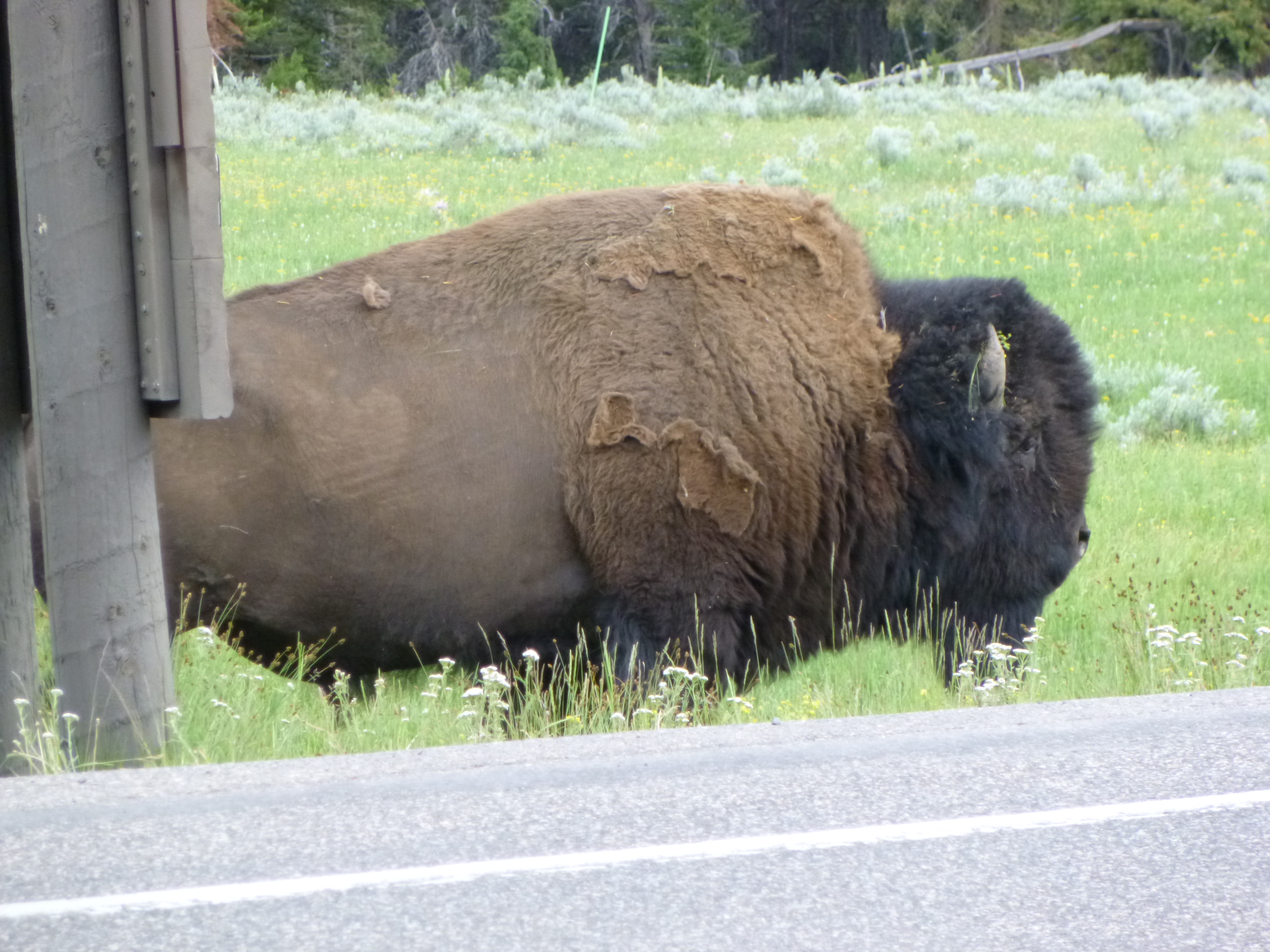
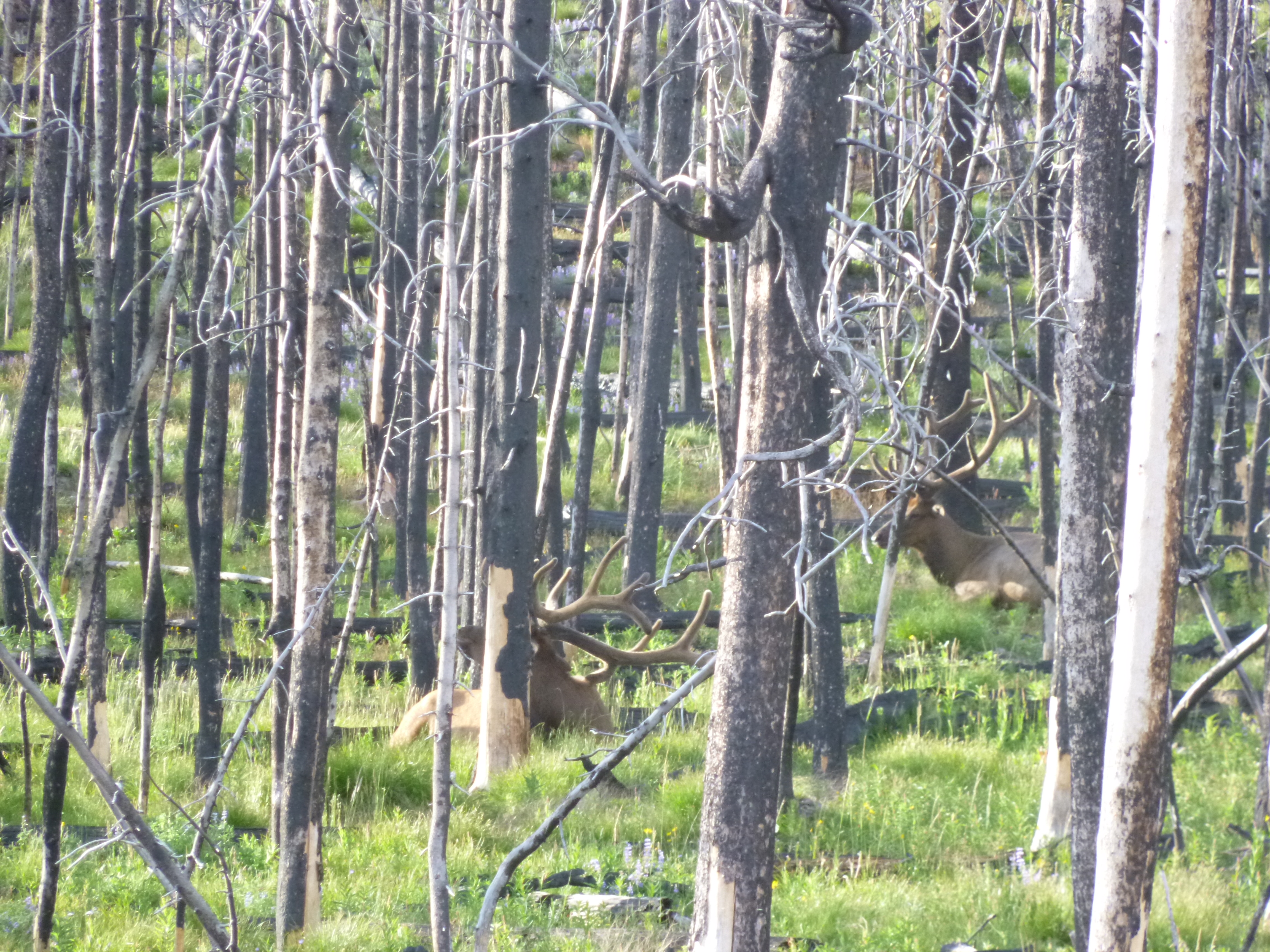
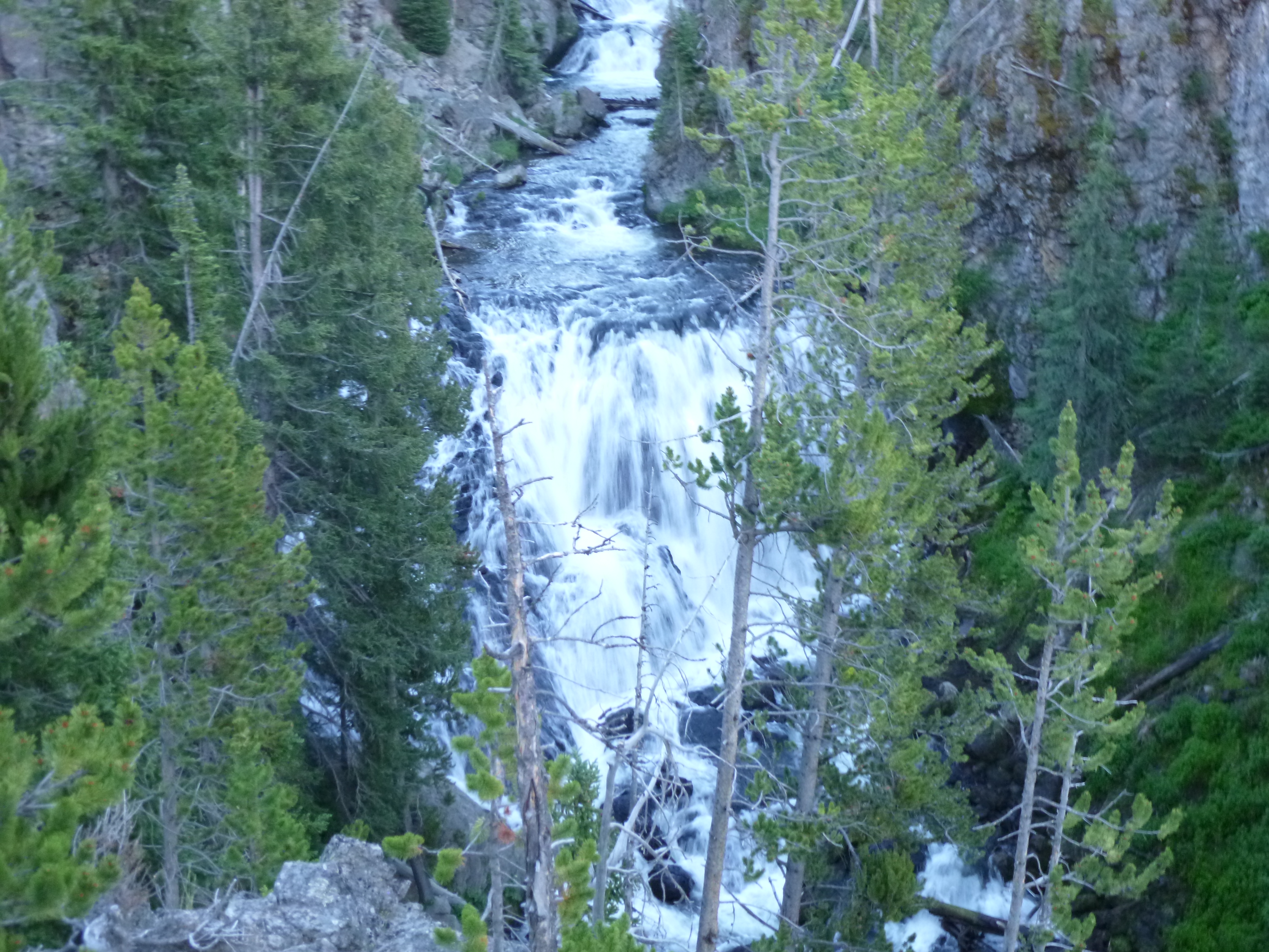
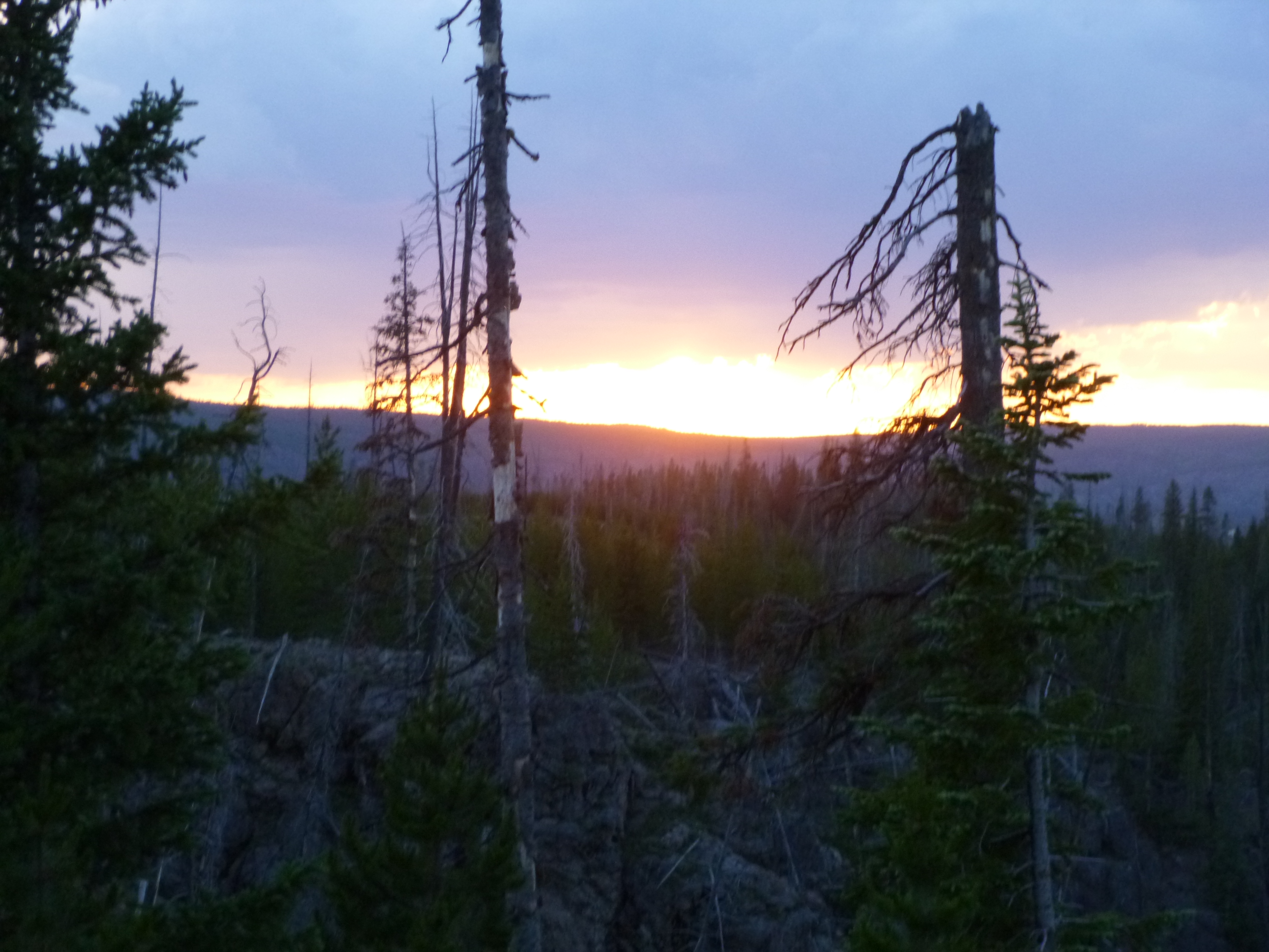
I was going to leave Wyoming via Yellowstone’s west entrance, and I took the long way around to see other parts of the park. I stopped for more walking at the Mud Volcano boardwalk, then stopped at the Canyon Falls visitor center. I also stopped at the Dragon’s Mouth Spring, and it really did look – and sound like – a big dragon breathing smoke! As I continued driving along, I came upon a whole herd of buffalo soaking up the sun right by the road. Needless to say, lots of cars had pulled over to admire them. Lots of them were laying flat on their sides, and others were just laying down surveying their kingdom. Some of them are still so shaggy – those coats have to be hot!
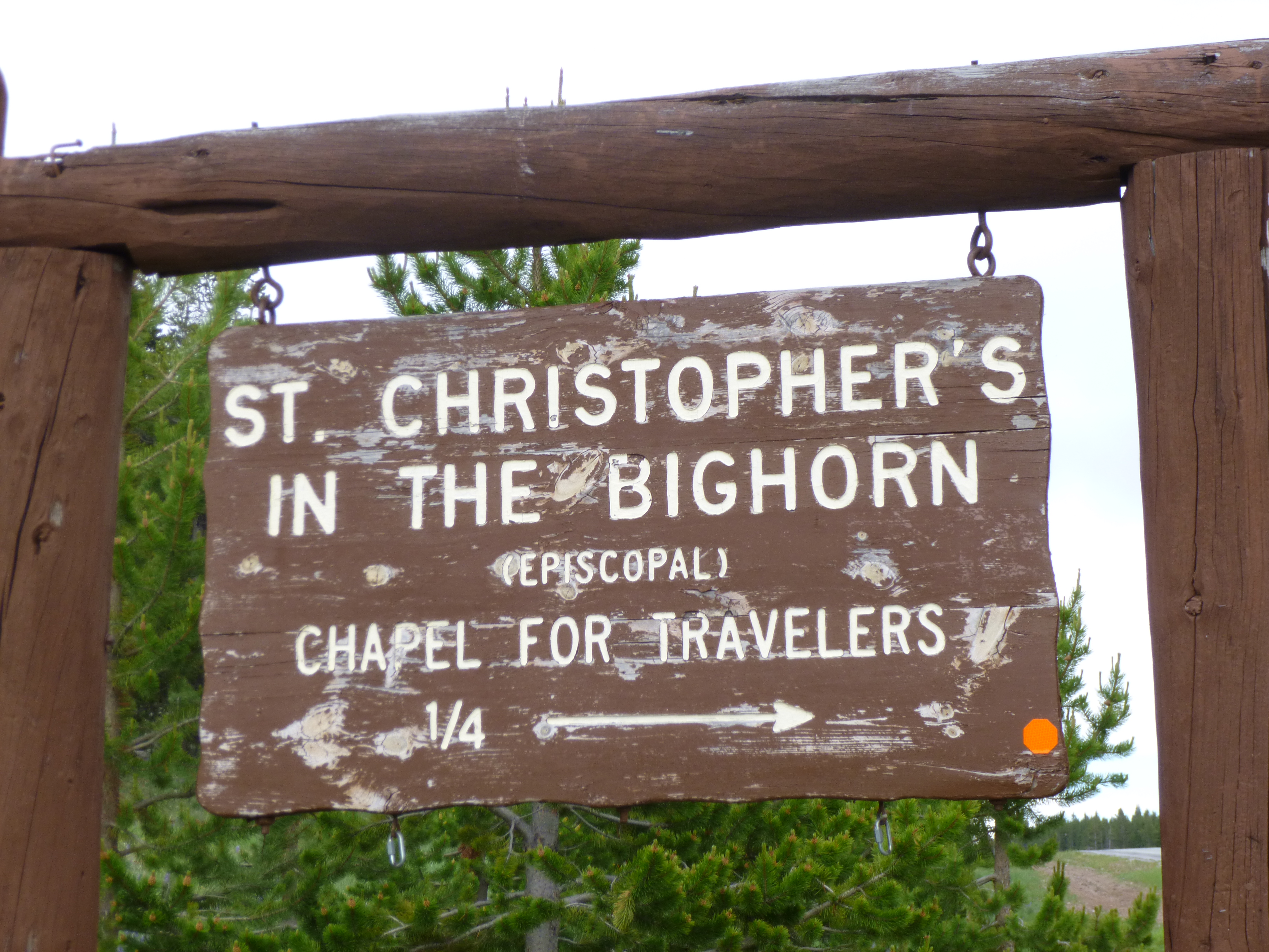
My last walk in Wyoming was to go see the Steamboat Geyser. It huffs and puffs and spurts out little streams of water, but when it does erupt it’s 2-3 times higher than Old Faithful, and that must be an incredible sight! The problem is, it’s totally unpredictable, and the eruptions can be anywhere from 4 days apart to 50 years! I did not wait around to watch for an eruption!
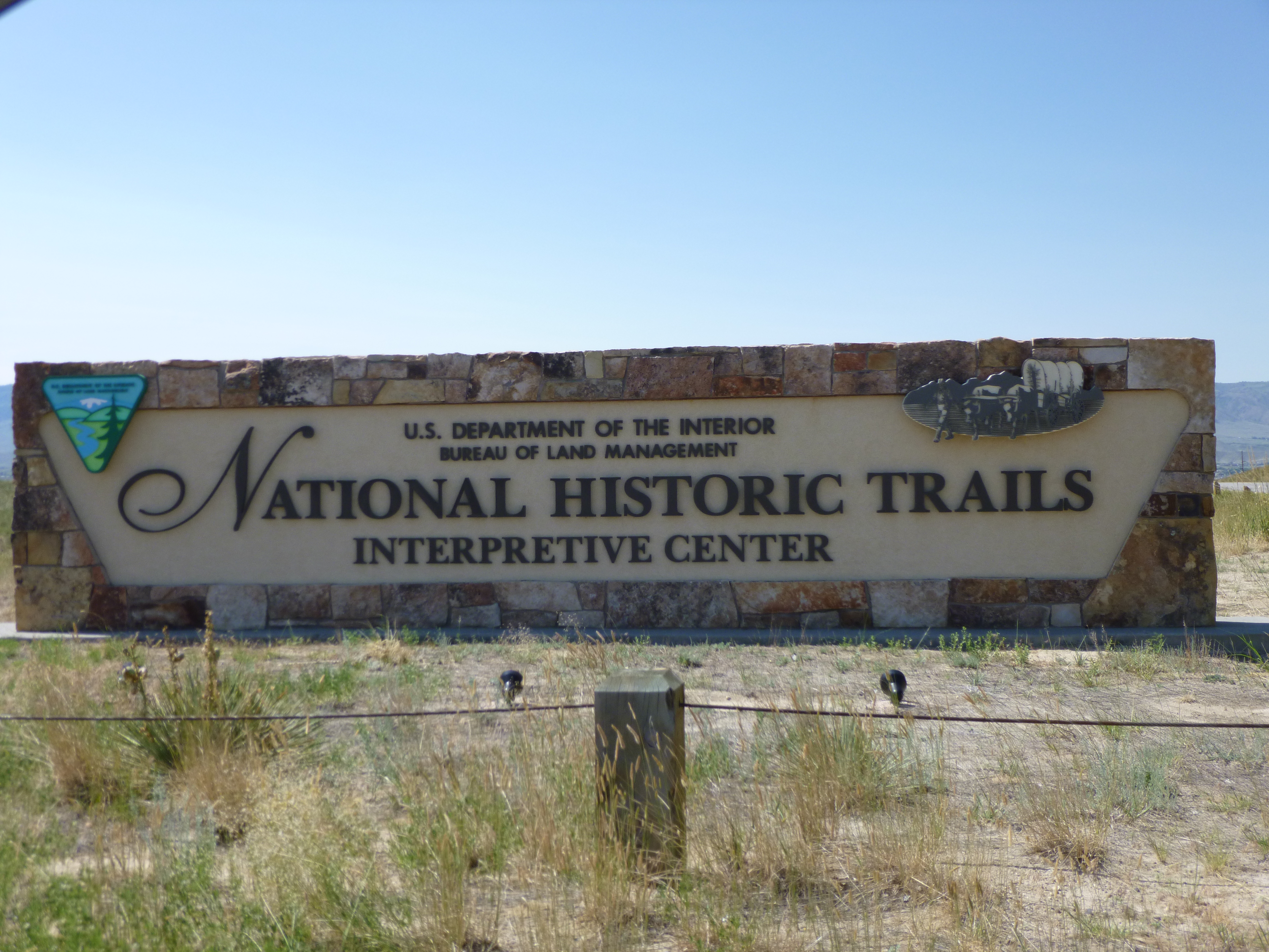
And then, my time in Wyoming had come to an end. I walked a little more than 56 miles (there’s just so much to see!) and made all 7 donations – The American Legion Operation Comfort Warrior program, the Little Laramie Valley Volunteer Fire Department fund raiser, Laramie Soup Kitchen, National Historic Rivers Interpretive Center, Bread of Life food pantry, Cody Cupboard, and Yellowstone Foundation.
I would have camped in Yellowstone if I could have, to end my visit in the parks, but my luck had run out with getting last-minute campsites. So I drove out of Yellowstone’s west entrance into Montana – West Yellowstone, Montana. And this is a big expensive tourist town where a lot of people stay who are visiting the parks. I wasn’t going to stay in town – it was all just too much for me. Even though it was getting dark, I started out on a winding, mountainous road toward Bozeman and got about halfway there. But there were a sad number of crosses on the roadside, and a sign reminding everyone of fatalities, and with it getting late and I was starting to get tired, I knew the wise thing to do was stop, even if the motel was a little pricey. So I came to a decent place in the middle of nowhere and called it a day. The people at the front desk waived the $25 pet fee, and after camping for the past 4 nights, I was happy to stop!


Wyoming – Tuesday, July 9
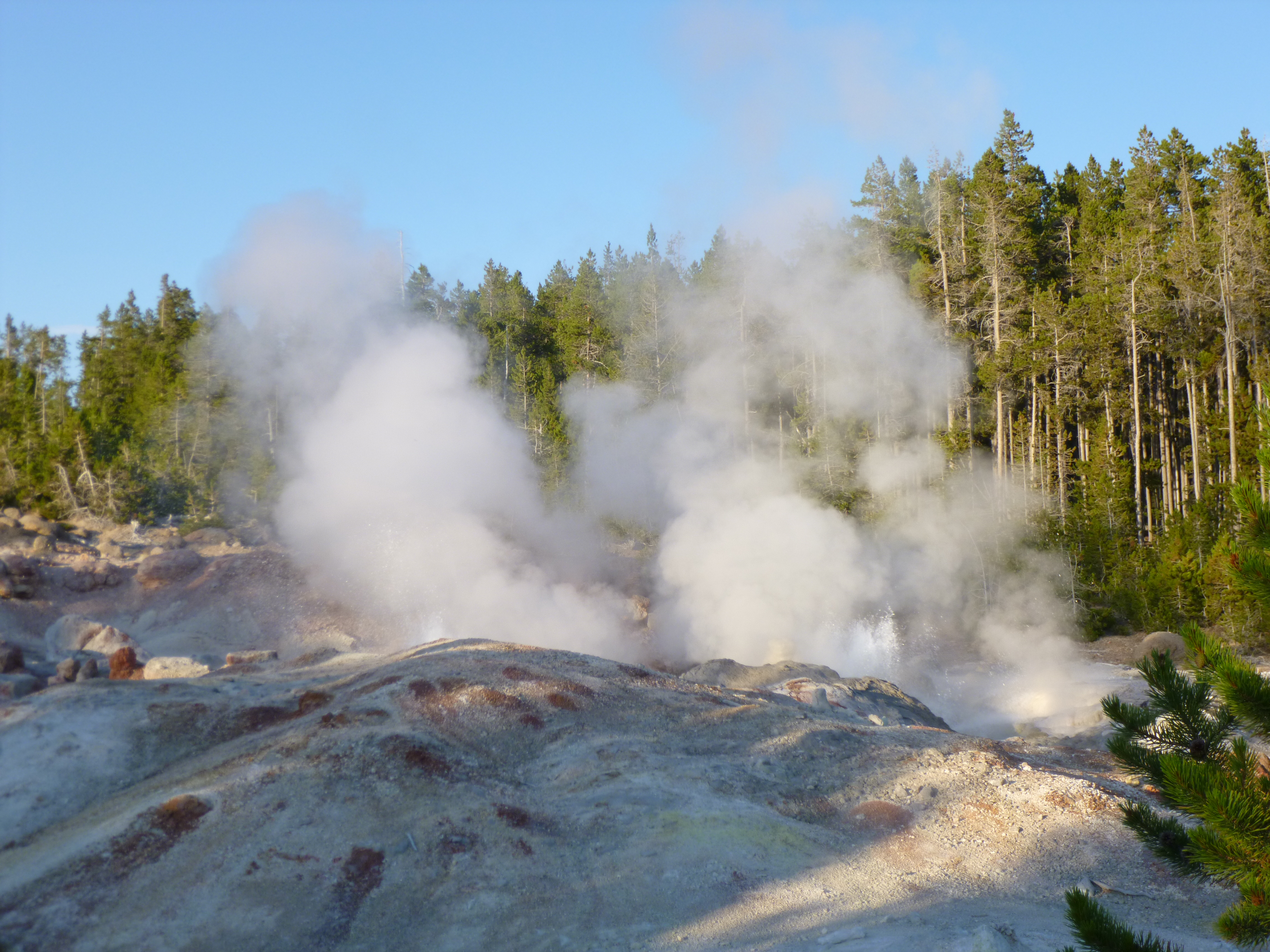
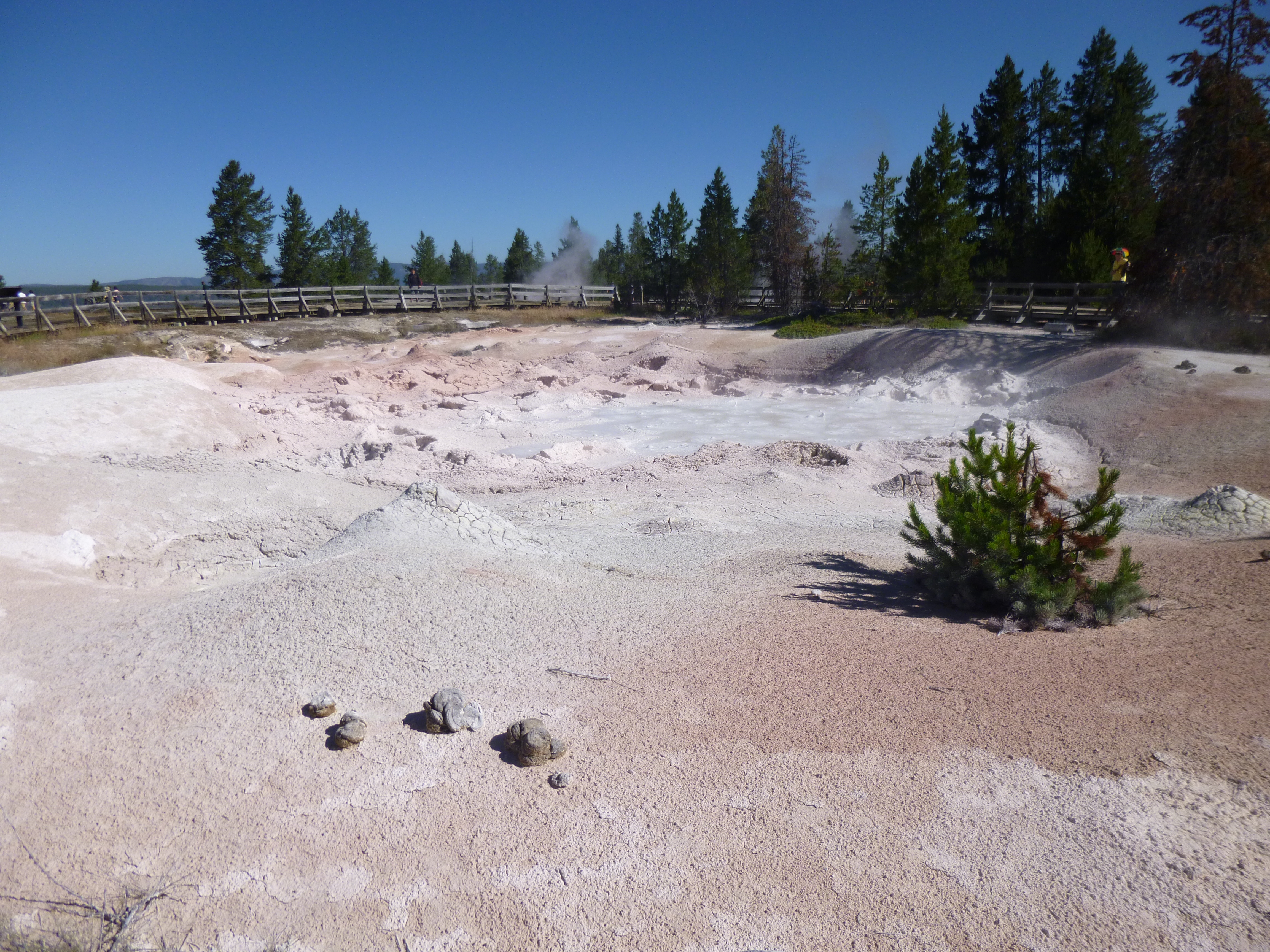
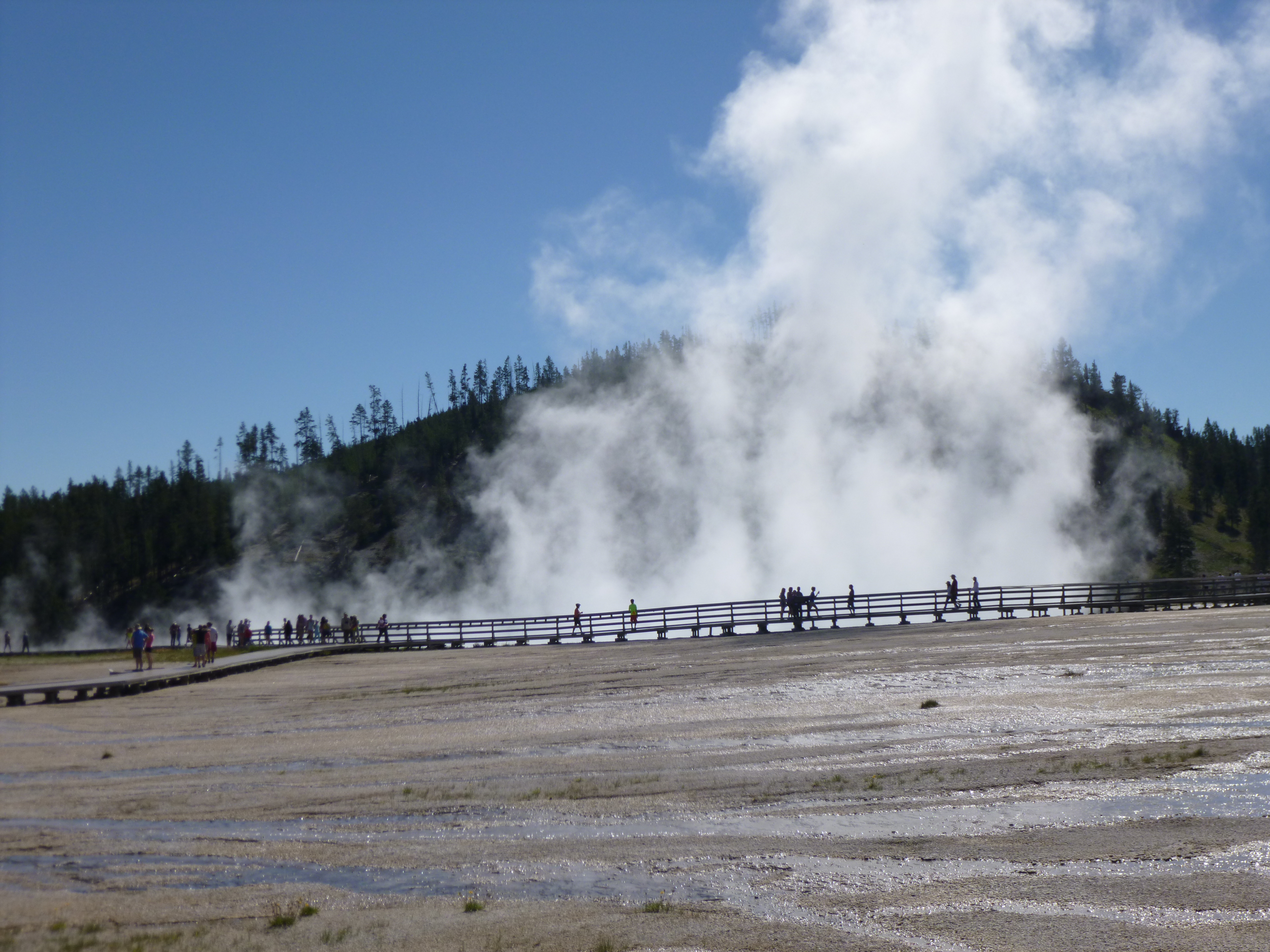
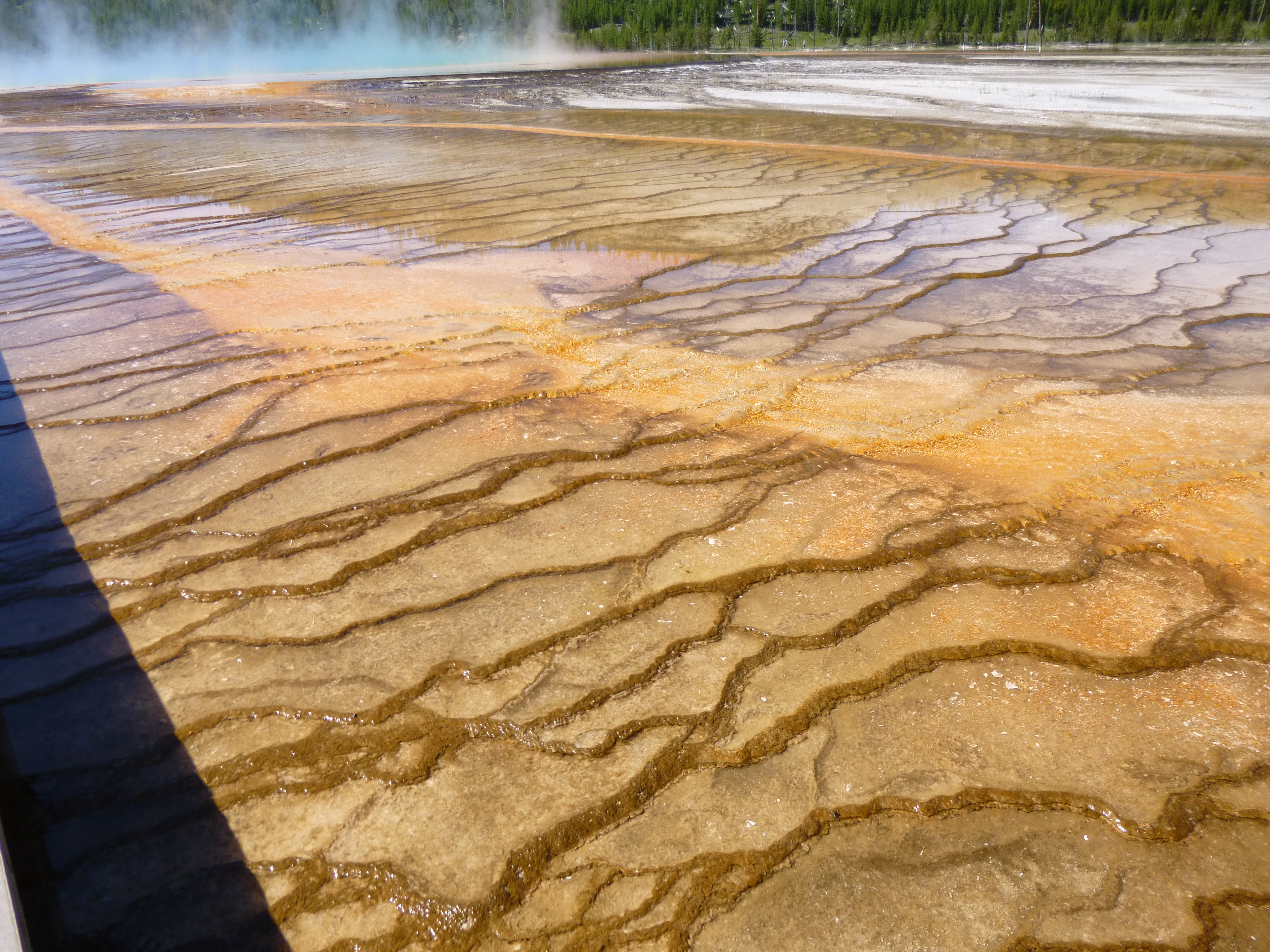
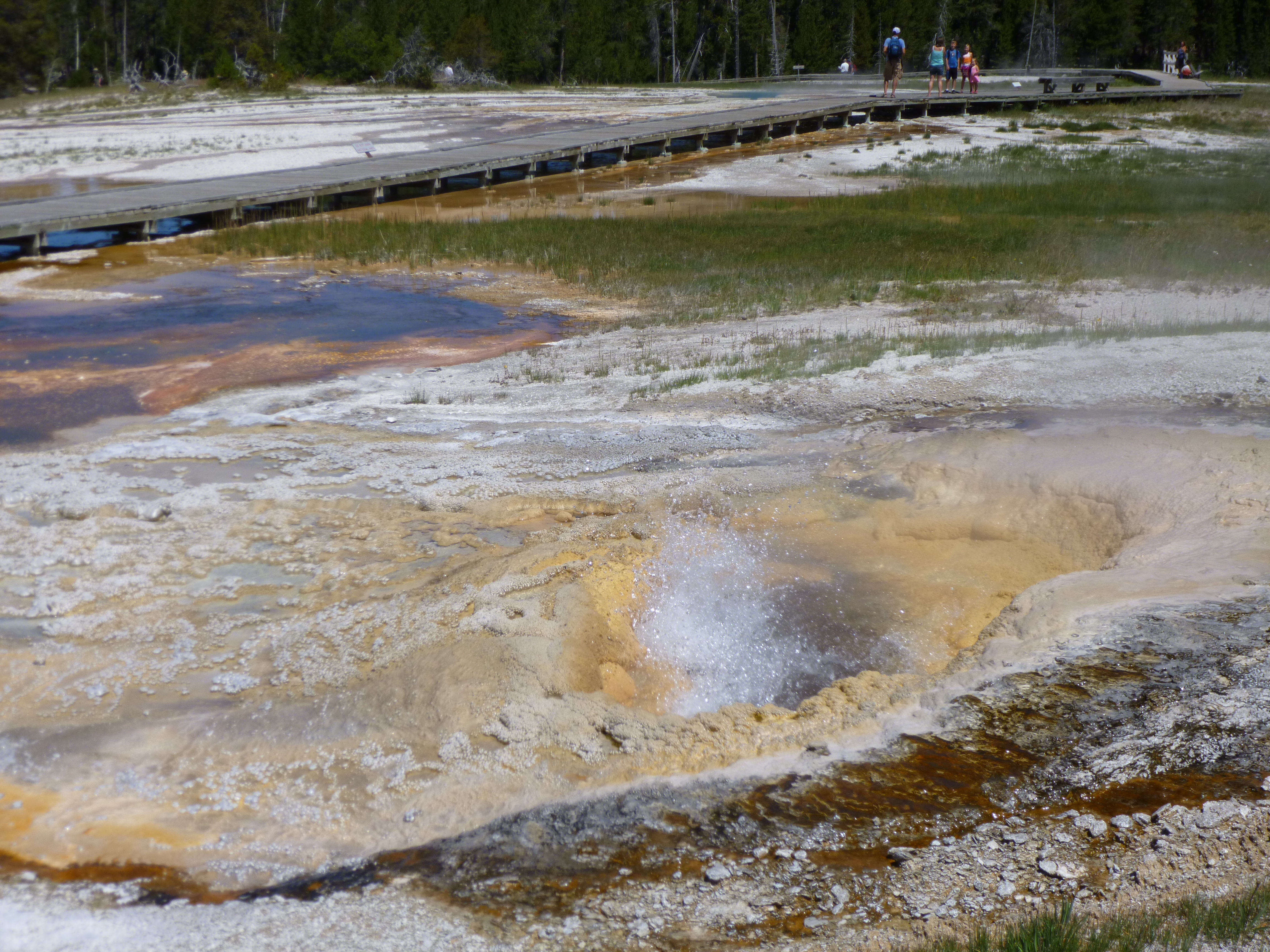
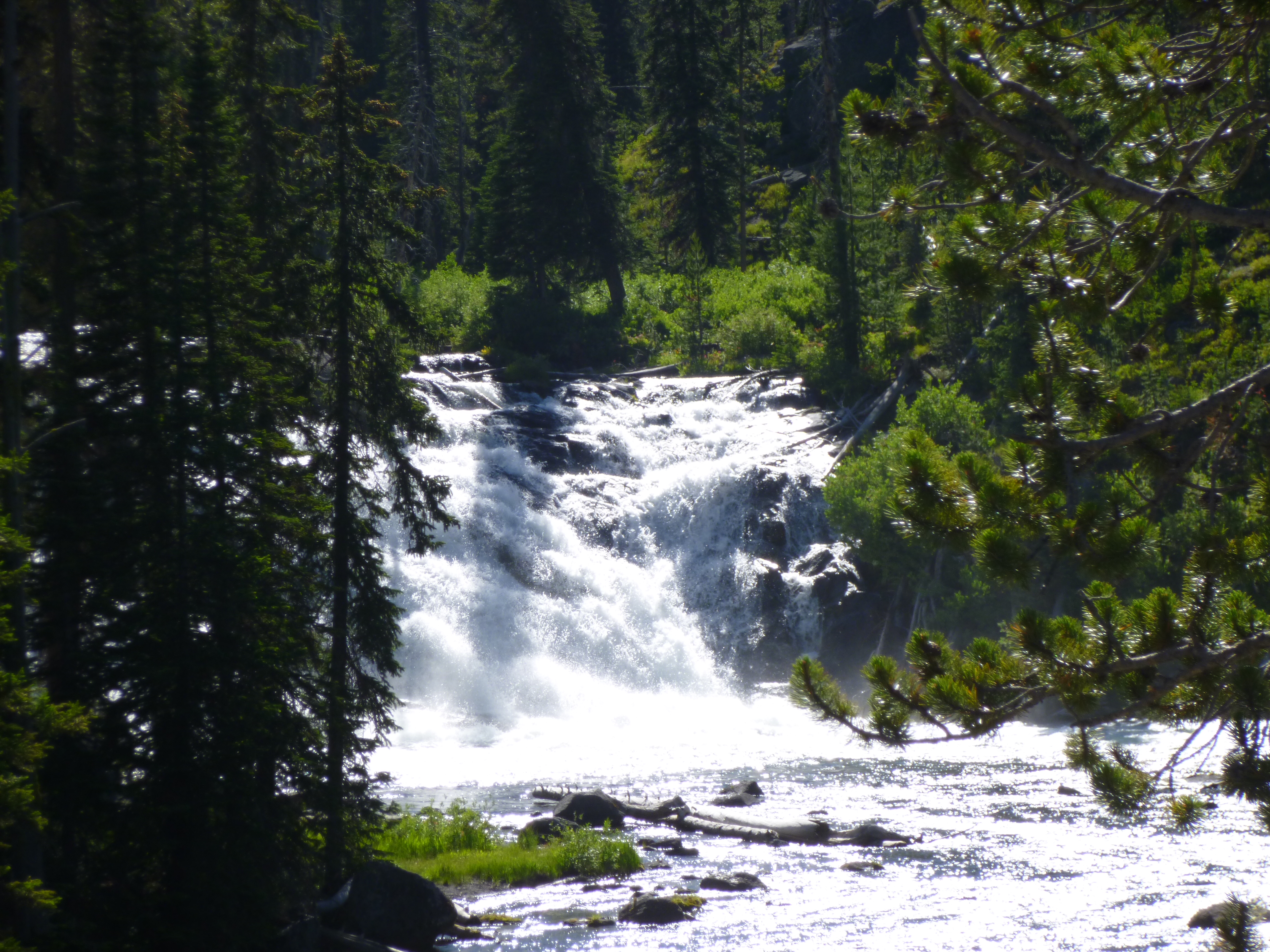
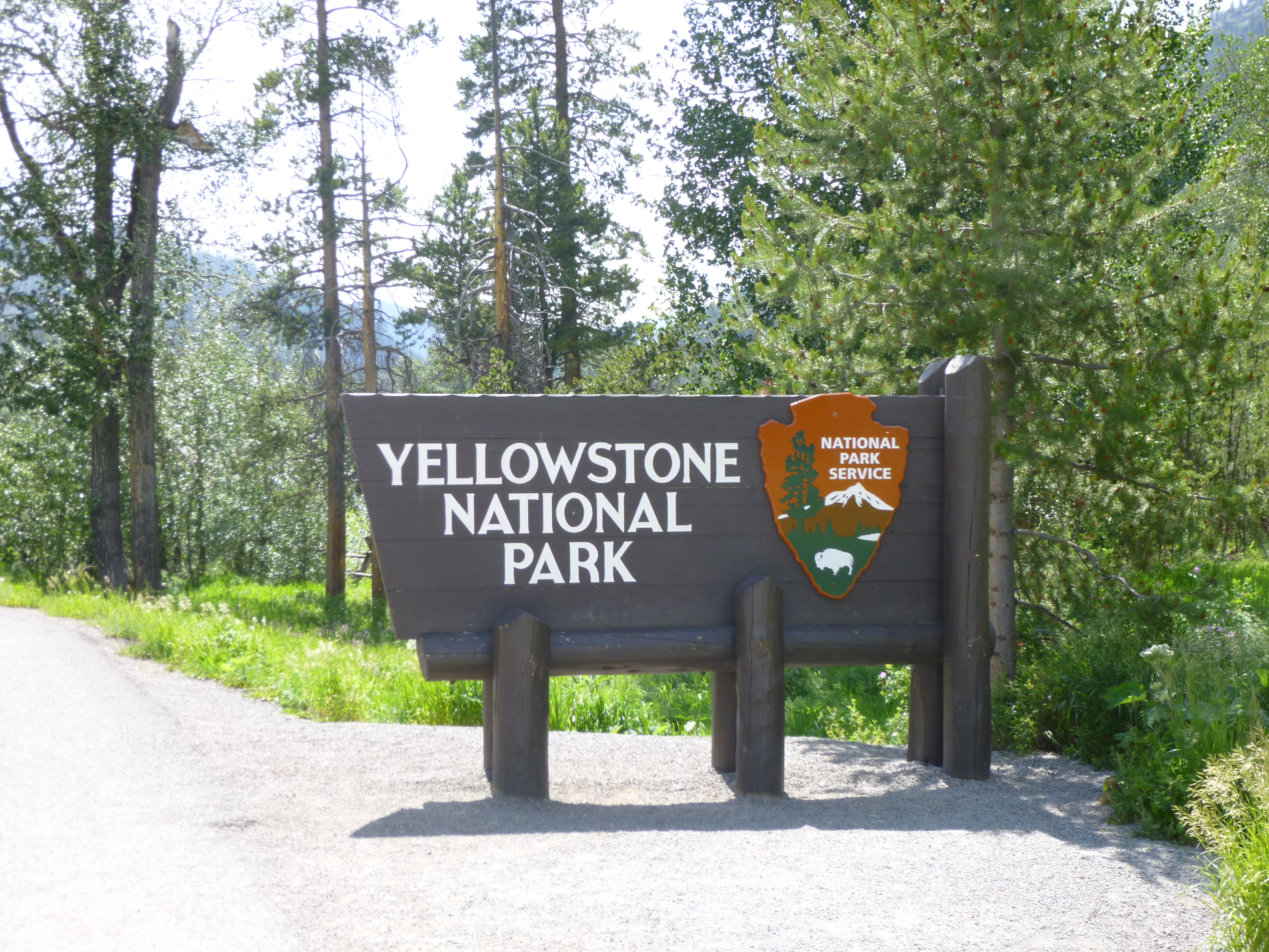
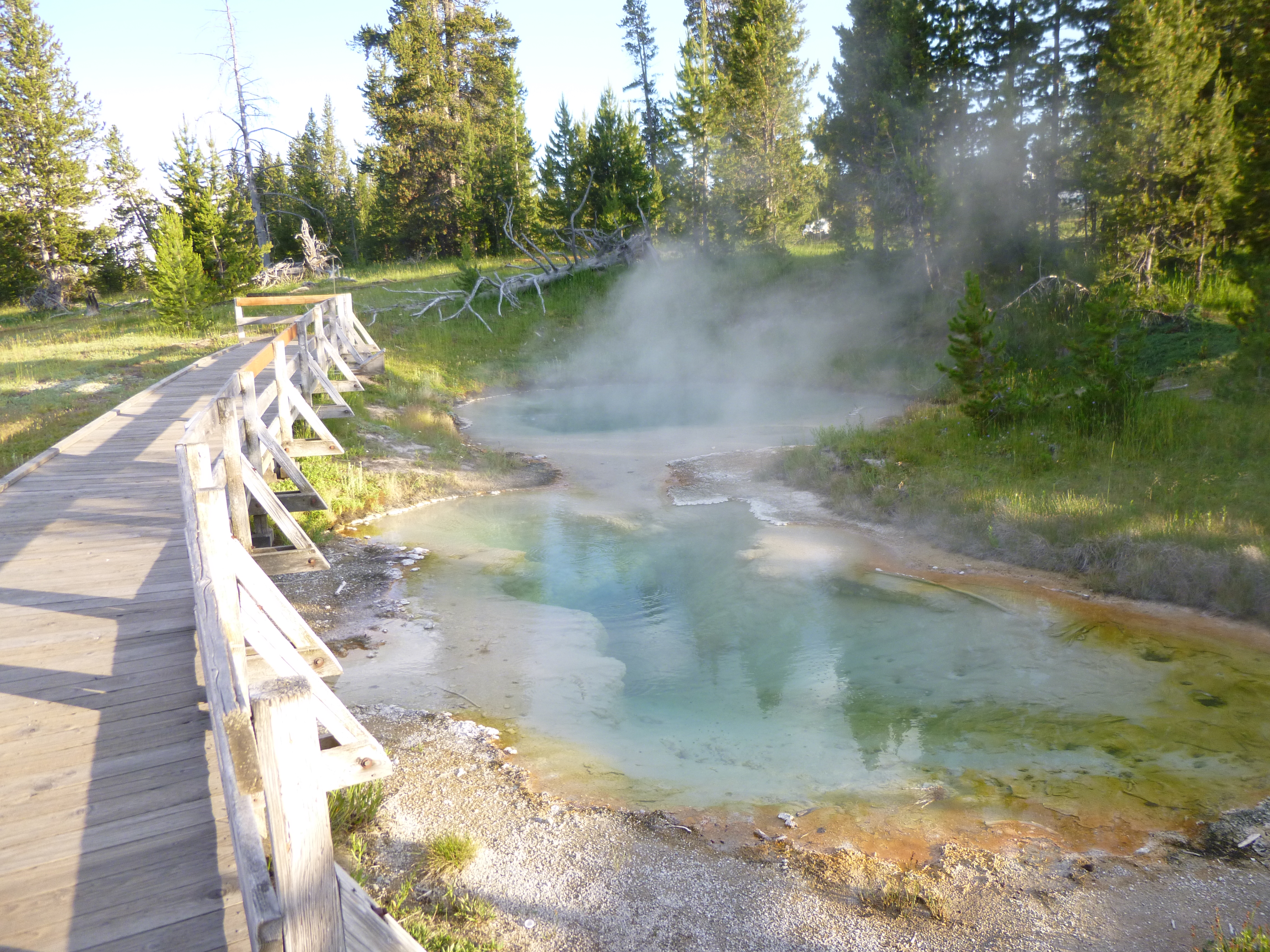
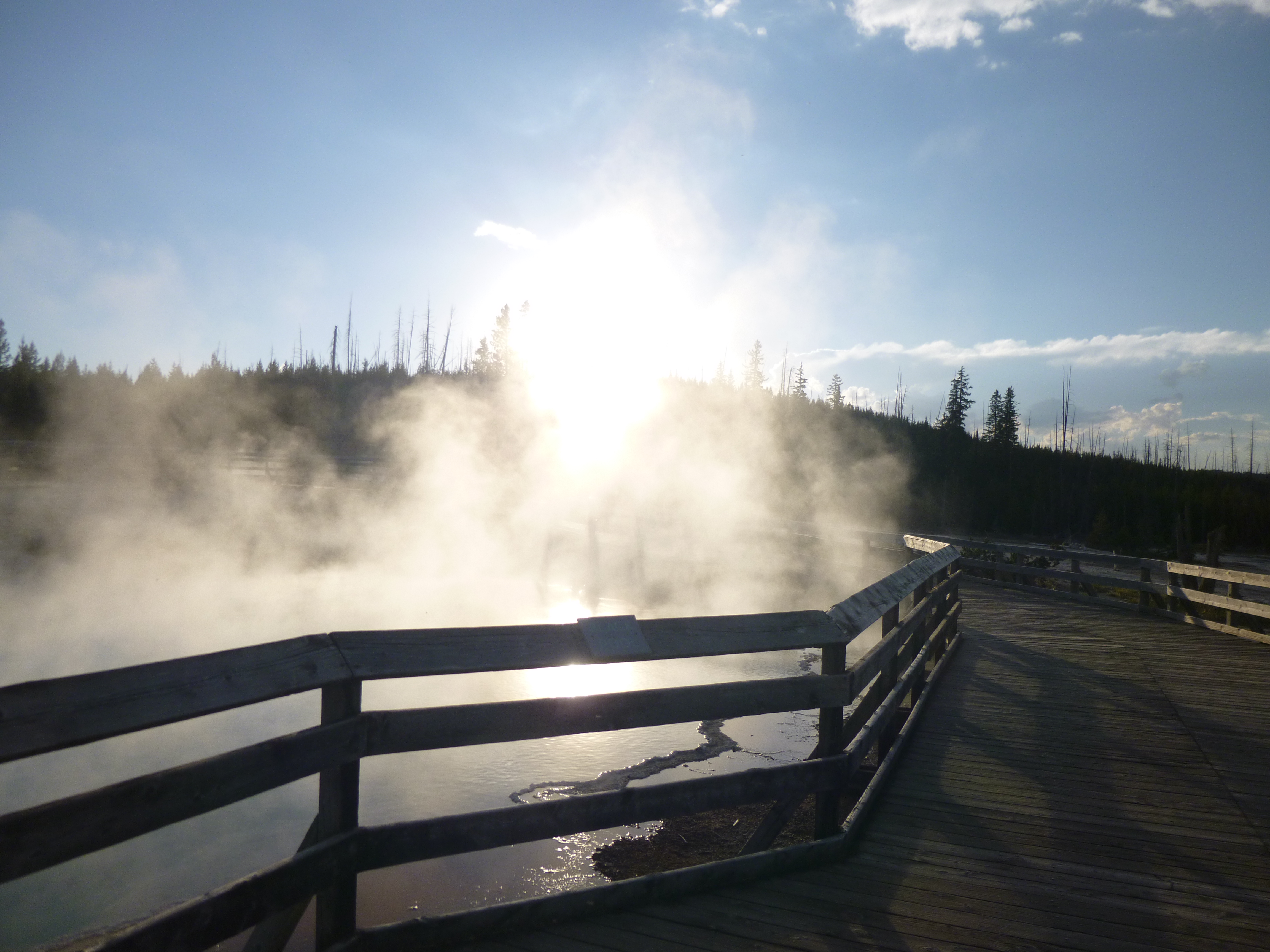
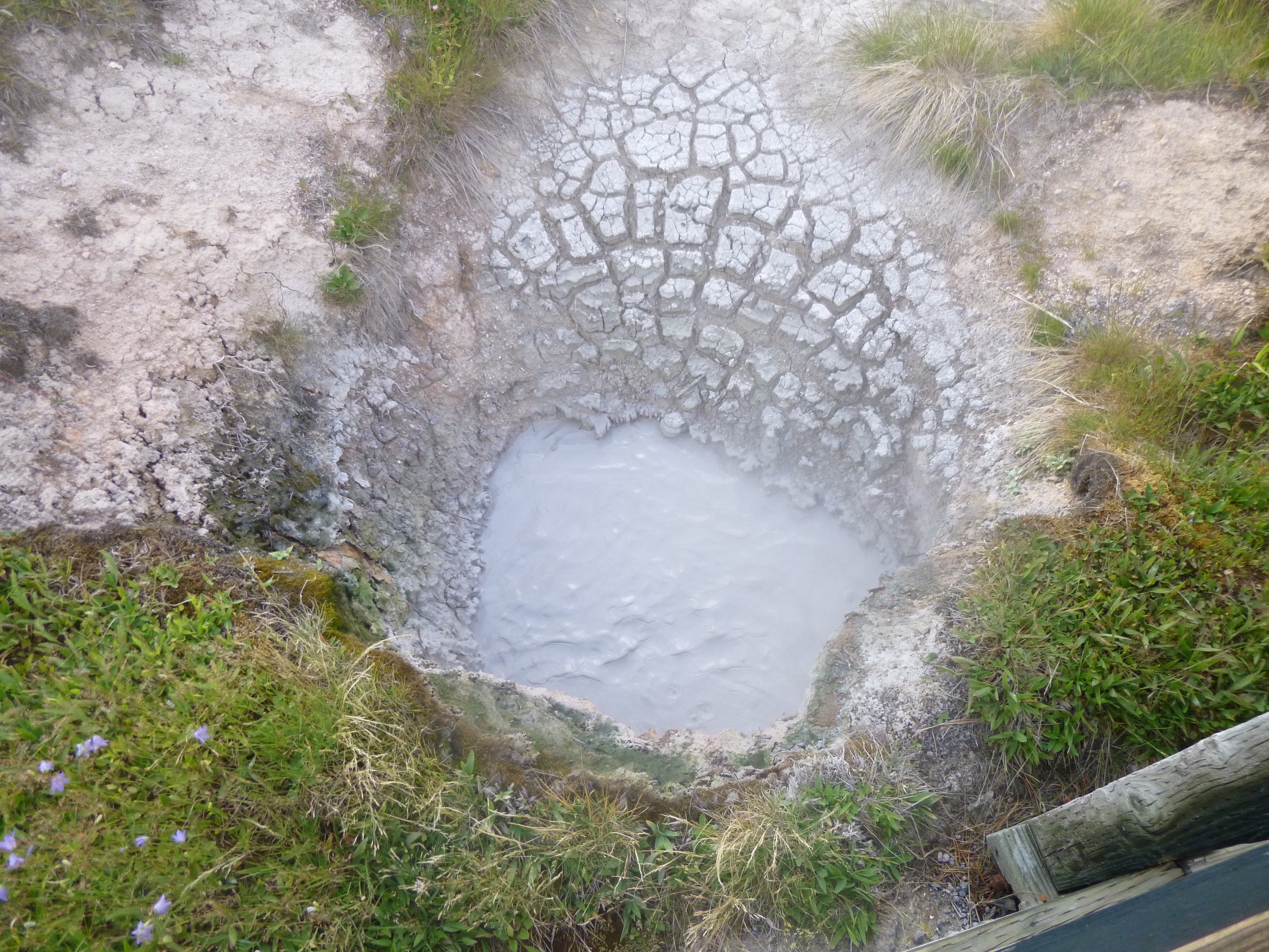
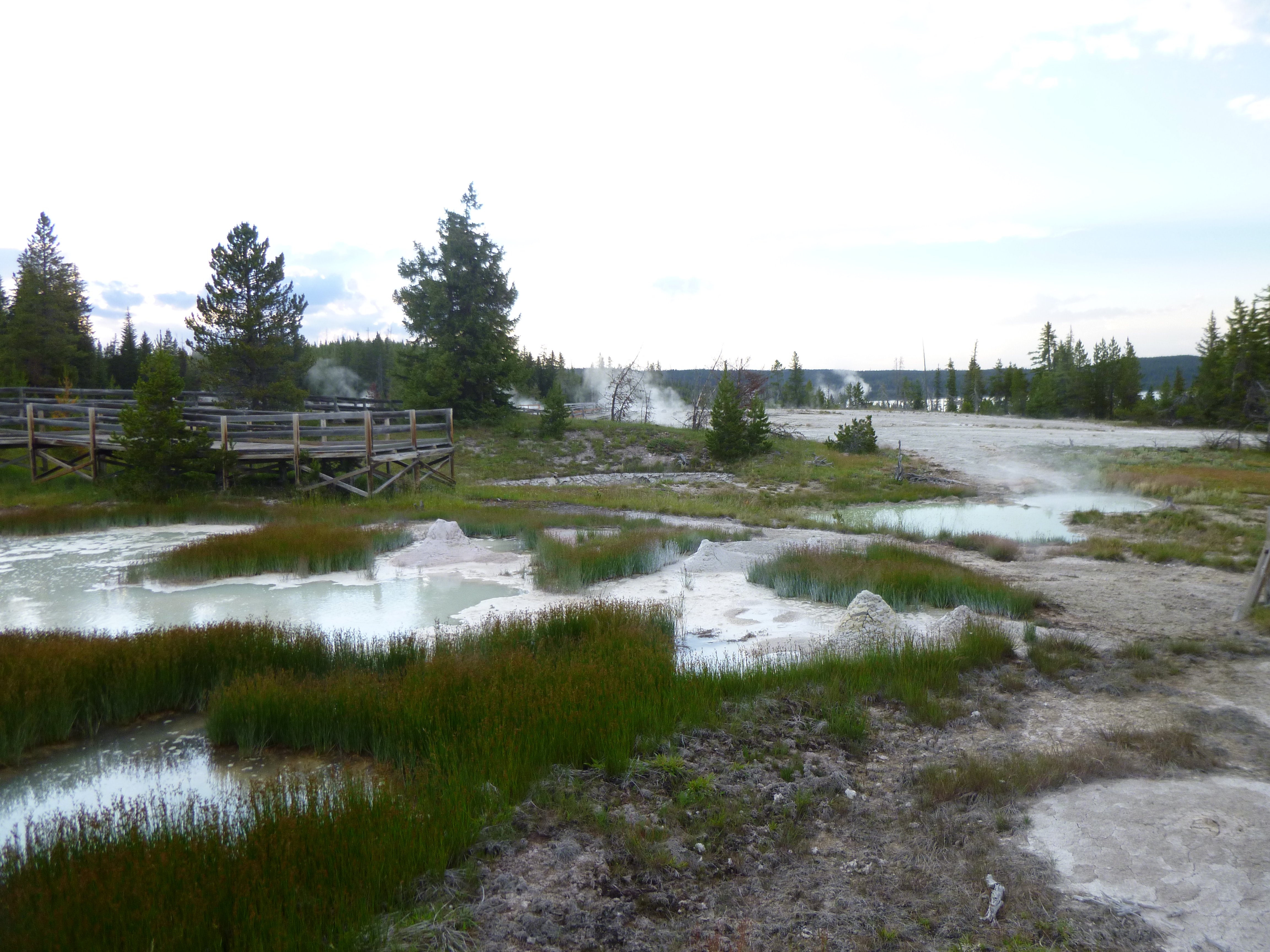
The beauty of camping right in the park was being able to get going right away while lots of people were still driving in. We started with a short walk around the campground, then I started making my way back to Old Faithful. But there were lots of places to stop and see along the way – the Midway Geyser Basin, Lower Geyser Basin, Fountain Paint Pot, Spout Geyser, Grand Prismatic Spring, Biscuit Basing and others. I stopped and walked on all the boardwalks, and once again felt like I was on a different planet. There was so much steaming and smoking, bubbling and boiling, eruptions and hissing that I wouldn’t be surprised if the whole place goes ka-boom some day! It makes me wonder about what all’s going on beneath the surface when this is what we see on top! It’s a spectacular place to walk through. One of the geysers was making so much noise it almost sounded like a jet engine getting ready for take-off. And that was a relatively new one – it didn’t exist before the 1950s and then there was a new explosion/eruption and this new, noisy geyser came into being. I overheard a tour guide saying they actually had to move some lodging because of the new geyser, and she stressed how this is a dynamic park, still changing year by year, and things certainly aren’t all predictable.
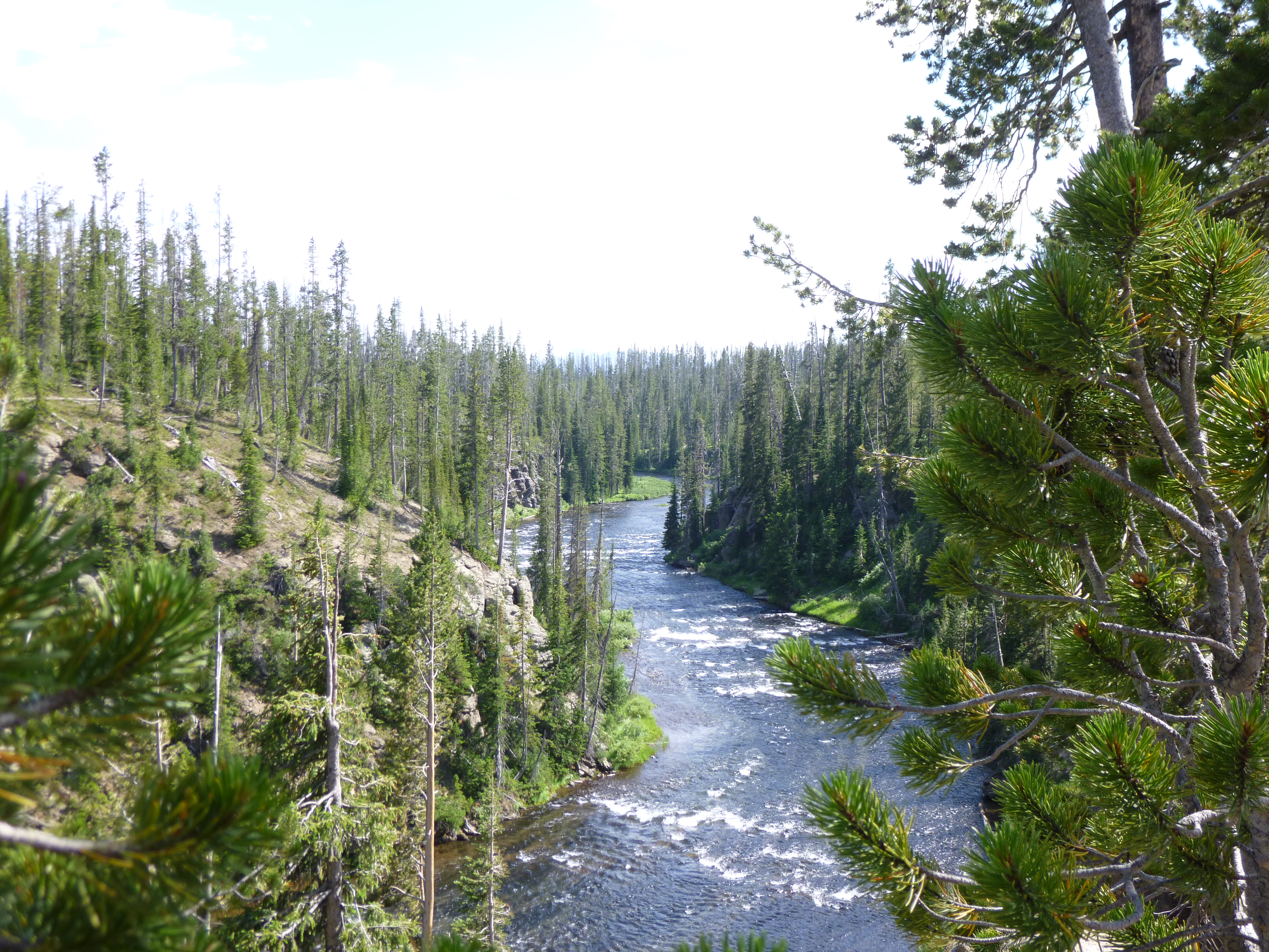
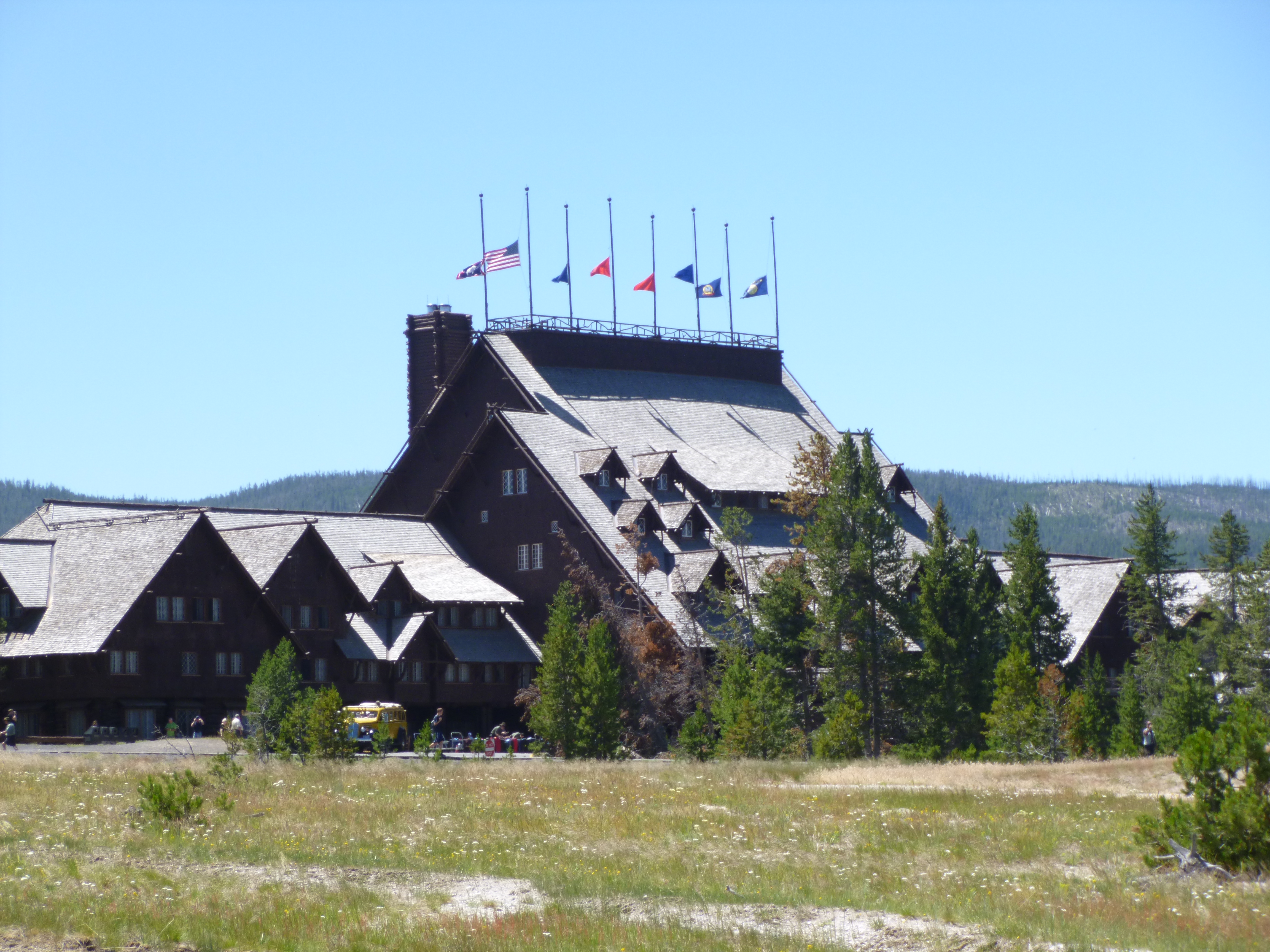
After all the boardwalks in the different geyser basins, I took a 2 mile walk on a trail by a river. That trail ultimately led to Fairy Falls, but it was a 5 mile round-trip hike, which was too long to leave Tula in the car. And there were so many other things to see anyway – no shortage of places to walk! And then I got to Old Faithful again, and timed it well. I must say Yellowstone knows how to handle crowds. I watched her erupt, then set off for several miles of walking in this geyser basin. It never gets boring – deep colorful steaming pools, orange mud, spouting water, and more hissing and gurgling. I took an extra walk up to Solitary Geyser that a lot of people pass by, and it erupts every 5-7 minutes. It’s not nearly as big as Old Faithful, and the first eruption I saw was just kind of a little dud, then the next one came out in such a torrent I almost got splashed! I stopped for a quick lunch of bison meatloaf (it was really good) in the cafeteria when most people were out watching Old Faithful, so I enjoyed another eruption through the window while eating lunch. I walked back to the van and got Tula out, and we enjoyed walking around the impressive old lodge and inn and visitor center. Lots of people were walking dogs on the sidewalk – at least there’s several good places in the park to get the 4-foots out to stretch!
Then I returned to the visitor center to make my donation-of-the-day. I wanted it to go to Yellowstone, since it’s the oldest park in the national park system. The rangers really liked what I was doing, and suggested the donation go to the Yellowstone Foundation so that it stays within the park, and doesn’t go to the National Park headquarters. They gave me a Yellowstone bag and a stuffed buffalo.
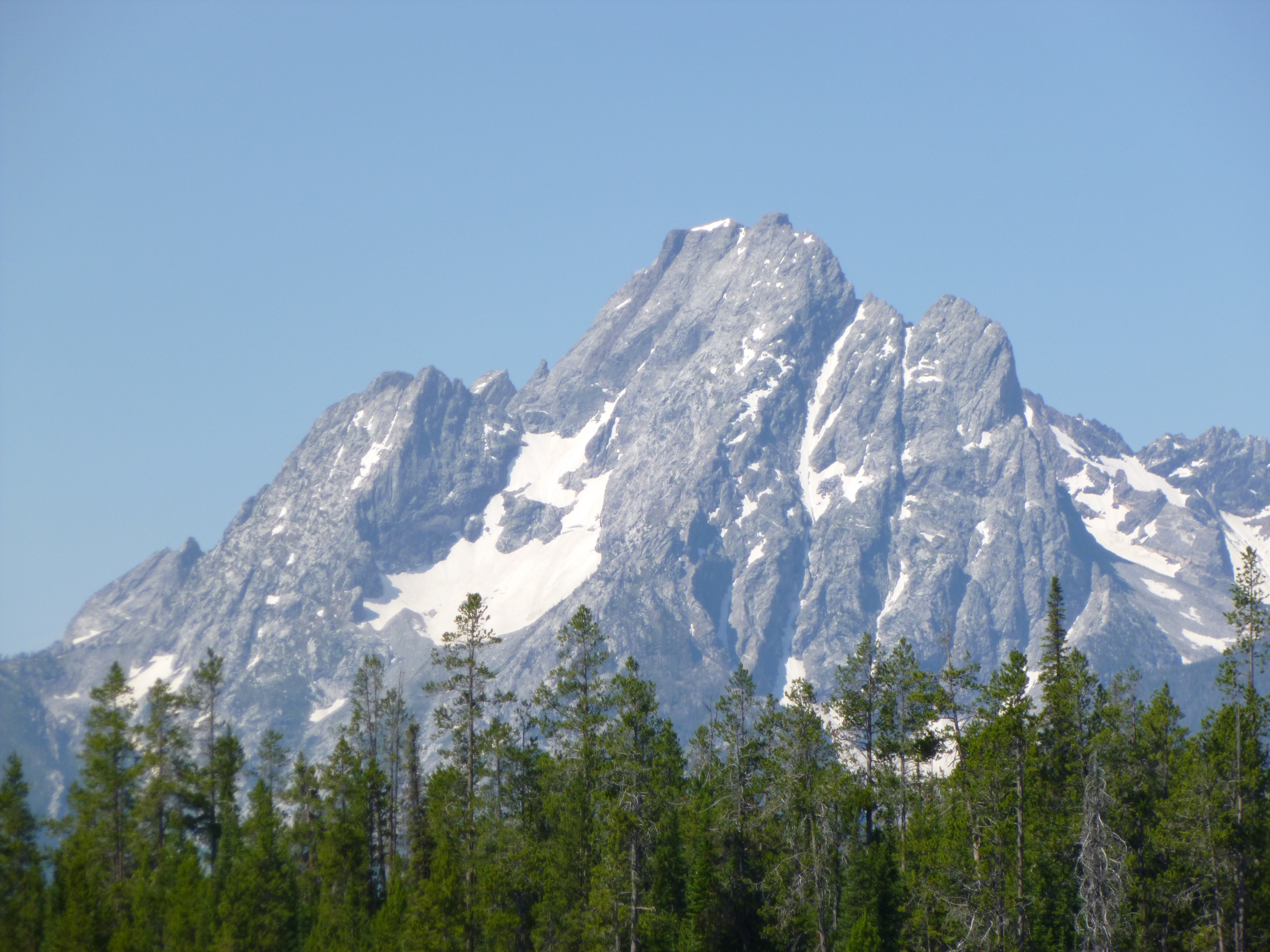
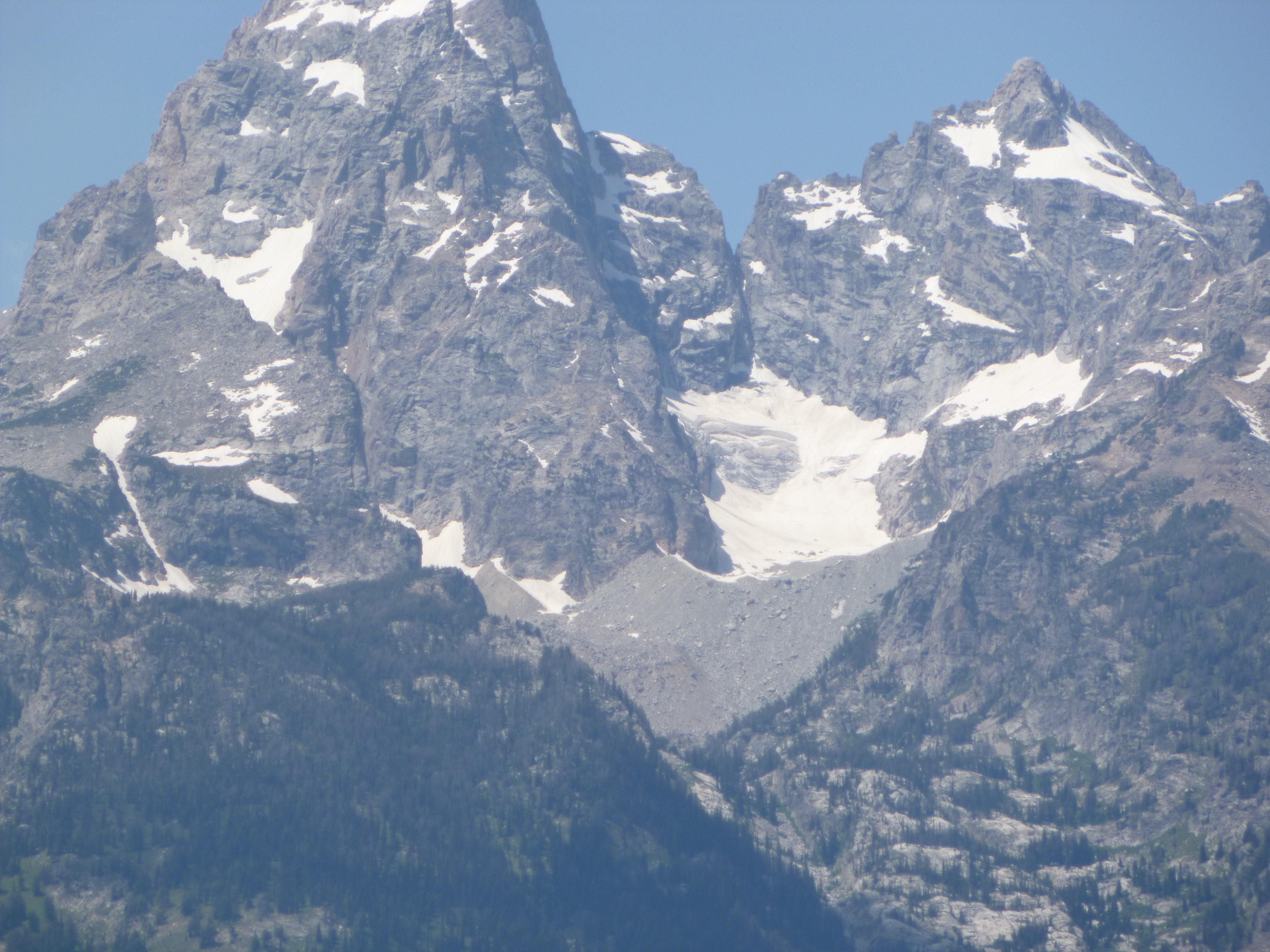
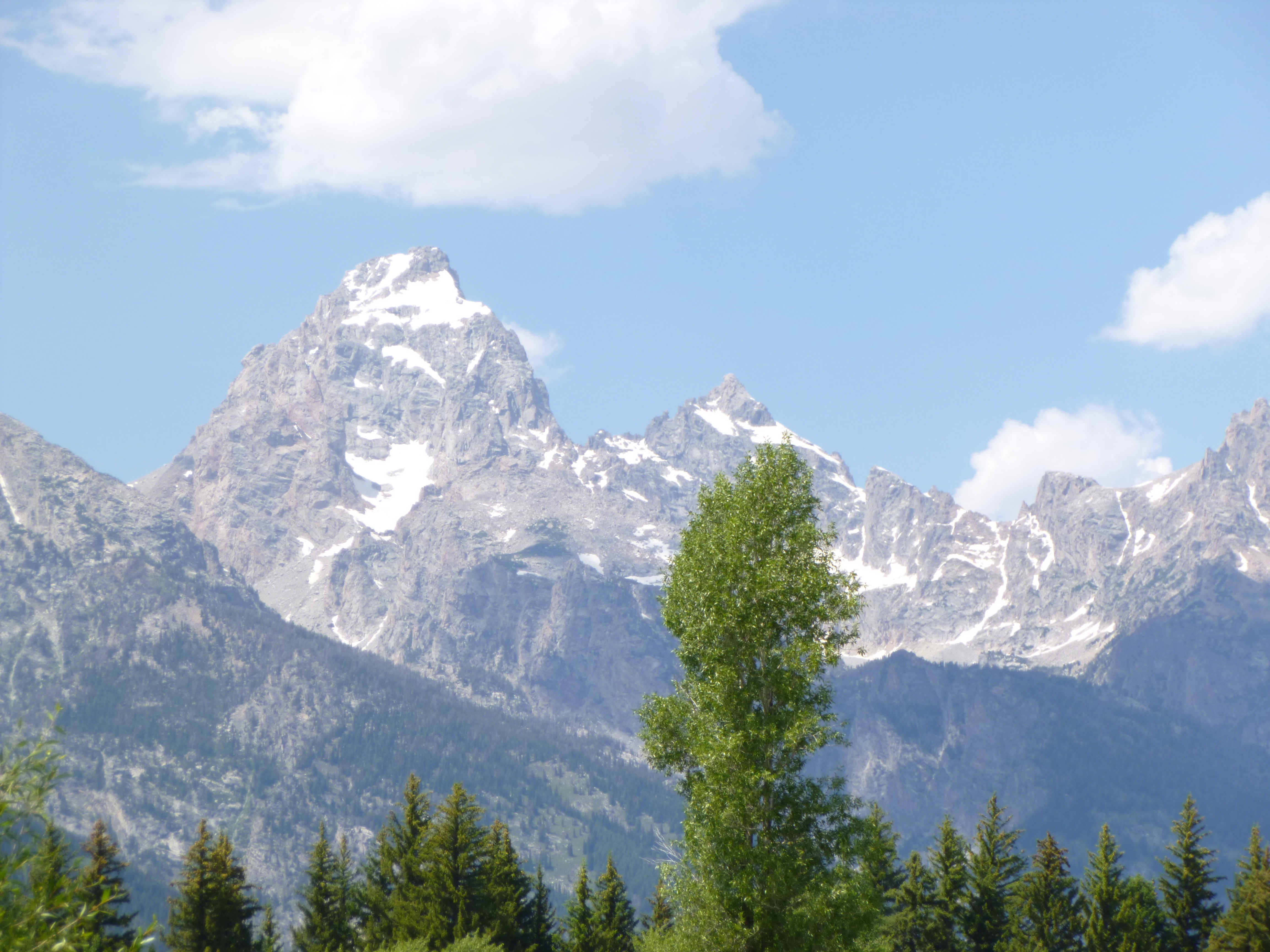
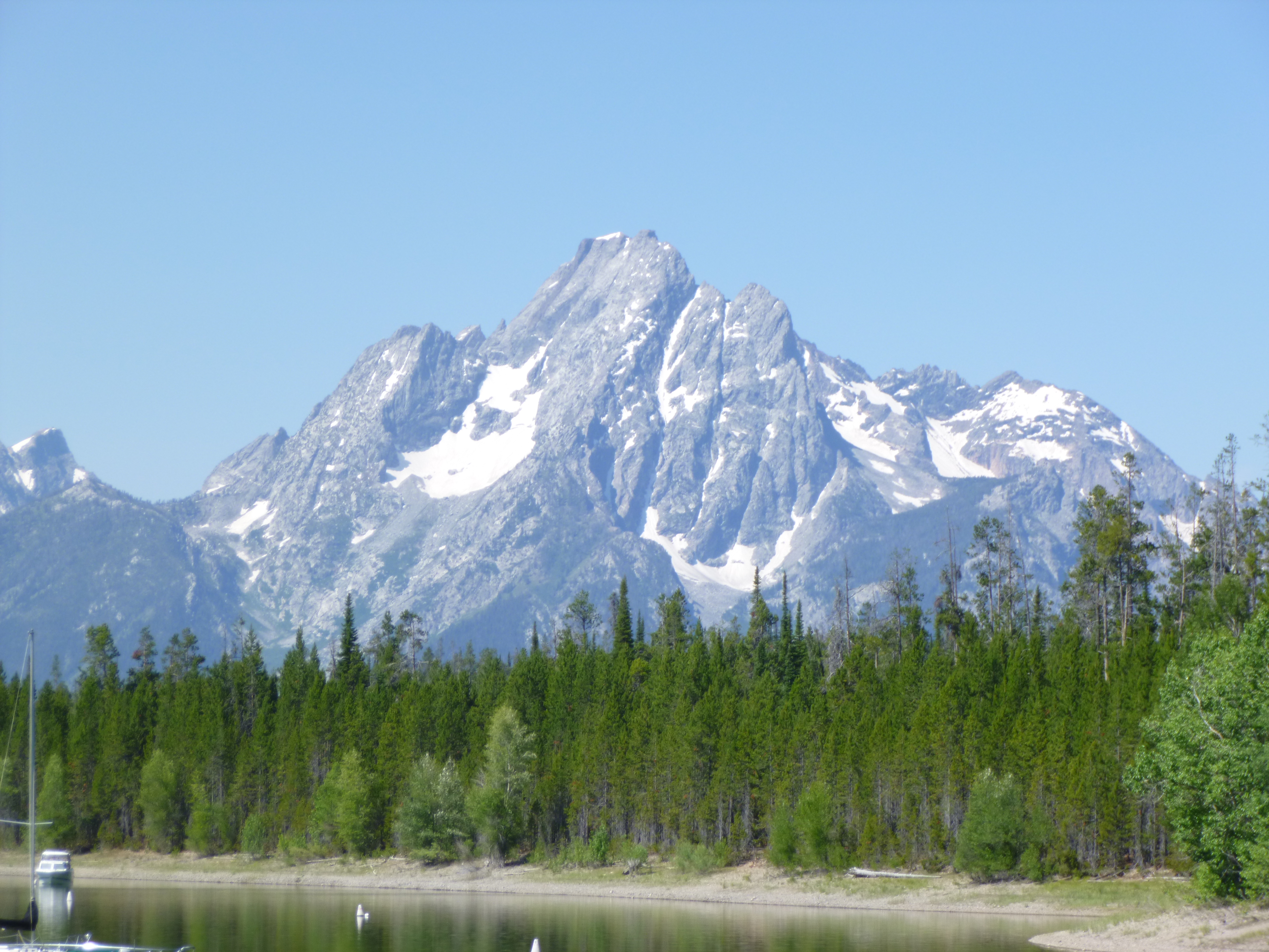
By this time, I had walked 8 1/2 miles and was ready to sit for a while, so I headed through the southern part of the park, and after a while I came to the Grand Teton National Park. Since the 2 parks are connected, one entry fee covers both. The Tetons are not a huge long mountain chain, but they are tall, with dramatic sawtooth peaks, and there was still a lot of snow – and a glacier – up among the top crevices. They’re absolutely impressive, and I was happy to be able to drive for miles alongside of them so I could see them to my heart’s content.
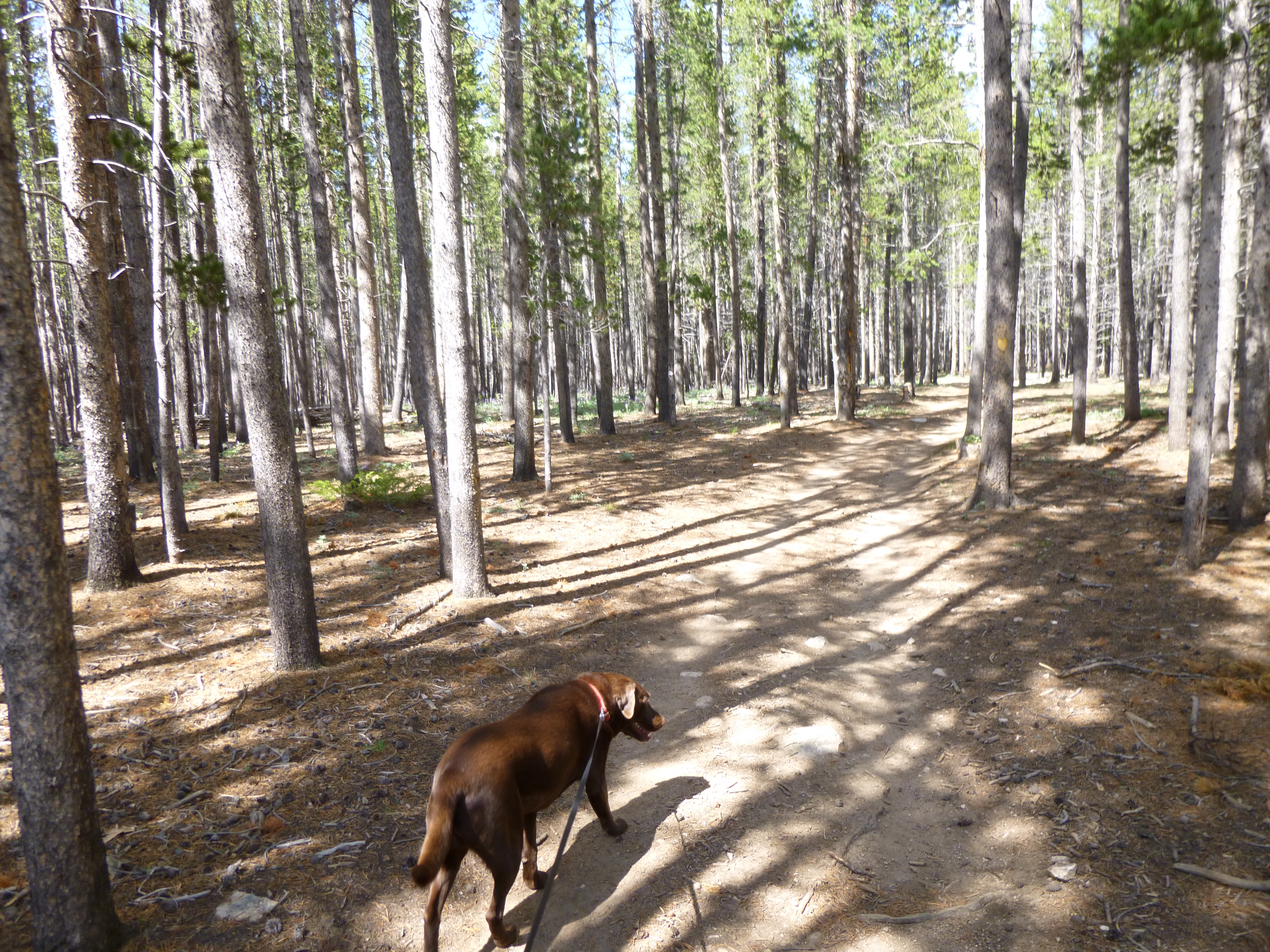
It was time to start thinking about a campground, and I had heard that it’s a little easier to get a space in the Tetons instead of Yellowstone. I passed the first couple of campgrounds, and then I saw one that was near one of the visitor centers. There was a view of the mountains driving in, but the campsite itself was in the woods so we couldn’t see the mountains. They still had openings, so I registered, and was happy to be able to camp in the Tetons. There were still the bear precautions (I couldn’t even leave Tula’s water dish outside the van) but it’s all good to keep everyone aware. Tula and I walked around part of the campground – it’s full of pine trees; I think they’re lodgepole pine. Then we settled in – Tula curled up on the pine needles until I let her on the air mattress, and I got caught up with some record-keeping while the sun went down. The campground was nearly full but it was set up in such a way that it didn’t seem crowded at all. It was pretty to listen to wind in the pine trees while I was catching up with things, and it got cool enough for sweatshirts. It was a very peaceful night!


Wyoming – Monday, July 8
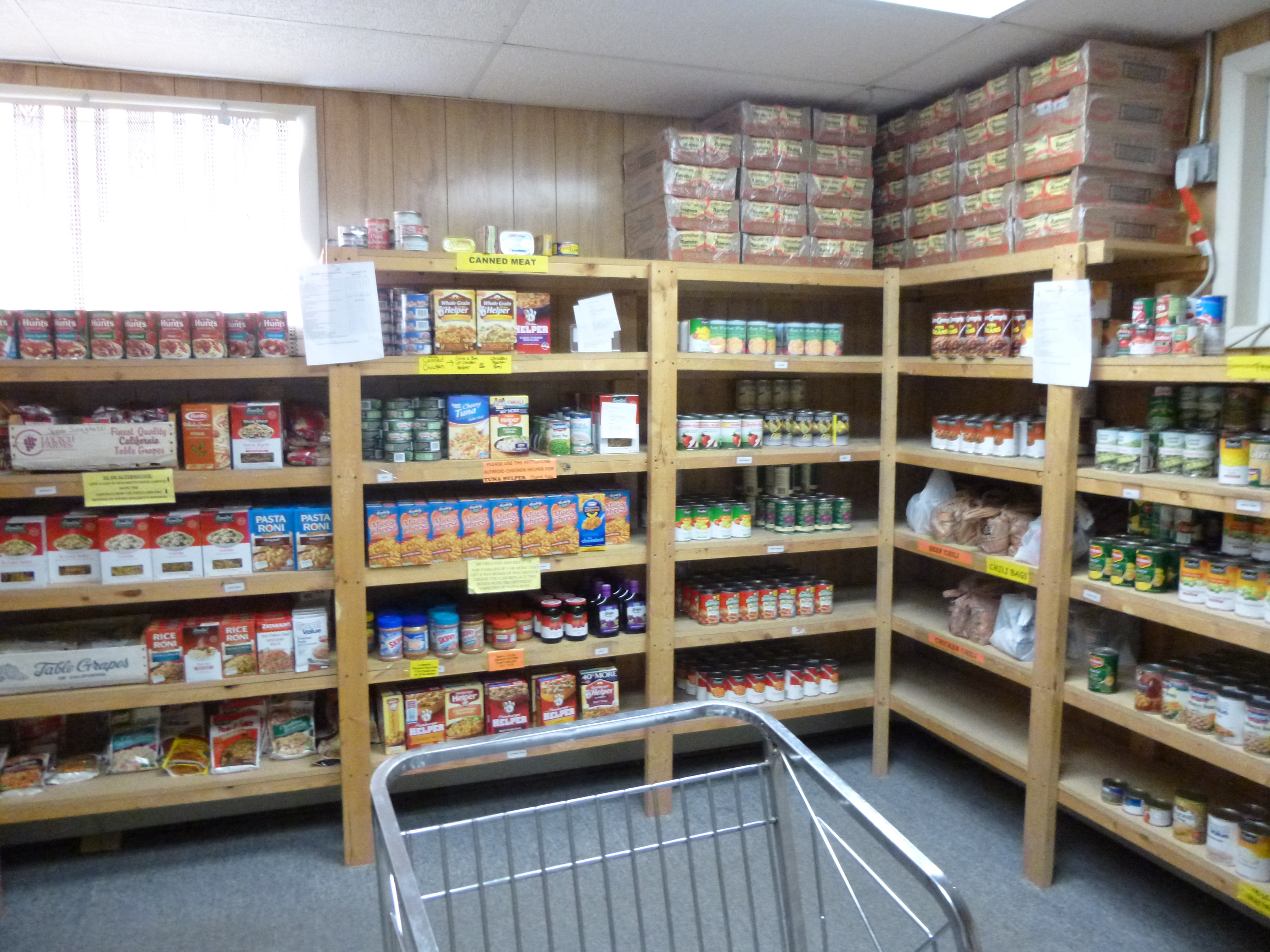
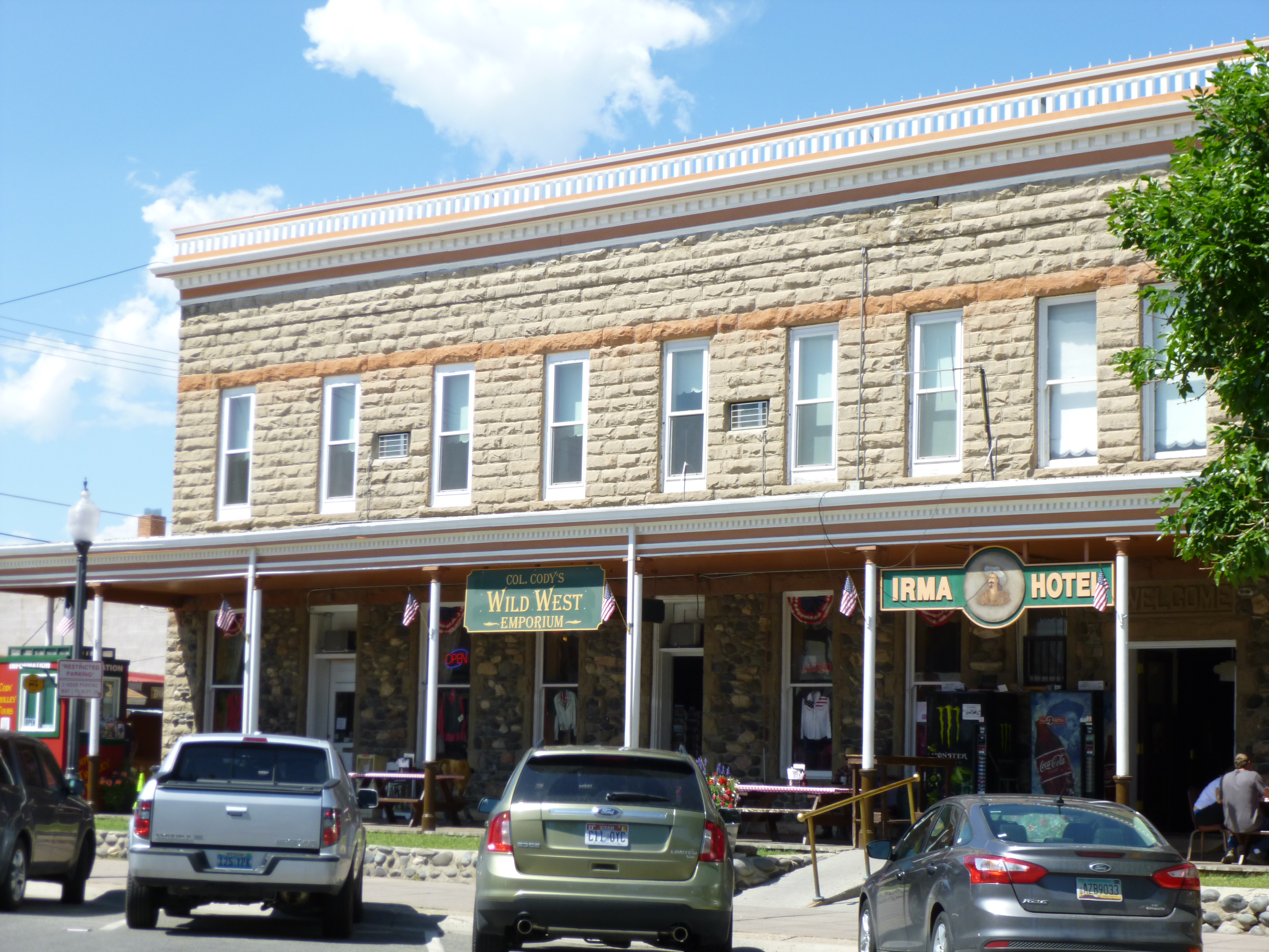
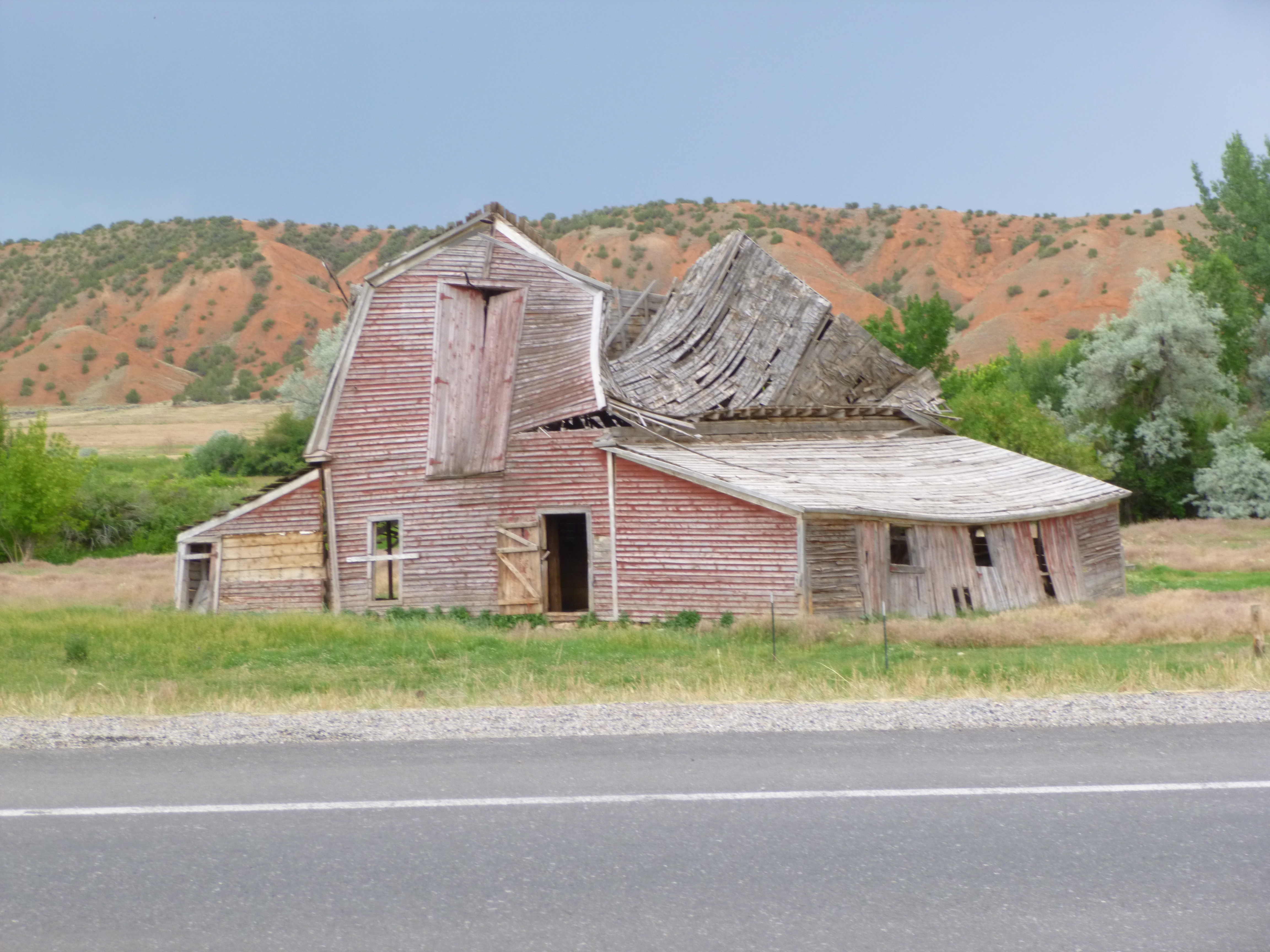
Tula and I took another walk around the campground when we got up, and then I packed things up. This campground actually offers free pancakes for breakfast, and then they have sausage, juice, yogurt and coffee for sale at very fair prices. It’s a good way to do business. Lots of people came in for pancakes, which were good, and then bought the other stuff. It was a good way to start the day! Then I drove into the town of Cody, and we did some more walking. This was a fun town to walk through – part western town, part touristy town, and kind of the last stop before the expanses of Yellowstone and the Tetons. The town was bustling. Cody had a food pantry called Cody Cupboard, and I called and talked to one of the volunteers to see if a food donation or a financial donation would be best. She said a financial one would be great, so that they can get the things they need when they’re out shopping. So I drove over to the food pantry, which was in an old log cabin behind the visitor center. There I met Donna and she showed me all around. The food pantry was very well organized, and like many of them, the amount of food the clients are given depends on family size. Typically the people they serve are referred to them through agencies like the Department of Social Services, but even if someone showed up without a referral, they would probably still give them food. They help around 300 families a month, although the numbers do fluctuate.
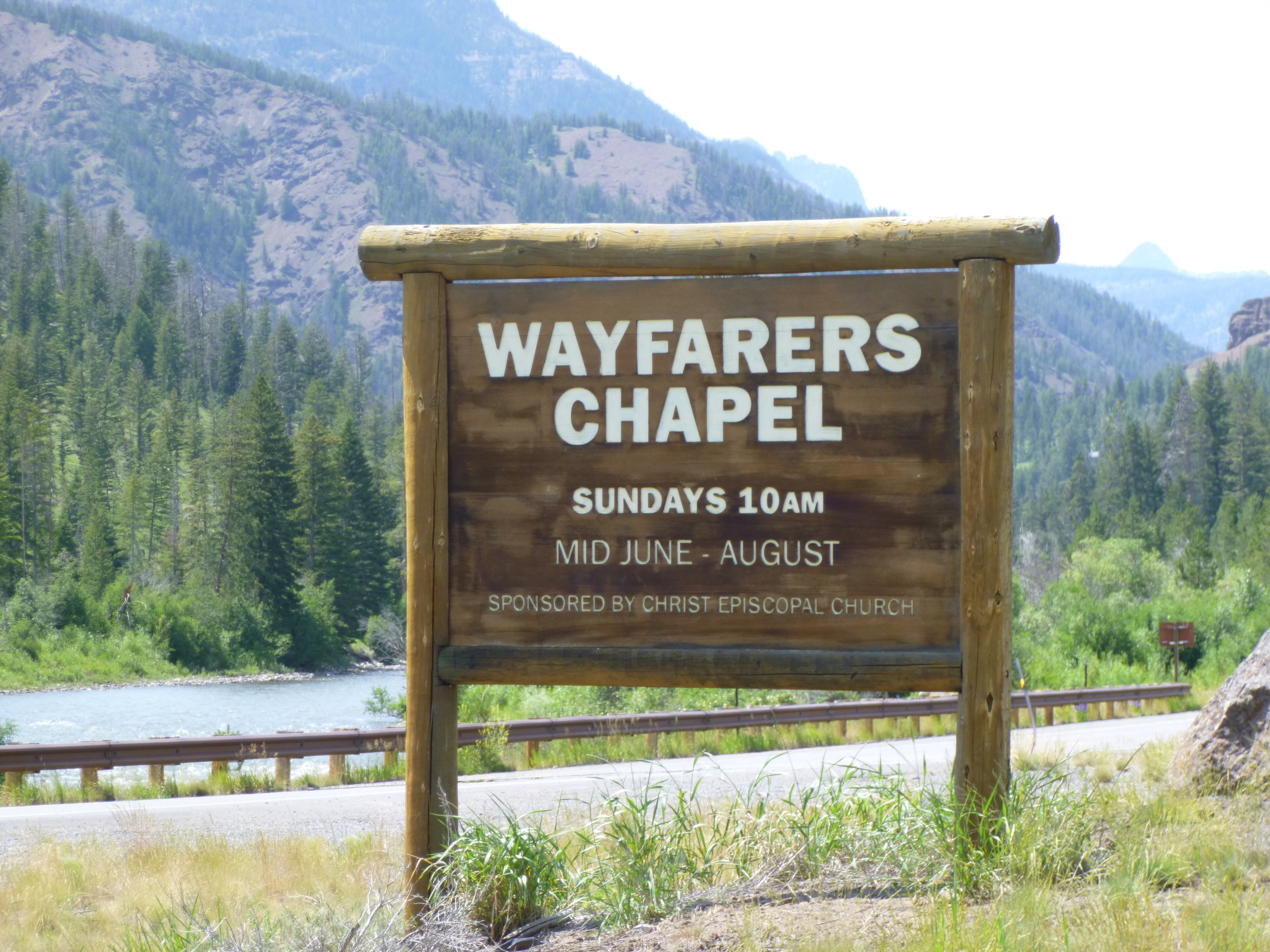
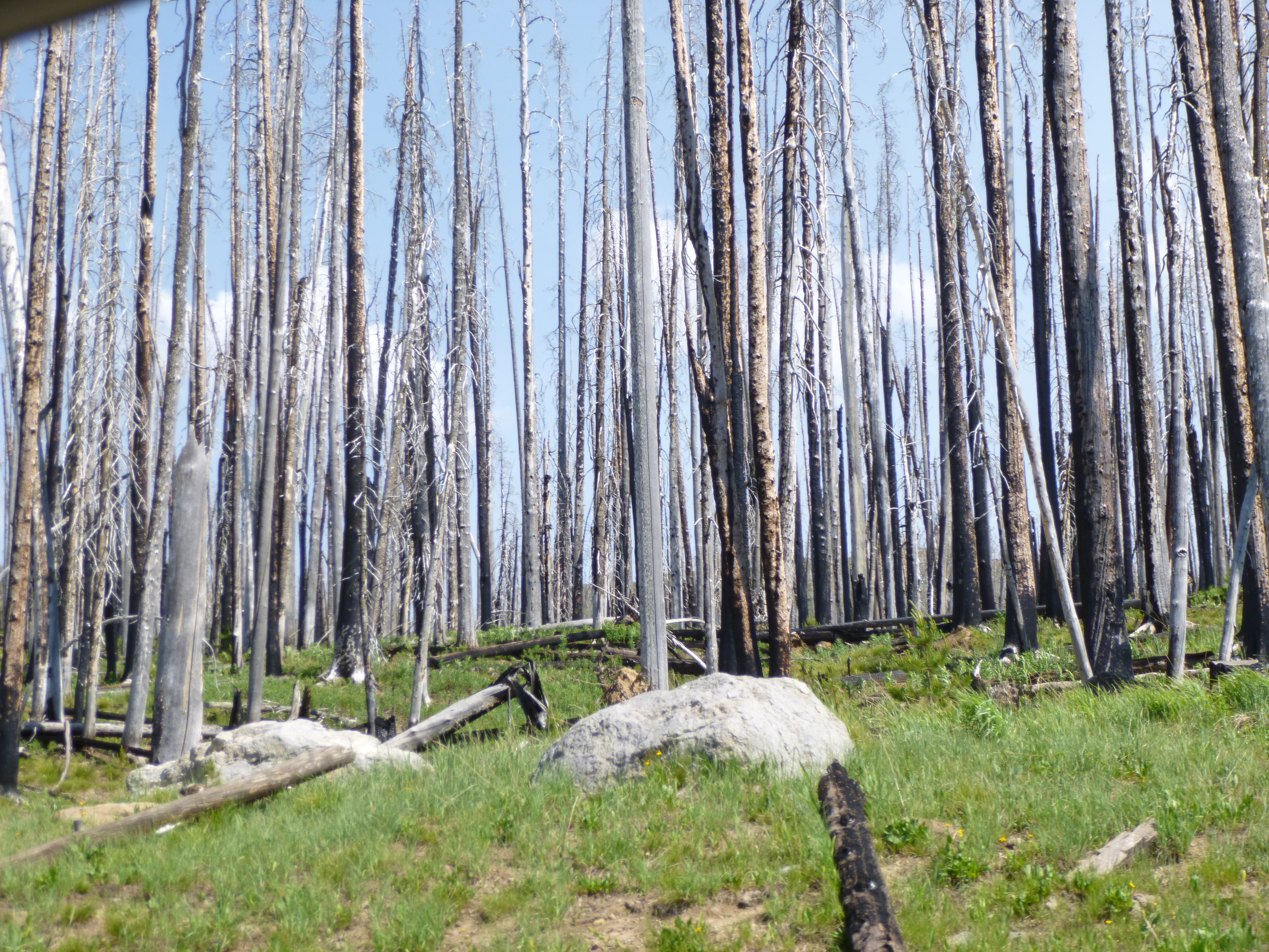
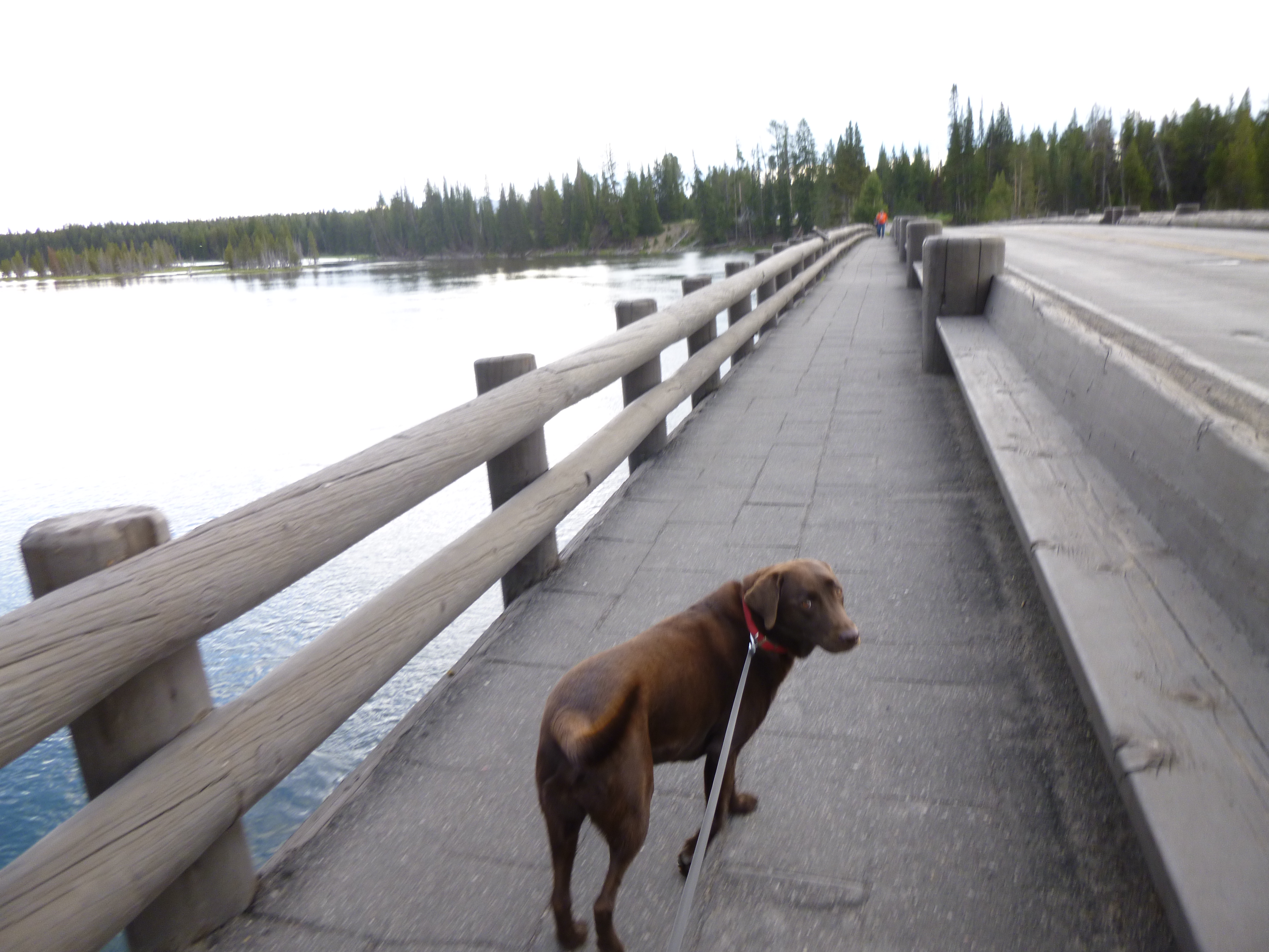
When I was done at Cody Cupboard, I had to take care of some things at the post office. Then I thought I better check into the possibility of reserving a campsite in Yellowstone. I already knew that campgrounds in the Grand Tetons were handled on a first-come, first serve basis – they do not take reservations. But Yellowstone did, and I called to see if their were any campsites open anywhere, and it didn’t matter which campground it was at. Because of the bears, tent camping isn’t allowed at all of the campgrounds – just certain ones. I was lucky enough to be able to reserve a campsite in Yellowstone – only about 14 miles from Old Faithful, and then I didn’t have to be rushing anywhere. I was relieved because all of the motel rooms in the towns near the park are ridiculously expensive, and out of my budget range. So I continued west toward Yellowstone, and on the way I saw a sign for another wayfarer’s chapel up on the side of the mountain, so I went to look at that one too, but I liked the one I saw yesterday better. And then I was in Yellowstone! The first thing that was apparent on this side of the park was the result of old forest fires – there were acres and acres of charred trees. I asked a ranger about the fires, and there haven’t been any major ones since 2006. Because of all the wildlife, dogs are only allowed on paved roads and sidewalks in both Yellowstone and Grand Tetons – they cannot go on any of the trails, and that makes perfectly good sense. And that was fine with me because I wasn’t going to be going deep into the woods on any trails by myself in bear country anyway! The first place we came to was called Storm Point, and I got out for a mile walk. It was open meadow by a lake, and as I was walking on the path toward toward the lake, I noticed a buffalo down getting a drink. He then walked right toward the trail and crossed it – I retreated and gave him plenty of space. I wasn’t sure if I was going to take that walk or not, but then he moved far enough away from the trail that I felt comfortable. It was a magnificent animal to watch. I then followed the trail down to a bigger lake, and when I came back there were at least 25 people looking at the buffalo – on my way down to the lake it had just been me. Then we stopped at Fishing Bridge, where there was a small visitor center and across the street was a rustic store, gift shop, gas pumps, and a small lodge sort of place. There were some sidewalks, and I was able to get Tula out for a mile and a half there, and we were also able to walk over the actual fishing bridge although fishing is no longer allowed in that particular area. I went into the gift store and the ice cream counter was doing a brisk business, and it did sound really good, so I had to try the buffalo chip ice cream (chocolate with caramel and nuts). We continued driving in the park passed a couple more buffalo and a couple elk, and saw some small steaming holes in the ground.
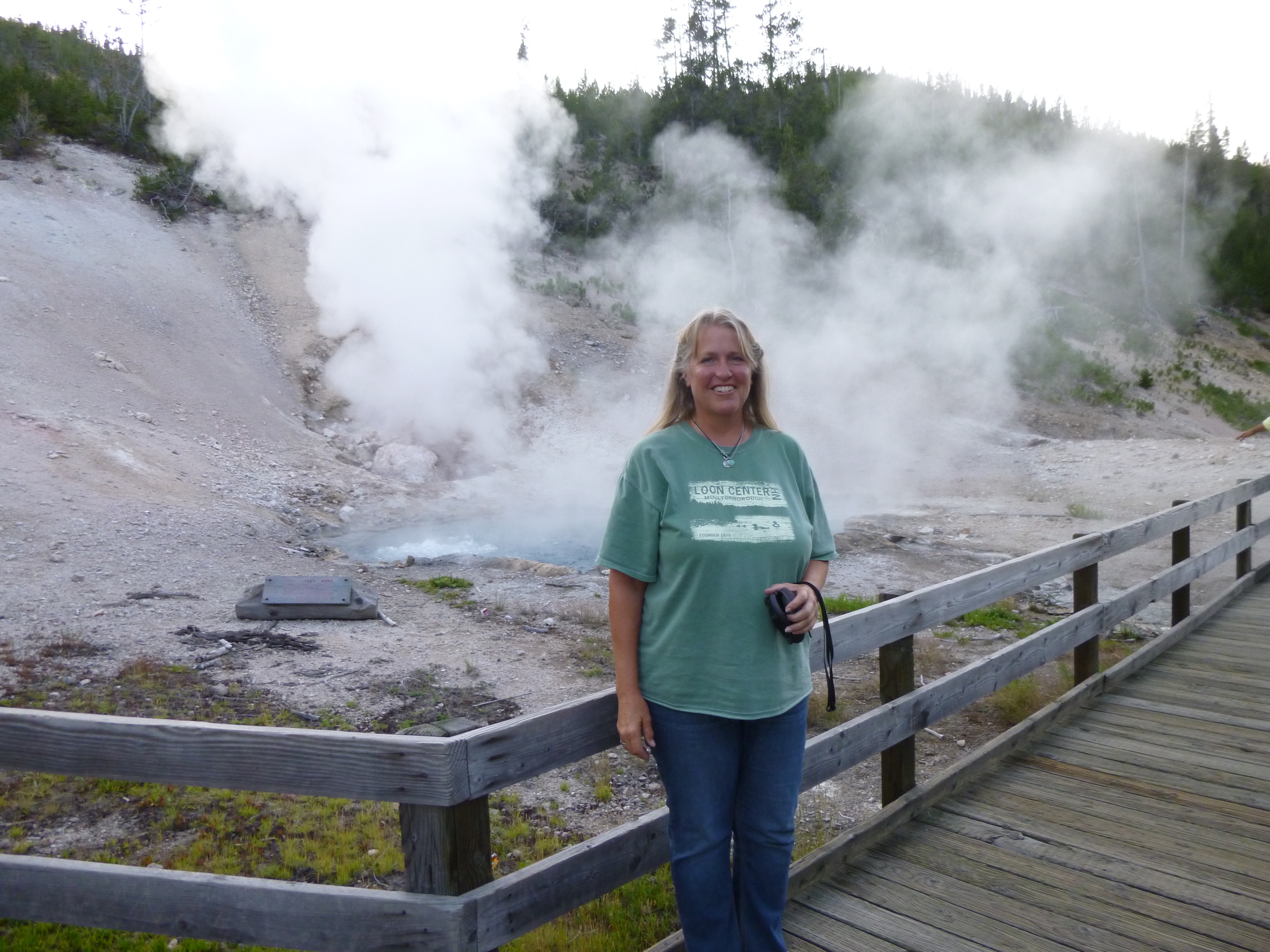
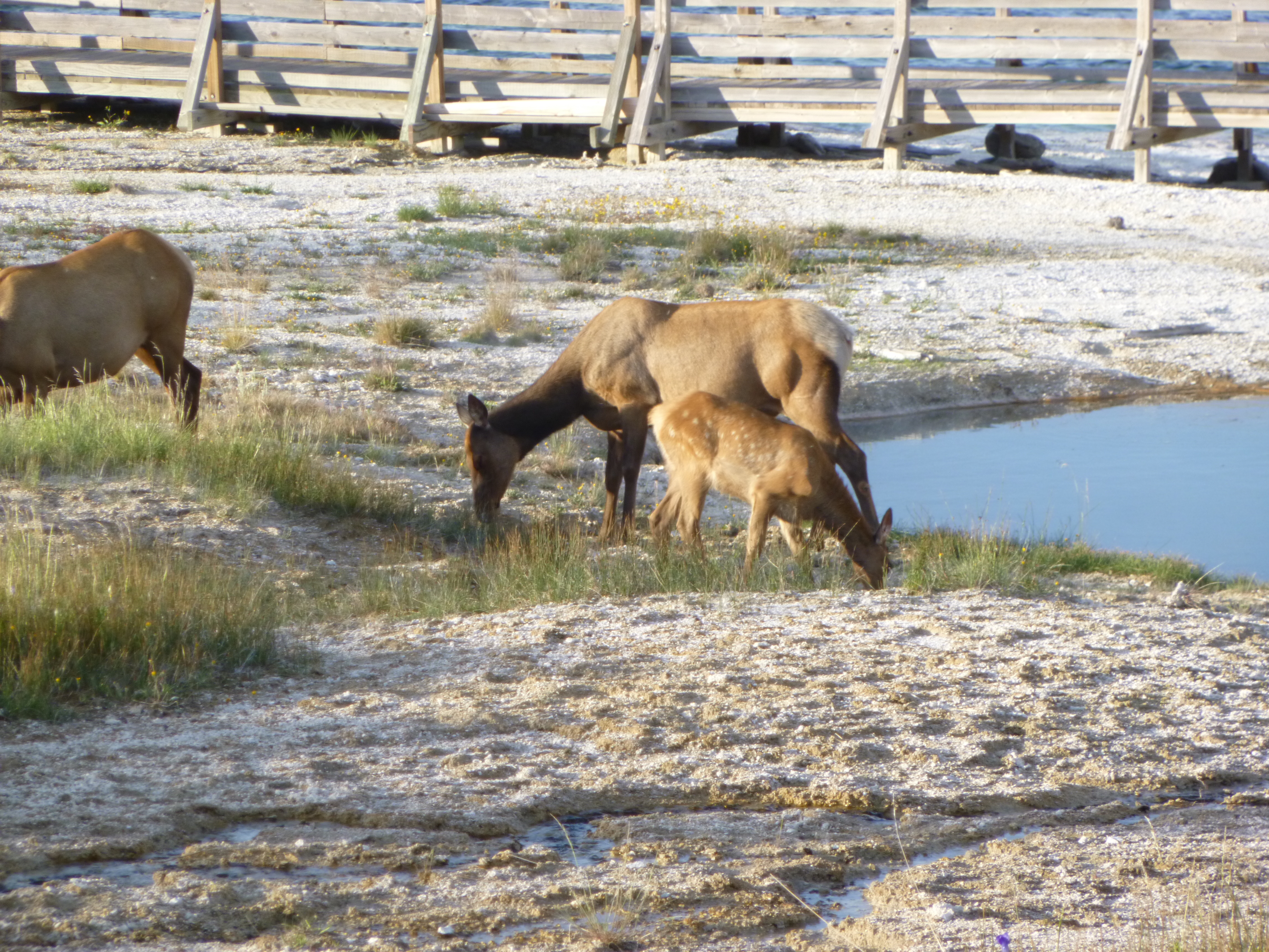
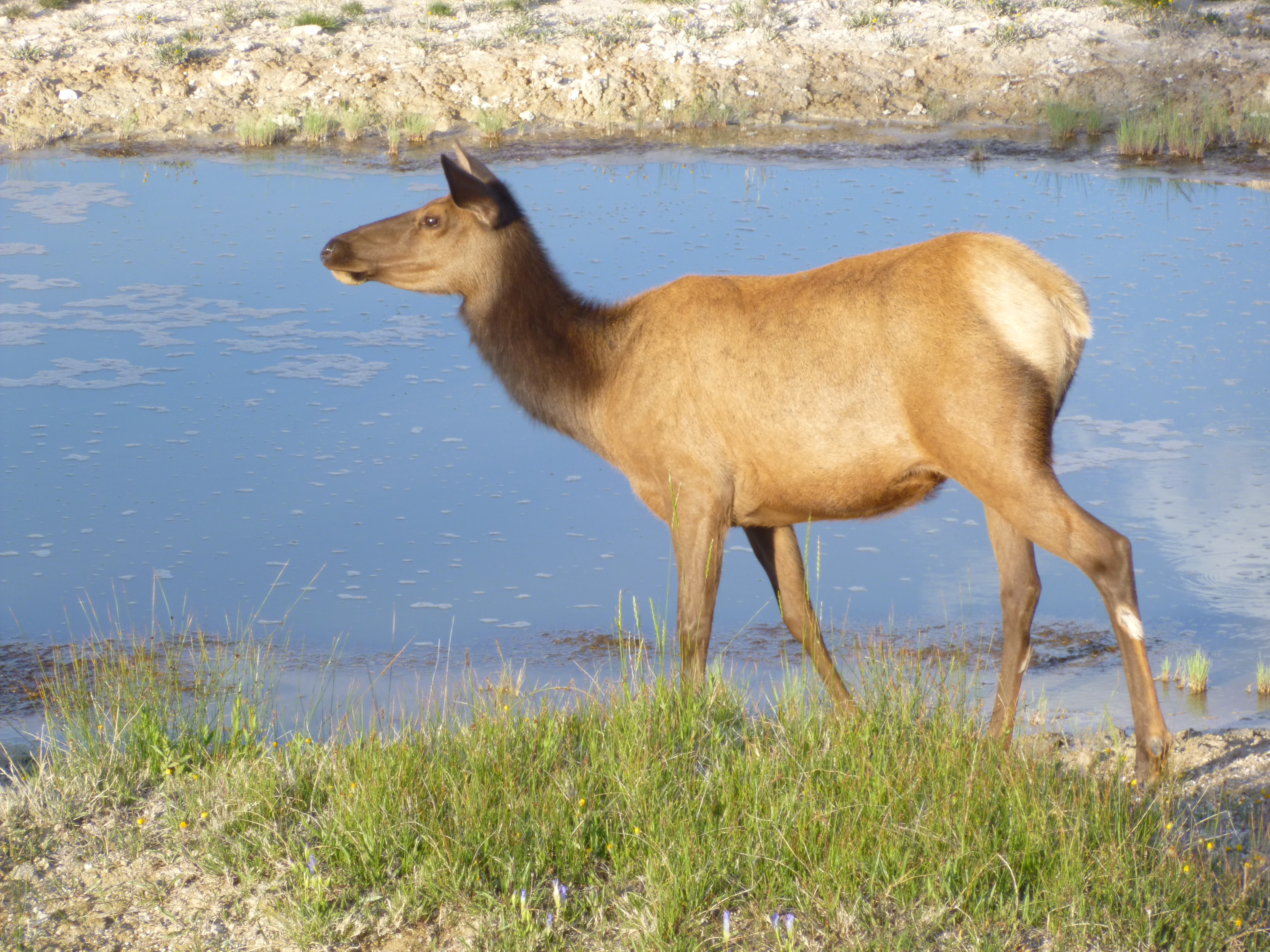
I drove on to the West Thumb area of the park, and there were some long boardwalks around some of the fragile ground, and there were more steaming holes and mud pots and bubbling mud, and so many weird things it seems like a different planet. It was evening time by now, and a beautiful time of day to be out walking around, and I had plenty of company even though it was getting later in the day. Everywhere I looked the ground was steaming. Elk can apparently walk on that terrain without breaking through the thin crust, and I got good close-up looks at mama elk and their calves. The babies had some spots on them like a baby deer.
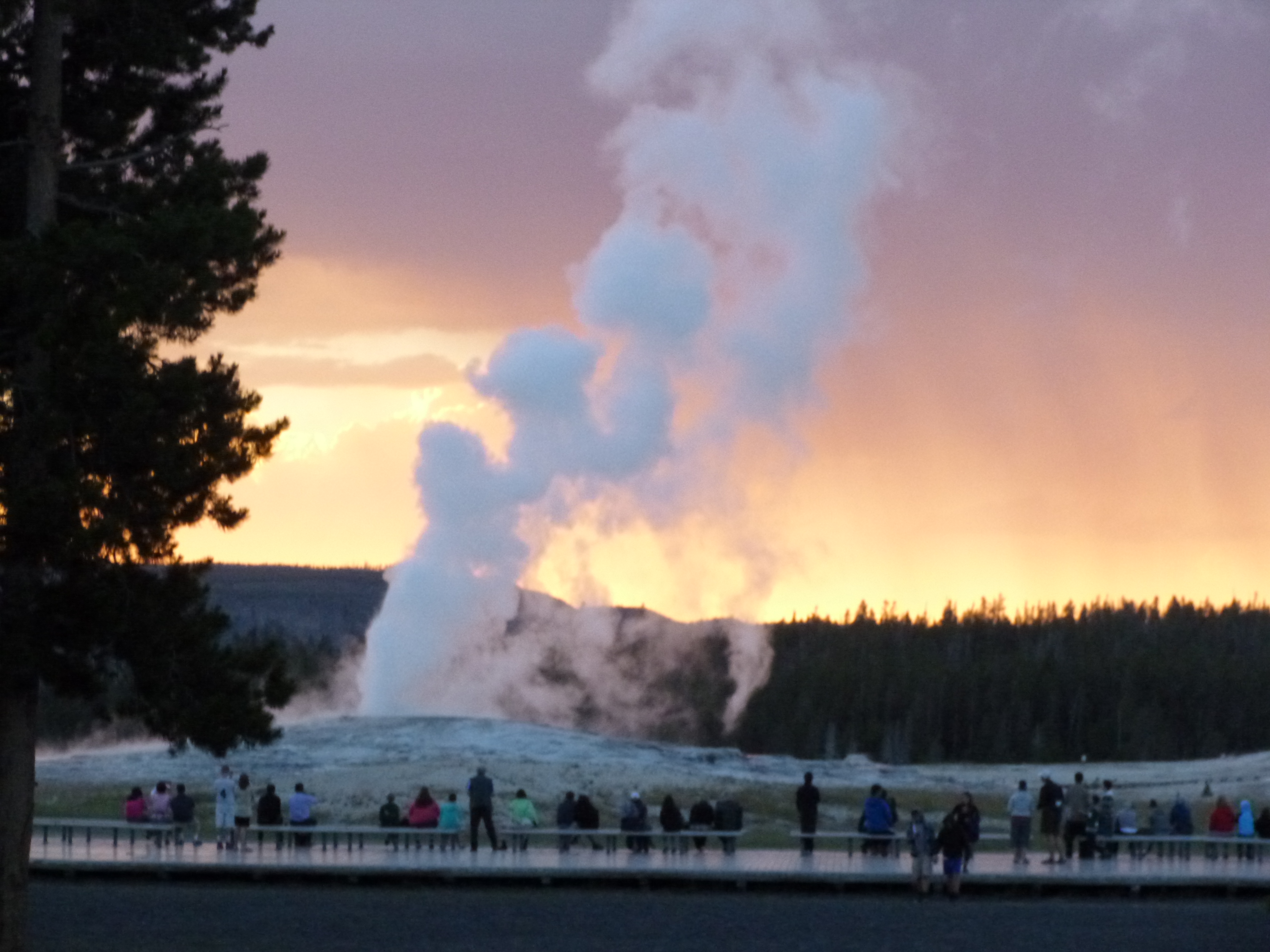
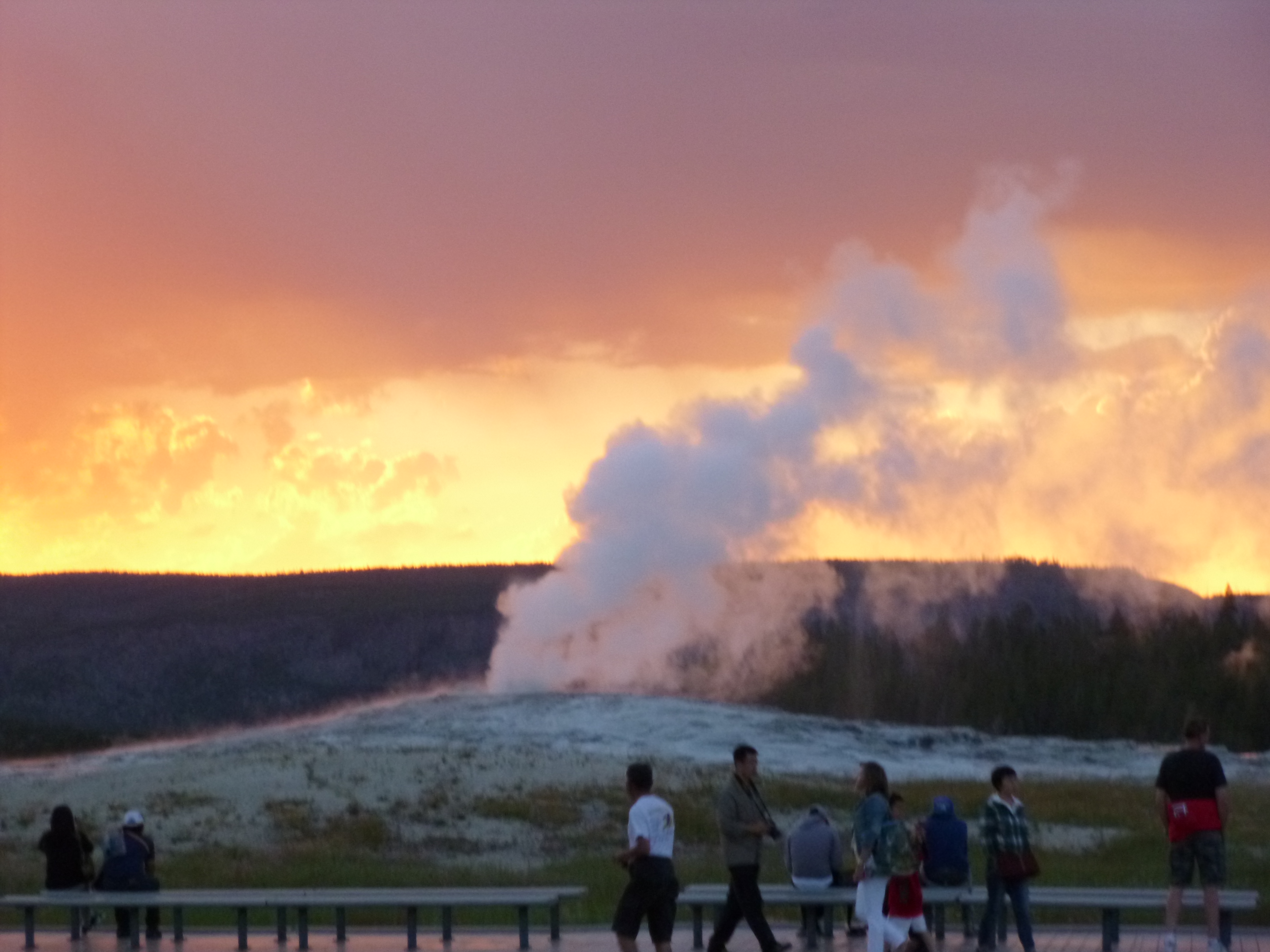
Once I had walked all around those boardwalks, I headed for Old Faithful since I had to pass near it to get to my campground. People swarm to Old Faithful, so there are extra lanes in the roads, extra signs and huge parking lots. Old Faithful erupts about every 90 minutes, and I had no idea where in the cycle I arrived. The sun had just set and the sky was really pretty, and parking wasn’t bad since it was almost 9pm so I hurried over, and saw Old Faithful just as it was erupting. I had a good view even though I was still walking over there. The eruption of water was really pretty against the colors in the sky. I watched the geyser settle back down, and then figured I better finish the drive to my campground so I could get set up before it was totally dark. Yellowstone is a really big park, and even though I’d already been in the park for hours, I still had about 1/2 hour of driving to do. I got there just as they were closing up the office (they would have just left a map out for me and other stragglers) and they went over the bear precautions – primarily about keeping all food, and anything with a scent, locked up in a car or a bear box.


Wyoming – Sunday, July 7
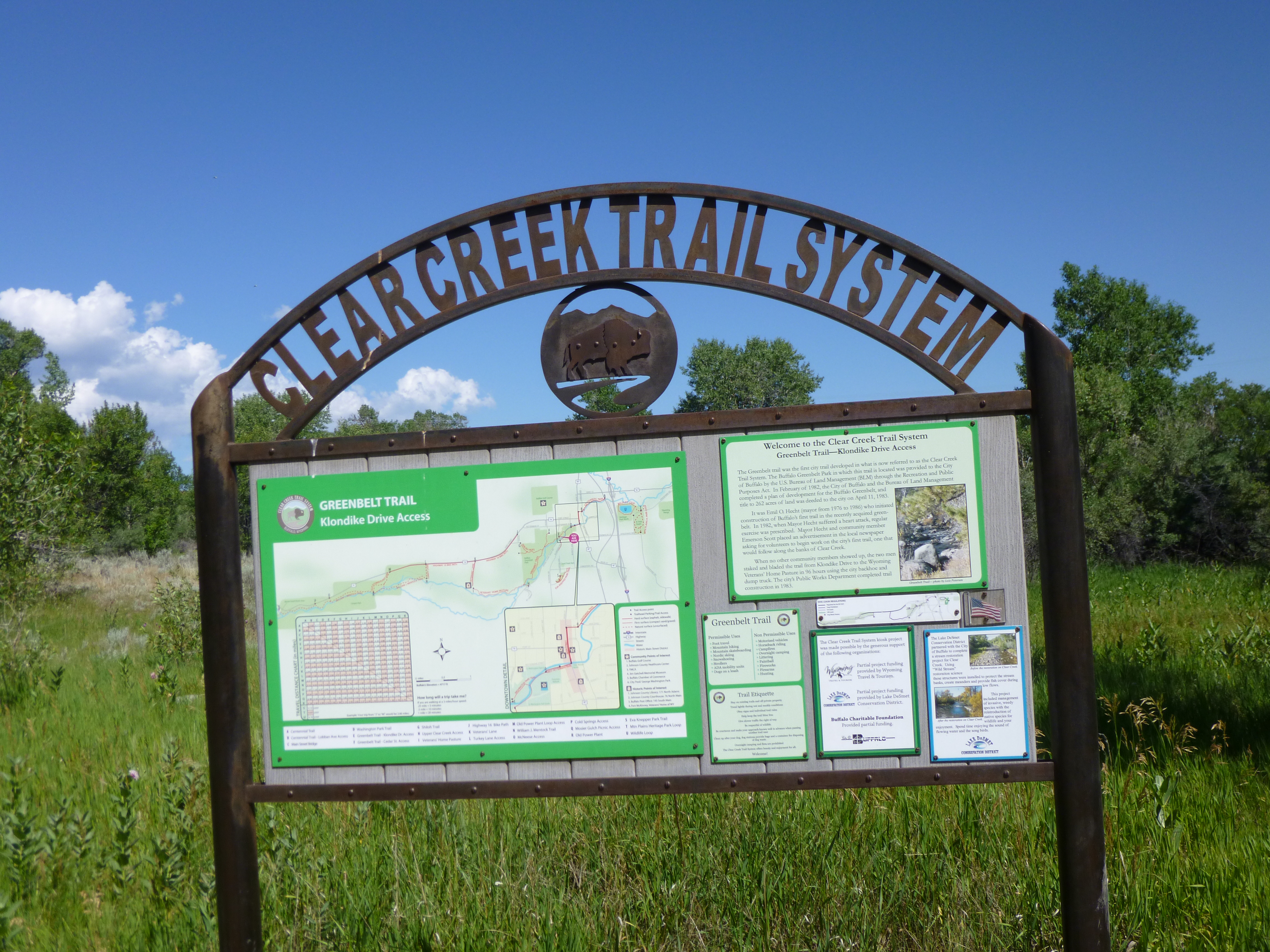
Tula and I went for a one mile walk as soon as we were up, and then I got our campsite packed up. It was a pretty morning out, and I found the Clear Creek Trail and got another couple miles in, looking at snow-capped mountains in the distance. Then I went to Buffalo’s historic downtown area, which is a classic old west style town. I saw a cute little cafe and thought I’d go have a very late breakfast and was looking forward to their special, but they started serving lunch at 11, so I had to switch gears because I didn’t want to just walk out! Then I wanted to see about making my donation – there was a food pantry in town called Bread of Life and it was based at one of the local churches. They’re open Mondays, Wednesdays and Fridays, and this was Sunday, but I drove to the church in case I could find anyone involved with the food pantry. But instead I found a sign on a back door saying the food pantry is temporarily housed in a different location while the regular one is being updated. The sign also said food donations could be dropped off any time at one of the inns in town. So I went to the inn and met the owner just as she was leaving for an hour or so. She said they do indeed collect food for Bread of Life, and said any of the usual staples would be good, and that they don’t often get rice so that would be a good thing too. She told me where to leave it inside since she was going out on an errand. So I went shopping and got rice, spaghetti sauce and noodles, cereal, baked beans, tuna and ravioli. I took it back to the inn and left it for the food pantry with a note.
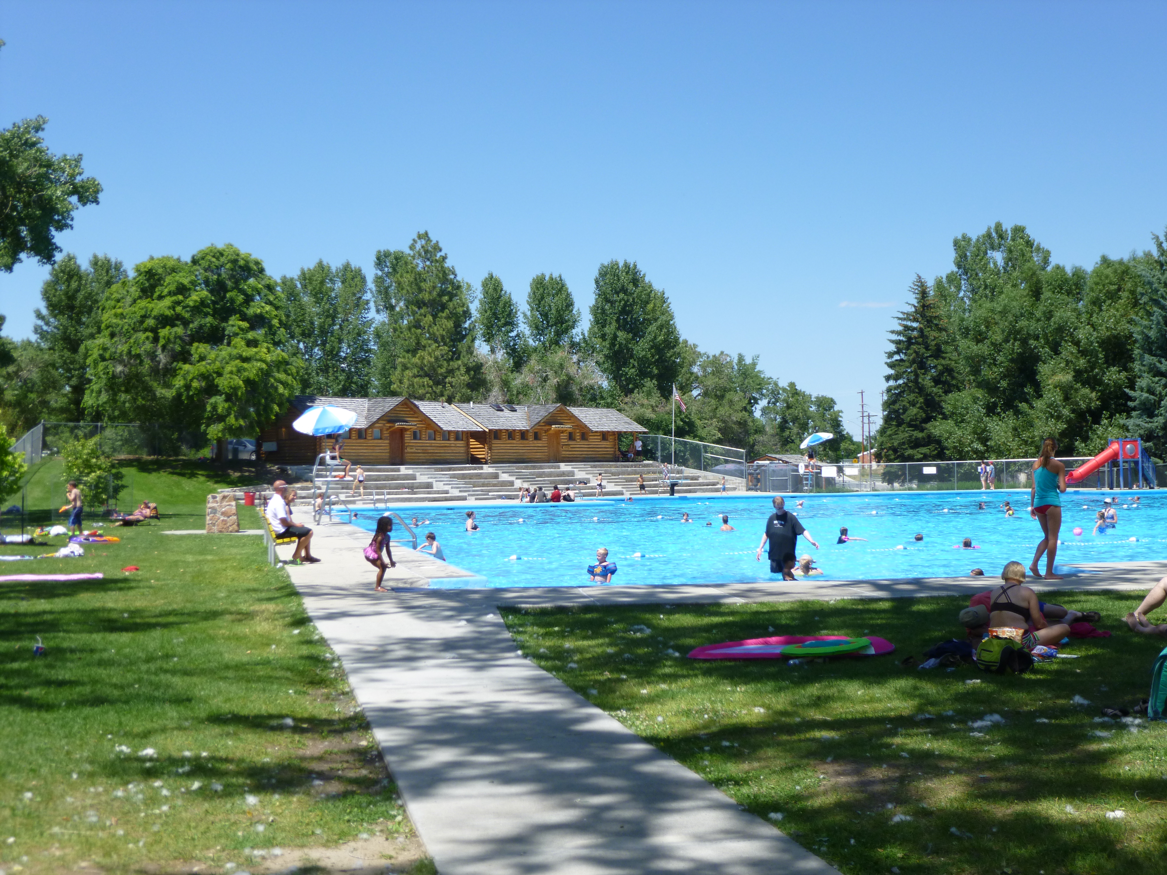
Then Tula and I took a walk in one of the neighborhoods and then I walked 3 miles all through the downtown area, and another part of the Clear Creek Trail, and then to the city park outside of town. They had a huge, beautiful pool, and a separate water play area for little kids, and plenty of grassy space for chairs and blankets. And it was all free. There were lots and lots of families there, and it just seemed like a really nice thing for the community to have.
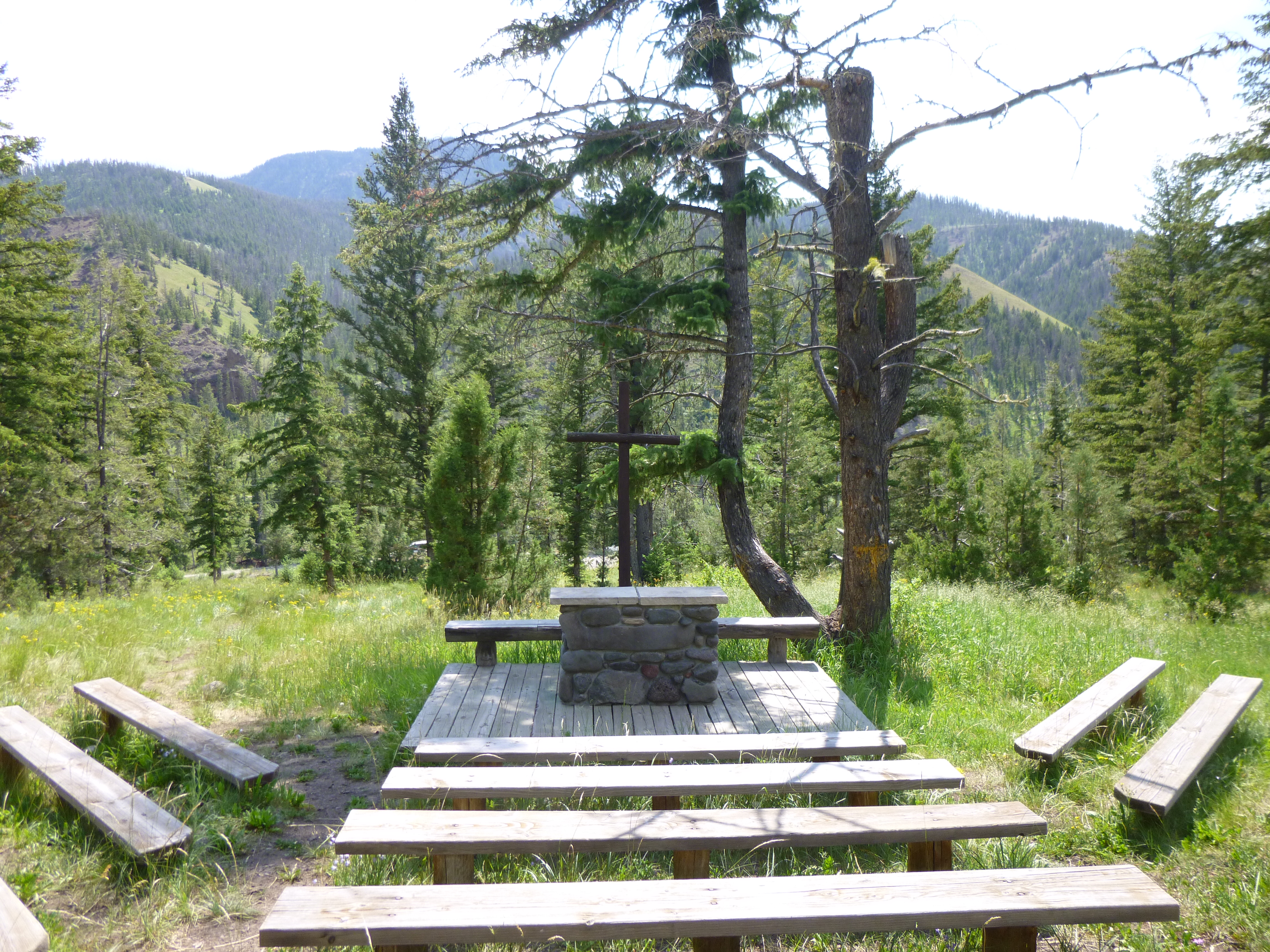
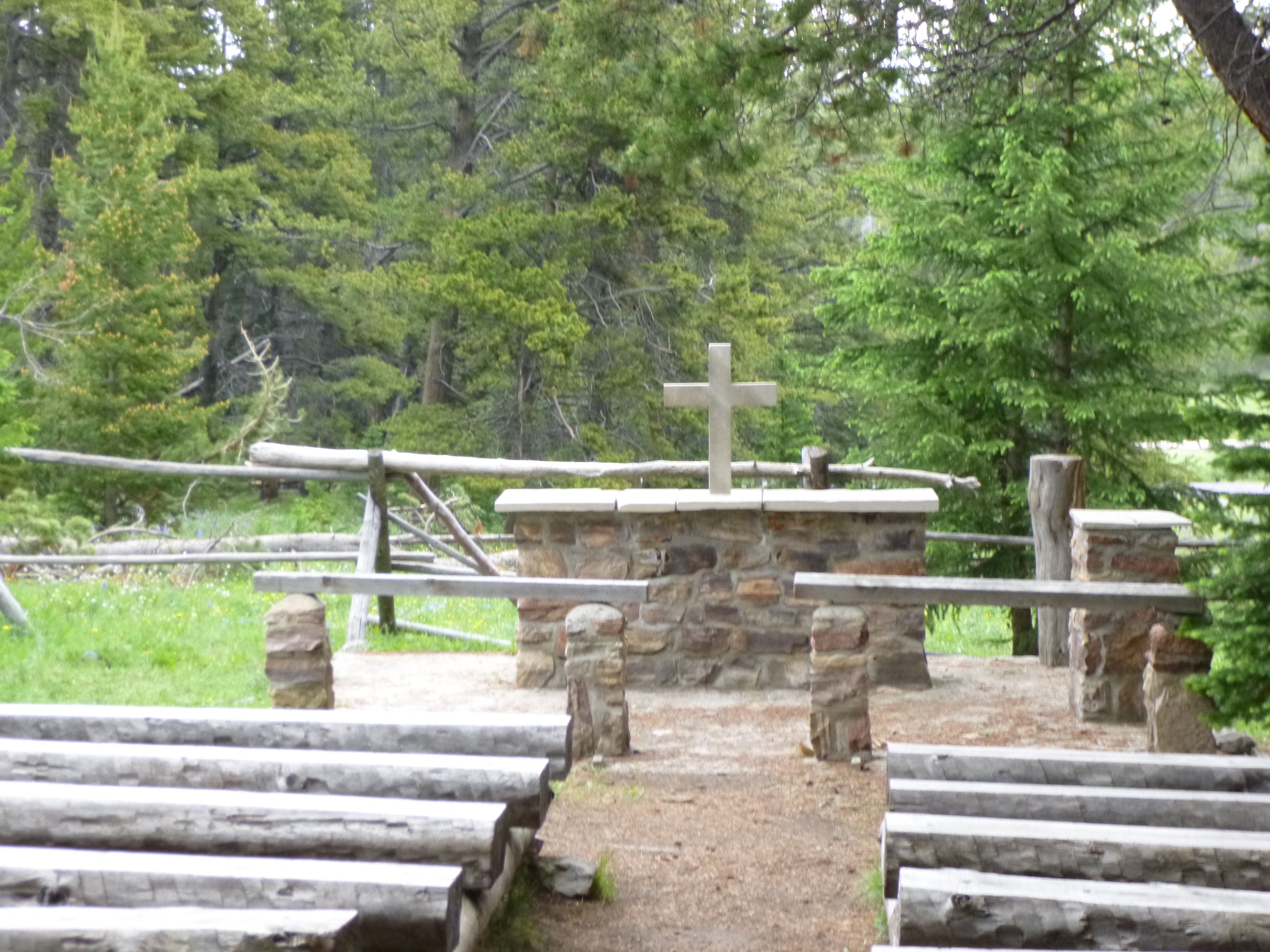
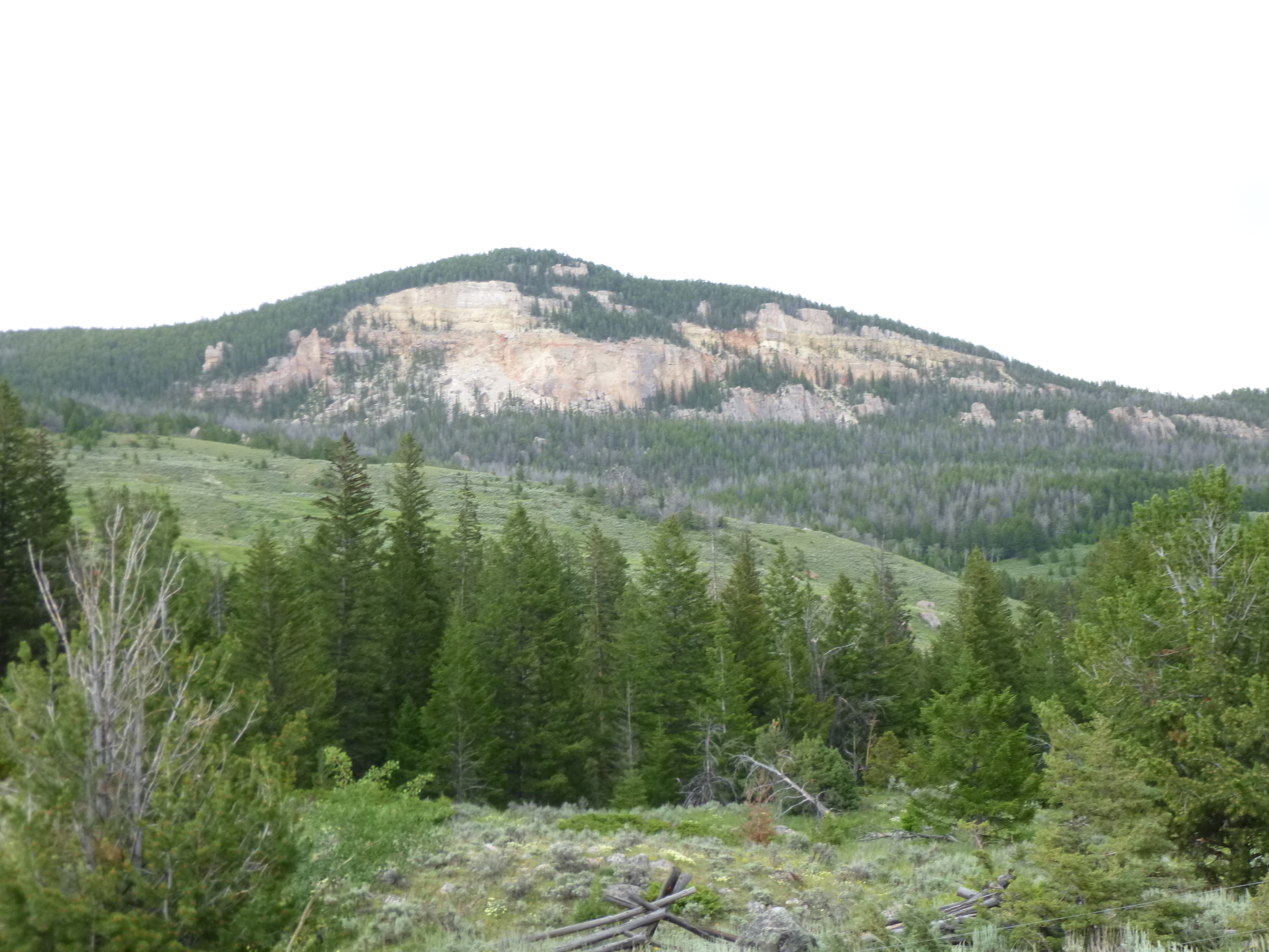
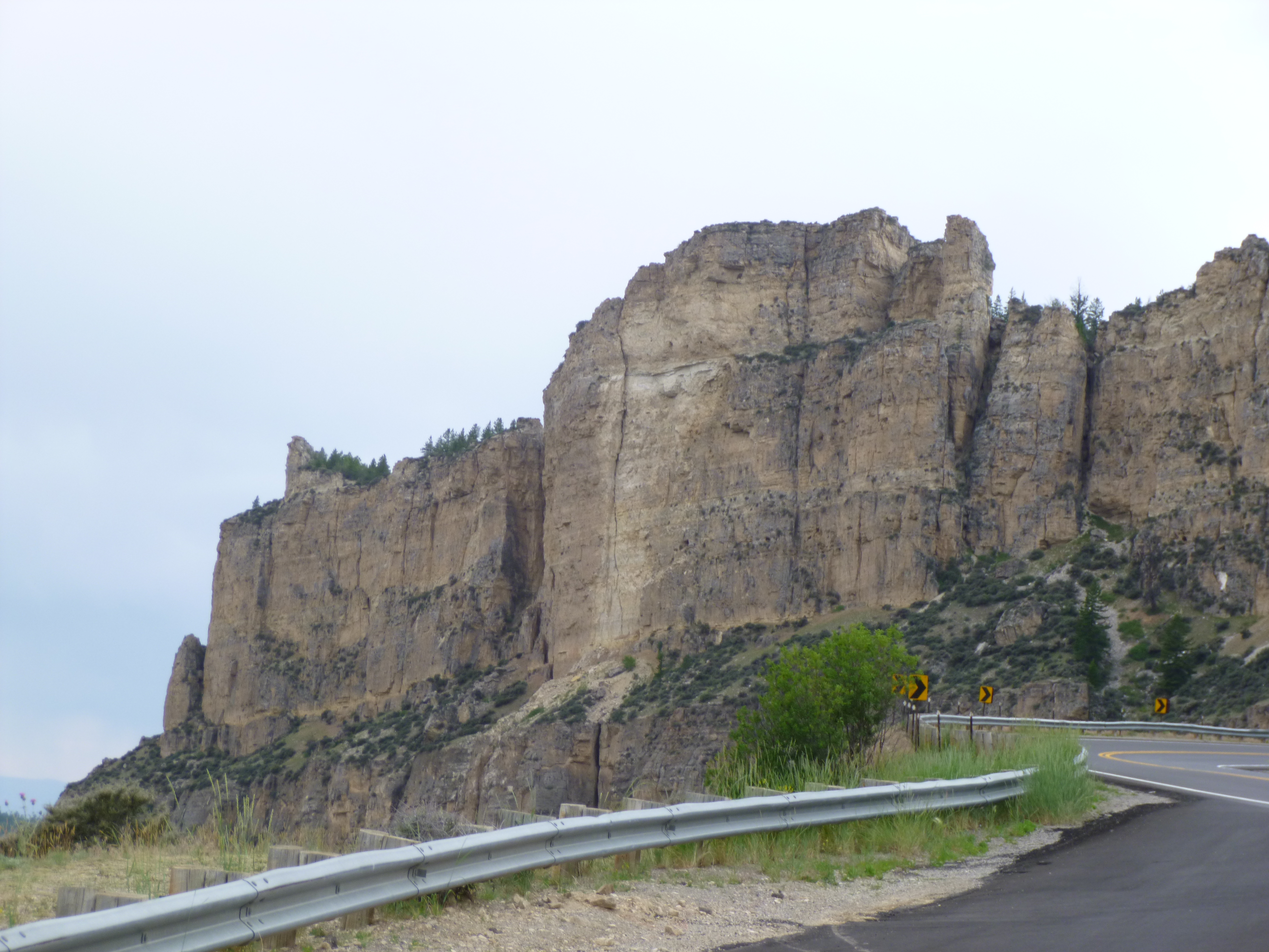
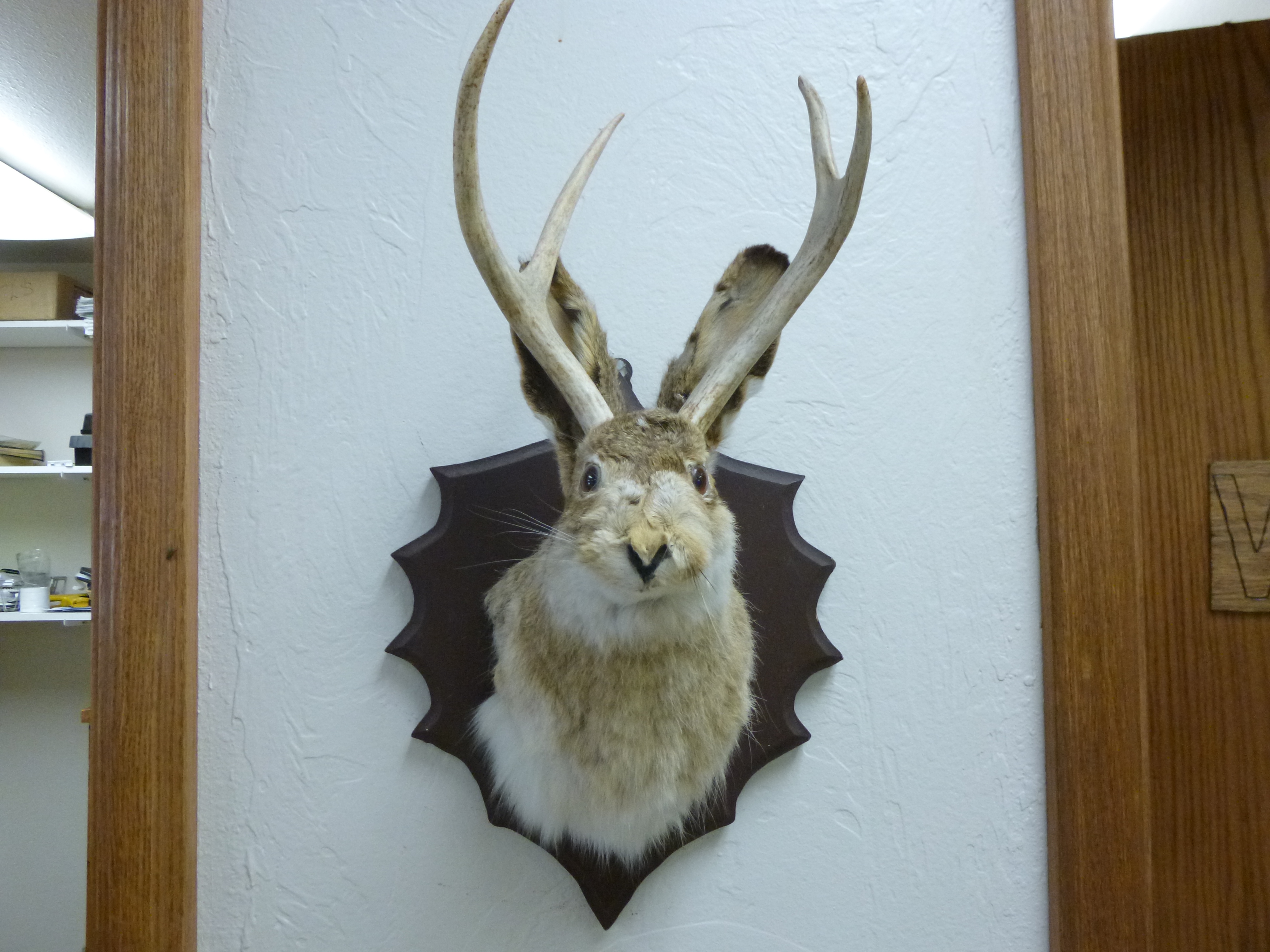
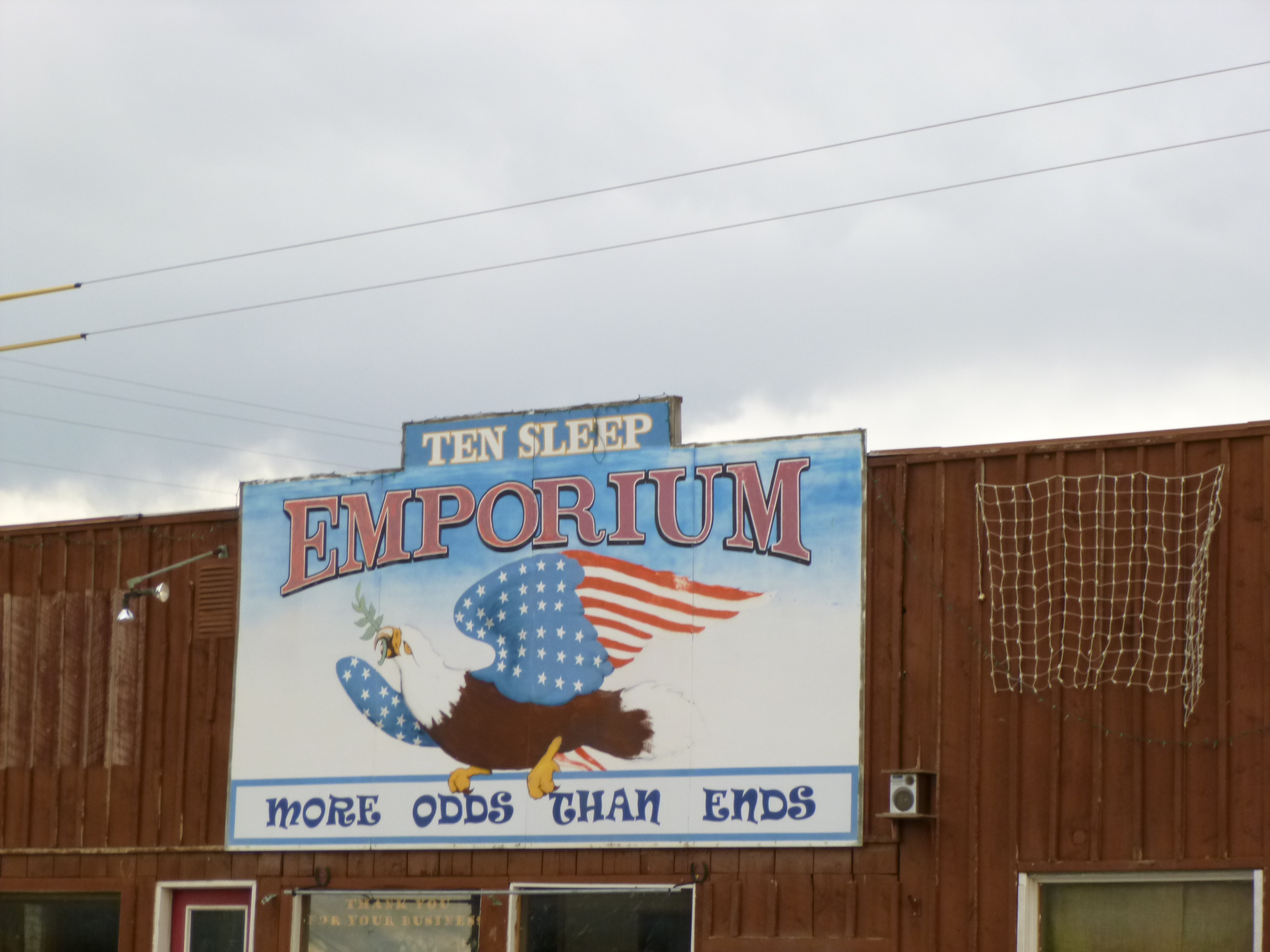
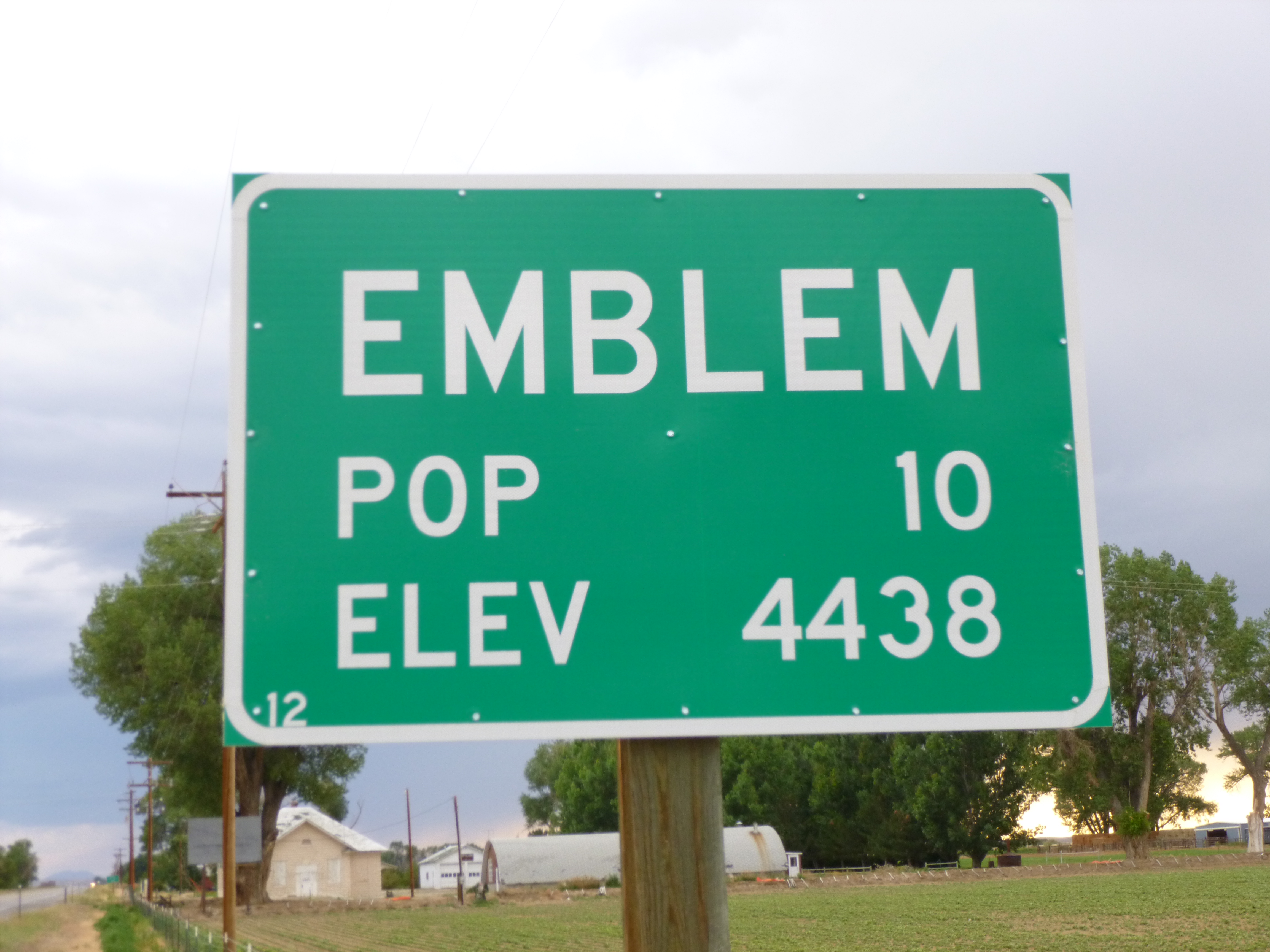
Then I started driving west – aiming for Cody. First I drove through the Bighorn Mountains which were really pretty, and we stopped and took a short walk on one of the trails. There was a little wayfarer’s chapel up in the hills and I went to look at that. And then we came to the tiny town of Ten Sleep, where we finished our walking for the day. Ten Sleep was a tiny little old-west town with just one street, and was so named because in the old days there were a couple big Indian camps a distance away, and all kinds of trails led from them. Ten Sleep was halfway between the 2 camps – 10 days (or “sleeps”) away from each of them. This is also the land of the “jack-a-lope” and the local gas station/convenience store had a mounted jack-a-lope on the wall. When we left Ten Sleep, I kept heading west to Cody. I passed through a nearly non-existent town that only had a population of 10 – Wyoming is not a crowded state! I knew there were several campgrounds in Cody, and the first one I came to was a KOA one, and it looked pretty decent. There was a big cabin for registration and a store and gift shop and all, and I was able to get a campsite – again, only because I needed a tent space and not an RV space with hook-ups, which were all full. Cody is quite close to the east entrance for Yellowstone, and I was happy to get a space there. I got everything set up, and even though Tula is always excited to get up on the air mattress once she hears me inflating it, we took a bedtime walk around the campground first. Our campsite was close to the horse corral, where they offer trail rides, so I enjoyed the faint smell of horse and listening to their nighttime sounds.


Wyoming – Saturday, July 6
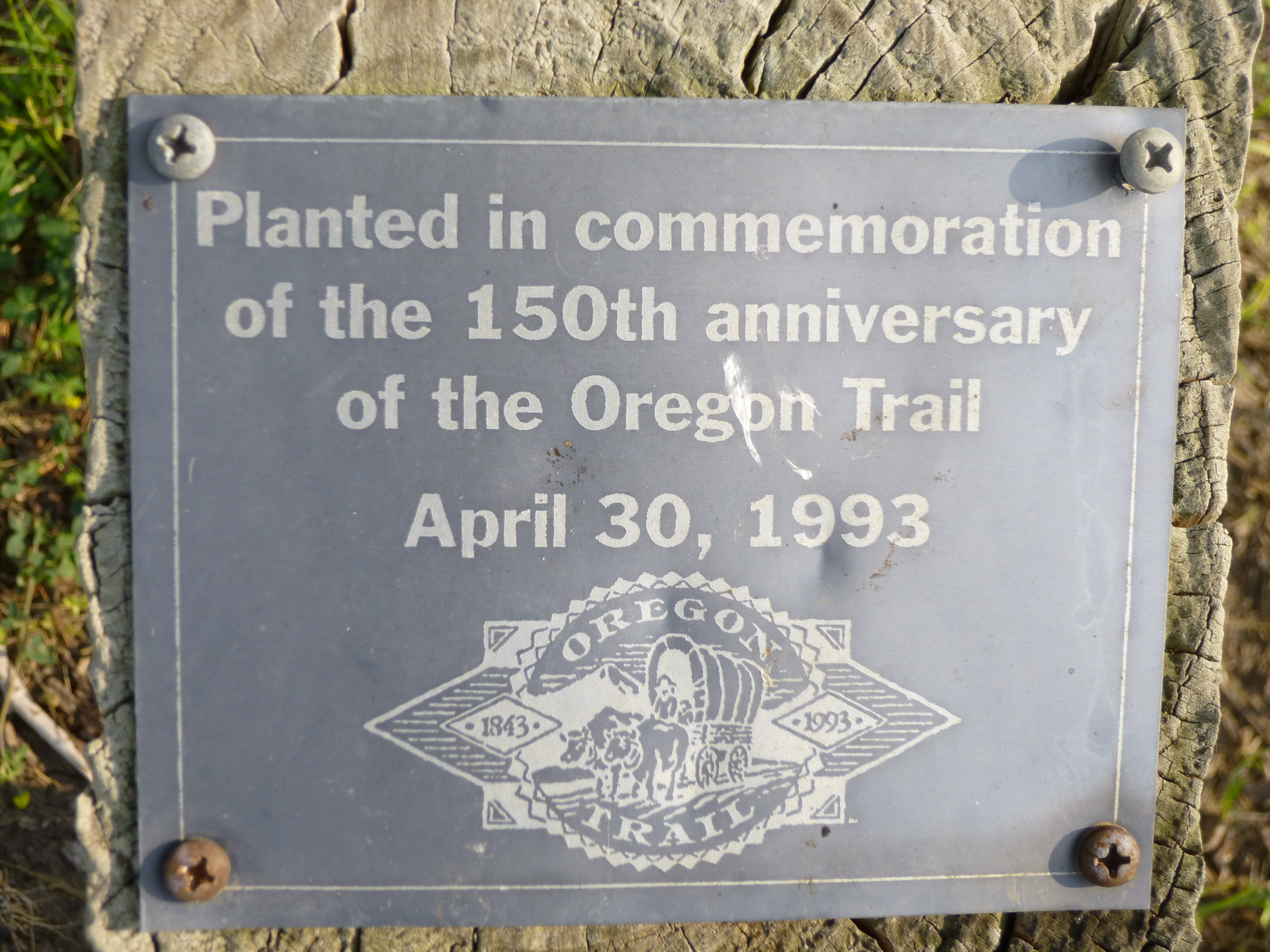
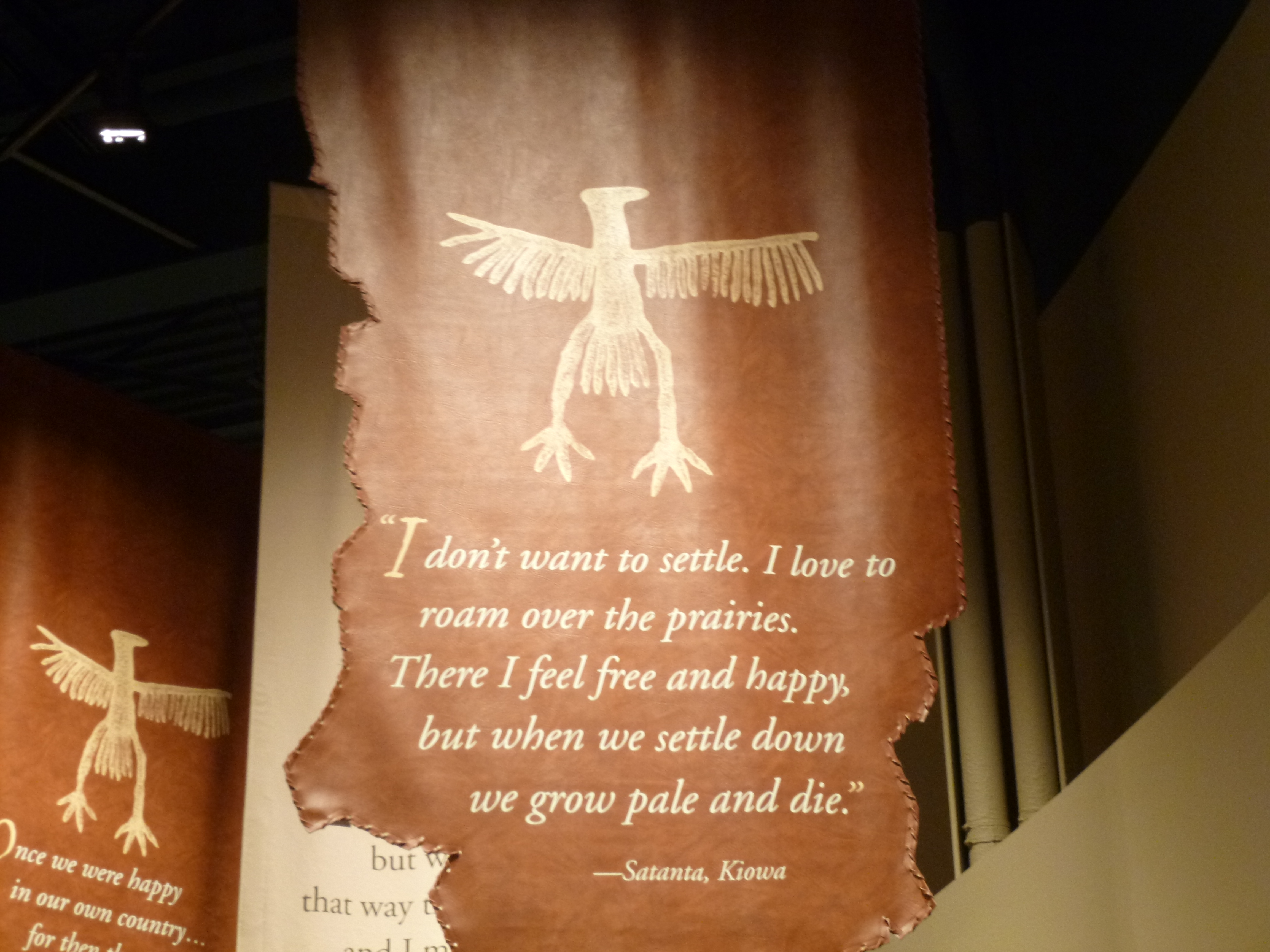
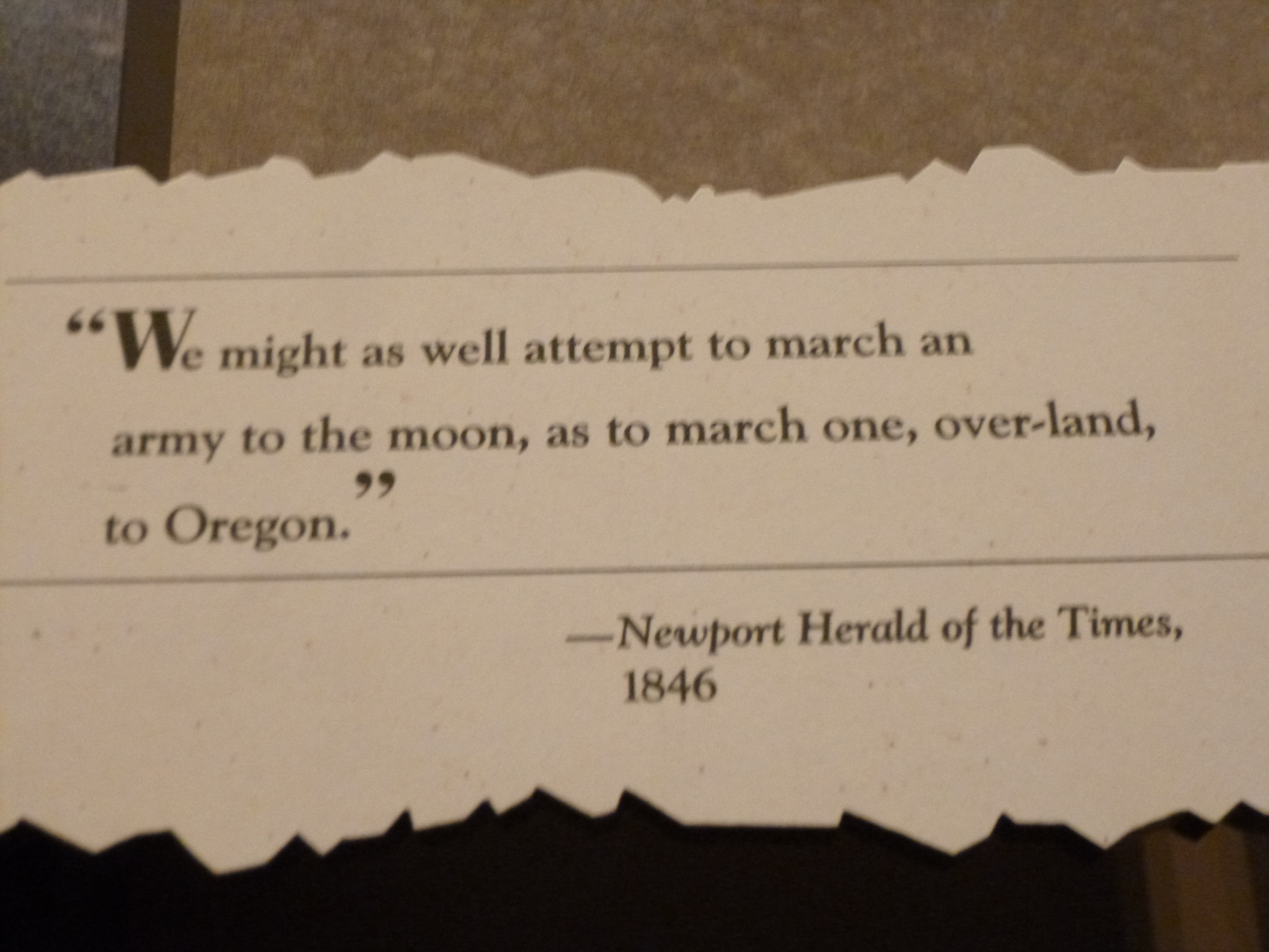
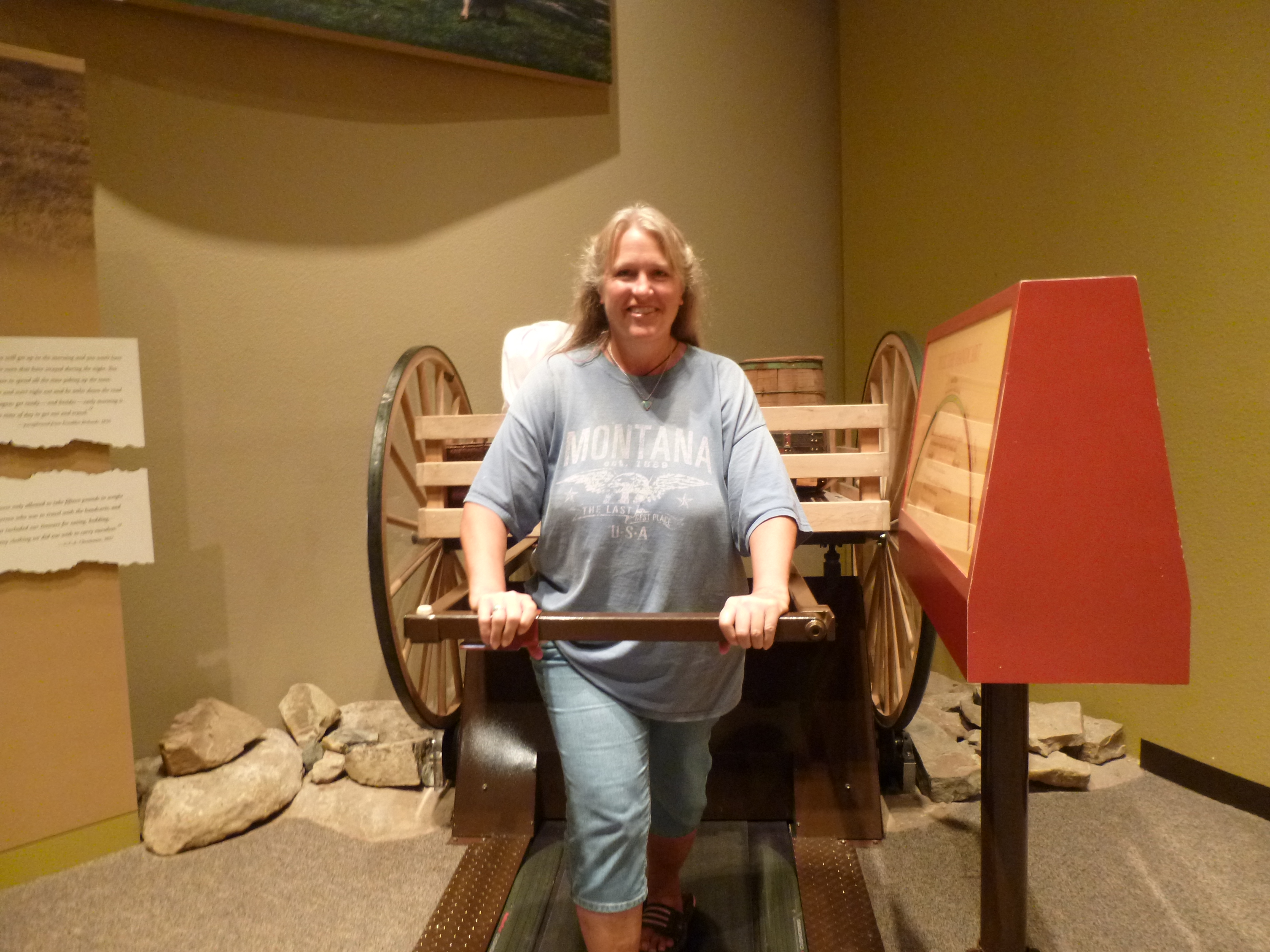
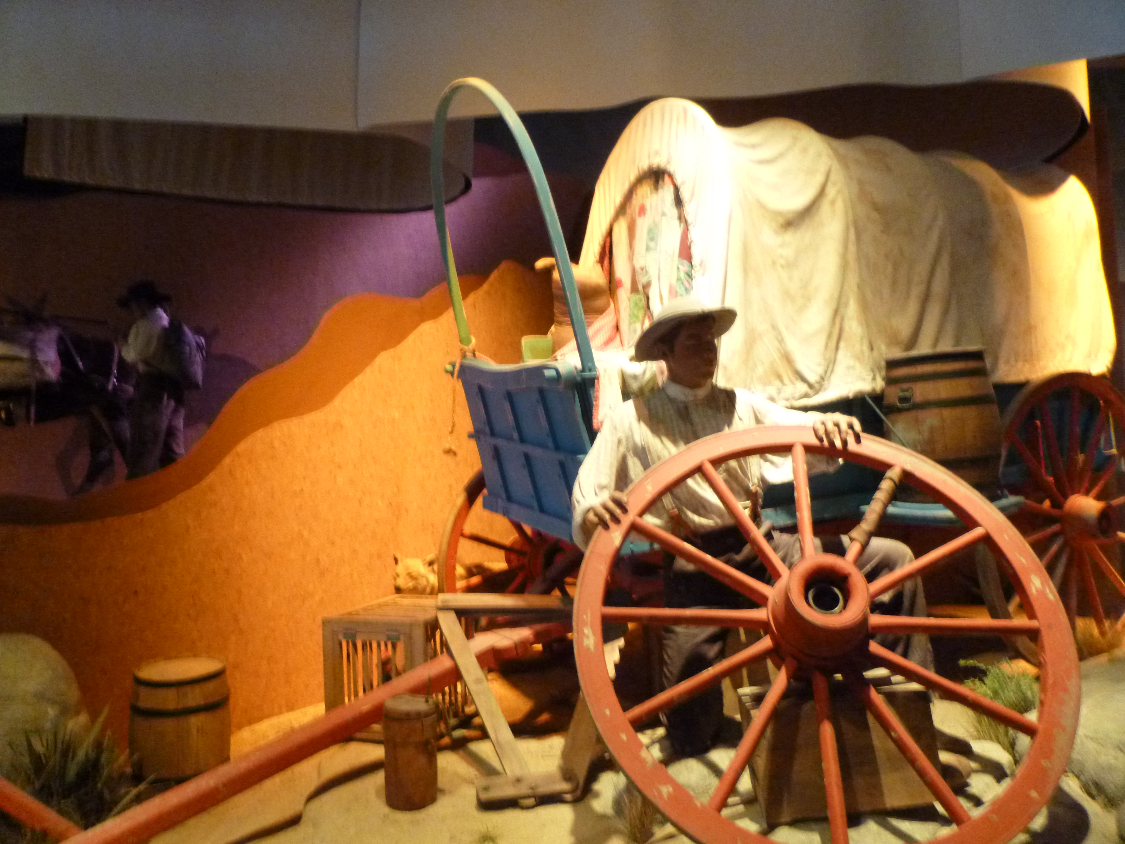
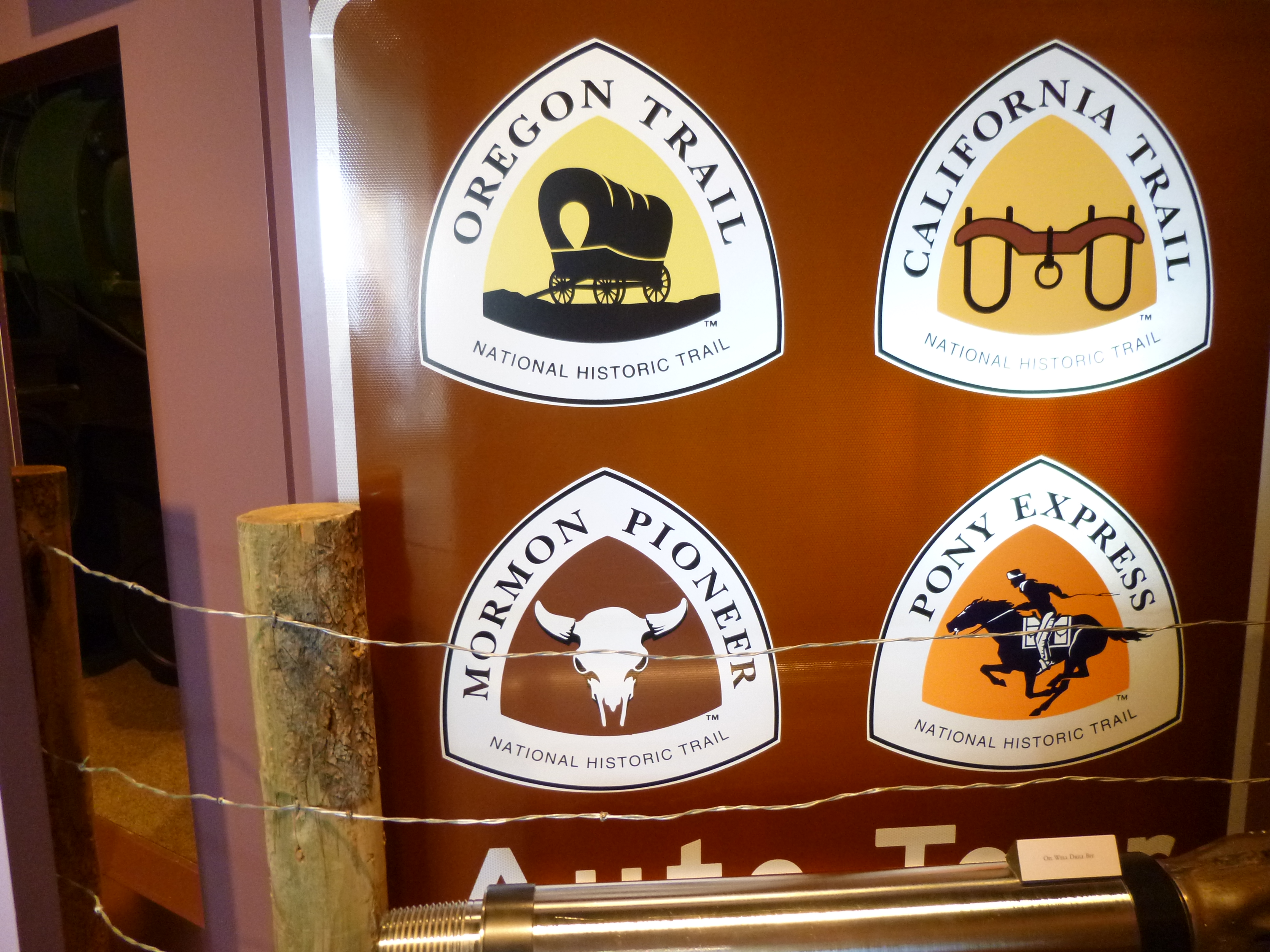
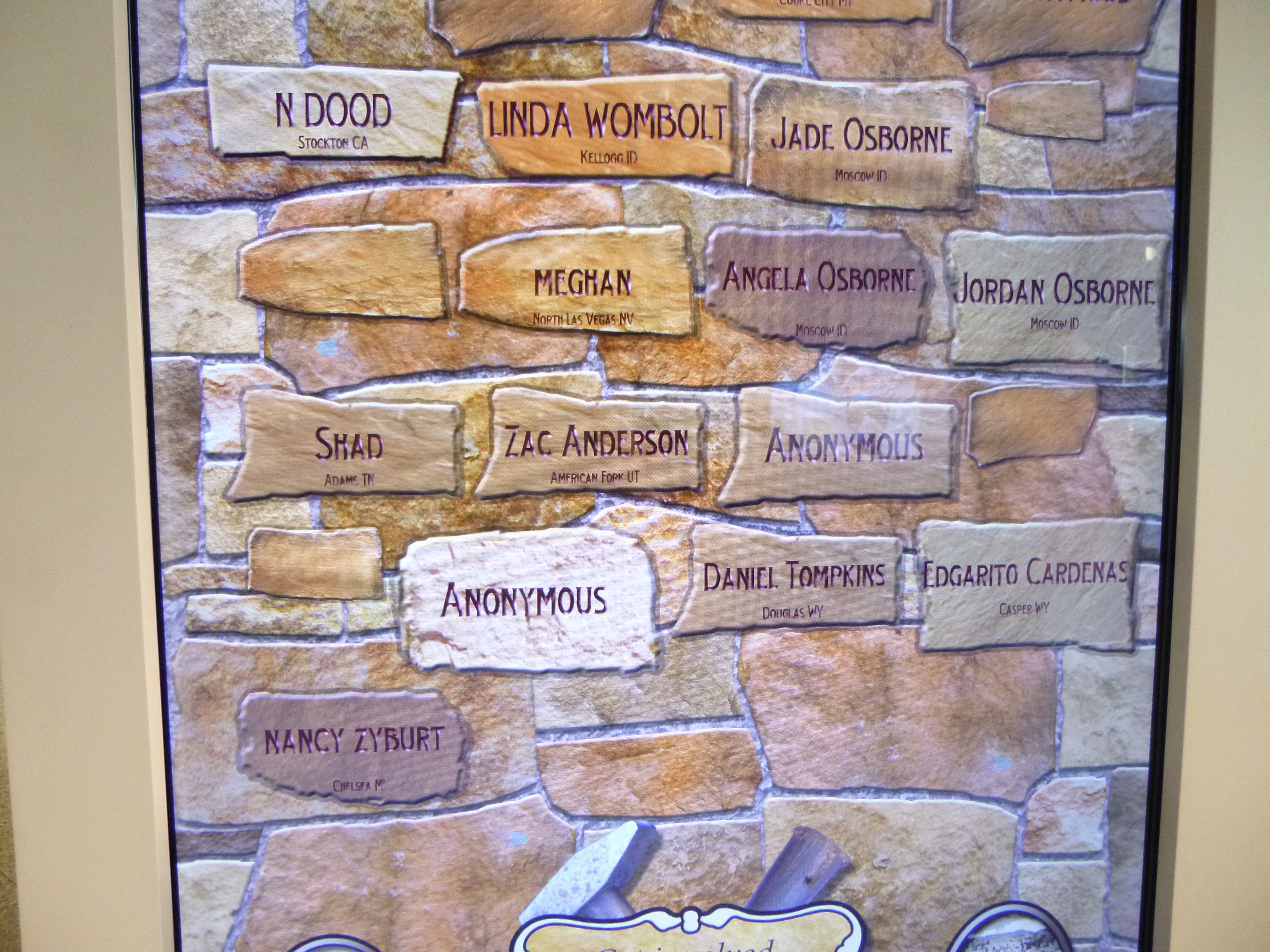
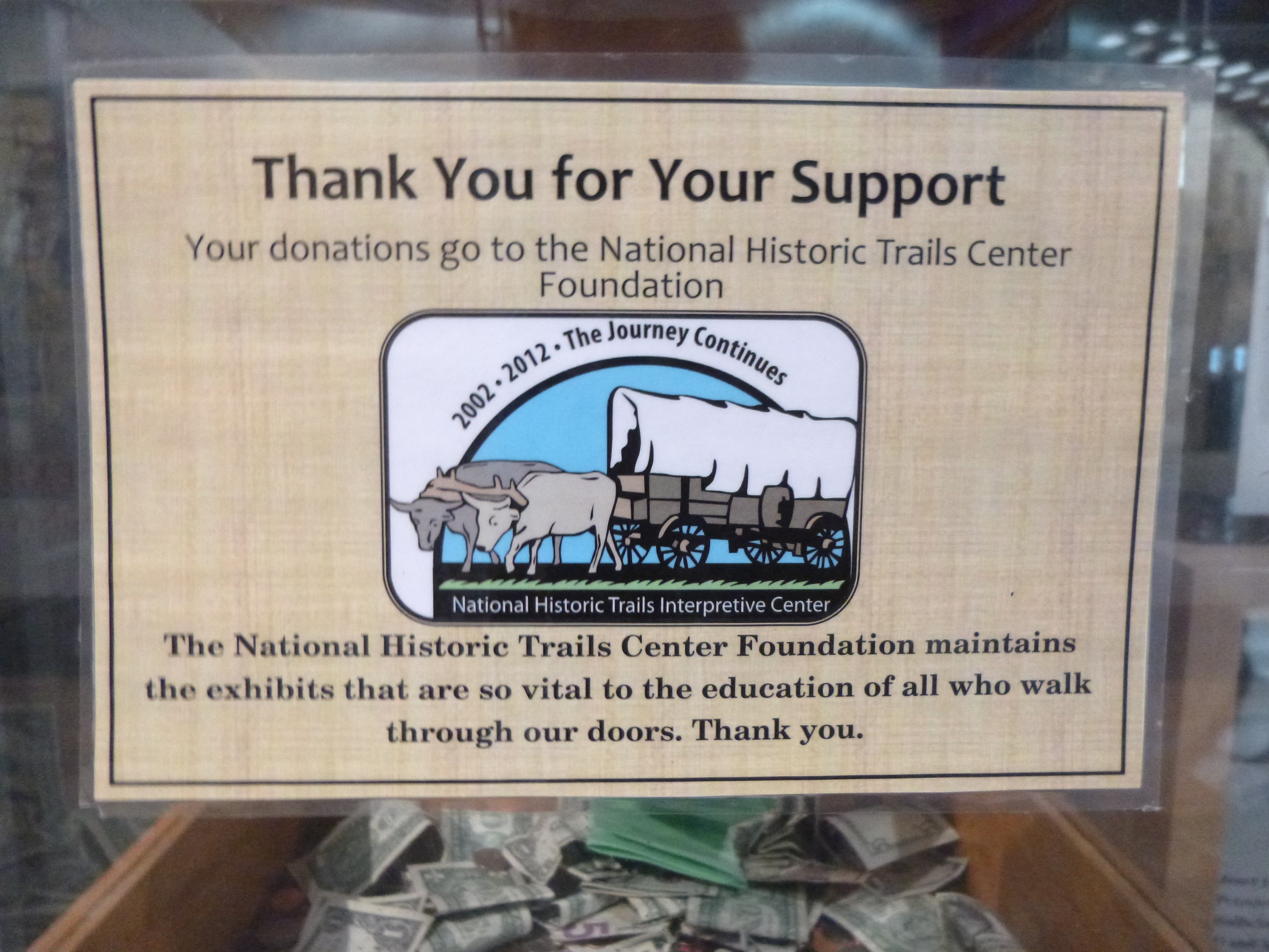
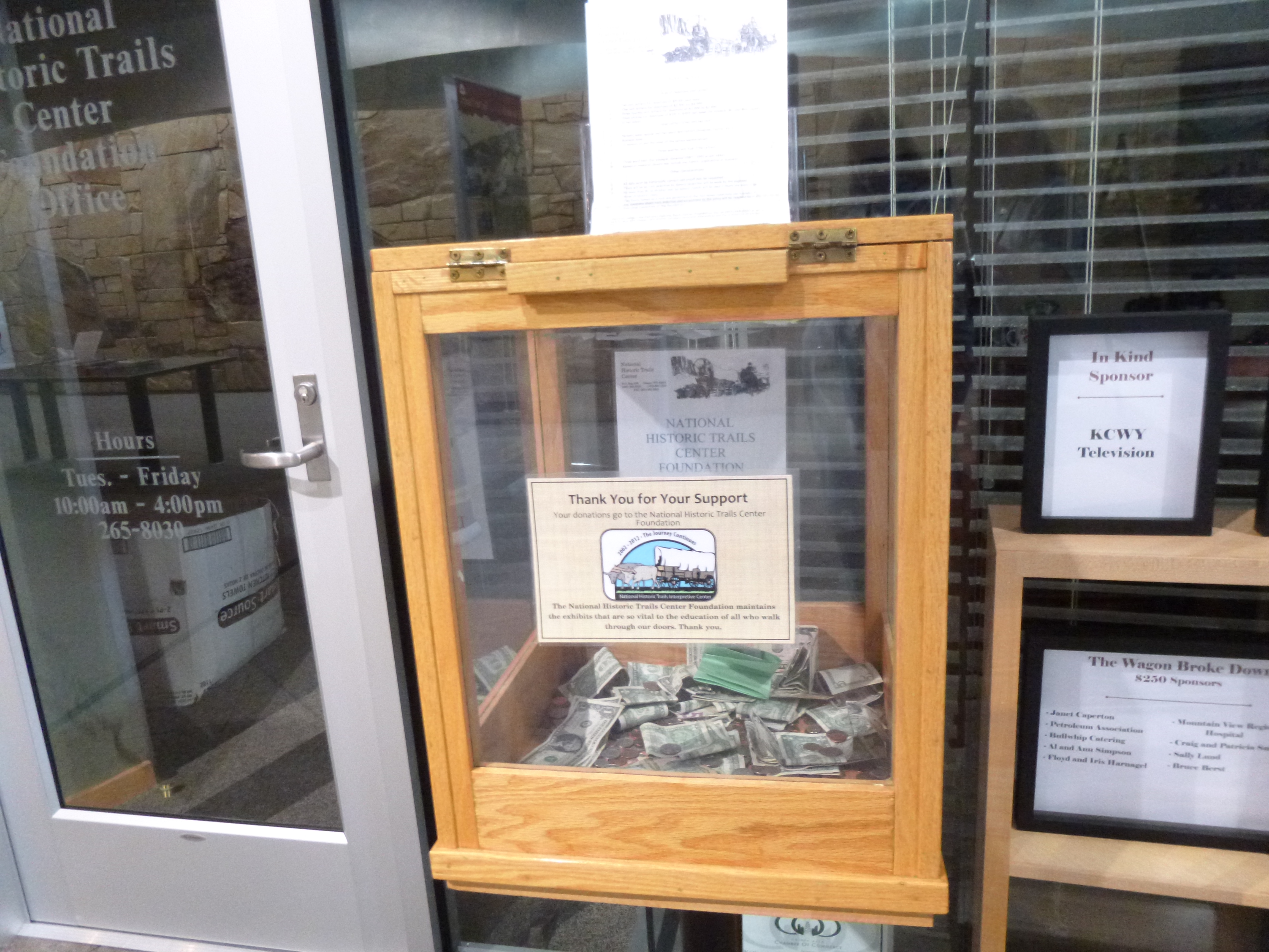
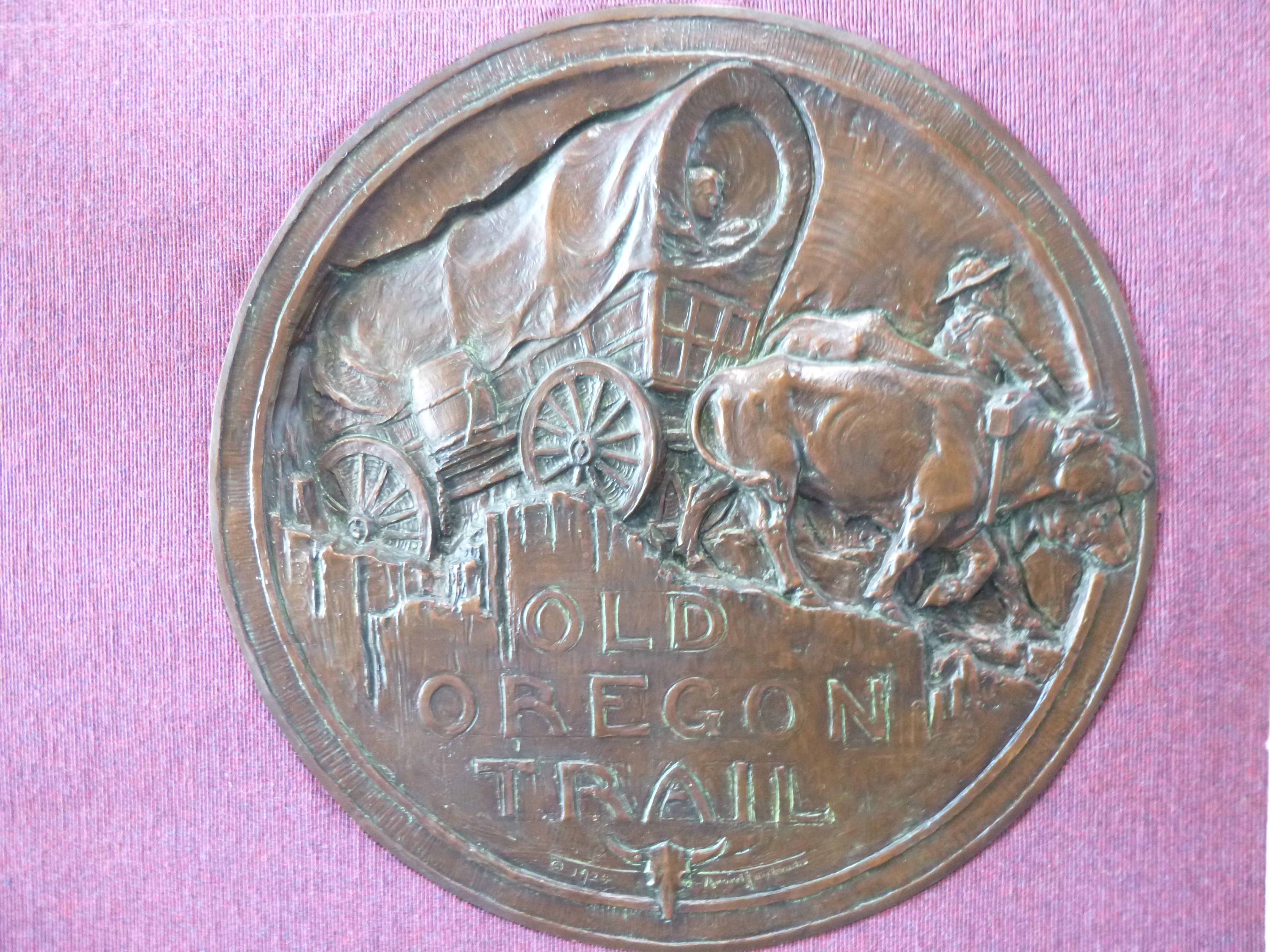
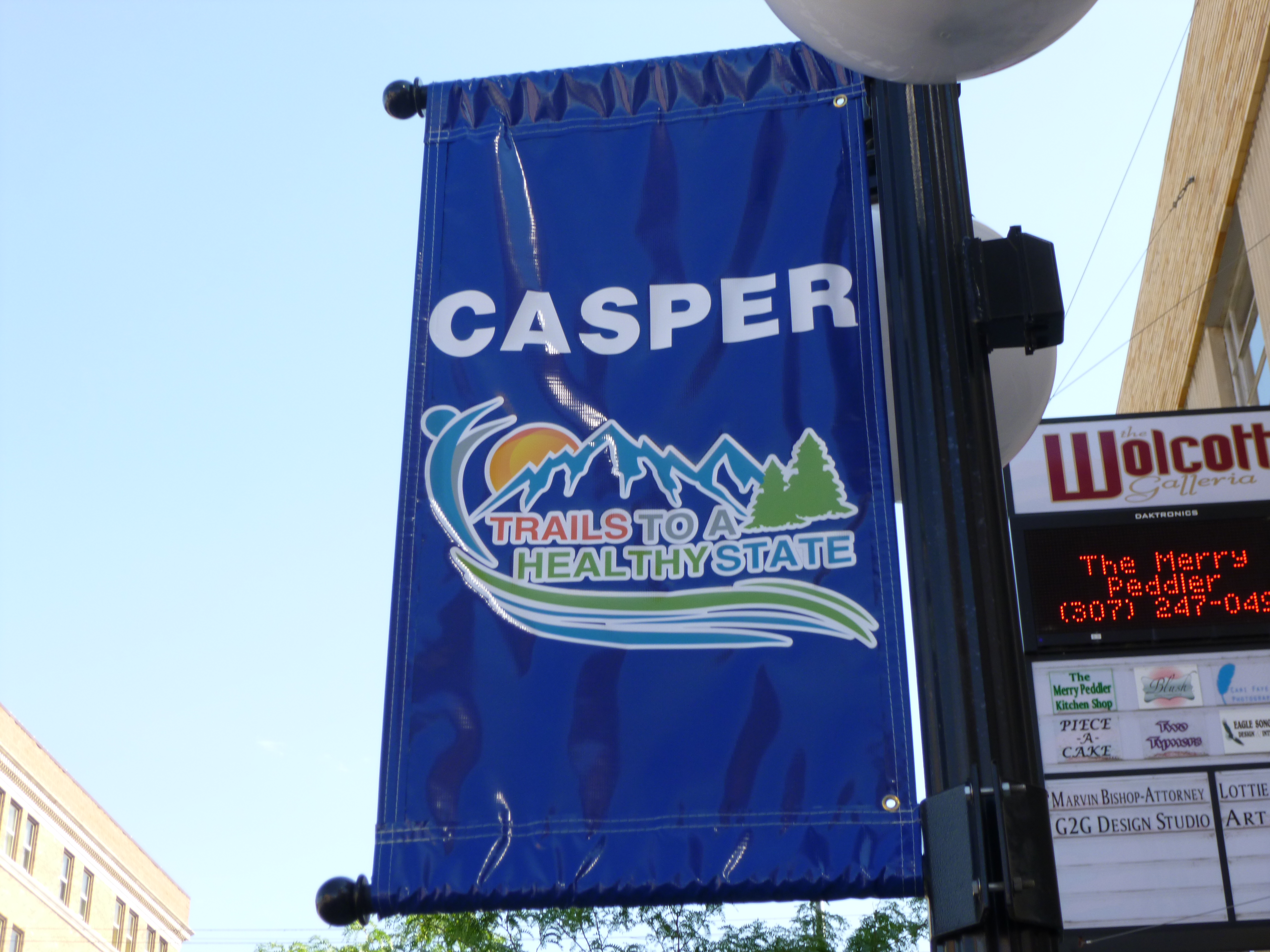
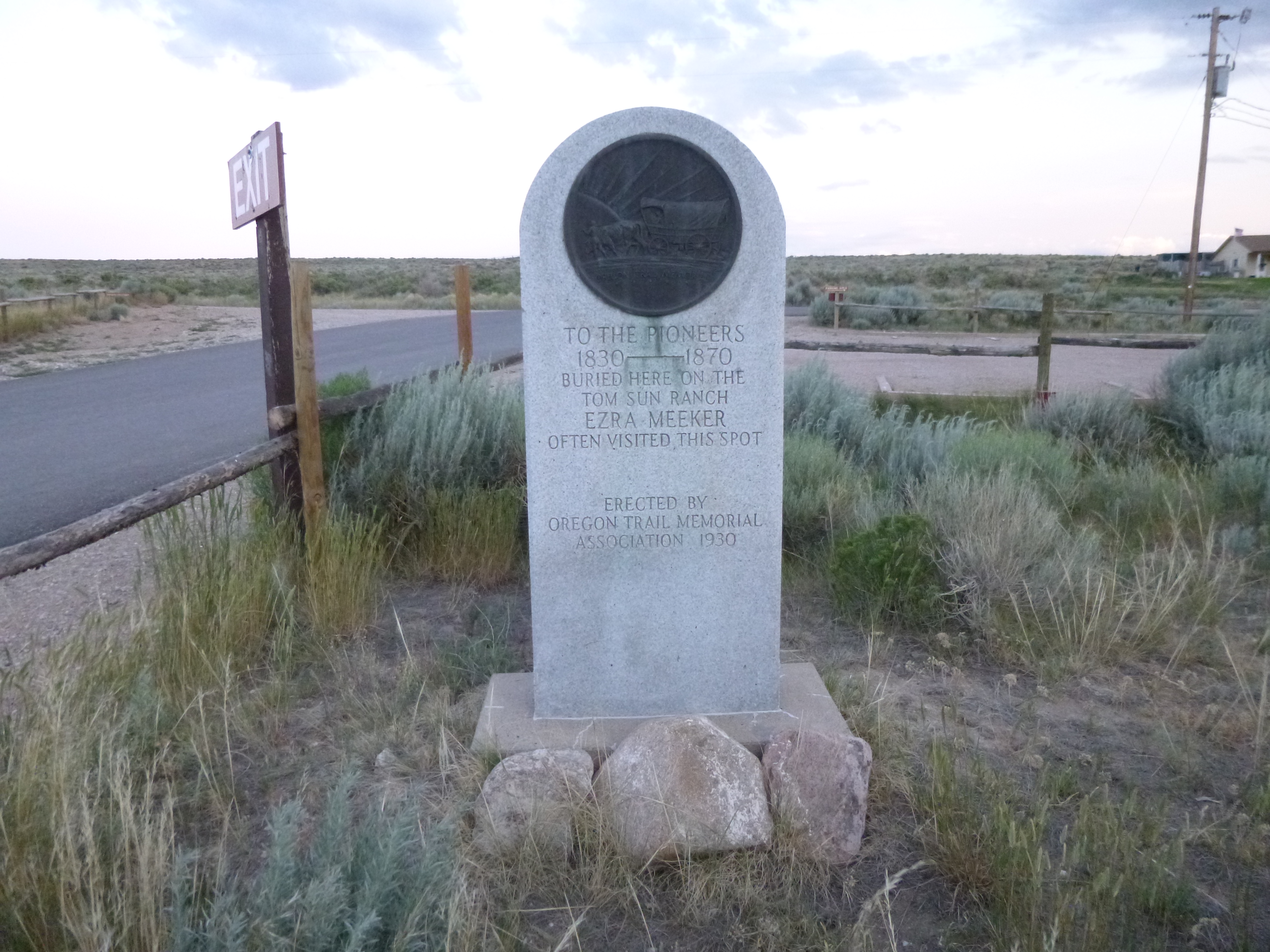
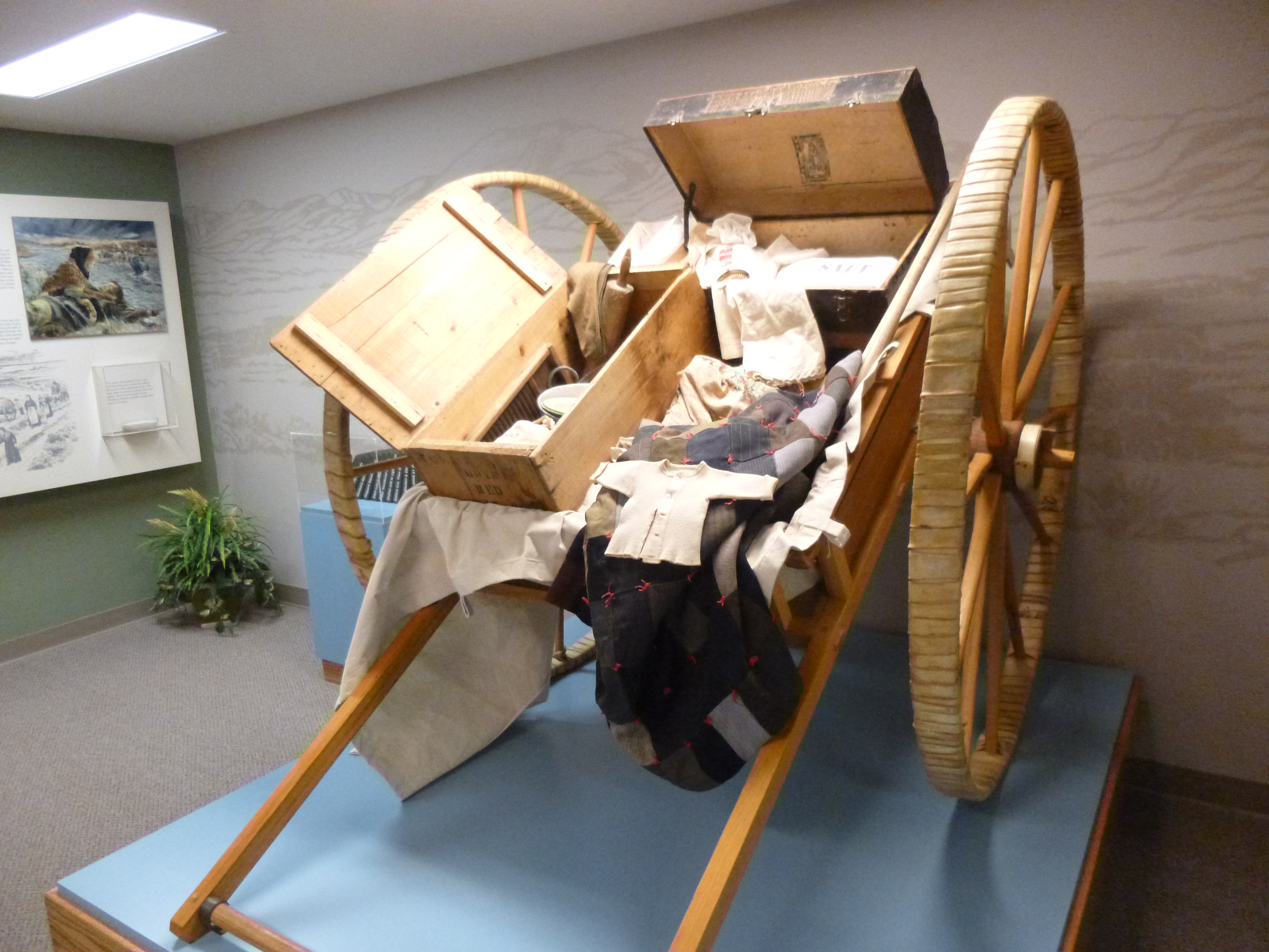
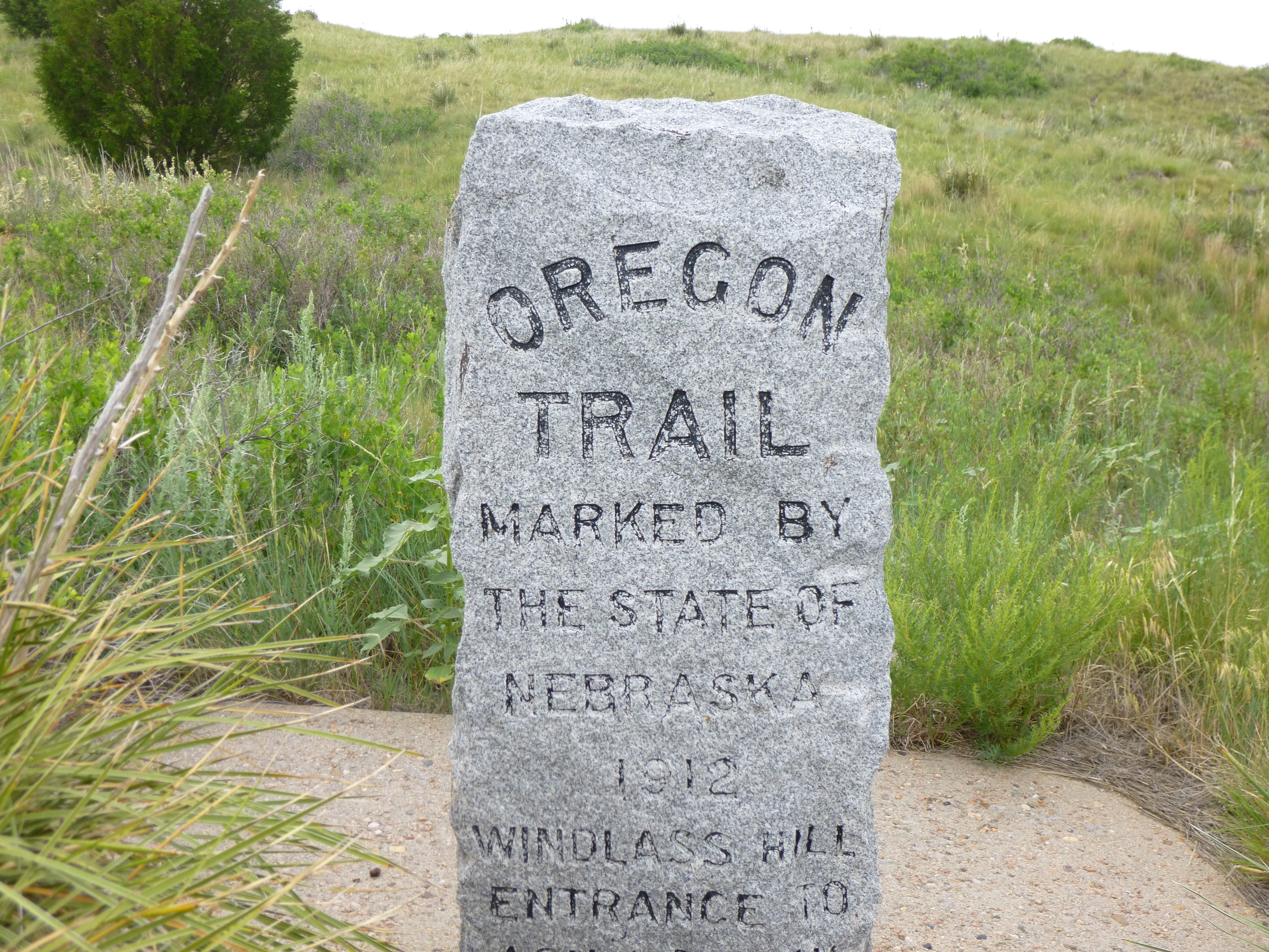
My little motel had been kind of hard to find last night in the dark and rain – it was up the side of a steep hill, and I passed the road I needed a couple times. But in doing so, I had seen a sign for the National Historic Trails Interpretive Center, so I knew I wanted to make a stop there this morning since I’m on an Oregon Trail kick. Tula and I got a couple miles of walking done around the center first, then I was able to use my national park pass here to save the entry fee. (I should have been keeping a list of all the entry fees I’ve saved because of that card!). It was a really good interpretive center, and was set up to show exhibits about all 4 trails west – the pioneer Oregon Trail, the California Gold Rush Trail, the Pony Express route and the Mormon Trail. All 4 trails converged near Casper, because it was the location of the last crossing of the North Platte River. More people drowned in treacherous river crossings than were killed in hostile attacks. There were some interactive displays, and I was able to climb into a covered wagon, where they showed a video in the front of a river crossing. To my surprise, the wagon started lurching as it entered the river, and with the sound effects, it kind of made it seem like we were indeed crossing a river. They also had a Mormon handcart that was set up in front of a conveyor belt-like track, and people could test their strength pulling it. There was a little meter next to it that indicated if you were pulling too slow to complete the journey, or if you were pulling at a reasonable pace, or if you were pulling too fast to sustain the pace week after week. The cart was heavy (since it was a sturdy wagon made of wood it was heavy even without supplies) and the needle on the meter for me hovered between too slow and adequate. In reality, I doubt I could pull the thing one mile, let alone halfway across the country! Fifteen miles a day would certainly be an accomplishment – and once again, I’m reminded what a physical toll these journeys took on the pioneers…and how comfortable and easy travel is today. I also got in a stagecoach where they showed another video out the side windows, again making it seem like we were on a stagecoach ride. There were a lot of exhibits and dioramas and another video about the trail history, and yet another account of the handcart people, and I’m so glad I stopped here. I ended up making today’s donation here, which will be used for educational purposes – they actually had 2 places to make donations, so I put my check and a note into the box, and the other place accepted coins and then people could write their names on a virtual brick on their virtual brick wall – so I put 56 cents in and did that too! With all the Oregon Trail history I’ve been soaking up (starting way back in Nauvoo IL at the start of one of the Mormon Trails) it was a good donation to make as I begin to move away from the trails a bit.
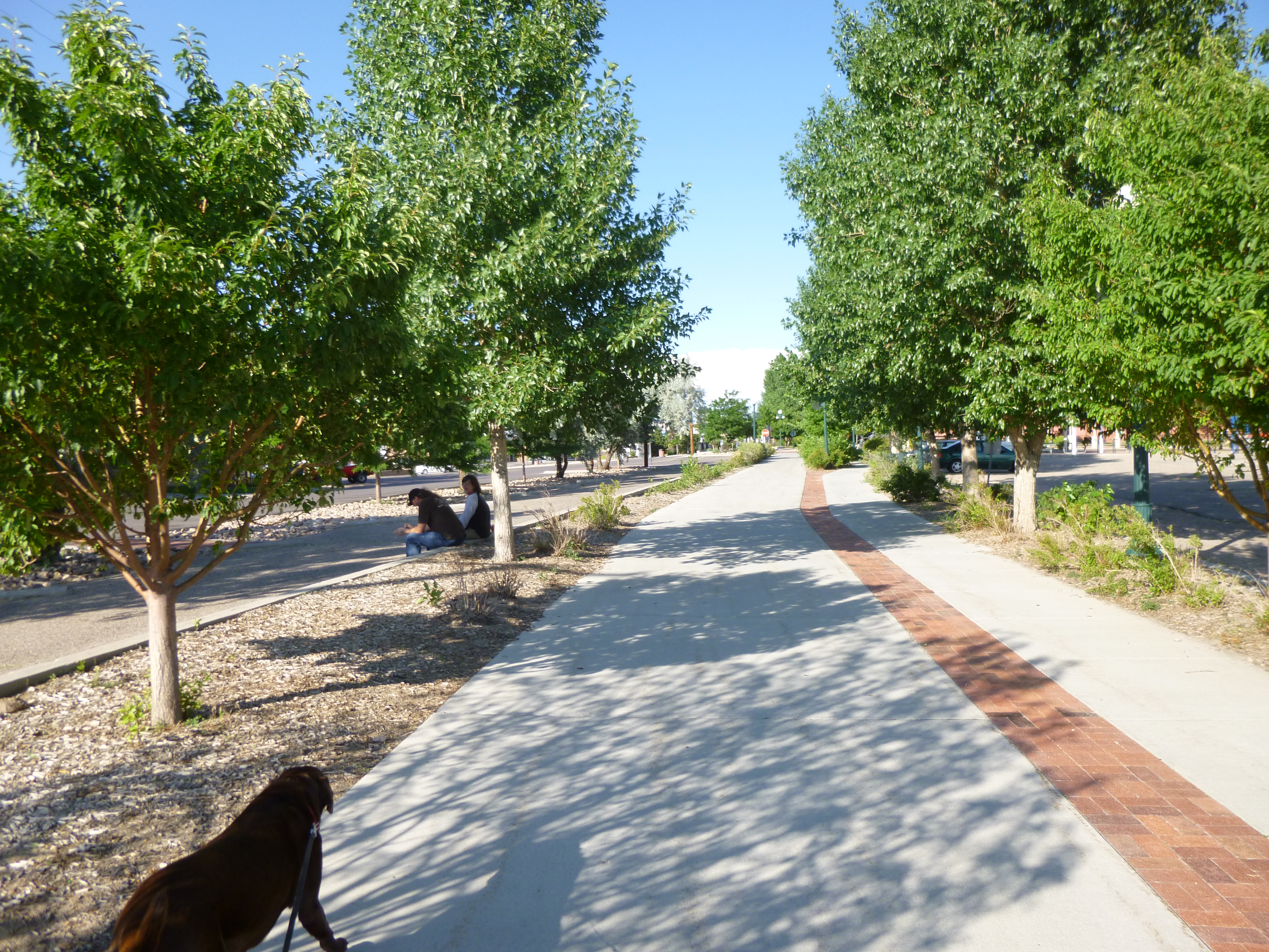
Then it was time for more walking. Tula and I got out on one of the bike trails by the river and walked a couple miles. It was a pretty warm day and there was no shade on this trail, so after 2 miles I put her back in the car and got my hat and walked 2 1/2 more miles in the other direction. I passed one of the preserved old-style wooden oil rigs – technology has come so far! There were quite a few people floating down the river on big inner tubes, or canoeing and kayaking. As I was walking back, I saw a bunch of EMS people on the other side of the river, and word was that someone had suffered a seizure while out on the river. Then we went to downtown Casper and walked around a bit – there had apparently been a sidewalk chalk contest as a part of the upcoming fair/rodeo festivities, so that gave us more to look at. Some drawings were just fun child drawings, but some were pretty complex and creative, especially since the kids were using chalk on rough sidewalk! They seemed to have a lot of movie theatres in town. I was happy to see that the fair was open, so I headed to the fairgrounds, but in walking around I discovered only the midway was open with all the rides, and the grandstand was open for a demolition derby. None of the animal buildings or exhibit buildings were open, and those are what I wanted to see. Those wouldn’t open til the following week. So I didn’t stay very long – just enough to soak up a little fair atmosphere in the grandstand crowds and carnival rides.
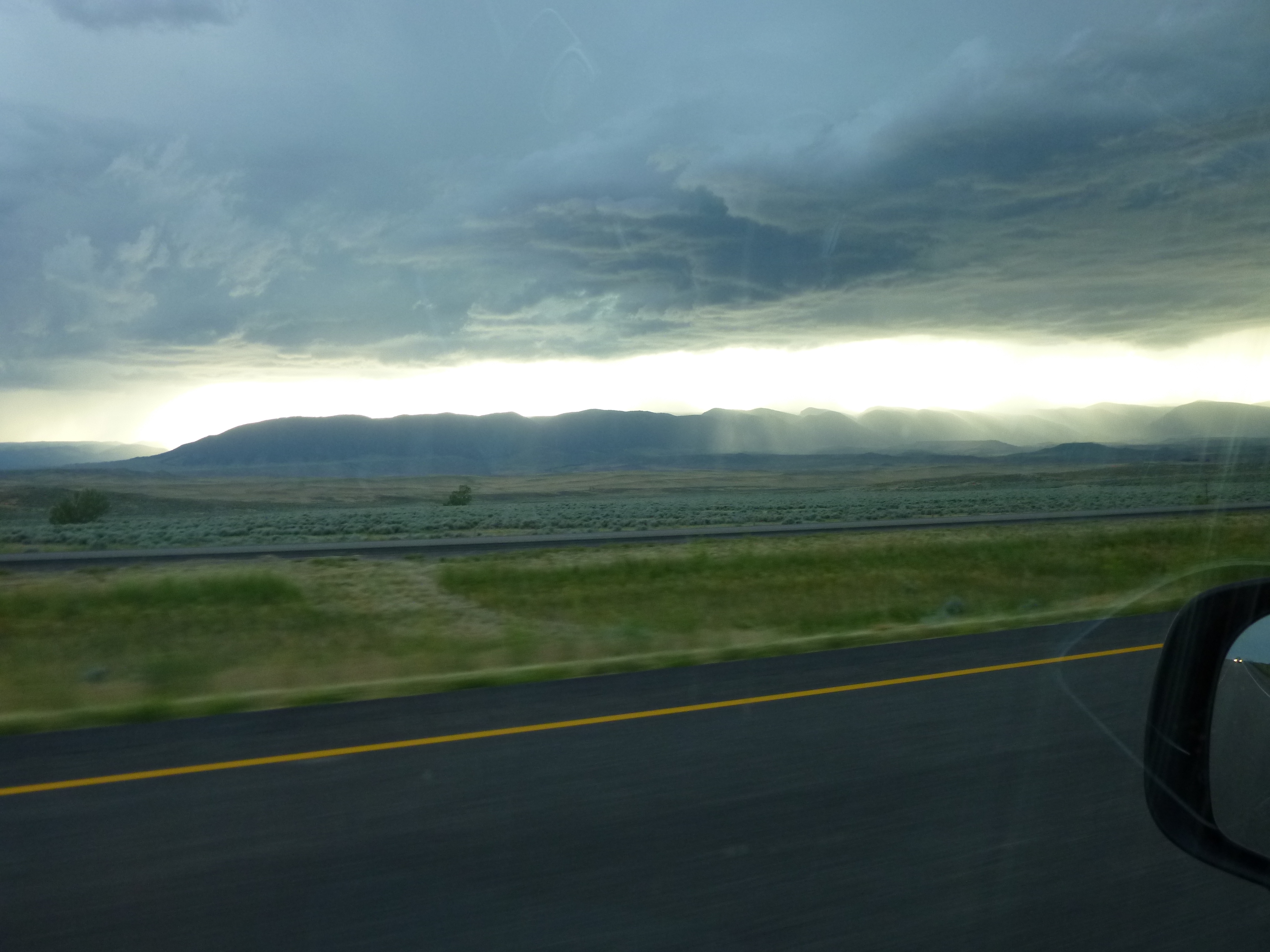
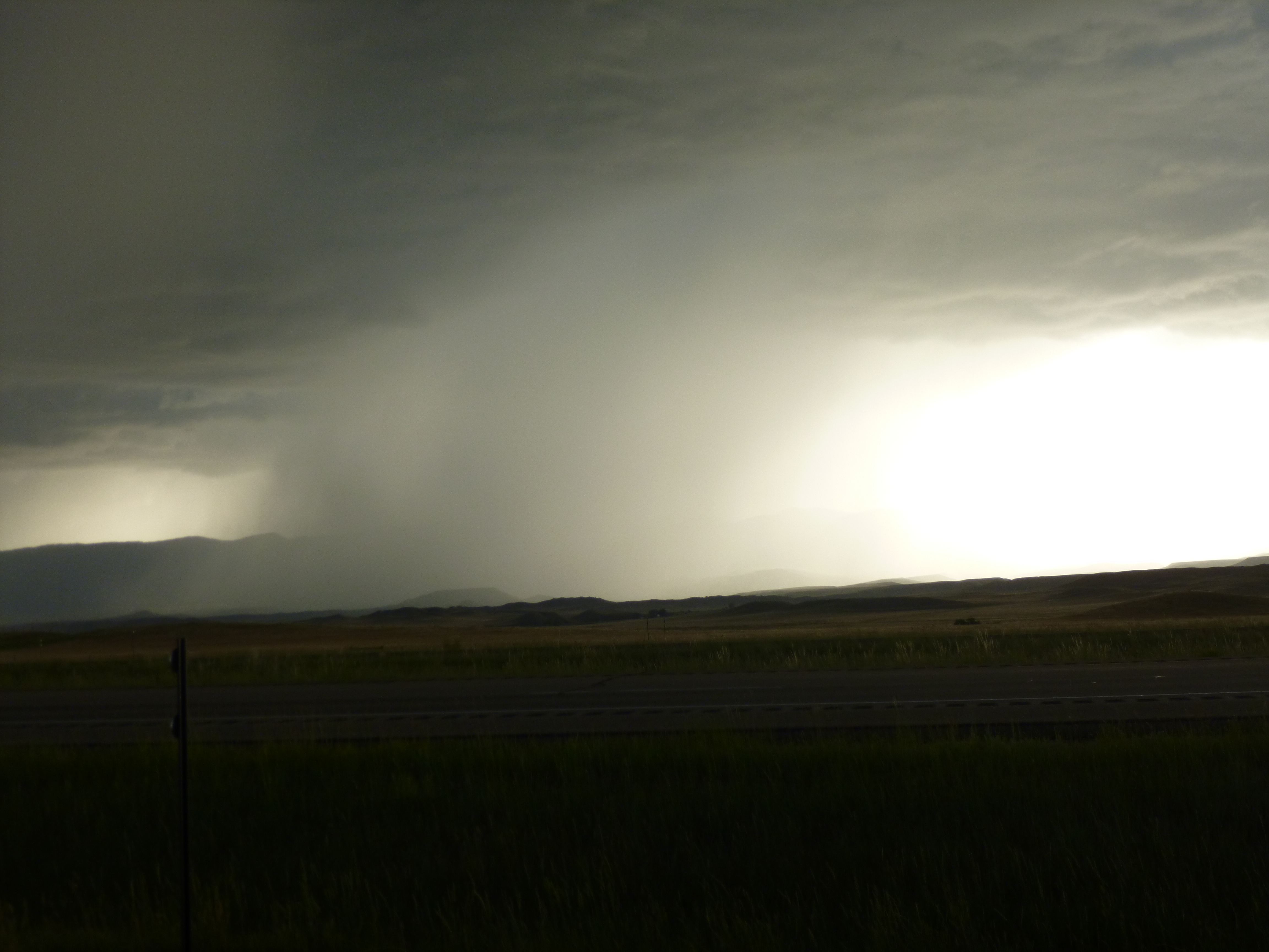
By now it was early evening, but my walking was done for the day, and I headed north to Buffalo, through more open and empty land. With such a wide open view, I could watch heavy rainstorms making their way toward me, although I avoided most of them as I was heading north. It made for some dramatic skies though. I had managed to reserve a campsite in Buffalo this morning for $10 at a motel/campground combination place, and while it was kind of small and crowded, I stayed on the end of a row in the shade, and was happy to have found such a cheap place to stay on a holiday weekend in the middle of summer!


Wyoming – Friday, July 5
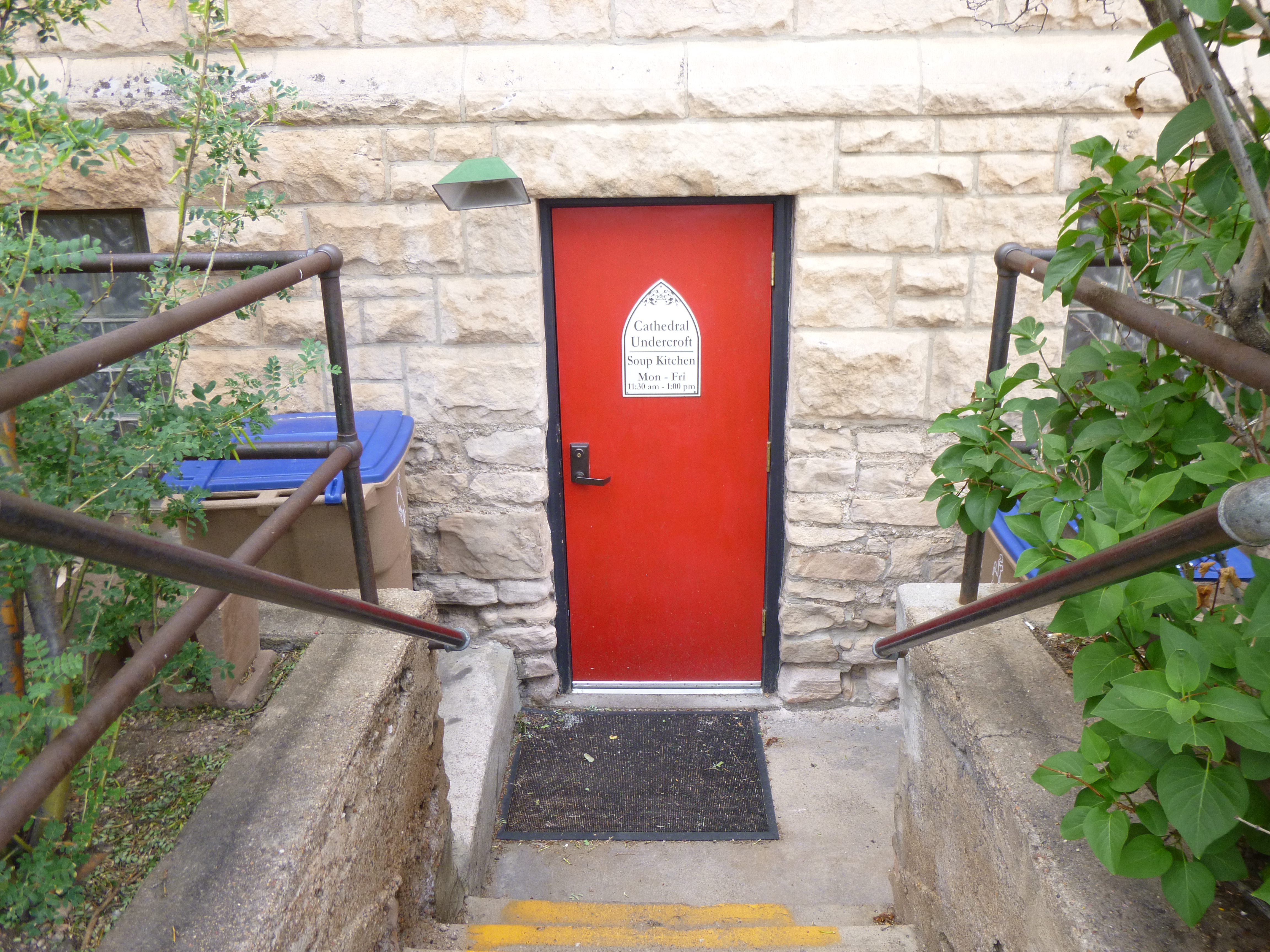
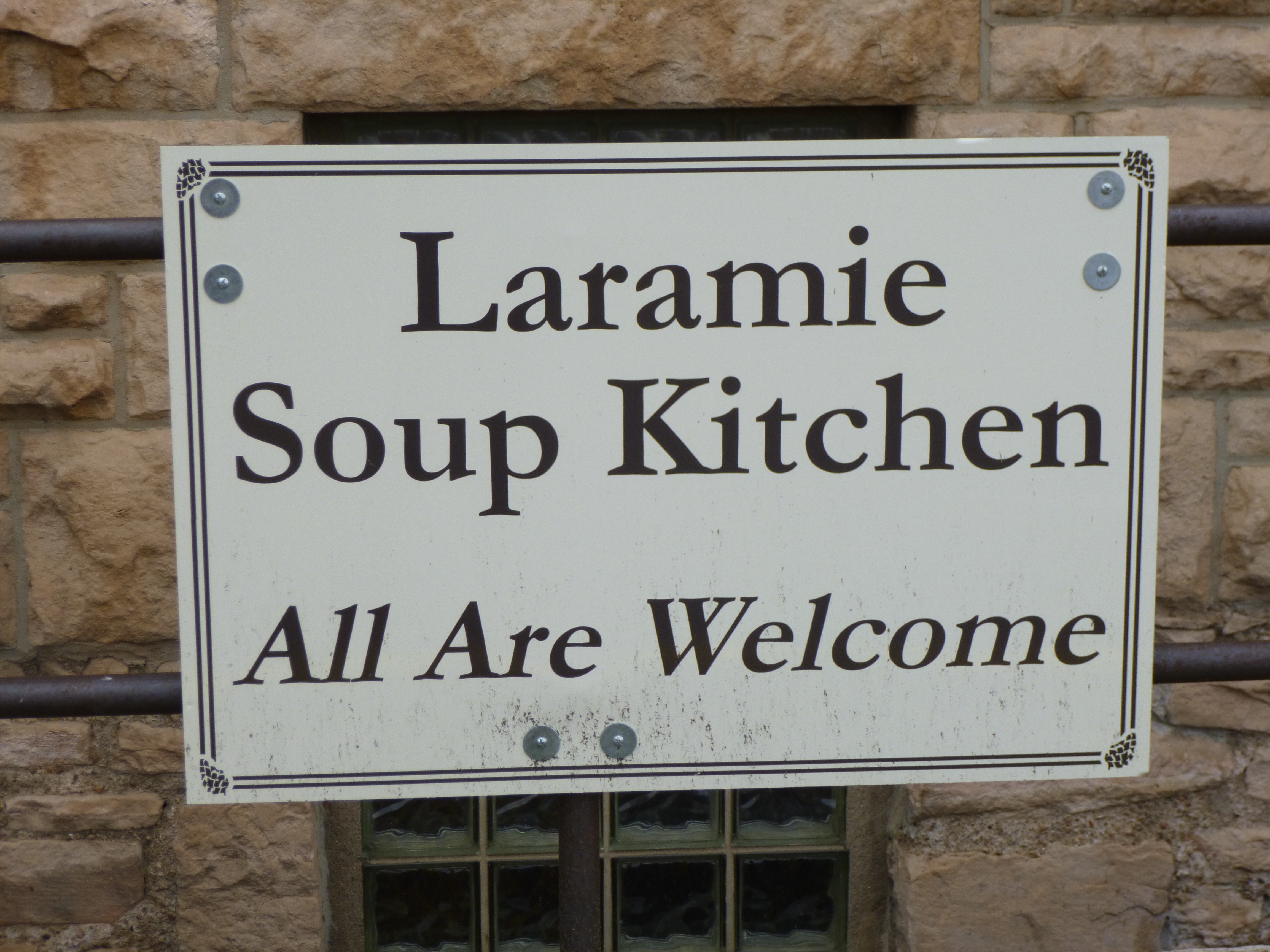
Tula and I started our day with a nearly 2 mile walk in the park where the festival was yesterday. It’s a big park, and it was totally different from yesterday! It was quiet, with just a few people out walking. Then I went shopping for the Laramie Soup Kitchen. I had called to make sure their wish list was up-to-date, and the lady told me it was, so I ended up getting coffee and tea, Kool-Aid and lemonade mix, flour, sugar and vegetable oil, butter and cheese slices, spaghetti sauce and salad dressing. I had a little trouble finding the soup kitchen, but found that it was in the basement of a local church, and the soup kitchen has its own entrance with a bright red door. This soup kitchen has been feeding people for 30 years, and it continues to grow. They provide lunch Monday through Friday, and a couple volunteers were finishing the clean-up from today’s lunch. She told me they usually feed between 60-80 people a day, and it can be a challenge knowing how much food to fix!
I eventually wanted to end up in Casper tonight, and I had to decide between taking a shorter route on smaller roads, or a scenic route which was partly on the highway. Because the weather was a little questionable, I figured I’d stick to the scenic highway route, and drive the extra miles. So I headed west into some wide open, kind of desolate land. There weren’t really any towns around – just wide open space. And out in the middle of nowhere was a big oil processing plant which looked really out of place. I took a short break at the Wagonhound Rest Stop, and I think everyone else on the road stopped there too! The winds were blowing like crazy over all the open space, but an informational sign said that was typical. There were a couple picnic tables, but they each had their own shelters around them due to the non-stop winds. I also saw a lot of big, heavy-duty snow fences – I’m guessing they help keep some of the blowing snow off the highway. There were also some really old tepee rings made of stone – it sounded like earlier Indians used stones to anchor down the tepee sides, and it’s one of the more common archeological finds because they’re found in a lot of different places.
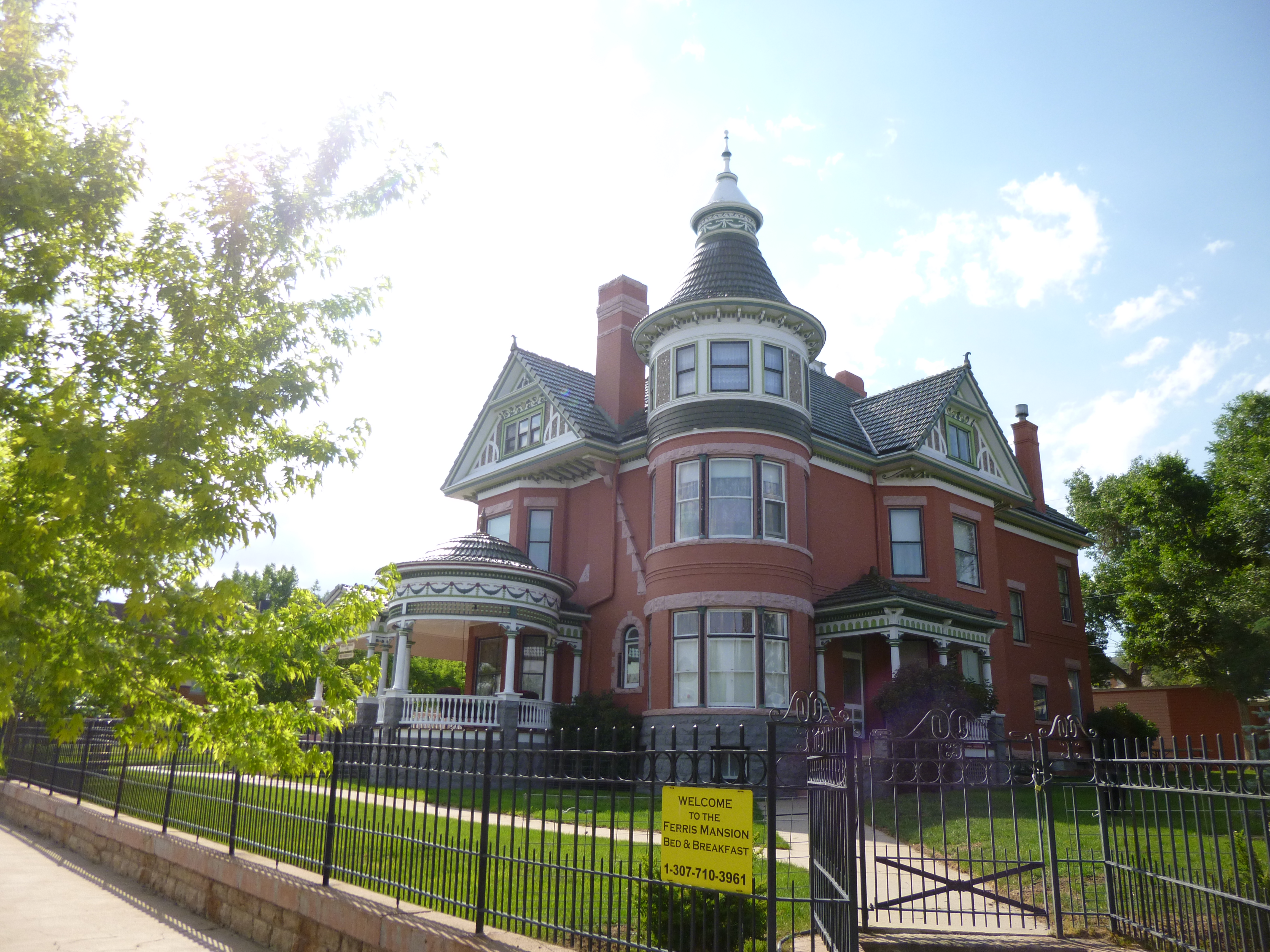
After a while I got to the town of Rawlins, and it was time for some more walking. Nothing really stood out in this town – it was just one of those places to get out and do some walking because it was the only place to do so! There were a couple of big old mansions which were now Bed and Breskfast Inns, and Rawlins was also the home of the Wyoming State Penitentiary – right near one of the big mansions! After a couple miles, I put Tula back in the car, and I wanted to walk a bit more, and then Toni called, so I covered more ground than I expected while talking with her, even if I walked on some of the same streets more than once. At this point I was up to 6.7 miles for the day, and since I still had quite a distance to cover before getting to Casper, I figured I would use the miles I walked when I first crossed into Wyoming to get me up to 8 for the day.
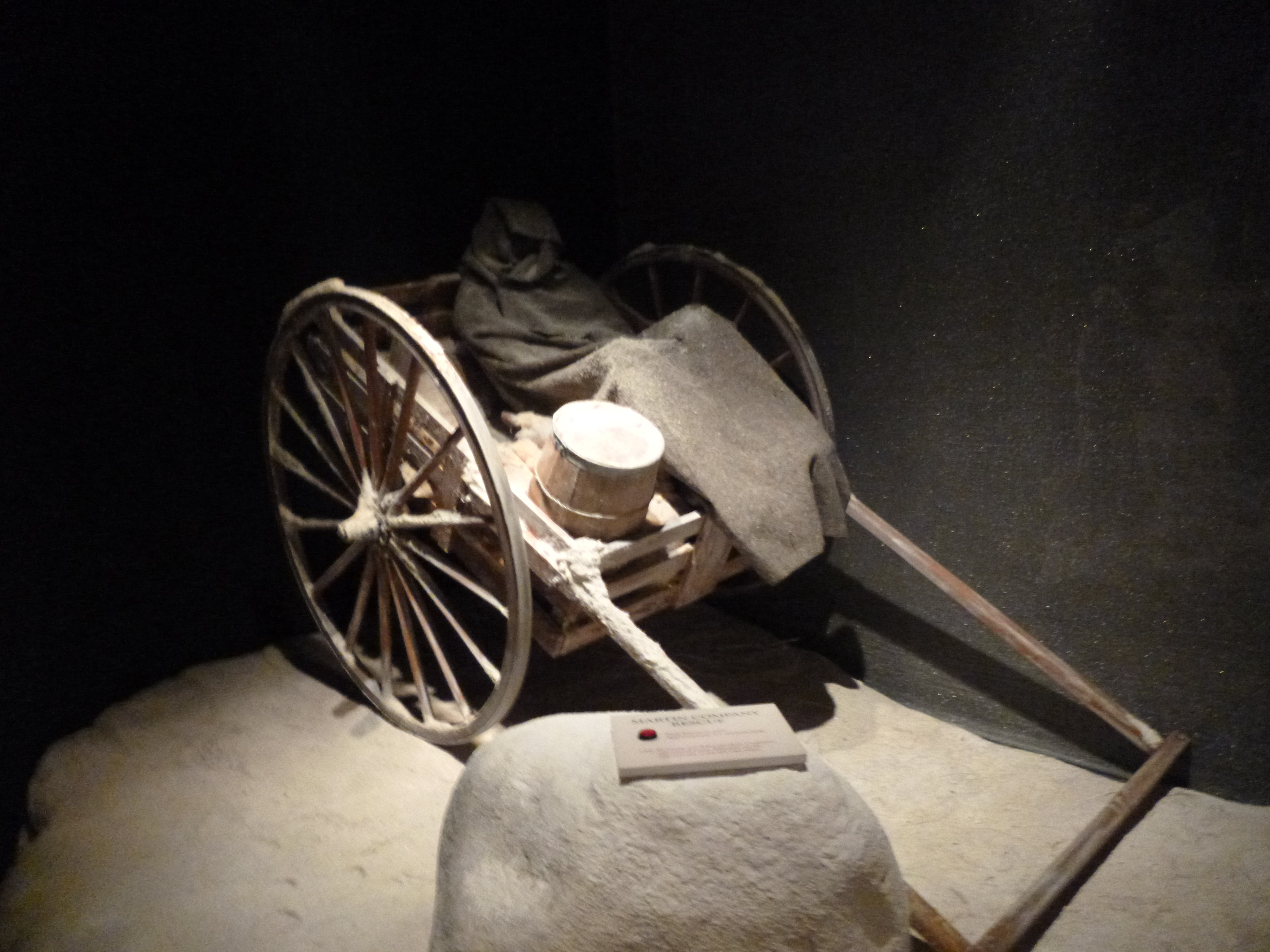
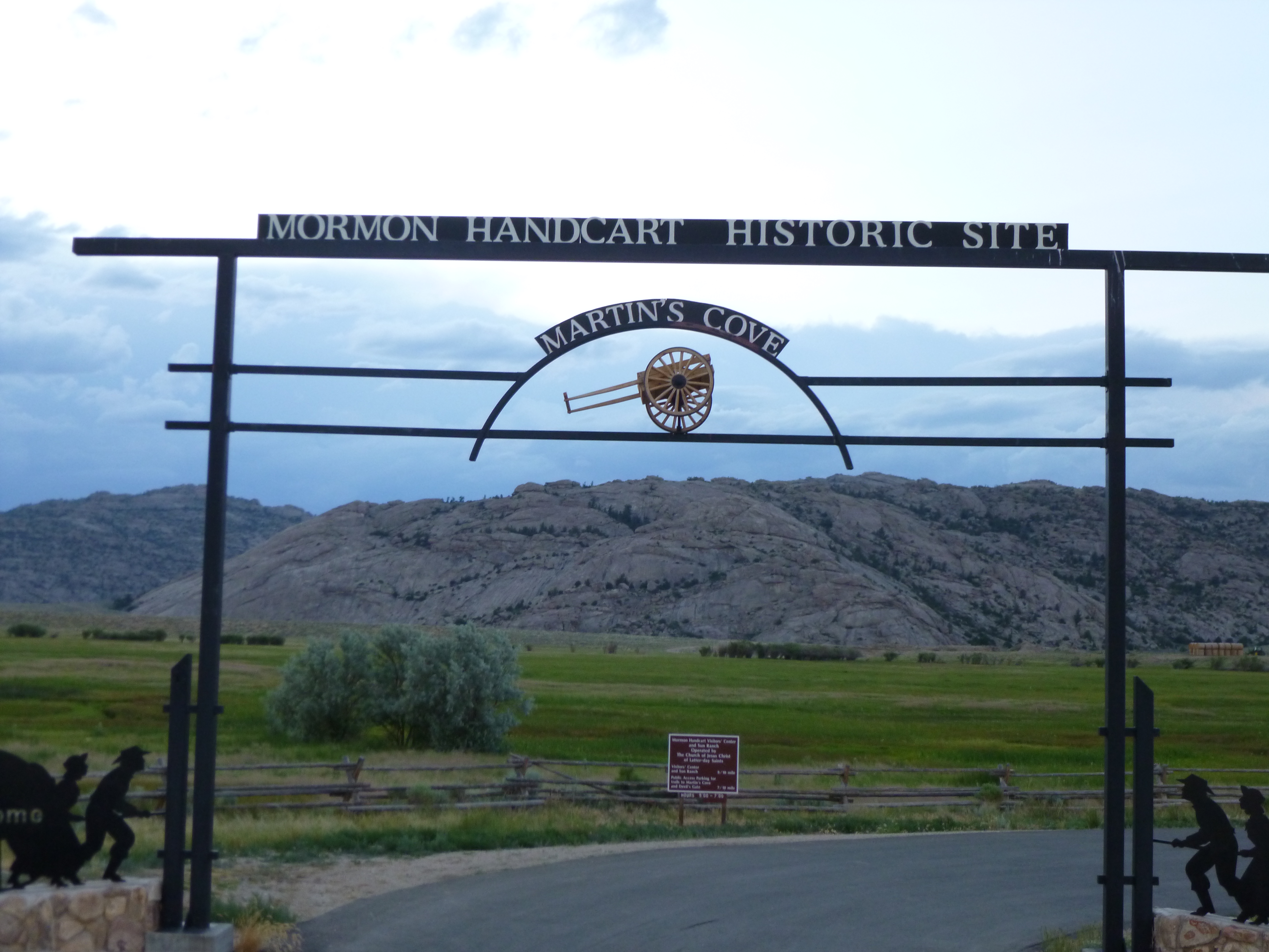
So I started heading north to Casper, through more really isolated land. I had about 100 miles to go, and it’s kind of strange to drive that far without seeing much of anything, and there was hardly any traffic. It was beginning to get dark by the time I’d driven about 3/4 of the way, and all of a sudden I saw some buildings and cabins, and a sign that said something about Mormon Handcart people. Since the gate was open, I pulled in to see what I could see. The visitor center was closed of course, but I was very curious about the place – I had never heard of Mormon Handcart people. As I was looking at some pioneer gravestones that were fenced off, a couple with name tags pulled up in a van, and I explained I was just stopping by, and hoped that it wasn’t too late or anything, but I’d been following the Oregon Trail here and there, and I didn’t know anything about handcart people. It turned out they ran the place, and they offered to open up the museum for me! It was 8:30 at night, and I said they didn’t need to do that. But they said that’s what they were there for, and it was fascinating! It turned out most of the Mormon Handcart people were very poor people from Europe, who couldn’t afford to outfit themselves with a wagon and oxen. They had learned from missionaries in Europe that many Mormon people were heading to Zion (Salt Lake City) and they had been encouraged to make the trek as a chance to start over with a better life. Once they made it to Zion, there would be people there to help them and look after them while they got on their feet and found jobs and all. So they came in groups of roughly 500 and had passage in ships across the Atlantic and then a train to St. Joseph MO (I think that was their starting city). From there each family received a wooden cart that they had to pull themselves, and the groups usually set off by April or May, so they would be settled in Utah before the snow. The men pulled the carts with food and supplies, and the women carried 17# packs (they had to cut their personal belongings down to only 17#) and the children also walked. But the end of the Crimean War affected the travels of 2 groups, and because England’s ships had been tied up with the war, the 2 groups got a very late start, and against better advice, they started their trek in August, but were getting within a few hundred miles of Salt Lake City when there was an unusual warm spike in the weather, so they tossed out heavy blankets and things to lighten their loads to quickly finish the trip, and a few days later got caught in a blizzard, surrounded by snow and wind. They couldn’t go any further. Brigham Young eventually heard of their plight, and assembled rescue parties, but they were farther away than anyone realized – a few hundred miles on horseback is no easy journey. A lot of people died,but a surprising number of them survived – given the conditions, one would have thought the ratio of survivors vs those who died would have been reversed. When they got supplies, they moved to this very spot in Wyoming where I was (Martin’s Cove) because there was a great bluff to shelter them from the never-ending wind until they could finish their journey. And most of these 2 groups eventually did make it to Zion. In all, there were thousands of handcart people who followed the Mormon trail west, and I’d never heard of them before, so it was a fascinating piece of Oregon Trail history to add in. The lady who took me through the museum did a wonderful job of explaining all the exhibits to me, and I never would have expected a personal tour of such an interesting place when I pulled in! The Mormon church bought all the surrounding land from a hunter/trapper (and a room of the museum is dedicated to him) to preserve the memories of the handcart people, and also to serve as a site where thousands of young Mormon “trekkies” come to spend a few days in the shelter of the bluff and to reflect on their ancestors and church. They can only bring 17# worth of personal belongings, and the lady said they were expecting 3400 trekkies next week, and often see 22,000 in a summer – staggering numbers! I’m pretty sure non-Mormon people can take a trek too. I offered to make a donation to the museum, but they cannot accept donations, so she gave me a Mormon book and sent me on my way. I had a lot of new history to think about as I finished my drive to Casper in the dark!


Wyoming – Thursday, July 4
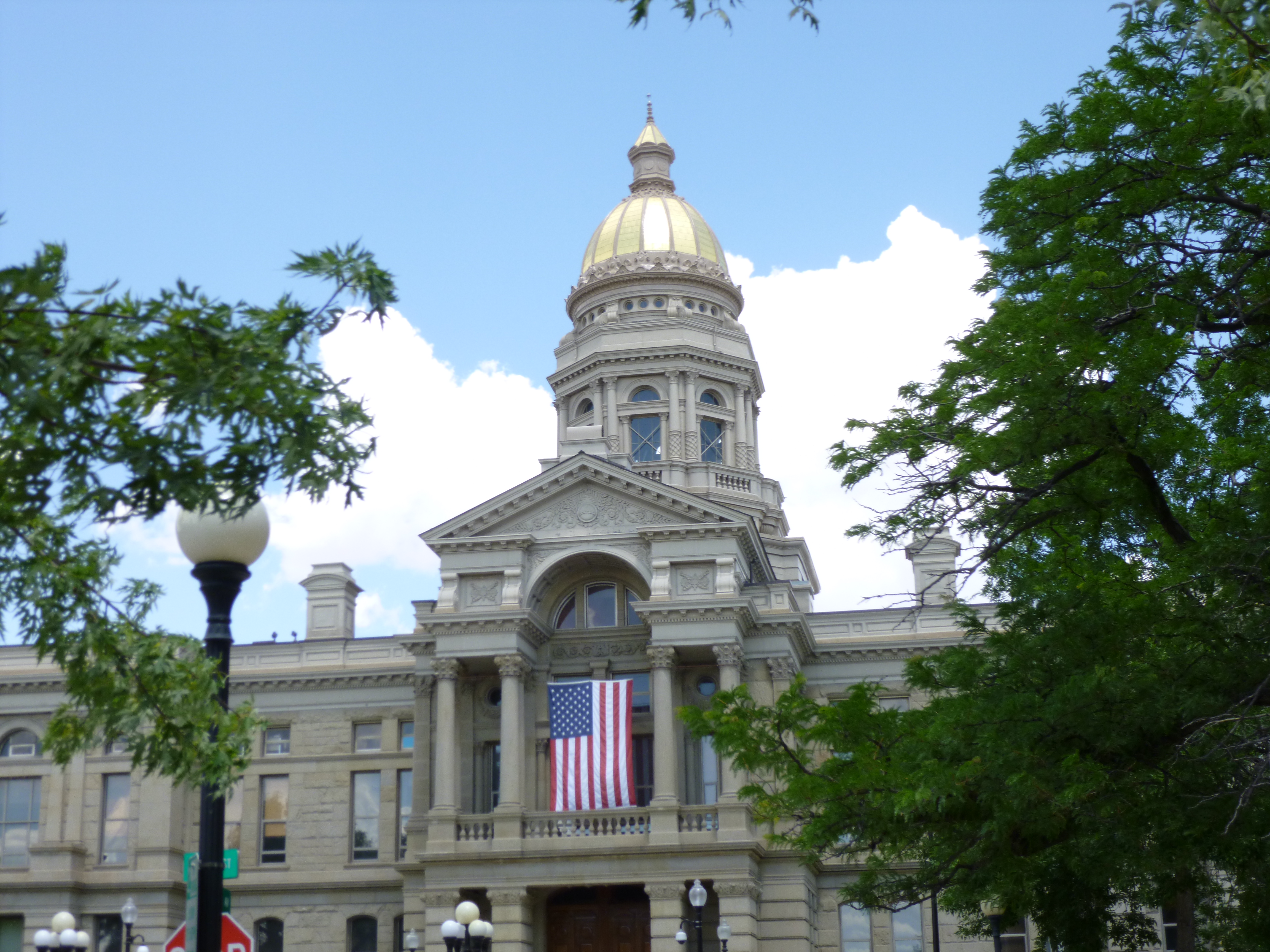
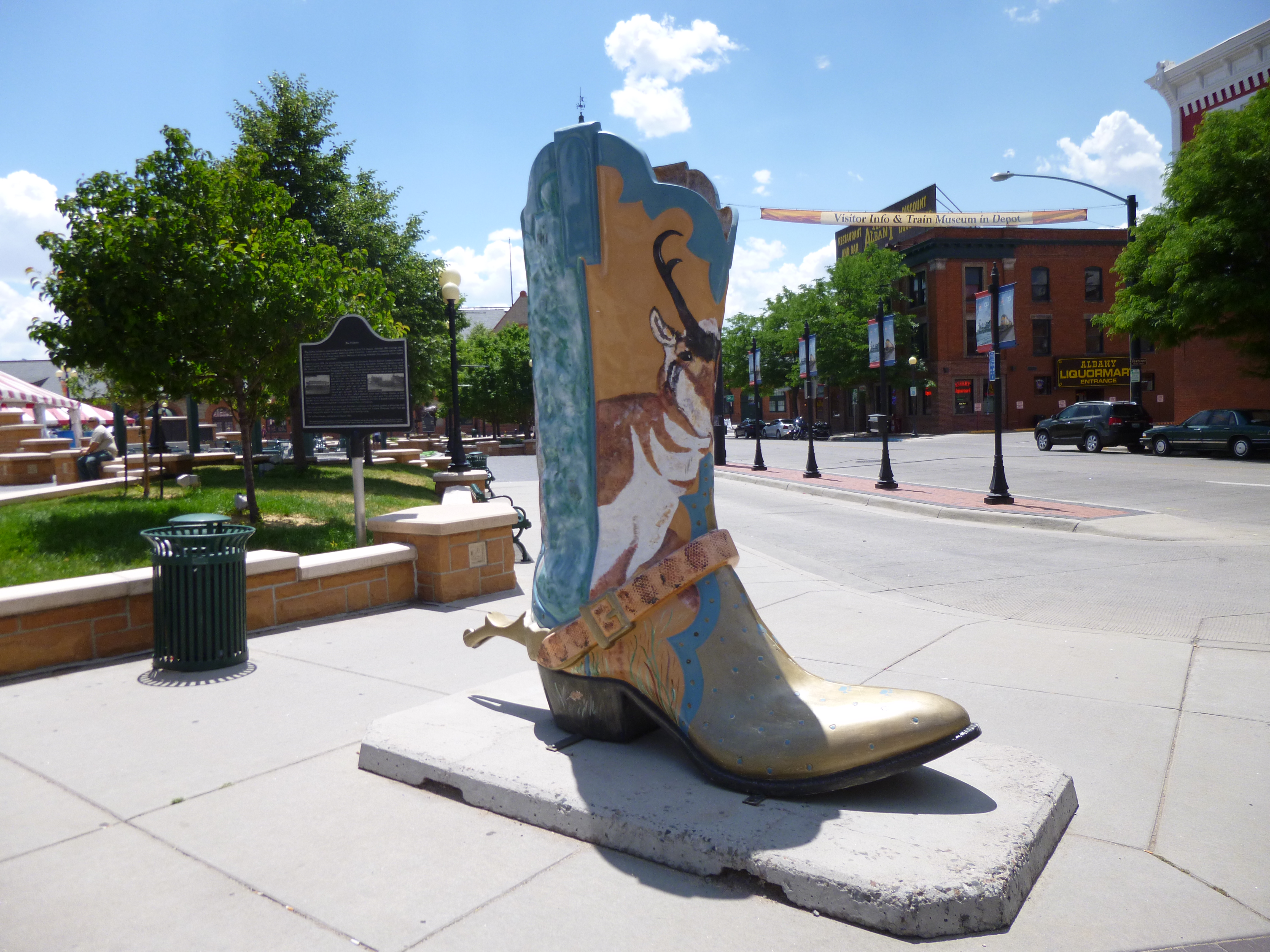
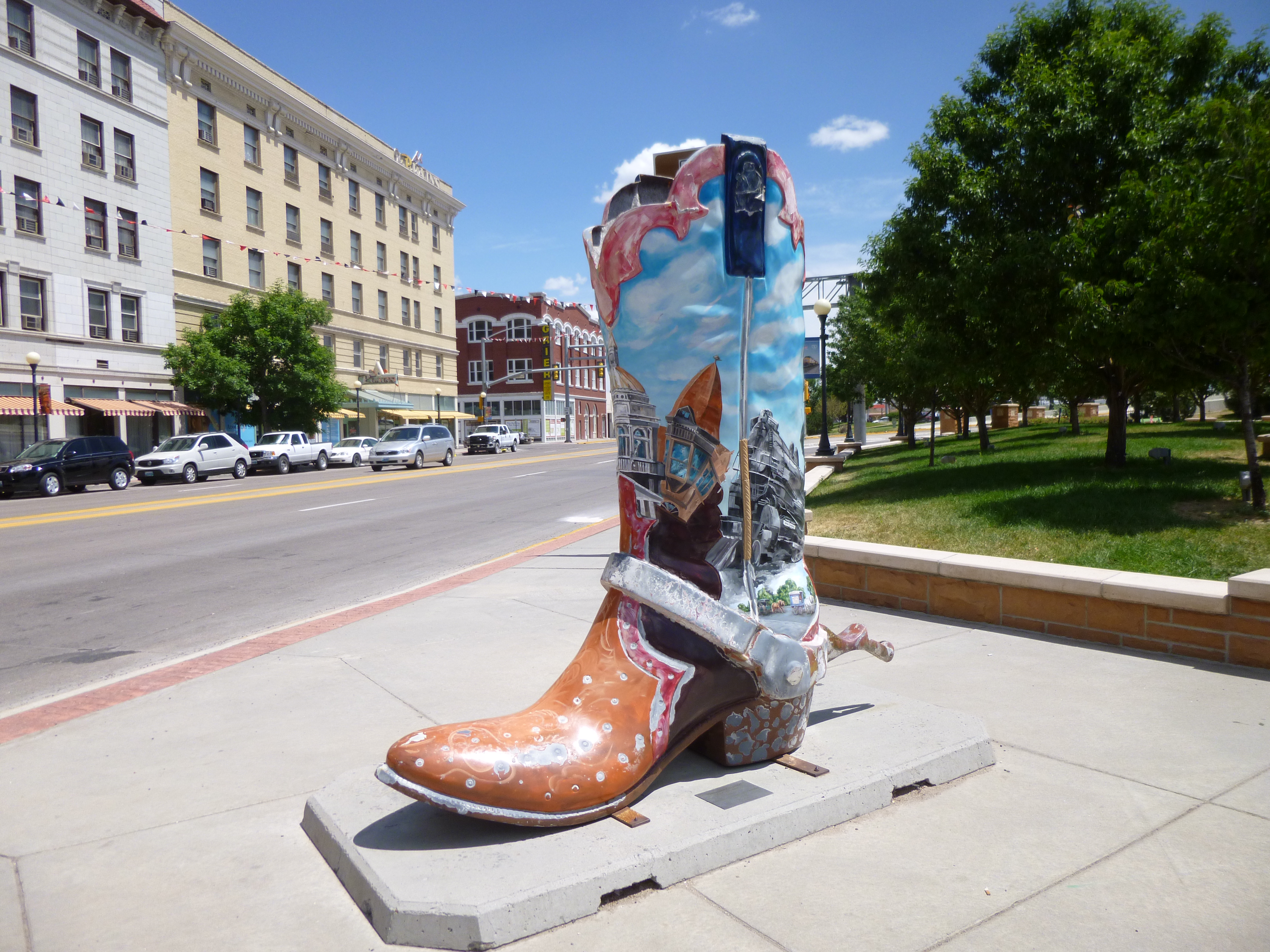
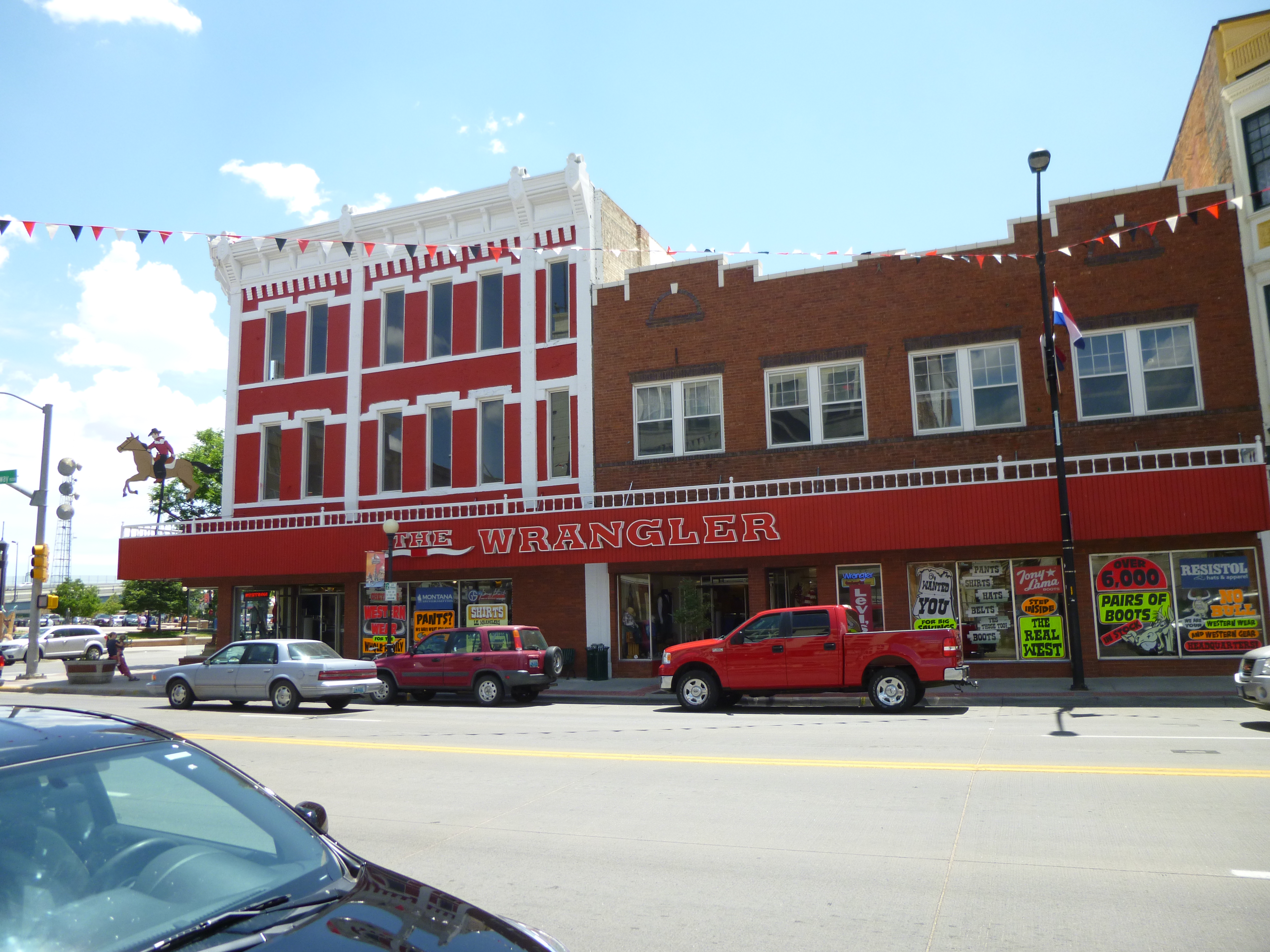
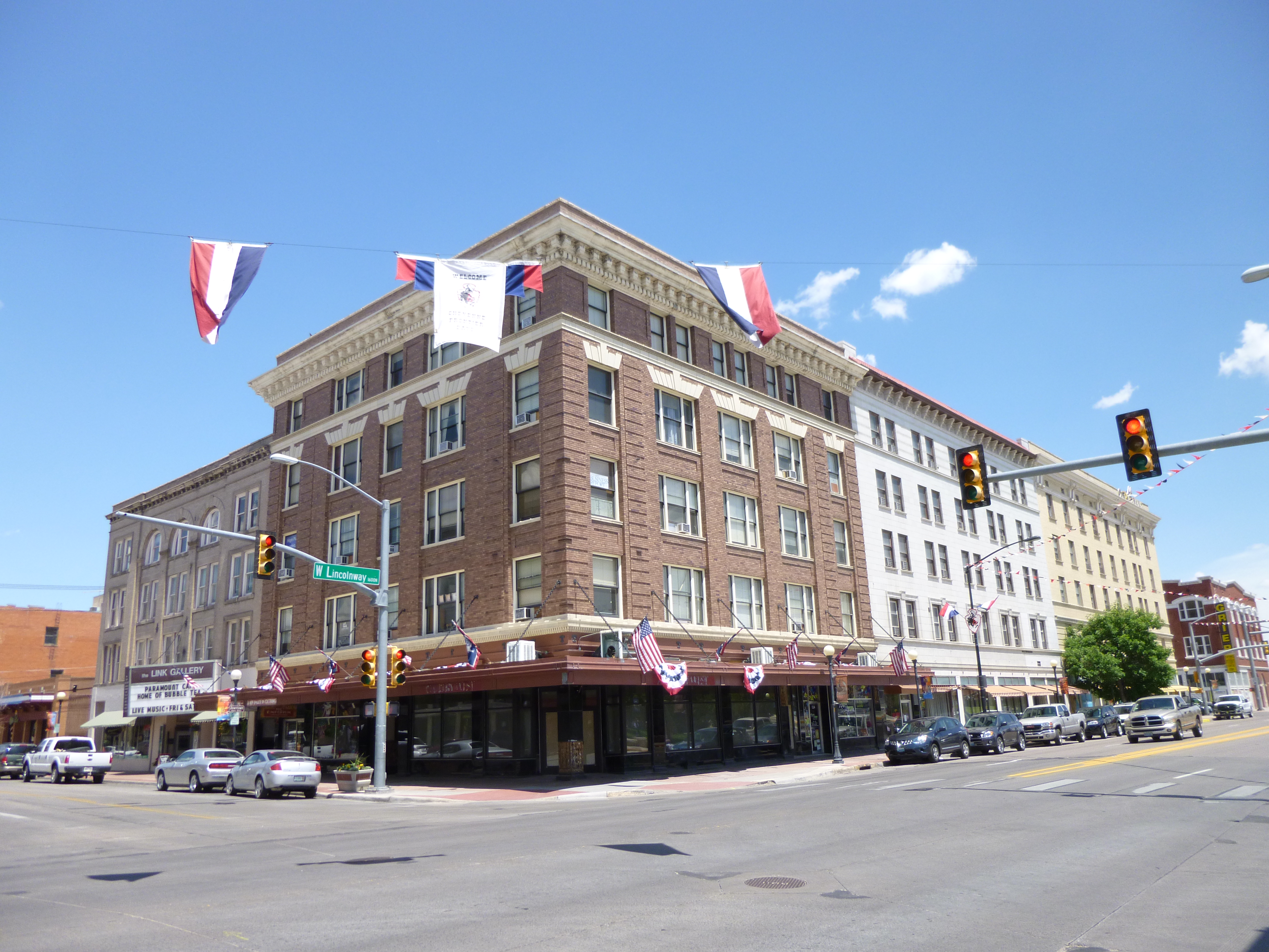
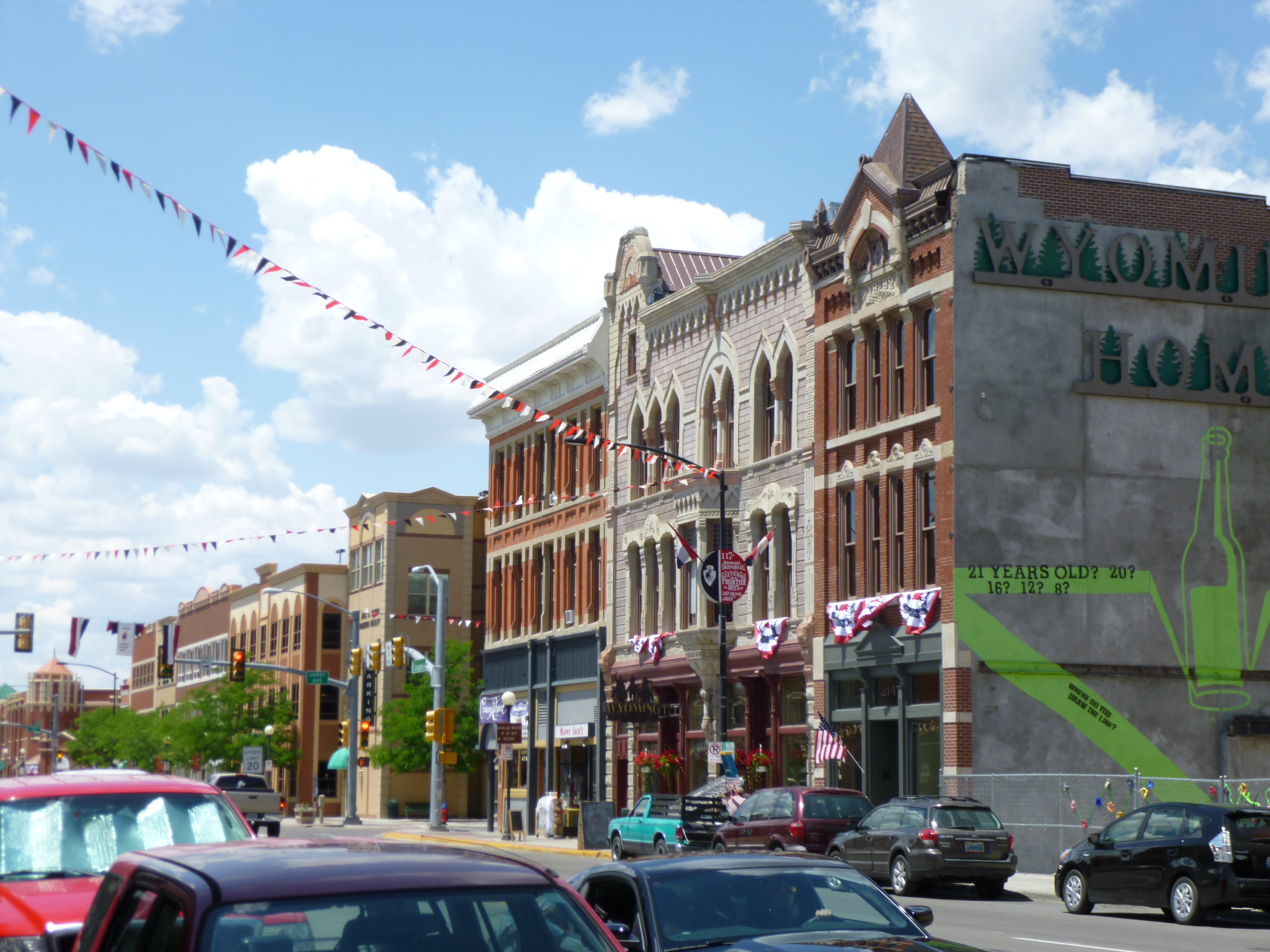
Since we ended up in Cheyenne last night, that’s where we started our walking for the day. Cheyenne is the capital of Wyoming, and we walked 2 1/2 miles all around the Capitol area admiring the buildings and statues – the Capitol Complex is a little ways away from the downtown area, so we also walked through some neighborhoods. Then Tula waited in the car while I walked another mile and a half downtown. There’s definitely a western feel to the town – big brick hotels and buildings that were built in the 1880s and 1890s, and shops advertising western wear and cowboy boots and all. There’s over-sized cowboy boot sculptures throughout town that are elaborately painted. And it sounded like some sort of religious event was going on in front of the train station.
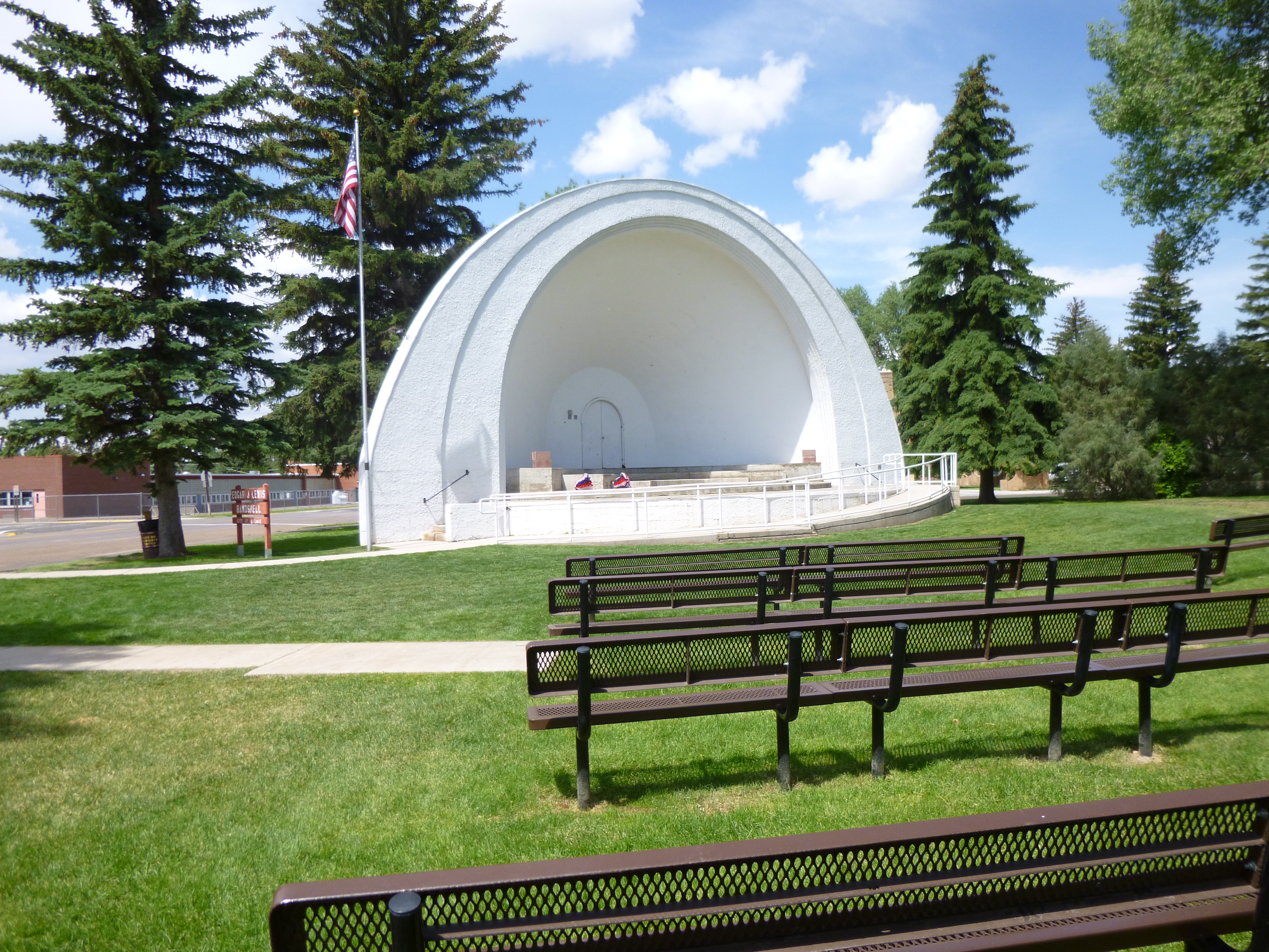
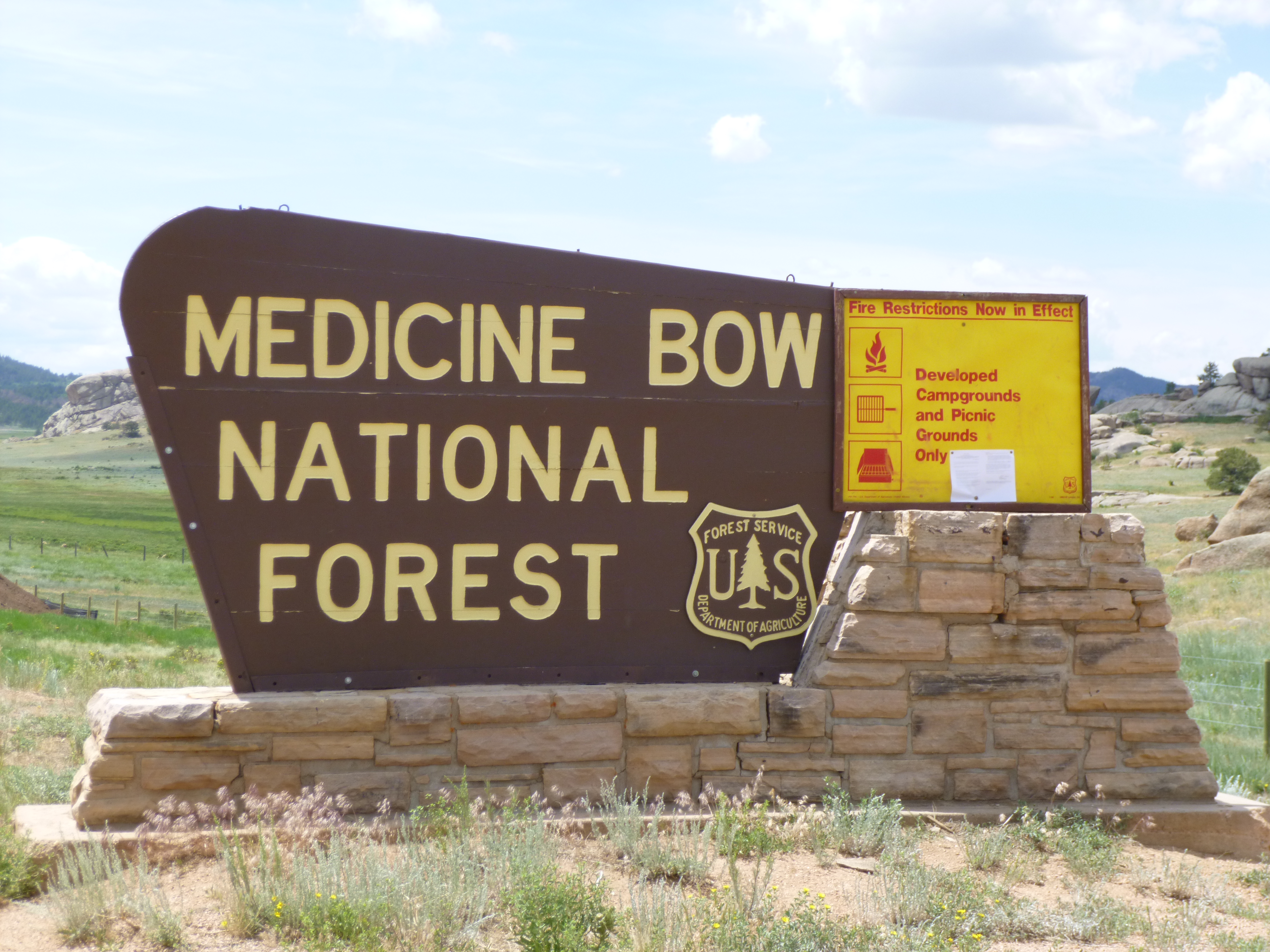
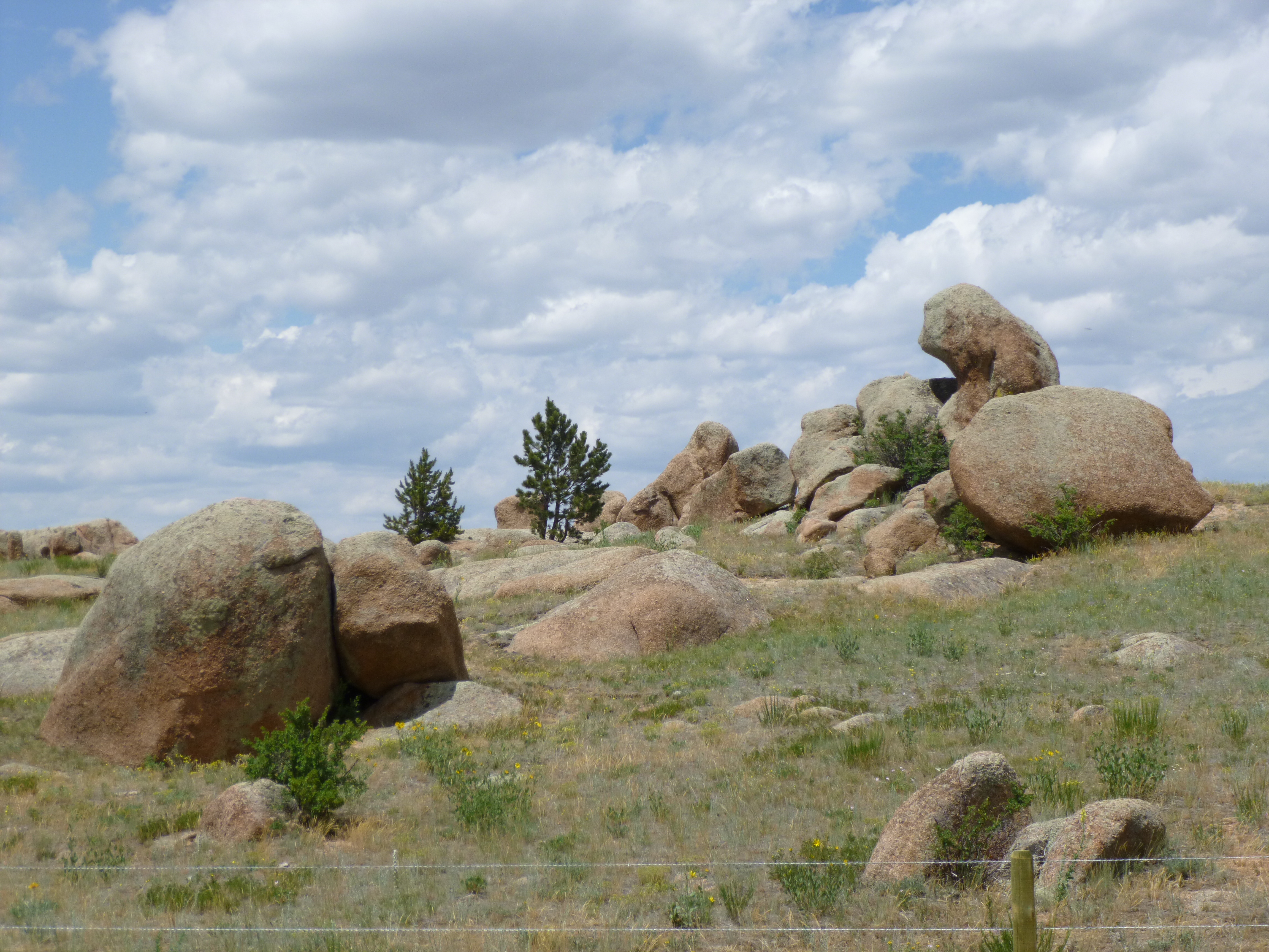
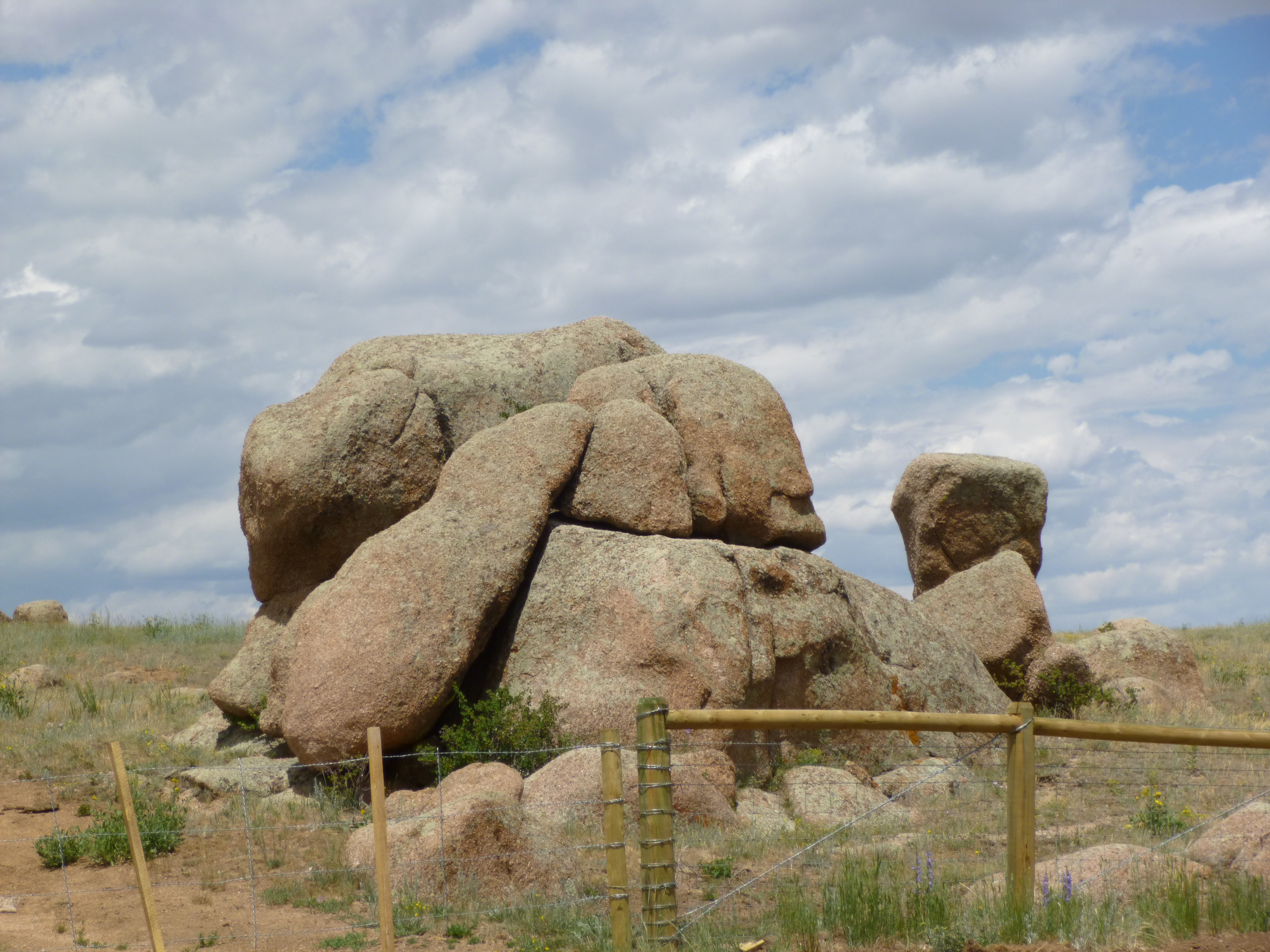
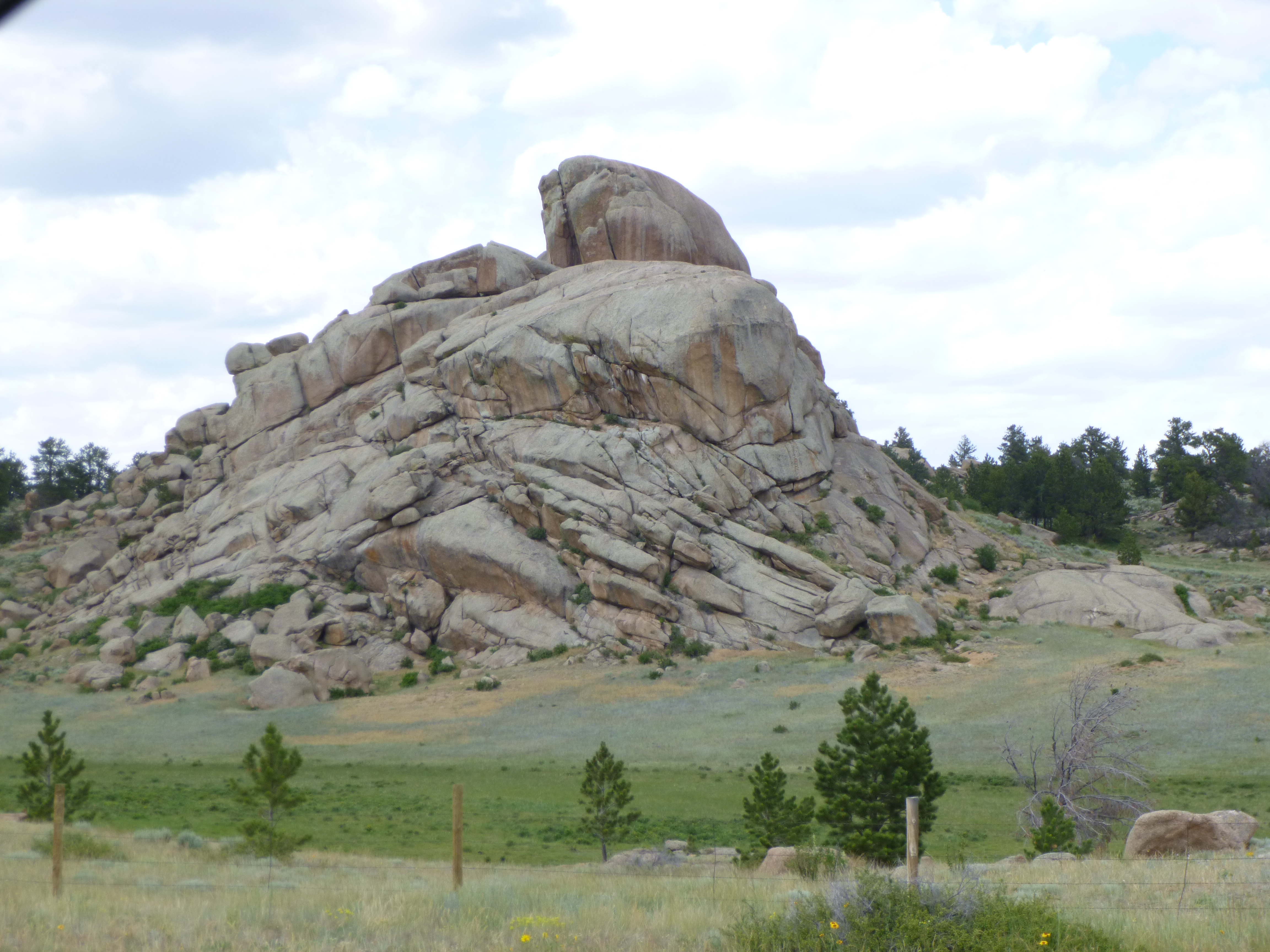
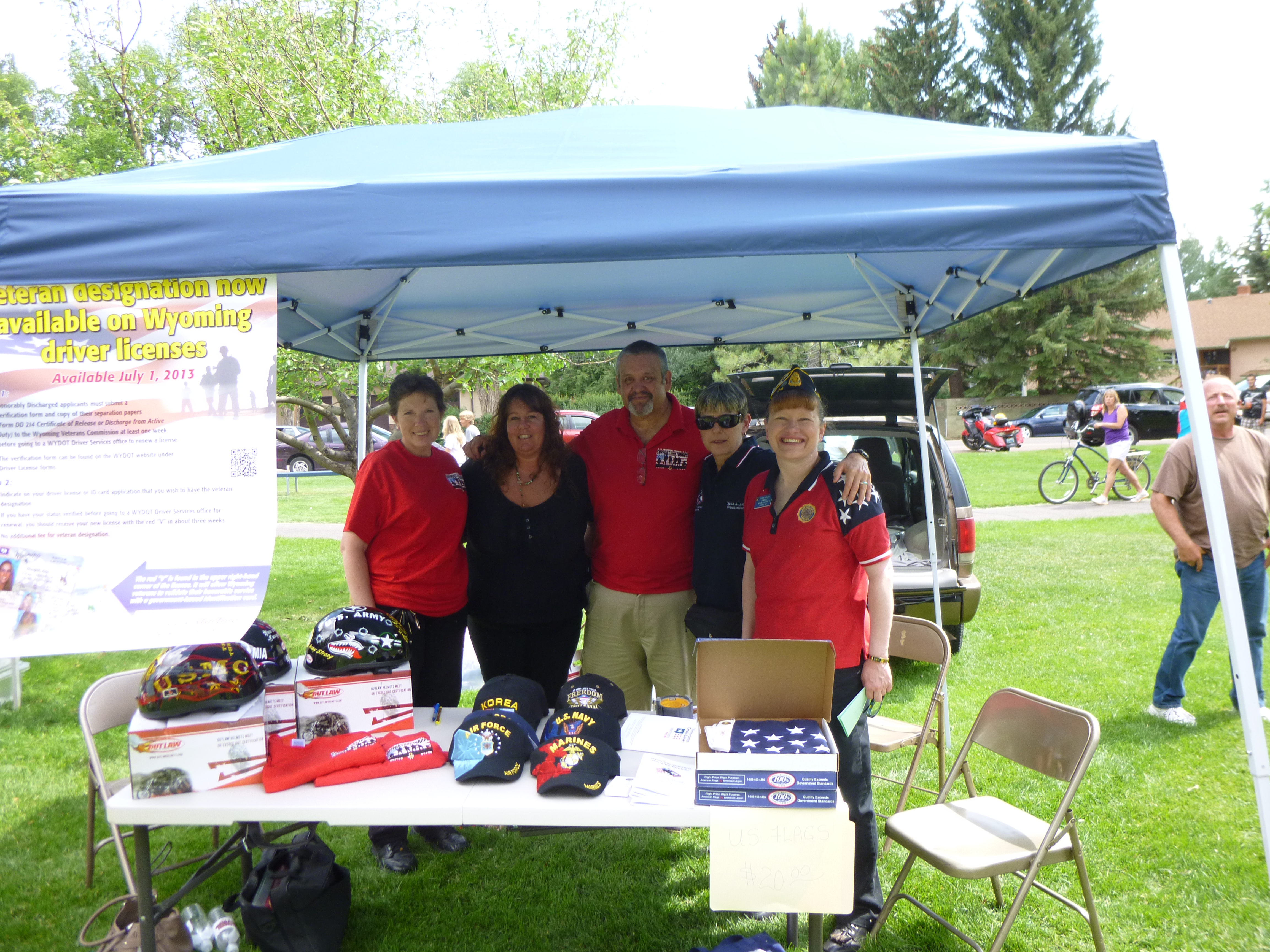
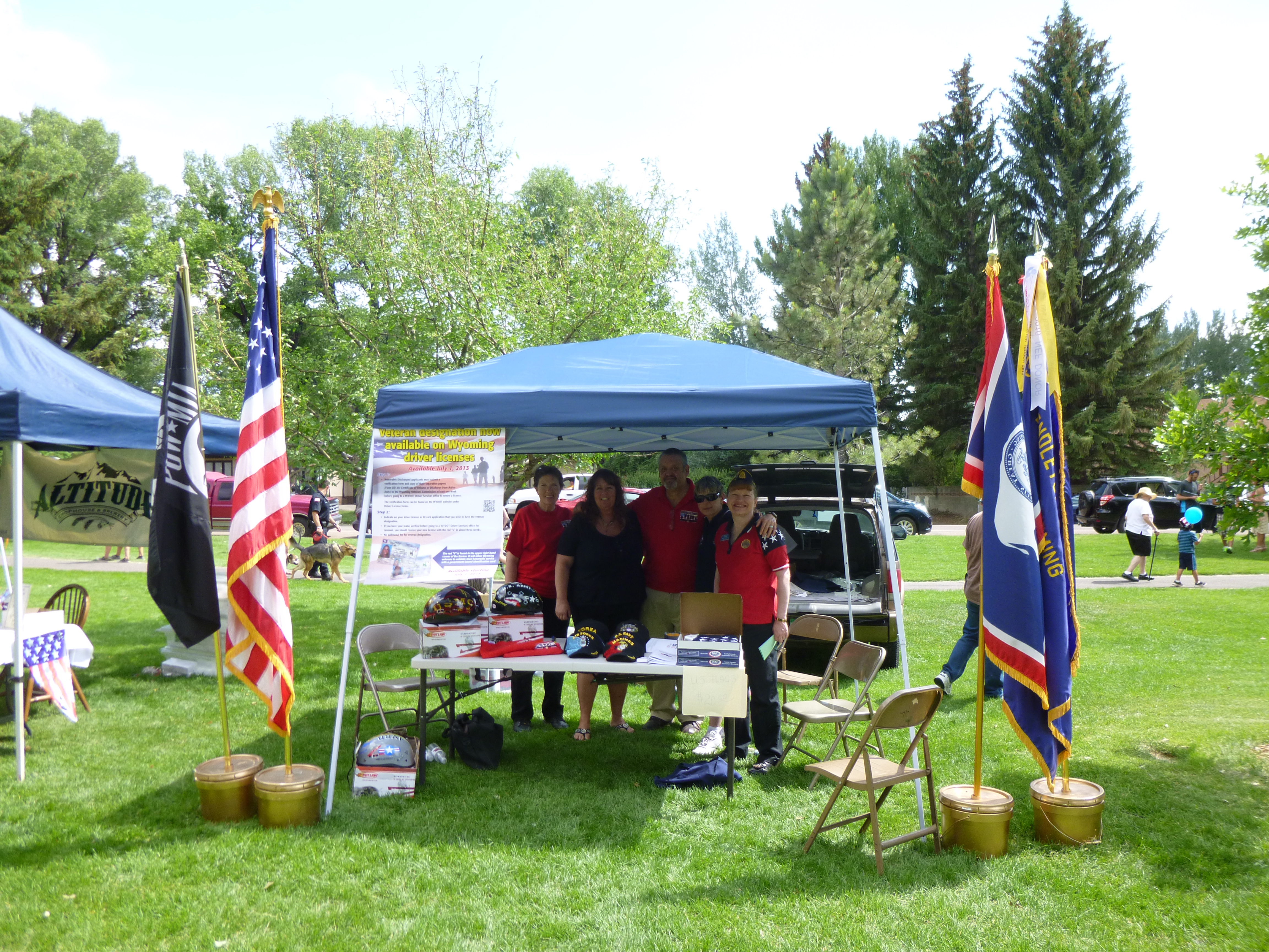
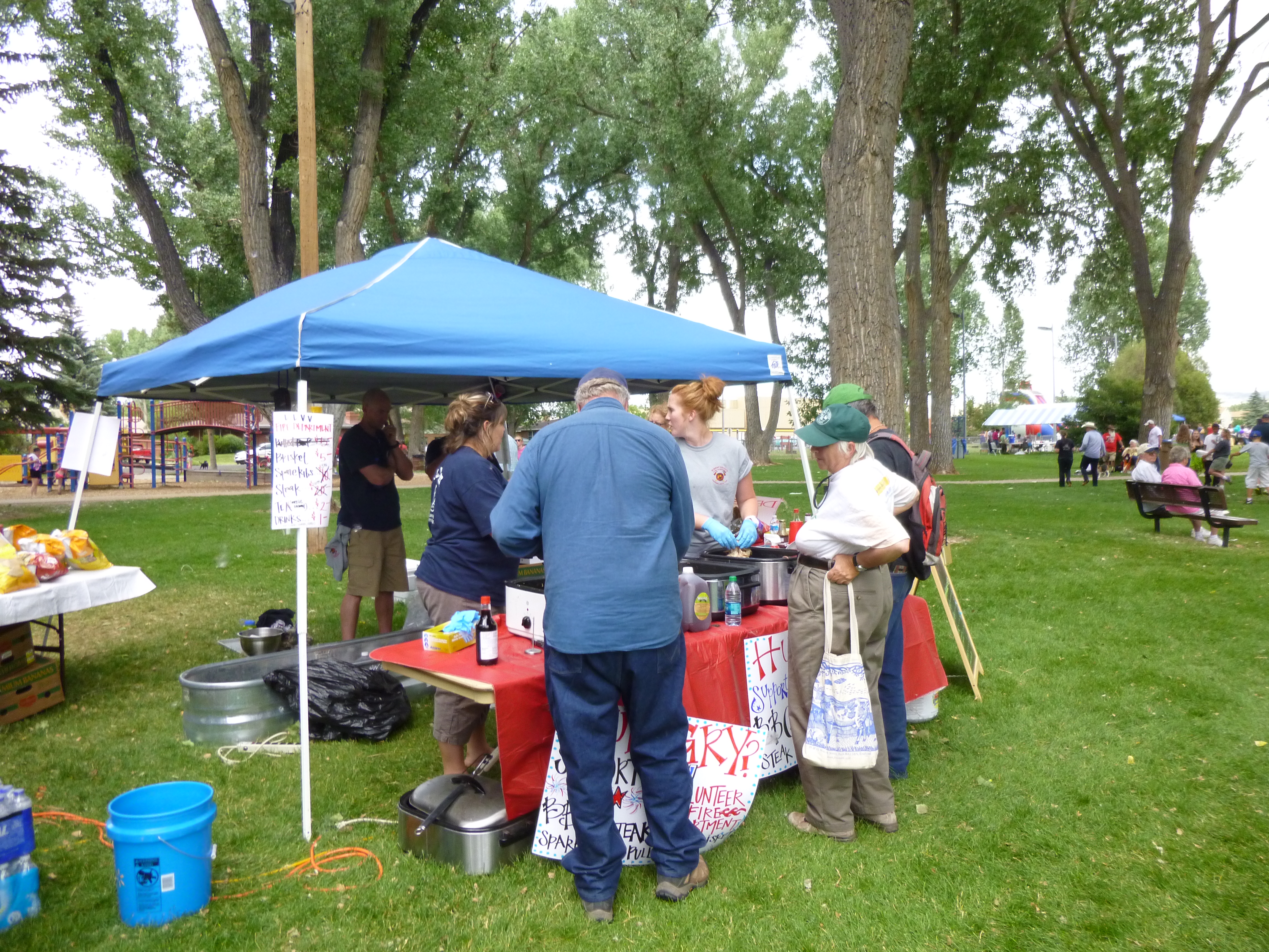
Once I had finished those 4 miles, I headed for Laramie. On the way there, I went through the Medicine Bow National Forest, which was full of bizarre rock formations. Little rocks were oddly balanced on big ones, and the edges were all rounded, and almost soft-looking, and it was different than anything I’d seen. Anyway, I had talked to the visitor’s bureaus for Cheyenne, Laramie and Cody to see which city might have the most interesting 4th of July events. They all were going to be setting off fireworks in the evening, but only Laramie had an event during the day, which was an outdoor festival in their park called Freedom Has a Birthday. (Cheyenne’s big summer event is Frontier Days, so that’s why their 4th of July was a little quiet.) It was a beautiful summer day and the park was full of people out enjoying different music groups in the band shell (I think all towns should have big parks and band shells!), kids’ games and activities, all kinds of food vendors and informational booths. Everything was decorated patriotically, and there were free ice cream cones and free sno-cones (I saw the ice cream before I saw the sno-cones, and Tula enjoyed part of my cone.) Different groups were selling food as fundraisers, and other booths were more just informational. I decided that with such an array of donation possibilities that I would do 2 today, but I had to walk around for a while to see everything, and think about where I wanted the donations to go. Because it’s a patriotic day to celebrate freedom, I decided the first donation would go to the American Legion. Their booth had a bunch of flags by it, and everyone was wearing red, white and blue clothes, and I went over to talk to them about a possible donation. They said they were collecting contributions for Operation Comfort Warriors, which is a program to help supply recreational goods for wounded or ill warriors. So that was a fun donation to start my Wyoming week with.
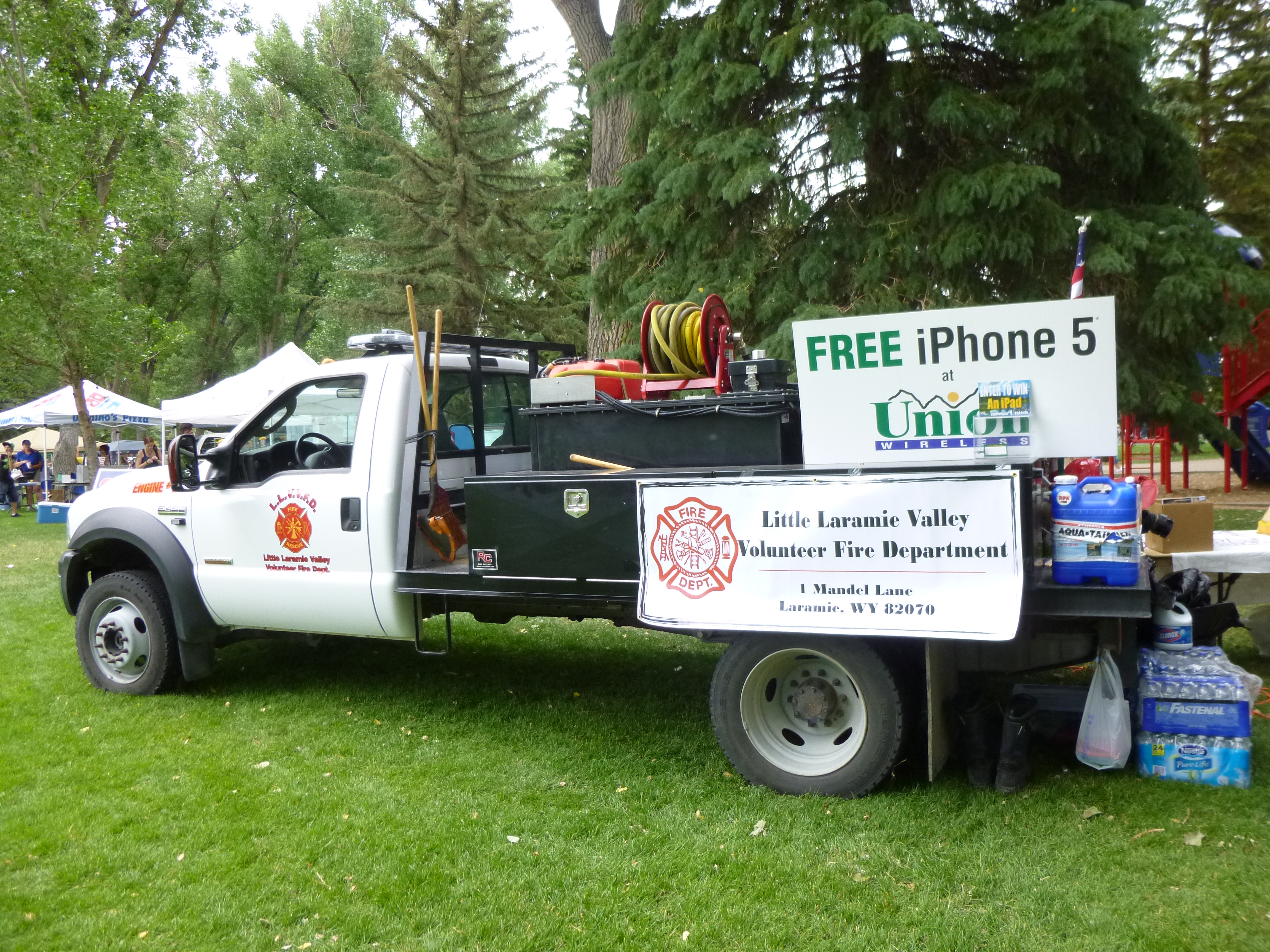
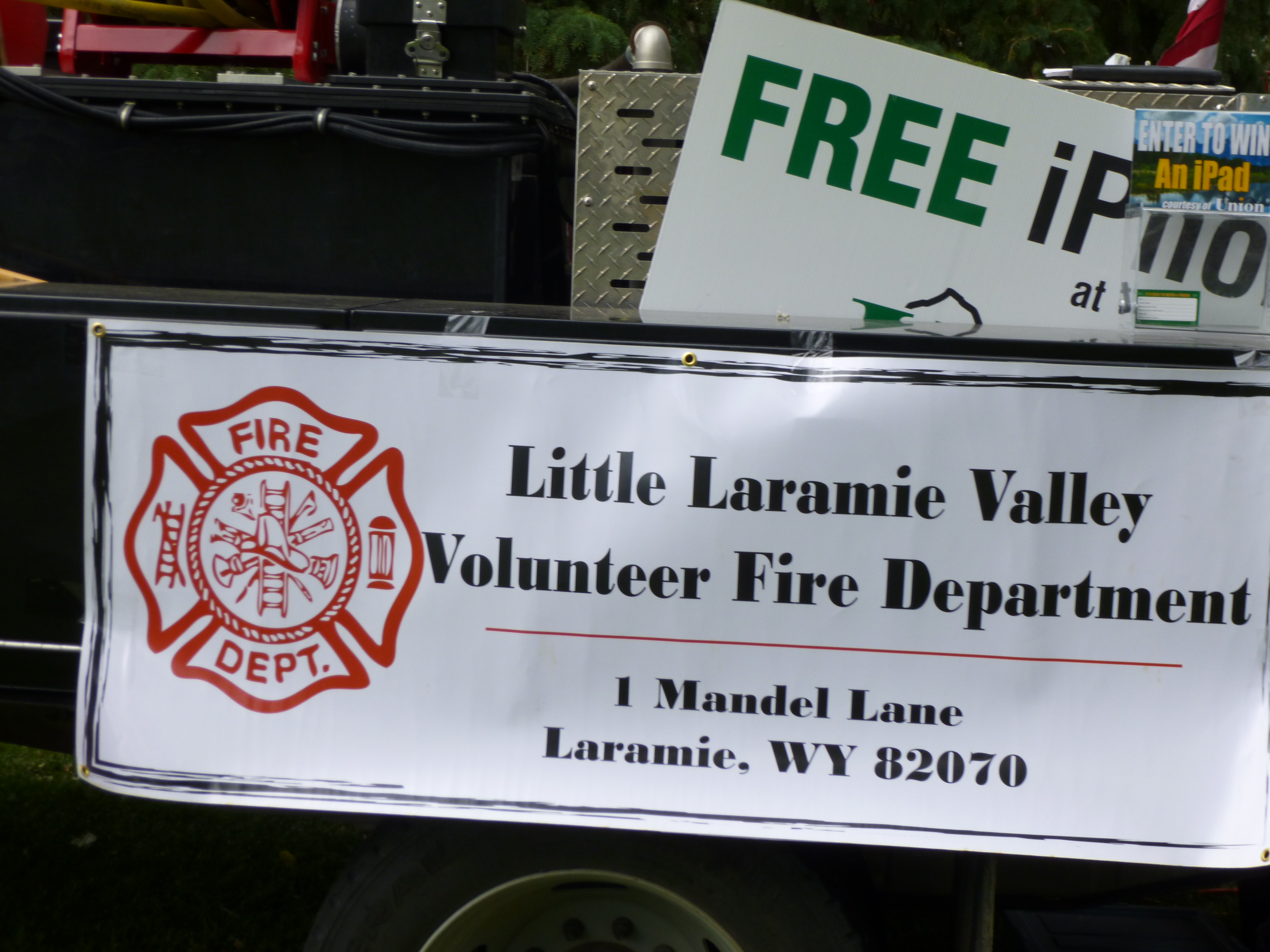
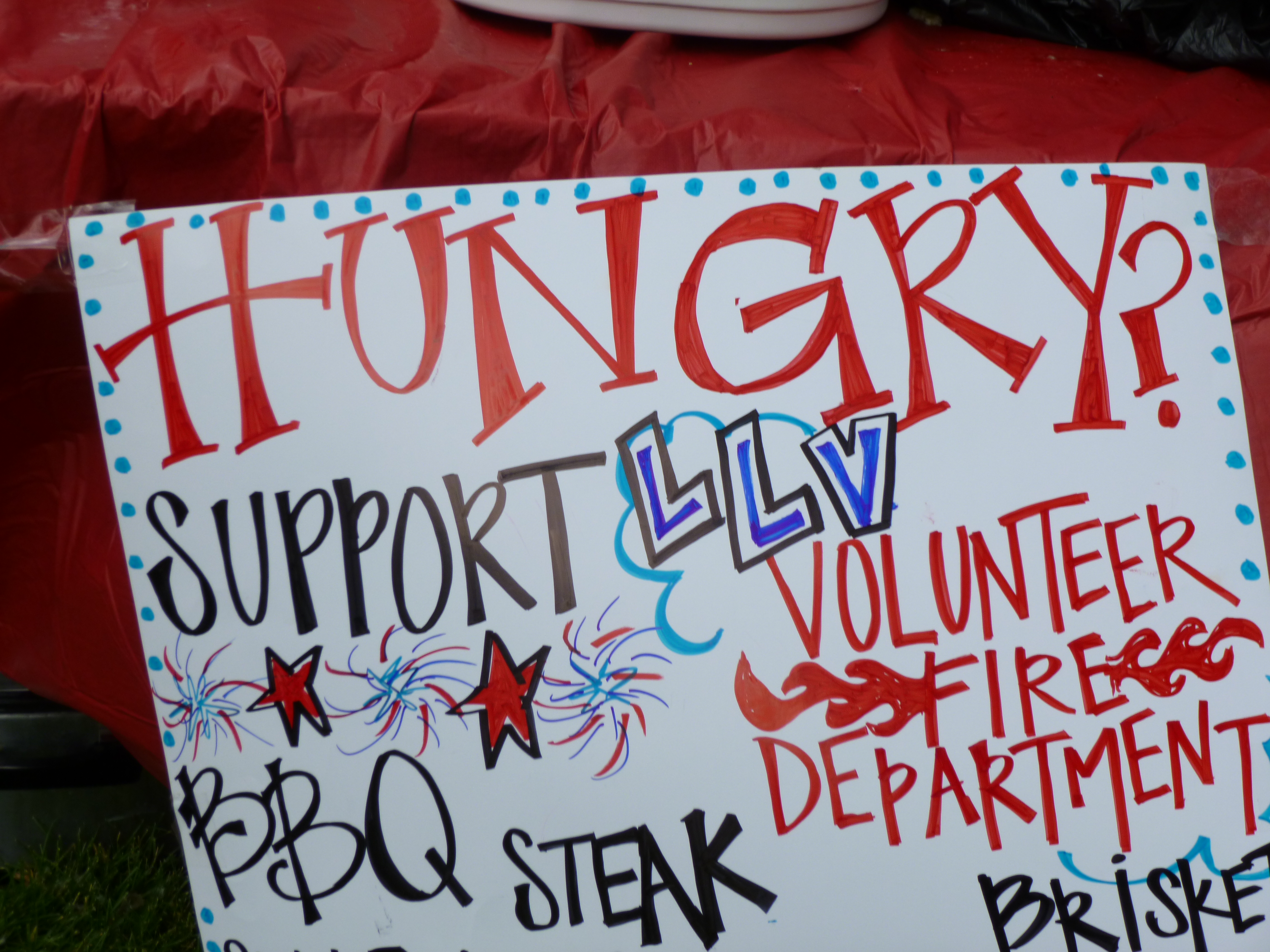
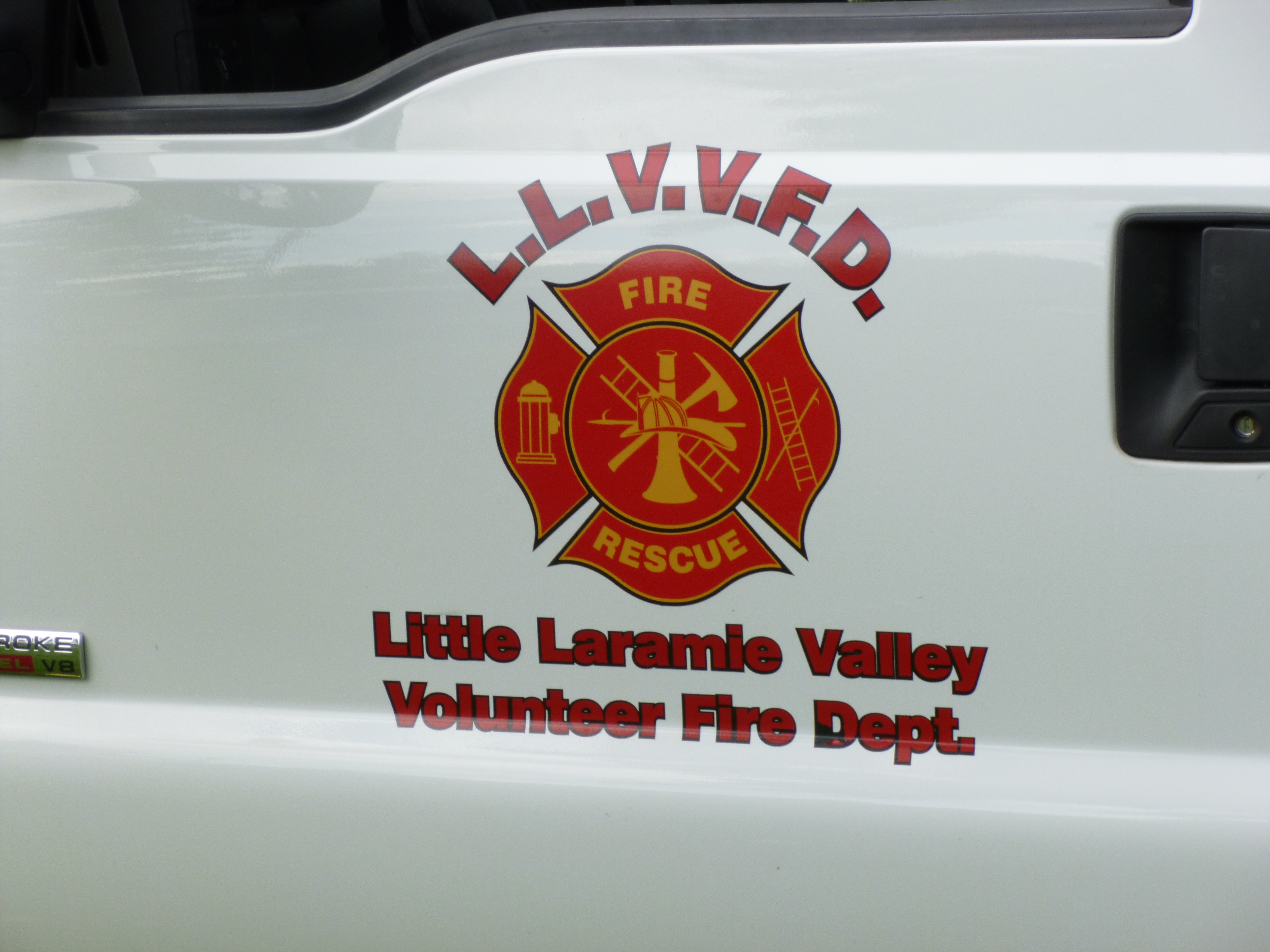
And then, while looking around at all the food options (and finding it hard to resist barbeque choices!) I saw a fundraising sign for LLVVFD – Little Laramie Valley Volunteer Fire Department. And they had just cut all their prices in half since the afternoon was beginning to wind down. So I went to get a plate of ribs and talked to the lady serving the food. She said an extra donation would be amazing – as a volunteer unit in a rural setting, they need all the support they can get. In fact, a call had just come in about a structural fire, and they were waiting to find out if they were going to get called out on that one. And I had just been thinking last week that I wanted to make a donation to a fire department. So that was my next choice for the day. They were happy for the donation, and she gave me so much BBQ that even I couldn’t eat it all! Several of them offered to give bones to Tula, but she would just crunch them up so I had to say no, but she was finding enough little tidbits under their table anyway.
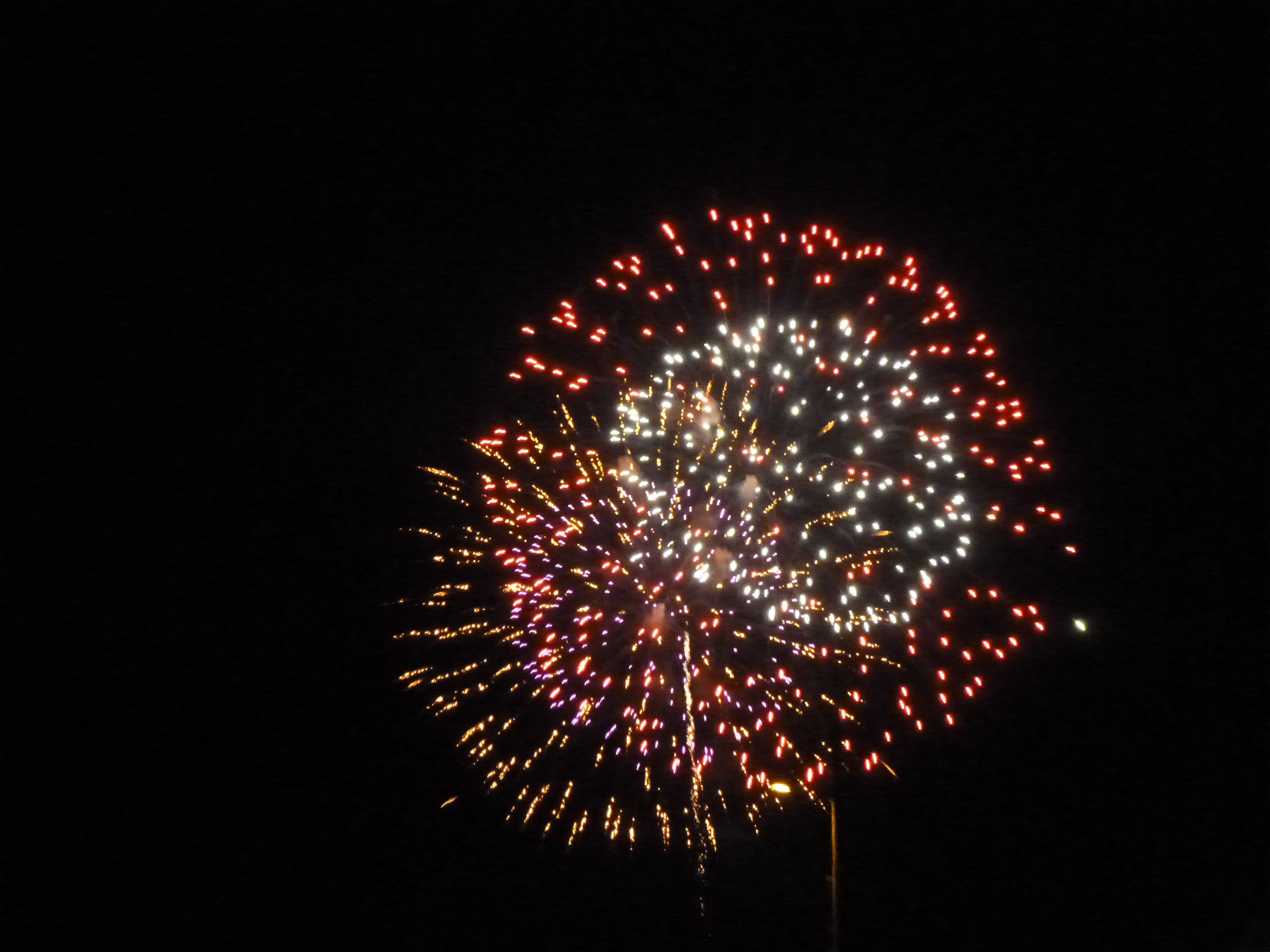
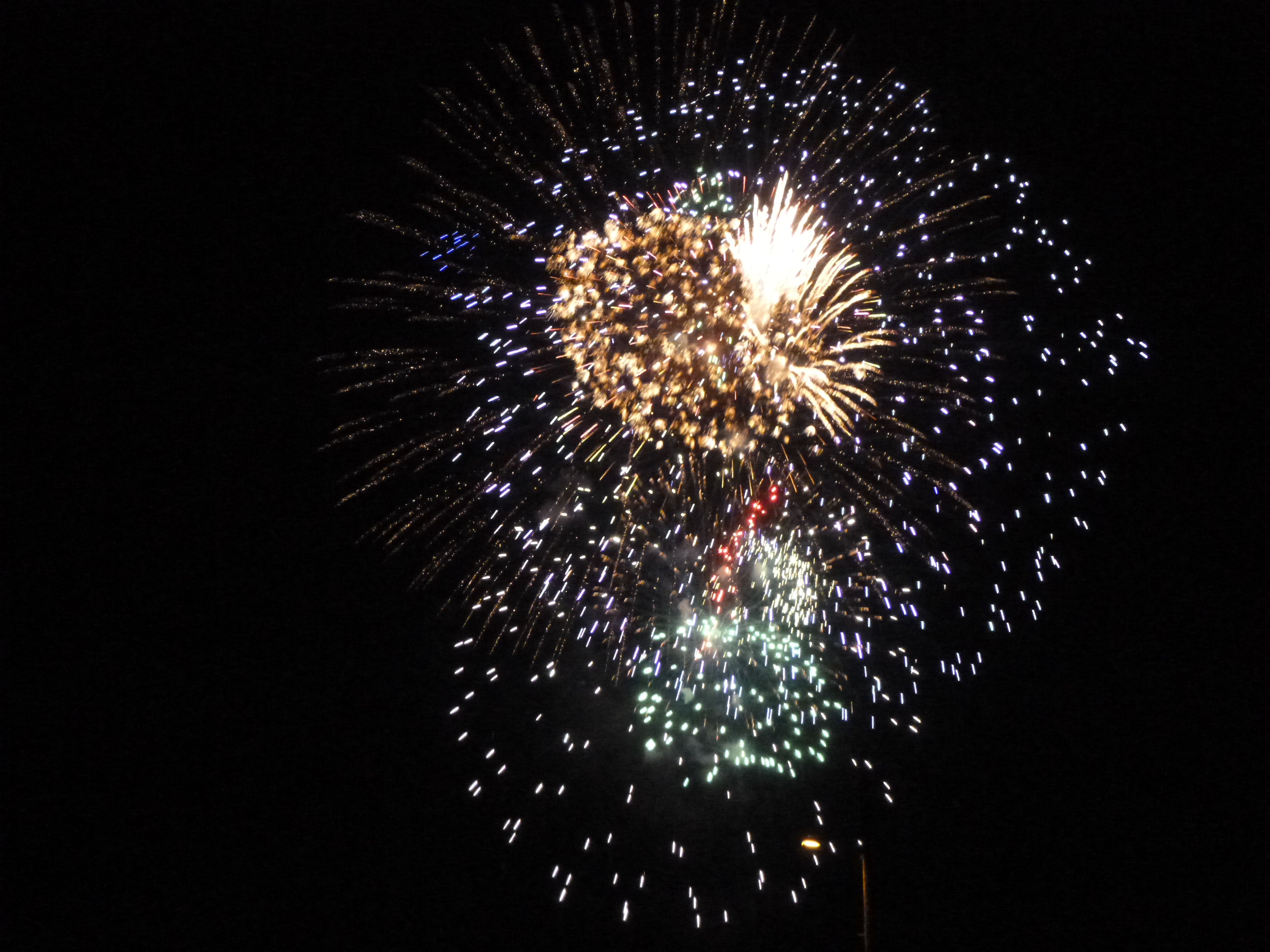
I also got some fresh kettle corn for a post-fireworks snack later – the guys making the kettle corn were literally selling it as fast as they could make it – it was a popular booth. So it was a fun afternoon. I had made a reservation at a motel just outside of town, since I didn’t really want to be camping on the 4th, so I checked in and took a short break, then Tula and I headed into the actual town of Laramie to do another 3 miles of walking. Laramie is home to the University of Wyoming, so we walked around town and the UW campus and in a couple neighborhoods, and finished the walking for the day. I headed back to the motel for a little more computer work, and then when it was getting dark, I headed back into town to find a spot to watch the fireworks, which were supposed to start around 10. I saw some people in a parking lot with lawn chairs out, and wasn’t overly crowded, so that’s where I stopped. It ended up being a great place – not overly crowded, and easy to get back out onto the streets after the show. It was a good fireworks display – about 20-25 minutes, and very colorful and noisy. Tula just stayed in the van with the windows up since it was cool enough, and she typically isn’t bothered by noisy things anyway. So it was a really nice 4th of July! Happy Birthday, America!


Nebraska – Wednesday, July 3
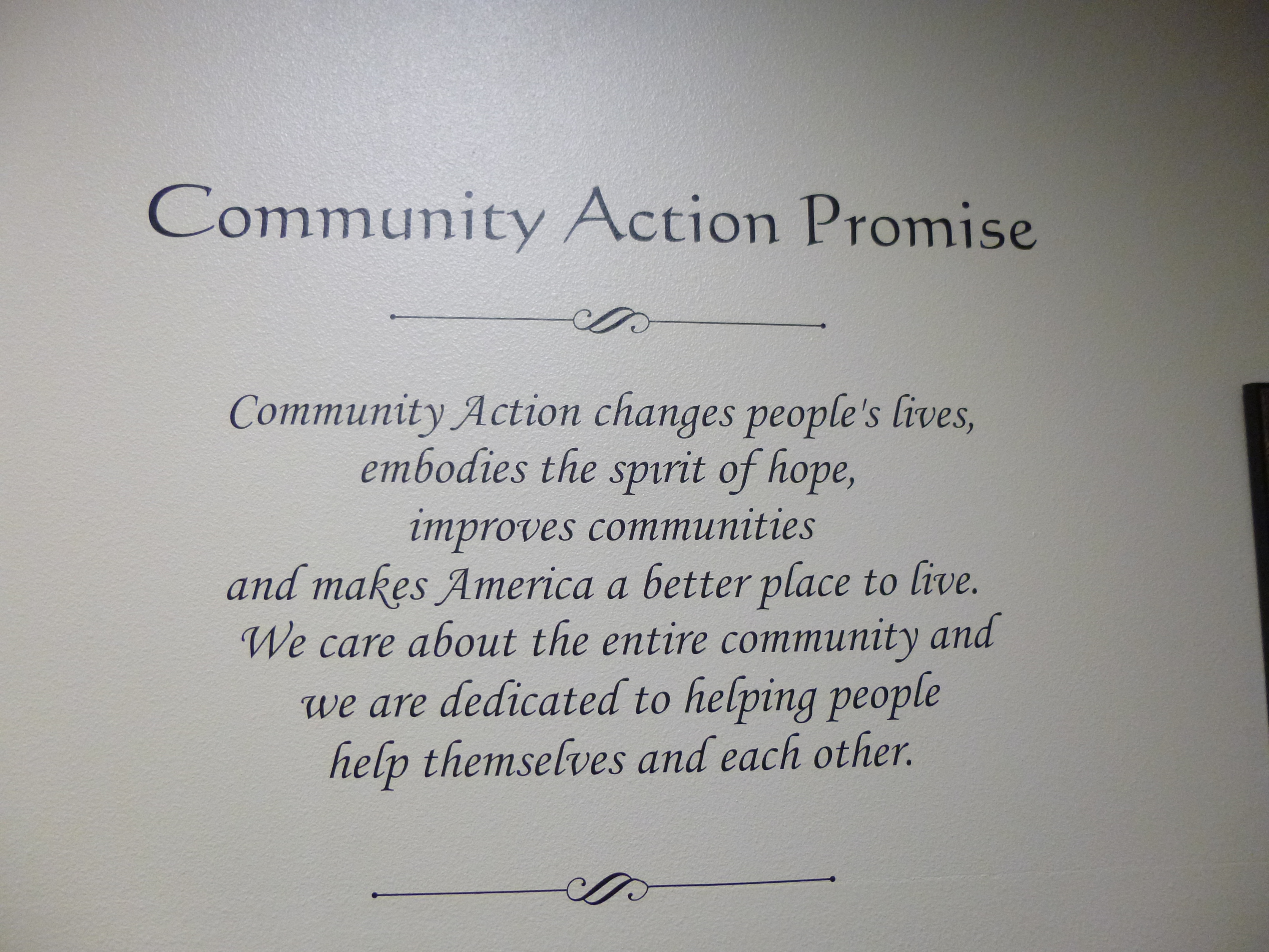
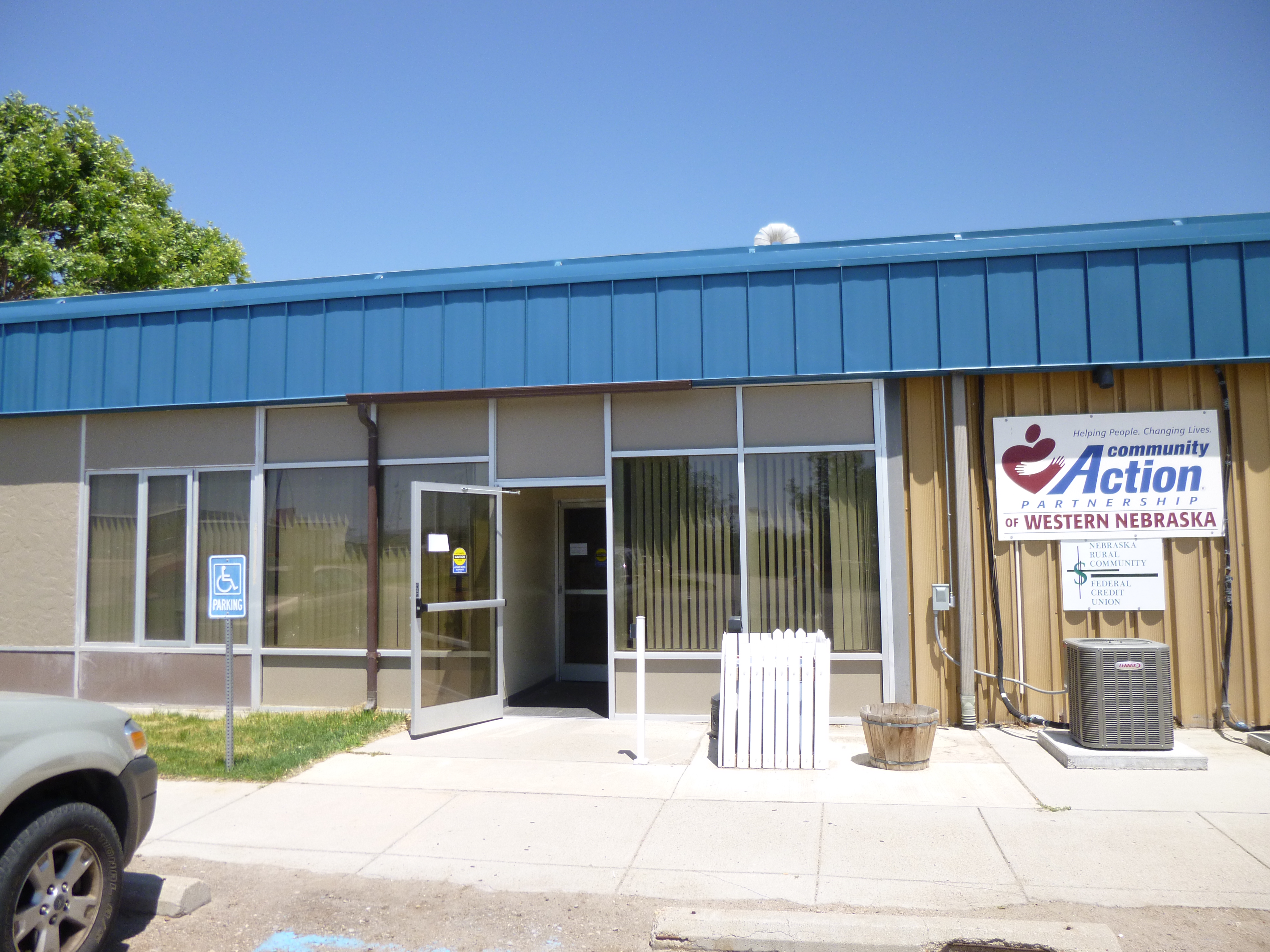
The first thing I wanted to take care of this morning was shopping for my donation to the food pantry at the Community Action of Western Nebraska. I had called them to see what they might need, and shopped for cereal, tuna and canned chicken and vienna sausages, canned chili and ravioli. They gave me good directions to their building, and I found the pantry and carried the food in. In addition to the food pantry, they also help with healthcare and youth programs and other things in the community.
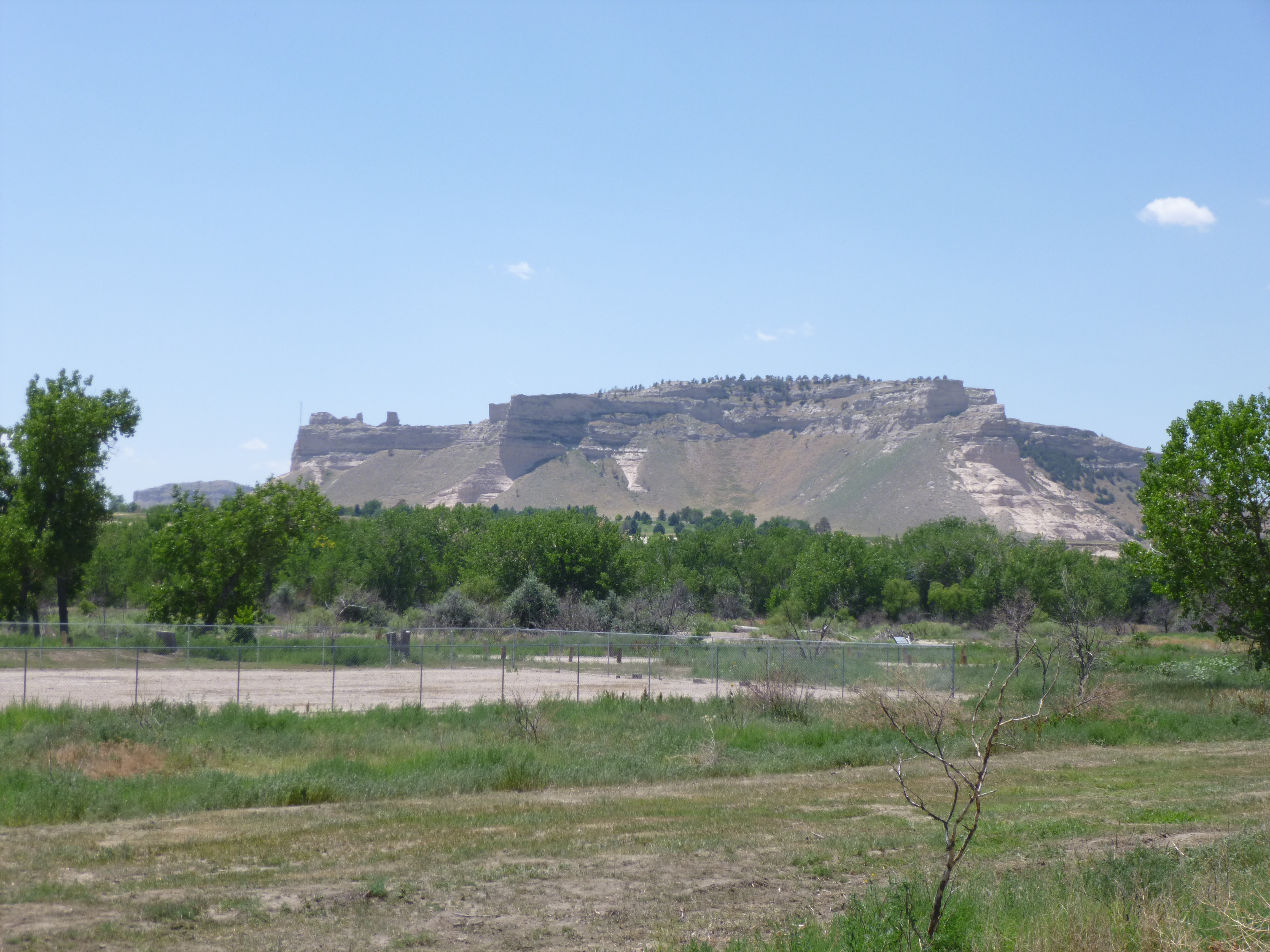
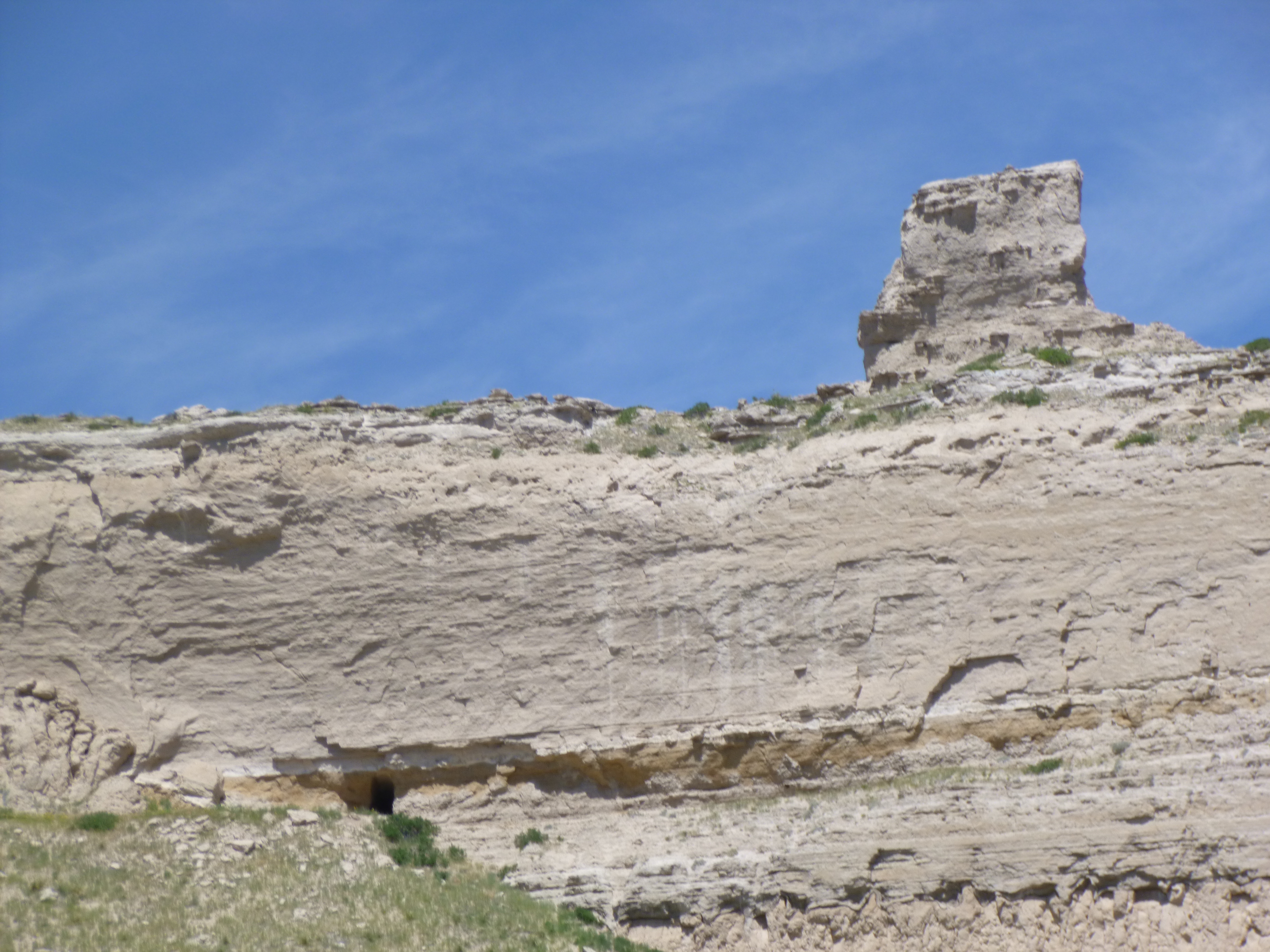
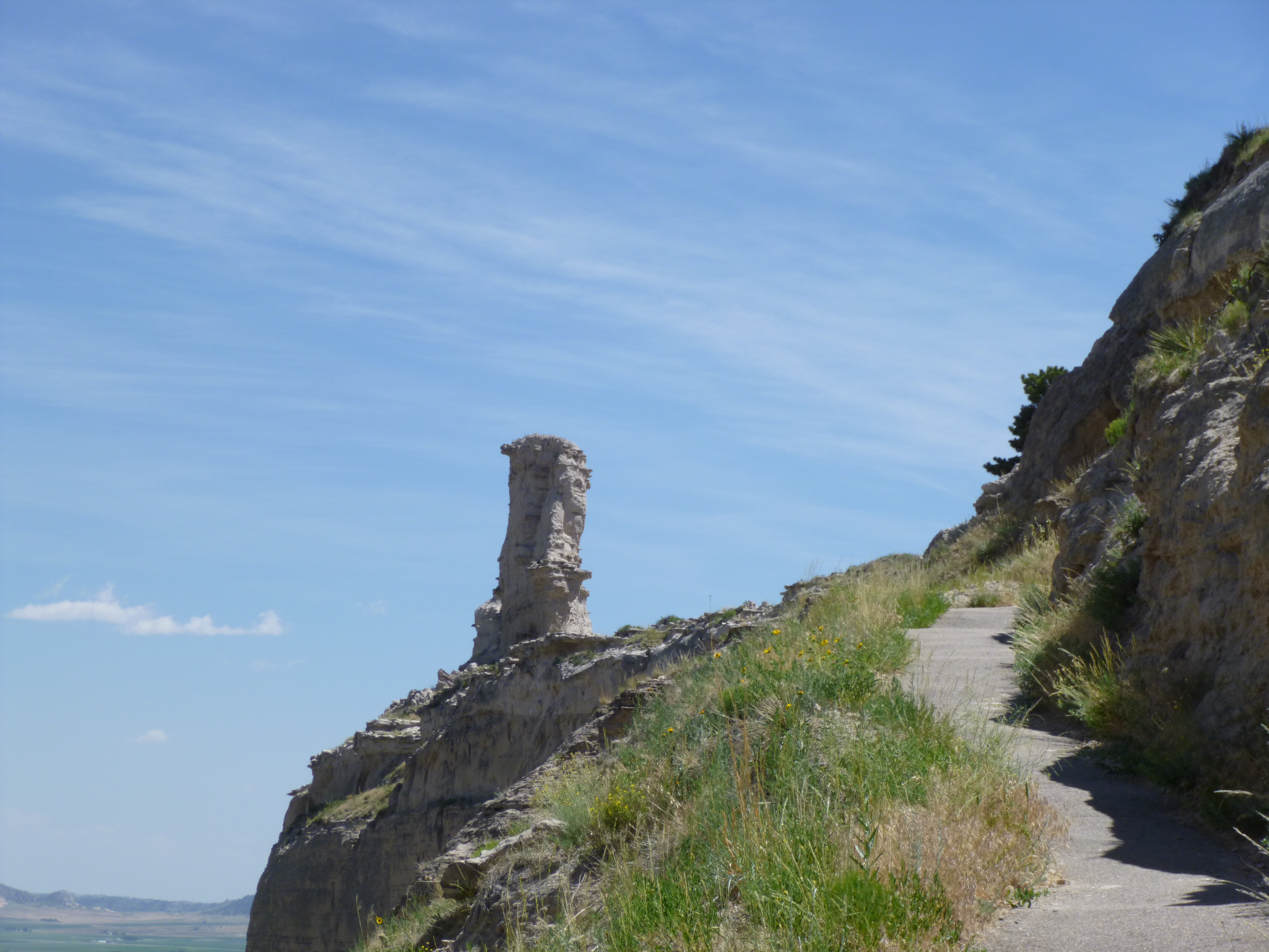
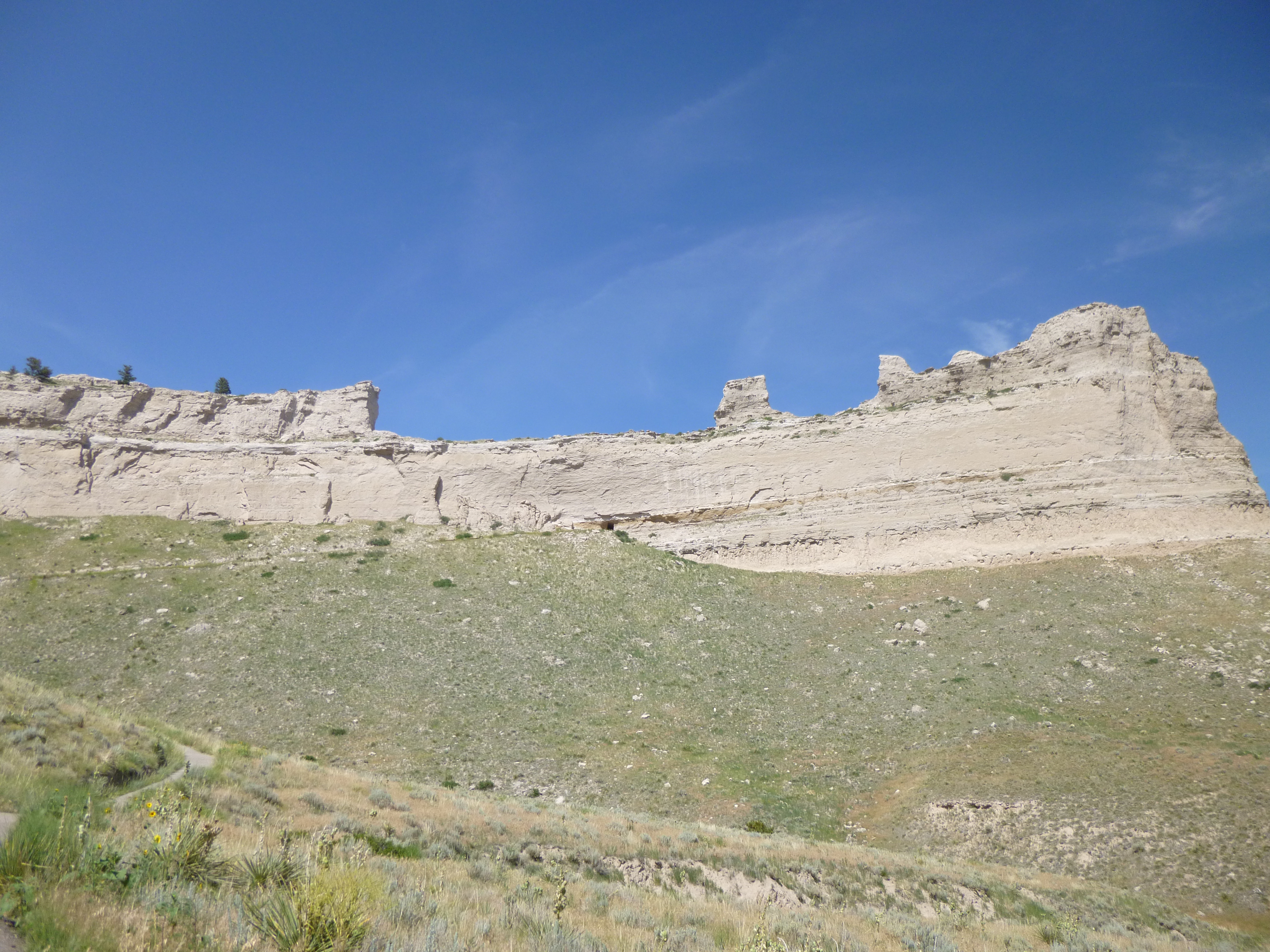
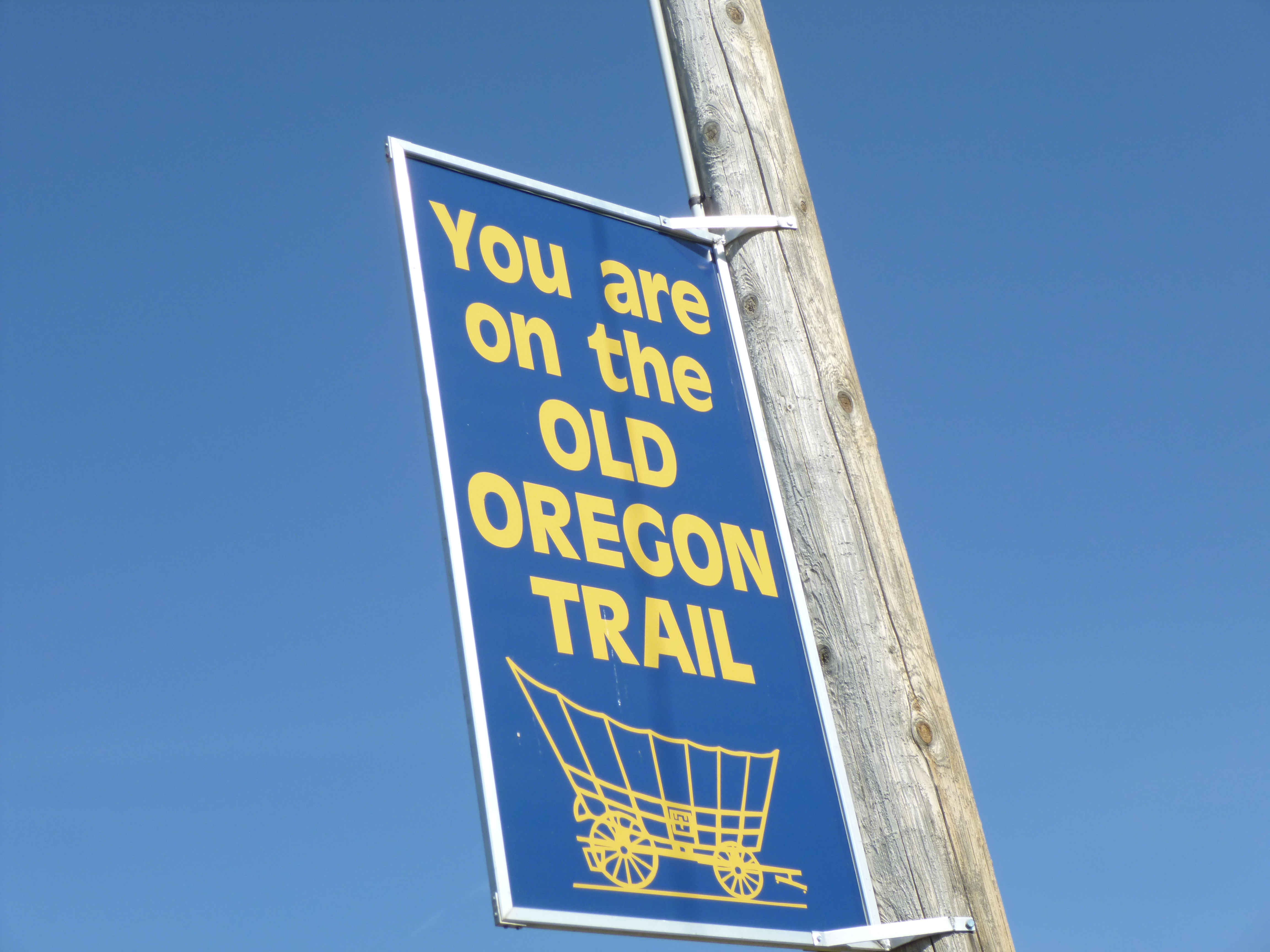
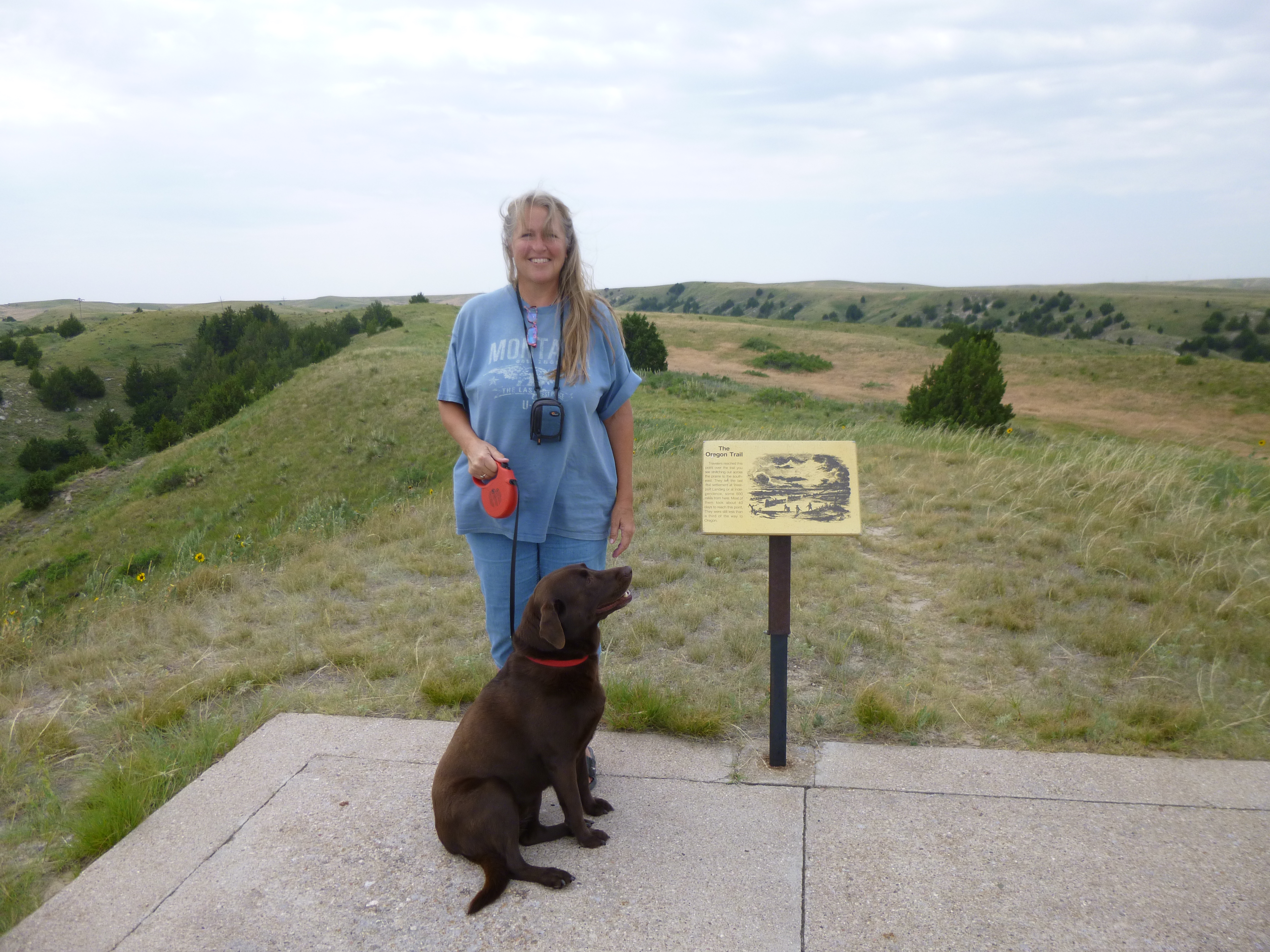
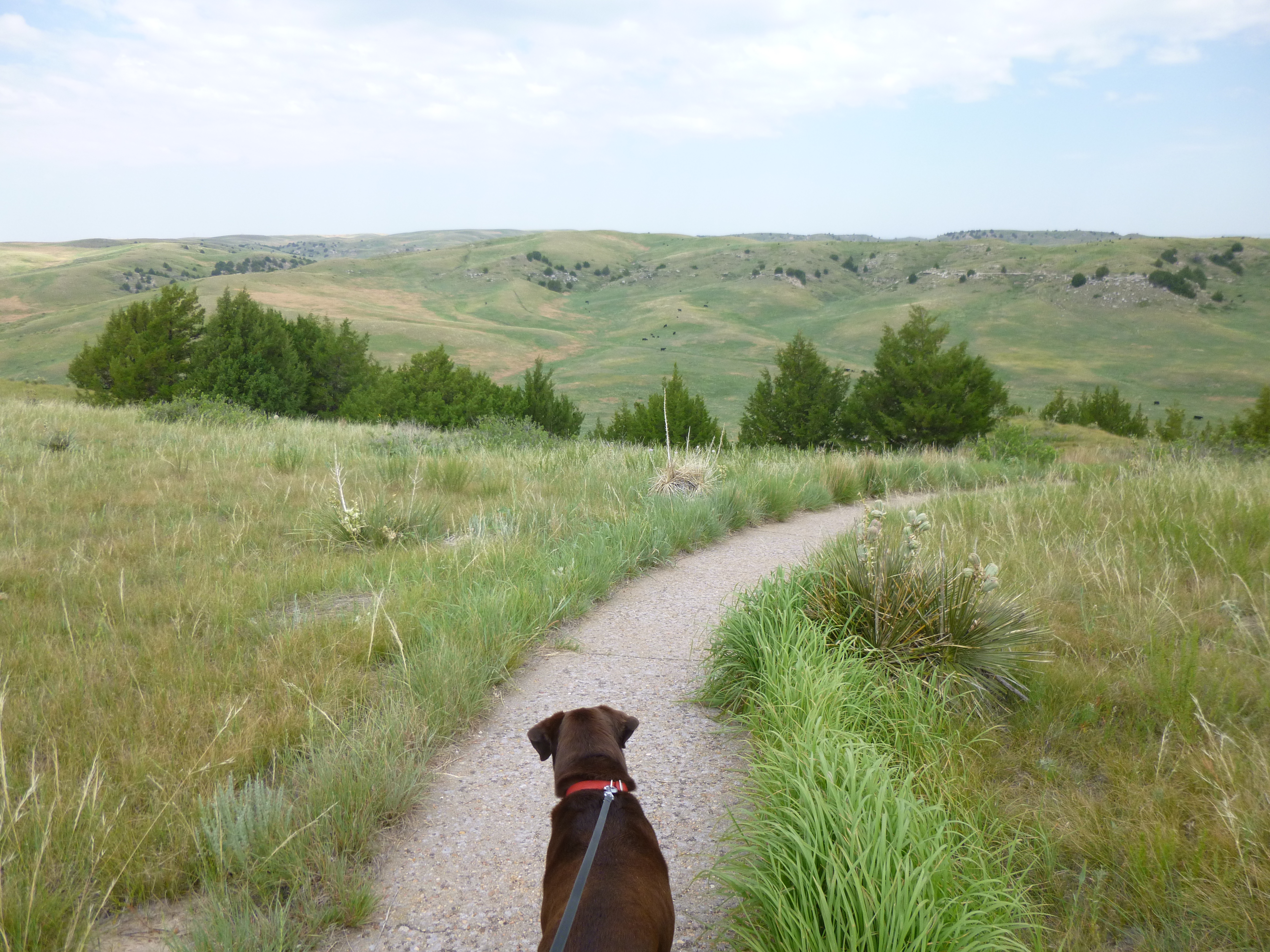
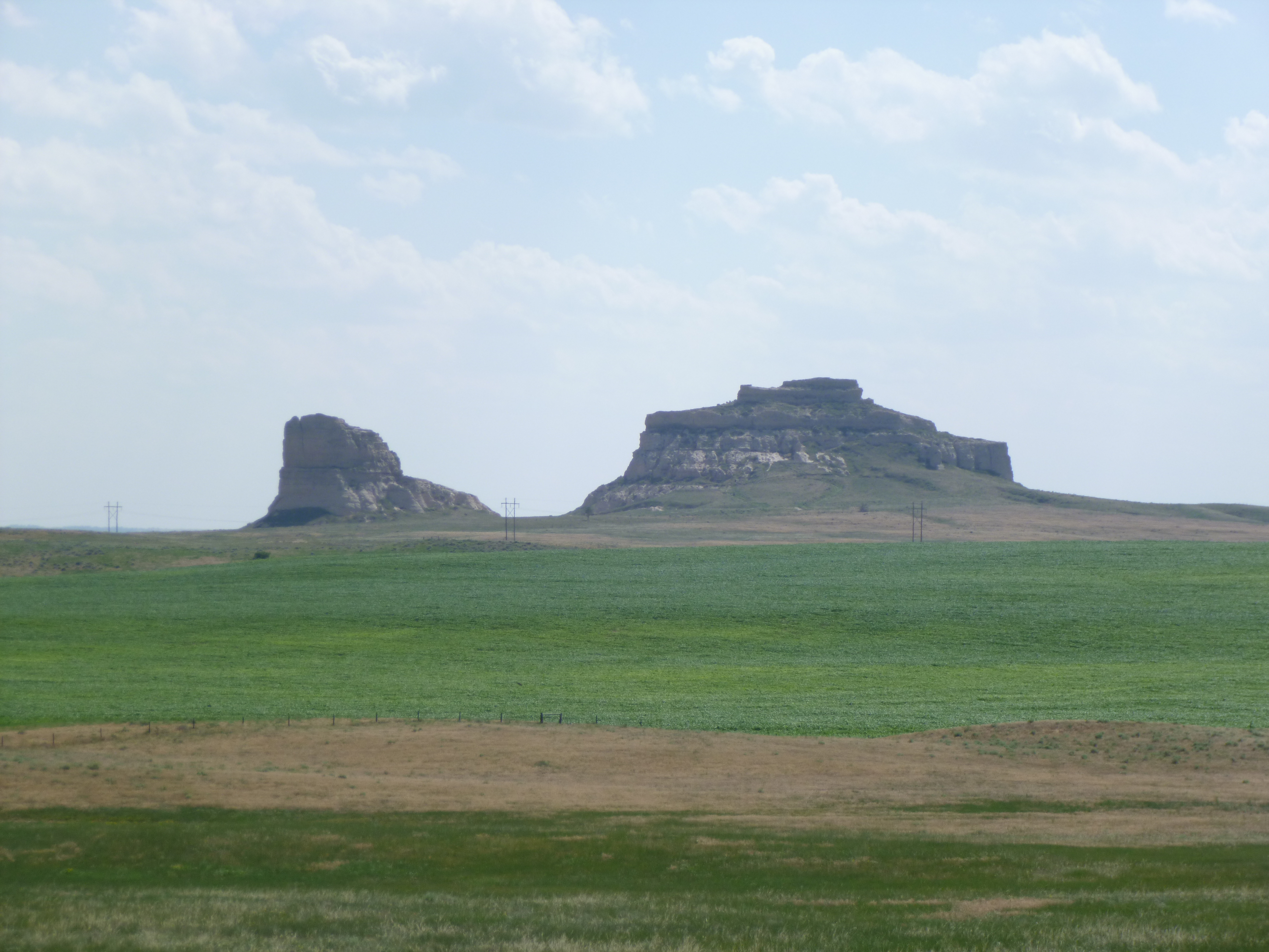
Then it was time for some walking. I started with a short 1 mile walk by the North Platte River so that Tula could get out, and then I headed for the Scottsbluff National Monument. I had been here back in 2005 and it was worth a return visit. Scottsbluff was another of the landmarks for the pioneers on the Oregon Trail – they would pass Courthouse and Jailhouse Rocks, then Chimney Rock, and then Scottsbluff, and then they were out into the open expanses of land again. There was a 3.2 mile roundtrip walk to the top of the bluff, and from up there, one can see for miles and miles in all directions. It was a pretty warm walk to the top, but it’s a good hike, and there are amazing views all the way up. I walked on a couple of the trails on top of the bluff too, and met an older couple with binoculars. We tried to figure out how far we could see, and Chimney Rock was visible even without the binoculars, and that was about 20 miles away. It was such a clear day. I started to head back down the bluff, and saw a sign that said the mile and a half back down would take about an hour. With all the downhill walking, it was a little too easy to get going too fast, and I was almost jogging, although still watching my footing. I made it down in 35 minutes, but my left knee was not happy with the quick descent, and I paid for that for a few days!
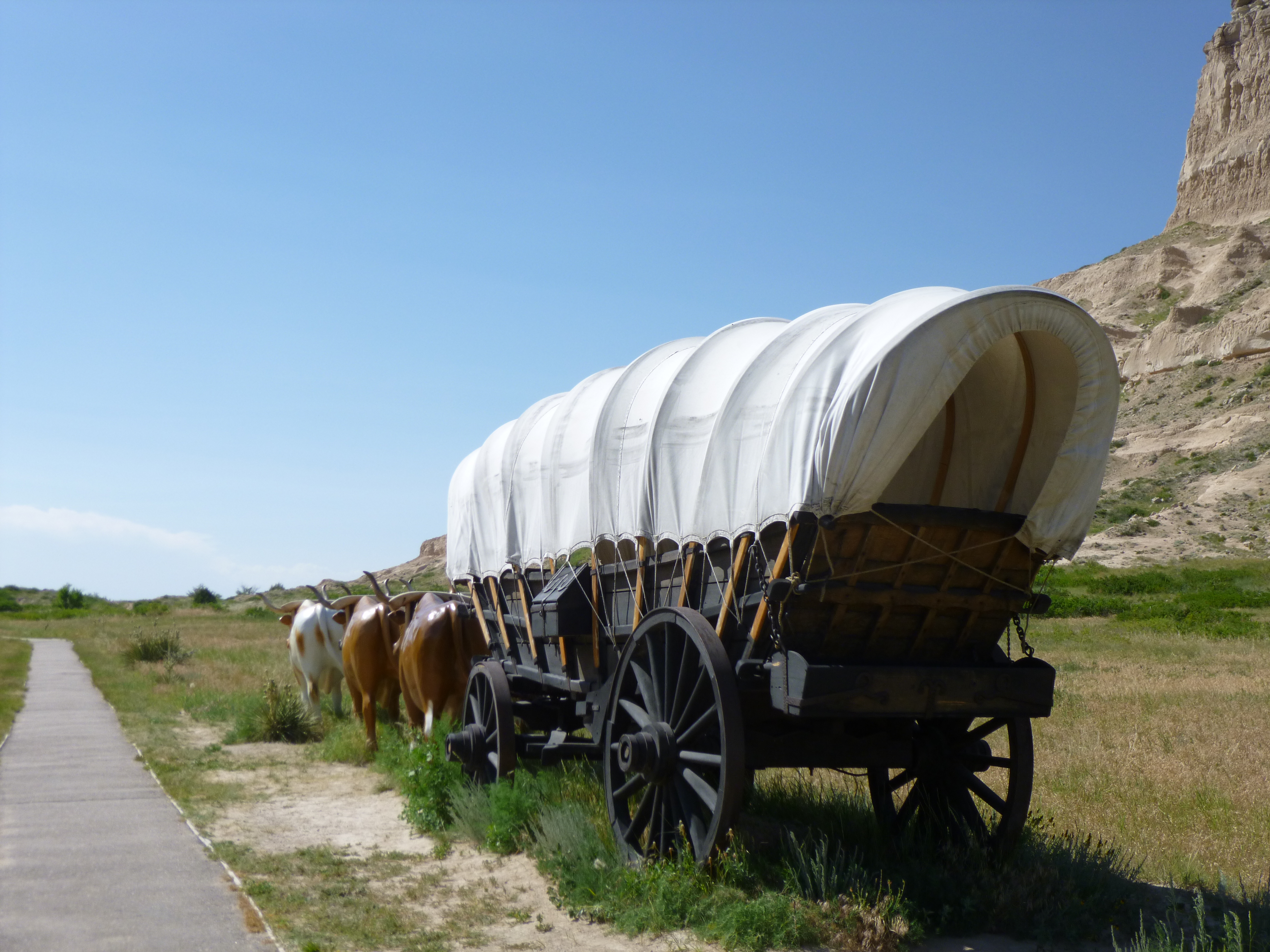
There was also another Oregon Trail site here, and they had several styles of covered wagons, and even life-size statues of oxen pulling one of the wagons, and in the warm breeze and dust, I could almost here the pioneer voices and clatter of wagon wheels. The trail led out to more covered wagon ruts – again, the wagons had formed depressions in the ground, which have deepened over time. Three different groups of people used the trail here on the south side of the North Platte River – the Oregon Trail pioneers, the California Gold Rush miners and the Pony Express riders. The Mormons made their own trail on the north side of the North Platter River – there seemed to be friction between them and some of the other people, so they made their own route. I just stood in their very tracks and looked out over the ground they traveled with awe – about 15 miles a day with questionable food and water sources, possible hostile attacks, and many of them had to throw out some of their meager possessions just to lighten their loads. Yet they continued on and on for months, and simply kept going.
At this point, I had less than 2 miles to walk to finish off Nebraska, so I pointed the van west toward Wyoming, and drove to Morrill, Nebraska – the last Nebraska town I would see before crossing the border. Tula and I got out and walked our couple miles – through some neighborhood areas just outside of town, and then through the downtown area itself. Morrill also had the ubiquitous grain elevators by the train tracks at the edge of town, and some osrt of auction was going on by one of the shops on the main street, and that had drawn a bit of a crowd.
And then Nebraska was done. I had walked all 56 miles, and all 7 donations given – the Kids’ Cruisin’ Kitchen summer lunch program, the Relay for Life, Adopt a Soldier, the Nebraska State 4-H camp, the Golden Spike Visitor Center, the Garden County EMS, and the food pantry at Community Action of Western Nebraska.
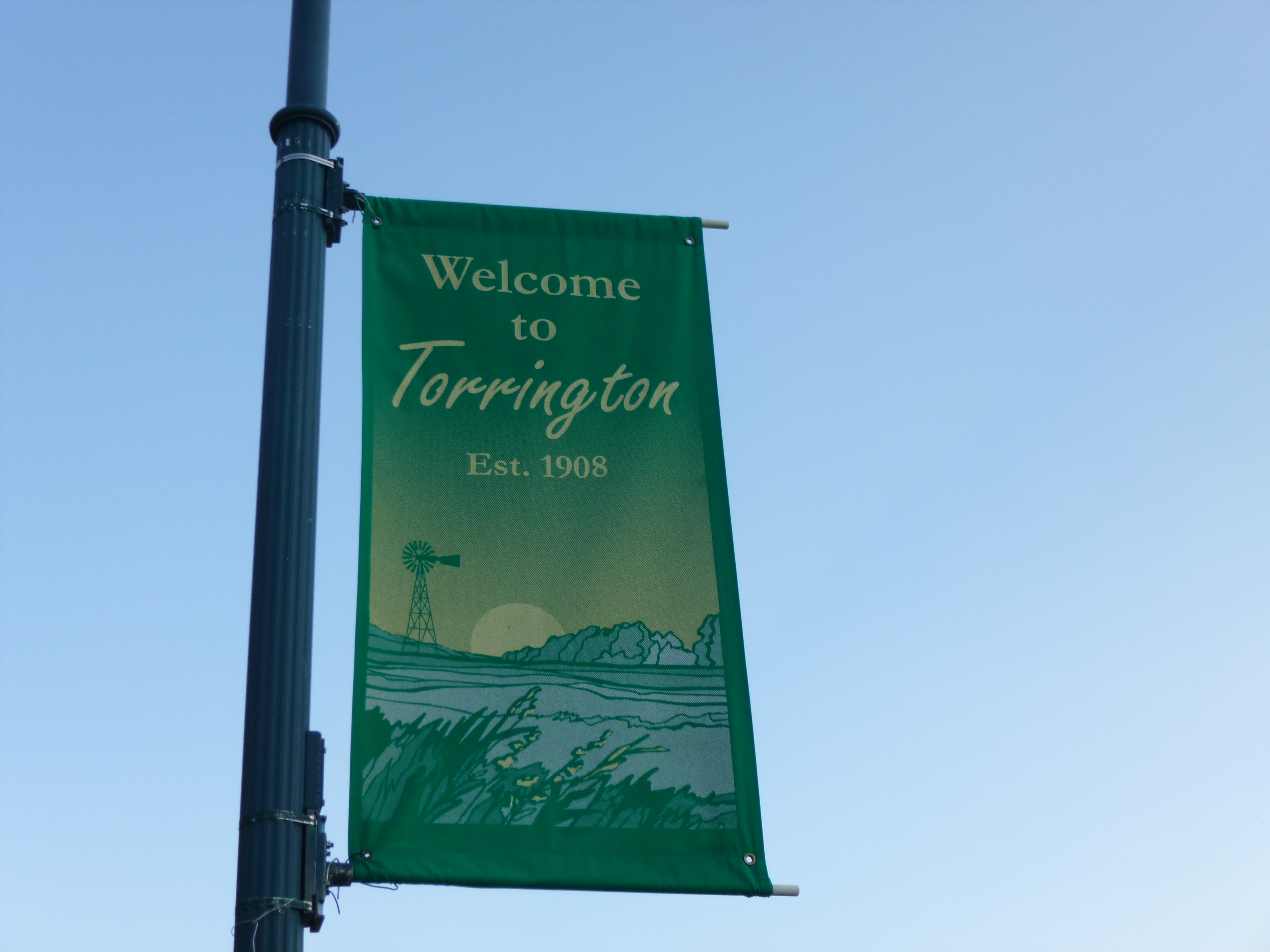
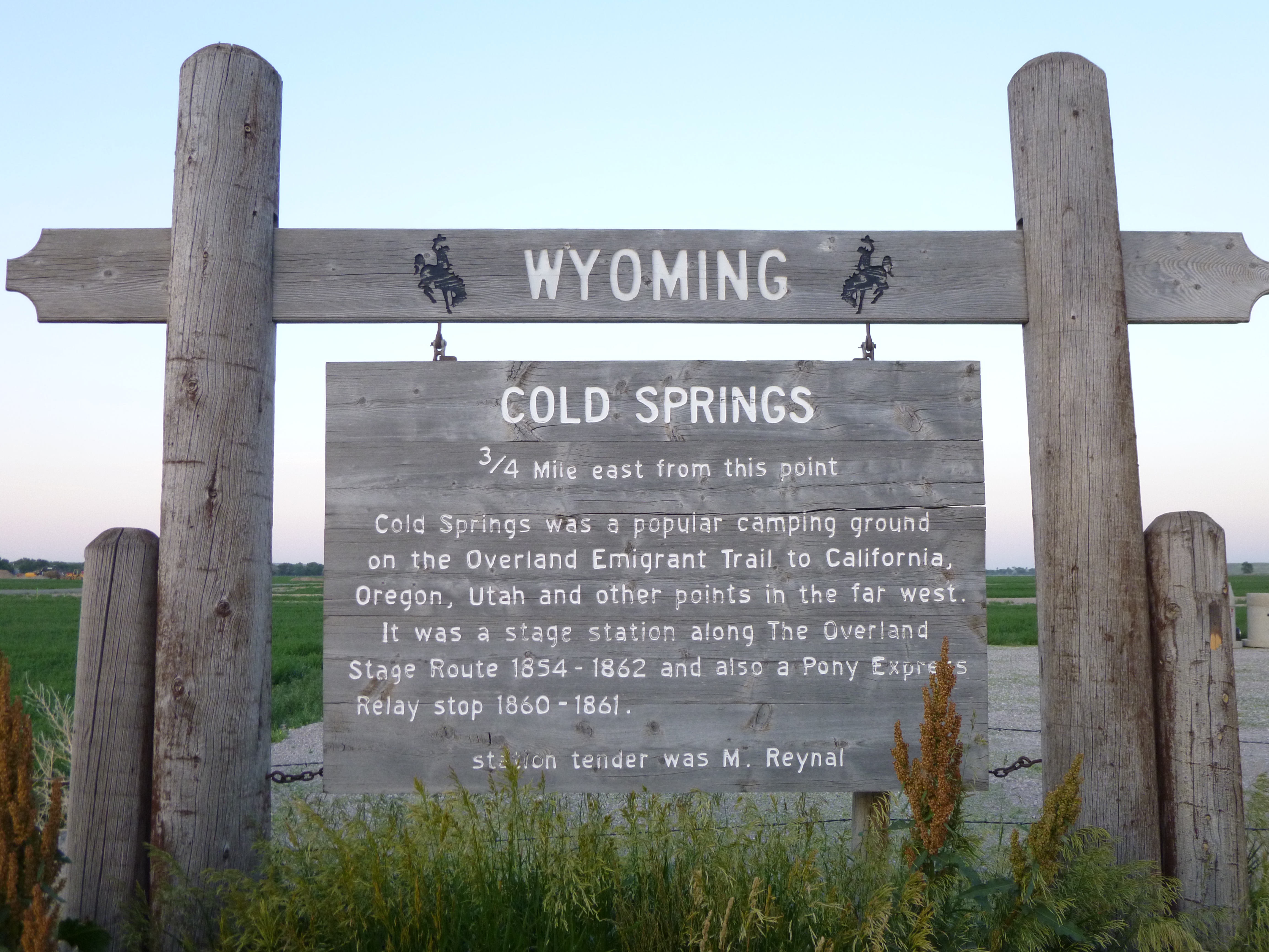
Since it stays light so late, I crossed into Wyoming this evening – State #40 – and stopped in Torrington to get the first mile and a quarter of the Wyoming walking done. On my way to Cheyenne, where I was going to stay tonight, I passed the Cold Springs historic site, which was a good water stop for everyone who was westward-bound. And then I enjoyed my drive south to Cheyenne, and saw a pretty sunset on the way.


Nebraska – Tuesday, July 2
Tula and I started our morning off with a 1 mile walk around the campground. It’s on the shores of one of the few big lakes in Nebraska, and seems to be a very popular fishing destination.
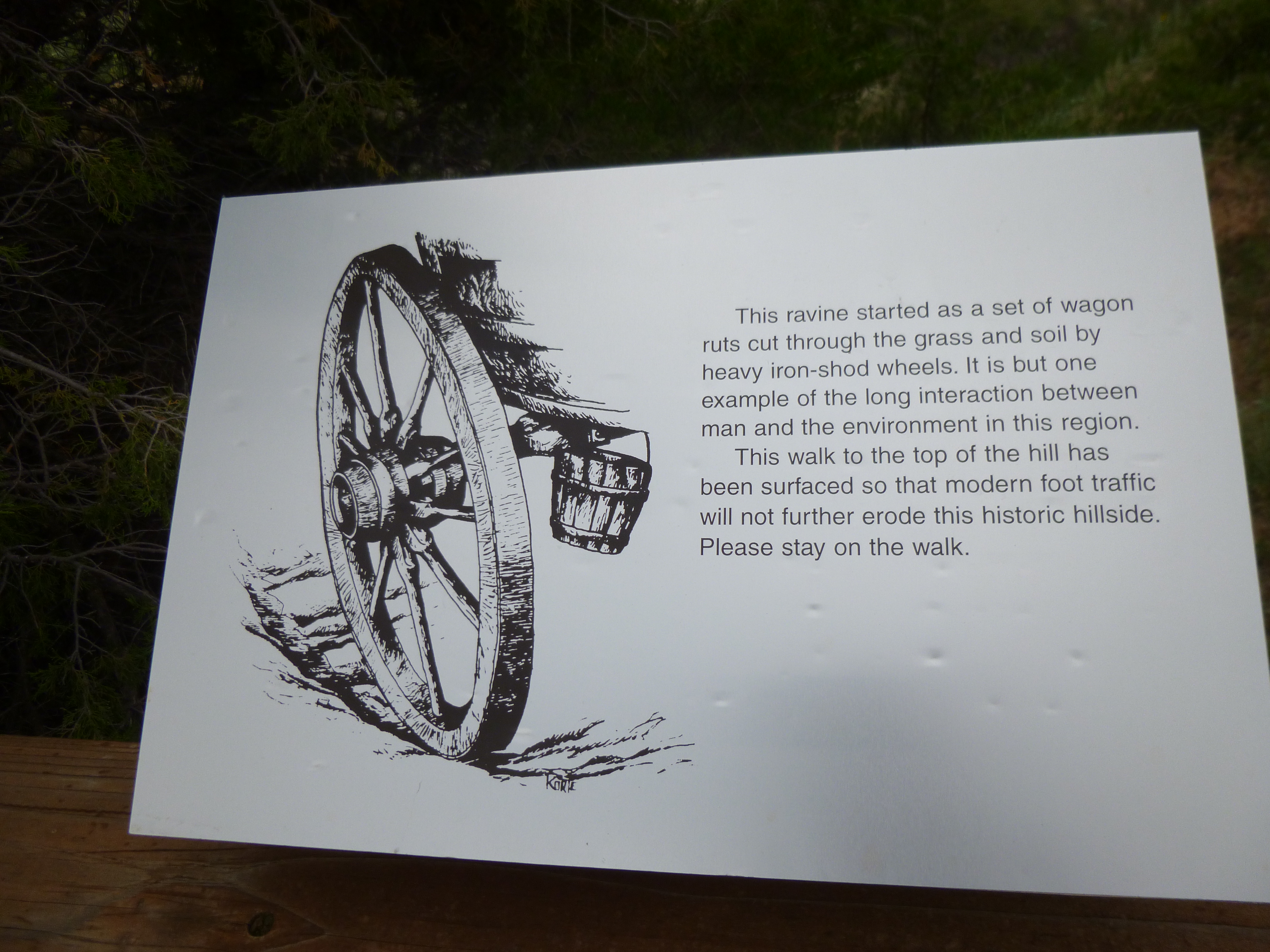
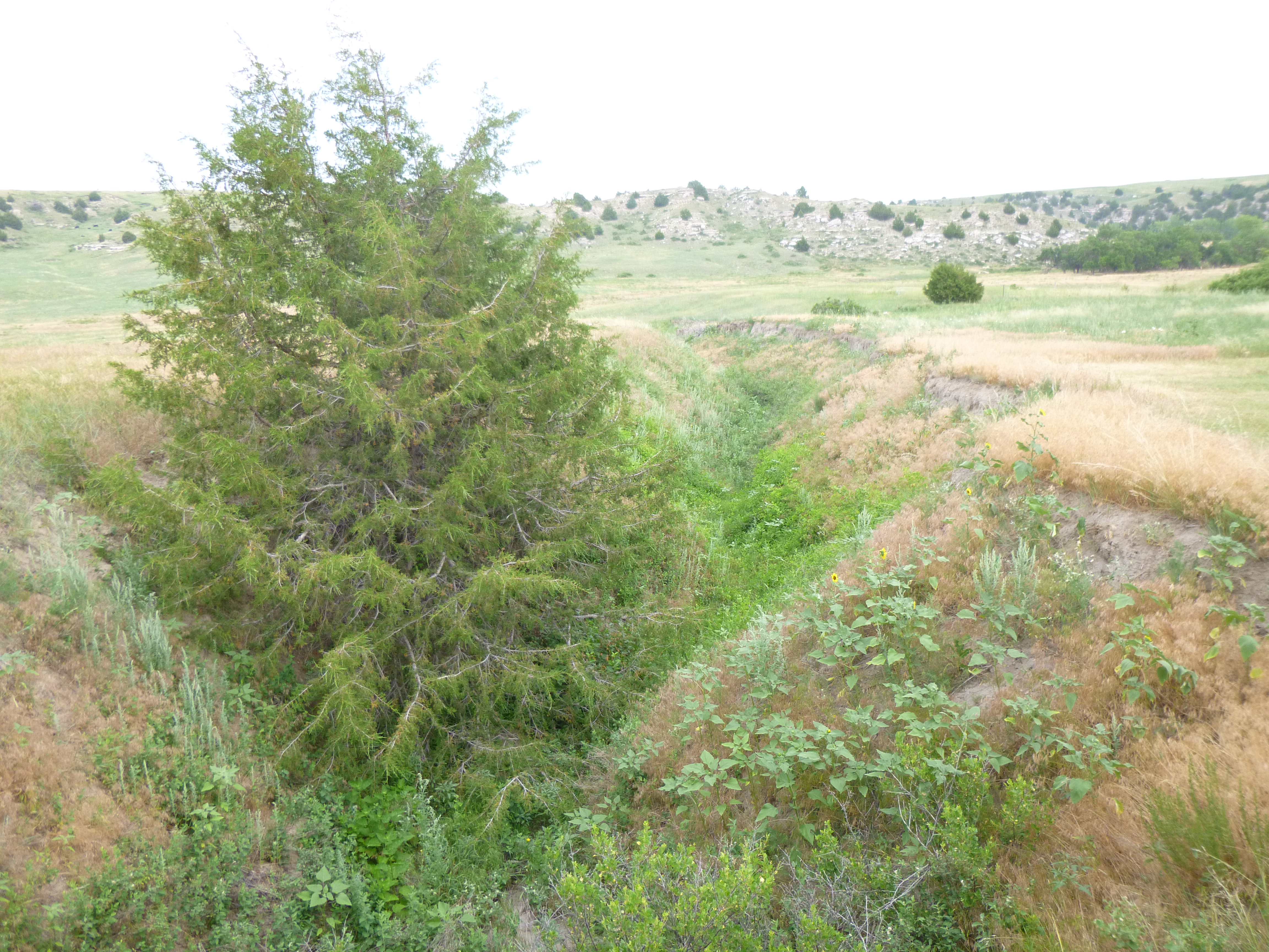
We then set off west – roughly following along the old Oregon Trail. I stopped in Ash Hollow State Historic Park, and we walked a trail to the top of the hills and bluffs in the area. It was a really windy day out, which I don’t think is unusual in these parts! There were some historic signs and photos along the way, and the ruts from the actual Oregon Trail were clearly visible. Since the wagon wheels had an iron rim around them, thousands of them wore ruts in the ground, which have deepened into ravines over time. The trail is very clear to see. A bridge crossed over the actual trail to preserve it, and I saw other trail remnants later too – also now gouges and ravines in the ground. This area was one of the first treacherous parts of the journey that the pioneers encountered, because of the steepness coming down the hills, and it was difficult to keep the wagons from rolling out of control.
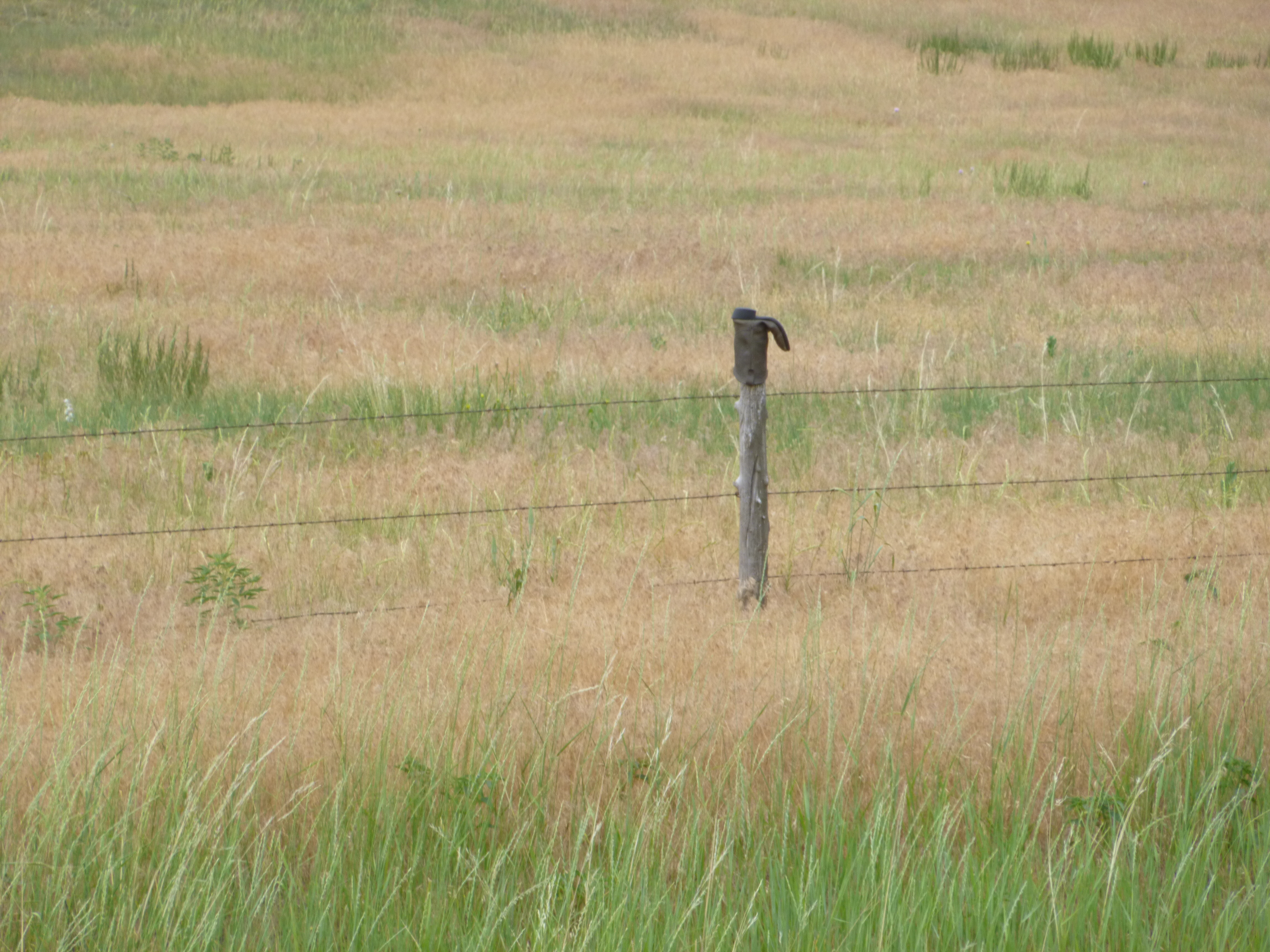
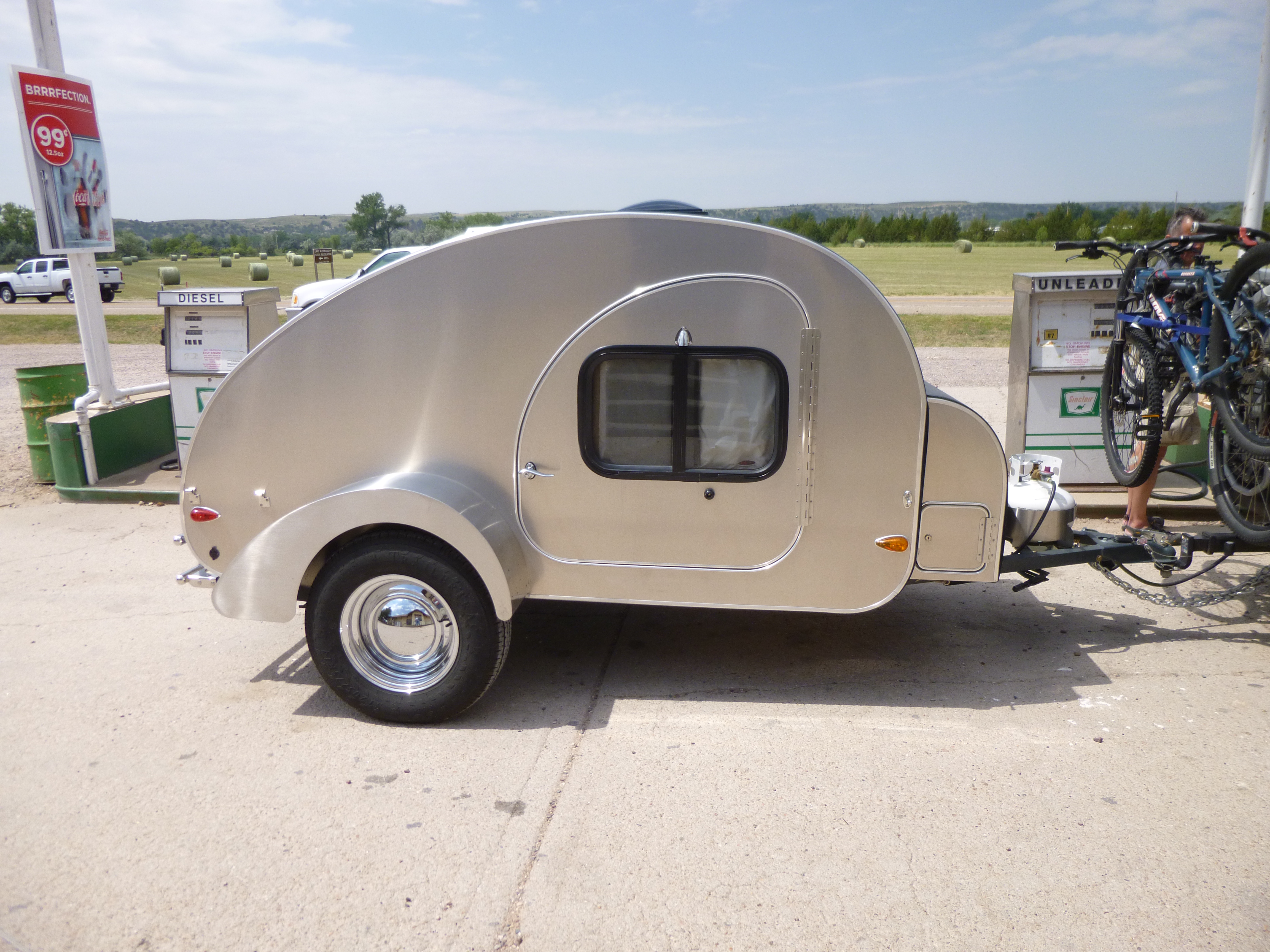
As I continued west, I drove past a long section of barbed wire fencing that had old cowboy boots and sneakers stuck on the fenceposts!?! And then I stopped for a little gas at one of the rural stations, and a couple pulled up with the tiniest trailer I’ve seen. It seemed to be about the size of a shoebox, and I asked them if I could take a picture. They told me the tiny trailer actually has a queen bed in it and a kitchen area in the back with a 2 burner stove. I still wouldn’t want to be pulling a trailer, but if I absolutely had to, that would probably be the one I would pull!
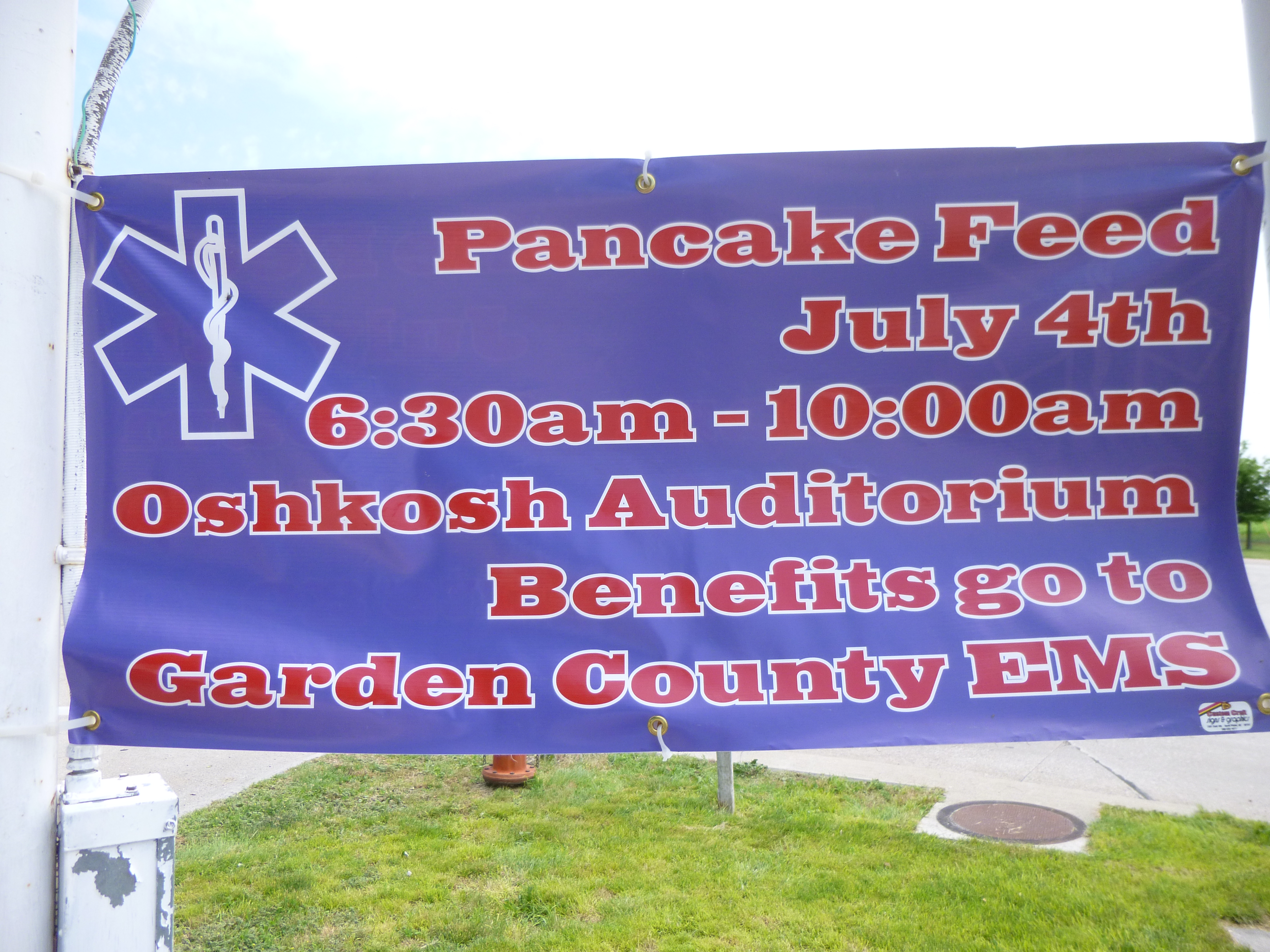
I continued on to the town of Oshkosh, where Tula and I got out for another short walk. Our walks aren’t long out in this part of Nebraska, because the towns are small without many sidewalks! But as I was walking past one of the shops in town, I saw a flyer about a Pancake Feed on the morning of July 4th to benefit the Garden County EMS. The EMS covers a very rural part of the state and the fundraiser was for some new equipment. I knew if I had been in town, I would have gone to the pancake feed, but since I wasn’t going to be there on the 4th, I wanted to support it anyway, so I called the local hospital right in Oshkosh, and they told me to come on in! It’s a small facility, which wasn’t surprising, and the hospital was combined with a nursing home. I think out here the facilities fill all kinds of needs – they have a large area to cover, and try to help everyone with their needs. I was happy to see both the flyer, and the banner out by the main road, and they were grateful to get a jump on the Pancake Feed fundraiser. I helped a police department fundraiser back in Wisconsin, and now this was an EMS fundraiser – I’ll have to keep my eyes open for a fire department fundraiser!
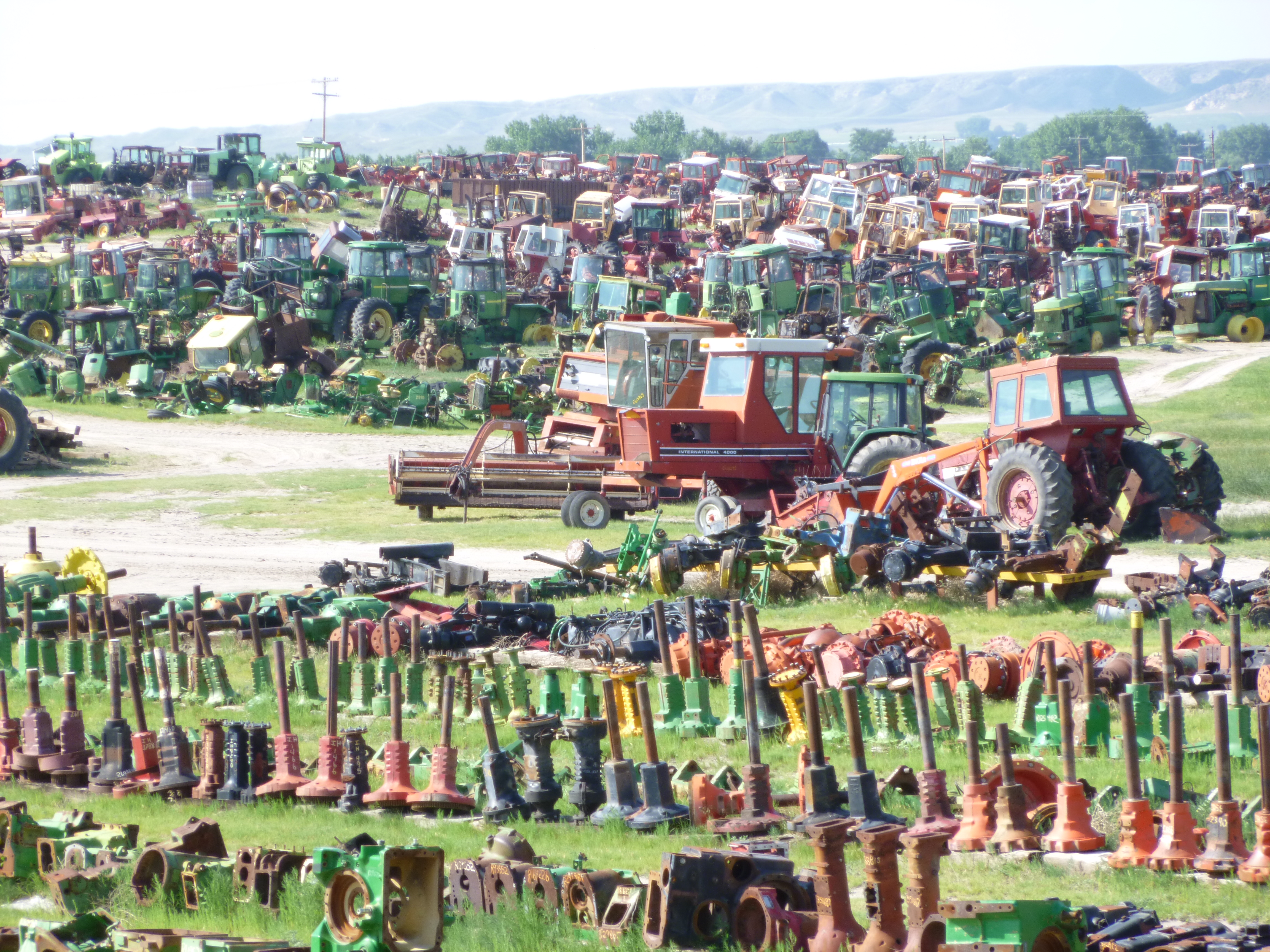
I continued meandering northwest through the hills, driving through an occasional old town where things were so quiet it was almost like a ghost town. I came to a state recreation area near Bridgeport and Tula and I got out for another mile and a half walk. Then I continued on to the first of the landmarks that the pioneers would see in this area – 2 huge rock formations that they called Courthouse Rock and the smaller one was Jailhouse Rock. The courthouse rock was said to resemble any courthouse on Main Street back east. After visiting them, I discovered the place where old combines and farm equipment go to die – the biggest (although very organized!) farm equipment junkyard that I could imagine – acres and acres of old colorful combines and tractors and other farm implements! It didn’t even look junky!
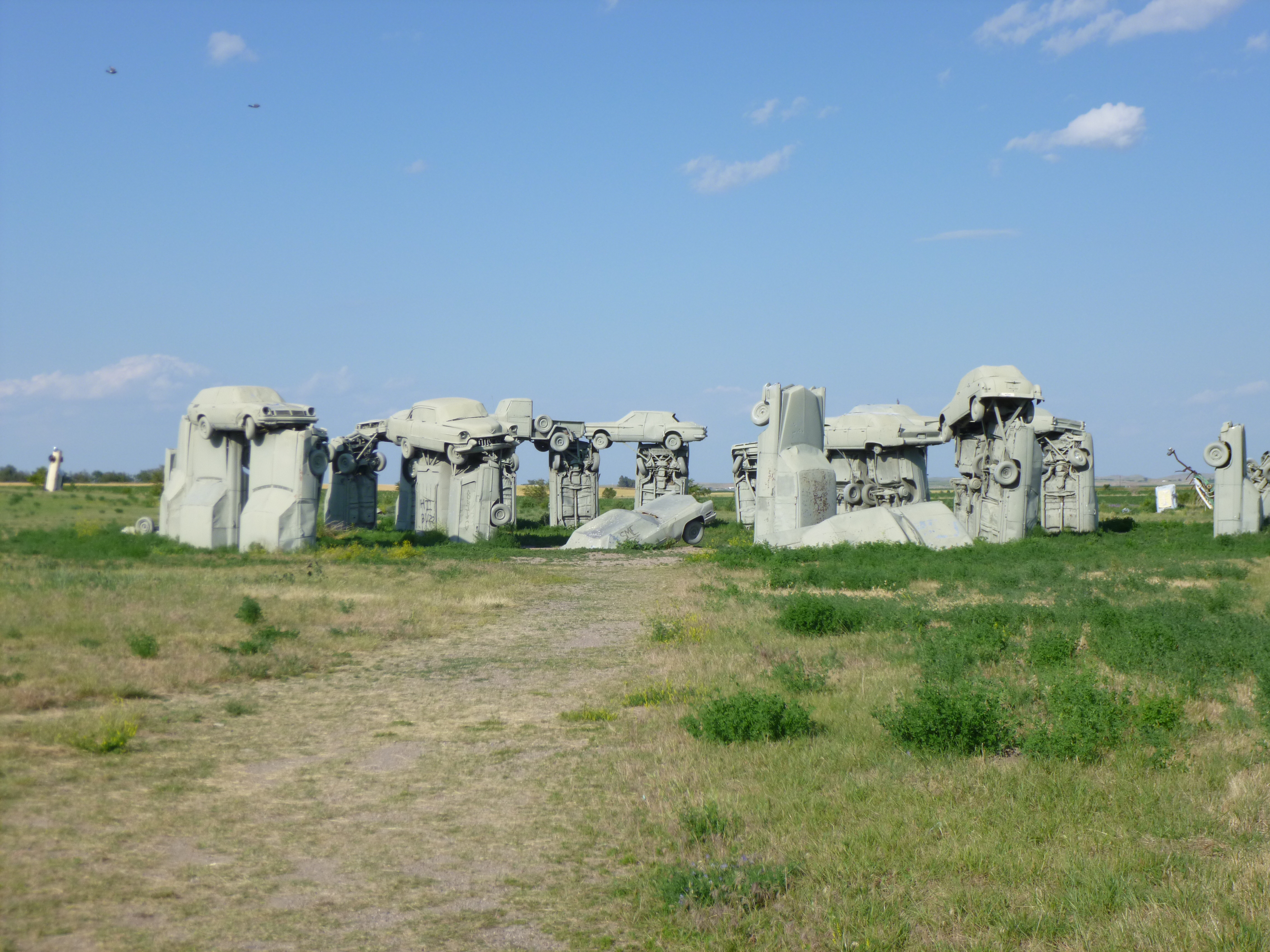
I headed north to the town of Alliance, and stopped at Carhenge, which I saw in 2005, but figured I’d stop again. Carhenge is a scale model of Stonehenge that was created by a Nebraska farmer as a memorial to his dad. He took old cars and dug holes to place them on end in a circle, and balanced other cars on top of those, and spray painted everything gray. And it does bear a resemblance to Stonehenge – kind of an odd little tourist attraction! Then Tula and I found a shady park and arbor with a fountain for nearly 2 more miles of walking, and I finished off the walking for today in the town of Alliance. The towns out here still have old-fashioned movie theatres with a marquee and neon lights, and as I walked past the theatre, the doors were open, and the smell of movie popcorn enticed me to go back and get a bag (reasonably priced no less!) to enjoy on my evening drive down to Chimney Rock! It was dark by the time I got to Chimney Rock, but there were lights at the base of it, and it softly glowed against the night sky, and I tried to imagine the thousands and thousands of pioneers who also saw it (day after day on their slow journey) as another one of the Oregon Trail landmarks.


Nebraska – Monday, July 1
(I haven’t been able to post anything for a few days since I camped for 4 nights in a row, and have been out of range of any services!)
Since I ended up in North Platte last night, Tula and I started our walking in some nice neighborhoods and covered a little over 2 1/2 miles. The residential area that I was in had long streets and tidy homes and pretty flower gardens. I don’t recognize everything I saw, but it was pretty and it smelled good.
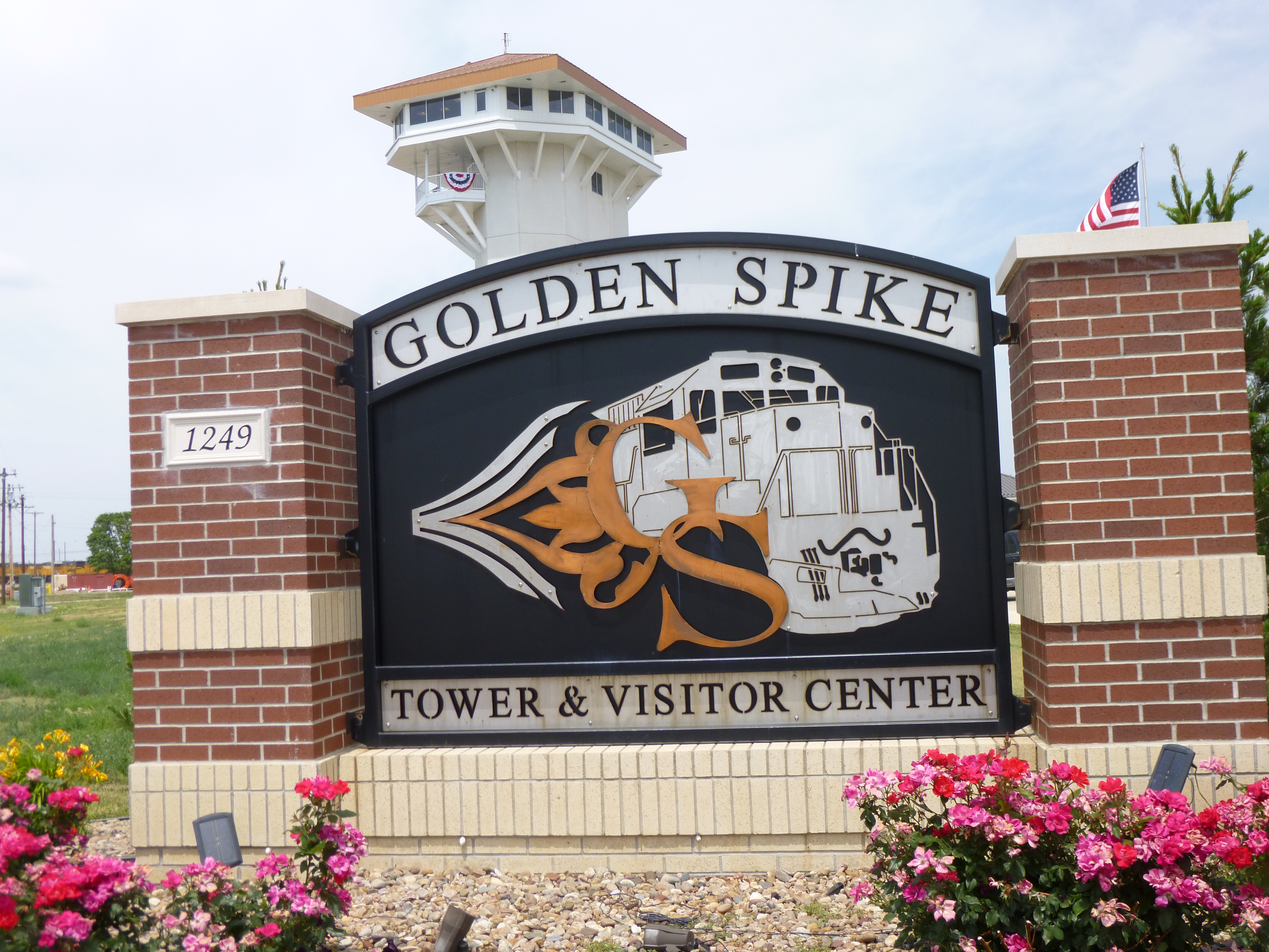
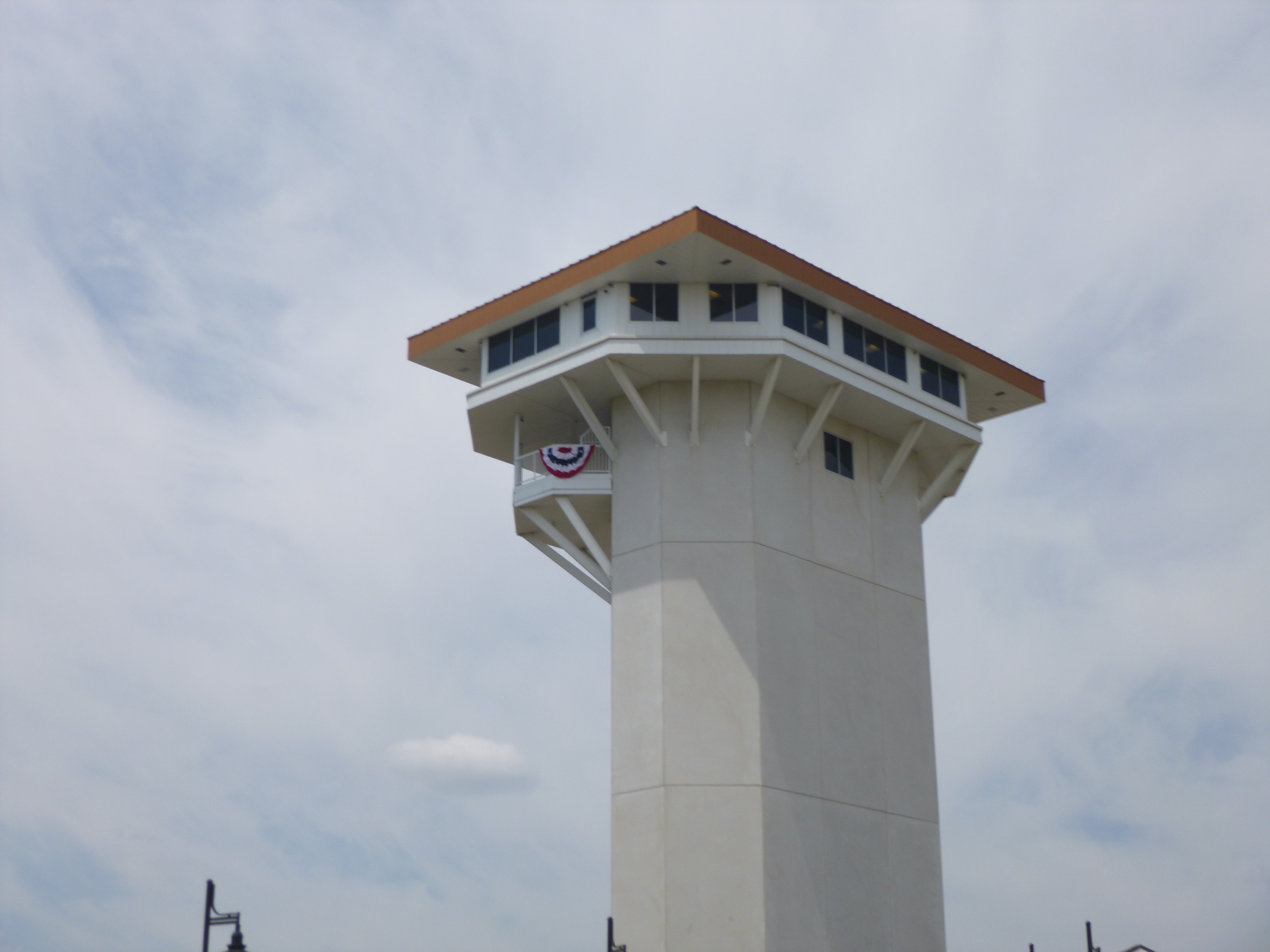
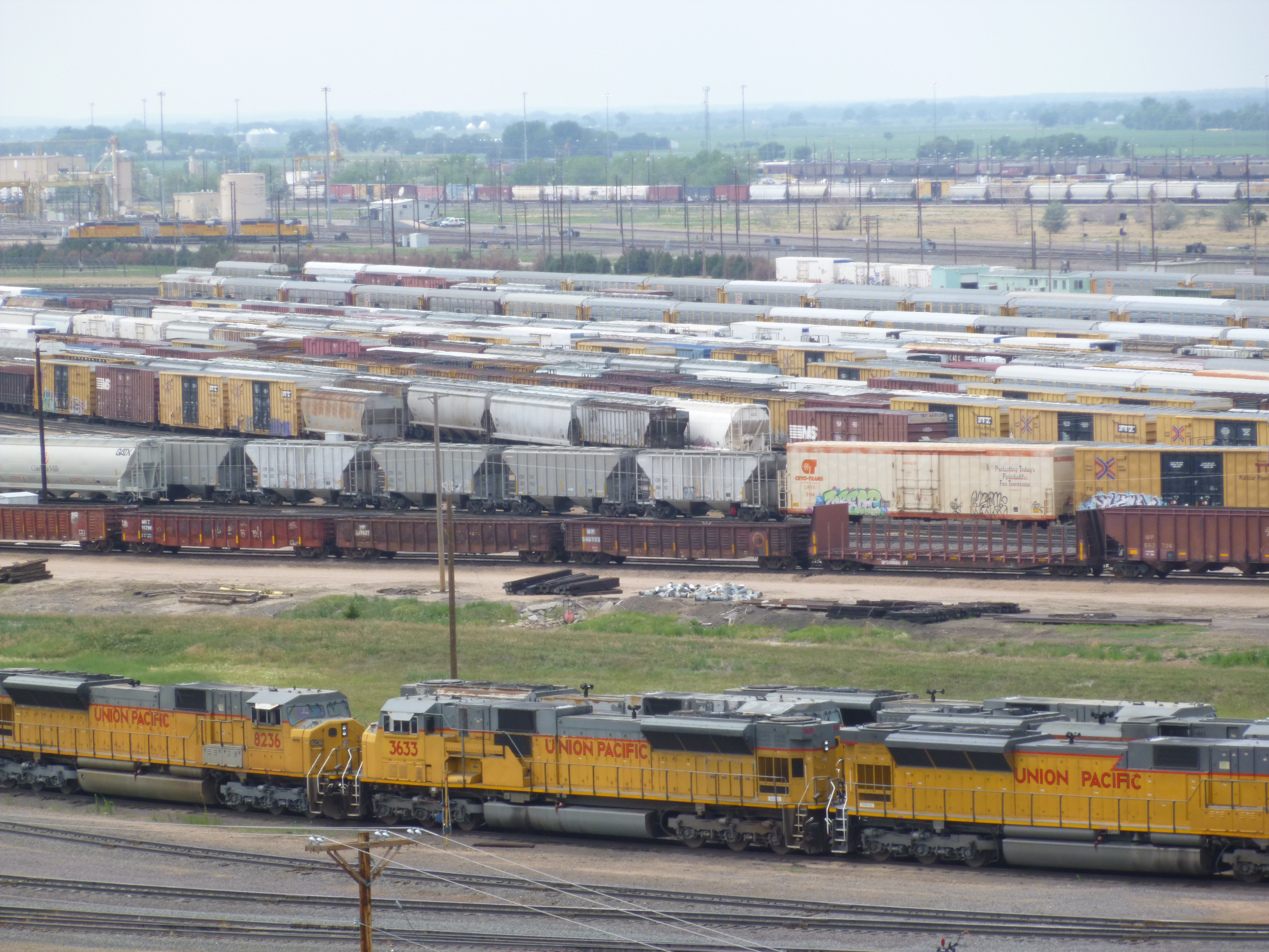
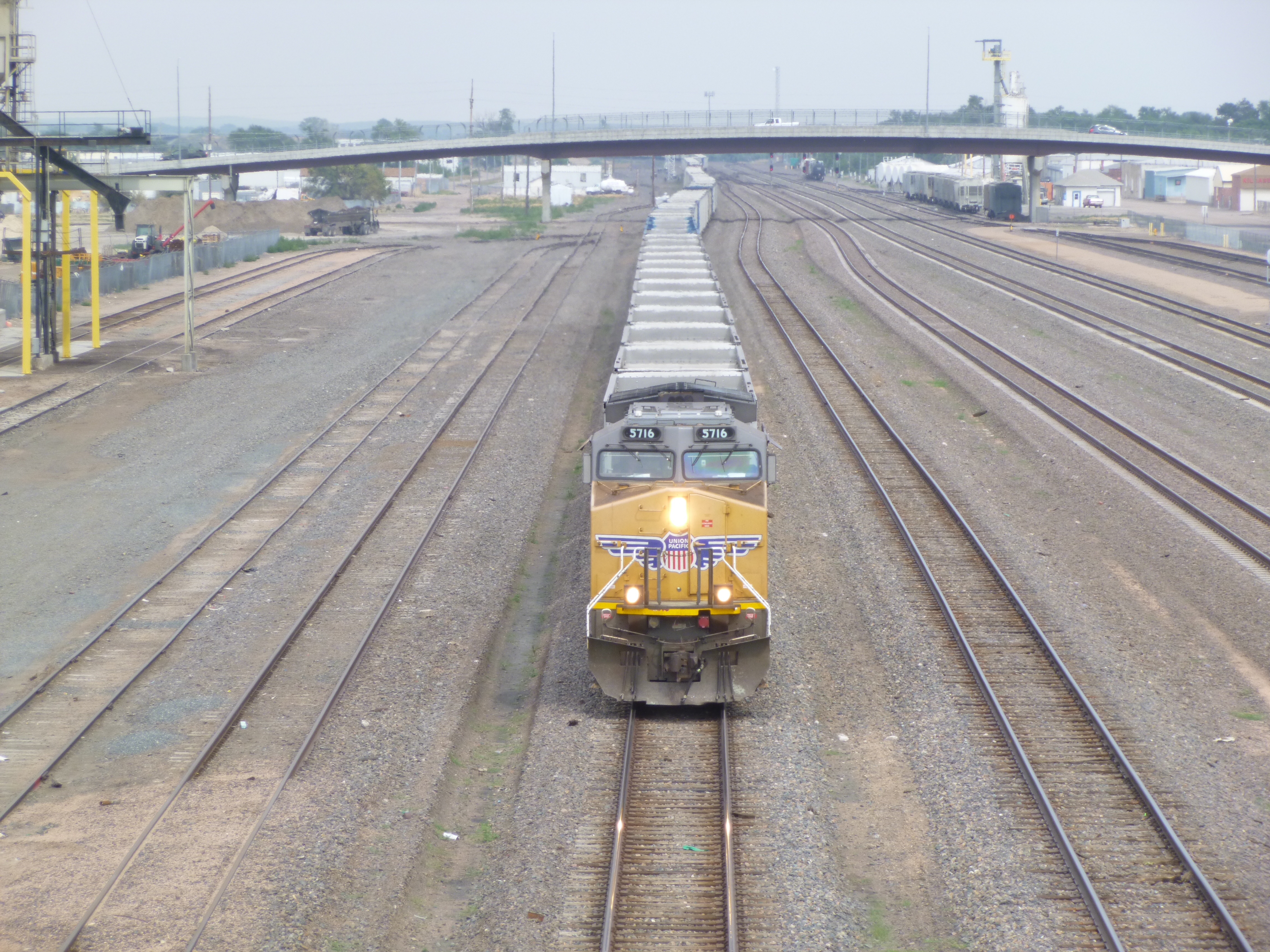
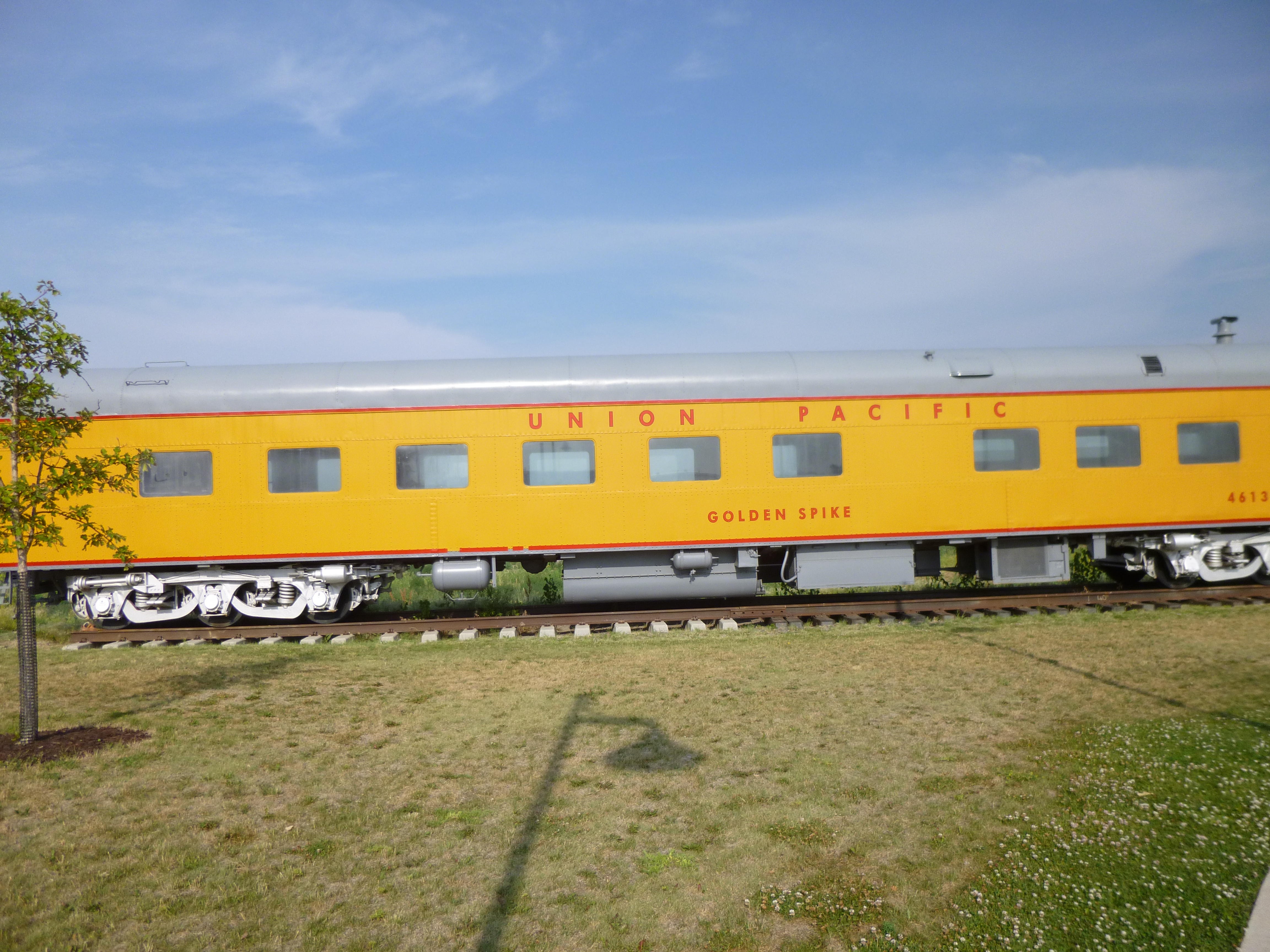
And then I headed for the largest railroad yard in the world – the Union Pacific hub of train traffic in the U.S. Back in 2005 when Nebraska was my “state-of-the-year”, I knew this was a large railroad yard, and had read there was some observation tower, but all we could find at the time was a rickety wooden thing that was on UP property, and it didn’t seem like we should really be there. But, 3 years after we were there, they built the Golden Spike Tower – a tall tower literally in the shape of a railroad spike, and there are both indoor and outdoor viewing platforms up high, and volunteers who were willing to answer any and all questions. I spent a good bit of time there, then left for a little while to get a couple more miles of walking in, then I came back when some “action” had started. For someone who likes trains, this is the place to be! This railroad yard handles both east-bound and west-bound trains of course, and they stay on separate sides of the yard. There are 64 tracks in the east-bound “bowl”, and 50+ tracks in the west-bound “bowl”. The bowls are used for sorting train cars and assembling trains according to destinations. And there are other tracks for the trains just going through, that don’t need any services or crew changes or anything – for example, all the coal trains. There are actually 36 coal trains every day – and my count yesterday was correct. There are 138 cars per coal train, and all that coal is coming from Wyoming (who knew?) but I forgot to ask where it’s all going. Each train needs 2 engines to haul all that coal, and the engine in the back is kind of like a stabilizer so cars don’t go flying off the tracks, particularly when those 36 daily trains return empty. Speaking of coal trains, on one of my walks I went over a viaduct, and watched an empty coal train pass directly below me. The insides of the coal cars are remarkably clean and shiny, and there was still coal in the corners of some of the cars. Coal is unloaded either through hatches in the bottom of the cars, or with some trains, the individual cars can be totally flipped over one by one and emptied that way. There’s only 2 people running the coal trains – the engineer and a conductor.
Back to the other trains. Union Pacific people do not call train engines an engine, or a locomotive, or a diesel. They are referred to as “power units.” But I’m still going to call them engines. I have never in my life seen so many train engines in one place. There had to be over 100 of them. There’s a huge maintenance shop and they repair 750 engines monthly, and they have huge fuel tanks nearby because the engines go through 14 million gallons of diesel fuel a month. The maintenance shop also replaces 10,000 pairs of train wheels a year.
The yard handles 10,000 train cars every day – full of oil, wood, autos, grain, produce etc. etc. (Produce trains are called “salad shooters.”) There are trains bringing in goods from the direct source, and those cars all have to be sorted and lined up according to destination, and to do that, there is an east-bound “hump” and a west-bound “hump” and one of the worker engines will pull a string of cars up the hump, and then the cars are released manually, one by one, or sometimes 2 or 3 at a time, to roll down the hump onto a specified track, which is controlled by computers and switches (985 switches to be exact!) to be part of a train that is being assembled. The cars headed for the closest destination are put right behind the engine, and the cars at the tail end of the train are headed for the farthest-away destination. So if you see a long freight train, and wonder why all similar cars are not grouped together, it’s because different destinations have different orders. I was curious why the cars headed to the closest destination were the first cars of a train, and it’s because once they get to their destination, they can simply uncouple the train at the end of that town’s “order”, and the engine already in use can pull them to a siding and then go back up and re-hook to its train; otherwise if the cars were at the back of the train would be released, some other engine would have to come to pull them into a siding, so it’s more efficient to put the cars in the reverse order than what one would expect. Many of the working engines in the bowls and the rest of the yard are remote-controlled – they’re the real workhorses and never leave the yard. They have a flashing strobe light on top, so employees know it’s remote controlled and that no one is actually in it. There were lots of working engines – pulling cars up the hump to be sorted (classified is the official term) – and the cars’ downward descent, which is by gravity only, is controlled enough that 80% of them couple automatically to their assigned train, although a human checks every train car for brakes and air lines and all that before the train leaves the yard. The working engines were also pulling cars with a red tag – ones that had been inspected and needed some sort of maintenance.
And then there were the intermodal trains – the ones where the cars looked like they had 2 semi trailers stacked on top of each other. Those are actually shipping containers, and have nothing to do with trucks, and most of that freight is not even intended for the U.S. The freight arrived by ship from countries to our west, and is being shipped to countries to our east, but because the volume of freight is too much for the Panama Canal to handle, the companies simply unload their ships onto flat rail cars, where they ride across the country, and then they are reloaded onto ships out east for the final leg of their journey.
The viewing platforms gave us a good birdseye view of the yard, which is actually 8 miles long, with 315 miles of track, and it’s an incredibly busy place. There were quite a few visitors, and a lot of information, and they had a box for donations, so it was pretty obvious this had to be my donation=of-the-day. Lots of people are interested in trains, and this was a great place to learn a lot about them.
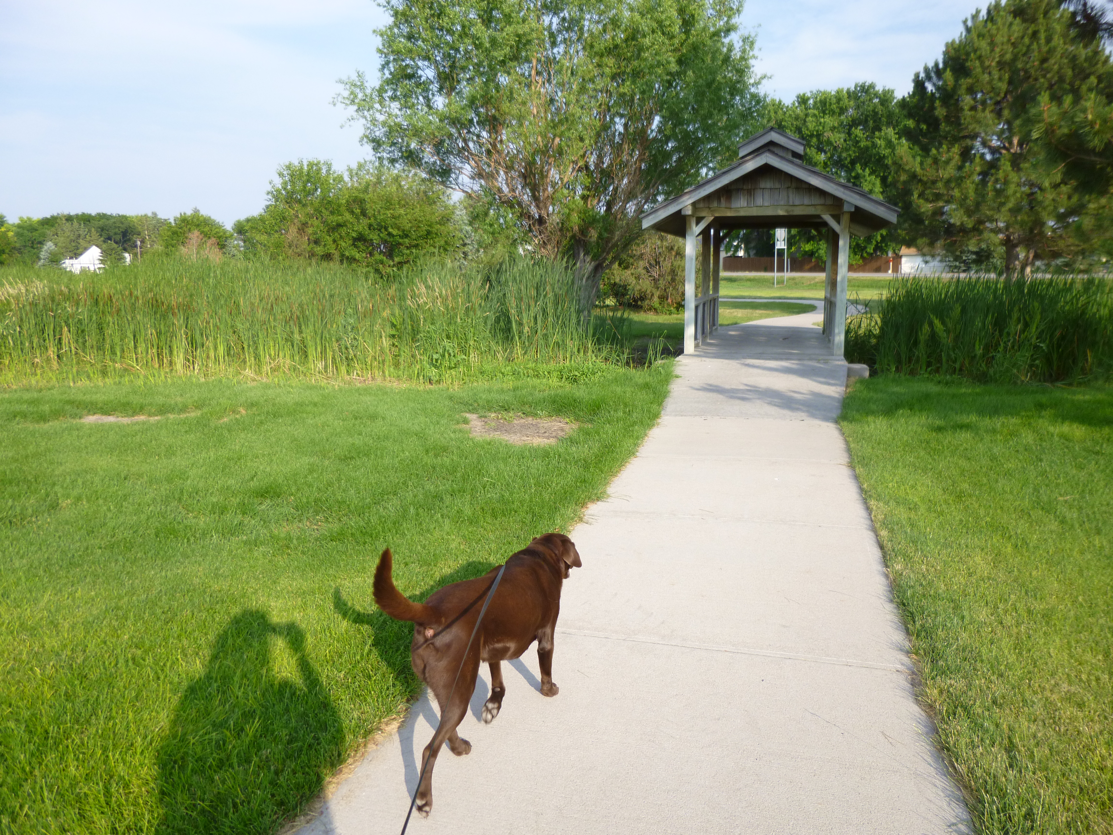
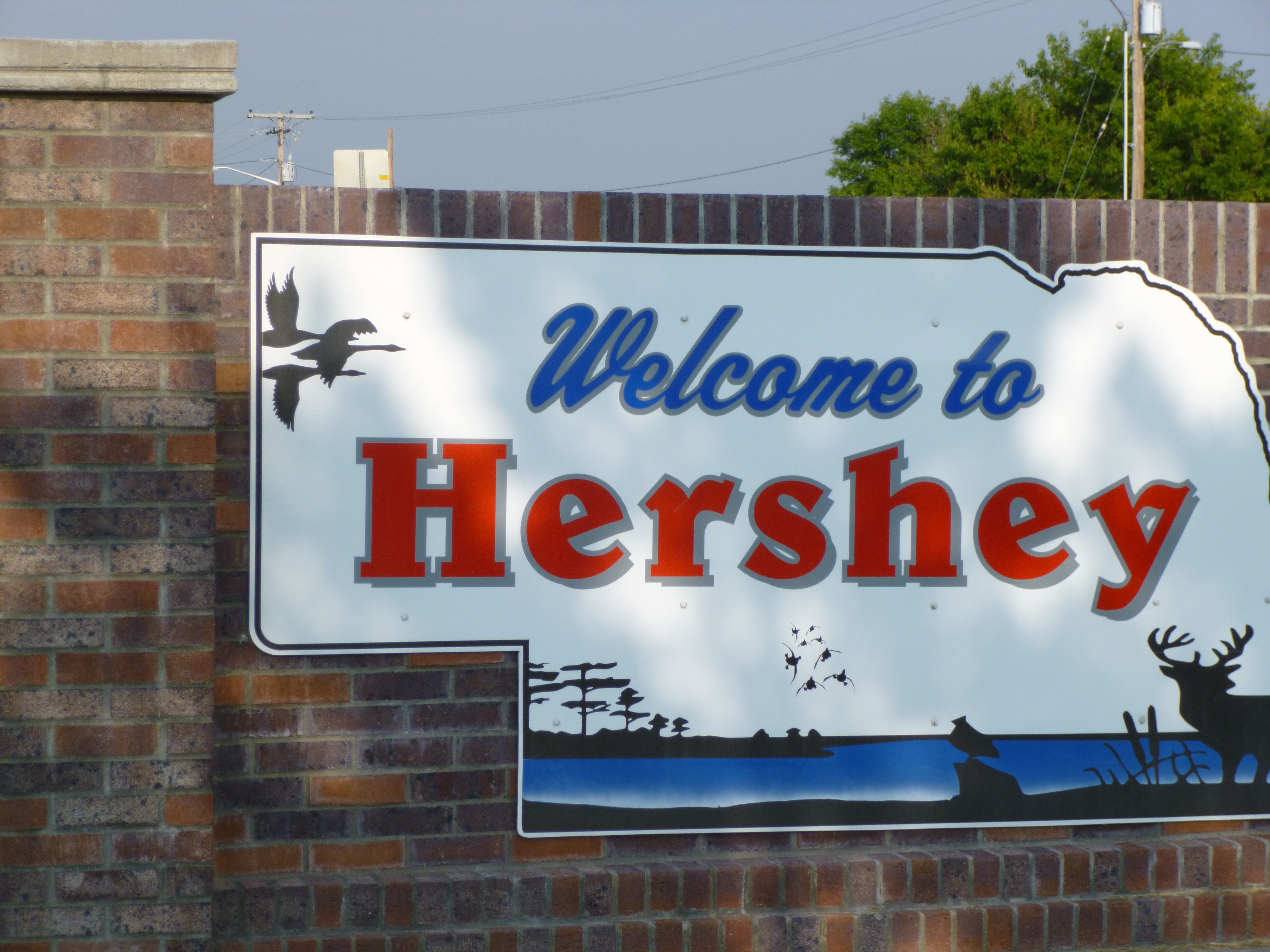
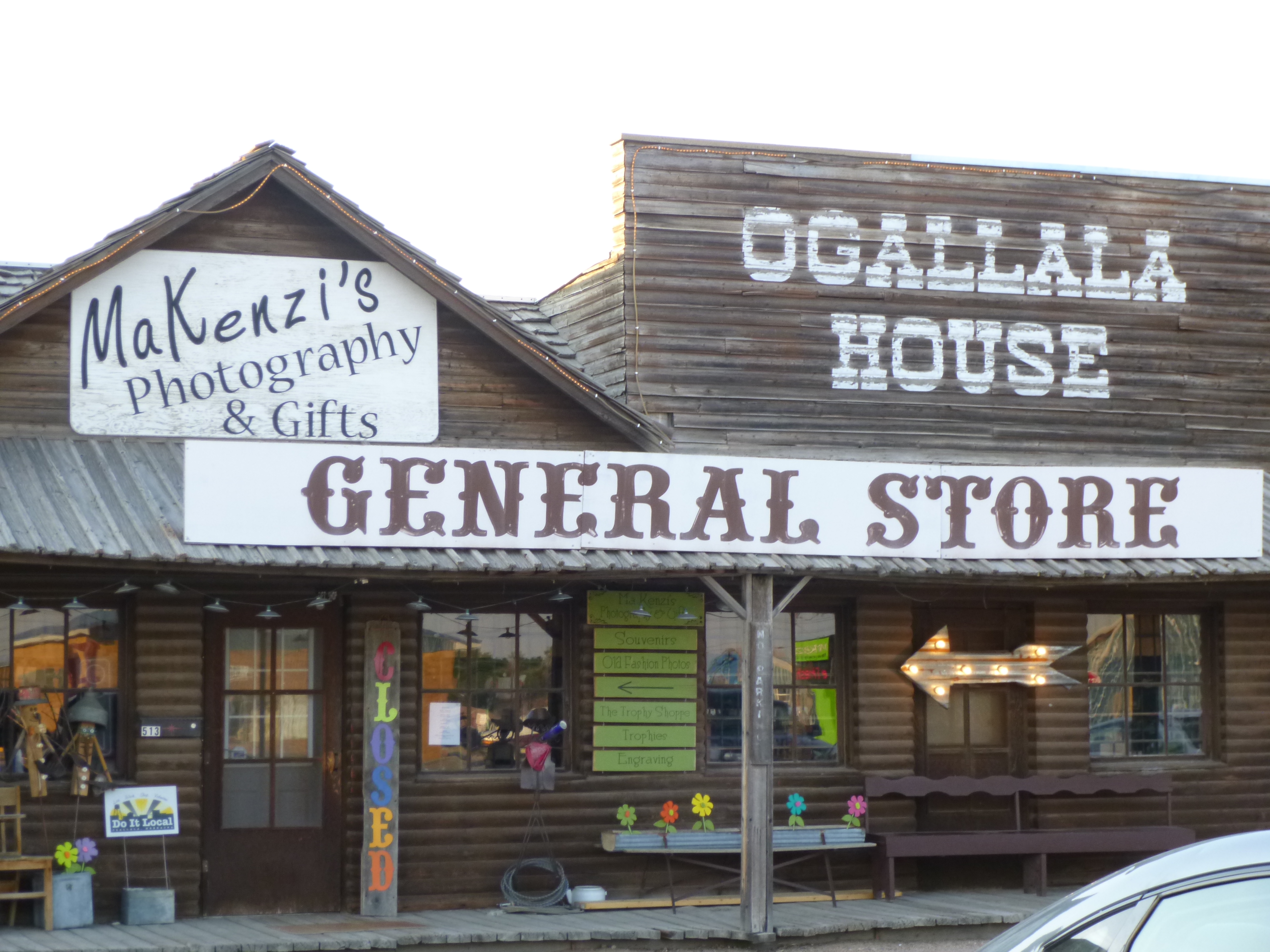
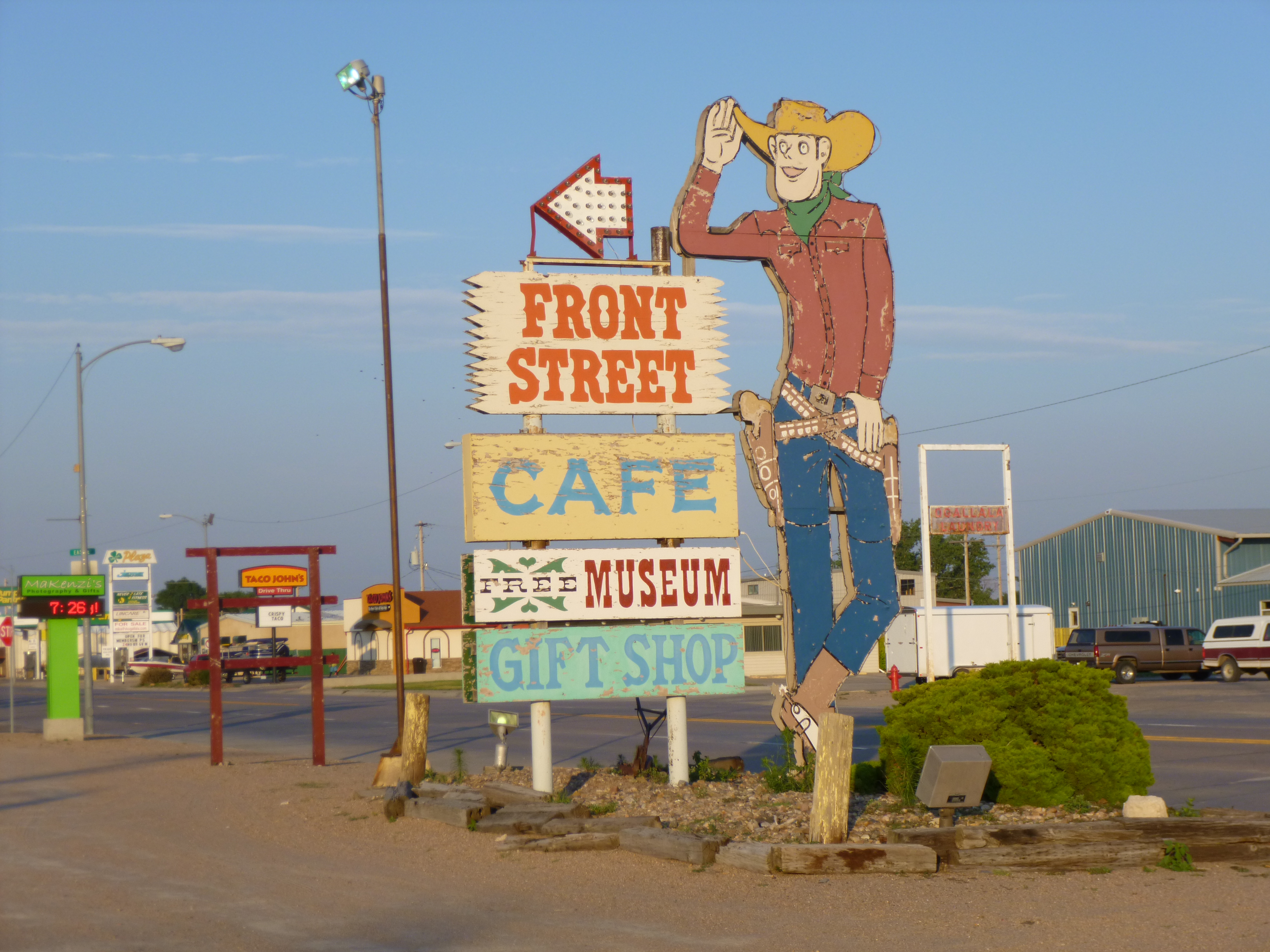
Between my morning walking, and time at the train yard, and afternoon walking, and more time at the train yard (lots of sorting was going on during this visit), it was actually early evening by the time I left North Platte. It was time to continue heading west, and I still had a little walking to do. I passed the small town of Hershey, and there was a big city park with a trail all around it, so we walked about a mile and a quarter there, and then moved on to the town of Ogllala, where we walked nearly 2 more miles, and finished up for the day. Ogllala was kind of a touristy old-west type town, with mock gunfights in front of a western restaurant – kind of a throwback to the ’60s. I was then heading back into the Sandhills, on another scenic route, and I passed a campground as it was getting dark, so we camped again. The little office was closed, so I just chose a spot and paid up in the morning.