Puerto Rico – Sunday, April 28
The motel had a decent breakfast so I fueled up for the day and tried to do a little more donation research, and then headed out to see what I would see. To put my mind at rest a little, I figured if push came to shove, I could always make 2 big donations (to Red Cross and the 1 food bank I’ve read about) instead of 7 smaller ones, but I’m hoping that’s not how it ends up.
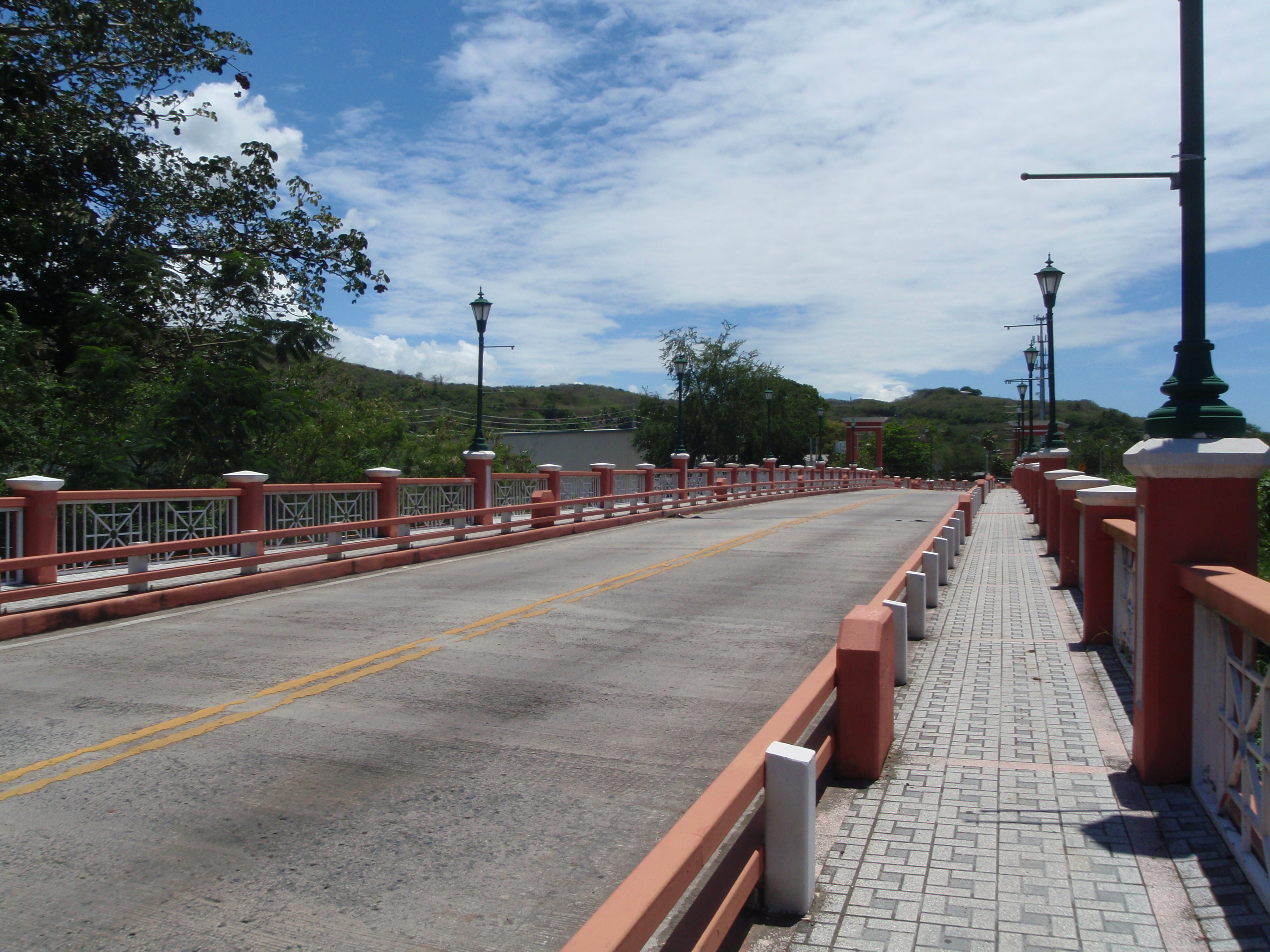
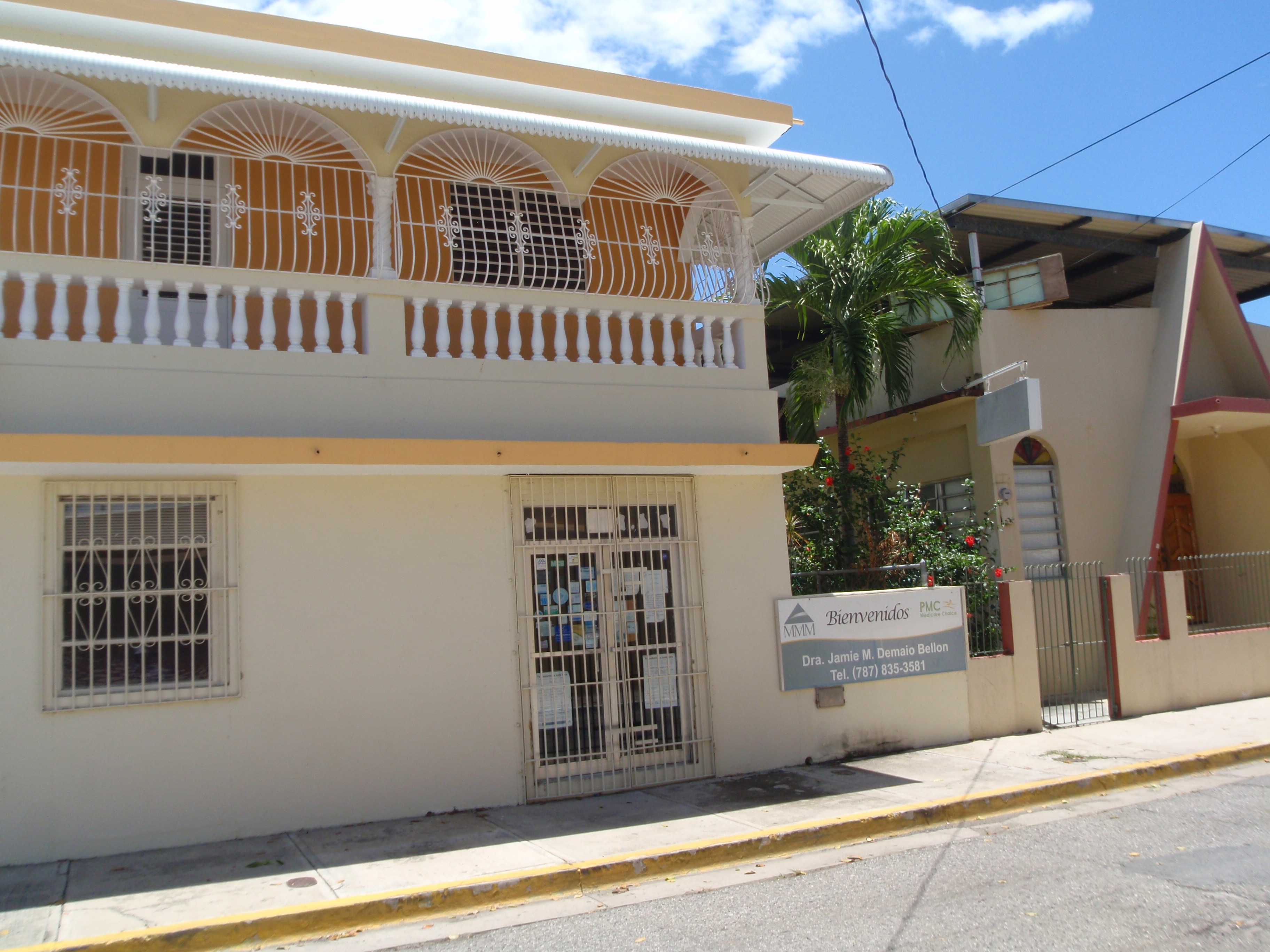
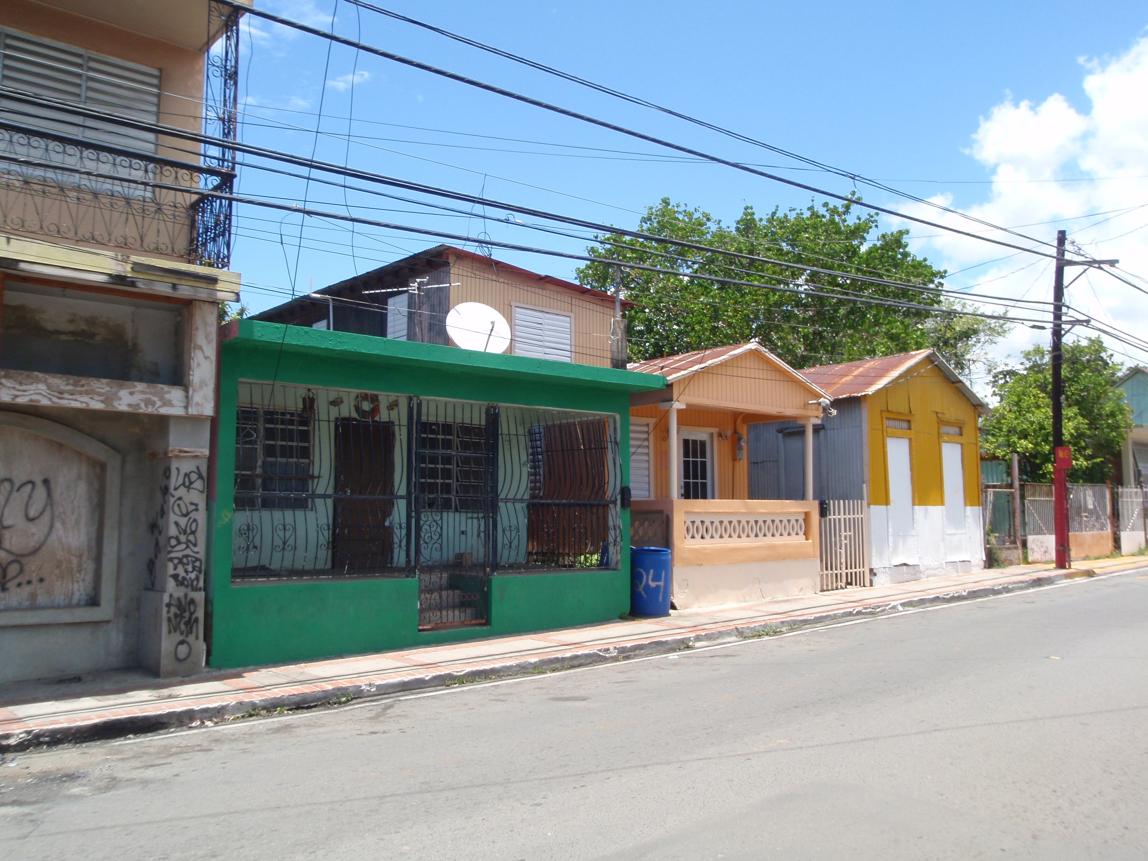
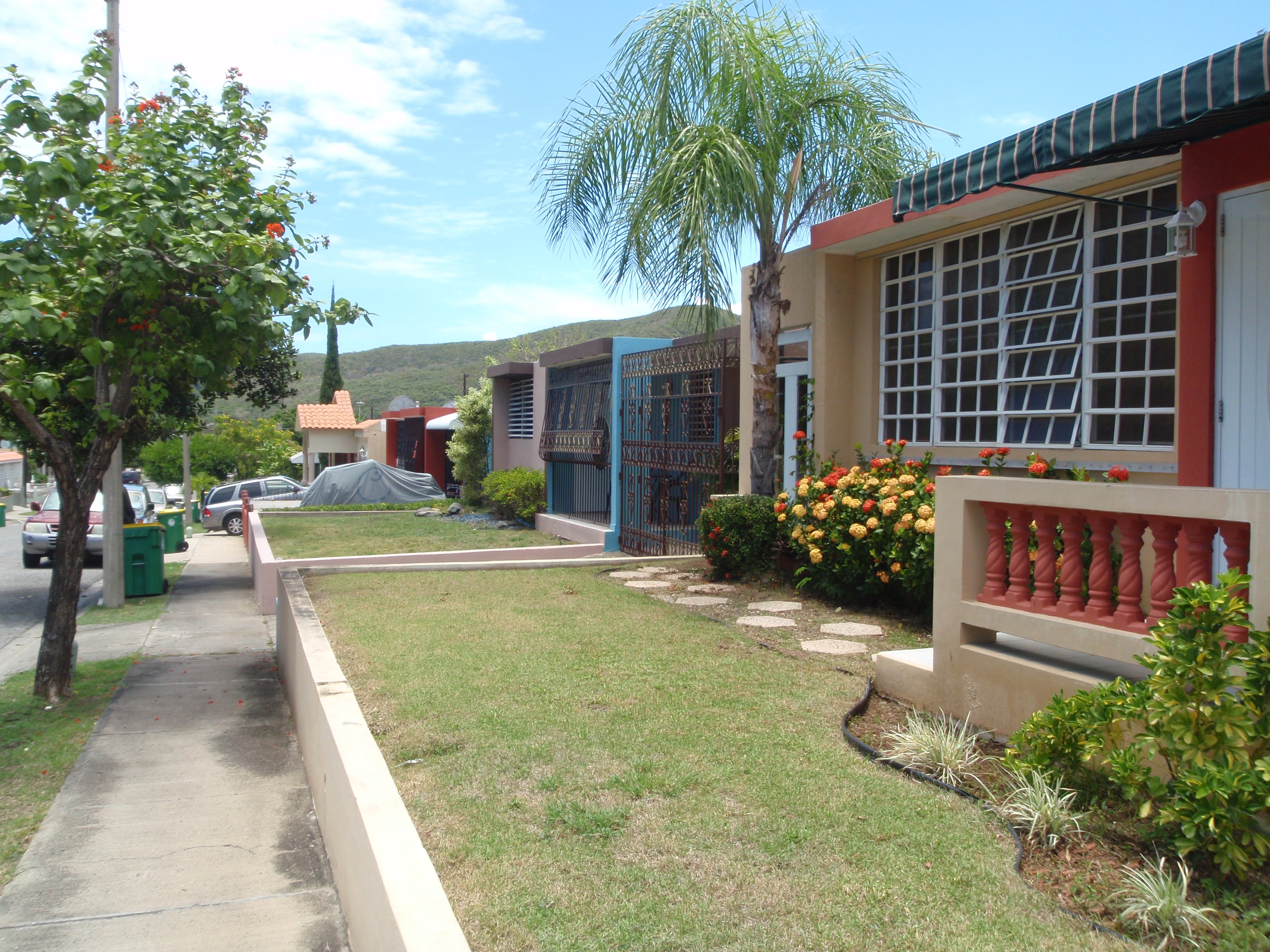
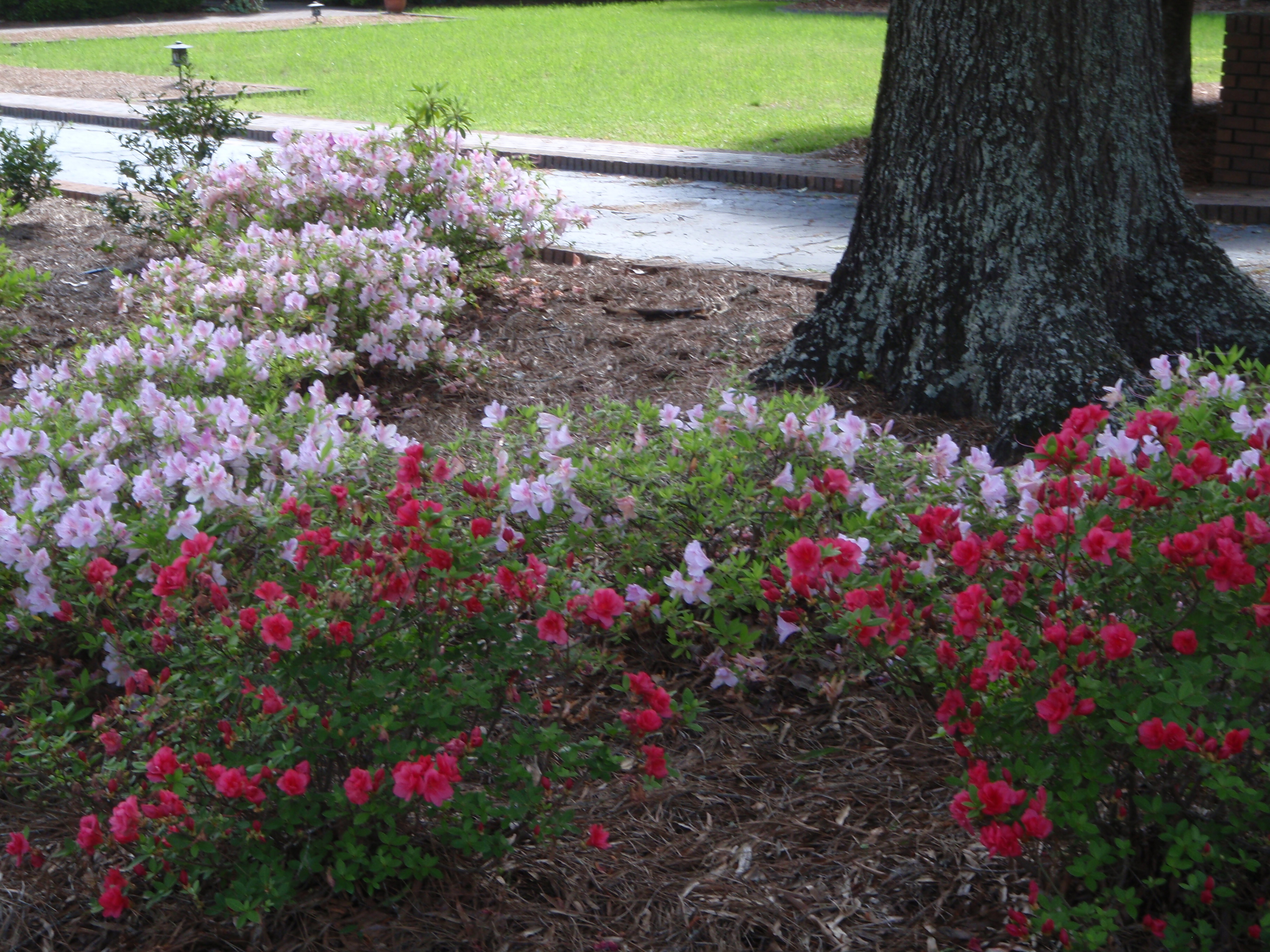
I decided to stop in the first town I came to, which was Guayanilla. There wasn’t anything in particular to see here, other than finding a place to start some of my walking. The entrance to town was over a nice red and white bridge, with good sidewalks, so I found a parking lot, and walked over the bridge and back. Then I walked through town, which was mostly just one street, with small shop buildings and narrow sidewalks and old cars parked along the street. I could hear chickens, and it even sounded like one of them was crowing from inside a house! But it was probably from an internal courtyard. On the way back through town, I took one of the side streets into a neighborhood, and was happy to see that it led to a number of streets in a very pretty neighborhood. The houses were mostly small, square, and flat-topped, and all of the homes had either concrete fences or iron gates in front of the properties, but everything was still neat and colorful. There’s hardly any space between houses, and yards are tiny – some are just rock, or sand, or plants – a few had grass. And nearly all the houses had floor to ceiling iron “gates” in the fronts of their houses, and part of the living space was simply open to the outdoors. The bars/gates had different filigree designs, and some bowed out, and they were painted different colors, and that all kept it from looking prison-like. It was a very attractive neighborhood. I did see some old cars like Gremlins and the old-style VW bugs. And I could hear people talking (arguing in one instance!), and TVs, and music, and meal preparation – the drawback to some of the open living areas. Once I made my way through the whole neighborhood, I ended up walking a little over 5 miles. I had a bottle of water with me, but the one I left in the car was almost too hot to drink, so I stopped for a cold drink.
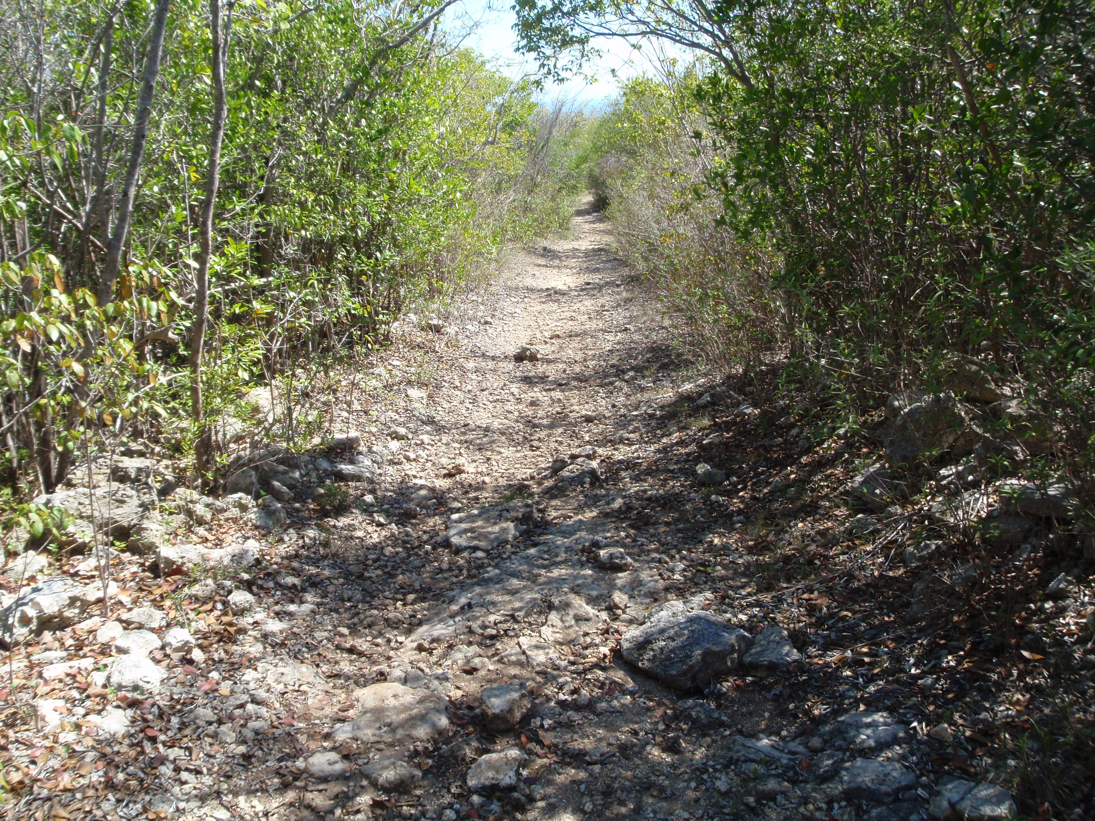
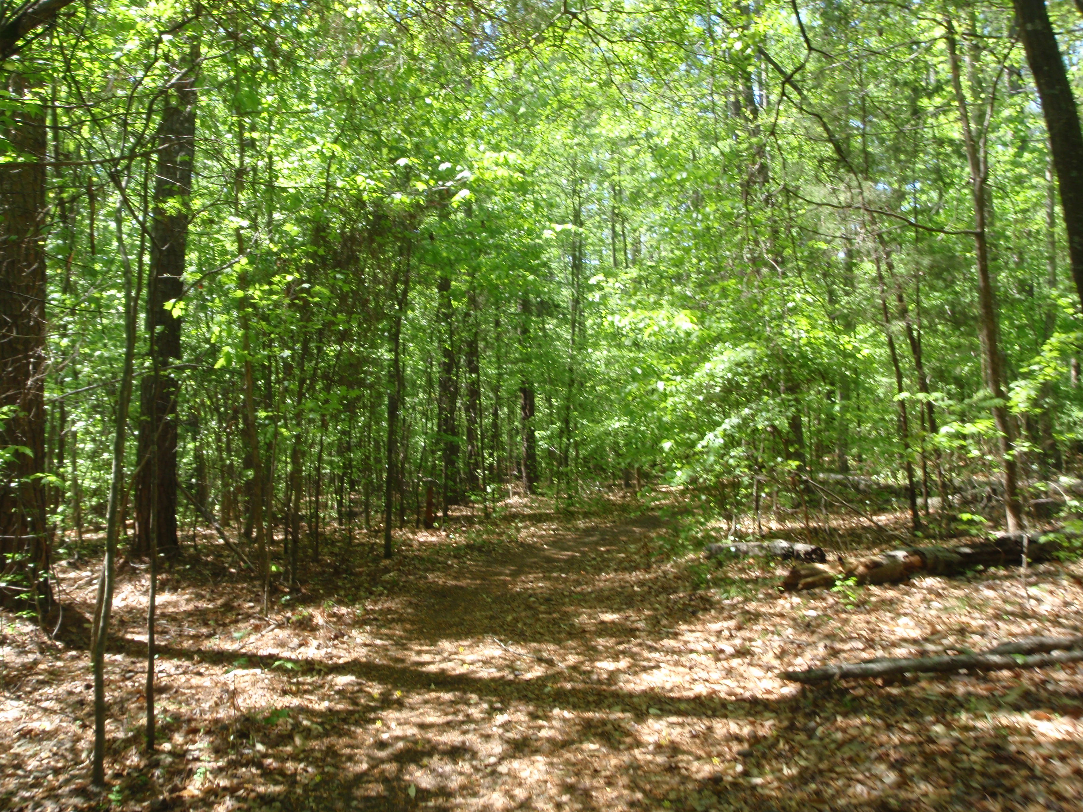
Then I drove on to Guanica – a seaside town in southwest Puerto Rico. Along the way, I passed the turnoff for Guanica State Forest and Biosphere Reserve, so after a couple wrong turns, I managed to go into the mountains a bit and find a tiny visitor center there. One of the guys there spoke a little English, and he recommended a couple trails, so I walked on those, and listened to a lot of birds. This is a “dry” rainforest – which doesn’t quite make sense to me, since I associate rainforests with a lot of rain, but there are bonsai-type trees here (which I didn’t see) and trees that don’t need much water.
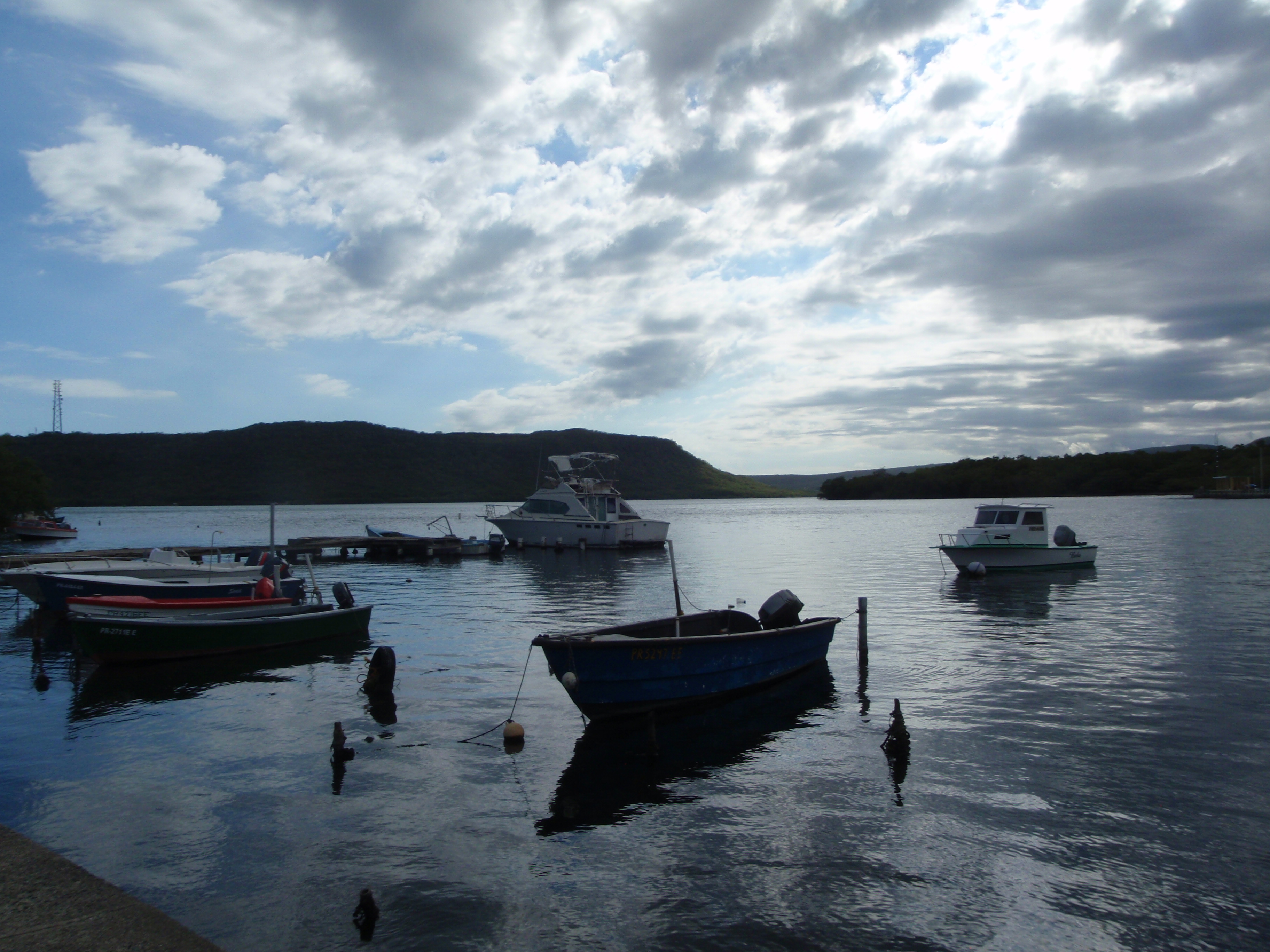
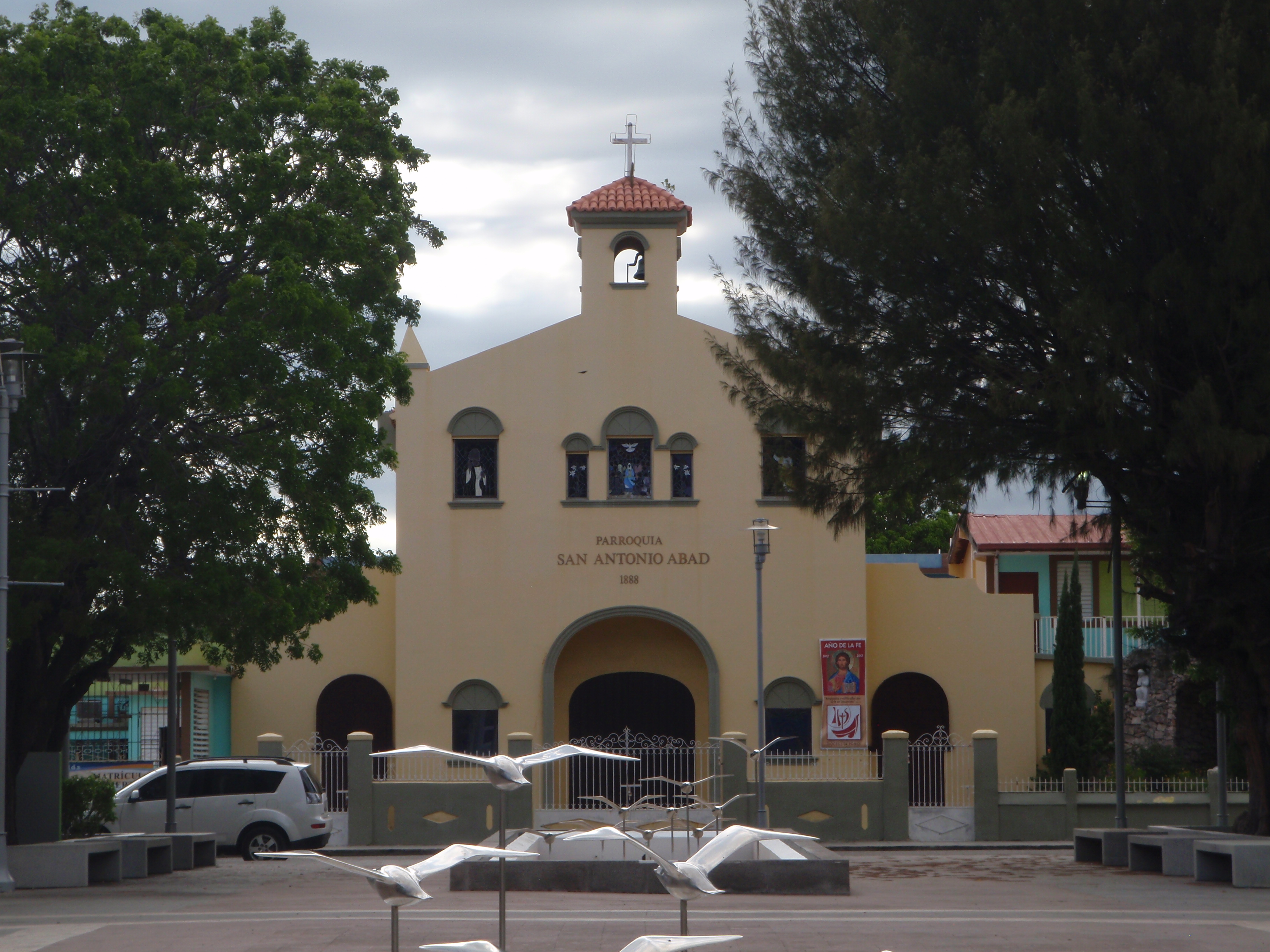
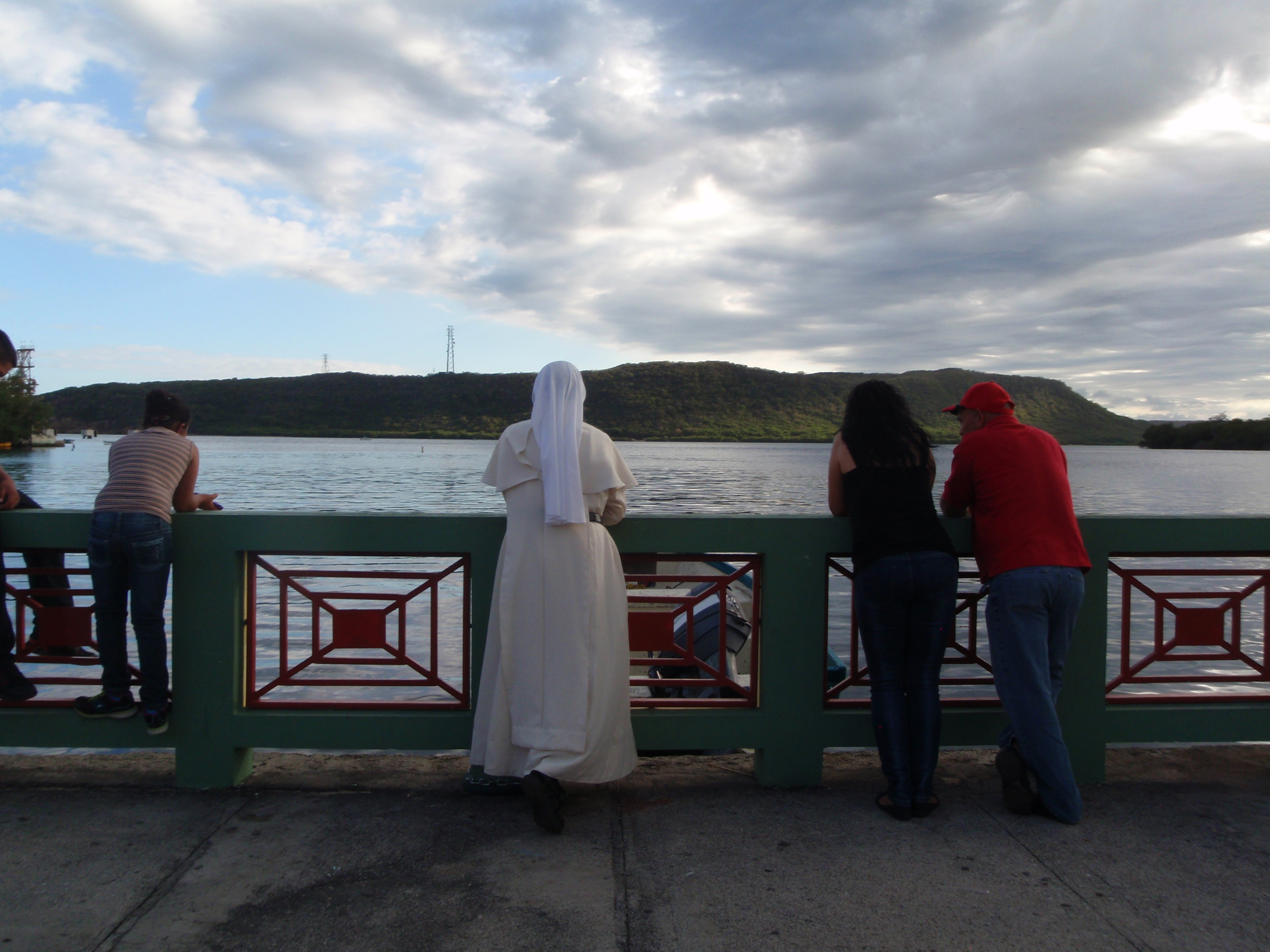
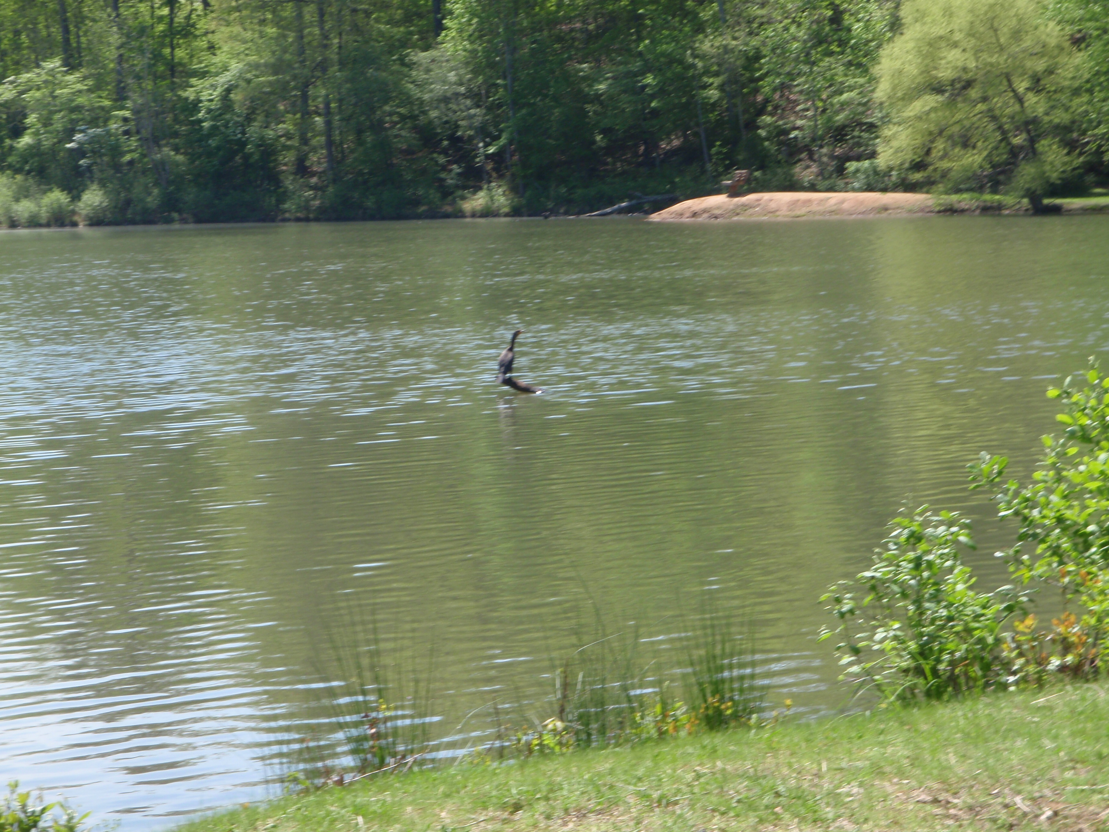
Then I drove into the town of Guanica and walked along the bay and through part of town. The island just offshore is called Gilligan’s Island because it resembles the island from the old TV show. By then it was nearly 5:00, and it looked like people were setting up for some sort of little festival. I asked a couple people if they spoke English, and when I found someone who said she could speak a little, I asked what was going on – if there was a special event or something. She told me that people frequently gather by the bay on Saturdays and Sundays, and there’s often some music, and tonight there seemed to be some religious event going on (I couldn’t understand a word though), and there were big inflatable toys for kids to jump around in, and carts with food and tables of crafts, so when I was done walking (and I did so much today I made up the mile and a half from yesterday, plus 2 extra!), I got some BBQ’d pork on a stick, and corn-on-the-cob, which they cleverly serve with a skewer in one end, and the ear of corn is upright in a plastic cup with melted butter in the bottom, which makes it easy and less-messy to eat while walking around. There was a big banner of Jesus up by the stage, and a priest sitting in the back, and that’s why I thought the talking that was interspersed with the music was religious. There were a couple nuns walking around, and I tried to talk to them to see if this was some sort of fund-raising event for the church, but we could not communicate. Various people in the audience had guitars, and drums and tambourines, and if they felt like joining in the music, they would do so. And there was often a simple circle dance going on that people would randomly join for a while, and then leave. So it was interesting to see all of that even if I didn’t know what it was all about.
By the time I’d eaten and watched the festivities for a while, I was ready to drive back to Ponce. It had been an enjoyable day overall, and although I still haven’t made a donation, I’m feeling a little more comfortable in my new surroundings.


Puerto Rico – Saturday, April 27
I had a 6:45am flight out of Gainesville, Florida this morning to San Juan, Puerto Rico – State/Territory #31. Friday had been a busy day – finishing the drive from South Carolina to Florida and dropping Tula off at the kennel, which always makes me feel so bad. Toni was going to watch her again, but she ended up going to a wedding out of state over the weekend, and her dog Ella was also in the kennel, so at least the dogs will be near each other. And I had other errands to take care of, and got my hair trimmed, and repacked for the next couple weeks. I stayed at Toni’s apartment Friday night even though she wasn’t there, and visited with her roommate a bit, and stayed up really late getting organized for the next 2 weeks. Since I was leaving the van at Toni’s apartment, I arranged for a taxi at 5:30am which was an early morning wake-up call after such a late night.
And then, a little after noon, I was in Puerto Rico! I noticed immediately, even in the airport, a lack of signs in English…kind of a lack of signs in general. Baggage Claim wasn’t marked, and there were no car rental signs. All I heard around me was Spanish, and I got an uneasy feeling I was in for some challenging times. I don’t speak Spanish, and that’s my shortcoming, and I know when I visit a “foreign” place, I shouldn’t assume that I will hear and see English – after all, I am the visitor. But, I figured since the Pacific territories were bi-lingual and they’re thousands of miles away with few American tourists, Puerto Rico would also be largely bi-lingual since it’s relatively close to the mainland and has a lot more American visitors. And it’s a US territory! But I assumed wrong, and I was fortunate the car rental guy spoke English and gave me a few directions, because that was about the last English I heard and saw for the next couple days.
I was kind of overwhelmed even leaving the car rental lot. It was a very hot Saturday afternoon, and I was hungry, and traffic was heavy and people were all over the place, and they seem to dart across streets whenever they want, and cars were blasting loud music. But the area I was in actually looked like a good place to walk for half an hour to just catch my breath, and I somehow found a parking space, and got out and walked nearly 3 miles, and found a Subway to get a sandwich, and then I felt more ready to tackle the traffic.
I had landed in San Juan, but thought I wanted to drive around a good part of the island like I did in the other territories, so I had made reservations at a motel in Ponce, which is Puerto Rico’s 2nd biggest city and it’s on the southern coast. San Juan is a sprawling city, with lots of smaller ones kind of connected to it. I don’t know how I managed to get out of town without going in circles. Luckily numbers are the same in English and Spanish. I felt a little better once I was driving through the mountains in the middle of the island. It was more mountainous than I expected, and lush and green. I began to enjoy the drive once I was out of the congestion. It took a couple hours to get across the island, and most of it was on a toll road, and luckily I had told the car rental guy I was headed for Ponce because it’s a cashless toll road in this part of the island, and I had to pay $10 to activate the easy pass. I’m not sure what I would have done if I hadn’t mentioned that! I made it to Ponce, and figured out where my motel was. The nice thing about using my iPad as a GPS is that it shows me exactly where I am on the map, and then I can figure out where I want to go. The iPad has not “talked” to me since Washington DC and I don’t know why it started there, and don’t know why it stopped afterward! But I like being able to see where I’m at.
I saw a Kmart, and stopped to get some water and a few other things. I decided to check in to the motel before doing more walking, because I didn’t want to be looking for it after dark – it was outside of town a ways. In fact, the motel – a Quality Inn – was on the infield of an old car racetrack, and to get to it, I had to drive through a tunnel under the racetrack. I think that’s the strangest location of a motel I’ve been at so far. I had a little trouble at check-in because of the language barrier – she couldn’t find my paperwork at first, and I thought something had gotten mixed up since it was a free stay using points. But we figured it out – she thought my name was pronounced Seeburt, and couldn’t find paperwork for the name I was saying!
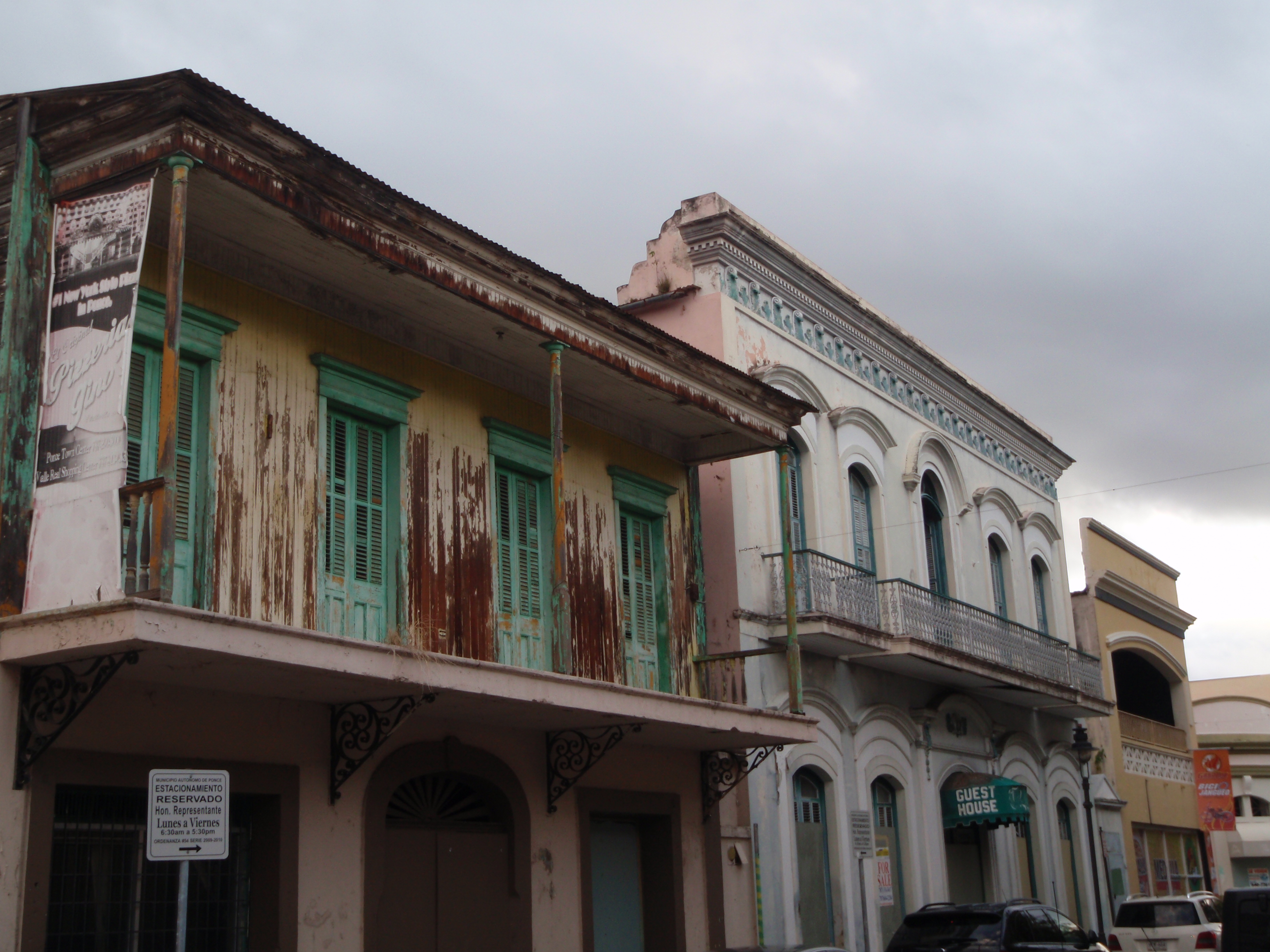
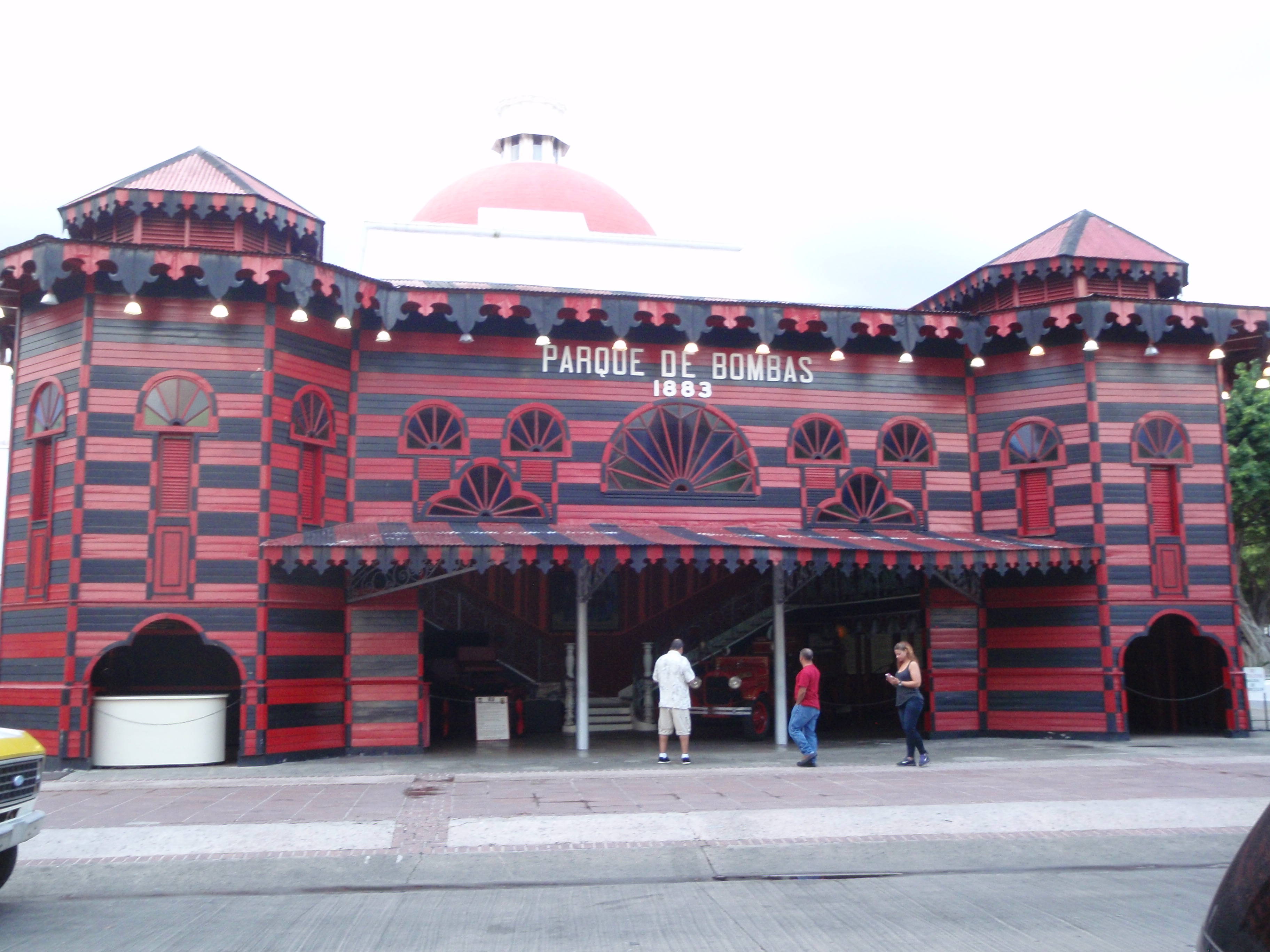
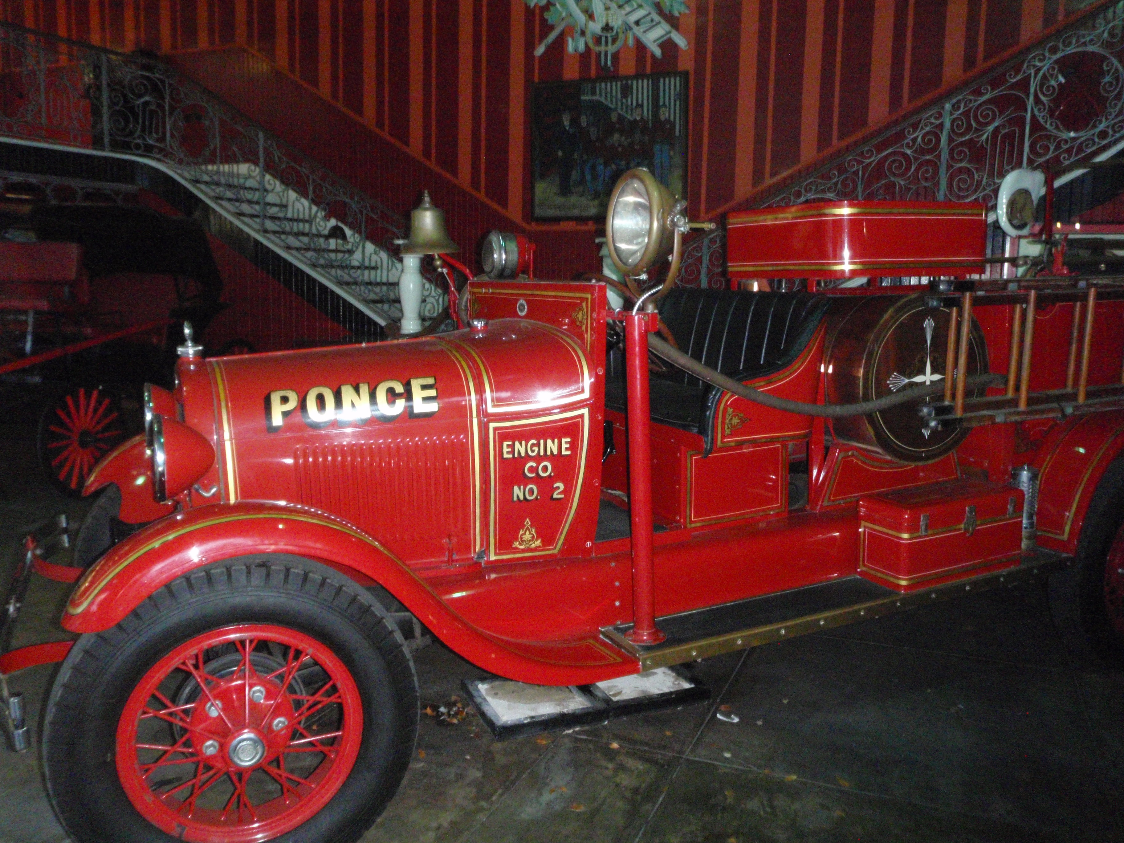
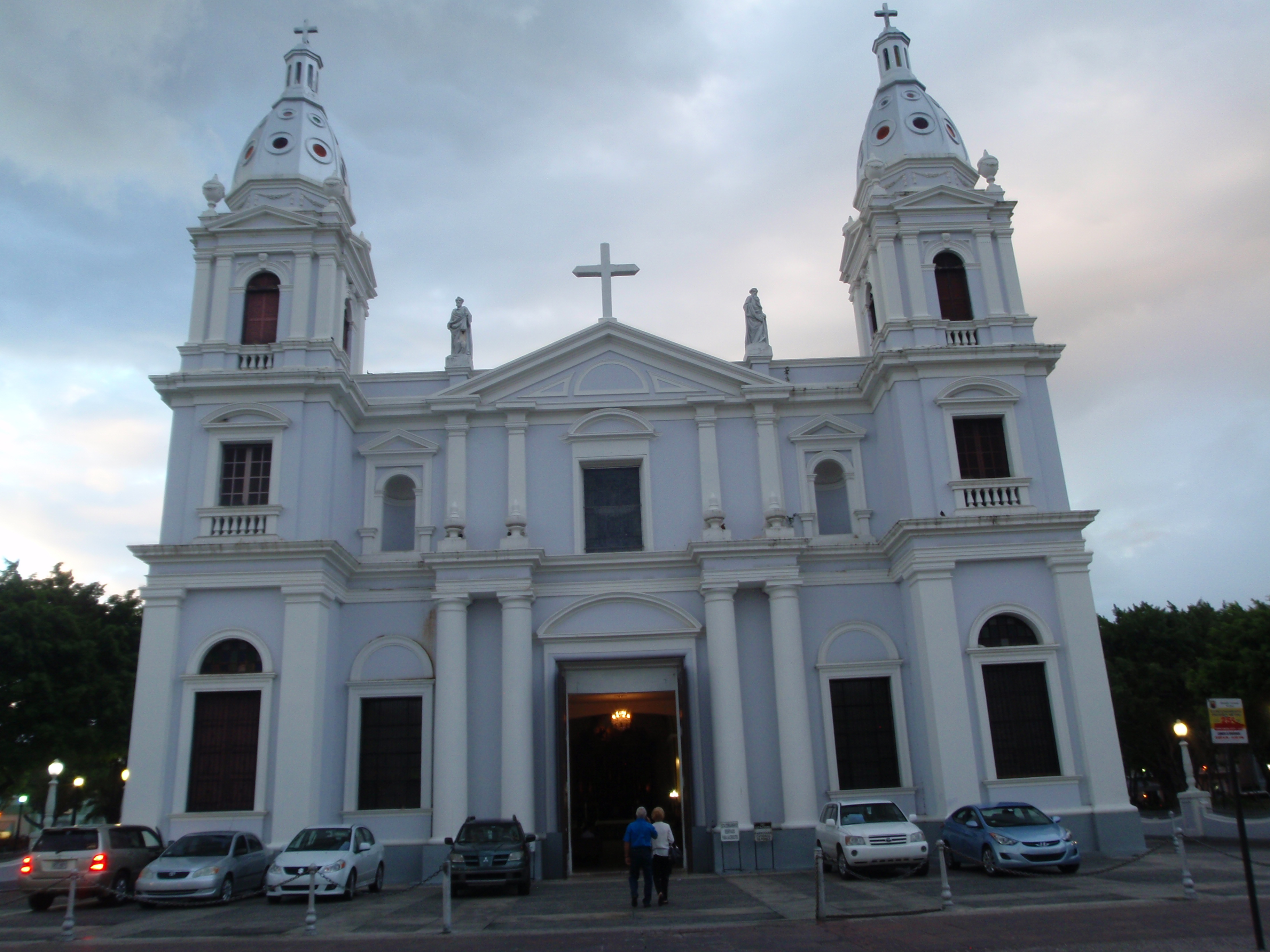
After check-in I drove back to Ponce to do some walking. It was early evening by now, and I knew I wouldn’t get the rest of my 8 miles in, but I wanted to do what I could before dark. Like many Puerto Rican towns, a cathedral often dominates the center of town, and this was no exception. It was a huge cathedral, and people were arriving for Saturday night services. I walked up and down all the streets in town, and out into one of the neighborhoods as far as I felt comfortable. There was also an old theatre where people were waiting on steps for the doors to open. Twice during my walk, I heard a lot of police sirens, but when the cars passed in a procession, they looked like ordinary cars with ordinary adults and kids in them! I don’t know why they all had sirens – and none of them had flashing lights. I have no idea what that was all about. And there had also just been a wedding in town, and I watched the bride and groom get in an old decorated DeSoto (I think!) and then there was another procession of cars all honking horns. Between sirens and horns, it was a noisy walk. I got another 3 1/2 miles in, and dark came a good hour earlier here – I’m still in the eastern time zone, but far enough east that the sun sets a lot earlier. So it was time to head back. I knew I needed something for dinner, and I didn’t want fast food, and I wasn’t ready to venture into a little restaurant, but I saw a sign for Chinese food, and that all of a sudden sounded good, so I went in to get a carry-out order, only to be confronted by a menu board in a combination of Chinese and Spanish. The only word I recognized was pollo – chicken. I asked the young lady if she spoke English, and she didn’t, so she called someone else over. I asked about sweet and sour pork, and there was some discussion I didn’t understand, and then they said something about sweet chicken. That was close enough and I agreed to get the combination, even though I didn’t know what it came with. I didn’t have to wait very long, and prices were very reasonable, so I took my dinner back to the motel, and opened it up to see the chicken in an orange sauce (no veggies), fried rice, and…french fries of all things! It seems like such a strange thing to get as part of a Chinese dinner.
I ate dinner and turned the TV on, but there were only a couple channels that worked, and it was in Spanish anyway, and then I tried doing some research for my donations, and kept pulling up websites in Spanish. I began to worry about how I was going to do my donations because of the language barrier. And last week, I had had a lot of contact from home – my neighbor had sent me some pictures from home, and I had talked with a couple of my studio instructor friends, plus there had been a big performance today that I would like to have seen since I still know everyone involved, and I’d talked to my sister-in-law for a couple hours, and I think all the contact from back home, plus being in a really foreign place had me really worrying about this week in Puerto Rico, and feeling very isolated for the first time on my journey.
But, I knew I only had to get through 4 days, and then one of my daughters and her boyfriend would be joining me for a week – they made reservations months ago, and then my sister will be joining me next week, so the timing for family visits is perfect, and that’s what I held onto this first strange night in Puerto Rico.

South Carolina – Thursday, April 25
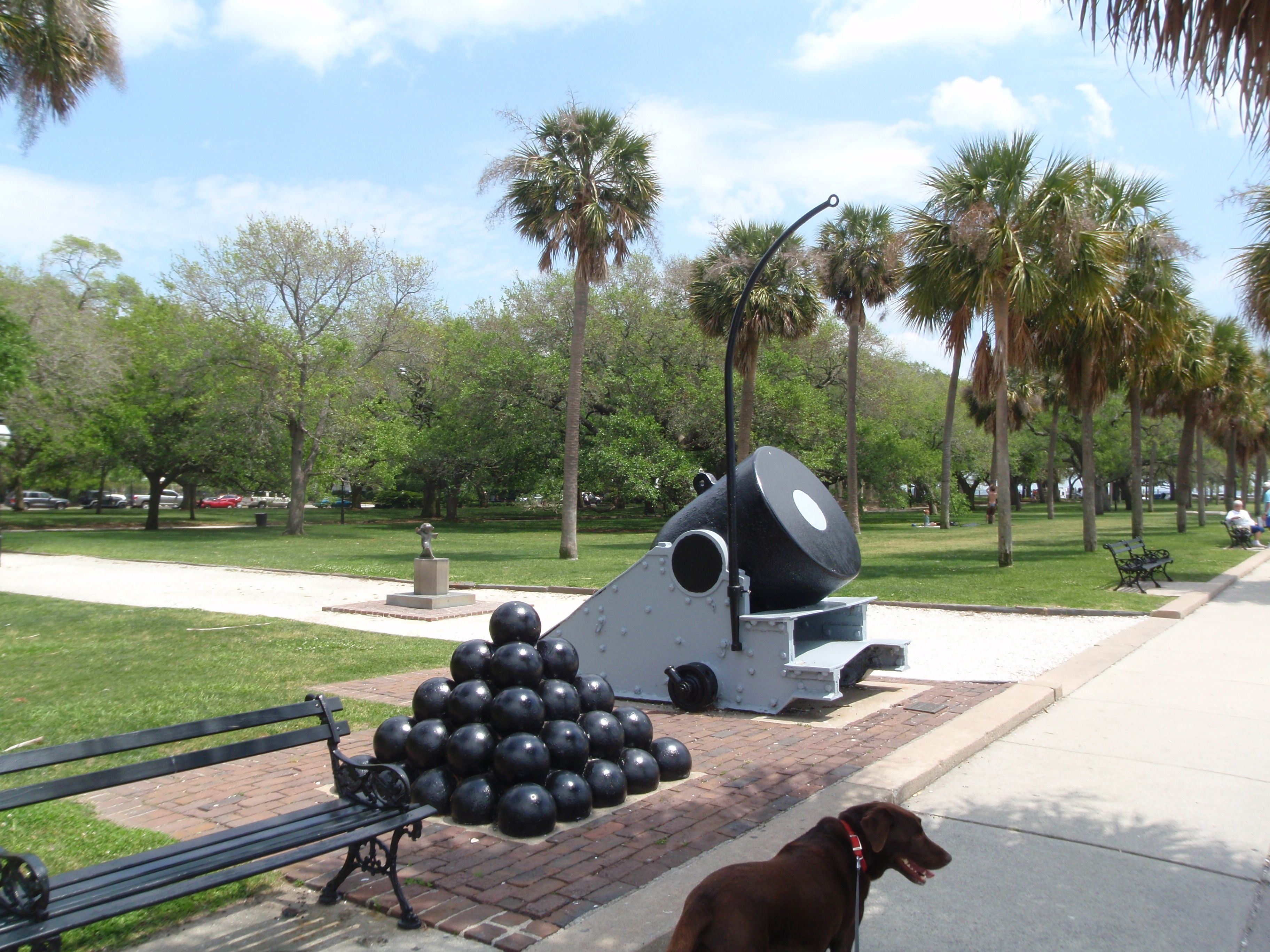
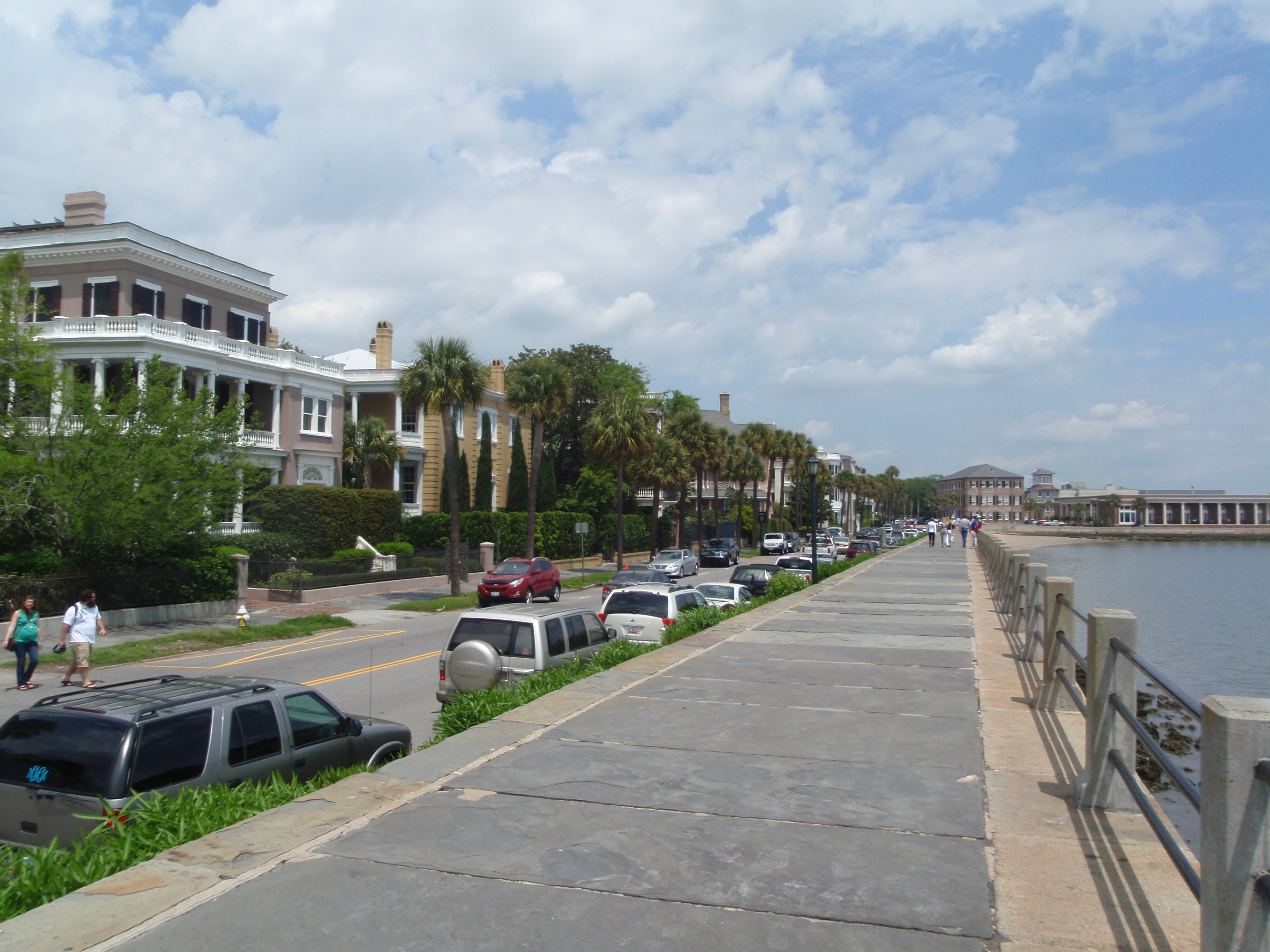
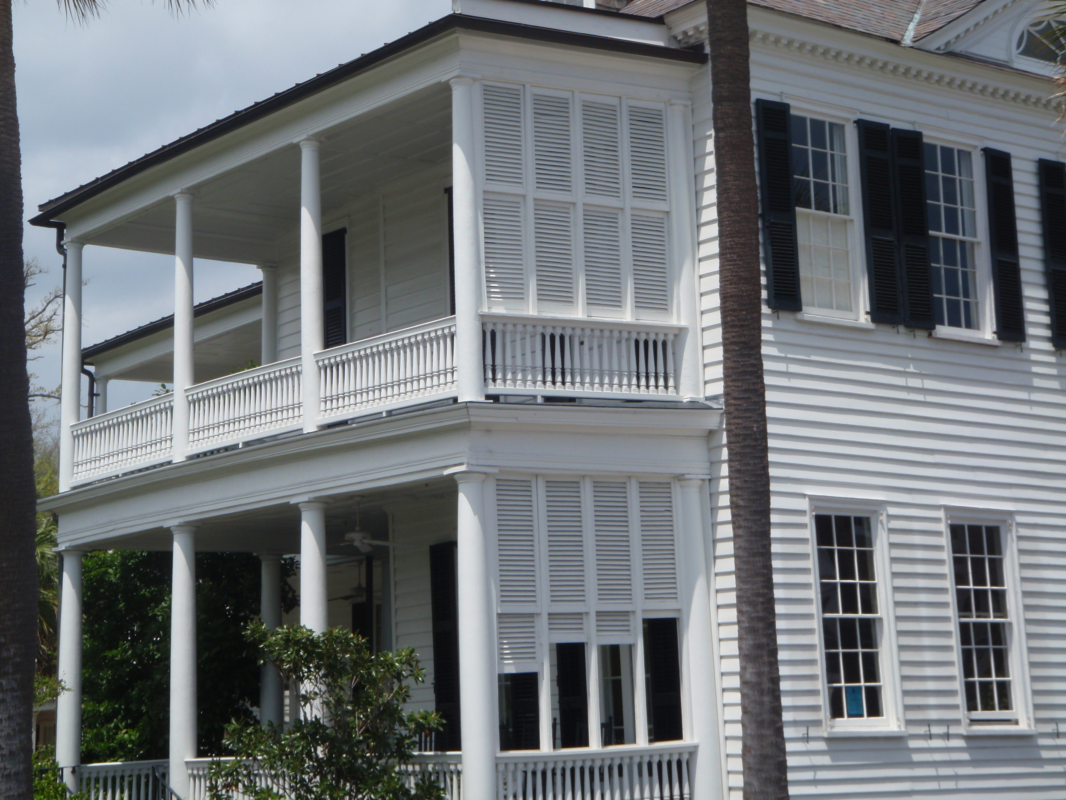
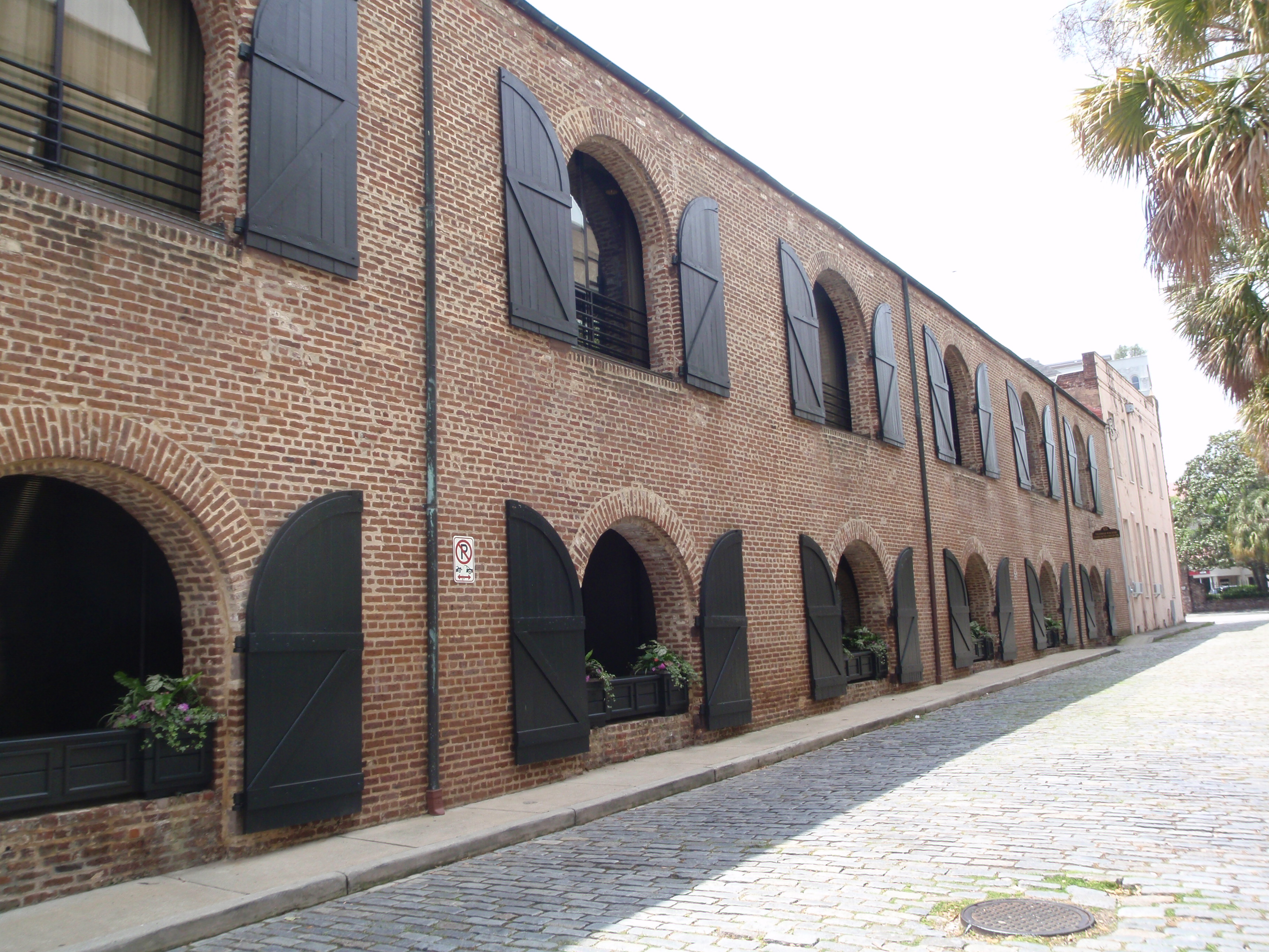
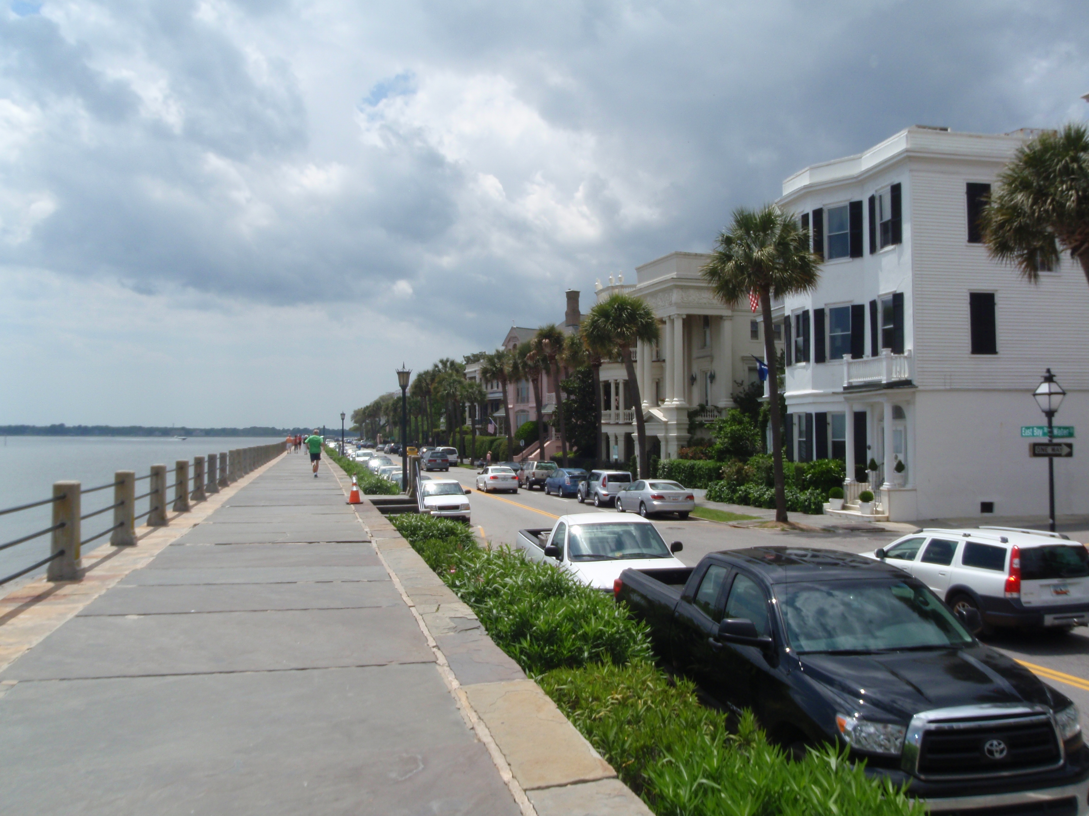
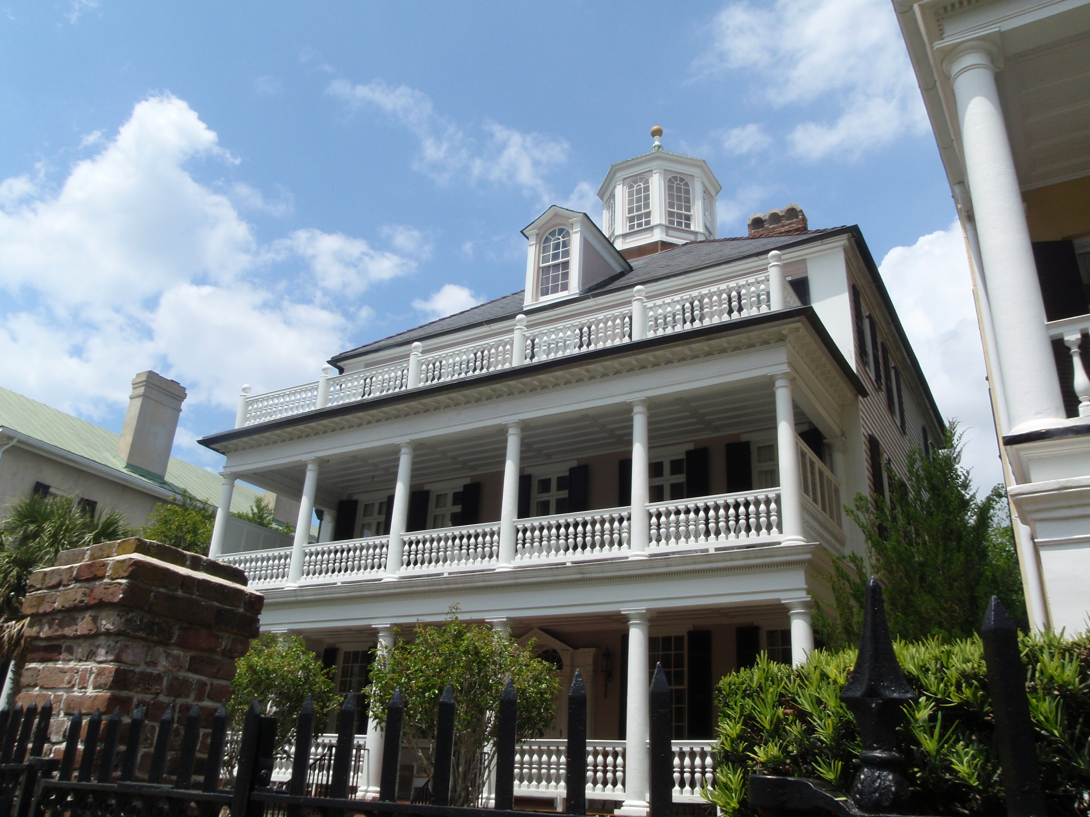
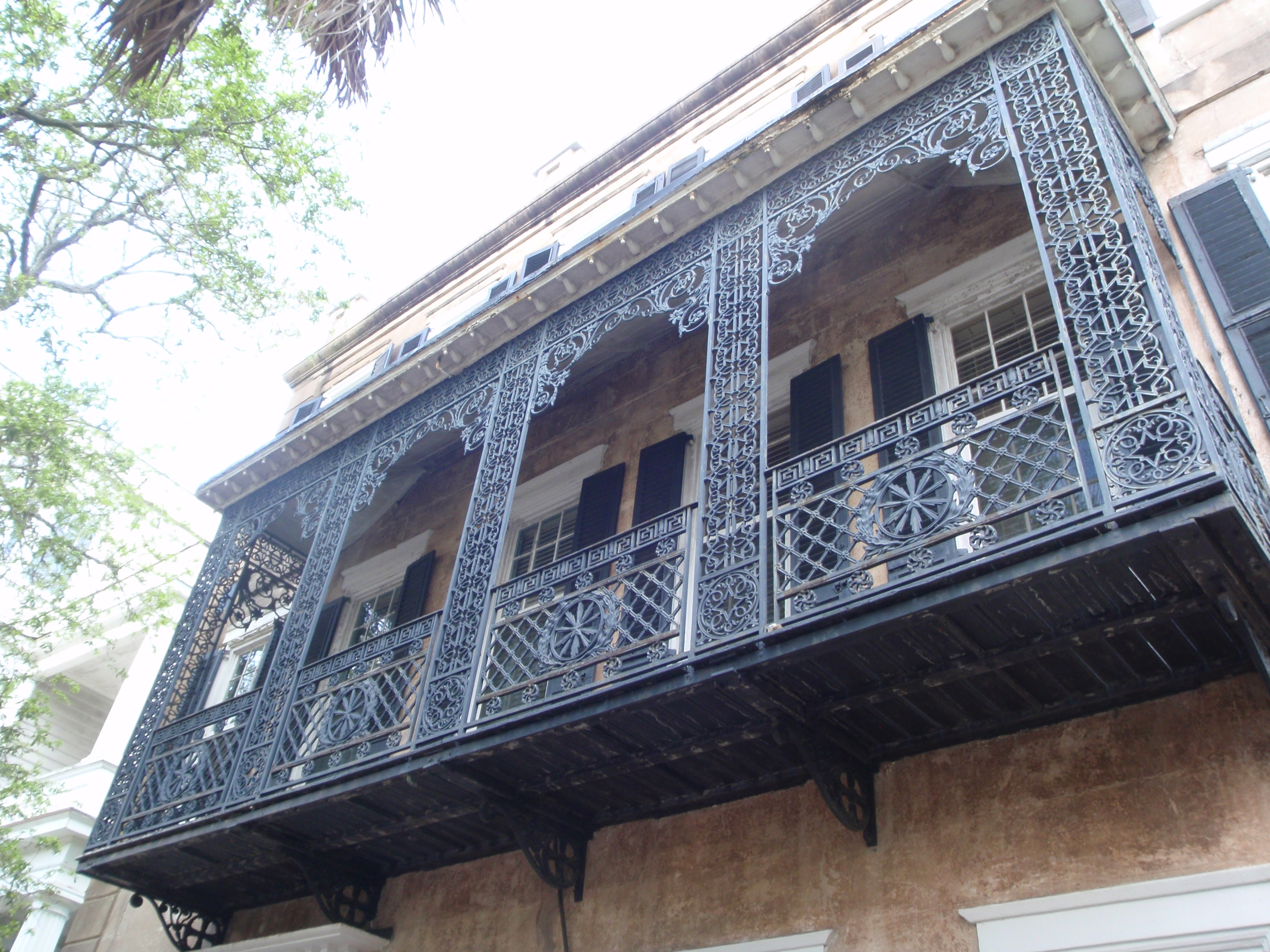
I’m really happy things worked out so that I ended up in Charleston again after all. It’s such a pretty city and it just oozes history. There are no skyscrapers in Charleston – religion was very important back when the town was formed, and there’s a law that no building can be taller than the city’s church steeples. And there’s all the elegant waterfront antebellum homes – with 2 and 3 levels of verandas, and houses painted in pastel colors. The walk along the Battery and through the park was shady and pleasant. There were lots of horse-drawn wagons out for city tours (mules pull the wagons too), and I caught bits of information from those guides as I walked all around. One wagon was stopped in front of some of old historic homes, and like many of them, it was 3 stories tall with a cupola on top. The cupola helped provide “air-conditioning” in the early days – homeowners would keave a door or 2 open on the first floor, and the ever-present sea breezes would blow into the cupola at the top of the house and make its way down to the lower levels, providing a little relief from the hot, steamy summers. We walked through town and neighborhoods, and made a PBandJ sandwich and enjoyed it in the park, and then walked some more. There are still a lot of streets named for the wharves they used to lead to, and some of the roads are still cobblestone (which is really bumpy to drive on). There were quite a few tourists out, but parking wasn’t too bad. I only had to walk about 6 miles to finish up the South Carolina walking, and ending in Charleston was a beautiful walk. I didn’t make a donation today since I did 2 yesterday.
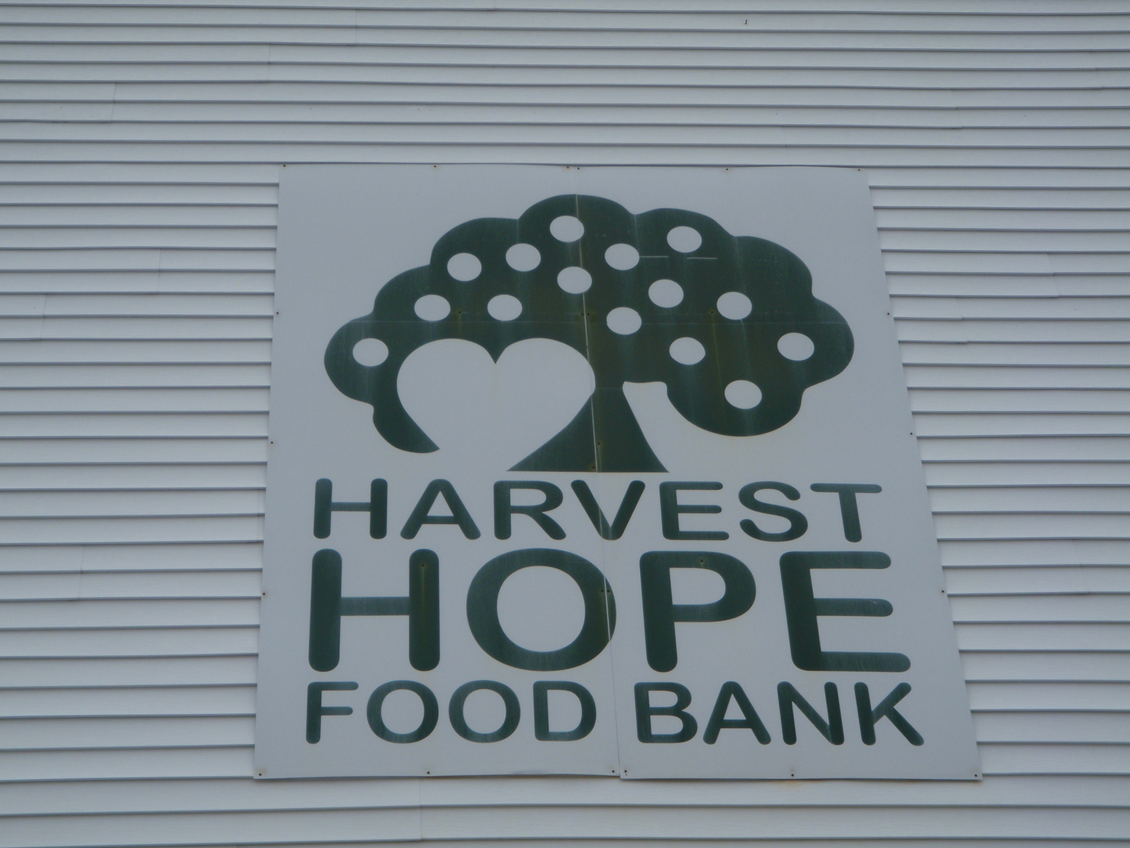
So, that wraps up State #30 – all 56 miles walked, and all 7 donations given – Fort Mills’ Community Cafe, Anne Springs Close Greenway, USO of South Carolina, Samaritan House, Harvest Hope Food Bank, Totally Turtles, and Community Kitchen.
By this time, it was mid-afternoon, and I settled in for some car time…heading toward the next adventure.


South Carolina – Wednesday, April 24
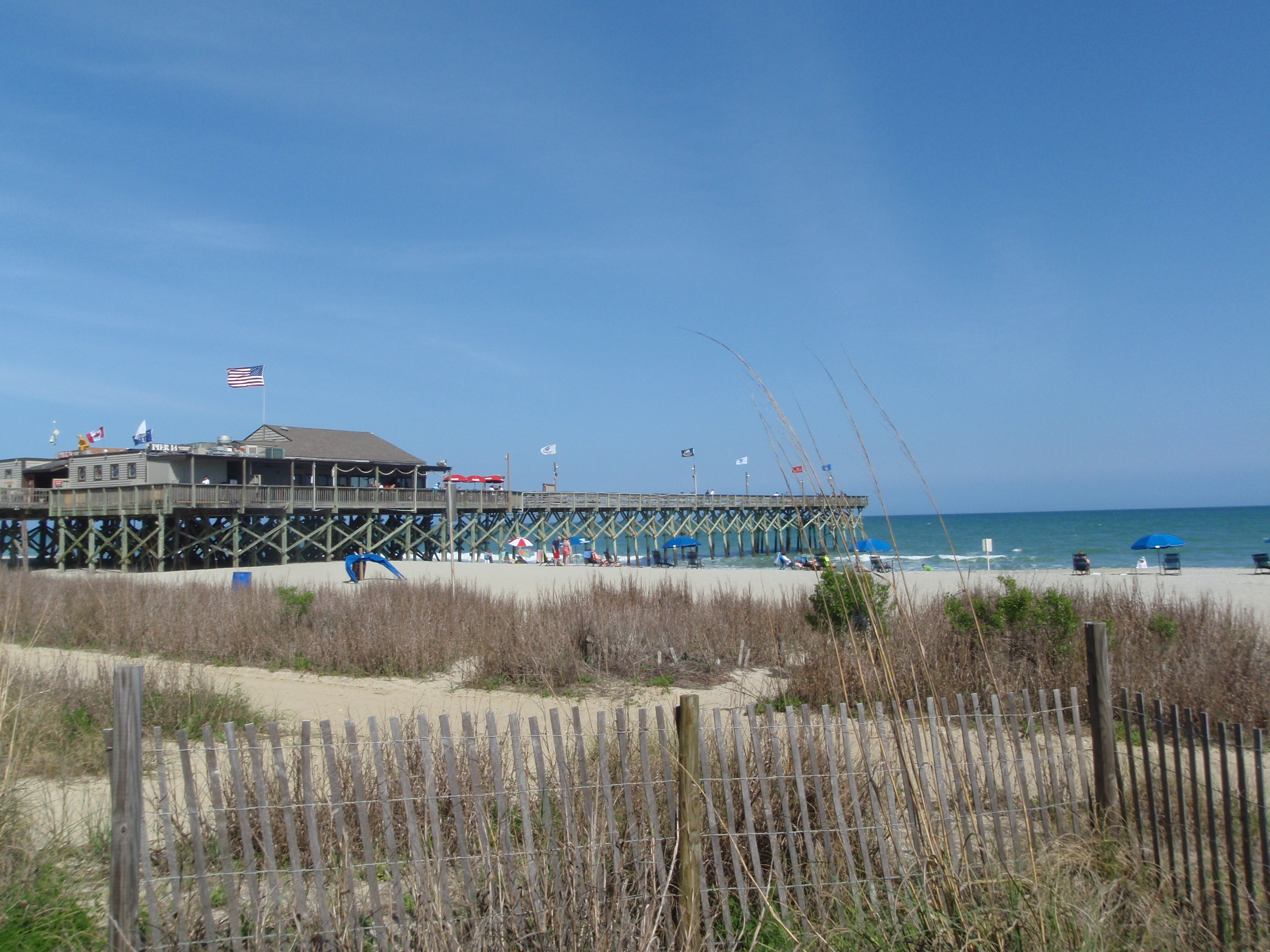
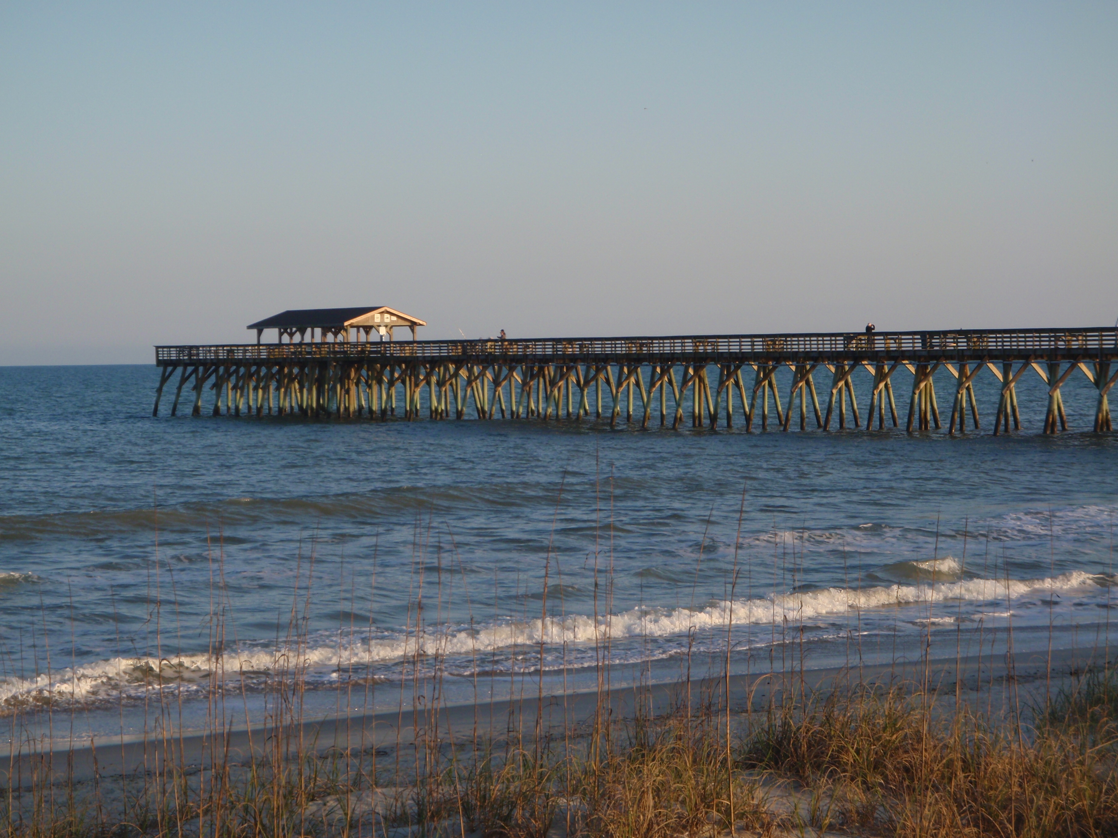
In the morning, Tula and I headed out for another walk on the boardwalk by the beach, and then on some of the other well-marked trails in the state park. I’m feeling kind of proud of myself that I didn’t chicken out from visiting this park completely – there are numerous signs about the copperhead snakes in the area, and snakes are the one thing I’m really afraid of. The signs talked about the snakes (and said they’re more afraid of me than I am of them, but that’s debatable!) and said they’re protected by law, and to not wear flip-flops. The park ranger said they’re “not out in full force yet” (whatever that means!) and she walks the trails several times a week and hadn’t seen one yet. I carefully checked my campsite, and we ended up with a good visit. I also walked nearly 2 miles along the beach, which wasn’t too crowded yet. Lots of people were out sunning, but not too many were swimming. There were a couple of big long piers jutting way out into the ocean, and quite a few people were fishing from them.
In one of the visitor centers, I learned that a lot of sea turtles will start coming ashore to nest here beginning in May – and they have a whole volunteer brigade to monitor turtles, their nests, and eventually the hatchlings. They offer a couple turtle awareness and education programs, and a big one coming up in early May is called Totally Turtles, which is an entire day of talks and activities to learn about the turtles to help protect them. They’ll also have some human-size simulation activities, like seeing if you can get out of the sort of tangled debris that turtles get caught up in, and that sort of thing – kind of helping to see life through a turtle’s eyes. So I made a donation to that program for an animal-related donation. I figure turtles have been around since about the time of dinosaurs, and their continued longevity deserves some assistance!
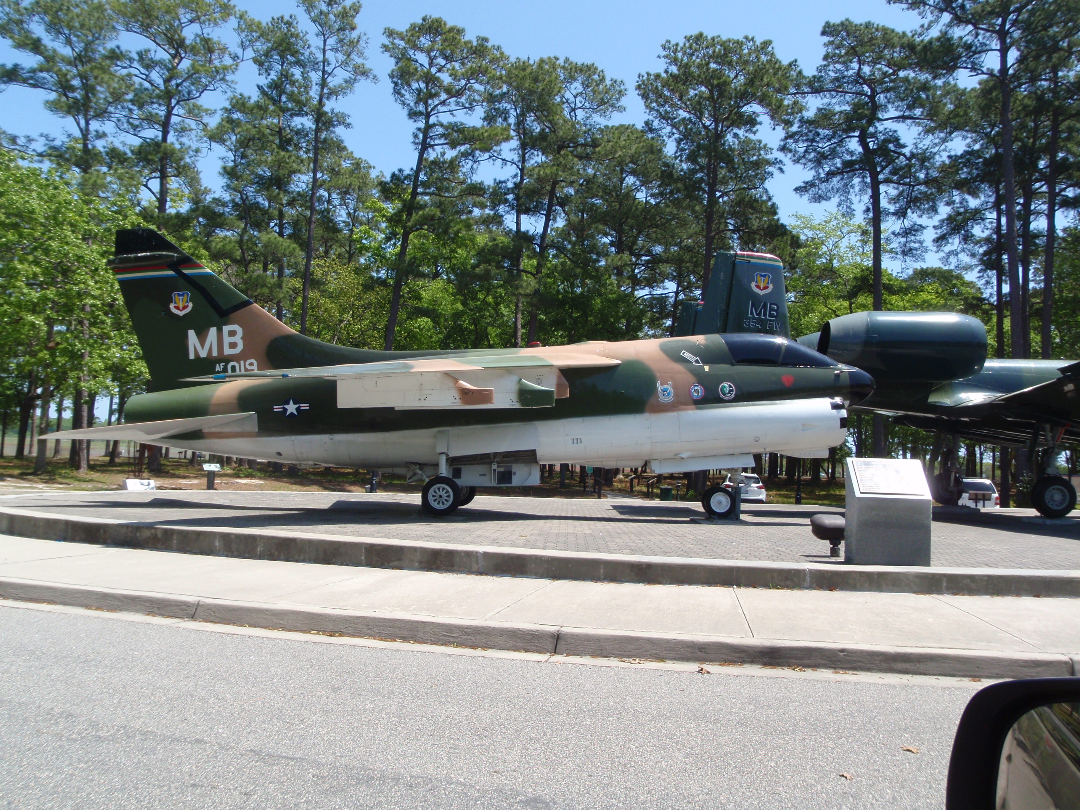
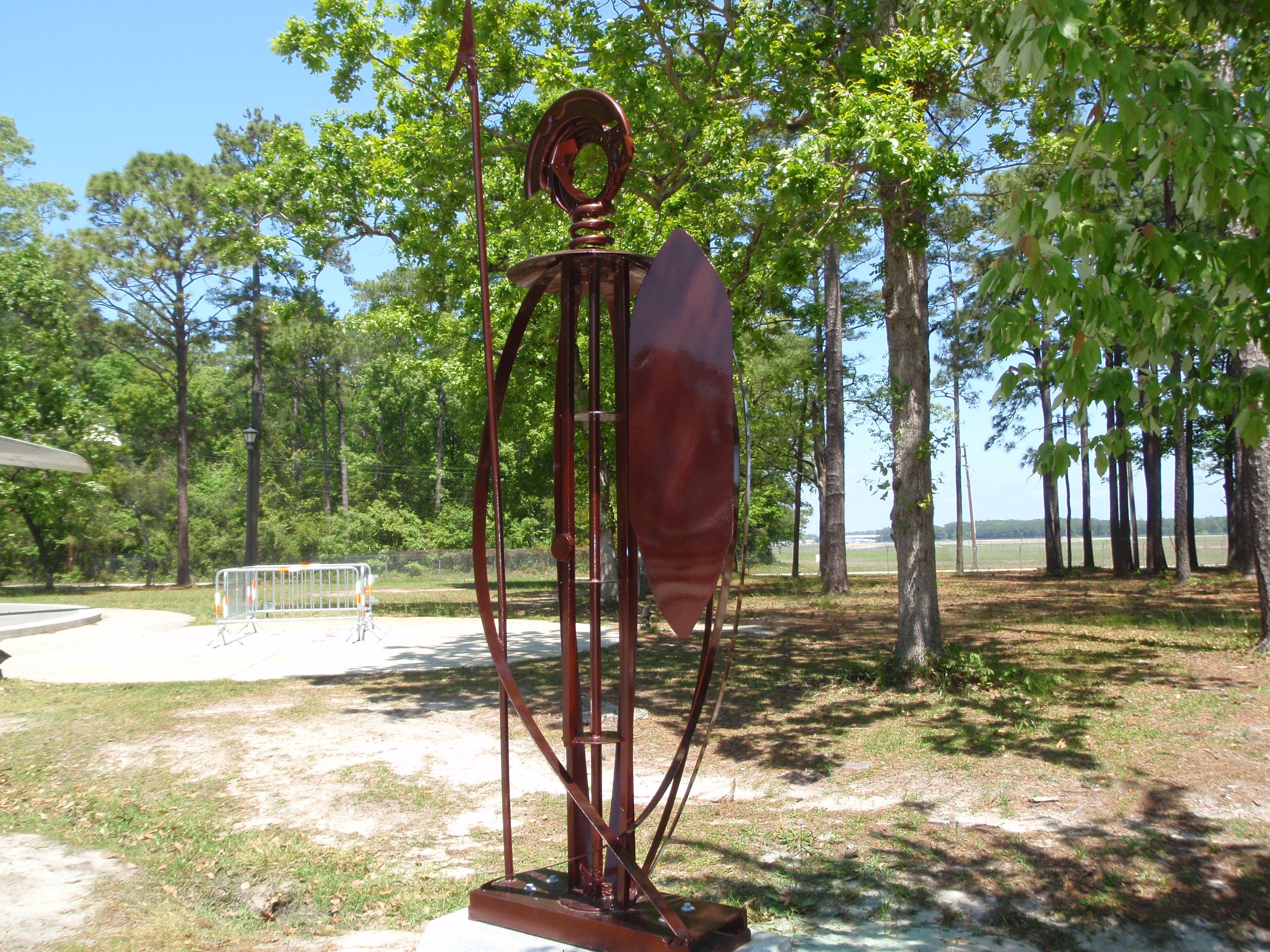
When I was finished with the state park, we headed over to another big park that I saw yesterday for some more walking. I also made a brief stop at the Warbird Park, which had several Vietnam-era planes on display, along with a really cool statue of a warrior.
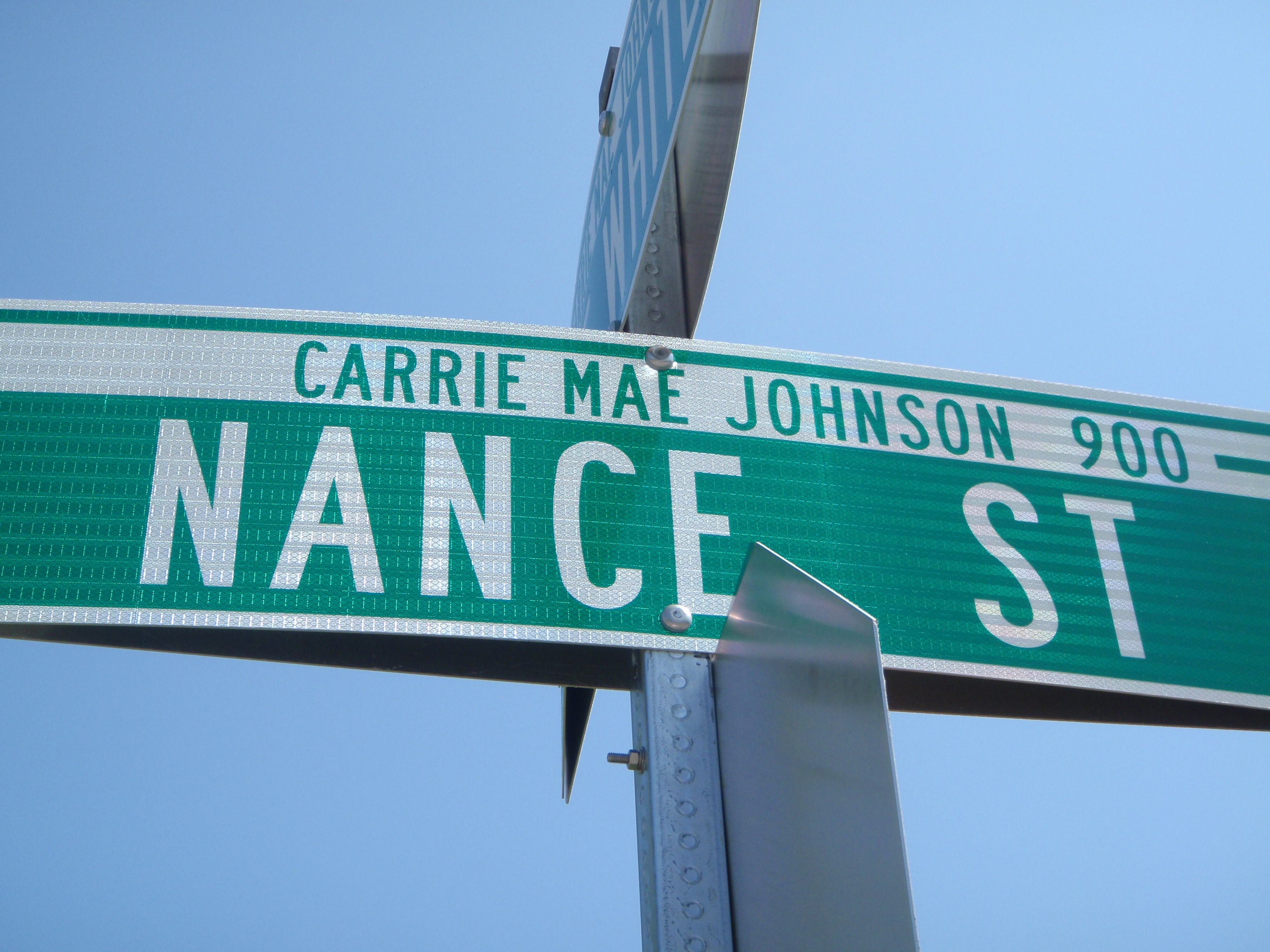
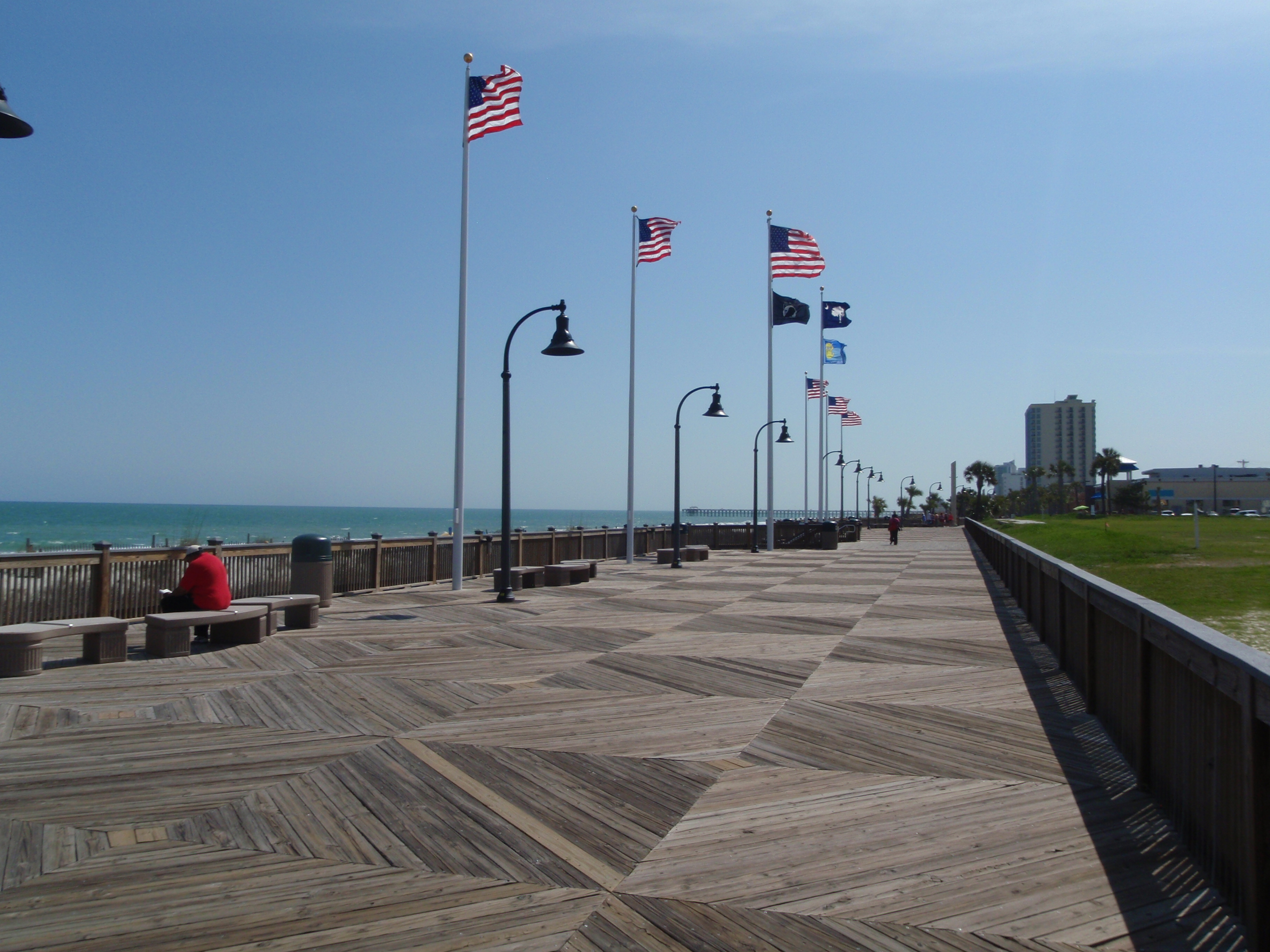
When we were done with the parks, I headed north a little to the actual town of Myrtle Beach to take care of the donation I had already planned on for today. Even though I did the Totally Turtle donation earlier, I had already found a soup kitchen called the Community Kitchen, and it was located on the corner of 10th Avenue and Nance Streets. And I also read that they had received a Caritas Grant from the Sisters of Charity. Since my name is Nancy Caritas, I HAD to give them a donation!! This is a soup kitchen that serves lunch 6 days a week, and when I called them, they were just finishing up for today – in fact, they had stayed a little later than usual to scrub floors. They told me a donation would be very much appreciated, but I would probably have to mail it since they were closing and I wouldn’t be around tomorrow. So I put the donation in the mail, and went to find the place so I could take a picture of it. Once that was done, I headed for downtown Myrtle Beach and their boardwalk. The boardwalk was only a true boardwalk for a short part of the 1.2 mile path – the rest was a promenade – so it alternated between a wide concrete, landscaped, curvy “sidewalk” and the conventional wooden boardwalk. Tula and I walked it from end to end, and around town a bit, so we ended up with more than 8 miles today after all the walking at the state park. Myrtle Beach is so very touristy that I didn’t actually like it all that much. Yesterday when I was heading toward Myrtle Beach from the middle of the state, the flashy billboards started popping up about 50 miles from town. And even the different visitor information centers tried to out-do each other: Free Water! Free Coffeee! Free Soda! Cheap Cigarettes! Picnic Tables! Cheap Gas! Discount Coupons! Free Playground! Cheap Ice Cream! Clean Bathrooms! It got to be a bit much along with all the hotels and other places of interest posting many billboards.
So I didn’t mind leaving all that behind. My plan was to drive south just a little and camp at Huntington Beach State Park, but when I got there, they didn’t have any campsites left, so I stopped and figured out Plan B. If I had camped, I would have enjoyed the trails and ocean in the state park, and would probably have also gone to the botanical garden place nearby to walk on all of those trails too. That meant I would have missed Charleston, because I just can’t squish everything in, but I was okay with that since Taryn and I had spent several days walking all over Charleston in 2011. But now, with my plans for camping foiled, I headed south to find a motel, and would be able to enjoy Charleston after all. While driving south, I passed through Georgetown and its historical waterfront, and it was such an interesting looking town we got out and walked some more. And then I found a place to stay on the outskirts of Charleston and called it a day.


South Carolina – Tuesday, April 23
I started today with a grocery shopping trip for the Harvest Hope Food Bank that’s in Florence. I got staples like cereal and oatmeal, peanut butter, pasta and sauce, rice, canned veggies, tuna and canned chicken. I finally found them (after a phone call – they were tucked away behind a farmer’s market) and unloaded the groceries. They weigh all their incoming food, and mine came to 39 pounds. The volunteer at the food bank told me they serve a lot of counties, and pass food out to nearly 80 different food pantries, many of which are located in churches.
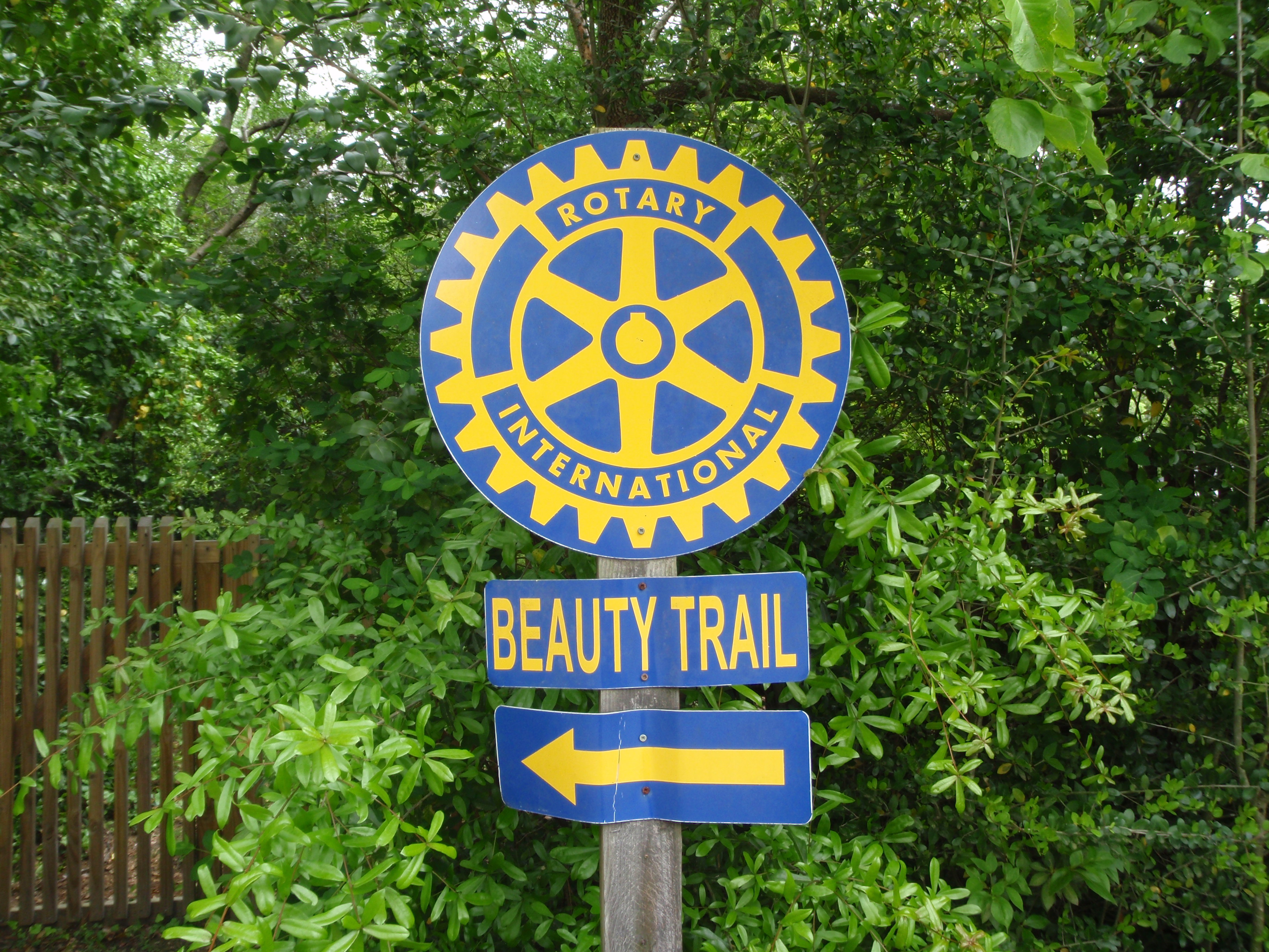
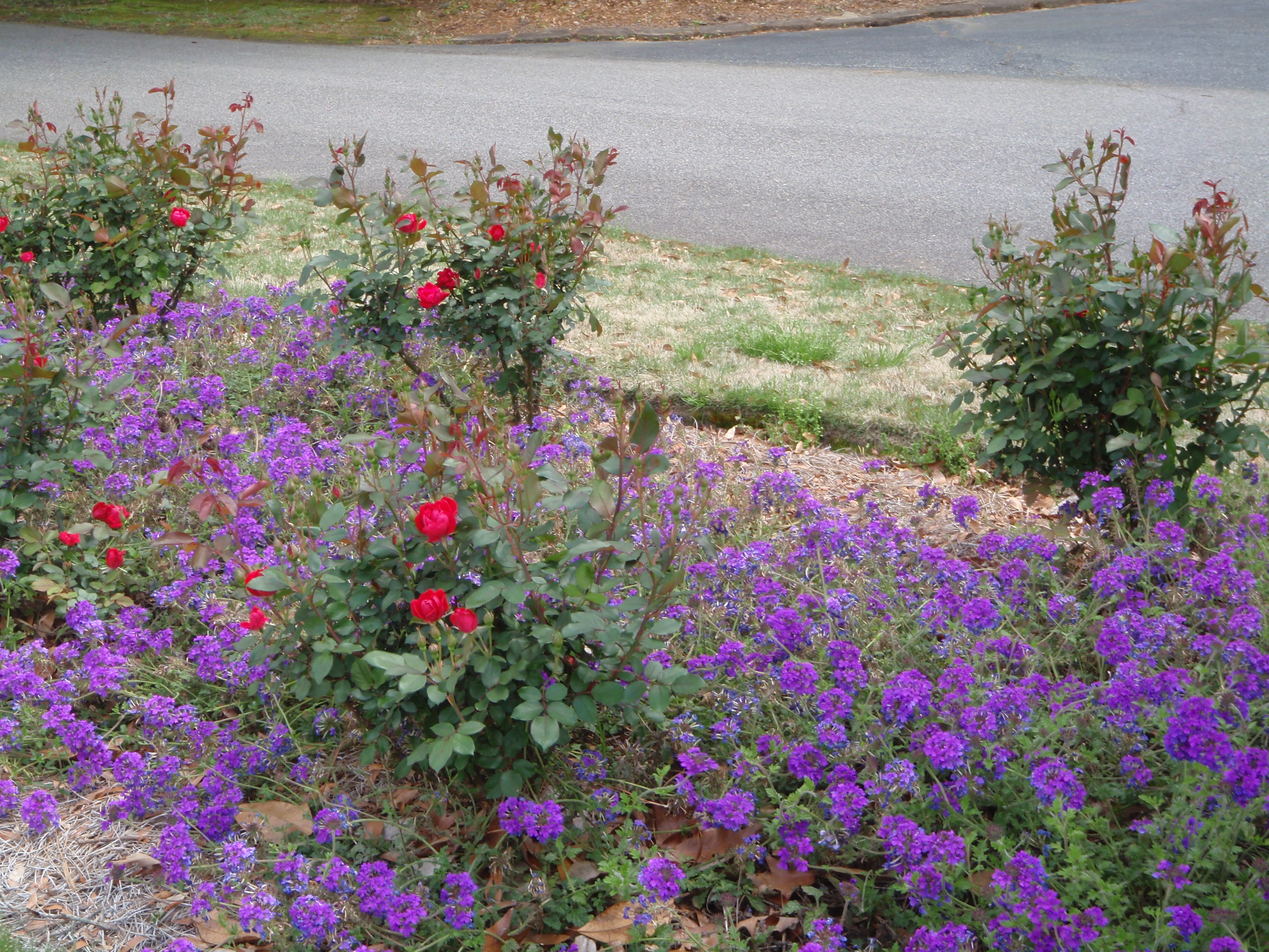
Then I wanted to find the older neighborhoods of Florence which are part of The Beauty Trail, which highlights flowering trees, gardens and flower beds, and is maintained by the Rotary Club, which has been doing this since 1945. I think it’s the only trail of this sort that the Rotary Club promotes. There’s about 12 miles of streets on this “trail” so I figured it would make for some pretty good walking. But when I found one of the main streets, there were no sidewalks, so I began to wonder if it was just a driving route. I followed it a bit, and then I came to a small neighborhood with quiet streets that had one narrow lane going each direction, and it turned out to be a good walking place. The road seemed like a wide sidewalk, and with barely any traffic and very low speed limits, and Tula and I covered nearly 3 miles. While it was pretty, I’m not sure there was anything more spectacular there than many of the other places I’ve walked this spring. I’m guessing what makes this really special is when the dogwoods and cherry trees are blossoming, and that time has come and gone. I drove around a little more, and then came to the area I was looking for on the Beauty Trail – a very quiet neighborhood with long blocks of streets with names like Camellia, Azalea, Oleander, Iris, Wisteria, and… Juanita. I walked up and down all the streets and there were indeed a lot of very pretty homes and landscaping (and numerous gardeners out working!) It was peaceful and pretty, and it smelled good, and I covered another 4 miles before I knew it! It was such a pleasant afternoon.
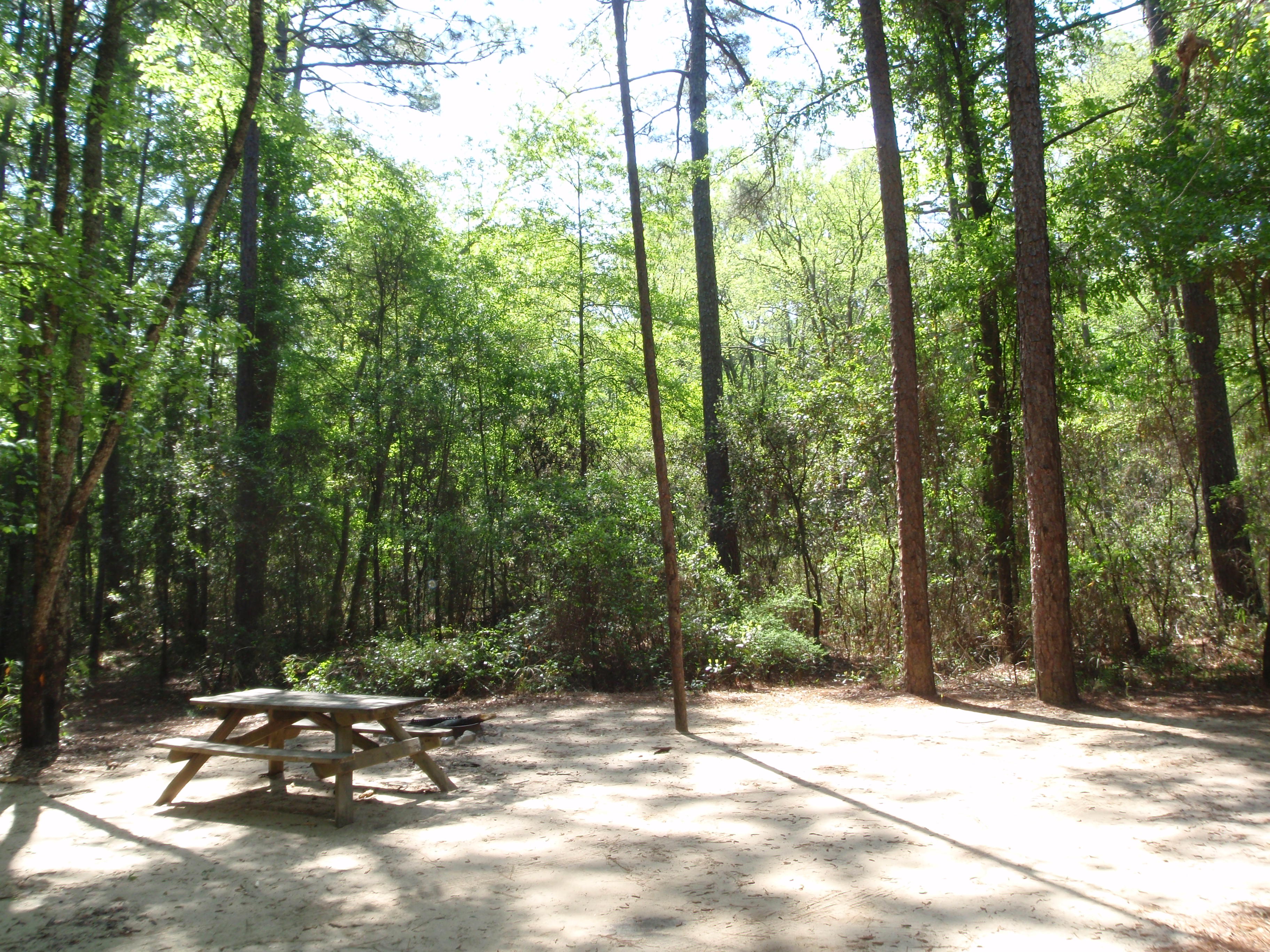
Then I stopped at Jimmy Johns for a sub, and headed east to Myrtle Beach State Park to see if they had any mid-week campsites available. And they did – so I was able to camp again, just a stone’s throw away from the Atlantic Ocean. Tula and I took a walk and explored our surroundings, and the trees and vegetation along the shore are oddly shaped – the land side is green and full, but the ocean side is stunted due to the wind and salt spray. It’s nice to be so close to the water that I can hear the waves from my campsite.


South Carolina – Monday, April 22
It was so pretty to go to sleep last night with a nearly full moon peeking through the trees, and to wake up to the sight of pine trees too. That’s one advantage to “car camping” – I can see out, but with tinted windows, I have privacy too – not that there’s many people around! And Tula’s a great camp dog! We started the morning off with a 3 mile walk around the state park. It’s so nice to get out for a walk first thing. Then I got packed up, and we started heading toward Orangeburg. I had done a little research, and there was a nice shelter there, which has been helping homeless people for many years. I spoke with the director to find out if food, supplies or a check would be most helpful, and she said a check would be good.
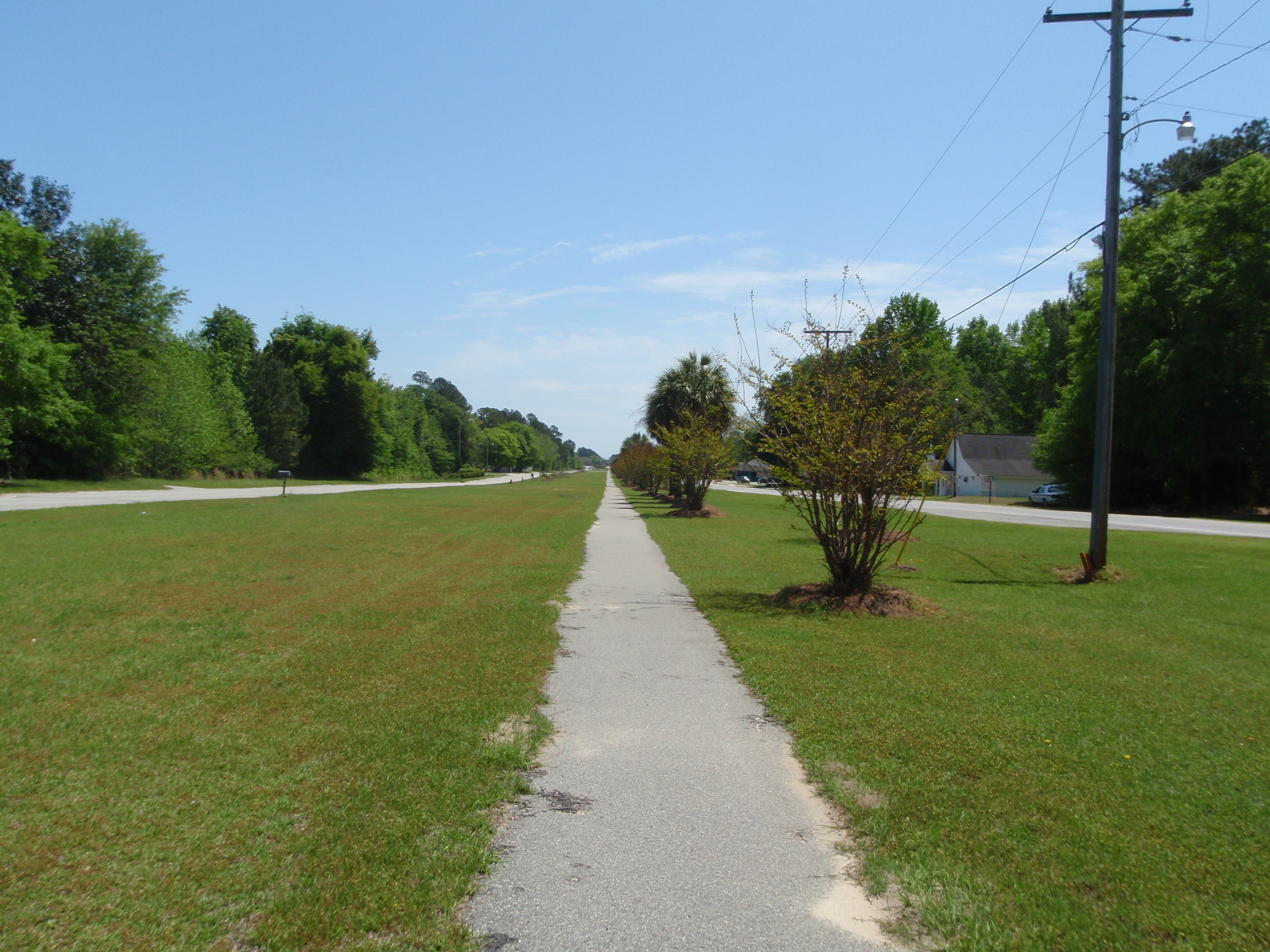
I drove through some rural areas of South Carolina on my way there, and we made a stop in the small town of Bamberg for a little more walking, because I saw a long walking path right down the grassy lane in the middle of a divided boulevard. It was called Bamberg’s walking path, but I was the only one out walking! I shopped for a few groceries for me and had a little lunch in the car.
Then we made it to Orangeburg, and I found the Samaritan House. It was a very neat and tidy house, with a freshly-cut lawn. It must be a very comforting place for the people who live there. I met the director, and she told me more about the place. They’re the only shelter between Columbia and Charleston, and there are 16 units of emergency shelter, and 20 units of transitional housing. The residents have to follow a lot of rules and do chores, and each of them has an individual plan toward self-sufficiency with the help of guidance from counselors. Samaritan House receives some funding from federal programs like HUD, so there are some strict guidelines the director needs to follow as far as who all she can help.
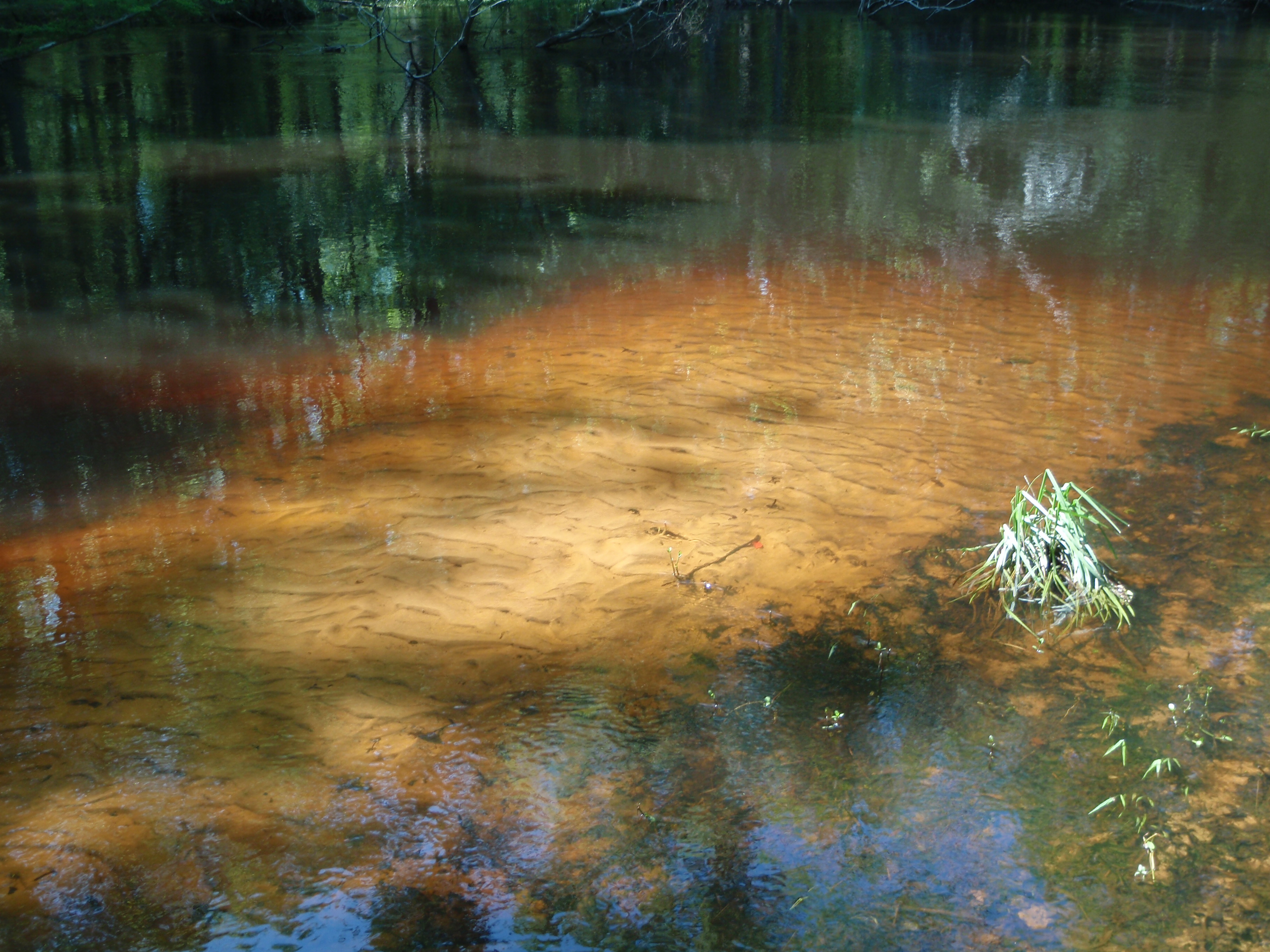
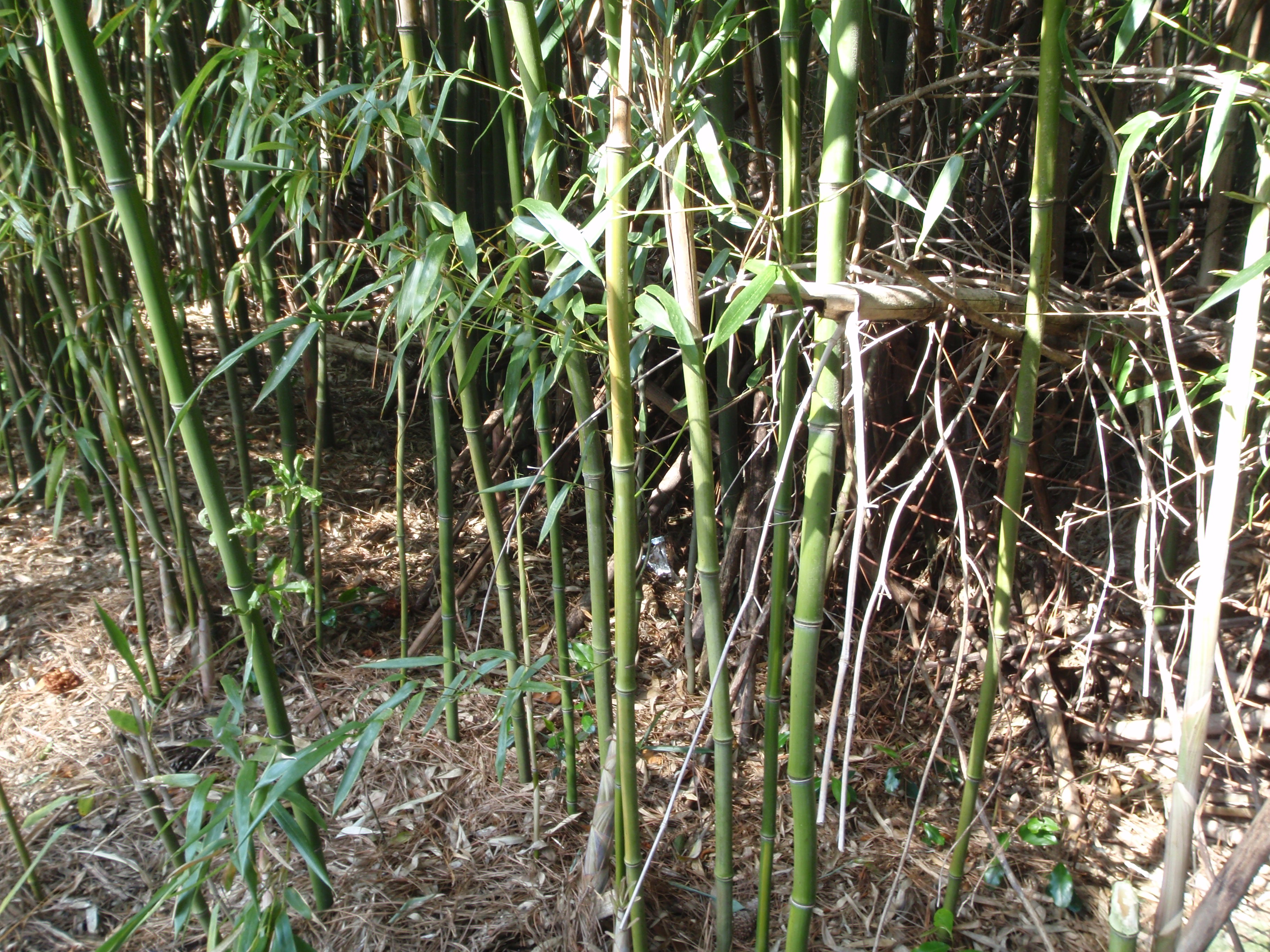
When I left the Samaritan House, I went into the town of Orangeburg and did another mile and a half of walking. Tula seems to be doing better, but I left her in the car for this walk – I don’t want to overdo it. It was a pretty town, but there were a few empty storefronts here and there, and it seemed a little quiet. And then, just outside of town, there was a beautiful, shady place called the Edisto Memorial Gardens. There were wonderful long boardwalks by the Edisto River, which is the longest free-flowing blackwater river in North America. A blackwater river isn’t dirty – it’s just colored by tannin which is produced by the decaying vegetation that falls into the river. And there were oak trees with Spanish moss, rose gardens, an herb garden, a bamboo grove and a lily-pad pond. I finished up my walking for the day there.
Then we were ready for a little car time, and drove a bit farther north to Florence, where I’ve got some plans for tomorrow!


South Carolina – Sunday, April 21
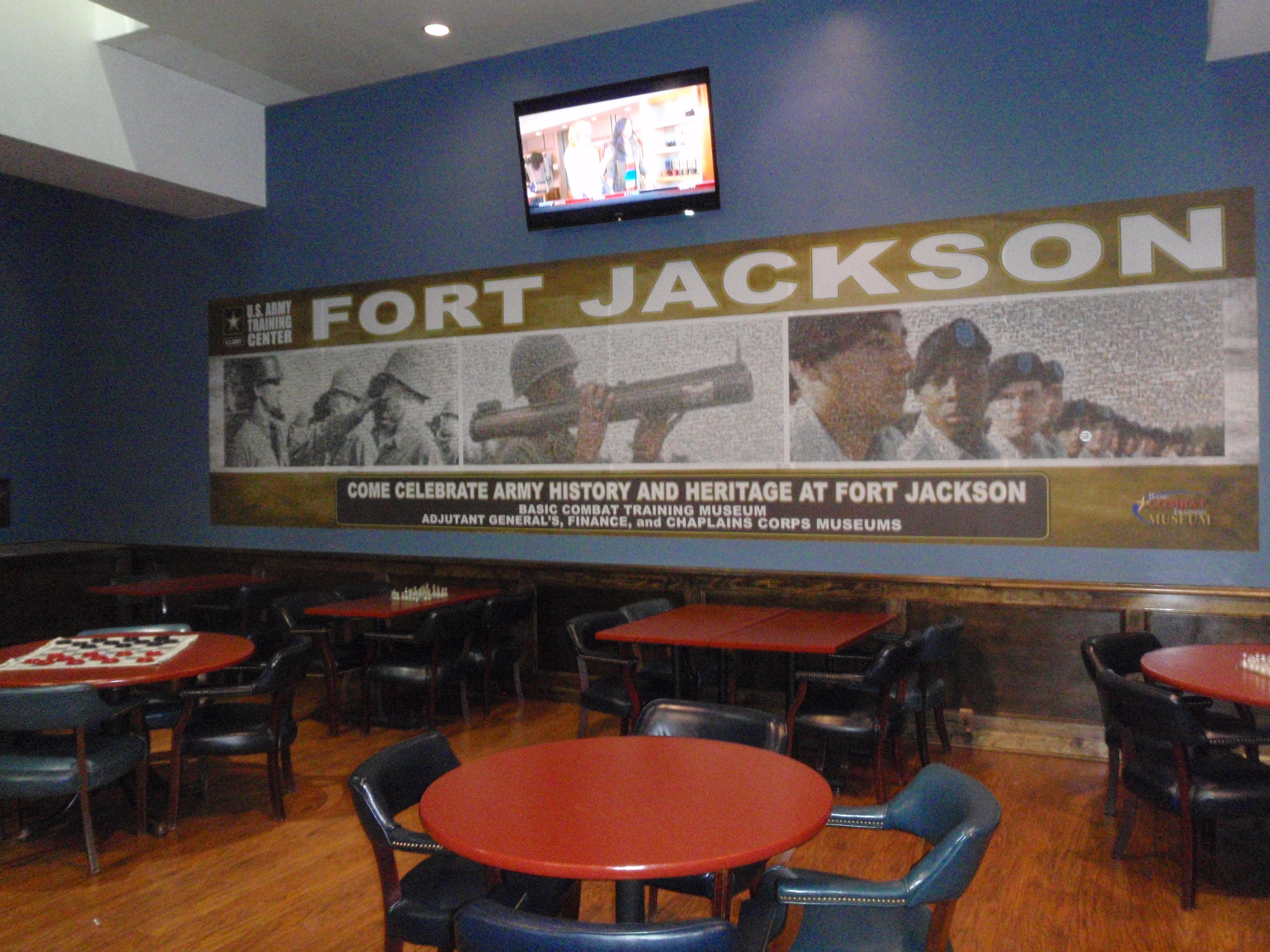
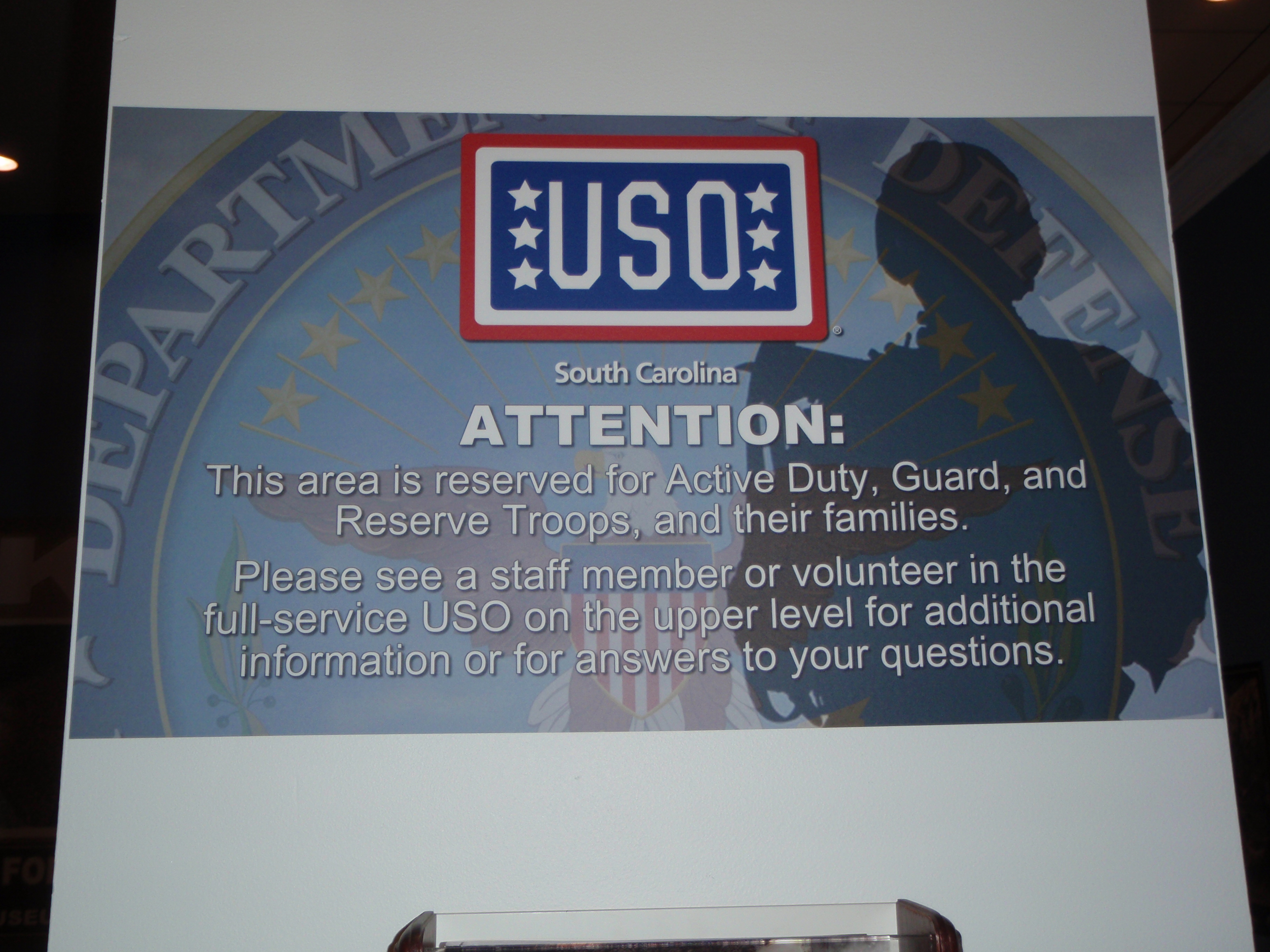
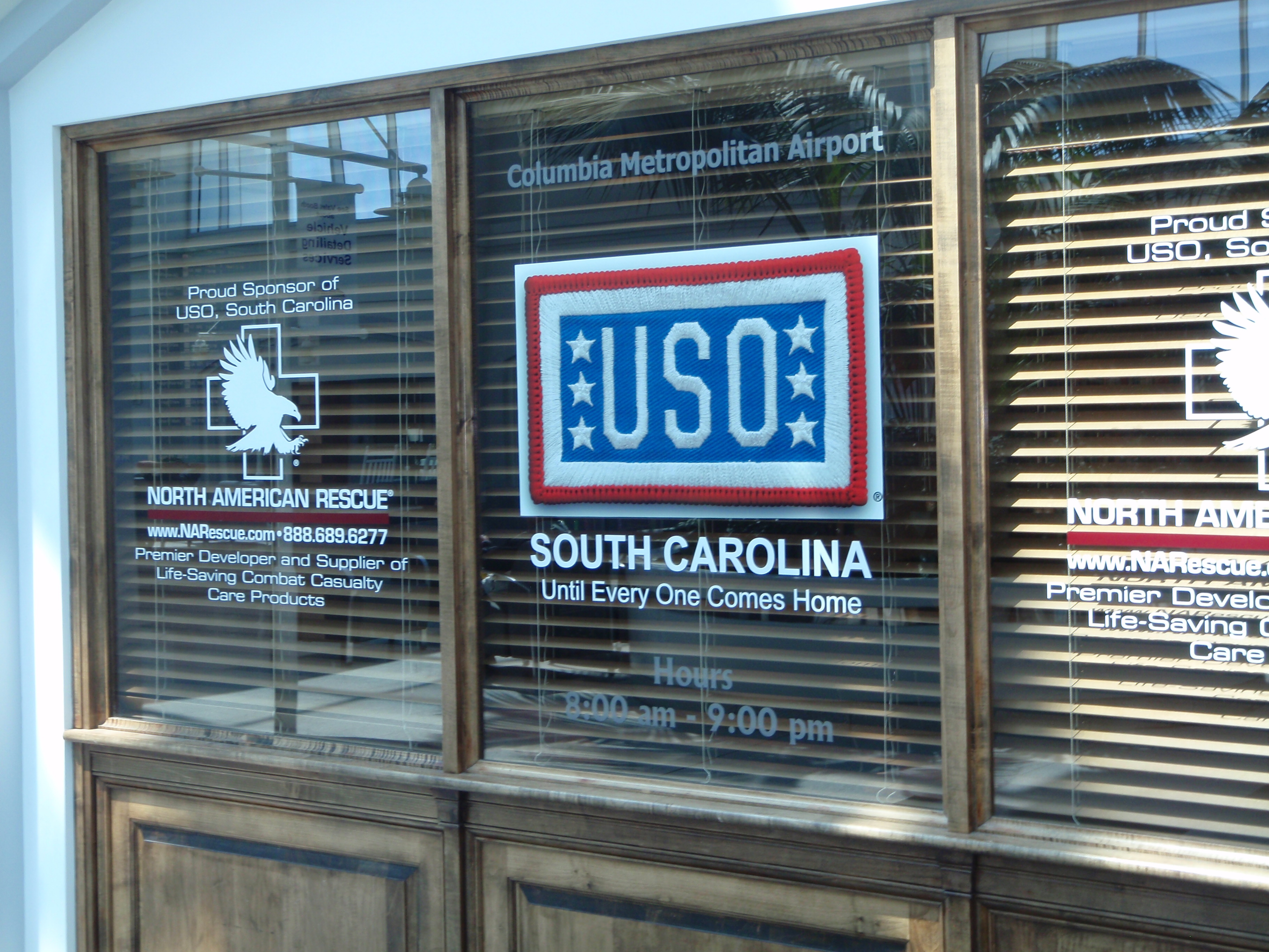
I stayed near Columbia last night because I had read that South Carolina’s USO is located in the Columbia airport, and since they’re usually open on weekends, I figured it would be a good place for my Sunday donation. So I drove to the airport, expecting a big bustling one since Columbia is the capital of the state. But it was actually very quiet, although when I drove around I didn’t see any signs at all about a USO. I drove around by both the departure and arrival areas, and began to wonder if I had mis-read something. So on the next pass, I saw a lady who seemed to be monitoring some curb-side parking, and I asked her about it. She not only told me the USO was indeed right inside the door, but she let me park in a place people can’t usually park since I was making a donation. I went in and met the volunteer who was working (she drives down from Charlotte, NC to volunteer!) and it’s a very nice place. It’s all wood-paneled (courtesy of Lowe’s) and is a very inviting place for all the military troops who come through. The volunteer also took me downstairs to the “overflow” room – sometimes they are very crowded. There was only one person in the place this morning, but the airport is close to Fort Jackson, which is one of the biggest army training areas in the country, and every summer the USO experiences “summer surge” when 9,000 new recruits come through to begin basic training. The volunteer said it’s pretty exciting when the place is bustling with new recruits! So it was fun to see all of that, and my donation will help get supplies for the summer surge.
Then I headed down to Aiken, which is in South Carolina’s horse country. But we stopped along the way in a little town to get a couple miles of walking in.
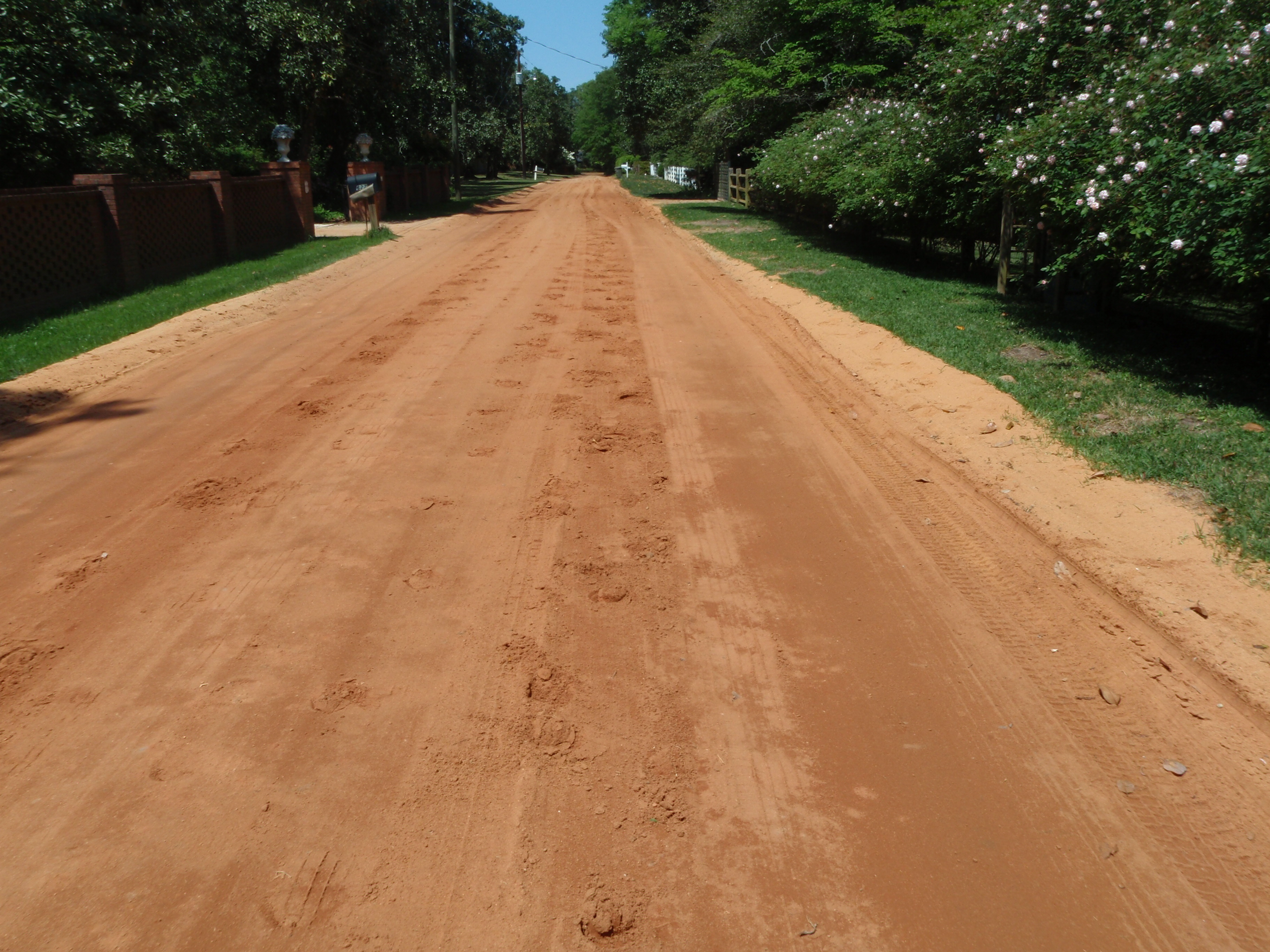
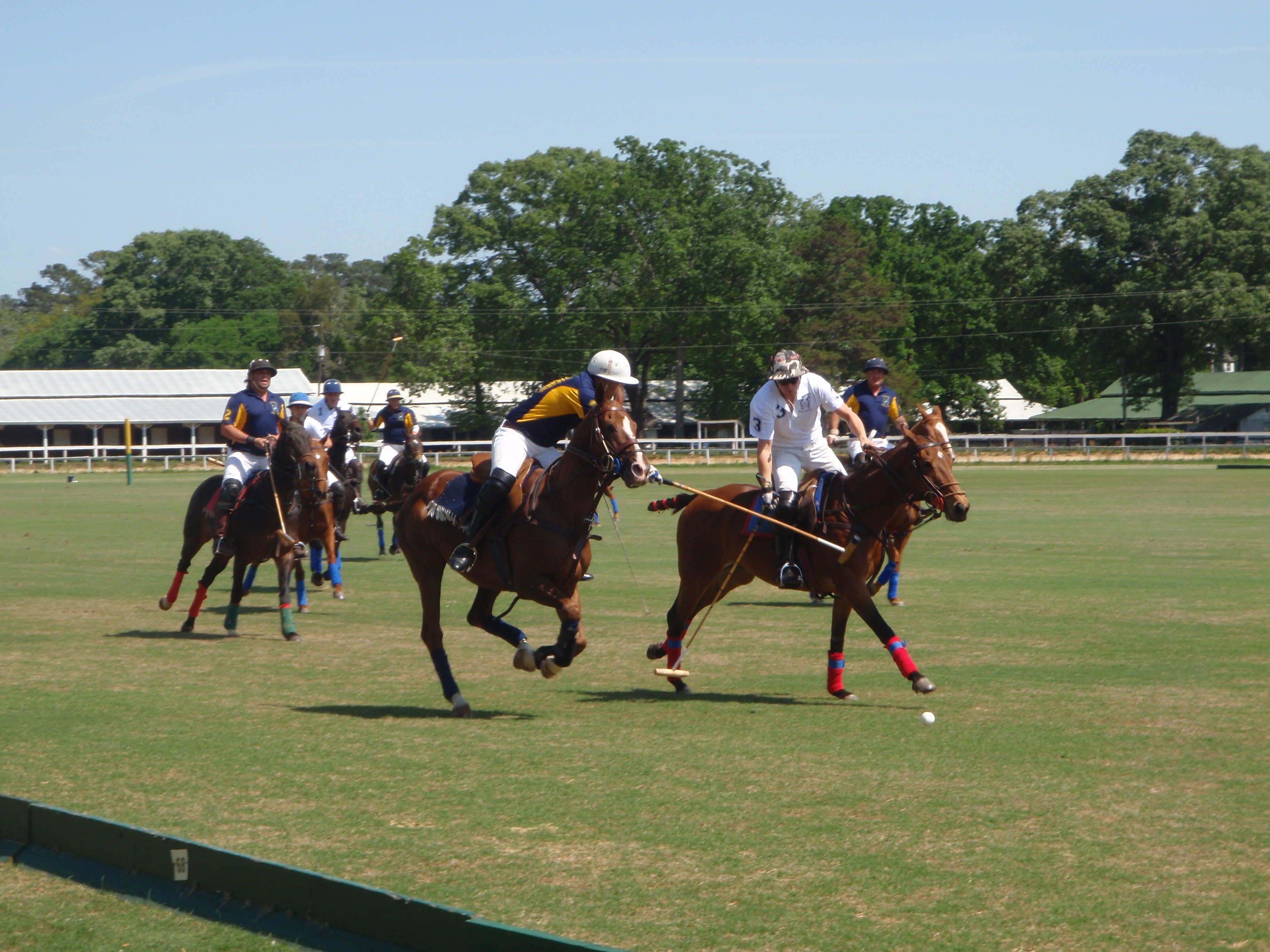
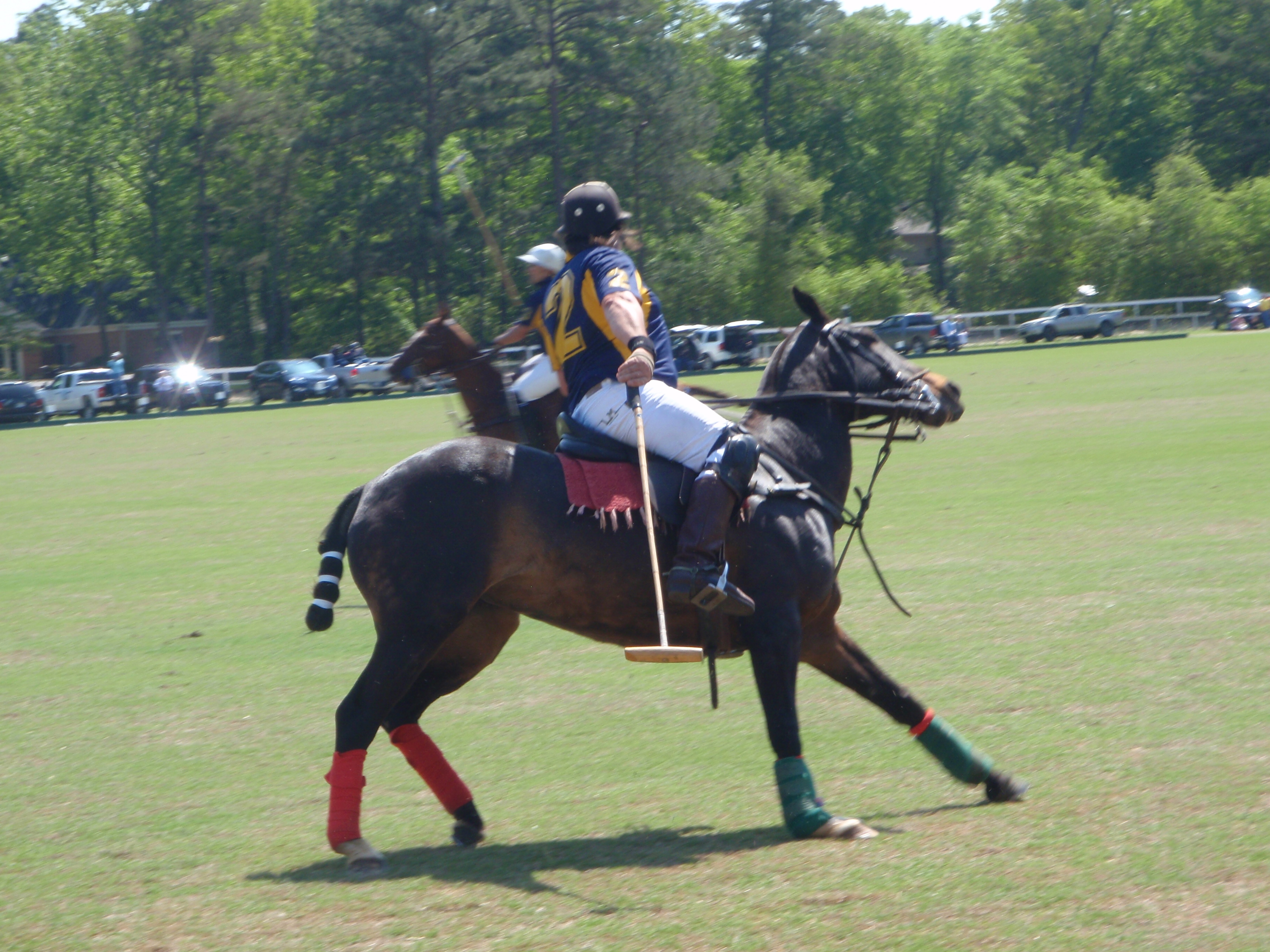
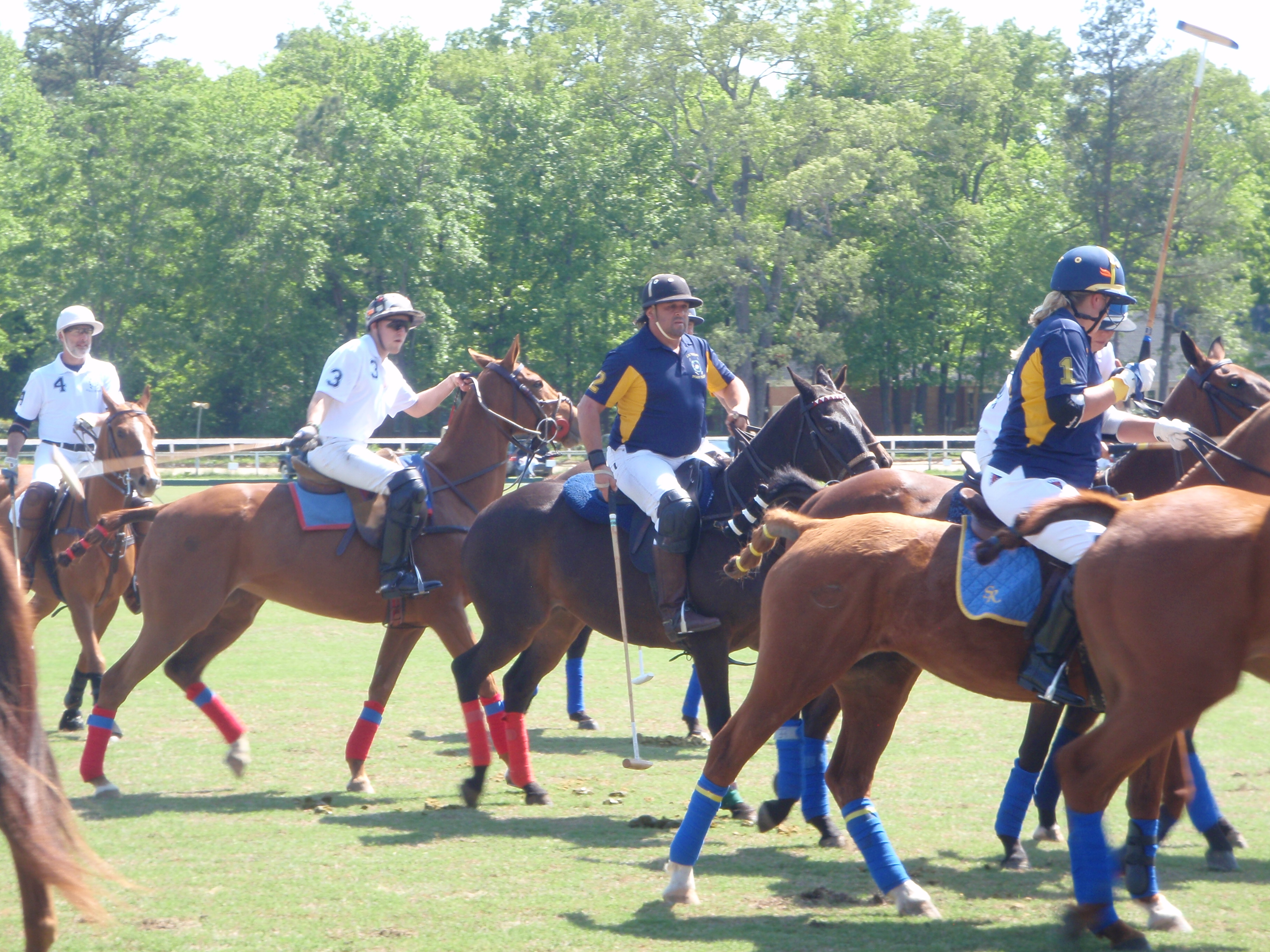
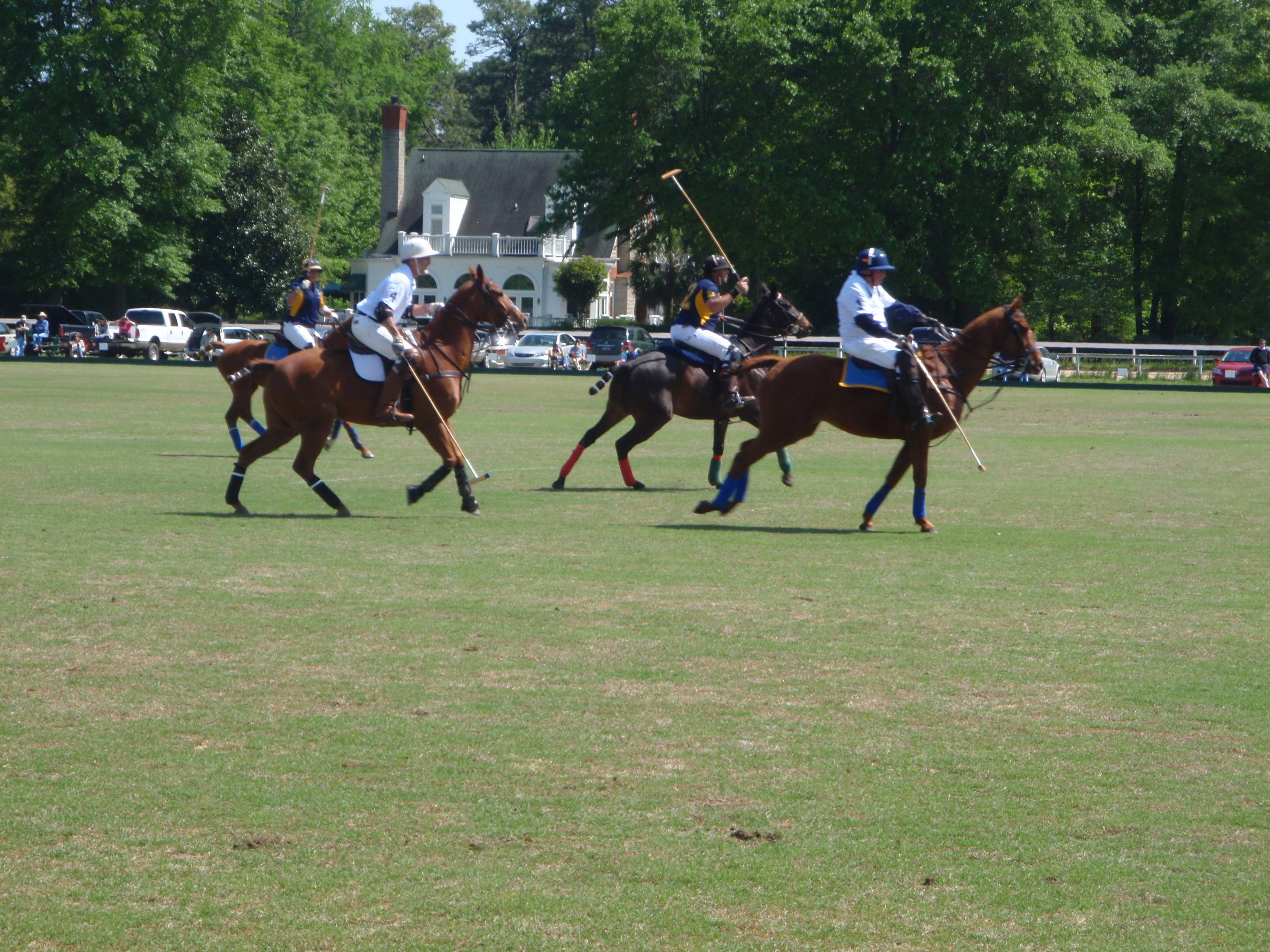
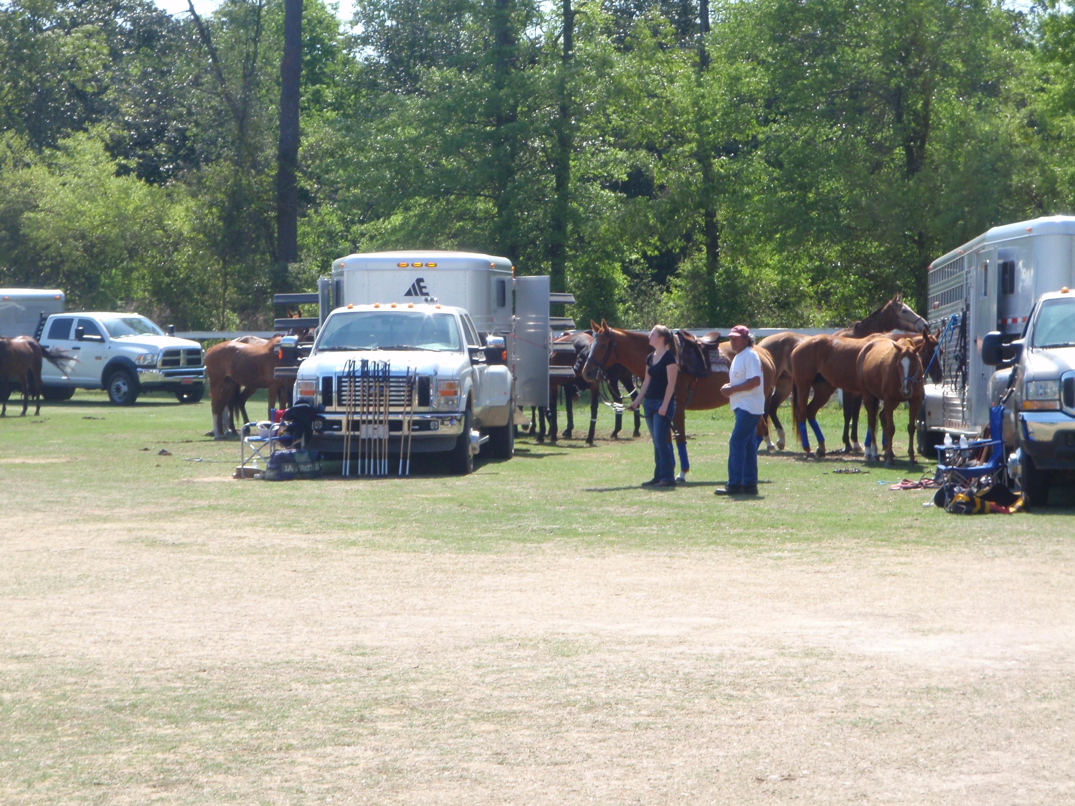
I had stopped in Aiken in 2011 when South Carolina was my annual “state-of-the-year” trip, and I knew I wanted to come back and walk some more here. The horsey part of town is truly a horse paradise. The roads are soft red dirt for riding (almost completely shaded by big trees) and there are countless horse barns, 2 polo fields, and a jumping arena. One of the polo fields had a sign out that there would be a polo match at 3:00 this afternoon. I found a place to park and Tula and I did some more walking on the red dirt roads until it was time for the polo match, which I wanted to watch. I found another cool shady place to park, and went in to see what polo was all about. Many attendees are regulars and they reserve places to park right along the polo field, and they back in and tailgate. The announcer said this is the oldest continuously-played-on polo field in the country, and they started back in 1882. Since I had just walked in, I found a good place to stand where no one had parked right near the center of the field, and enjoyed watching the first half. There are 4 people on each polo team, plus a referee, so there’s 9 horses dashing around the field, and the thundering hooves kind of echo. The mallets must be about 4 feet long, and they’re sometimes swung in circles, and sometimes swung outward from the horse, so in addition to all the running horses, you have swinging mallets (and they hit that ball hard!), and it’s simply hard to believe that horses and people aren’t hit with a mallet! I would think a good thwack from a mallet could break a horse’s leg, but they’re all protectively wrapped, and their tails are wrapped too, so they don’t get tangled up in any of the action. There were 3 chukkers in the period, and each chukker was 7 minutes long, and a horn blows to signify the end of a chukker. The ball has its own “right-of-way” and there seem to be lots of rules to remember. The players and horses could get a few moments of rest during the frequent fouls, which often seemed to have something to do with the ball’s right-of-way. At the end of a chukker, everyone goes and gets a fresh horse, so I’m sure there’s a great deal of strategy involved figuring out when to use each horse, when each player needs 6 of them during the match – one horse isn’t sufficient; a polo player needs a whole string of horses! During the halftime break, the spectators were asked to go out onto the playing field to tamp down the divots that the horse’s hooves had dug out of the ground. So I walked out with everyone else and pushed sod back into the little holes. The polo field is really big – I’m not sure what the dimensions are, but certainly bigger than a football field. I’d been standing during the whole first half, which was about 50 minutes, and I was ready to move around a bit, so I got Tula out and we walked some more around the dirt lanes. I thought I’d get back in time for the last chukker, but the second half must have gone faster than the first half, because people were already leaving when I got back. But that was fine – I’d seen what I wanted to see!
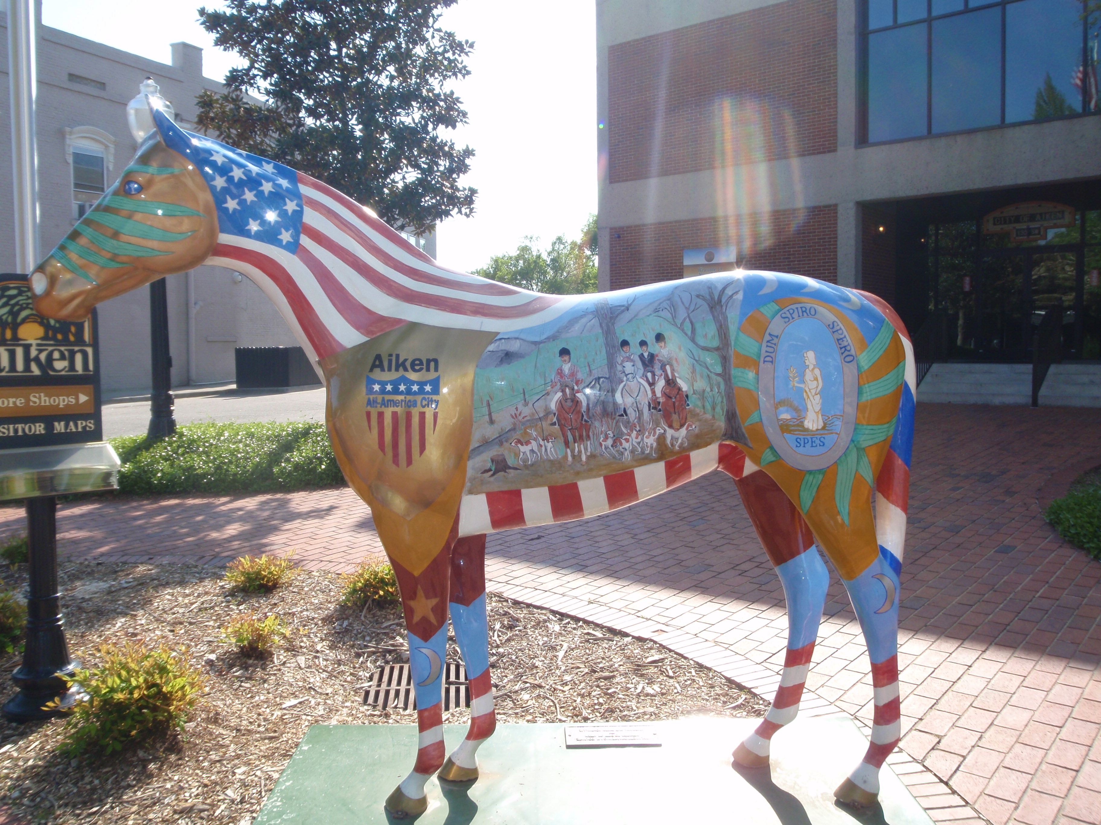
The actual town of Aiken is pretty too – and I finished off my walking for the day there. There are numerous horse statues throughout town, and they’re all painted differently.
And then I was ready to camp! It had been a beautiful day and it was going to be a pleasant night with no rain, so I looked to see what my options were. The website for Pine Acres Campground just north of town looked nice, so I drive out there, turned in, and immediately came back out! I don’t know what the website was picturing, but this looked like a place where there were permanent shabby trailers, and a sign saying they were also selling repo’d trailers. I couldn’t stay there! Then I read about Aiken State Park, which was a ways away, but it was a pretty drive, and it turned out to be a beautiful uncrowded campground with lots of pine trees, and I really enjoyed being able to camp again – it had been a long time!


South Carolina – Saturday, April 20
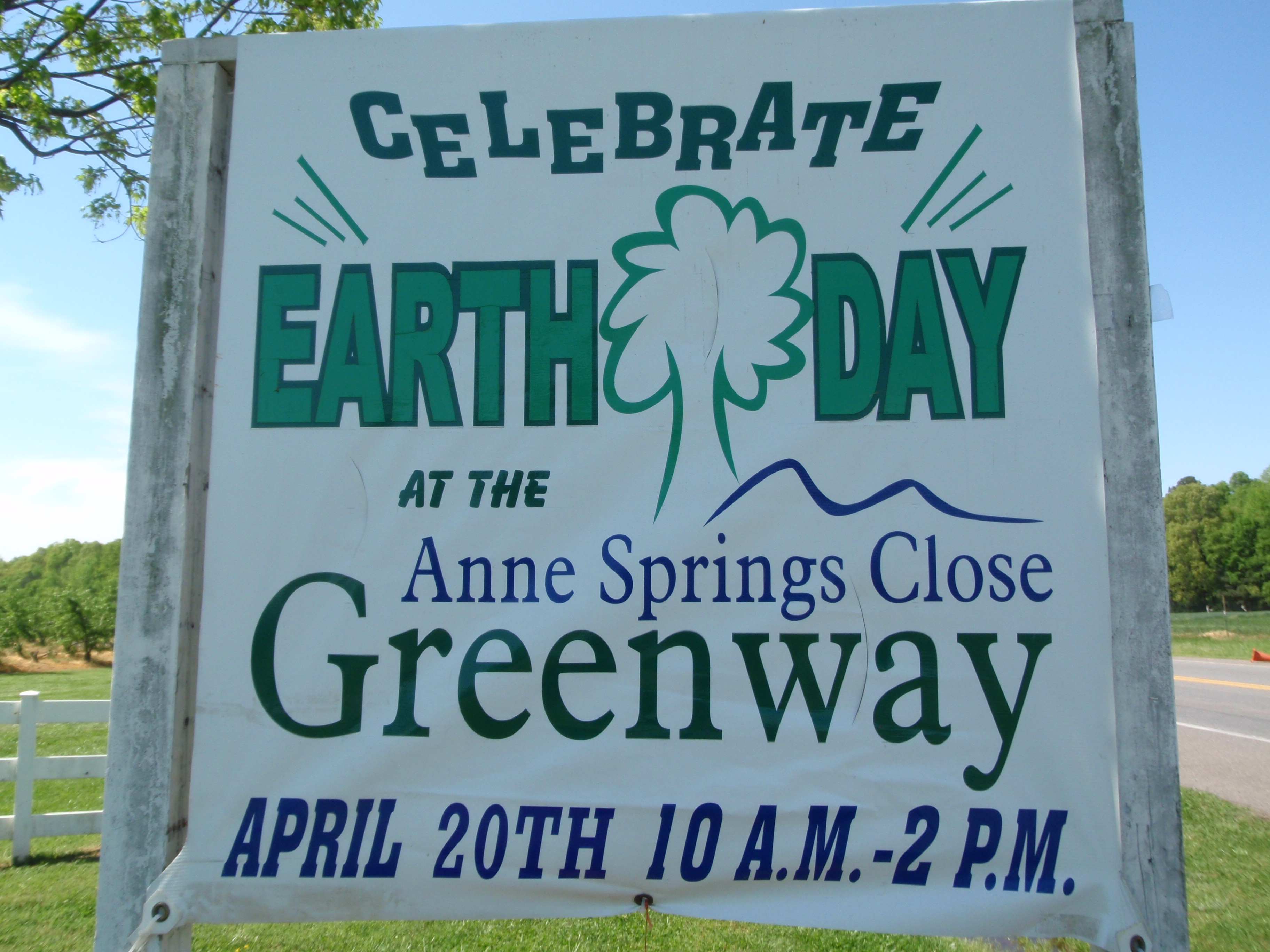
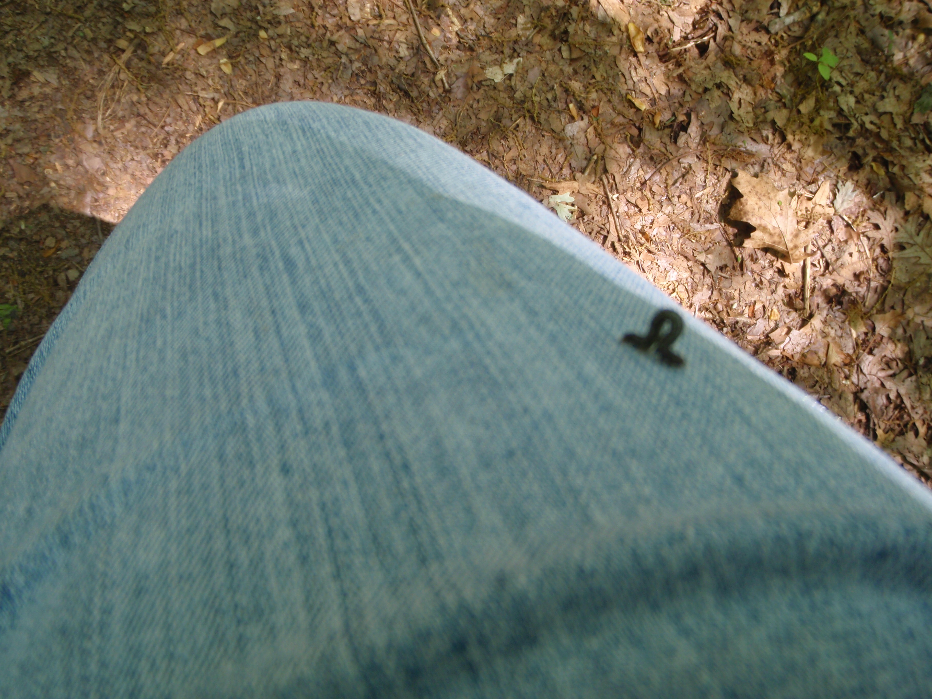
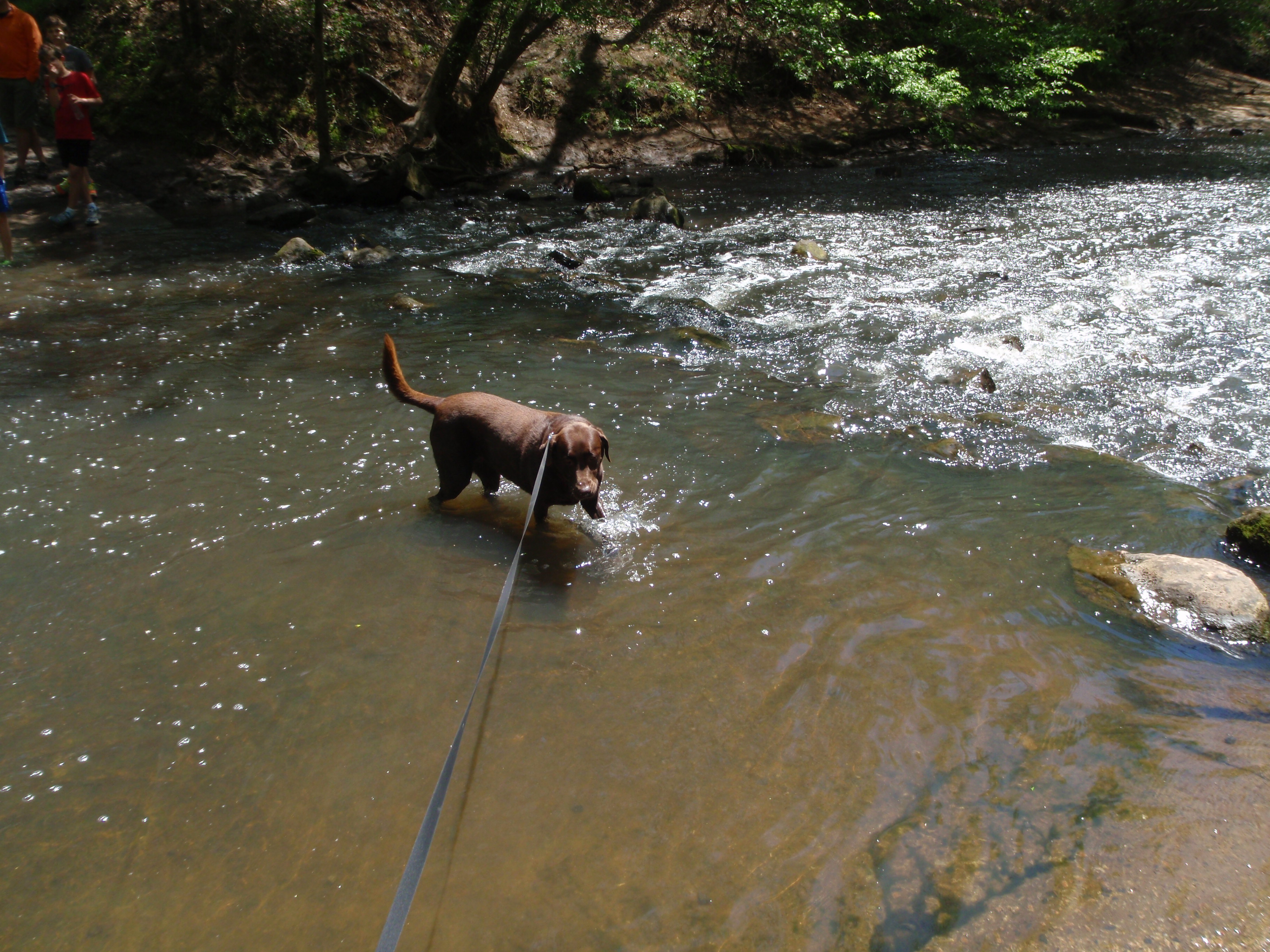
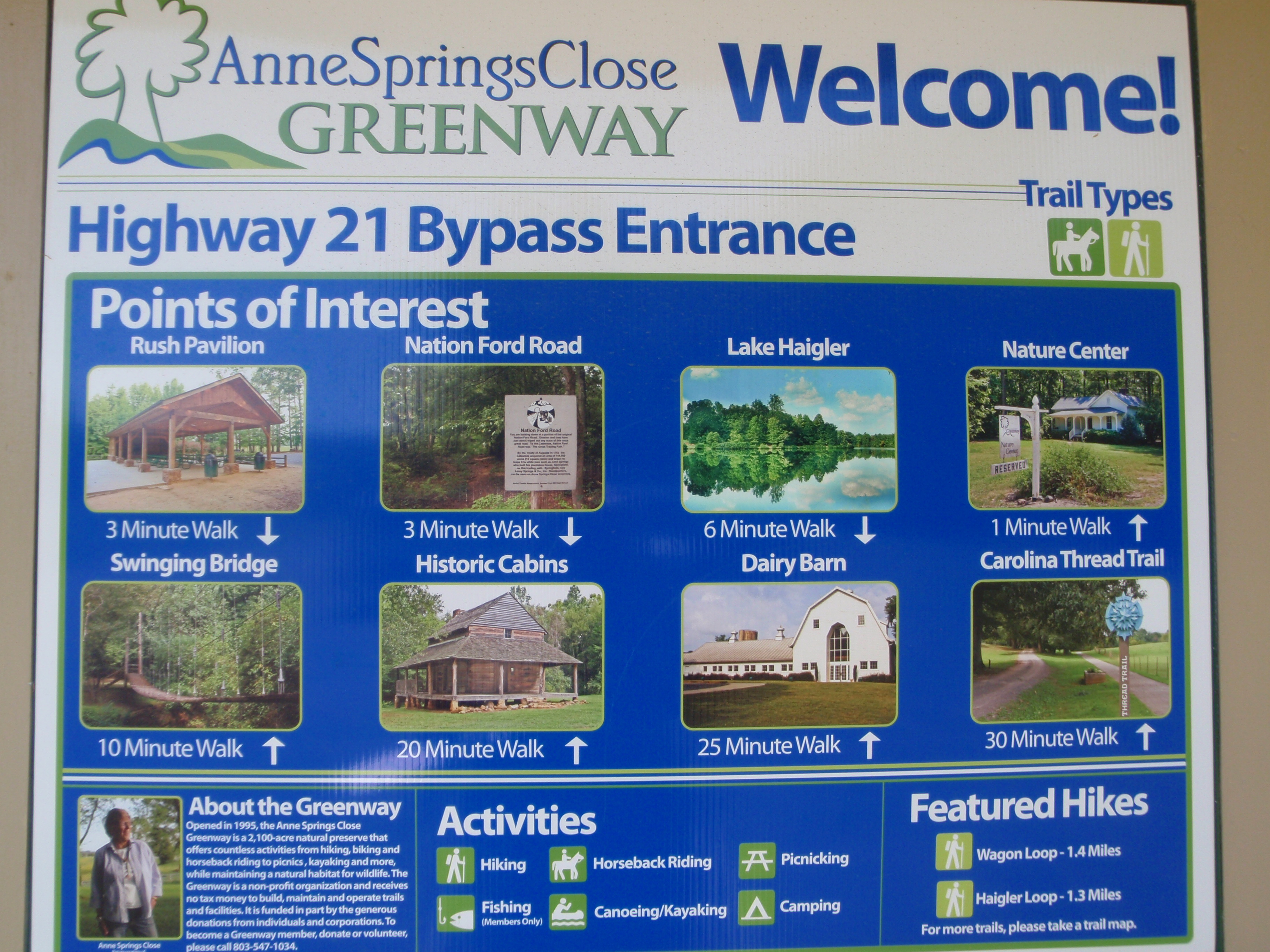
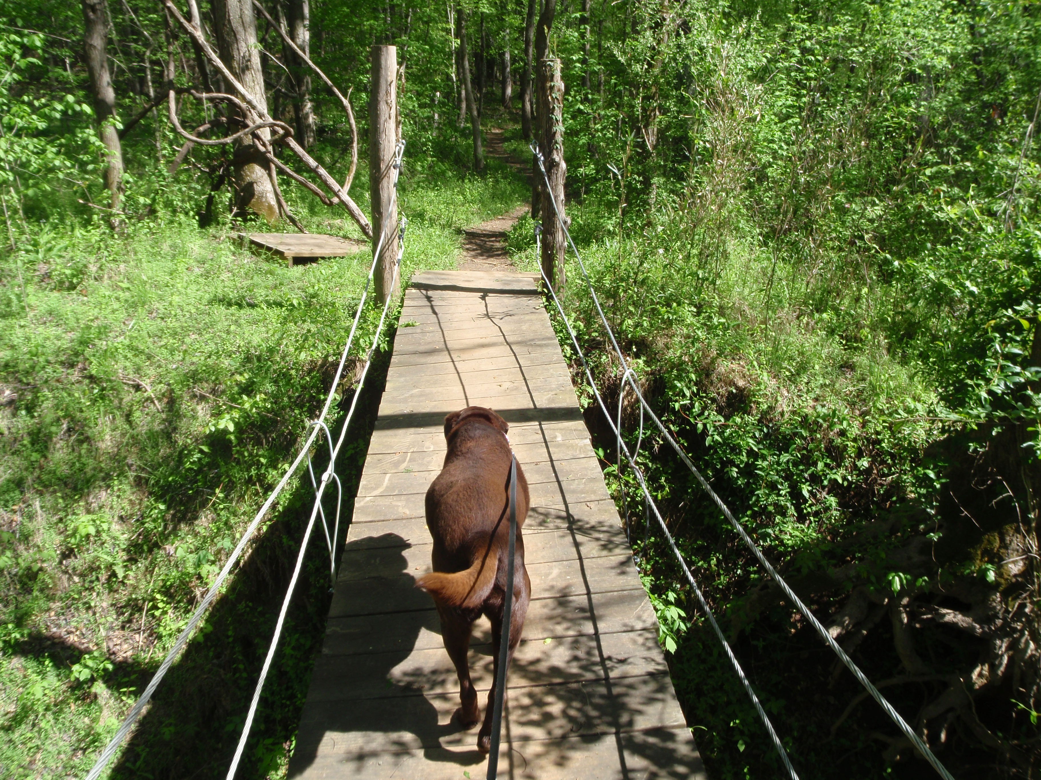
When I was driving around to find the Community Cafe yesterday, I noticed a sign for Anne Springs Close Greenway, and greenways usually mean there’s some good walking trails, so that’s where I headed this morning. When I arrived, I saw big signs about their Earth Day celebration today (mostly in terms of a petting zoo and games and crafts for kids) and this turned out to be a 2100 acre nature preserve with miles of trails, horseback riding, nature trails, educational programs, etc. It was a beautiful place, and all this land had been donated to the public by the children of Anne Springs Close nearly 20 years ago. Entry fees were waived today in honor of Earth Day, and there were lots of people out enjoying the preserve and activities. I read that they do not receive any state funding to maintain the park – that’s all done through memberships and entry fees and donations, so I knew there could be no better Earth Day donation than one to a big nature preserve that countless people enjoy! Tula and I walked about 5 miles on trails out in the hills and woods and around the small lake – some of it got a bit slippery because of the rain yesterday, but we made it through with some red mud (and lots more inchworms-they seem to be suspended from thin air!) clinging to us. Then I was going to walk in another part of the park, but that required crossing a wiggly suspension bridge, and Tula didn’t want anything to do with that. She was ready to go through the stream below, but I wasn’t sure how deep it was, although I was pretty sure other people just waded across. So I put her back in the van, and walked a couple more miles in the area across the bridge. I was really happy to come across such a nice outdoor place on Earth Day – which I had forgotten about!
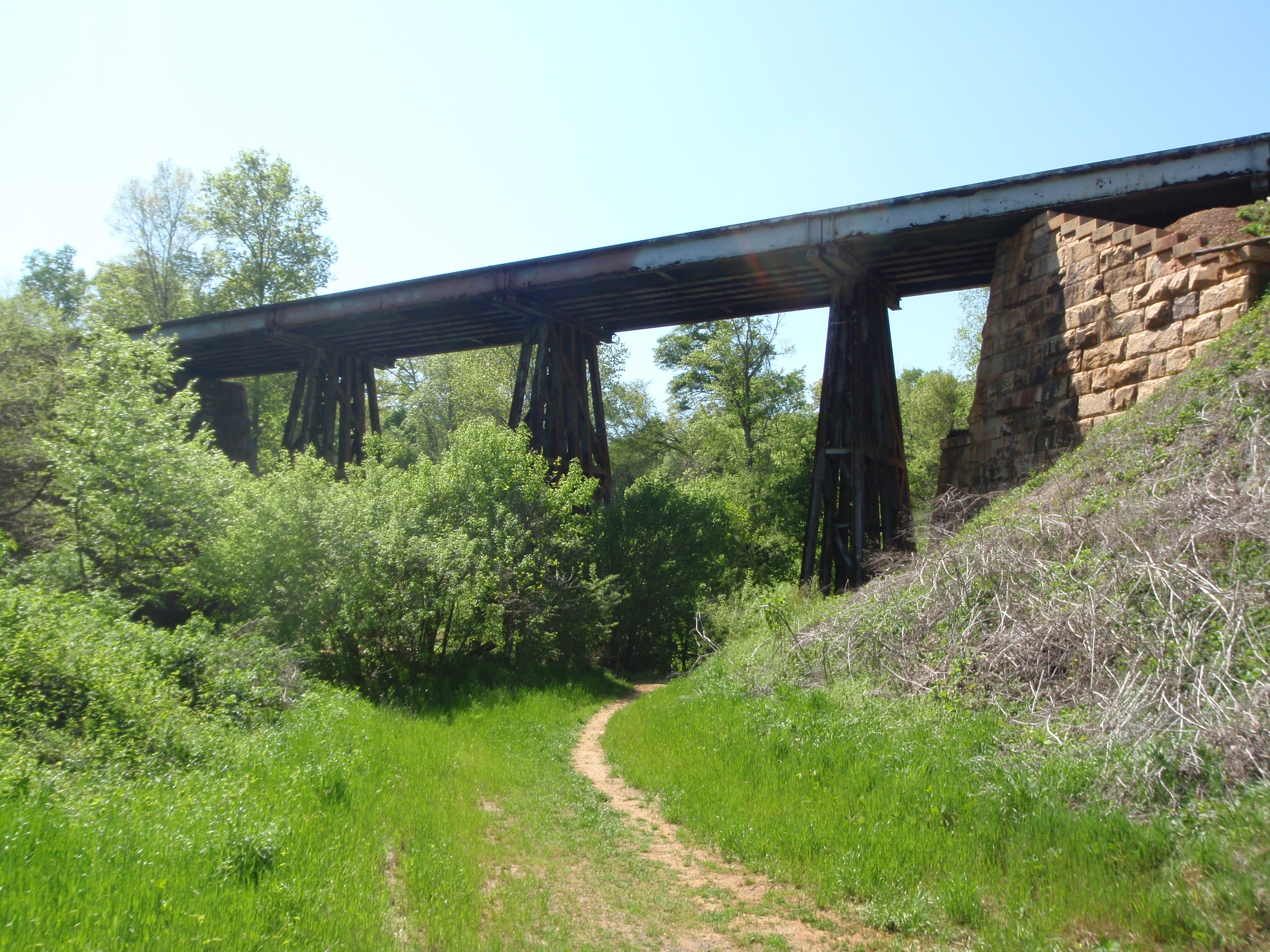
I made my donation and then we drove to a different area of the park to walk just a little more – I wanted to see an old train trestle back there. We came to another short swinging bridge which wasn’t very bouncy, and I wanted to see if Tula would follow me across if I took her leash off. She was still afraid of the bridge, and instead, with me on the other side, she started down the ravine and was going to check out the water and come that way. I didn’t want her to do that, so I came back across and we took another trail to the train trestle! She puts up with just about everything I do – I can certainly cross swinging bridges off my list!
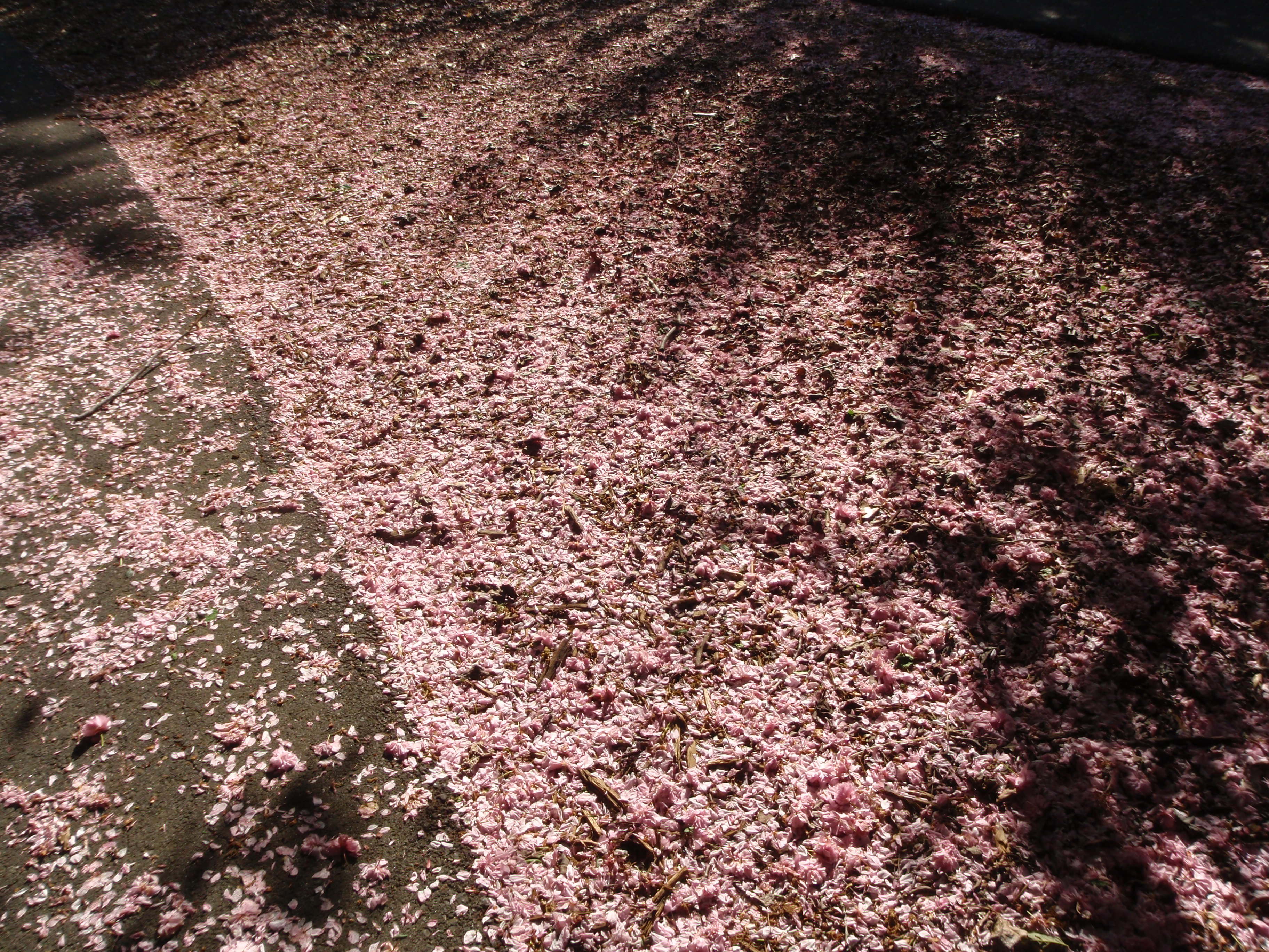
We ended up spending a good part of the day in the Greenway, and finished nearly all our walking. I’m still barely inside the South Carolina border, and I’ve already spent nearly 2 days here! It was time to drive a little, but I stopped in the next town down, Rock Hill, and we walked a little more in a really pretty city park, where there were so many pink cherry blossoms on the ground it looked like pink snow in places! By then I had made up my mile from yesterday too, and then we headed to the Columbia area where we stopped for the night.


South Carolina – Friday, April 19
Since I took such a long detour through coal country, I didn’t make it all the way to South Carolina last night. So I drove through North Carolina this morning, and went through some heavy rain and fog. Then the showers lightened up, but it was still a gray day. We crossed into South Carolina after noon. After a few hours in the car, Tula and I were ready for a walk, and I took advantage of the break in the showers and stopped in the first town I came to, which was Fort Mills. The first place I saw to start walking was a pretty, landscaped sidewalk that seemed to run for a good mile along the front side of a professional area. So I parked and we got out, and walked along that sidewalk, which led to another street with huge pine trees, which then led us to a park-like area with a walkway – and boardwalk – around a huge pond with baby ducks. So what was going to just be a short stretch-our-legs walk turned into a pretty 3 1/2 mile walk.
Then, since it was already mid-afternoon, I looked into donation possibilities in the Fort Mills area, and discovered the Community Cafe, which provides lunches at 2 local churches a couple days a week. I tried calling the church where the Friday lunch is held, but it was too late – lunch time had come and gone. I decided to drive over there anyway, and found Lake Wylie Lutheran Church, which had recently built a new fellowship hall, and just started serving lunches in the middle of last year. They have some big banners out front, and I read online that they’ve already served over 8300 meals since opening last year. The 2 churches seem to serve 400-500 meals a week, and people can also get take-out meals, and they deliver meals to those who can’t get out. So I was happy to mail in a donation for them.
In looking for the church, I had passed another pretty area that I wanted to walk in. The clouds were getting a little heavier, but I hoped to squeeze in a few more miles. I parked and we set off through another park, and passed a couple small peach orchards, and then enjoyed a winding walkway through some more big pine trees, and everything was pretty and green. In West Virginia I had been watching the buds just start, and saw the green become more noticeable every day, but down here everything was in full bloom and beautiful. At the farthest point of our walk, the sprinkles started, and gradually got a little heavier. By the time we were about halfway back, it was raining pretty hard, and needless to say, we were getting drenched. And there was nothing I could do about it except try to walk a little faster. And then the wind blew something in my eye, and that was painful and my eye started watering like crazy. And, there were inchworms all over the place – hanging from tree branches and I seemed to be a magnet for them, and kept stopping to pick them off my clothes. So I felt like a mess – soaking wet, a watering eye and inchworms clinging to me; walking a wet dog! Despite all of that, some kind lady pulled over and asked if she could give us a lift somewhere. We were almost back so I declined and thanked her for stopping, but I thought it was amazing someone would offer to pick up a drenched person and a wet dog! We got back to the van and I couldn’t get the towels out fast enough – Tula jumped in the van and shook all over the place. I dealt with my contacts and dried off as best I could – and picked off still more inchworms. It’s a good thing they don’t gross me out! It just felt good to be out of the rain. I could see the rain wasn’t going to be letting up any time soon, and since it was early evening anyway, I was ready to just find a motel nearby and call it a day. I got checked in and had a good meal, and it was nice to be settled a little earlier than usual after a very late night last night. And, despite the rain, I still got 7 miles of walking done!


West Virginia – Thursday, April 18
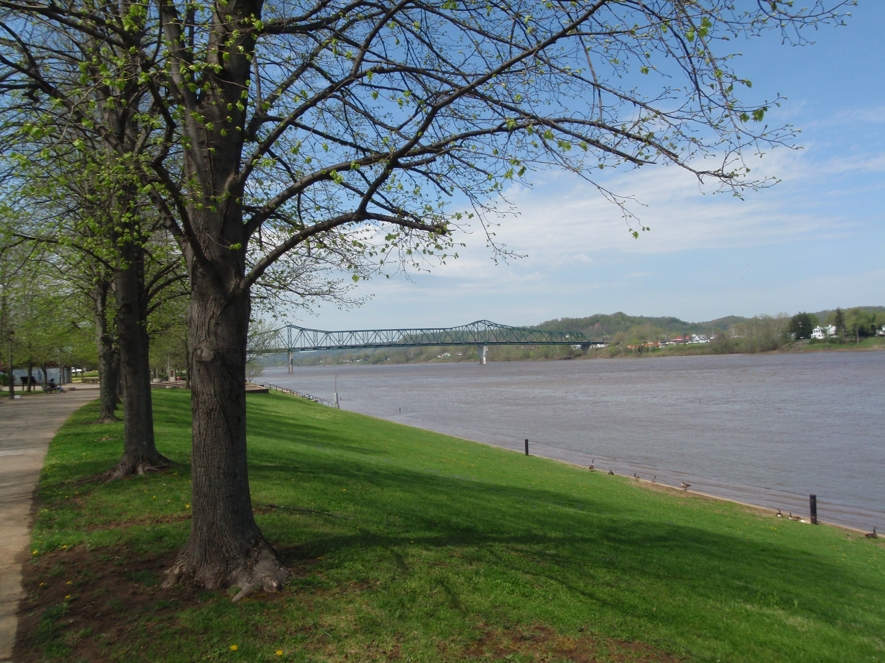
I stayed near Huntington last night, which is on the Ohio River right across from Kentucky. I thought there was a long river trail in town, but I could only find a short one, and I walked on it anyway. It was a pretty park, although lots of it was hidden behind tall concrete walls. At first I thought I was in some big industrial area, and then I realized the long wall was there to help prevent flooding when the river gets too high. And as I looked at the river, I once again have trouble understanding how it can rise so high, but I know it happens all too often. Tula came with me on that walk, since it was in a shady park and we only did a mile, and then I got another 2 1/2 miles in around town and Marshall University.
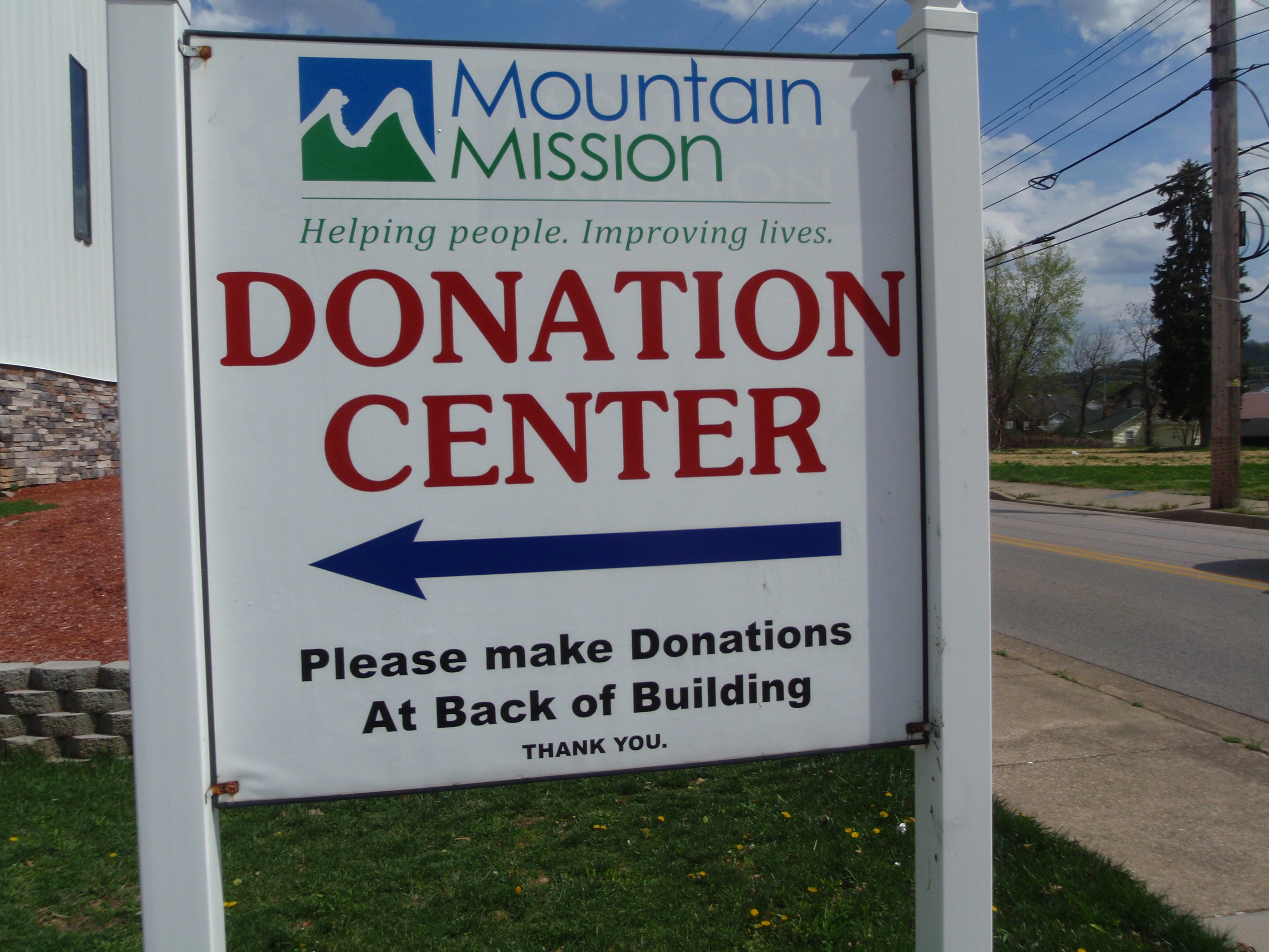
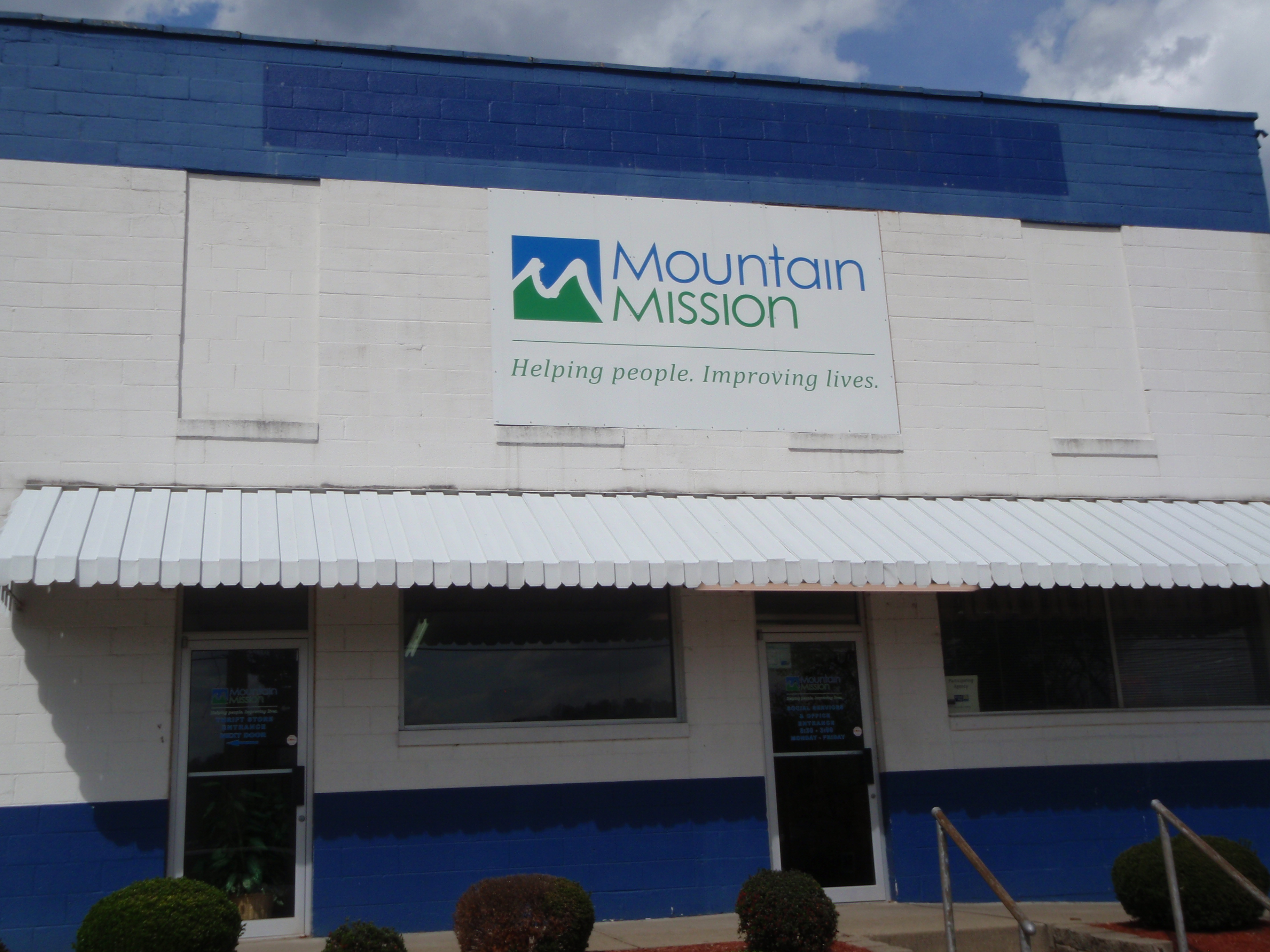
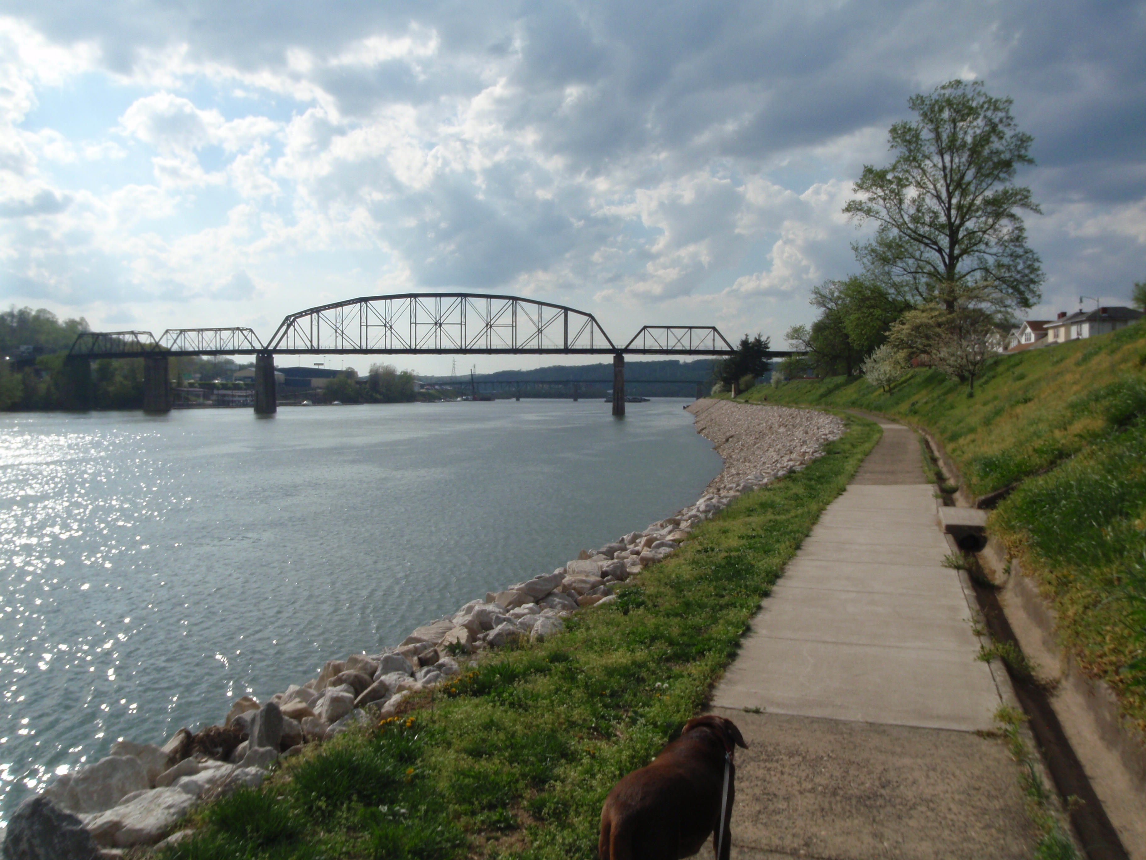
Then I called the Mountain Mission Food Pantry to see what sorts of things they need. I ended up getting a bunch of cereal, oatmeal, muffin mixes, pasta, rice, beans, and mac and cheese. The Mountain Mission Food Pantry is located in Charleston, the capital of West Virginia. They gave me good directions and I found them and met Janice and John, the manager and director. They told me more about the people they help feed – 14,000 of them last year. Many of the people who seek their help are the working poor, who work full time at minimum wage, and can’t quite make the ends meet. Mountain Mission is continuing to develop its programs, and they’ve bought some more land across the street and hope to eventually be able to open up a soup kitchen to add to the food pantry and thrift shop. We took some photos, and then they told me about a river trail which was just the thing I needed to finish off my West Virginia walking. They also gave me good directions to access the river trail, and Tula and I walked about 5 1/2 miles, enjoying the river breeze on a hot afternoon, and we watched a barge pushing a big load of something up the river. Tula seemed to be happy on the long walk – I think her allergy meds are helping. Right downtown there’s a “built-in” little auditorium area on the river – I imagine it’s a good spot for performances and 4th of July fireworks and all.
Then, with walking complete, I was ready for a little driving. I was going to be heading south through the coal country, and since coal is such a huge part of people’s lives down there, I did some research last night to see if there was any sort of donation I could make for coal mining families. I eventually ran across the Friends of Coal Ladies’ Auxiliary program, which is located in Beckley in the heart of coal country. This morning I talked with Rhonda, a volunteer there, and she told me a little about how they try to help coal mining families. Last Christmas they were able to buy gifts and supply a weeks’ worth of food to over 100 families. They’re there to help when it’s needed. She gave me the number of Regina, the director, and I called a couple times and left a message, and she called me back when I couldn’t answer, so we played phone tag and never did catch up! So I’ll be mailing a donation in – it would have been fun to meet up, but sometimes it’s not always possible. Even though it was late afternoon, I knew I still had a couple hours of daylight, and I made the decision to drive along the Coal Heritage Trail – along narrow, twisting mountain roads, and through dozens of little coal towns. I actually found the Friends of Coal logo on the side of a building in one of the towns. My guide book says the stores are company stores, and I don’t know if the housing is company housing – some of the homes have certainly seen better times. Some of the little towns seemed to be so far from basic stores that I thought about how tough it must be to live there. And I wondered how long the bus routes are! But I did pass through a couple bigger towns, and that’s where people seemed to be hanging out, and there were grocery stores and gas stations and all. Every now and then I passed mining areas – all in all, a fascinating glimpse into a life I know nothing about.
The daylight eventually faded and I finished my drive along the Coal Heritage Trail in the dark, and said good-bye to West Virginia, with all 56 miles walked, and all 7 donations given – EPIC for autism awareness, Zion Episcopal Church free lunch program, Soup Opera, Heart and Hand House, West Virginia Veteran’s Home, Mountain Mission and Friends of Coal. On to State #30!