Virginia – Wednesday, March 6
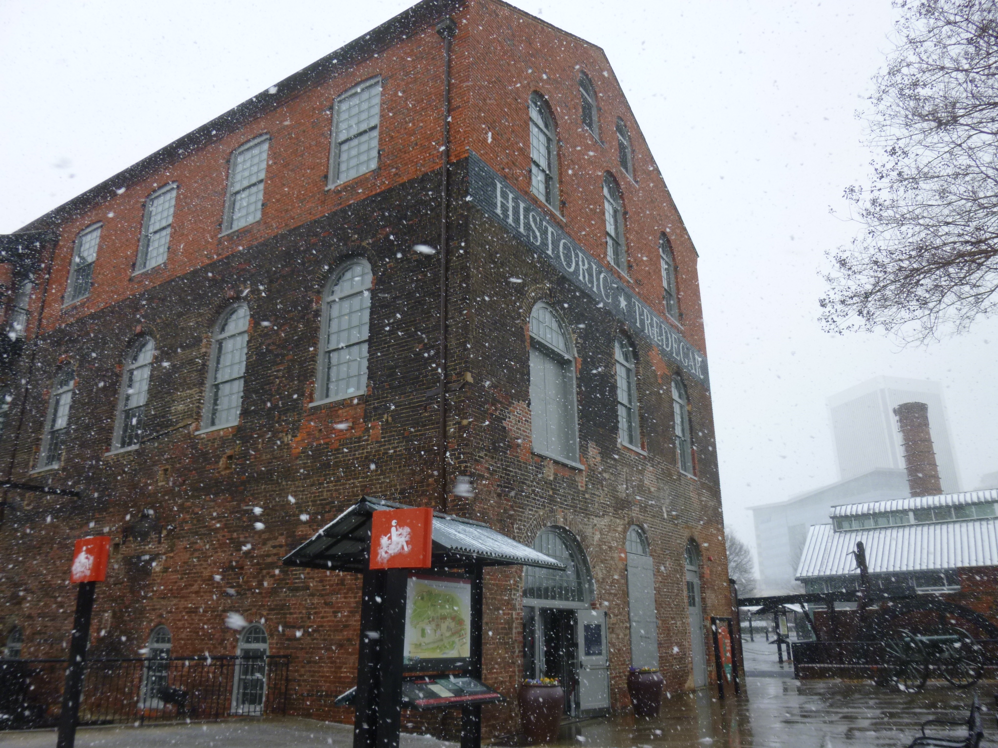
It rained all night, and was still raining when I woke up. Knowing it was going to be kind of a wet, cold day, I planned to visit the Richmond National Battlefield for just a little walking, and go to the visitor center, as well as the Chimborazo Medical Museum – about one of the biggest Civil War hospitals. And there was the Maggie Walker House, a national historic site, which I was planning to visit too, so I had a nice indoor sort of day planned, and was happy I had done some extra walking earlier in the week. I called to make sure the places were still open, which they were. The rain began to turn to a sloppy wet snow, and I delayed leaving for a bit to see if that was going to mess things up. It was snowing pretty hard, but the roads weren’t bad – yet. I got to the Richmond Battlefield Visitor Center and it was in a really cool old building that had started out as a flour mill, and then turned into a building where lots of the cannons were made for the Civil War. But the ranger told me they were closing in about 10 minutes due to the weather. I was disappointed, but certainly understood. I’m used to driving in snow, but it doesn’t happen a lot down here, and kind of messes things up when it does snow!
The beginning of a canal walk through Richmond was right near the visitor center, and I knew Tula had to get out, so we went on a short mile and a quarter walk along the canal, which would have been a pretty walk on a nice day, but this was a soggy, cold, slushy, windy walk, and I had to cut it short – I was worried about Tula’s paws getting too cold, and the snow was so heavy it soaked through my raincoat. I didn’t want to wrestle with an umbrella in the wind like some people were trying to do. So we ended the canal walk, and then I got out one more time in the historic part of downtown Richmond, but then that was it – too unpleasant to be outside!
And I didn’t make a donation today in this sloppy weather, so I’ll double up in the next couple of days.
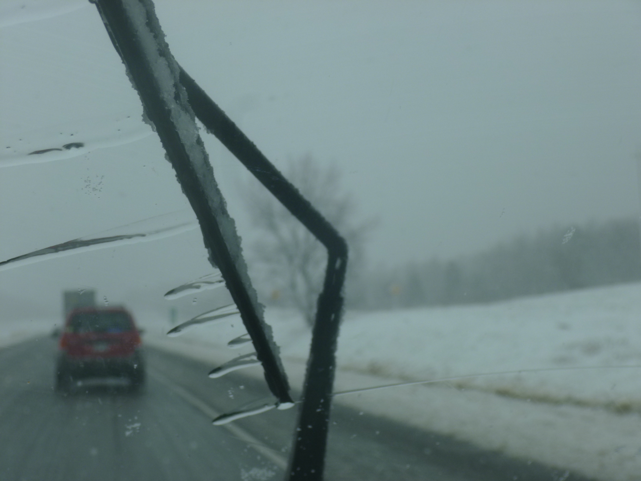
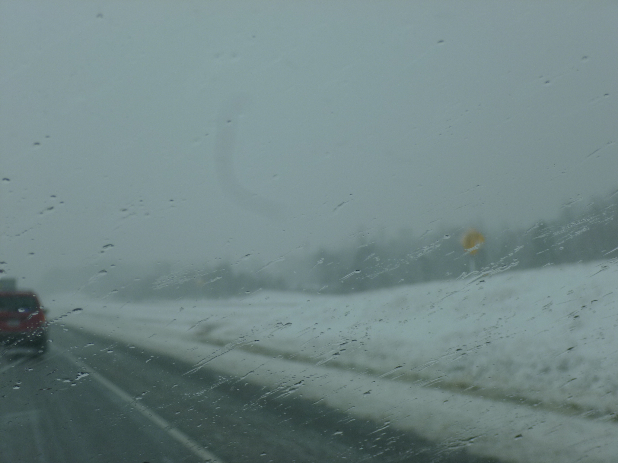
I decided to head southeast a bit, so I’ll be close to the “historic triangle” area of Virginia to see some of that tomorrow when things clear up – hopefully. It started out as a very snowy drive, and there were several cars that had spun off the road. It was actually pretty, despite the slow go! As I got farther southeast, the snow gradually began to turn over to rain, and everything was just a soggy mess. I checked into my motel earlier than usual, and decided to tackle the laundry which was overdue. That took a while, and then it was nice to just heat up some soup on a rainy evening. I think this was the worst weather day so far in my journey.


Virginia – Tuesday, March 5
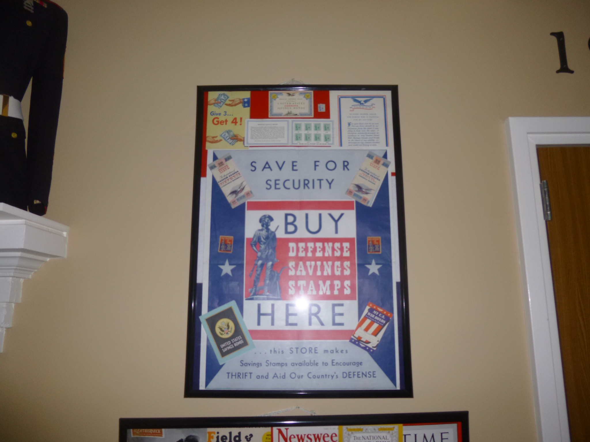
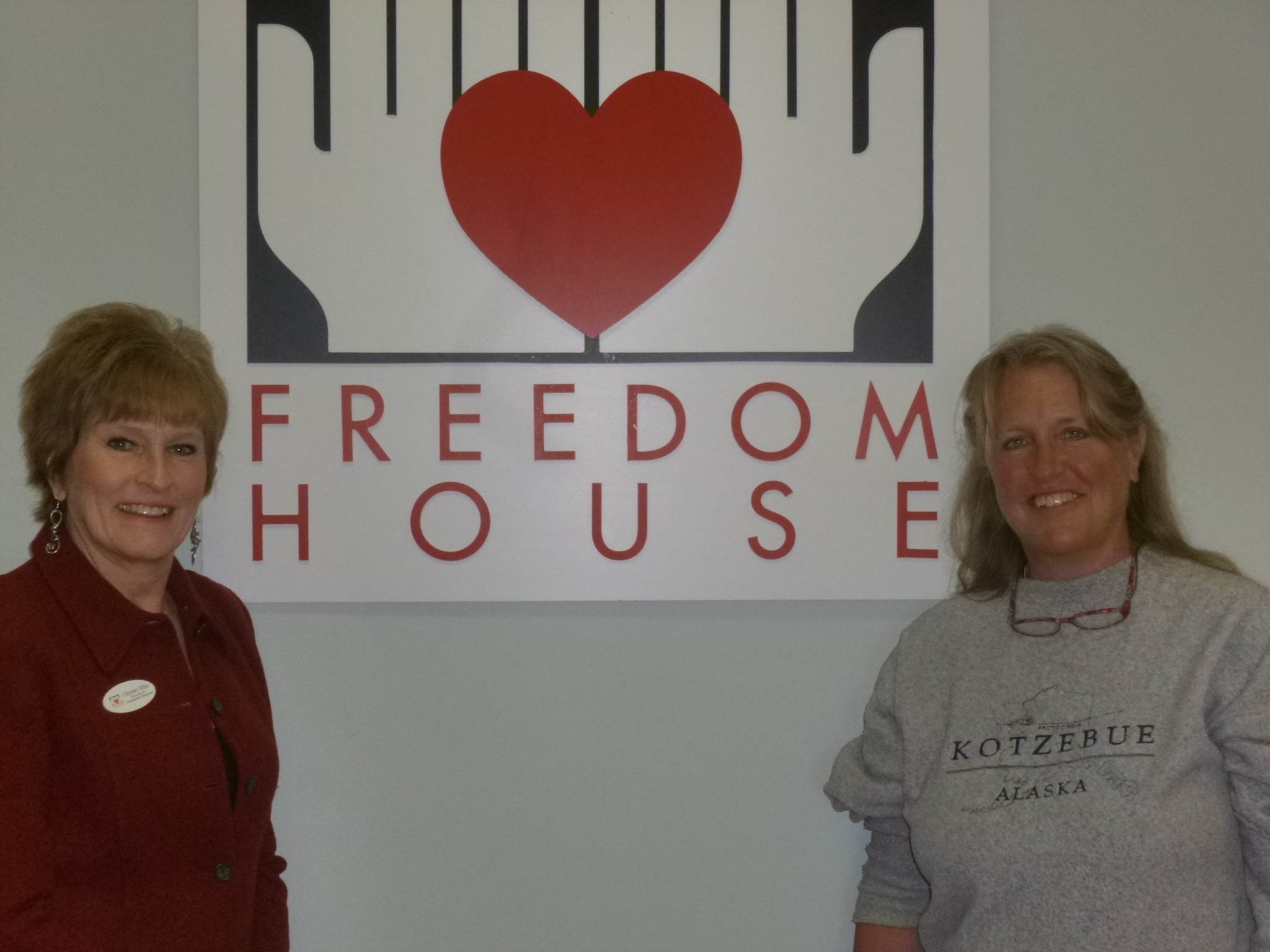
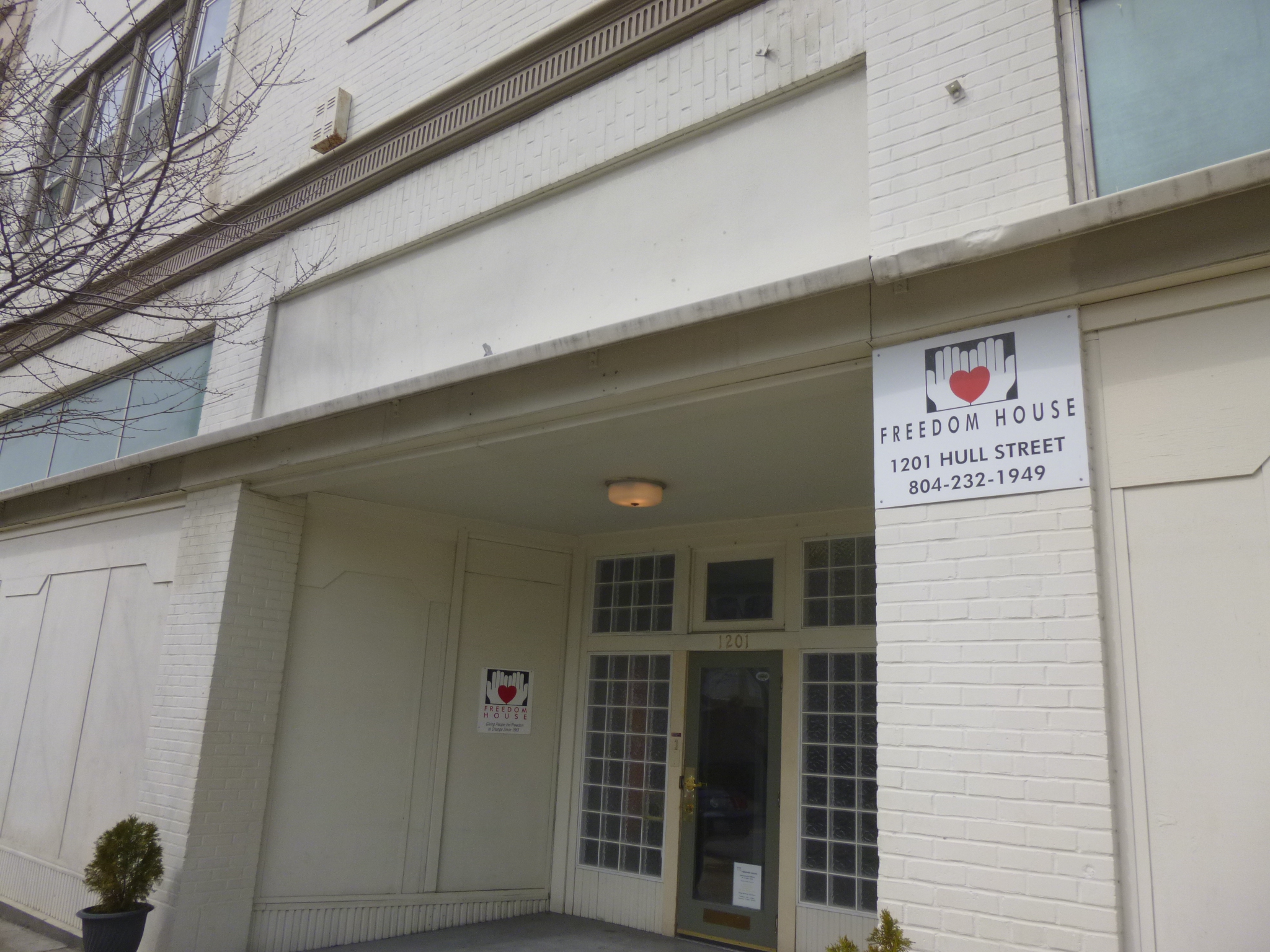
I looked into donation possibilities for Richmond since I ended up there, and came across Freedom House, a comprehensive program that has a soup kitchen, a community shelter for both men and women, a halfway house type place, and even a junior board to get young people involved in their community. Their slogan is Food, Shelter and the Power to Change. I liked what I read on the website, and tried calling to see what supplies the soup kitchen might need, but just caught the answering machine. Freedom House wasn’t far from where I was staying, so I just drove over to make a donation for the soup kitchen part of their program. Right after I got there, Christy, the director, returned and she was the one I had tried calling. I explained what I was doing and she was kind enough to take the time to tell me more about the programs and show me all around the facility. Freedom House has been helping people for 25 years, and their soup kitchen, which is at a different location from the building with the shelter and administrative offices, has served over 48,000 meals to the homeless during those years. Then she took me upstairs to the shelter part of the facility, and it’s a nice place for the 36 people who get to stay there. This is a place for people who are serious about making a change in their lives – there are a lot of things they need to comply with, and a lot of accountability on their part to keep moving forward, and they all have a case manager. The sleeping areas are divided into 24 beds for men, and 12 for women, and some of the beds are available for veterans. Their meals are provided, but they must do the cleanup, in addition to their classes and/or jobs. They have a high success rate with people in the shelter being able to get back on their feet and support themselves. In the end, I put my donation toward the shelter instead of the soup kitchen, since I was able to actually see that and hear more about it.
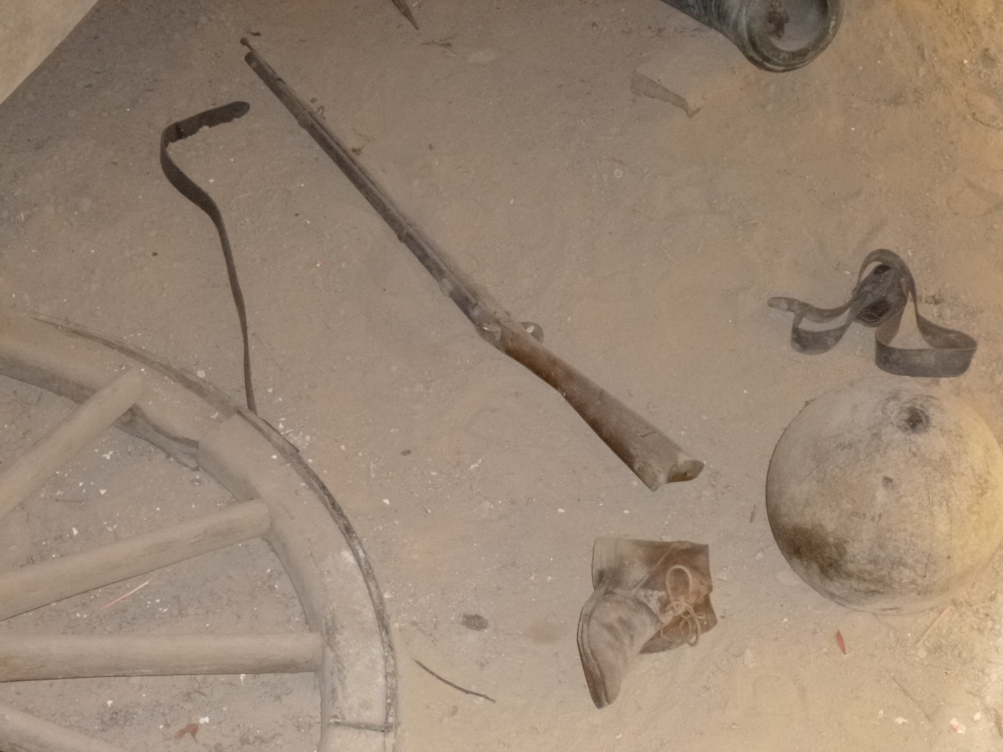
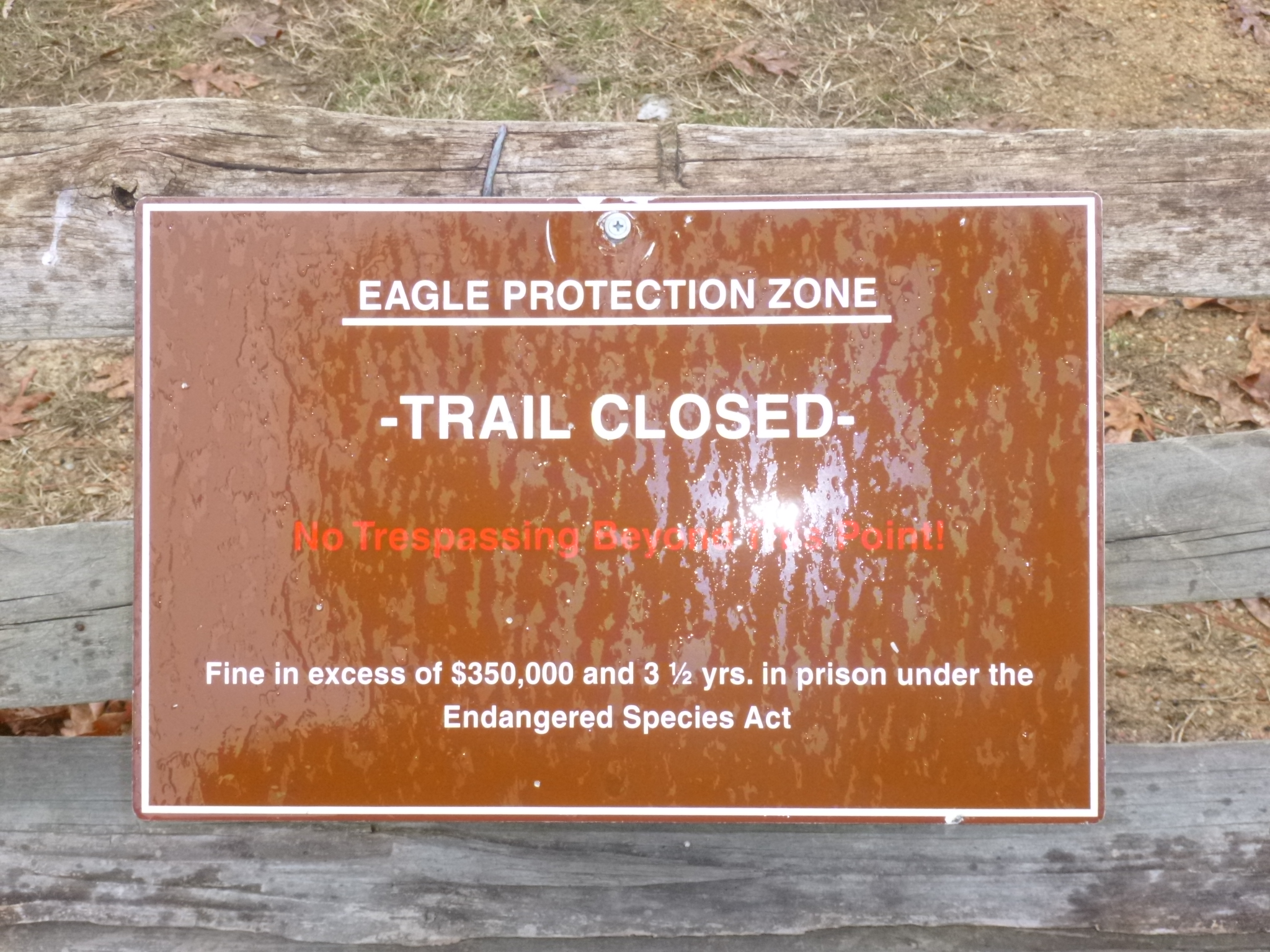
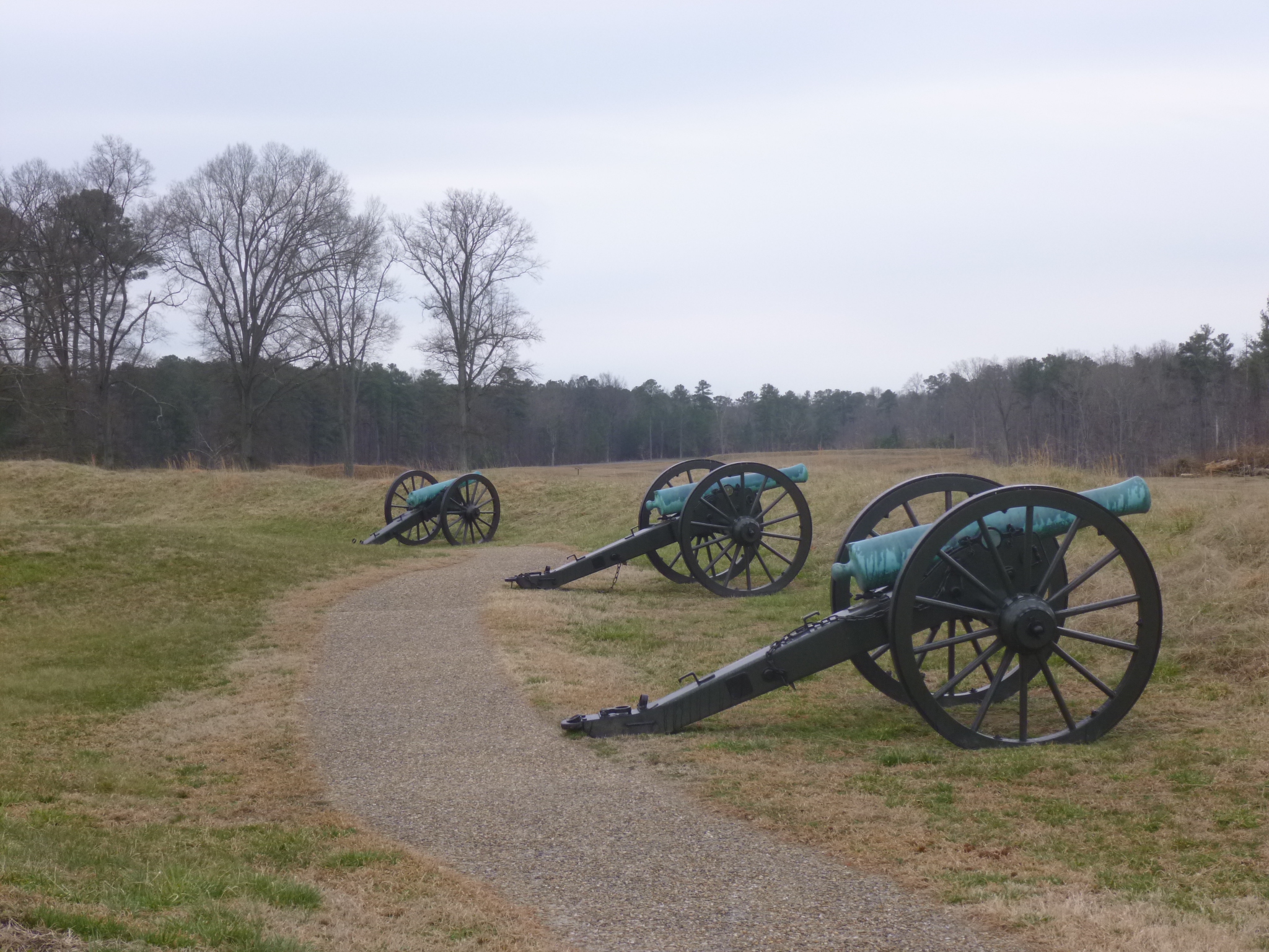
Then I drove a little south of Richmond to Petersburg National Battlefield, another National Park site, and got another dose of history. The siege of Petersburg was a 9 month ordeal – the longest military event of the Civil War. I watched a good video about it, and enjoyed the exhibits in the visitor center, then set out to walk on the auto tour route. I really enjoy walking in the national battlefields – this is the 4th or 5th one I’ve been to, and I didn’t expect to enjoy it so much! The history is interesting, and the land is usually rolling hills, to provide some cover during battle, and it’s very pretty. The auto routes are typically one way with low speed limits, and they’re designed with a pedestrian lane, so it’s easy for anyone to walk as much or as little as they want. Tula and I set out and walked a couple miles and then it started to sprinkle. We turned around and didn’t get too wet, because the sprinkles came and went, but I began to keep an eye on the increasingly gray sky. I drove a little farther on and walked another couple miles. I came across a section of a trail that was closed because it was an eagle protection zone for nesting eagles – with a $350,000 fine for anyone who trespasses! A lot of the trenches and battle lines are very visible – stretching on and on, and thinking about all the shoveling and digging and what slow work it must have been, especially in bad weather, really makes it seem like a miserable event. Back then, the Union and Confederate soldiers were in close proximity to each other, and the siege was hard on both sides. Eventually some mine-worker Northern soldiers tunneled about 500 yards to a spot under the Southern fort, and packed the end of the tunnel with gunpowder and blew the whole thing up – the crater is still sort of visible. I got Tula out for a last short walk as the rain began, but then I enjoyed another mile of walking under my umbrella – I thought it was very pretty to listen to the rain on the umbrella while out walking in the hills on a gray misty late afternoon.
The rain and wind began to pick up, and I headed back to Richmond – the news was full of all the incoming snow, but I’m down near the southeast corner of Virginia, and the snow is not expected to come quite this far.


Virginia – Monday, March 4
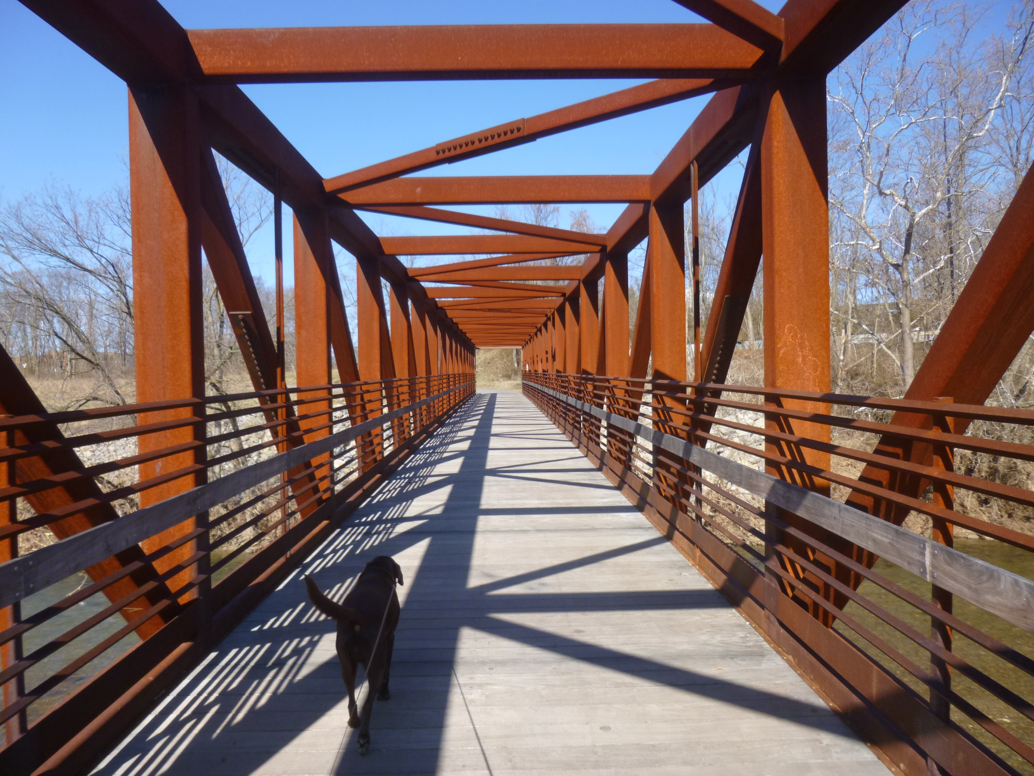
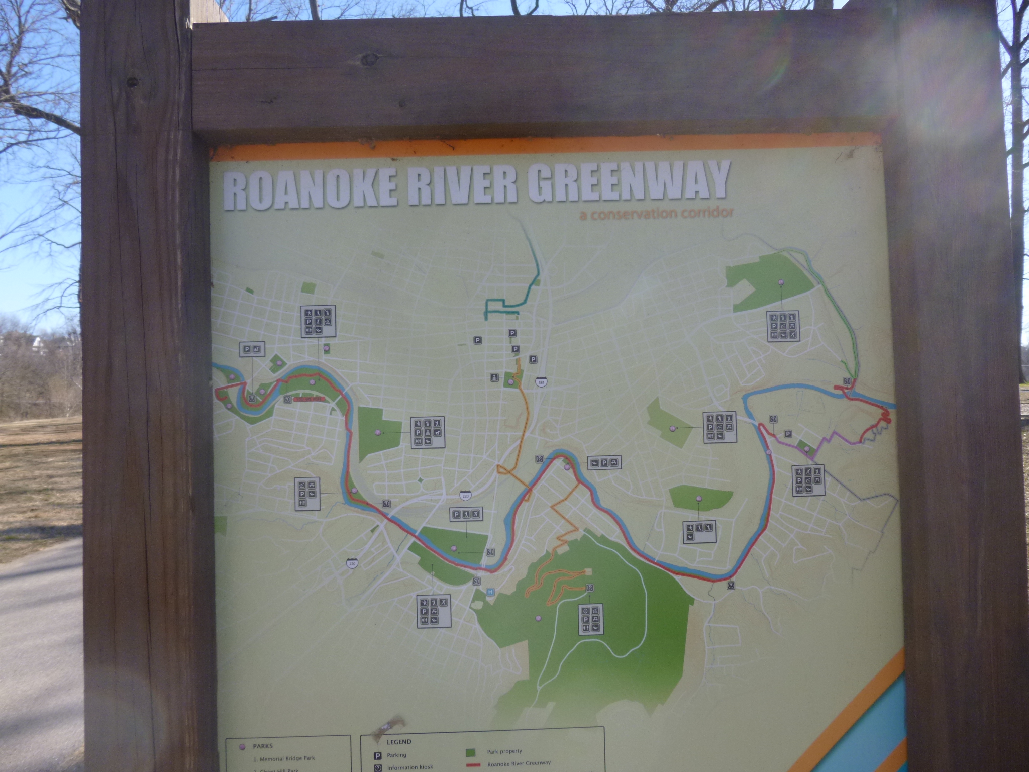
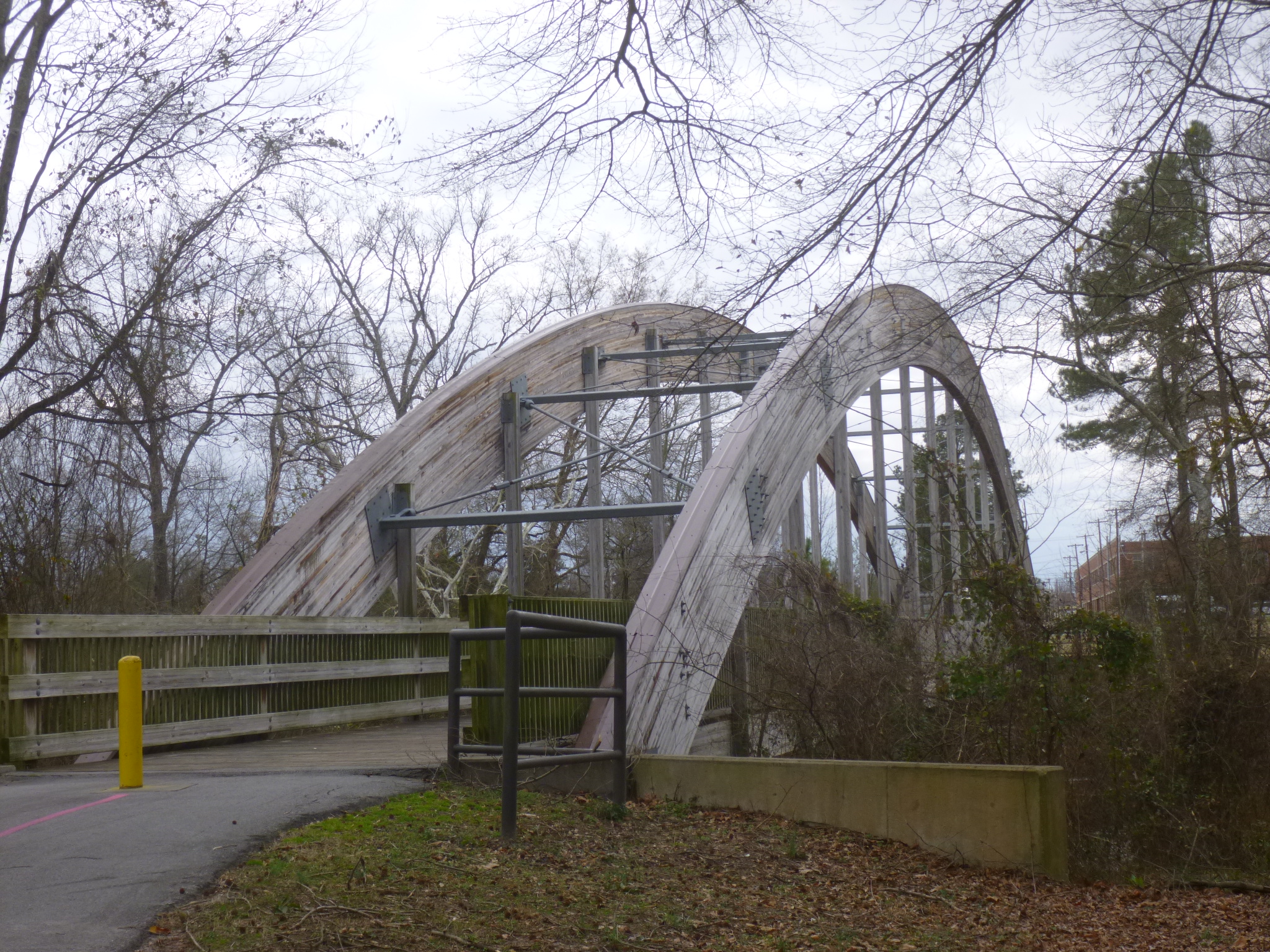
It was another chilly morning, and first I headed for downtown Roanoke, thinking I might walk a little in the historic area, but everything looked gray and cold – the sun wasn’t reaching down into the streets because of the tall buildings, and there was construction by one of the historic areas, so I headed right for the Roanoke River Greenway, figuring that would be warmer and sunnier! And it was! Roanoke has miles of greenways, and Salem has some greenways, and if a 4-mile stretch could be completed between the 2 cities, the networks of trails could be joined together, making it one of the largest urban greenways in the eastern states. So there’s a fundraising drive going on called “Bridge the Gap,” and when enough money is raised, the 4 miles of trail will be built, connecting the miles of Roanoke trails with Salem’s. Considering I walked miles in both towns, and I’m really enjoying all the greenways I’ve been walking on, today’s donation is a contribution to Bridge the Gap. I hope they can get that segment of trail built soon!
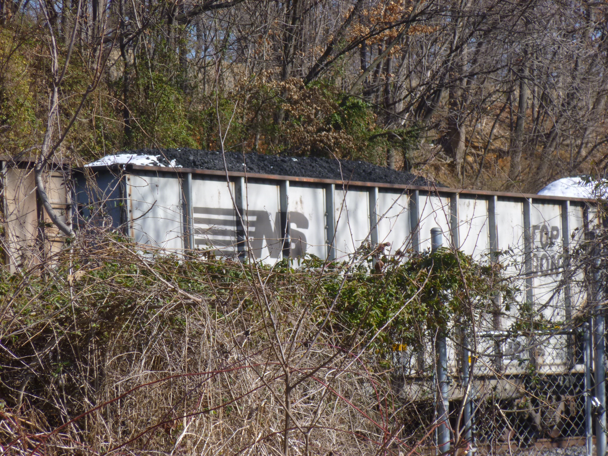
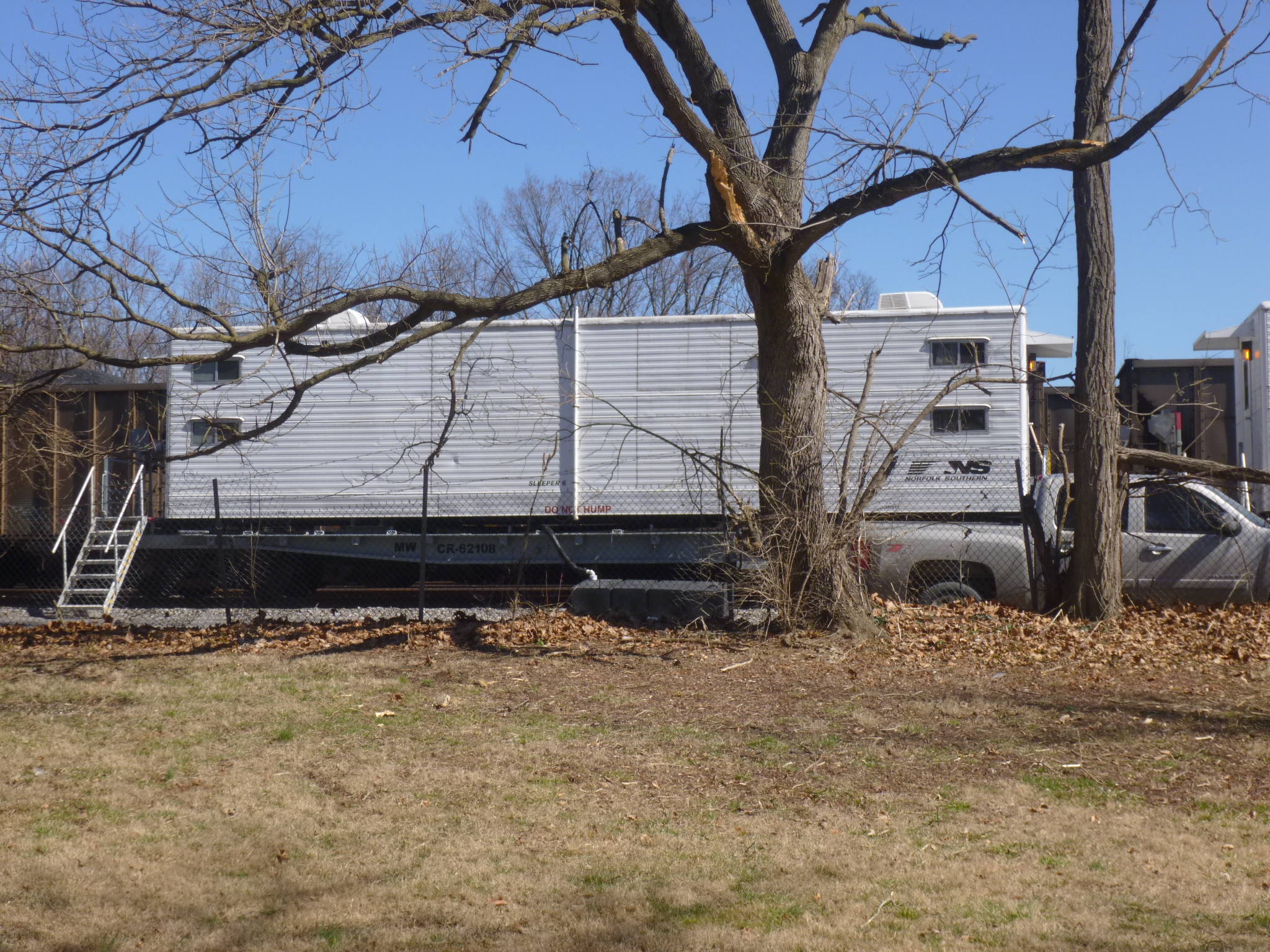
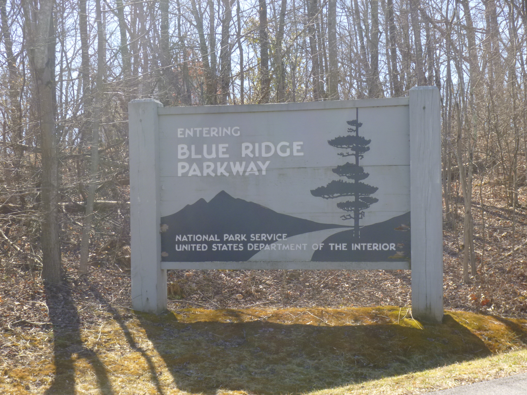
Tula and I walked 6 miles, and saw several long coal trains passing. The coal cars have open tops and they’re heaped full and had a dusting of snow on top of the coal. We passed a train yard where it appeared that there were some kind of train cars that looked like little apartment cars. They were on the tracks, but had some pretty sturdy steps into the cars, and vehicles parked out front. They might be for some of the Norfolk Southern employees – I’ve never seen train cars like that. After the long walk, I decided to try getting on the Blue Ridge Parkway again, since I was by another access point. This time I was successful, and settled down to enjoy a pretty drive, with no trucks, advertising, billboards or anything. Tula and I stopped at one of the pull-offs for another short walk, and continued on….only to find the parkway closed at the next section. I had only gone a little over 20 miles on it. I’m guessing it’s closed in anticipation of the snowstorm coming in a couple days. So I had to come up with another plan. Unless I wanted to backtrack to Roanoke, and there was no reason to, my only choice was to head east. And that put me in line for a national park site, so I was happy to change my route!
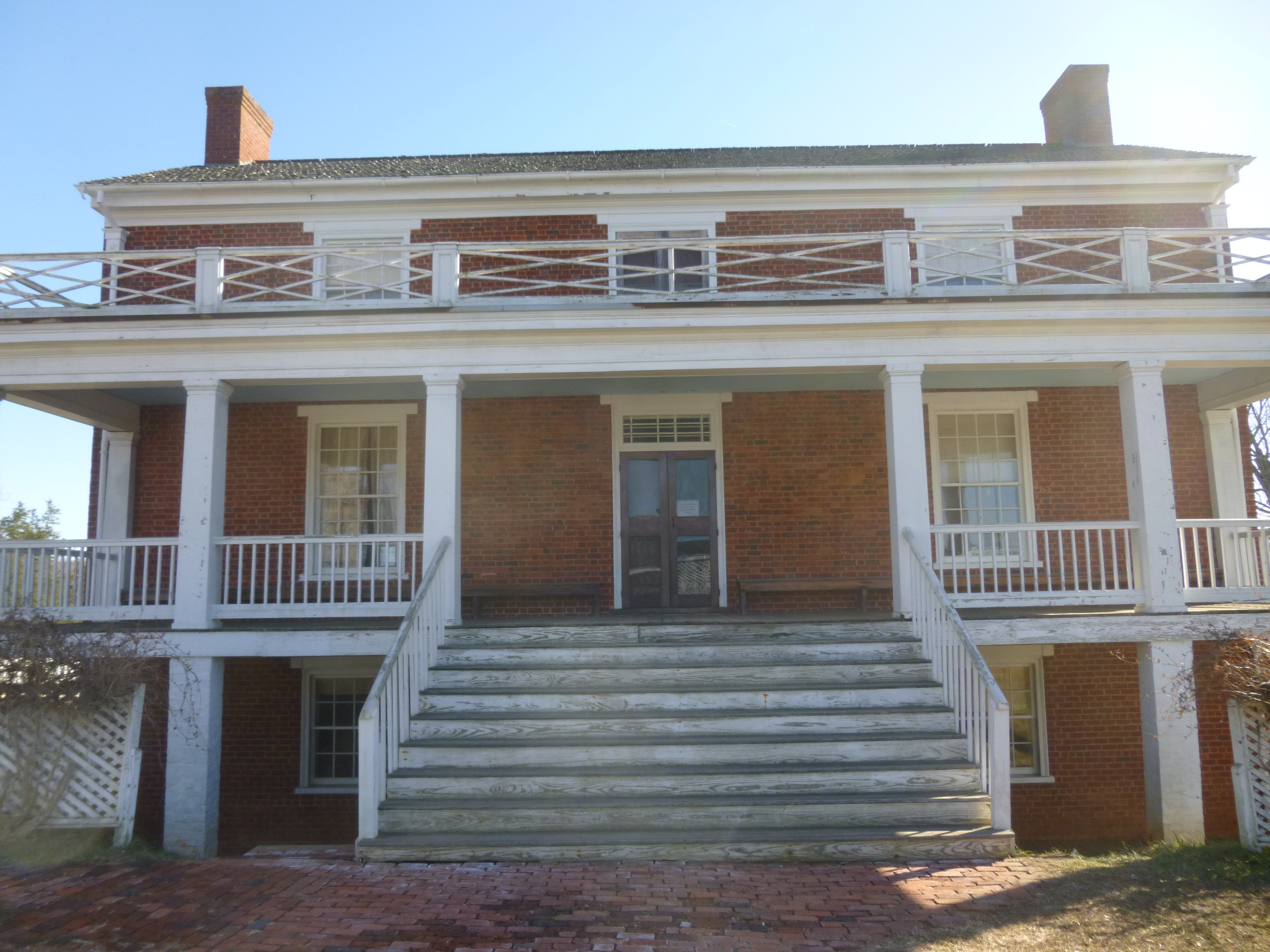
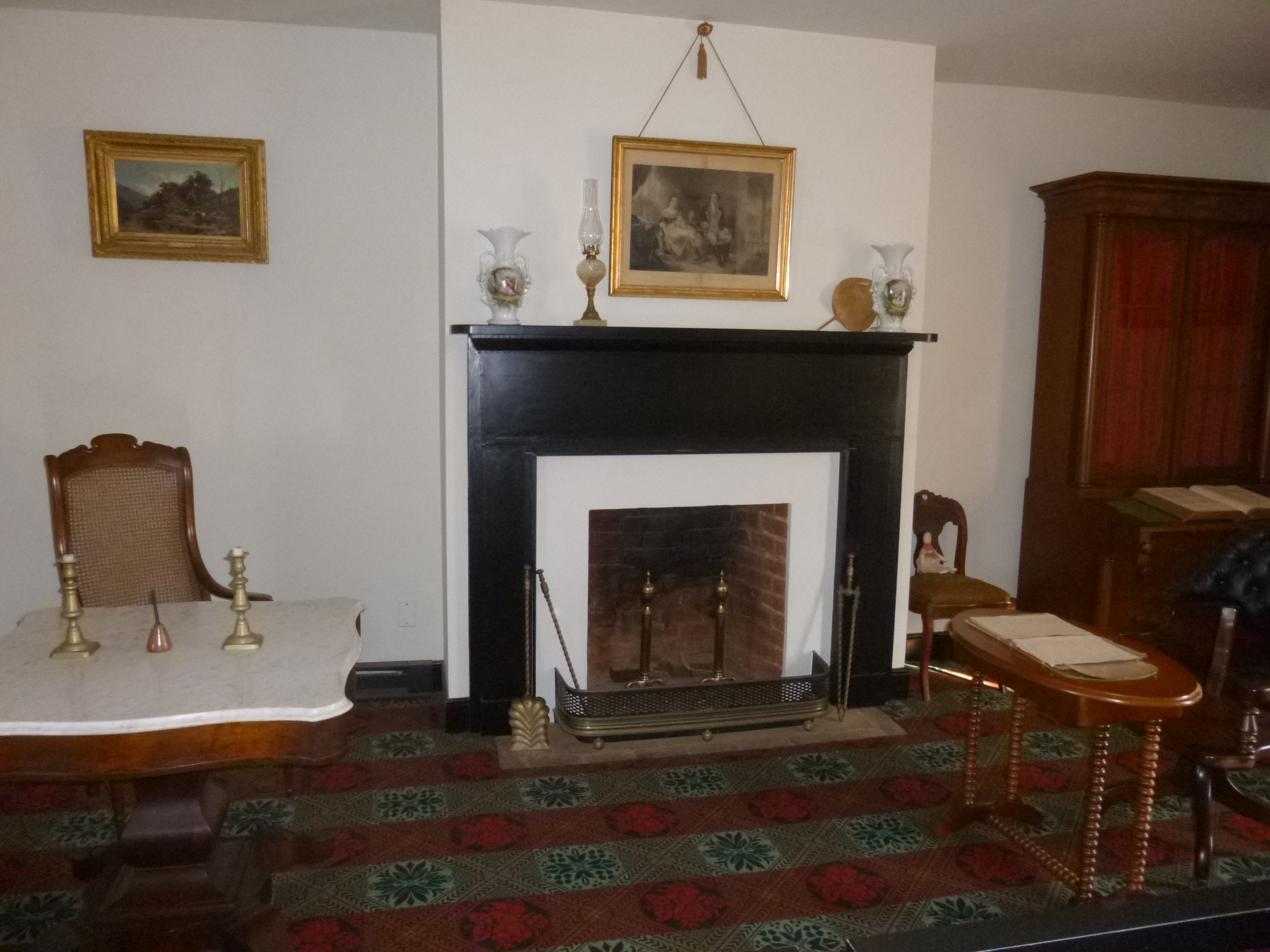
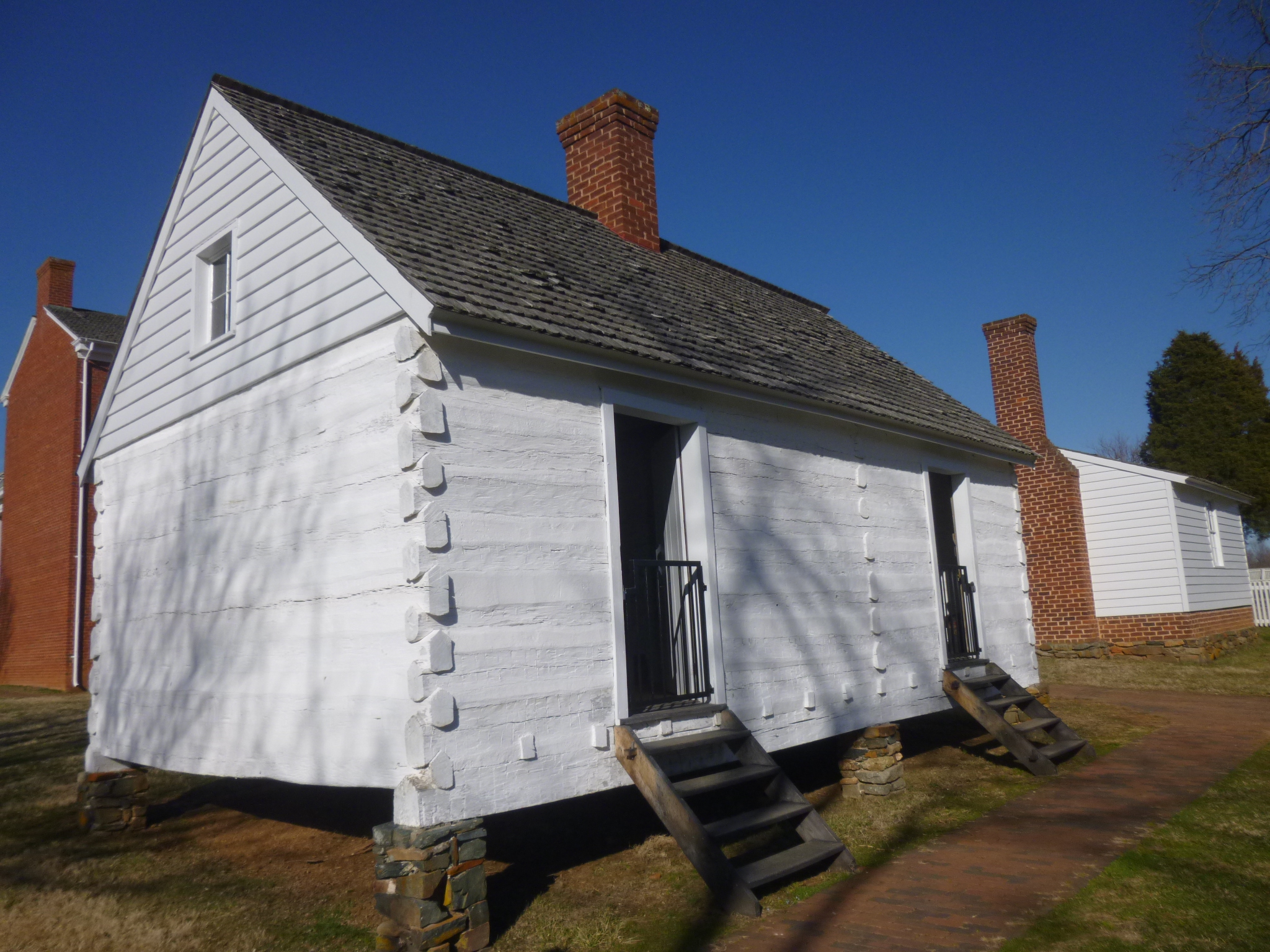
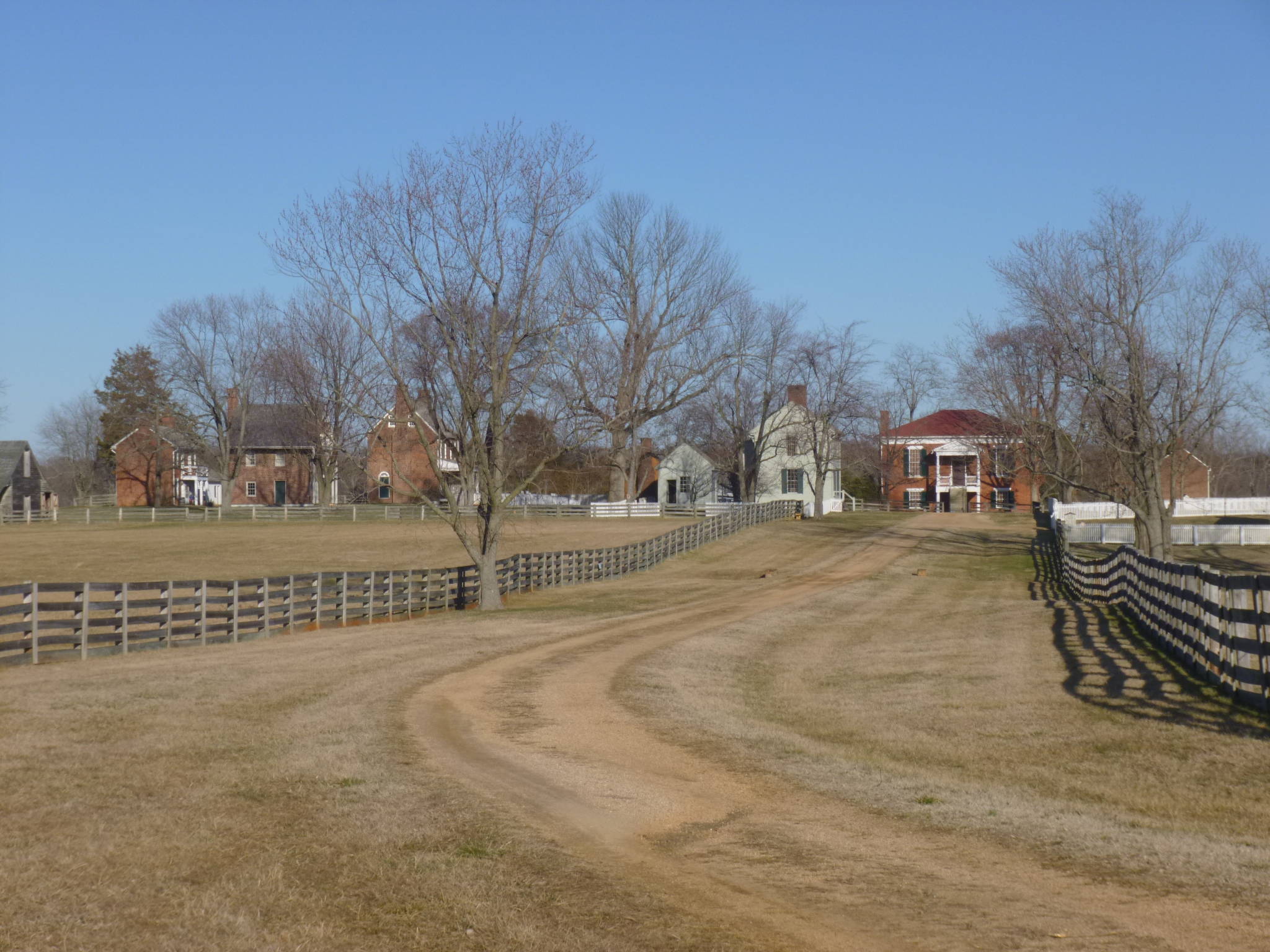
I drove to Appomattox Courthouse National Historic Park – not sure exactly what it was all about. And it ended up being a huge part of Civil War history – the actual house where Generals Grant and Lee met to sign the surrender papers, effectively ending the Civil War. They conducted that business, with a few aides on hand, in the private home of a well-to-do family, which was typical of the times. Nice homes had parlors in them, and they were used as offices when needed. So the papers were signed, and word spread quickly to soldiers on both sides – and at General Grant’s request, his soldiers did not boast or taunt or humiliate their foes – they were allowed an honorable defeat. The tiny town of Appomattox (about 27 buildings) is still standing much as it was when all this happened, and the buildings are all part of the national historic site. The old road that Lee rode in on to sign the surrender is still there. I still find it amazing to be walking in the footsteps of so much history!
I was lucky to get to the national park when I did because the McLean House (where the surrender papers were signed) is only open a few times during the day on a ranger-led talk. The ranger was full of historical tidbits, and there were other outbuildings to look at, including a couple slave cabins still furnished the way they were when they were being used.
There was still some daylight left when the park closed, and one of the rangers told me there were a couple more trails up the road that were still on national park land, so I went up there, and ended up walking more than I thought I would – it was a pretty evening and I was enjoying the surroundings and the history. Then, with darkness falling, I called around to find a place to stay. My intent was to head north for tomorrow, and then get out of the mountains before the snow comes on Wednesday. But I had trouble finding a reasonable place in the north part of the state that was pet-friendly, so I ended up with a reservation in Richmond, and could always head north for the day from there if I wanted. So I had a good hour of driving time, heading east, but after walking almost 11 more miles today, I didn’t mind!


Virginia – Sunday, March 3
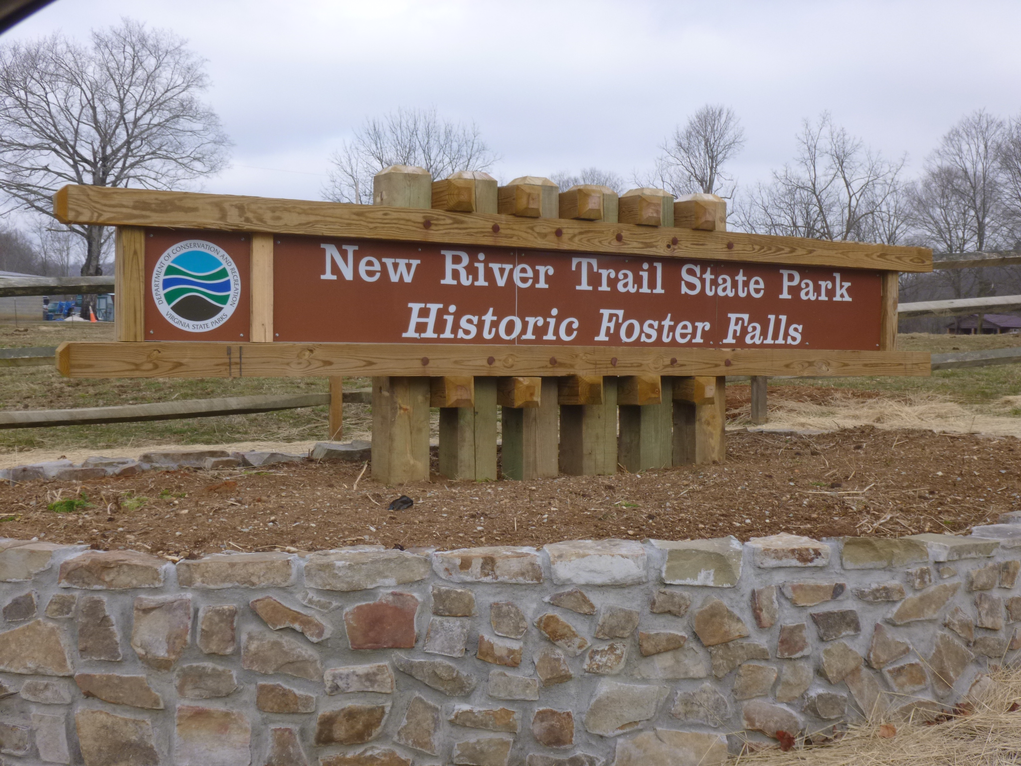
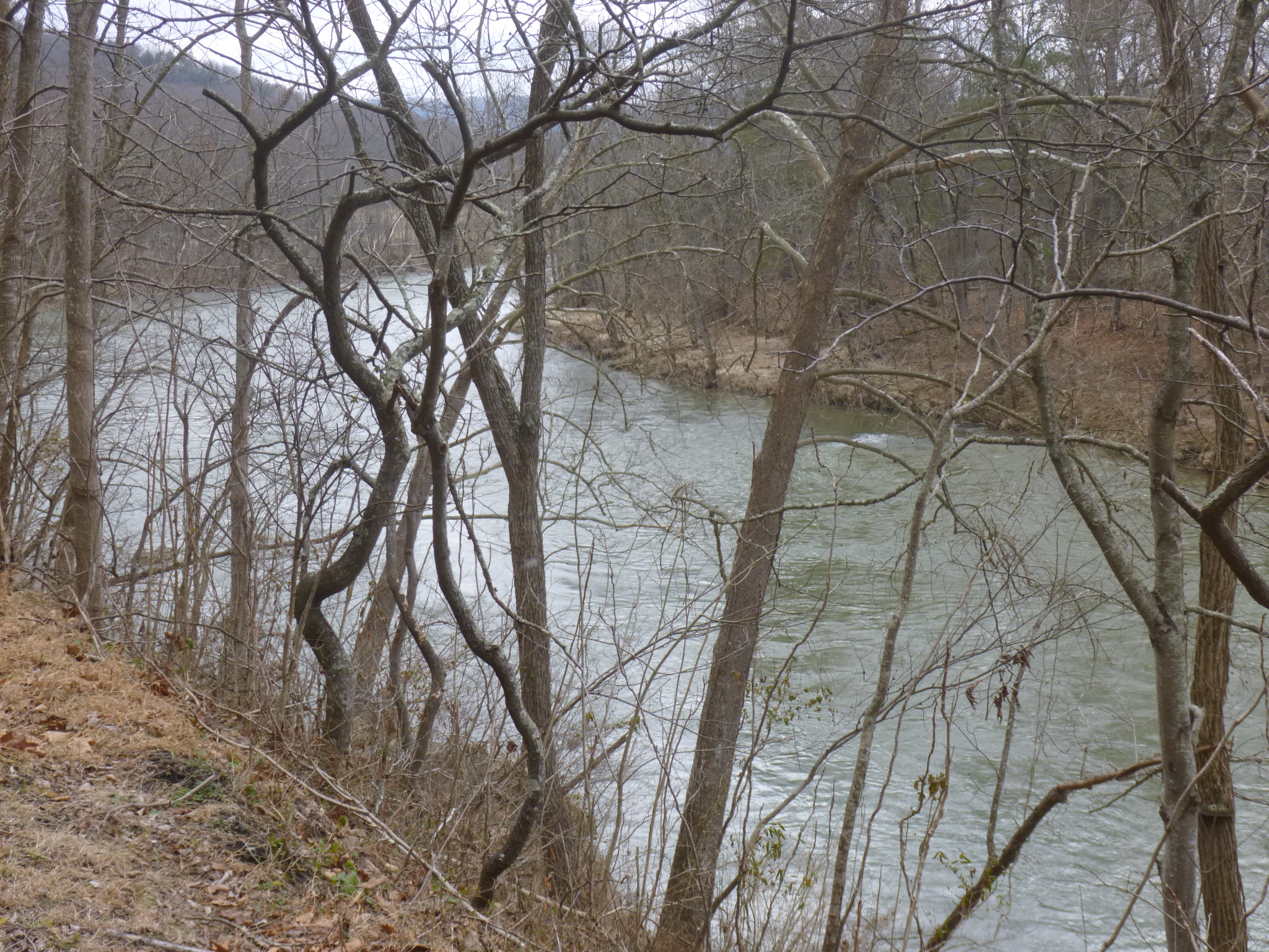
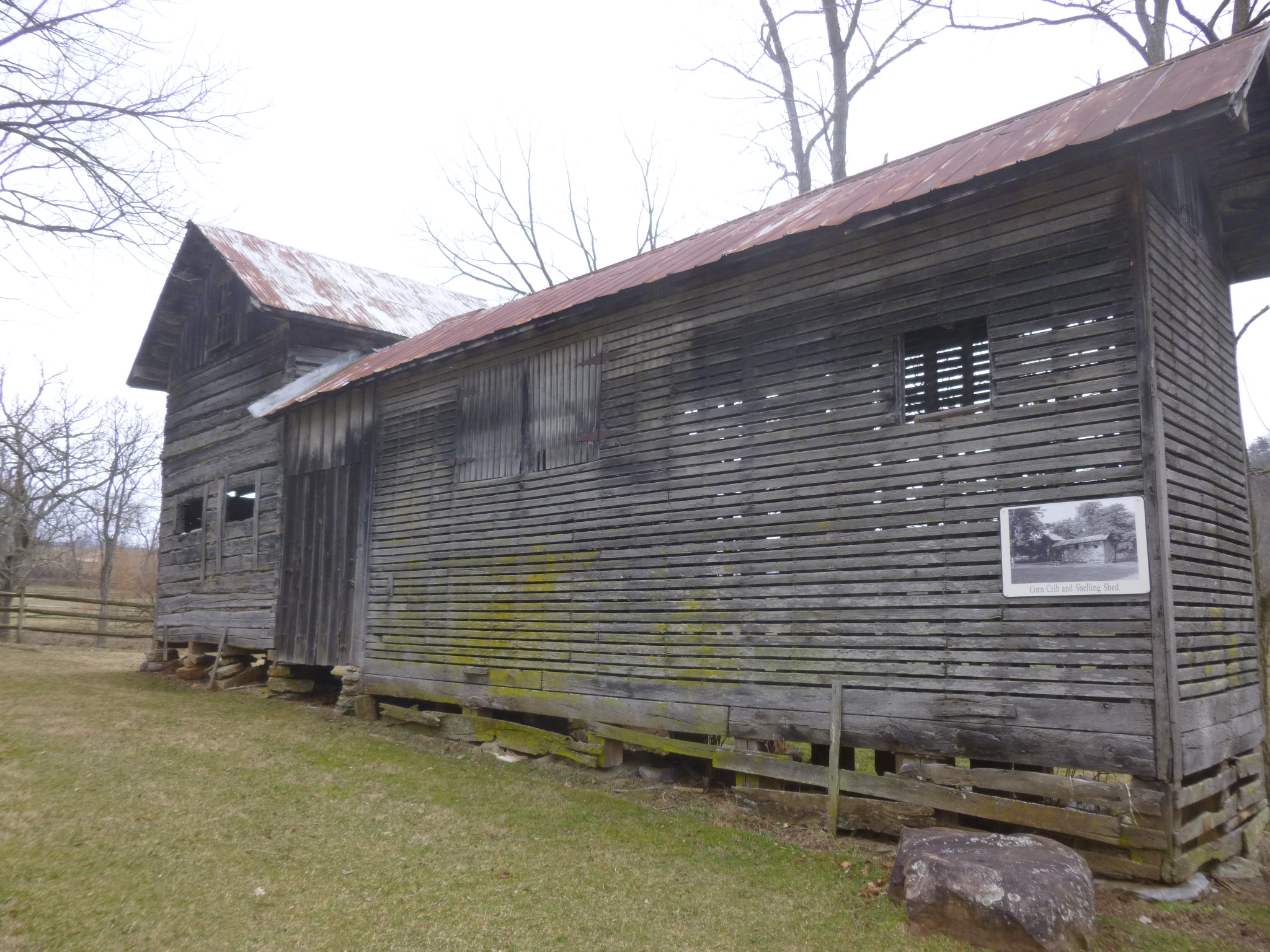
I woke up to see a dusting of snow on the van and everything else. This is the first snow of the journey (other than the snow in Ohio after leaving New England during Hurricane Sandy). But it’s only a little, and I just bundled up a bit more and set out for New River State Park, which is Virginia’s longest and skinniest state park – in places it’s not much wider than the old railroad tracks and their right-of-way. I backtracked a little to get there, and Tula and I headed out for a 6+ mile walk along the river. Some of the trail was bumpy frozen mud, and walking into the wind made the beginning of the walk a bit chilly. This would probably have been a very messy walk if it hadn’t been so cold. But the morning warmed up, and it ended up being a good walk. I was at the Foster Falls section of the park, and there were a few old buildings left from the original town, and it looks like it has quite a variety of activities in the summer, with a storage shed full of canoes, a livery for horses and a big campground.
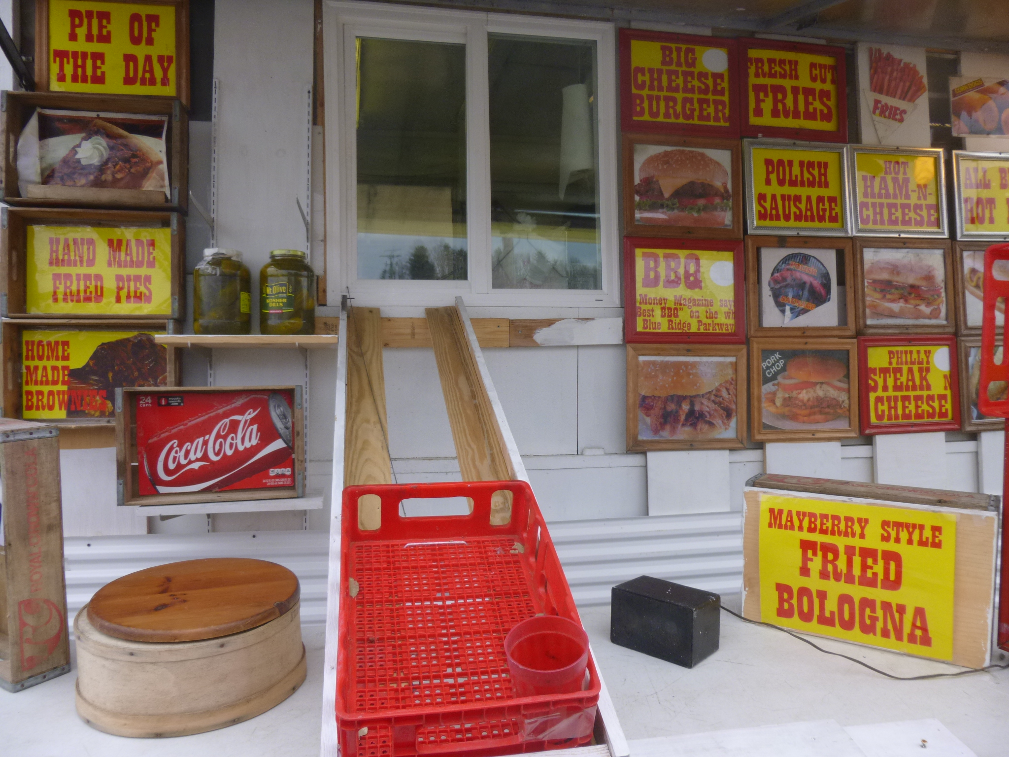
As long as I had backtracked a bit, I went a little farther back to get on the Blue Ridge Parkway for a while. It may not be the prettiest time of the year, but I still wanted to drive on the parkway. On the way, I stopped for gas, and there was a BBQ trailer by the road, and the timing was perfect for a local sandwich. There was even a version of a drive-thru with a bread crate and a plastic cup for money and string for the crate to be reeled in! It accomplished what it needed to! I headed up to the access point for the Blue Ridge Parkway, only to find it unexpectedly barricaded with no explanation. The little bit of snow was gone, and it had become a clear day, and the people at the gas station just figured the closing was because of the little bit of snow last night, and more snow to come this week. That was a bit of a disappointment, but I headed north a different way and ended up in Salem, which had been my destination anyway.
I had read up on donation possibilities in the Salem area, and liked what I read about the Salem Food Pantry. They have a variety of programs that they help with, and I was interested in Snack Buddies, where they help provide school snacks for kids in pre-school through 5th grade if their parents are unable to send snacks with them. Last year they helped kids in 20 elementary schools and 19 pre-schools. They weren’t open on a Sunday evening of course, so I wrote a little note to include with a check, and it will have to be a mail-in donation.
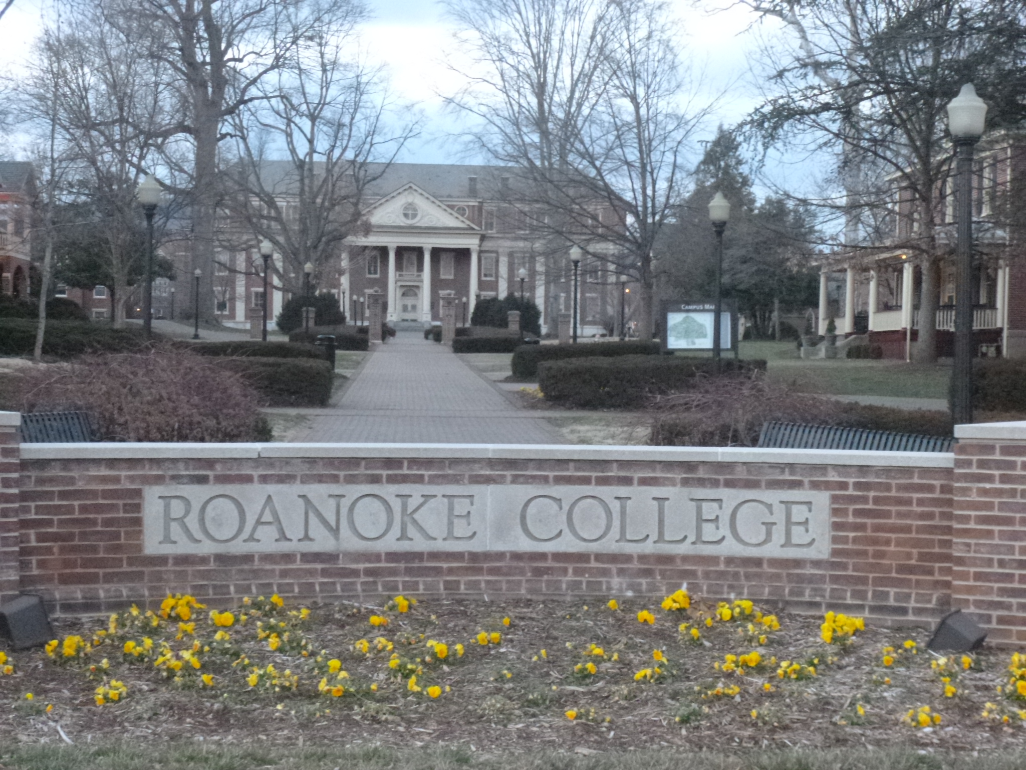
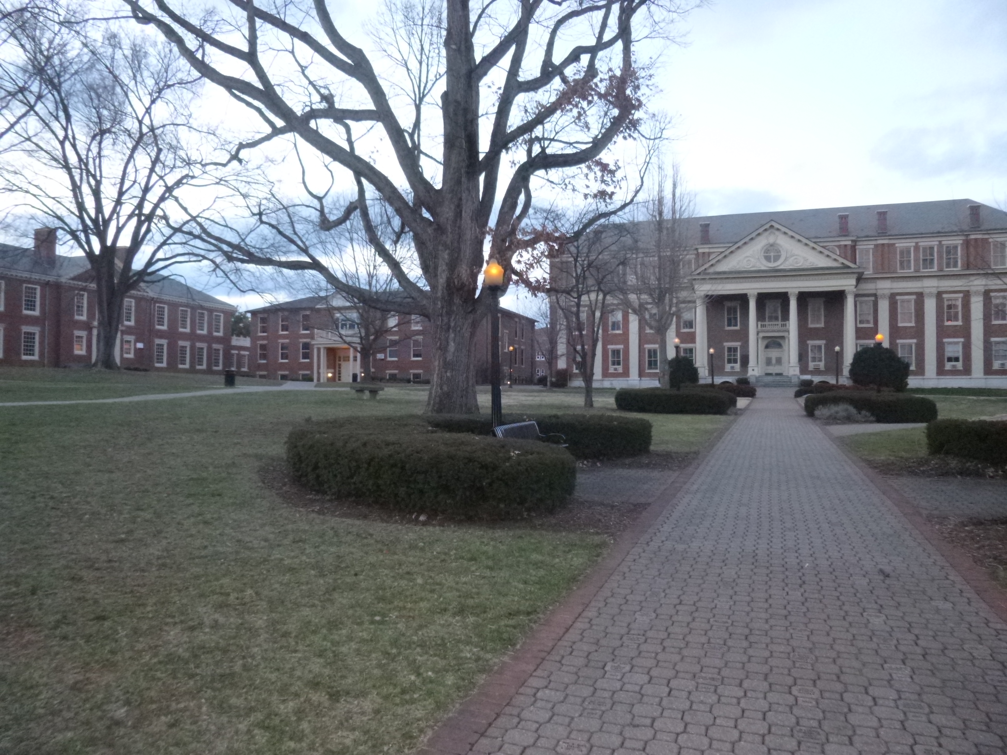
Salem was a great town for walking – an interesting downtown area, and then some good neighborhoods to walk in, along with some nice mountain views. And Roanokoe College was there too, and that was another pretty campus to walk through. I ended up walking nearly 4 more miles, giving me almost 11 for today. But I’m happy to be stockpiling a few miles in case the expected storm during mid-week is worse than predicted. I drove just a little farther to Roanoke, where I called it a day.


Virginia – Saturday, March 2
I crossed into Virginia and decided to head for Wytheville. My plan was to spend a couple days in the mountains, and then head for the coast when the snow arrives later in the week. Plus I had read about a good state park nearby with a rail trail. It was late afternoon by the time I got into Wytheville, but it looked like a good town to start off my Virginia walking, so Tula and I headed out in the chilly weather and covered 3 miles, and saw some snowflakes.
North Carolina – Saturday, March 2
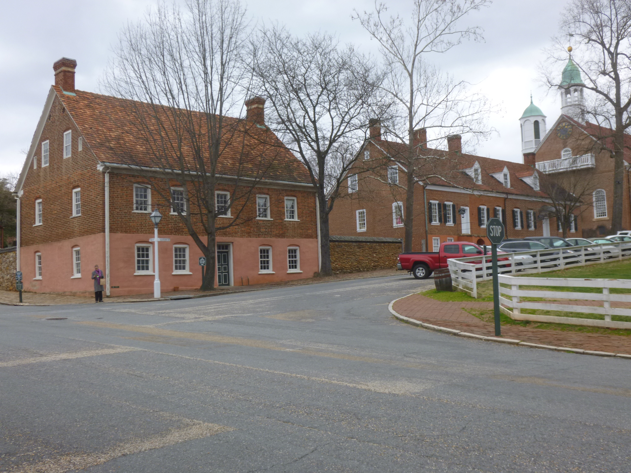
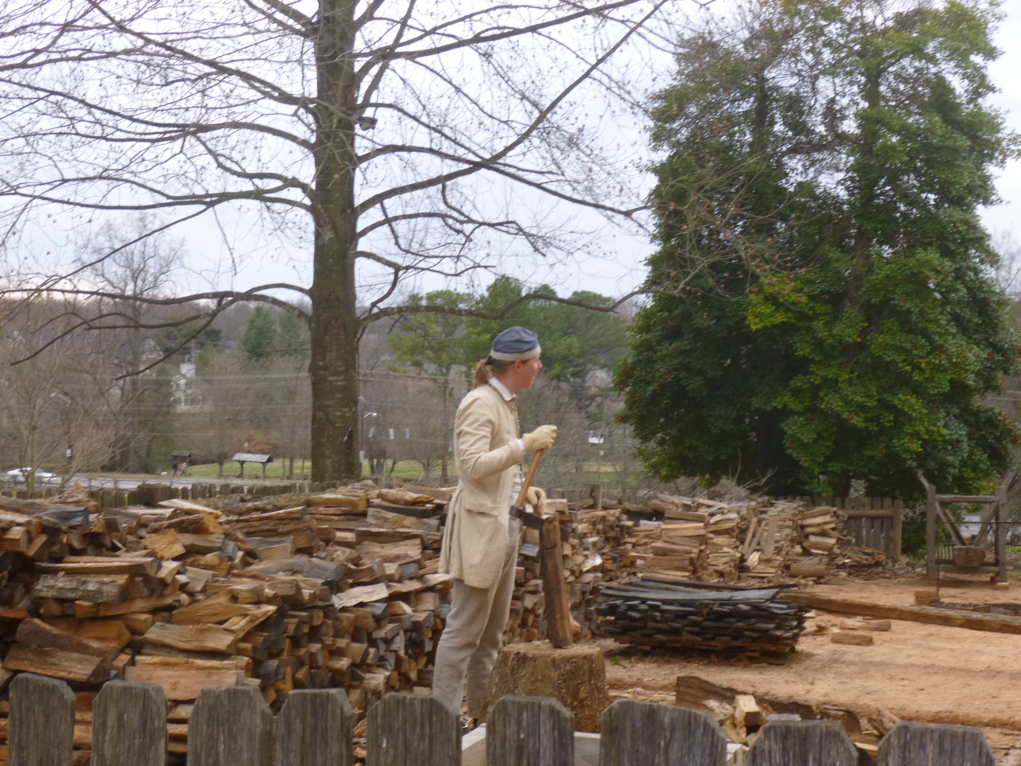
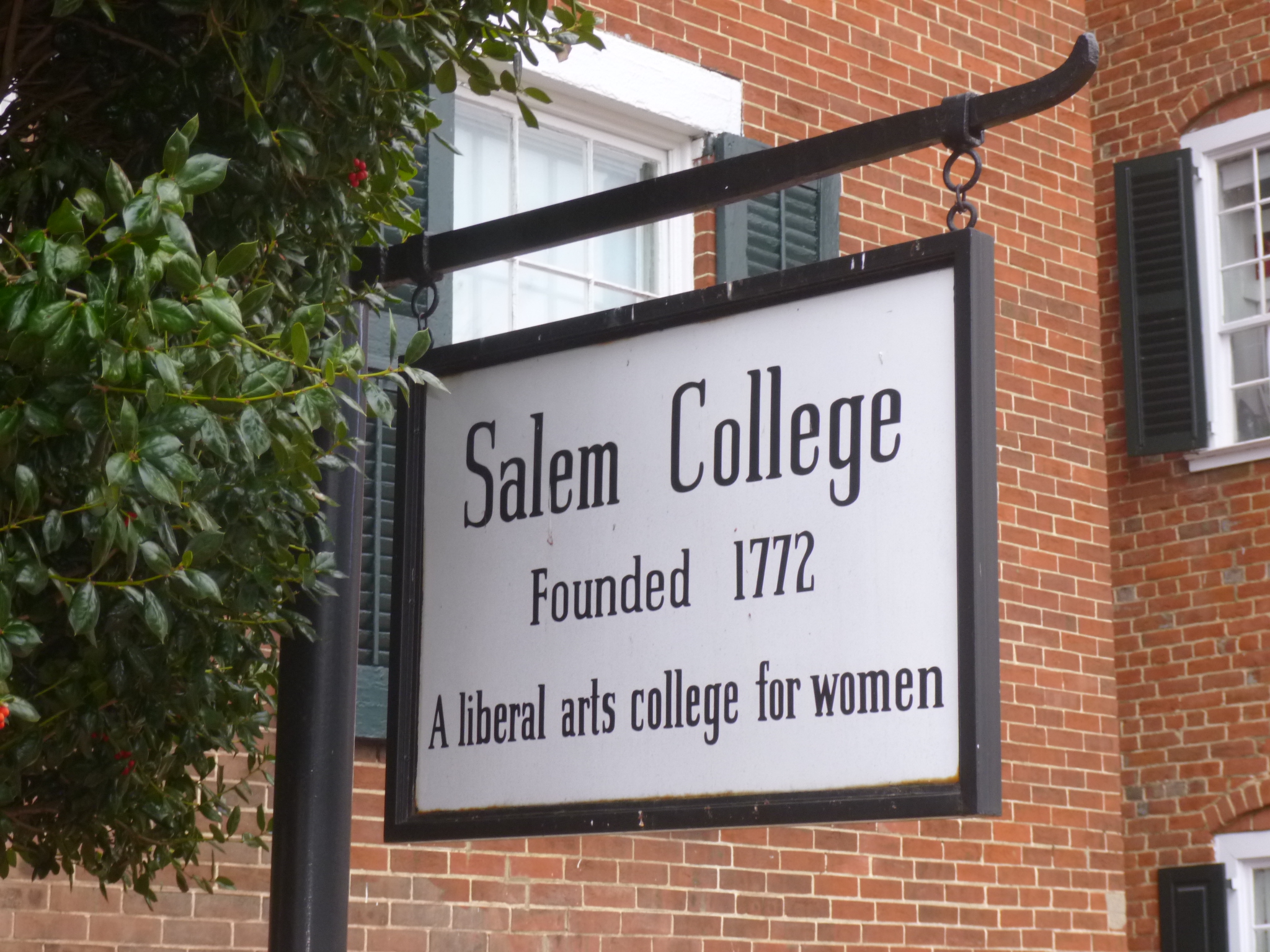
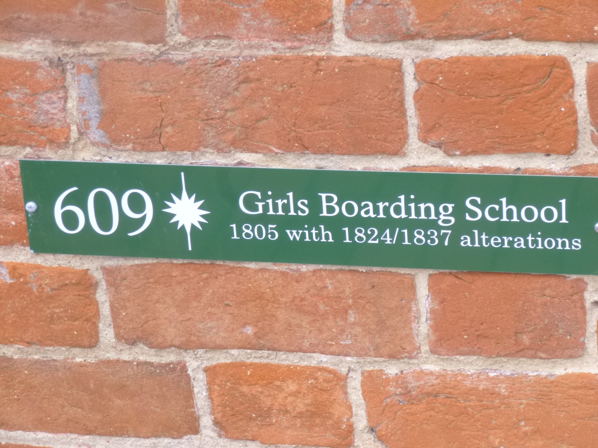
With all of my donations done and only 4 miles of walking to finish before leaving North Carolina, I headed for the historic Old Salem part of Winston-Salem. Salem was originally settled by a group of Moravians from Pennsylvania, and Winston was founded nearly 100 years later. But Winston grew fast because of the successful tobacco industry, and quickly became bigger than its much older neighbor, and they consolidated in the early 1900s. The drive was pretty and Old Salem was a wonderful restored town to walk through. Many of the homes had been built in the 1800s and some are still lived in today. The sidewalks and streets were brick, and with the smell of woodsmoke in the air on this chilly day, I could almost think I’d gone back in time. There was an old set of mounting steps to get into a carriage or on a horse, and several old wooden rain barrels were out in the yards, which I realized later were garbage cans! We walked past Salem College, which is a small women’s college founded back in 1772 and it just blends right in with the old town. There was also a girl’s boarding school from 1805, so some communities thought about education for girls back then! There’s a big coffee pot at the end of town which is a local landmark – a smaller version used to be in front of the tinsmith’s shop back in the day. We also walked on the “strolling path” that was built to connect Old Salem with the downtown area. And then my North Carolina walking was done.
So I wrap up State #23, with another 56 miles walked in Lumberton, Whiteville, Wilmington, Jacksonville, New Bern, Plymouth, Kitty Hawk, Raleigh, Old Salem and several river trails, bike trails and rail trails. And all 7 donations were given – Holy Grounds, Mother Hubbard’s Cupboard, Jacksonville USO, Coastal Women’s Shelter, The Beach Food Pantry, Ronald McDonald House of Chapel Hill and the Shepherd’s Table Soup Kitchen. And I continue to learn and soak everything in!
I headed north, still listening to the weather forecast, and decided that this would not be a good week to be in West Virginia – a couple of snowstorms and mountain roads do not seem to be a good combination so once again, Mother Nature has taken it upon herself to change my plans!


North Carolina – Friday, March 1
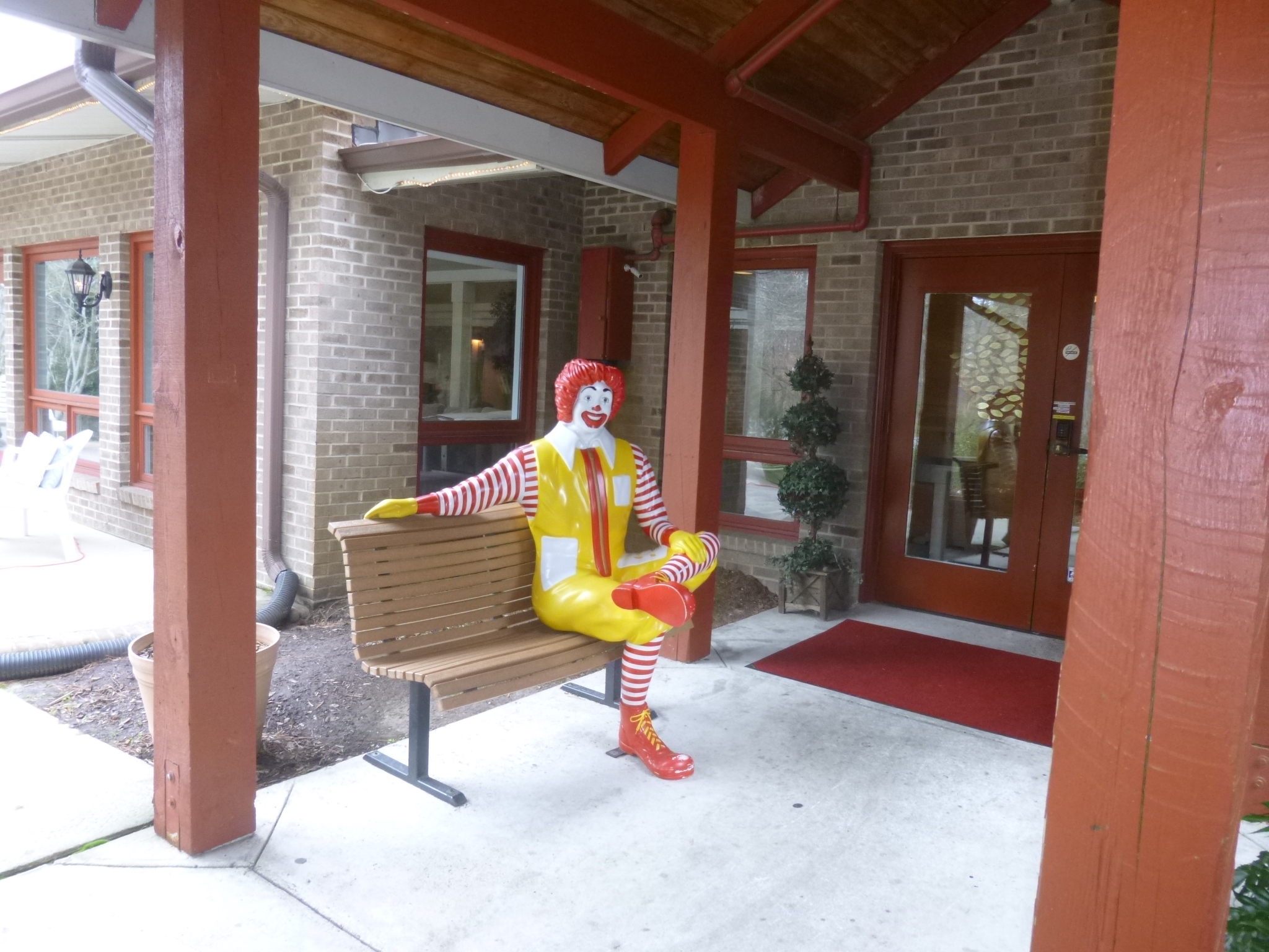
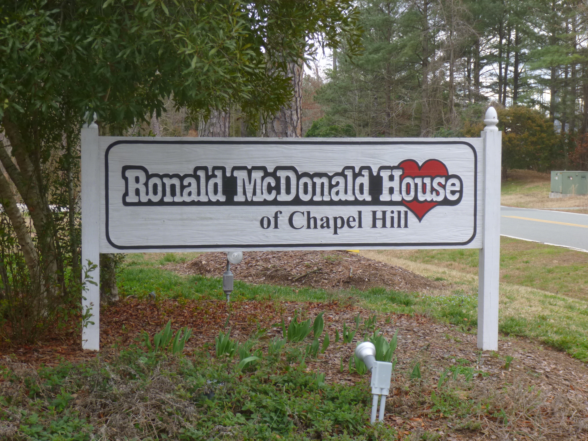
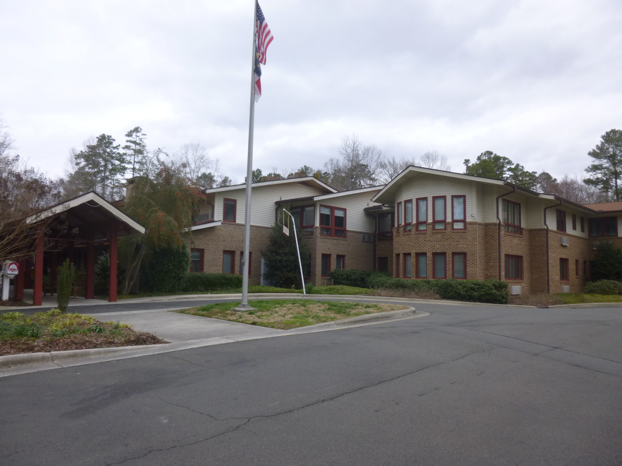
I ended up staying in Chapel Hill, and when I read up on the whole area and looked into donation opportunities, 2 places jumped out at me. The first one was The Ronald McDonald House because it was only a few miles away from where I was staying, and the Chapel Hill area seems to have a lot of medical facilities. This Ronald McDonald House has been providing a home away from home for families of critically ill children for 25 years. When I called to see what kind of donation might be most helpful, they said a financial donation would be best, so I drove over to drop off a check. The office area was very nice, and they’ve certainly been able to provide comfort for many families over the years.
As I was driving to the Ronald McDonald House, I saw a bike trail in a pretty area, so after I made the donation, we got out and walked the first 4 miles for today.
Then I wanted to head back to Raleigh, the City of Oaks, for 2 reasons. I had read that back in 1974, the year I graduated from high school, Raleigh started building its extensive system of recreational trails to help preserve some natural space in and around the city despite its growth and urbanization. Because of that, in 1975, Raleigh was named the first “Green Survival City”, so I wanted to go walk some miles on one of the greenways. I had also read about a big soup kitchen in Raleigh called the Shepherd’s Table that sounded interesting, and it was only a block away from where I had parked yesterday, but I hadn’t walked down that particular street, so I hadn’t noticed it. So I returned to Raleigh and found the Church of the Good Shepherd, where the soup kitchen was, and there I met the associate director Ashley, and she showed me all around and told me about the program. They have a wonderful, huge space in the basement of the church that was built specifically for the soup kitchen. The volunteers provide lunch to anyone who comes through the doors 5 days a week, no questions asked, and they average about 300 people a day. Since they are not federally or state funded, they don’t have to worry about what communities the people come from or any other details – they just feed everyone. About 50% of the people are repeat guests (some have been coming for years), and many others come and go. About 80% of the guests are male, and usually everything goes fine, but they do have an off-duty police officer who comes during lunch just to keep an eye on things, and to be available during the rare times that someone might be looking for trouble. In addition to the regular food donations that they get, they send out a “food rescue” truck to area restaurants, and stores like Trader Joe’s and Costco also are generous with donations – in fact, Trader Joe’s supplies fresh flowers every Tuesday, so those are placed on all the tables to help provide a welcoming environment. The kitchen is very spacious and Ashley showed me the biggest soup kettle I’ve ever seen – they often make 18 gallons at a time. They do not plan their menus because they don’t know in advance what food will arrive, and they have a large volunteer staff – the “Monday Group”, the “Tuesday Group” etc. I really enjoyed seeing everything and hearing about the program. It’s big and organized and it’s a really nice environment. Lunch time is probably the nicest part of the day for many of the people who show up.
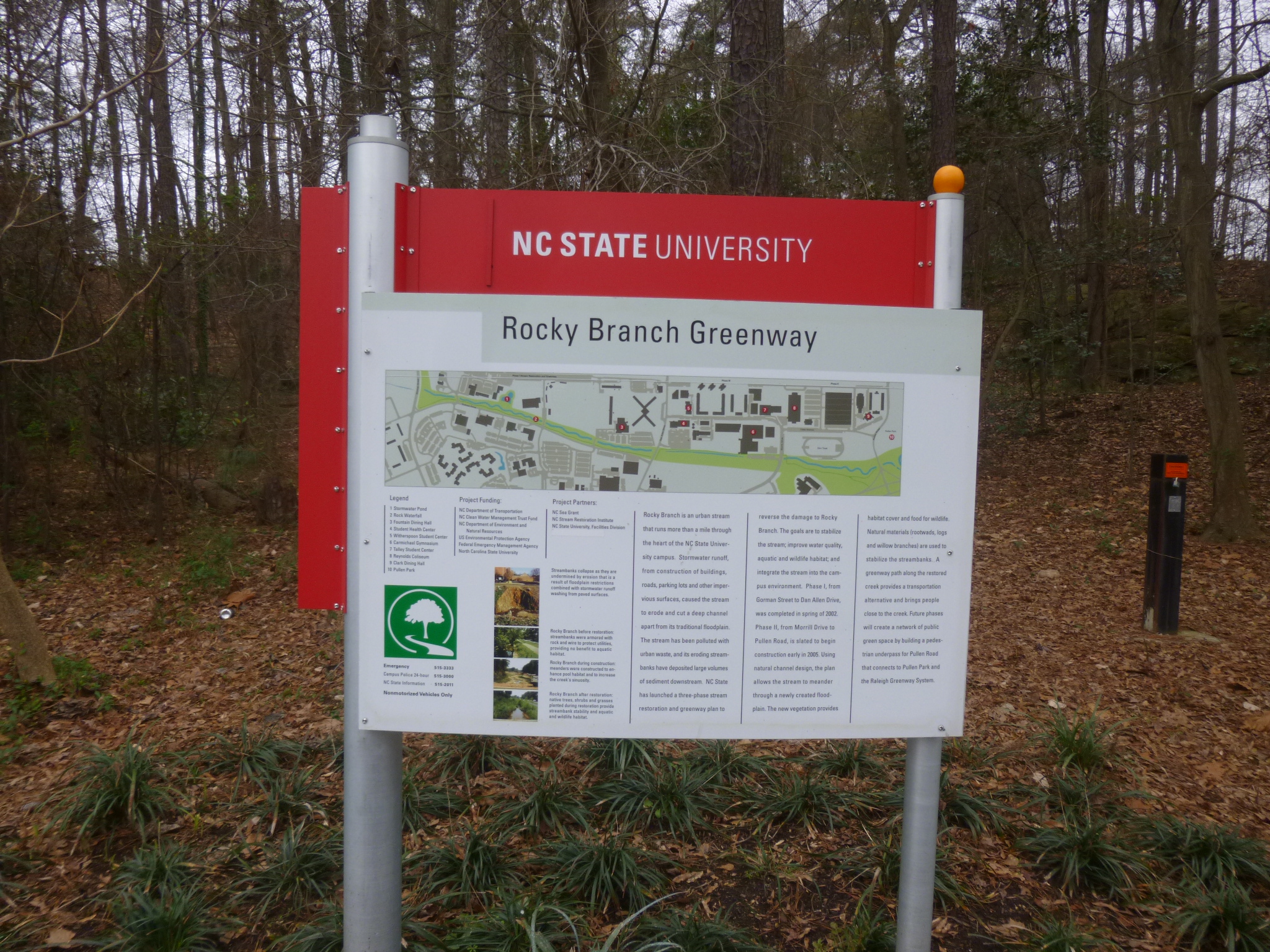
Then Tula and I went out and walked 6 miles on the nearby Rocky Creek Greenway, part of which took us through the heart of the North Carolina State University campus. There were environmental signs along the way, with information that urban creeks and streams can be some of the most difficult to clean up. And, despite all the effort, there was still quite a bit of litter in the water – it’s too bad so many people are careless with their garbage. By this time it was getting dark, and I headed back to Chapel Hill. Snow seems to be in the forecast for the West Virginia mountains both this weekend and mid-week next week, so I had some thinking to do about my itinerary!


North Carolina – Thursday, February 28
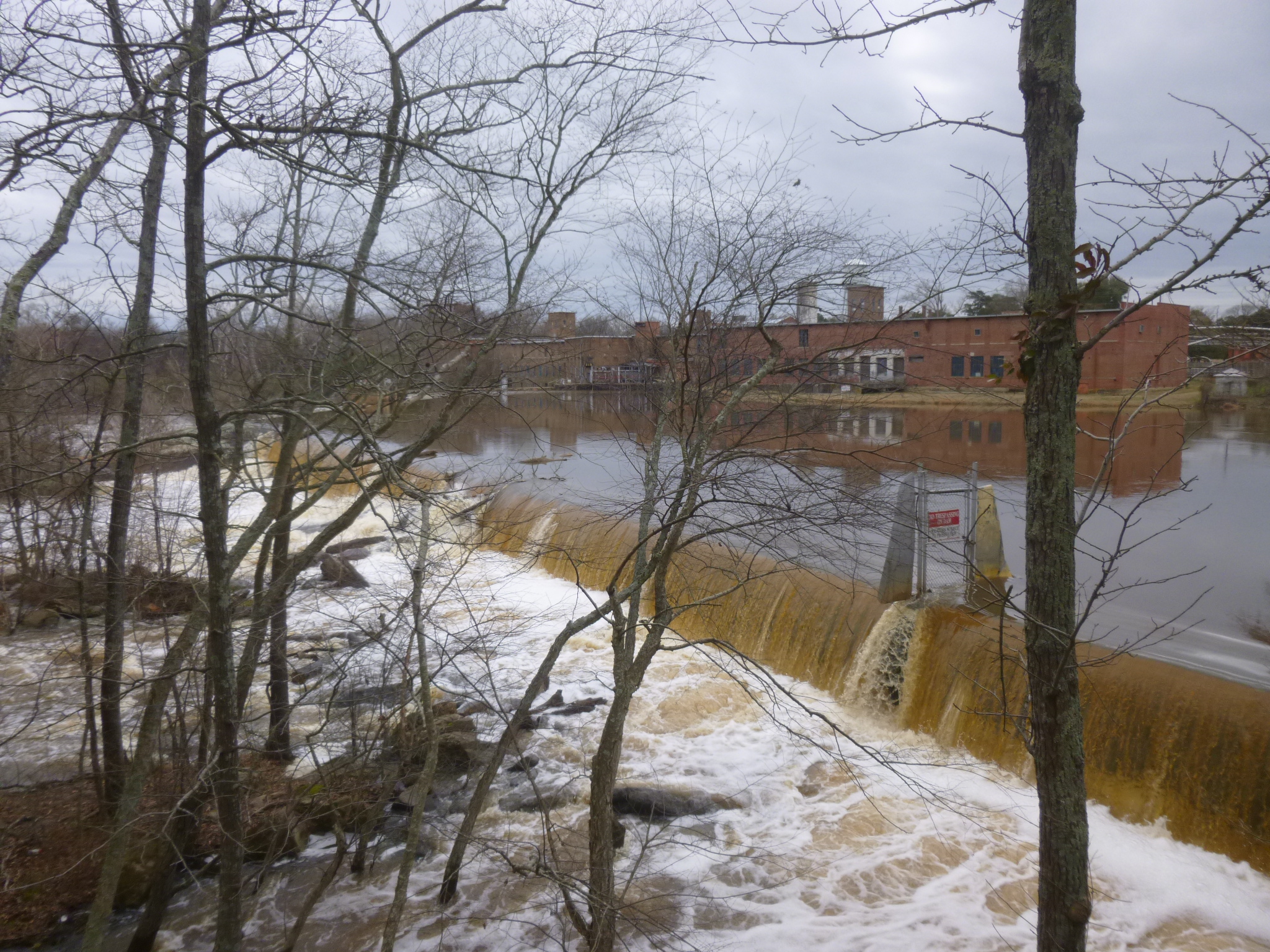
Tula and I headed for the Tar River Trail first thing this morning, and walked the 3.9 miles from one end to the other and back. The trail followed the Tar River and we passed a waterfall/dam that ran by a huge abandoned woolen mill. We also crossed the river on a bridge that had a plaque overhead indicating the high water mark after a hurricane. The bridge was over the water and the sign was over my head, and it’s simply impossible to imagine all the water that had to be around to raise levels that high.
North Carolina was a big producer of tar, pitch and turpentine (from pine trees) in its early days, and the nickname of Tar Heel state has several origins – whether from the tar that stuck on the heels of the tar workers’ boots, or more likely from the Civil War era when soldiers would joke about putting tar on the heels of other soldiers to slow them down.
Next I drove through Raleigh, and I headed downtown to walk through the State Capitol area and some of the historic neighborhoods, and past the Governor’s mansion. I covered nearly 4 more miles, so I walked about 11 1/2 miles altogether today. I didn’t make a donation since I’d been doubling up on them the last couple of days.


North Carolina – Wednesday, February 27
As of last night, I couldn’t make up my mind whether to head east or west in North Carolina – so many choices! Part of me wanted to head east to the Outer Banks, which I’ve been to in the past and really like, and part of me wanted to head west for Asheville and the mountains – I’ve heard wonderful things about Asheville and I’ve never been there. So, I read up to find the most interesting donation possibility, and the Outer Banks won! On the drive toward Kitty Hawk, I stopped in the town of Plymouth to get the first couple miles of walking in.
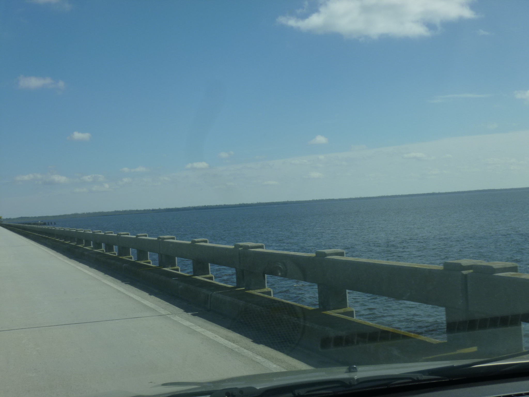
As I continued toward the outer banks, I drove across bridges and a causeway, and I noticed there was the Fort Raleigh National Historic Site on Roanoke Island. So I had to go see what that was all about. This national park site commemorates “The Lost Colony” – the first settlement in the Americas in 1587 that vanished without a trace during the 3 years its governor had gone back to England to see about getting more supplies and equipment. Virginia Dare, the first English baby born in the New World, was part of the lost colony. When the governor returned from England (delayed because of a naval war between England and Spain), the colonists had vanished and so had all their cabins and all traces of life, except for the word “Croatoan” carved on a post. Whether they simply perished due to hardship, or if the Native Americans were involved, or they tried to sail back on their own without success, remains a mystery to this day. While Indian/English relations had been good in the beginning, the English became a bit greedy and aggressive, and relationships had deteriorated. Since this settlement vanished, Jamestown in Virginia became the official first colony.
Then I finished the drive to Kitty Hawk and found the Beach Food Pantry – the Beach Food Pantry on Sand Dune Drive in the Outer Banks – I couldn’t pass this one up! This was a fun stop – I met the volunteers and they told me about moving into their wonderful new facility in January. Their old one had flooded in a hurricane, and this new space was bigger, and they had everything well organized. At this food pantry, people can come in up to 4 times a year and they get 2 weeks worth of food for their family size. They even provide pet food for people with pets. They also have some stores and businesses drop things off – today there was a table of bakery goods and a shelf of fresh produce that people could choose whatever they wanted to add to the food they were already getting. One of the volunteers knew a reporter from the local paper and he came over to do an interview and get a picture of me and Tula.
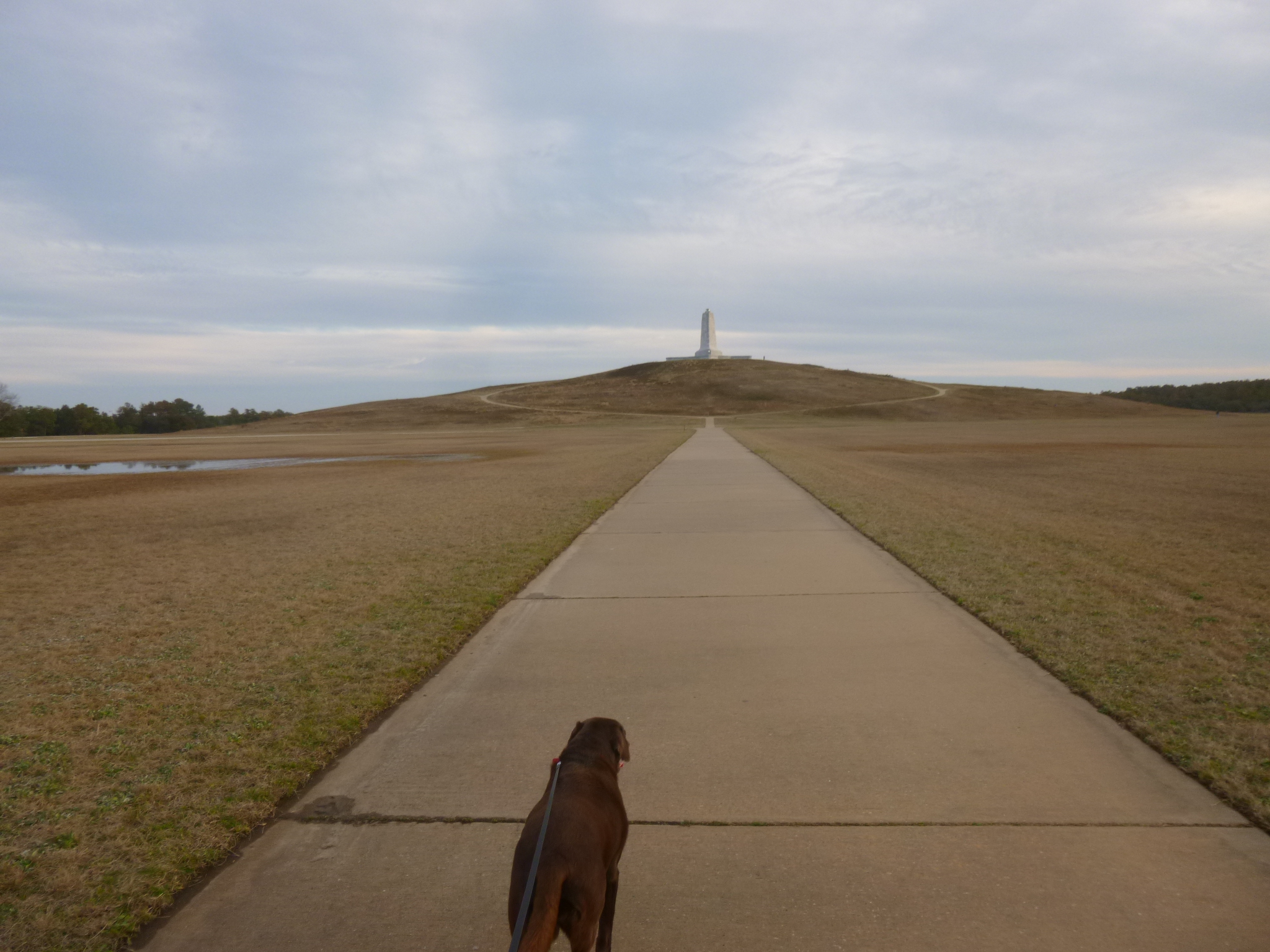
We were right near the Wright Brothers Memorial which I visited a couple years ago with Toni, and I knew it’d be a good place to get out for a few more miles of walking. But I didn’t do all 8 miles today – I wanted to get out onto the “real” (not commercial) outer banks for a little driving before dark, and I made it about halfway down – to Rodanthe – through the twilight hour. There wasn’t much traffic and it was kind of desolate in a very pretty way. There was some heavy equipment here and there, and sand across the road in a couple places, and even some water on the road – don’t know what storm all that was left over from.
Even though it was a short visit to the outer banks, I’m really glad I came. I walked 6 miles today, and will use my extra from Monday, so I only have one extra to do before I leave North Carolina. I got on the highway and made my way over to Rocky Mount to get back into the middle of the state – current plans are to head for West Virginia next, so I couldn’t linger on the east coast.


North Carolina – Tuesday, February 26
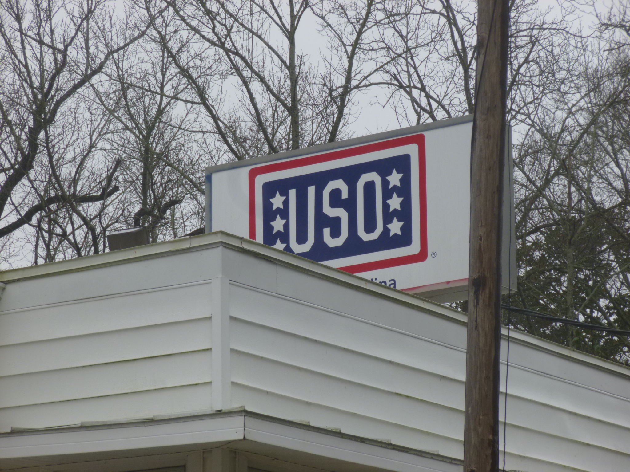
When I was researching donation possibilities last night, I thought maybe this would be a good town to make a military-based donation because I’m right by Camp Lejeune. And that’s when I discovered there are still USO facilities! In my mind, those were something from WWII days with Bob Hope entertaining. But there are still quite a few active USOs in the country and the one here in Jacksonville offers several programs like Smiles Over Miles (where family members can make videos for deployed loved ones); Honors Support Team (to make sure a fallen comrade is never alone on the final journey home and to help the family at airports and with other red tape); Deployment and Homecoming Support; and other programs. I found the building and went inside and it was fun to look around. It was very spacious and there were a few shelves of USO items that were for sale. They have a cafeteria which is open to the public for lunch, and several of the rooms can be rented out. The lady who showed me around says the function of a USO has certainly changed over the decades – many of the programs that used to be part of a USO are handled right on base now, so this USO does more outreach programs instead of having soldiers come to them. There were a couple of original phone booths in the big reception room where soldiers used to line up to make phone calls. And there were old records, old sheet music and old photos on the walls. So it was fun to make this donation and learn about USOs of today – especially since this one turned out to be the oldest continuously running USO in the country. The one in Fayetteville is a little older, but they shut down for a while after WWII.
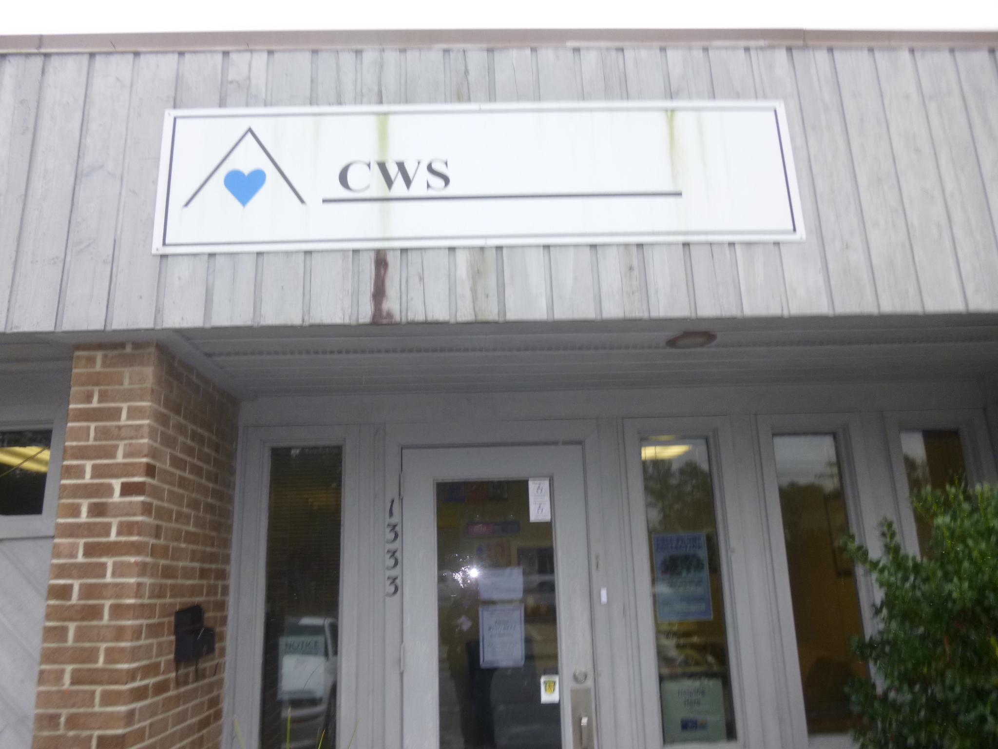
It was a rainy morning, but I saw a bike trail and thought I’d try to do a little walking. I left Tula in the car since it was so wet, and set out with my umbrella, which turned out to be too small to be very effective. I only covered about a mile and a half. From there I went to Wal-Mart to shop for items on a wish list for the Coastal Women’s Shelter in New Bern, where I was headed next. I also bought a bigger umbrella for me! I drove up to New Bern which was settled by German and Swiss people, and there were several signs cautioning people to watch out for bears. And there were “bears” all over New Bern – on flags, statues, signs, carved into buildings etc. I found the administrative offices for the Coastal Women’s Shelter outside of town – as I figured, the address wasn’t the actual home – very few people know the exact location. The volunteers there were very friendly and supportive of what I’m doing, and they told me they currently have 7 people in the shelter, and they helped over 600 women last year. It’s very sad that these places are needed, but comforting to many women they’ve helped in their 27 years of existence.
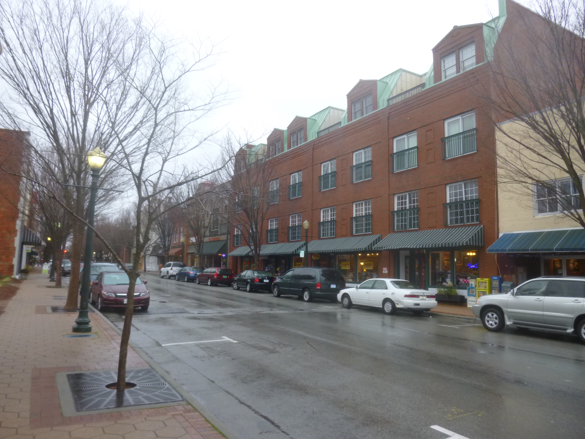
Back in downtown New Bern it was still raining, but Tula had to get out, and since she’s a lab, it didn’t bother her getting wet! It’s a good thing I travel with some towels. We took a pretty long walk, then I put her back in the car and walked around some more on my own – my new umbrella is a definite improvement for me. I went down by the waterfront and it was cold and windy, and the water was very choppy and beginning to lap up over the walkway. Oddly enough though, when I was walking back into town I could feel the temperature rise a bit. New Bern was the birthplace of Pepsi, and there was a big Pepsi store so I stopped in and looked around (even though I’m a Diet Coke fan!). I was talking to the lady in the Pepsi store and she told me where there were some historic neighborhoods that would be good for walking, and since the rain had stopped for the time being, Tula and I set off for the last walk of the day in some pretty neighborhoods. I didn’t think I’d be able to get all my miles in today since it was so wet out, but I did, and then had a 45 minute drive up to Washington, NC where I called it a day – and it was raining again!