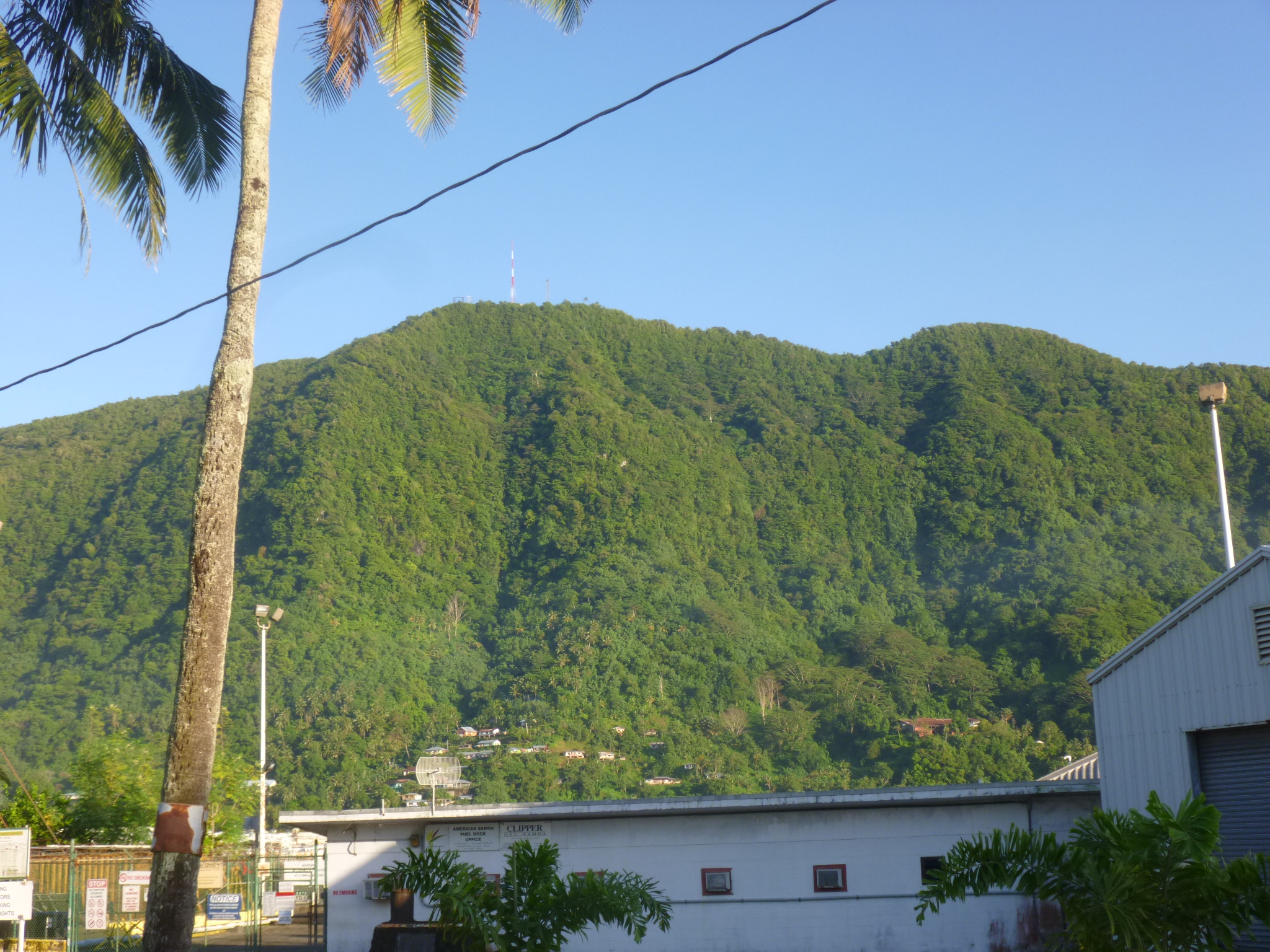
Mt. Alava
American Samoa – Saturday, January 19
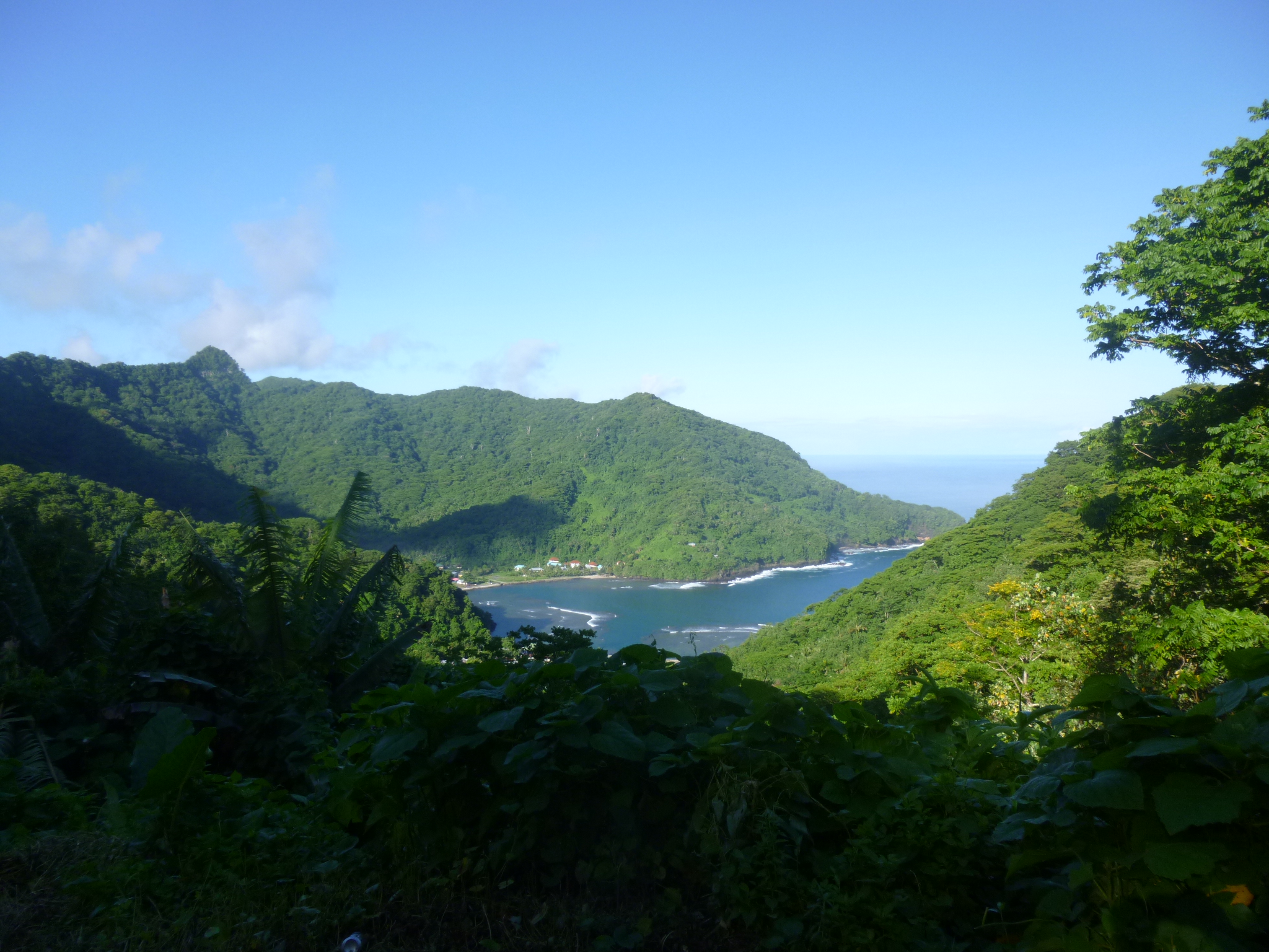
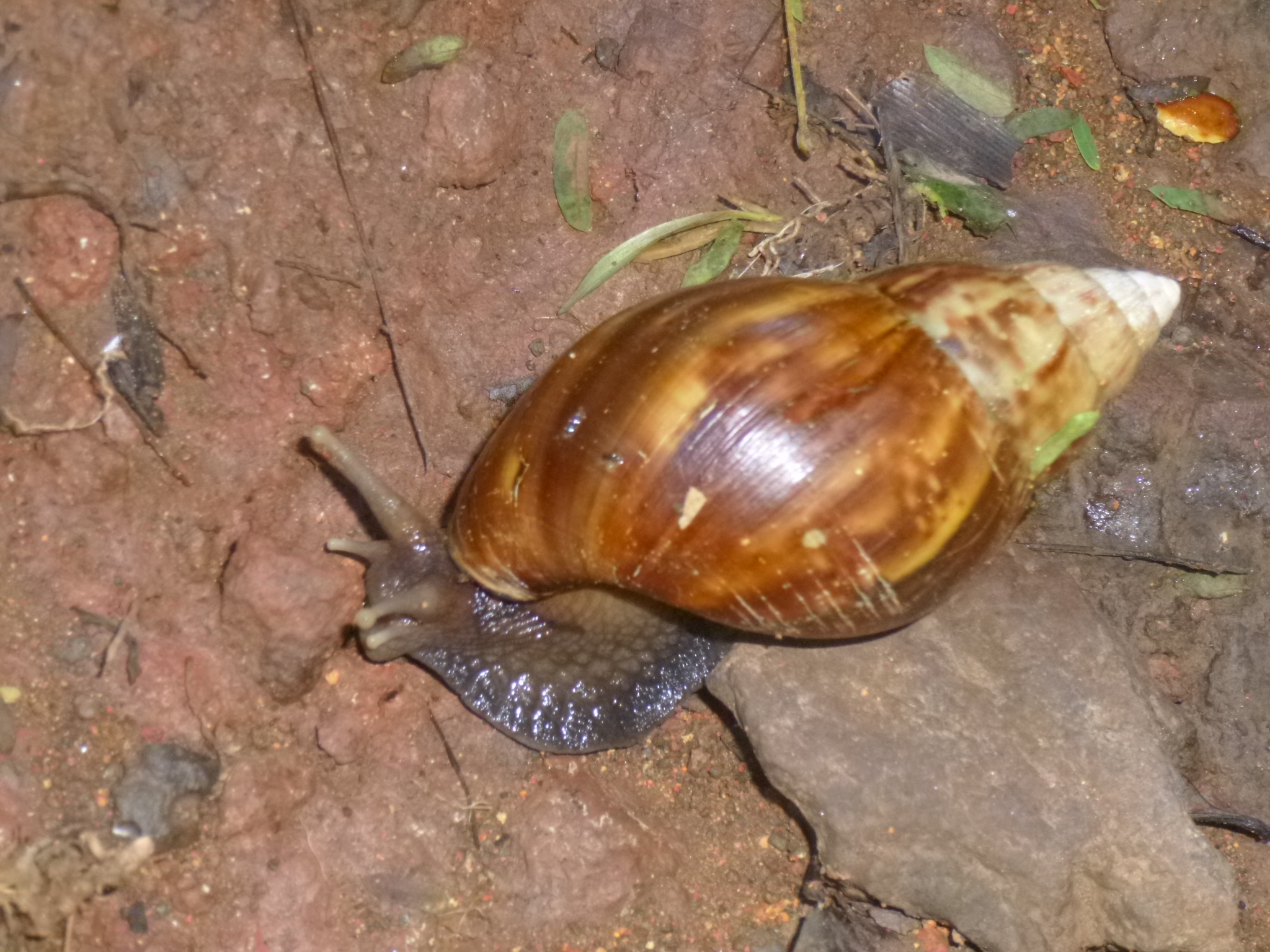
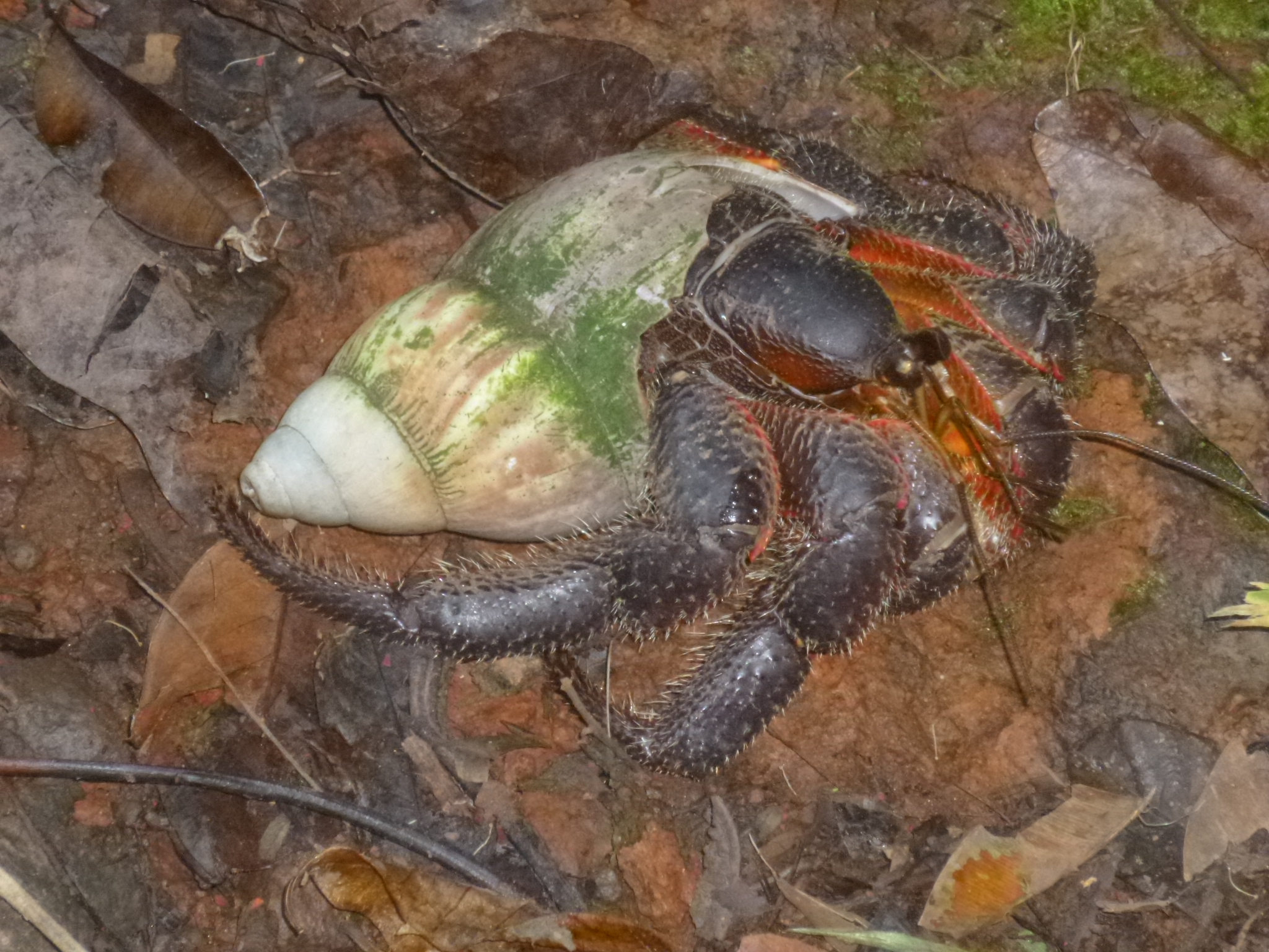
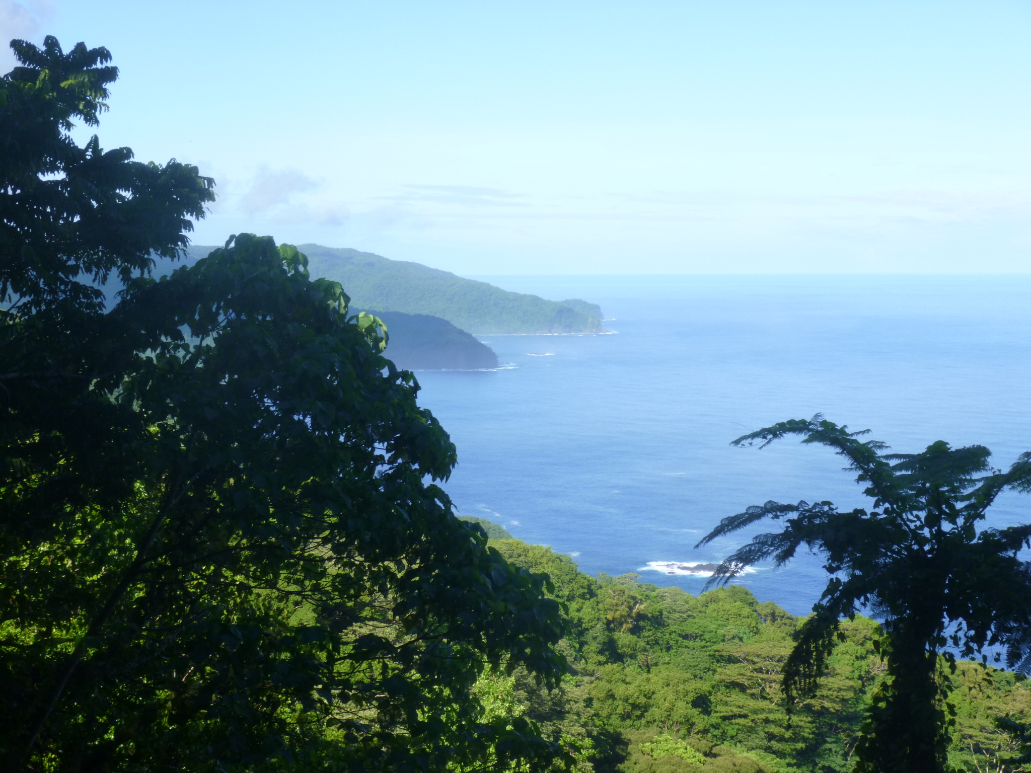
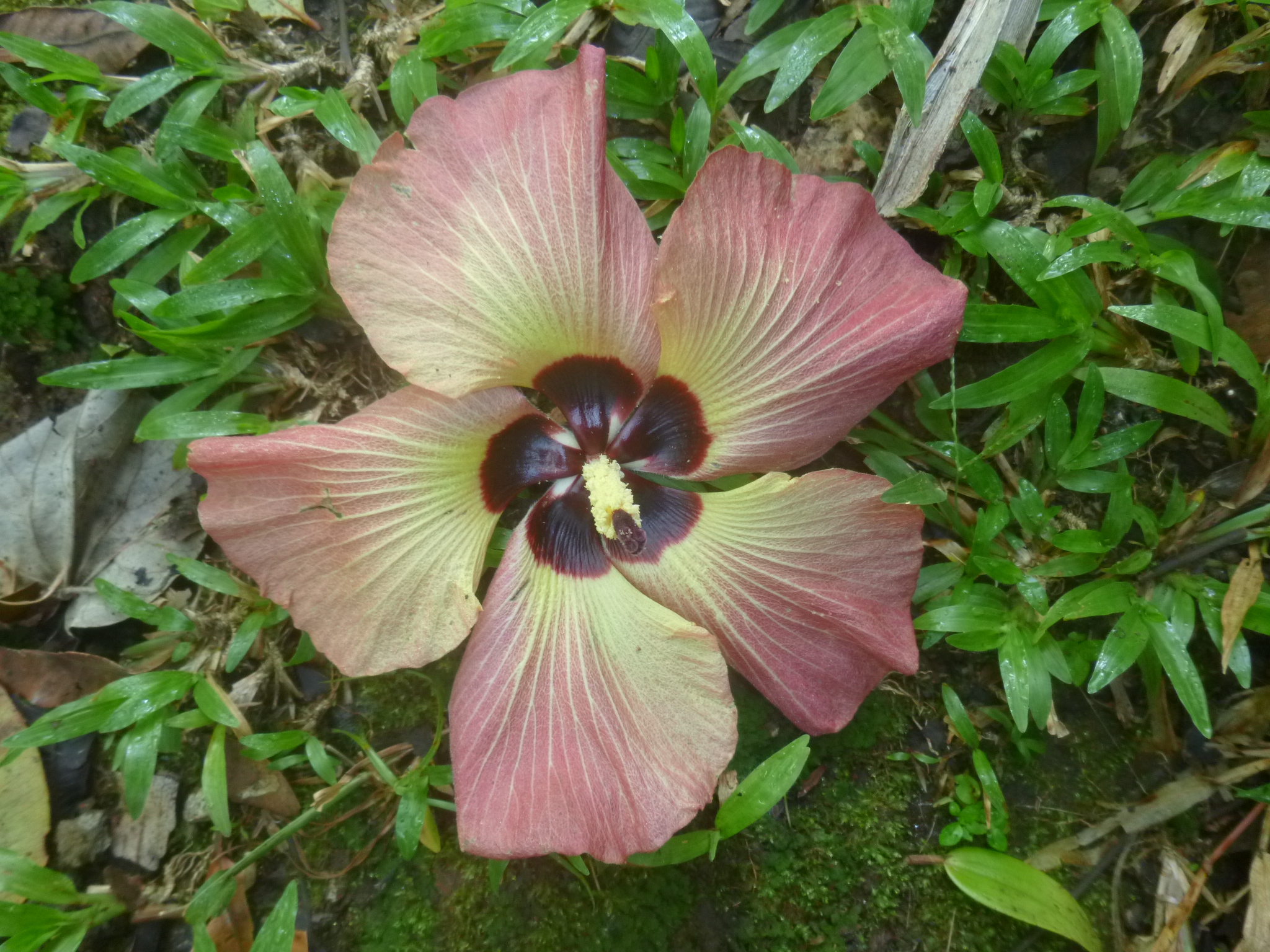
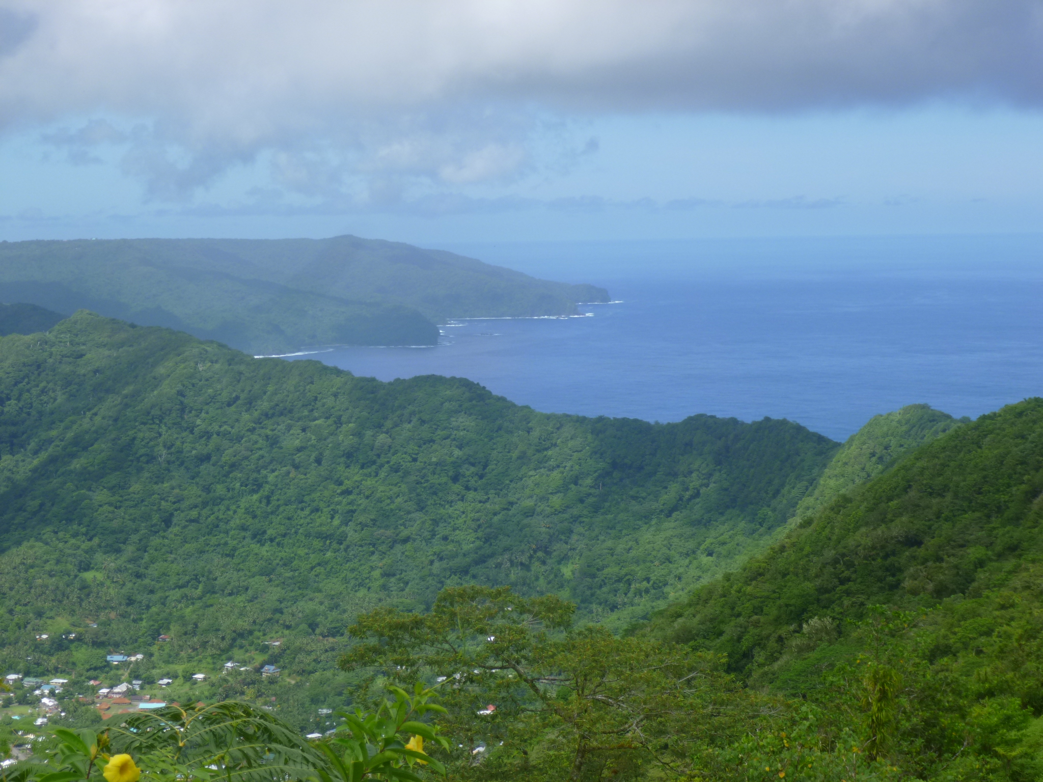
I was out the door by 7am to head for my 7 mile hike in the rain forest. First I walked up to the marketplace, and had to ask around to figure out which bus was going over the pass where the trailhead is. I did not pronounce the name of the village correctly, and quickly learned that many times where there’s a “g” in a word, it often has a “ng” sound. Plus different syllables are accented than what I would think – and there’s lots of vowels and they all need to be pronounced! So I went to the wrong bus stop first; talked with someone else and they sent me back across the street (which seemed logical to me); and then someone told me I’d be looking for the only white bus on the island. I had to wait quite a while, but a white bus pulled in and was going where I needed to go. The bus fare is inexpensive – adults pay $1 when they get off, and students seem to pay 50 cents and young kids pay 25 cents and the little ones don’t pay anything. The buses are small – maybe 8 or 10 rows of wooden seats (some have thin cushions)and they have a little storage space up in the front if people are bringing groceries or packages home. They also seem to be used as a delivery service – we made an extra stop where a lady was waiting for a box. We got up to the pass and there was already a beautiful view of the bay down below. It was about 8am when I started my hike – armed with lots of water, a sandwich for the top and some trail mix. It was already hot out, but since I was going to be walking up the ridge in a rainforest, I was in shade most of the time, which was a relief. I don’t think I would have done this hike if it was in full sunlight the whole way. There were lots and lots of birds, but because the foliage was so dense, I couldn’t see any of them! I could hear whirring of wings, and lots of different bird calls, but didn’t see one bird! Of course, lots of the time I was keeping an eye on my footing – it was muddy in places and a bit rocky in places, plus I had my hat on which restricts my view just a bit. The trail was wide enough for a vehicle to fit through, although no vehicle could have gone up that trail today. It was grassy in places and I would get tantalizing views of the ocean and little islands. The trail had some steep parts too where I would have to stop and catch my breath – up and up and up! I almost stepped on a pretty shell and discovered there was a big snail in it! And a little farther in I saw a good-sized crab in a shell scuttling along! That surprised me because I thought crabs needed to be near water (later I learned about coconut crabs – they live on coconuts and do not need to be near the water – the adult crabs can open coconuts with their claws, and no human can open a coconut with their bare hands, so those claws are very very strong.) I kept going, passing old banana and coconut plantations, and enjoying the views. I was heading to the second tallest peak and there are radio towers up there. It took me nearly 2 1/2 hours to climb the 3 1/2 miles, but the radio towers came into view, and there was a long metal stairway up to the last national park plaque, describing my view, and it was magnificent. I could see the ocean on both sides. One of the brochures had said there would be a traditional Samoan resting hut at the top, and I was looking forward to sitting a spell and eating my sandwich and banana, but there was no hut. Only the metal staircase, and next to that some sort of pulley system to maybe haul supplies up the last steep part. I took a good 20 minute break up there, feeling like I was on top of the world! There was no shade at the very top (which is why I could see so far) and I felt like I was beginning to bake, so it was time to head down. It took me almost as long to get down as it did to climb up. I think I actually prefer climbing up steep spots rather than going back down them. I took my time to not slip in the muddy parts – its easy to get going a little too fast. I didn’t have to wait long for the bus to come by again and even though it’s not a usual stop he picked me up. He continued into the little village of Fagasa on the other side if the pass. There were the usual homes and a church, but I also saw several big, sturdy-looking tents, and wondered if they were just some extra living spaces. I found out later that those were FEMA tents – provided after the tsunami of 2009. Which reminds me, there are dozens and dozens of tsunami signs – warning when you’re in a potential tsunami-prone area at lower elevations, and then signs at the appropriate elevations when you’re out of the tsunami threat area, and even some signs for tsunami gathering places. I can’t imagine the chaos of only having a few roads that go up and over the mountains (which is where everyone would flee)and having the vast majority of islanders living down by the water.
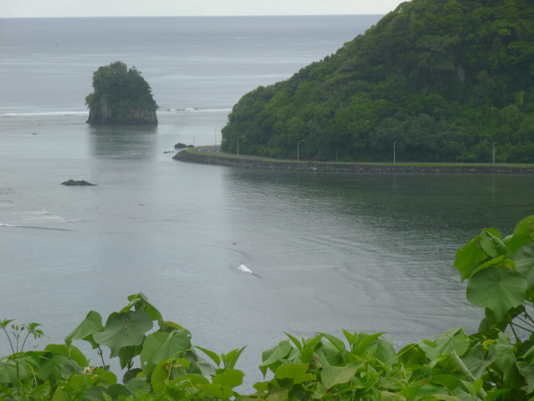
It was about 1:30 when I got back to the motel – and I was hot and tired. There’s a pool area out in the back, near the little private beach, and it sounded like some sort of high school party was going on. Kids were playing games, and swimming (mostly in their clothes), and I asked one of the handymen what was going on. It was a Tatou, which is like a party where people can get “live” tattoos (which I guess means have them done in front of the gathering)- lots of Samoans have traditional Samoan tattoos, get some food and listen to music. This had started a while ago, and I didn’t see anyone getting a tattoo (not sure that’s something I’d want to watch anyway!), but I was able to get a good BBQ meal right before they closed up – I think this was a lunchtime event, and I got in on the tail end. It was kind of like an early dinner for me! But I had some good grilled fish (mahi mahi I think), and chicken and sausage, and lettuce and tomatoes, and a couple things I couldn’t quite identify. One might have been raw tuna in a coconut milk sauce. It was okay, but the texture was strange – I just don’t think I’m a raw fish sort of person! So that revived me, and then I read a bit until the sun wasn’t quite so hot, then I got a second wind, and headed about a mile down the road to walk on a short national park trail by the sea, to see where an old cannon from WWII days was. I thought the trail would be flat since it was by the ocean – silly me! Of course they would want the cannon up high to help protect the harbor. Pago Pago harbor is one of the deepest natural harbors in the South Pacific, and although American Samoa didn’t turn into a WWII battleground, there was still a big American military presence as they guarded the bay, and it was a good re-fueling location for other maneuvers in the south seas. That wasn’t a long trail, but I ended up with another 10 miles of walking for the day. I went back to the motel and took another quick dip in the ocean to cool off, then tried to do some stuff on the computer, but I’m finding I need to be in the office for the wi-fi to work, and this is when I began to have problems with the laptop – Firefox crashed, and Internet Explorer was being temperamental. So I decided that was enough for one day, and hoped the computer would work in the morning!


Date: Mon, 28 Jan 2013 10:26:02 +0000 To: jenilu2348@msn.com
I can’t imagine what it looks like there! My only comparison would be Beaver Island which is about the same size but nearly flat (thank goodness for no tsunamis). I’m excited to see your photos and enjoy the history and geography in your blogs. Stay safe and have fun.