Ohio – Friday, March 15 – Monday, March 18
It was a good weekend for a family break, so I drove from Maryland to Ohio on Friday for a long weekend at Tara and Josh’s house. I couldn’t wait to see the grandkids again!! It had been 3 months. The 2-yr-old is chattering up a storm, and the 6-month-old was a lot bigger and is a happy little guy! So I enjoyed some good grandma time, and they kept me busy! And Taryn and Jared drove down from northern Michigan with their puppy Croix, who I hadn’t seen yet. And in-laws Gretchen and Graham came down, and it was really nice to see and get caught up with family. We all went to a Ducks Unlimited banquet on Saturday, and enjoyed a leisurely breakfast on Sunday. And I babysat all day Monday before starting to pack up to return to Maryland. I’m glad I was able to be in Ohio when other family members were down too 🙂

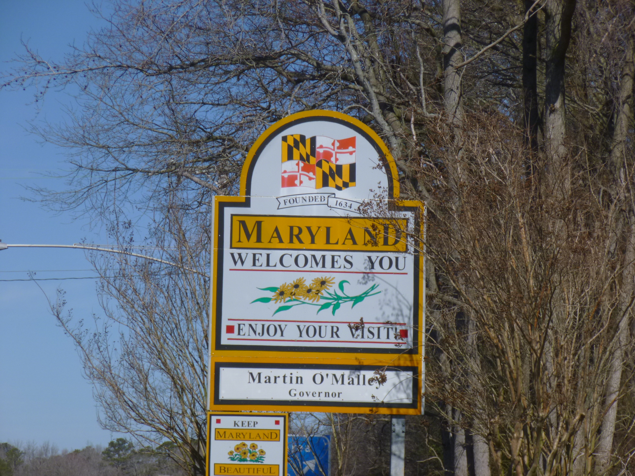
 Maryland – Thursday, March 14
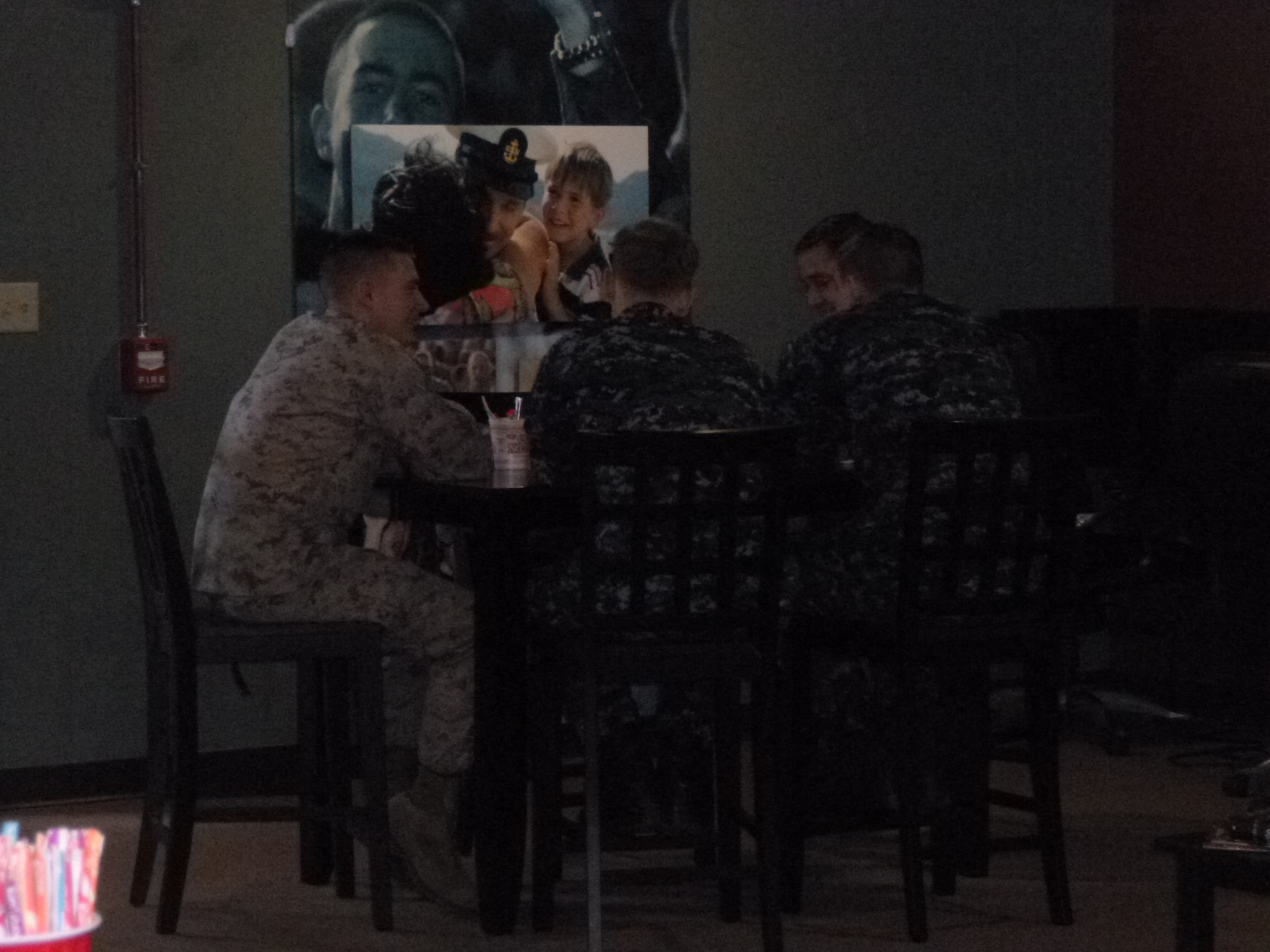
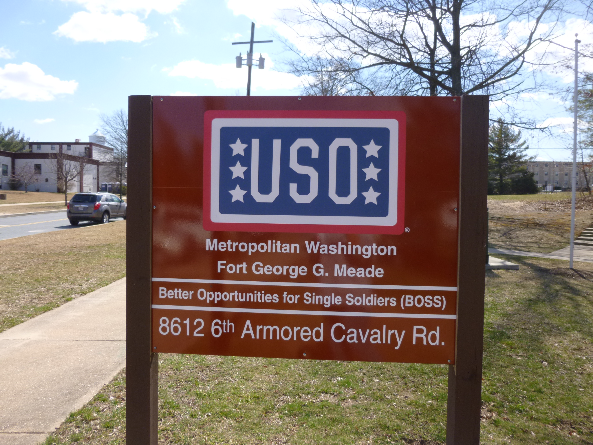
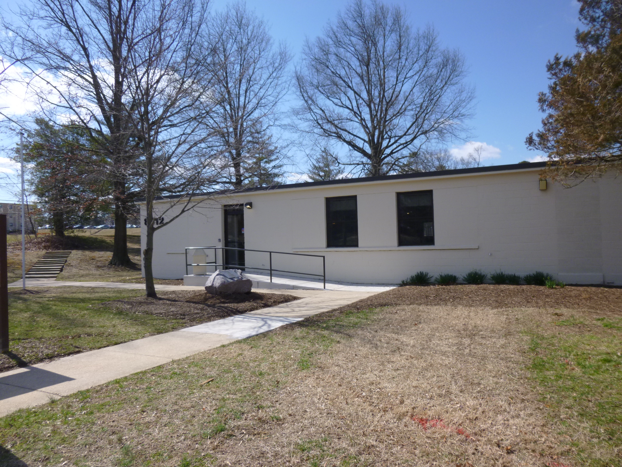
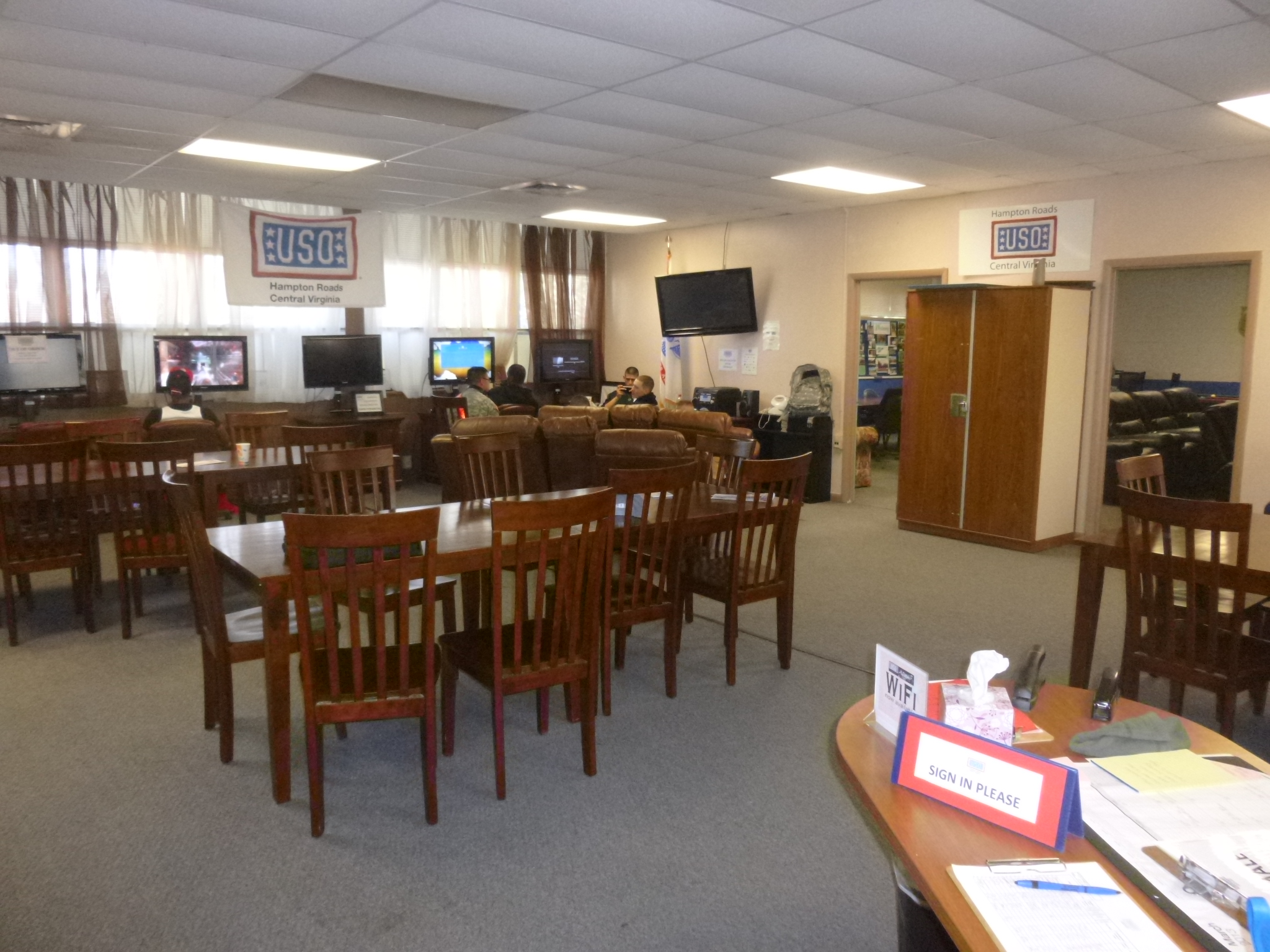
I stayed in Jessup last night which happened to be sort of close to Fort Meade and the USO that was going to be my donation-of-day. So I set off for the base, and got turned around a bit, and finally found an entrance gate. But it wasn’t an entrance gate for visitors, so the guard gave me directions to the other main gate, but he left out a major road so that slowed me down temporarily again. I found the right gate, and the signs all said vehicles would be searched, but the guard just took my license and registration for a minute, then waved me through. It was another big base – basically a small city – but I found the USO with no trouble, and went in to make the donation. Two of the volunteers were busy sorting stuff behind the main reception counter, and I was a bit confused to see what looked like a bunch of costume jewelry! That was not what I would expect to see people sorting on an army base! They explained they were getting ready for a special event for the military wives/women on base – a Cinderella-for-a-Day bit of pampering. The USO had just moved into its new location in January, and the volunteers were very happy about that – not only was it bigger space, but it was right across from a lot of the barracks, which made it more convenient for many soldiers. And there were soldiers coming and going and enjoying the amenities. I enjoyed seeing some of the base while I was driving in and out.
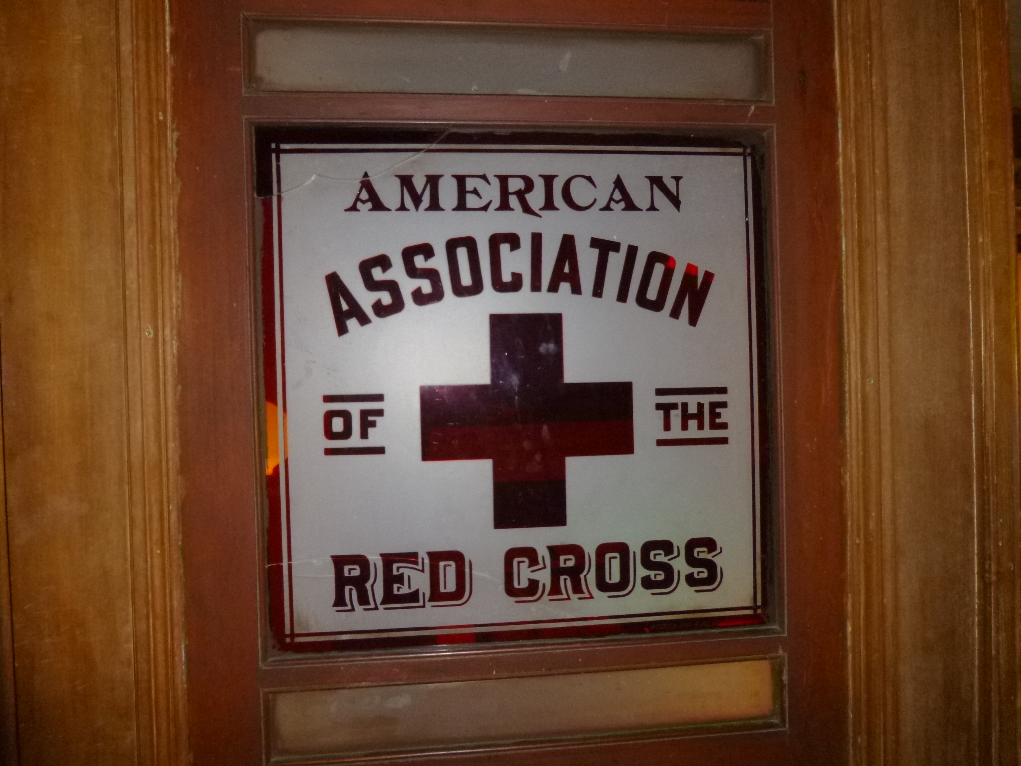
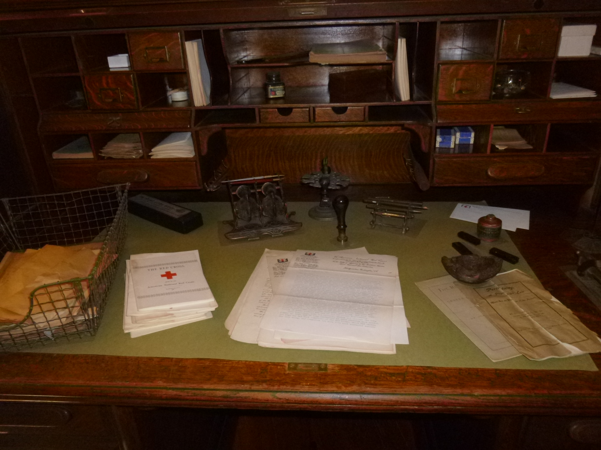
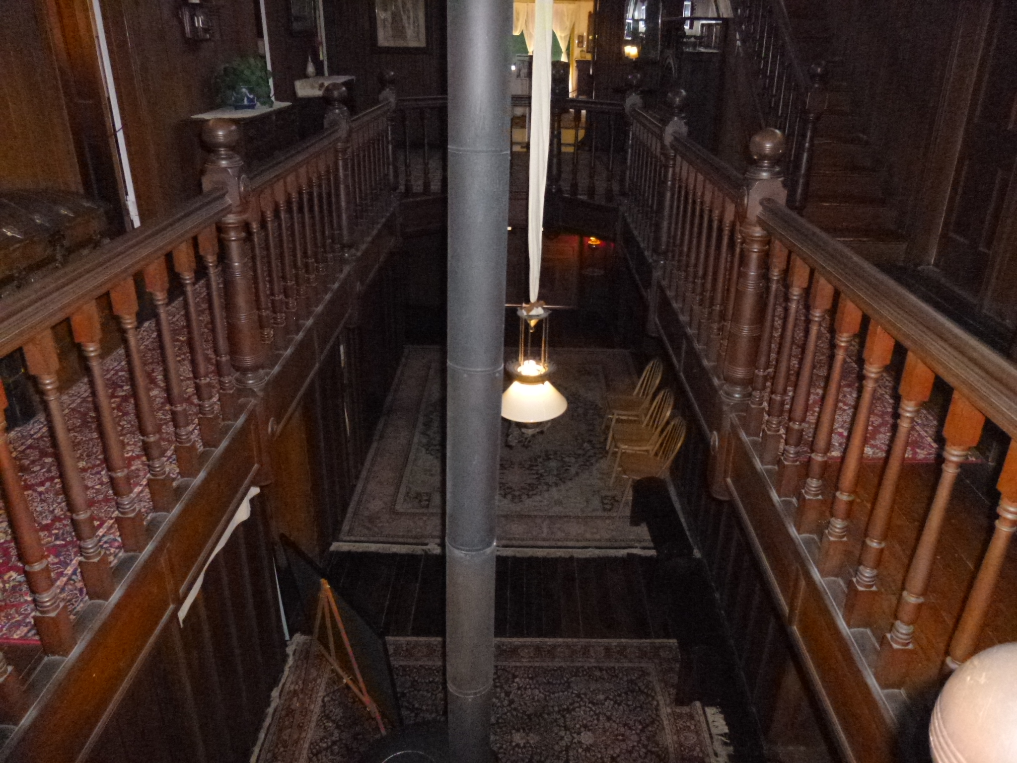
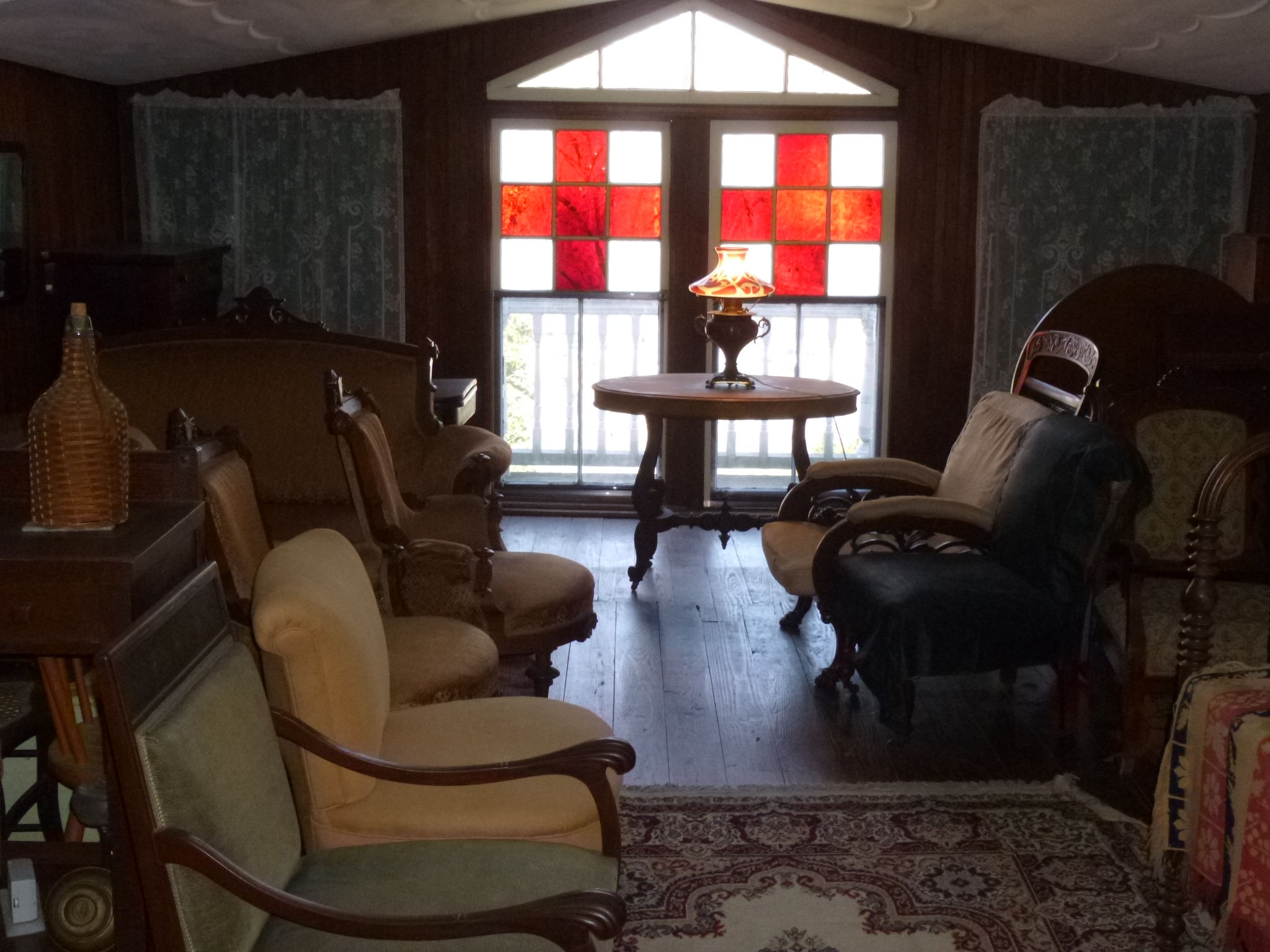
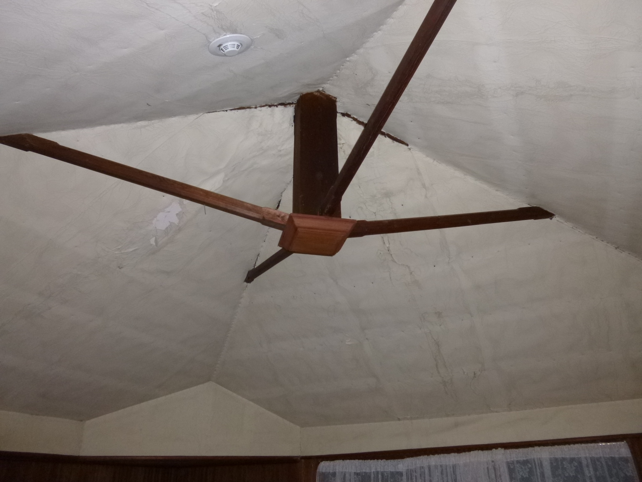
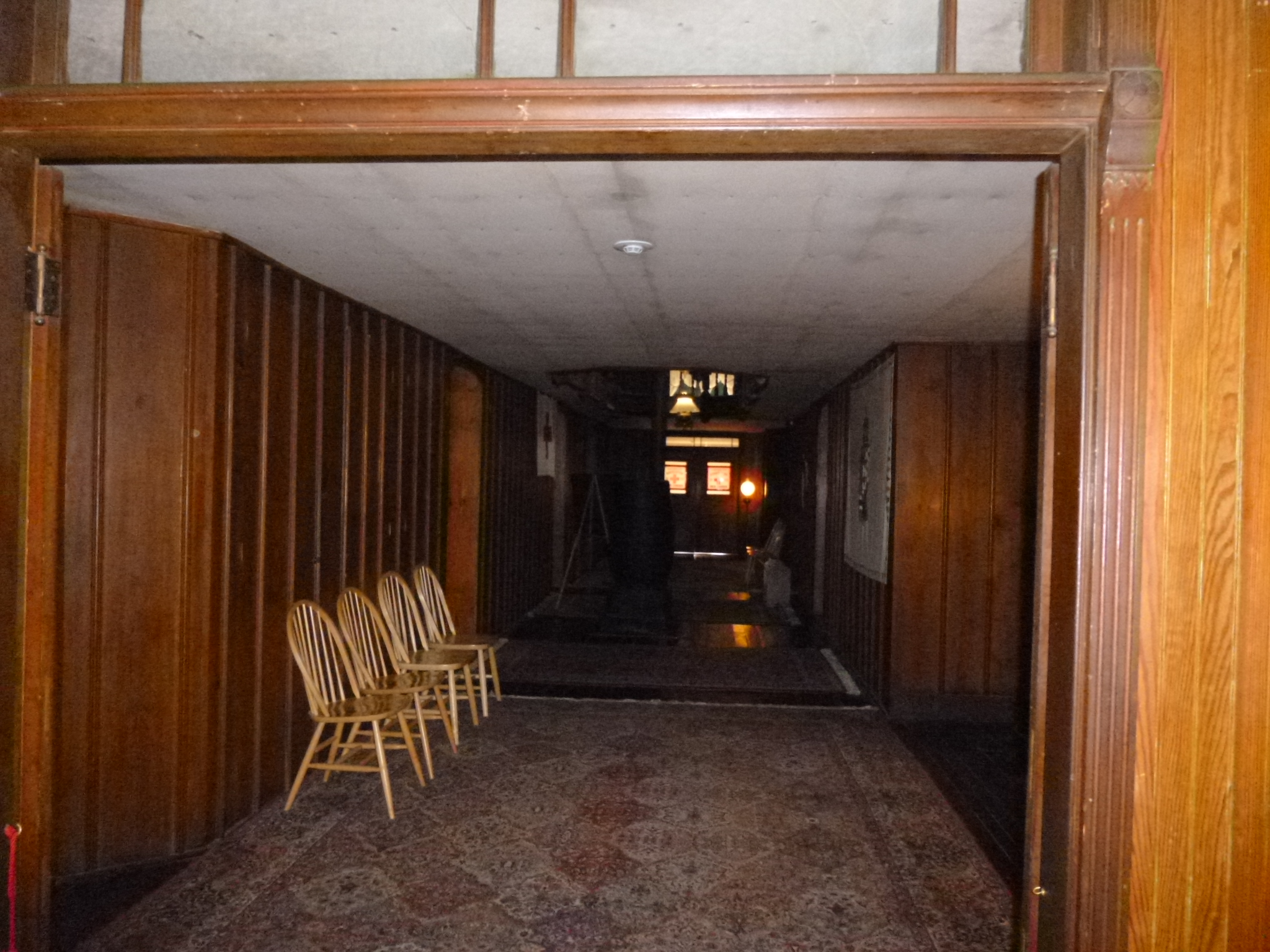
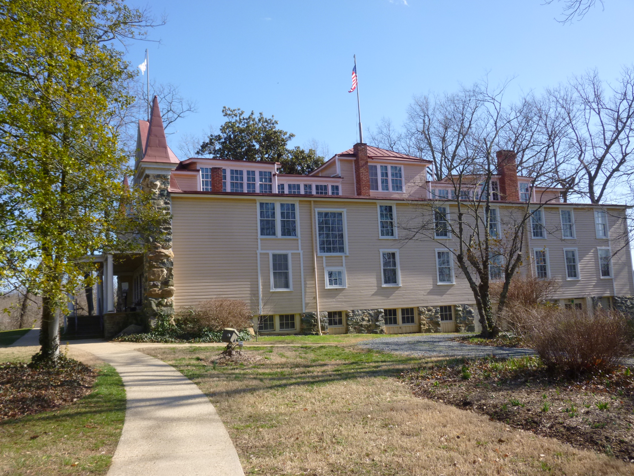
Then I headed for the Clara Barton National Historic Site – with 2 daughters who are nurses I thought it would be interesting to find out more about a Civil War nurse. But Clara Barton turned out to be the most famous nurse who was not really a nurse! She was never formally trained, but did practice nursing on the battlefields. And the reason she was allowed on battlefields in the first place has to do with her being a teacher in her younger years… Clara was a teacher in her young adult life, but then she decided she wanted to broaden her horizons so she moved away from Massachusetts and went to college (school teachers didn’t need a college education back then) and met a good friend from New Jersey. She eventually found herself in Washington DC, where she noticed there wasn’t much of a school system, so she spoke with town officials and offered to start a small school for free, and it grew quickly. The next year officials decided to hire a principal for pay – but it wasn’t Clara Barton because she was a woman. During this time, America was becoming embroiled in the Civil War, and Clara Barton began to see soldiers arriving in Washington from the New England states, and when she saw the Massachusetts soldiers, she realized a lot if them were her former students. They in turn told their families that their old teacher was in Washington DC, so they could send supplies to her. So Clara began receiving loads of supplies for the Union troops, and her friend from college also organized shipments of supplies from New Jersey where she came from, and Clara was unwittingly thrust into managing supplies for Civil War battles, which is how she was given permission to be on the battlefields and did some nursing. After all of this, she had some health issues and her doctor advised her to take a break and tour abroad, where she became familiar with the Swiss Red Cross agencies. And that’s how she got the idea to start the Red Cross organization in the US and become the first president. She eventually finished a large home/office/storage area/Red Cross office in a large building near Glen Echo MD, just outside of Washington DC. And that’s where I saw everything. To save money while finishing the “house”, she simply used bolts of bandage fabric to cover the ceilings instead of expensive plaster. They were painted white, and they’re still there – one would never know there’s bandage fabric on the ceilings! The house had 10 guest rooms for Red Cross volunteers and 50 closets for storing supplies – there was no such thing as pre-made canned soup, so food supplies were things like home-canned beans, peas and carrots, and baskets to carry it all in since plastic and paper bags didn’t exist yet. There was also a safe in the house with $3000 in it, so if a disaster happened on a Sunday, they could put the wheels of assistance in motion without waiting for banks to be open. Lots of her her original things we’re on display – a fascinating visit. She just sort of went with the flow and did a good job with whatever she ended up doing – I think she’s my new hero!
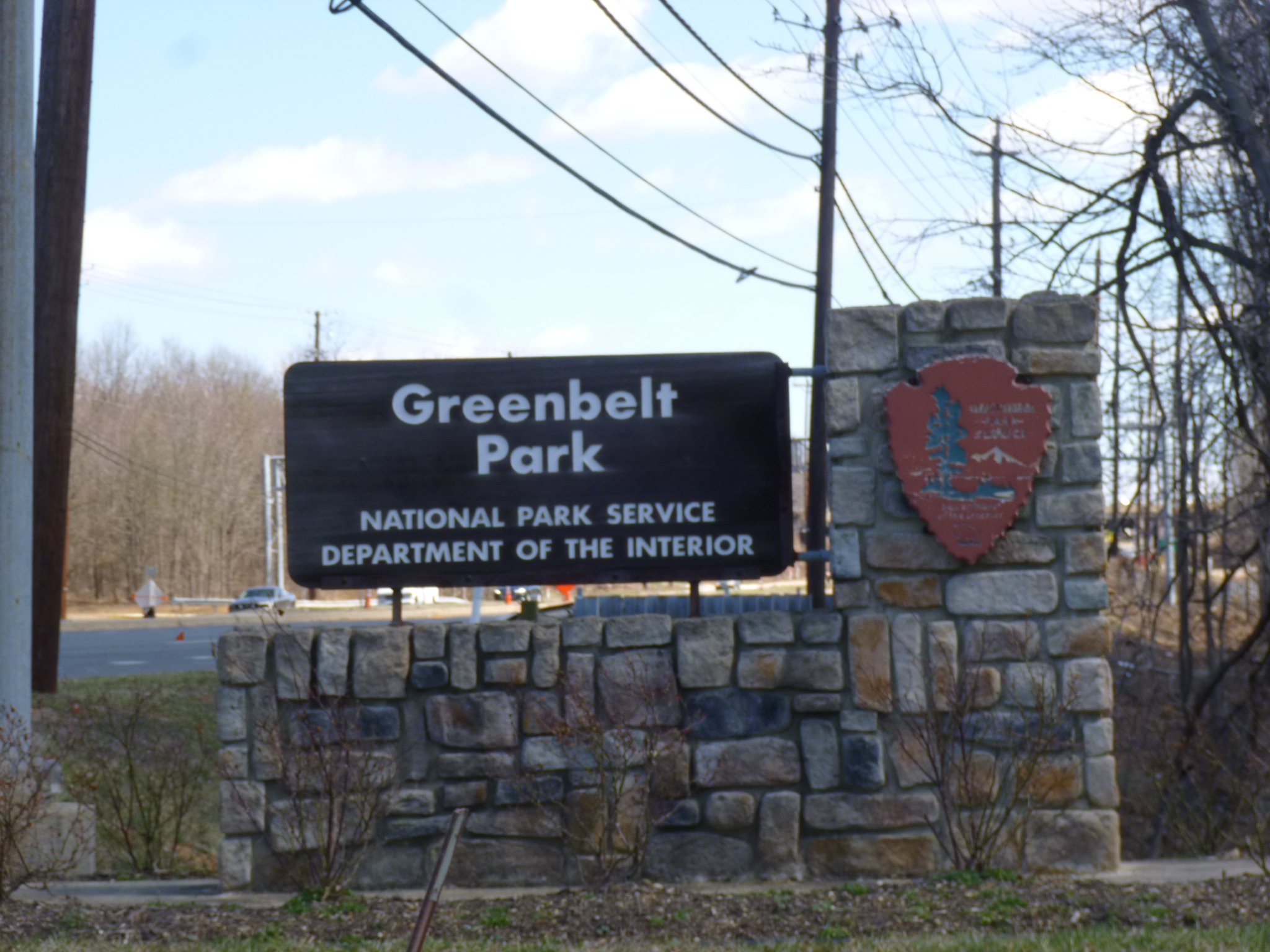
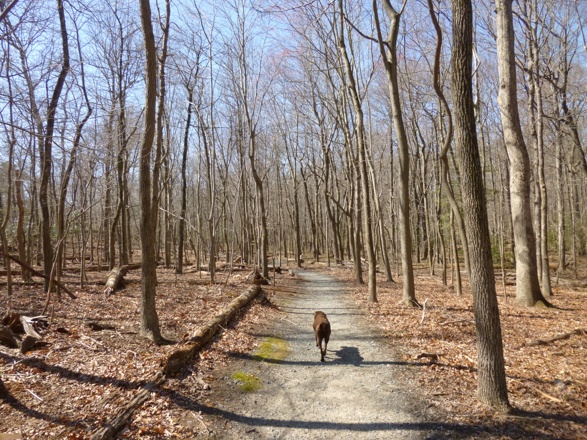
As I had been driving from Fort Meade to the Clara Barton place, I saw a national park sign for the Greenbelt Park, and I’d never heard of that one. I pulled off at the exit, and found a big park in the woods with some nice trails and Tula and I walked our first miles of the day there. The amazing thing about the Greenbelt Park is its proximity to Washington DC – it’s so woodsy and quiet, it’s hard to believe the metropolis of Washington DC is only about 12 miles away. They call it an urban oasis, and it truly is.
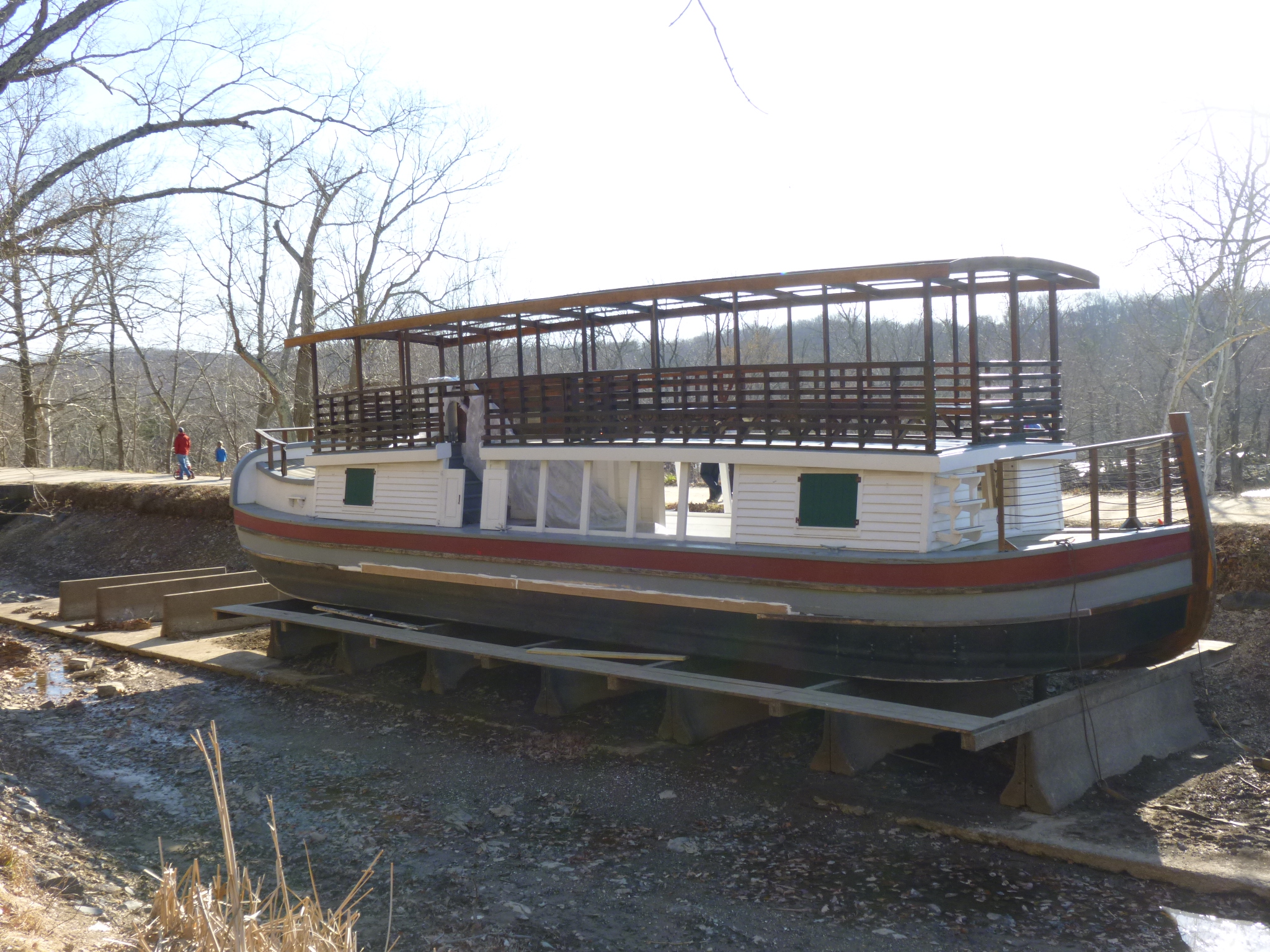
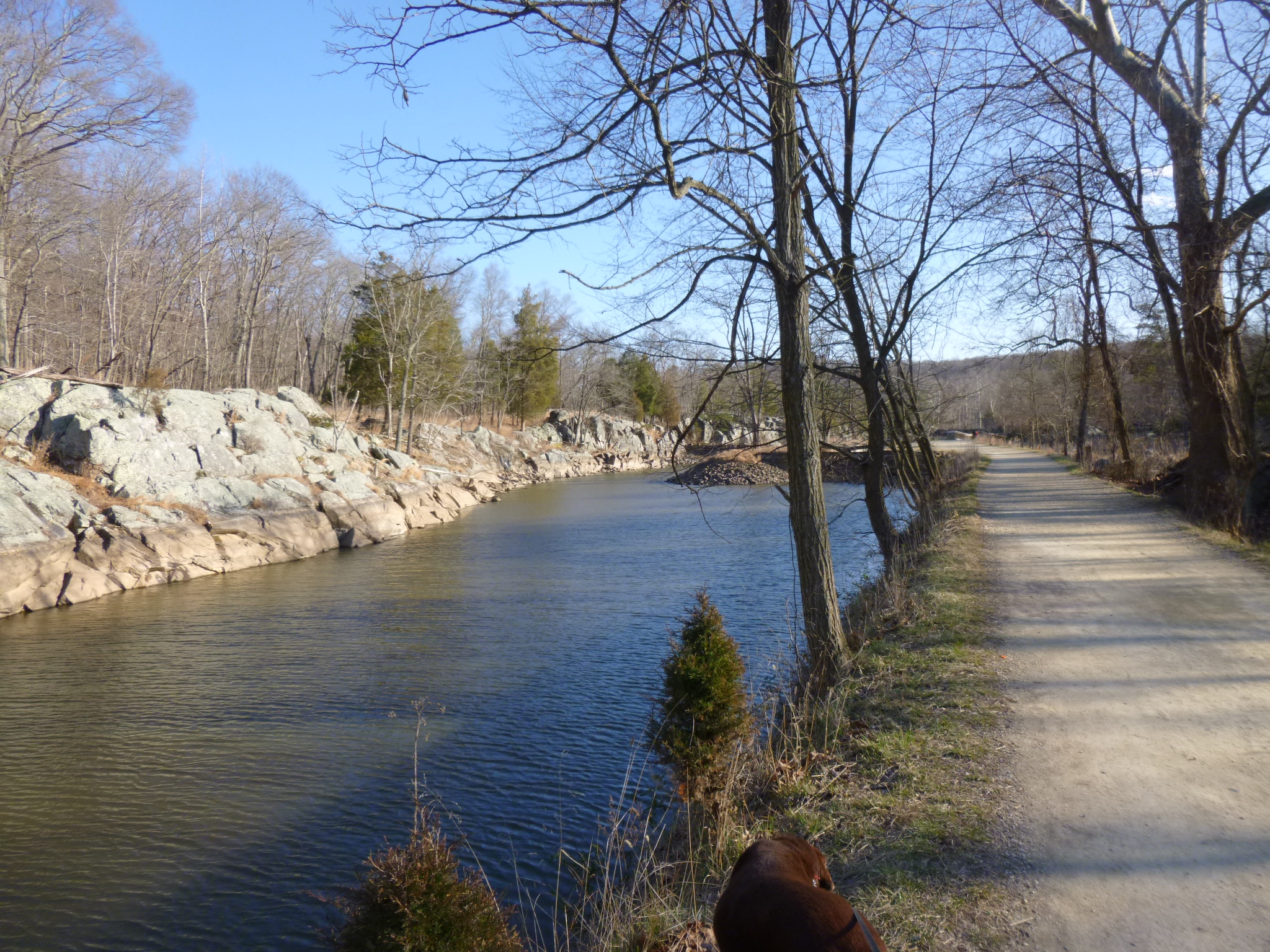
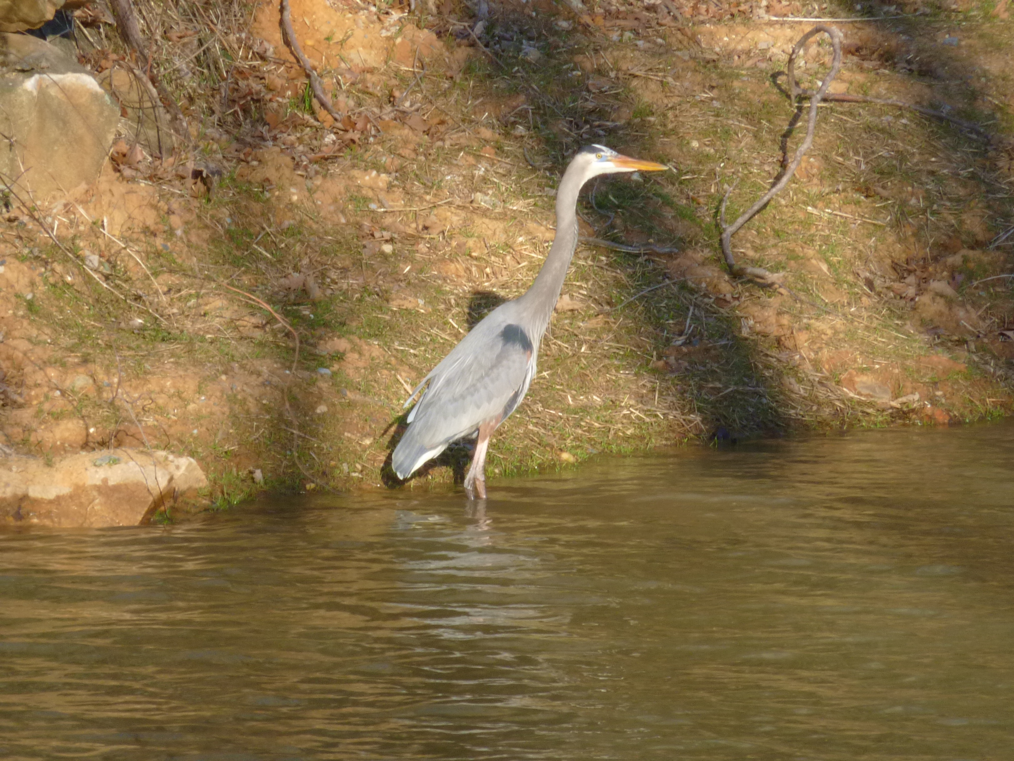
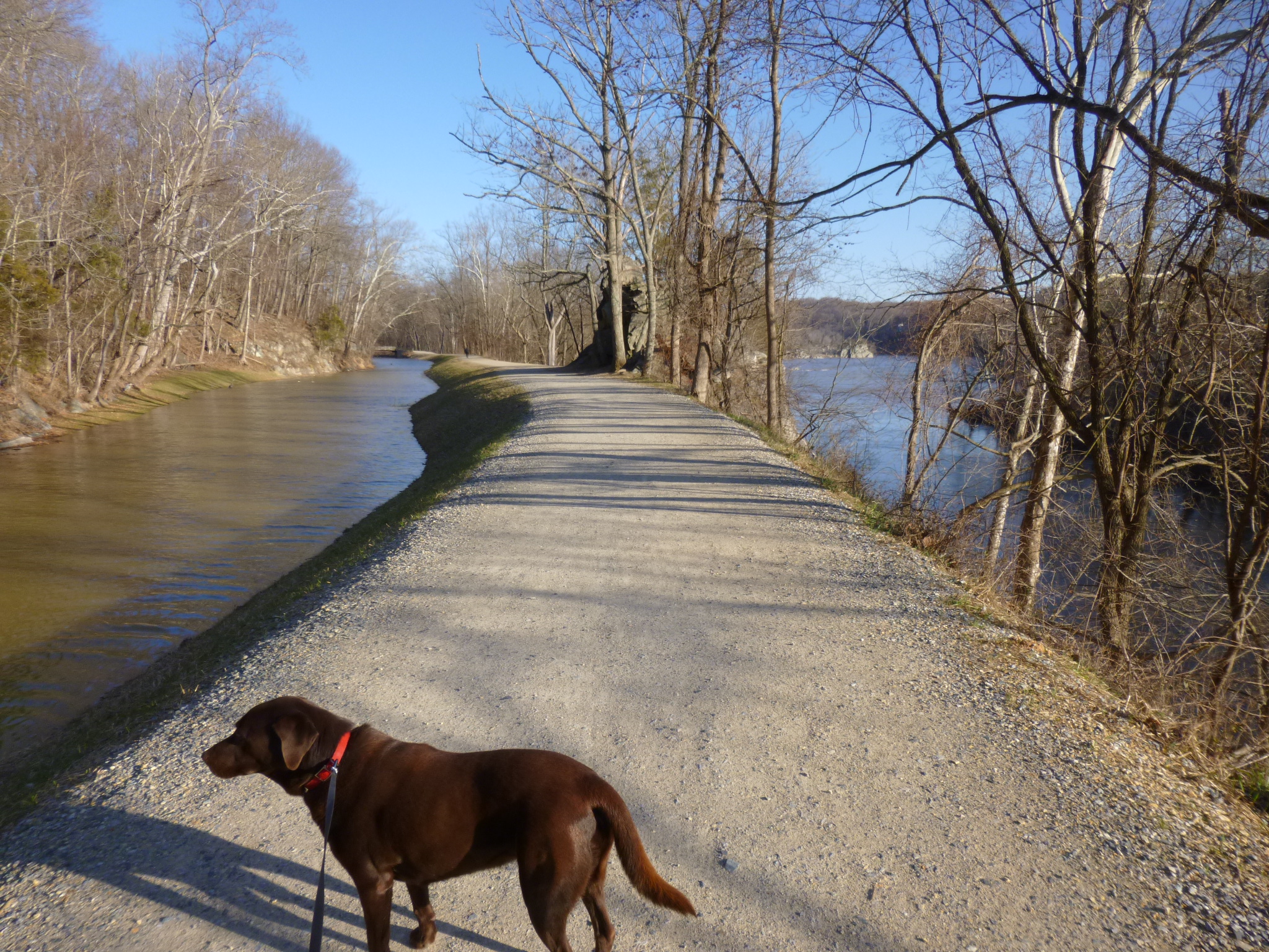
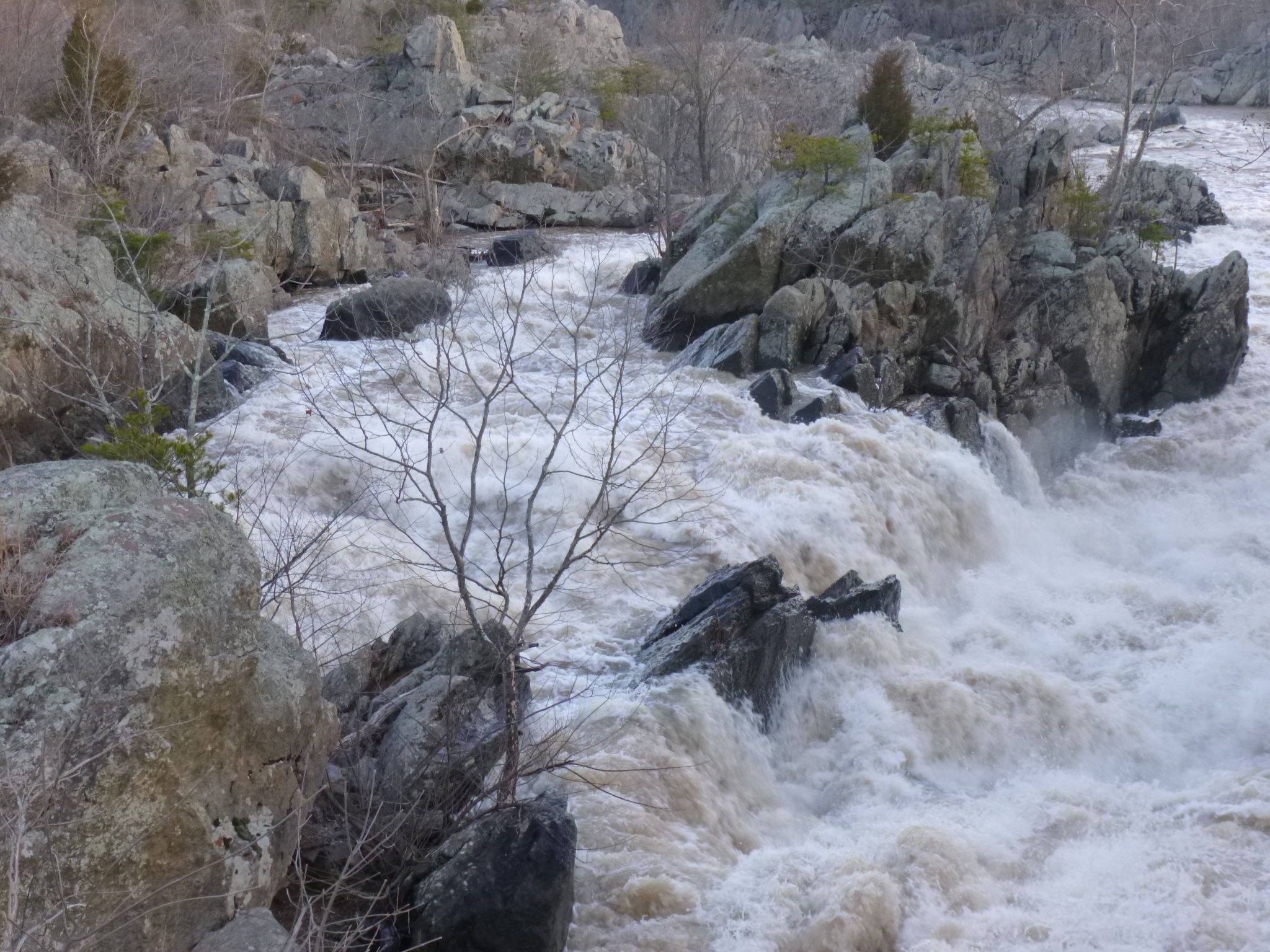
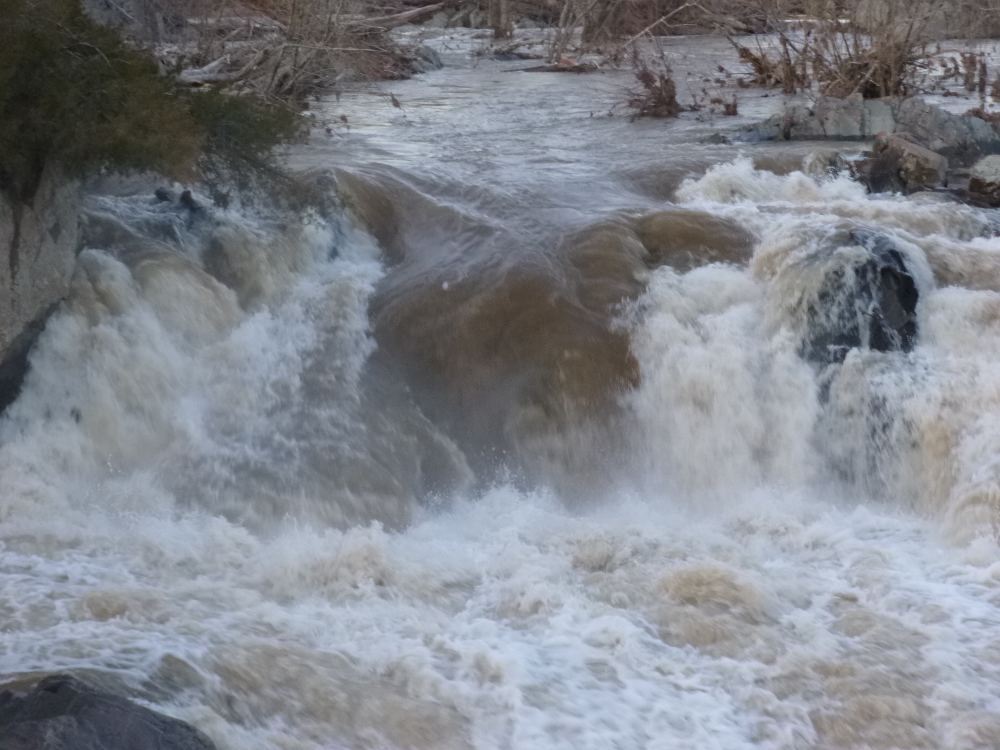
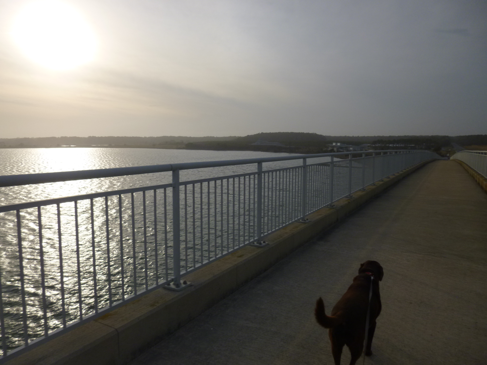
After my visit to Clara Barton’s house (and I was the only person on the tour!) the ranger directed me to the C and D Canal Historic Park, where the towpaths are now used as walking trails. It was only about a 15 minute drive away – C and D stands for Chesapeake and Delaware canals. The canal had to be dug along the Potomac River because the river falls about 60 feet as it approaches Washington DC, and the whitewater made it impossible to navigate. Maryland has a big canal system, and canals were very labor intensive to build. The canal also connected the Delaware River to the Chesapeake Bay. They only served their purpose for 20-25 years before the trains started hauling everything, although they still continued to be used for a while. Mules would pull the barges and stuff upstream and the tow paths are still there and make awesome walking paths. (And I couldn’t help but think of the elementary school song about the Erie Canal and the mule named Sal!) Tula and I walked over 4 miles along the canal, and even though it was cold out, it was one of the most peaceful, beautiful walks I’ve taken in Maryland. There were lots of ducks and herons, and it was so pretty following the canal along the Potomac. There was a boardwalk leading to the Great Falls and a little island, but dogs weren’t allowed, so I put Tula back in the car after our canal walk, and went back to the falls. There were a couple pedestrian bridges over the river, and the Potomac was a churning, turbulent mass of whitewater – nothing could have negotiated its way downstream or up – which was why the canals were built. The power in all that thundering water is something to see and hear, and I could sometimes feel the spray. I got an extra mile of walking in today, and I don’t think a day could be any more full and wonderful!


Maryland – Wednesday, March 13
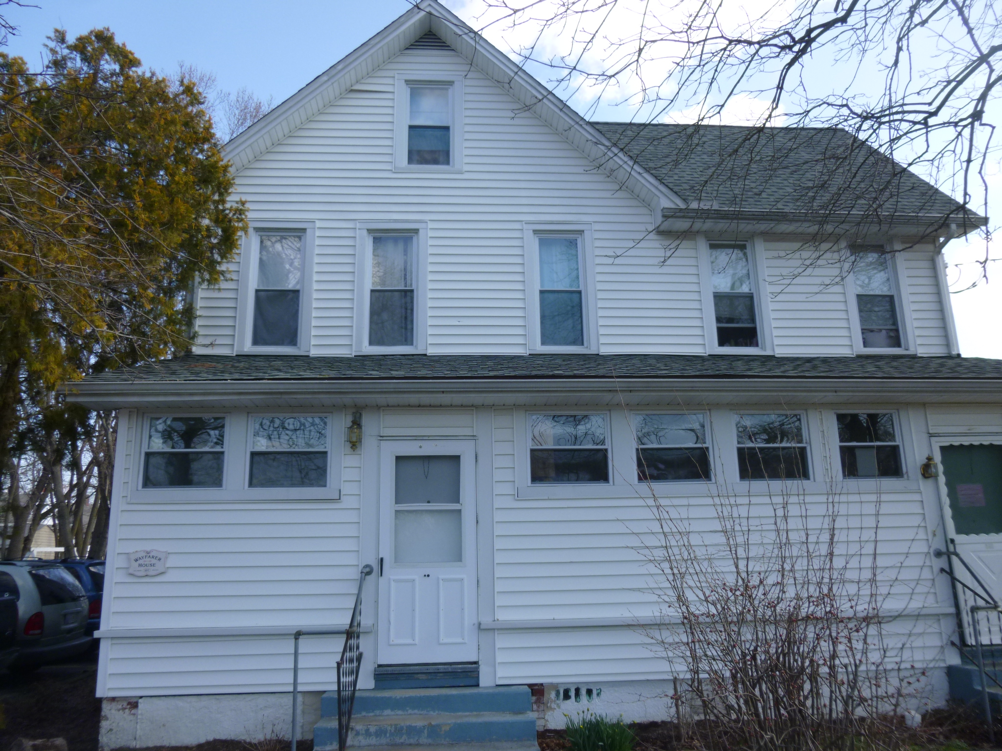
I ended up in Elkton last night, so I looked into donation possibilities there, and found the Wayfarer House, which is a shelter for women and their children operated by The Meeting Ground, which also runs a couple other shelters, a food pantry, and provides hot meals for people in need. I called them to see if a food donation or a financial donation would be most helpful, and they said a check would be wonderful. They say that a dollar given is multiplied 3 times in the help it offers to homeless families. I drove into town and found the house and went inside to make the donation – it looked like it was a busy place.
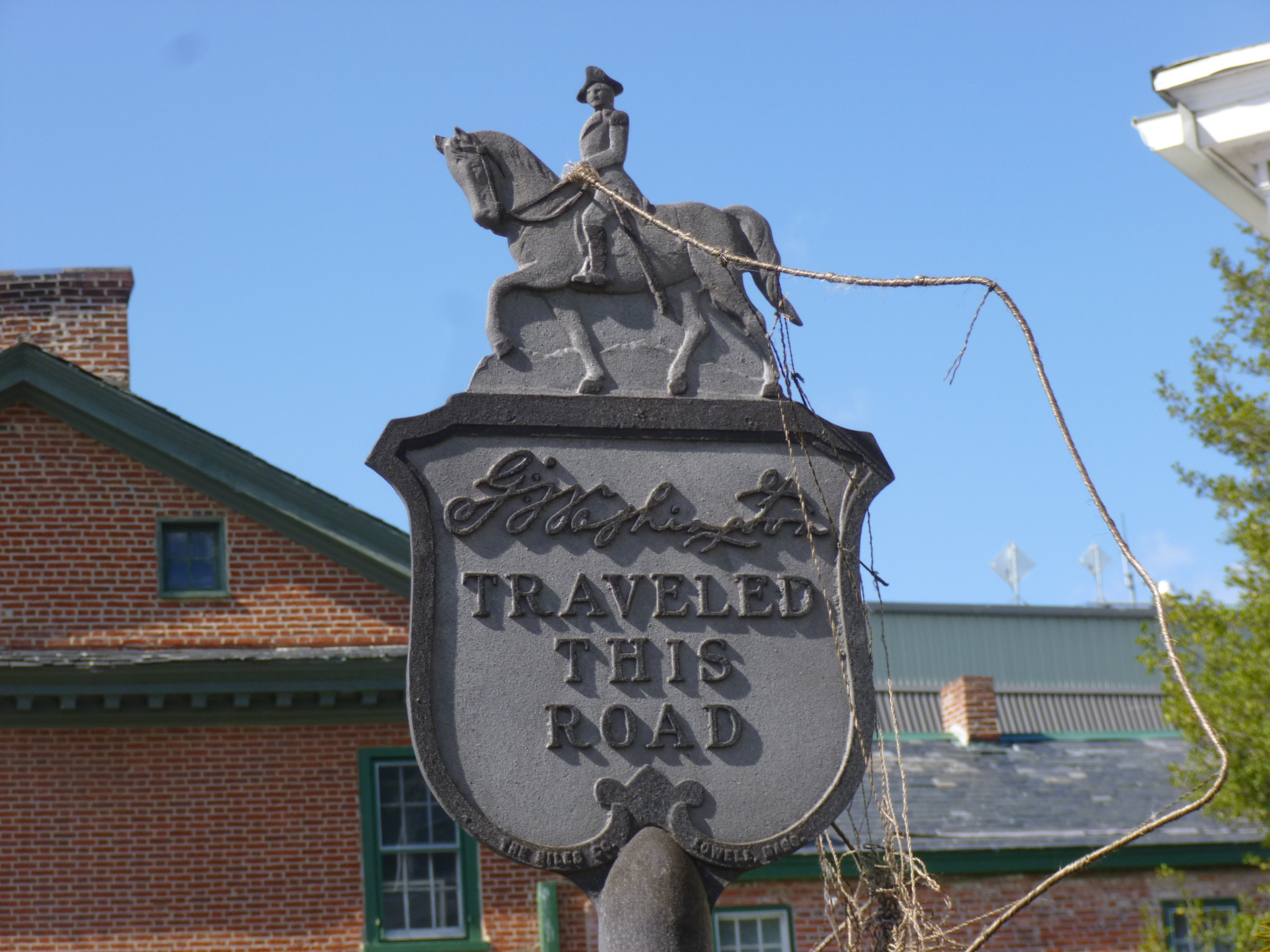
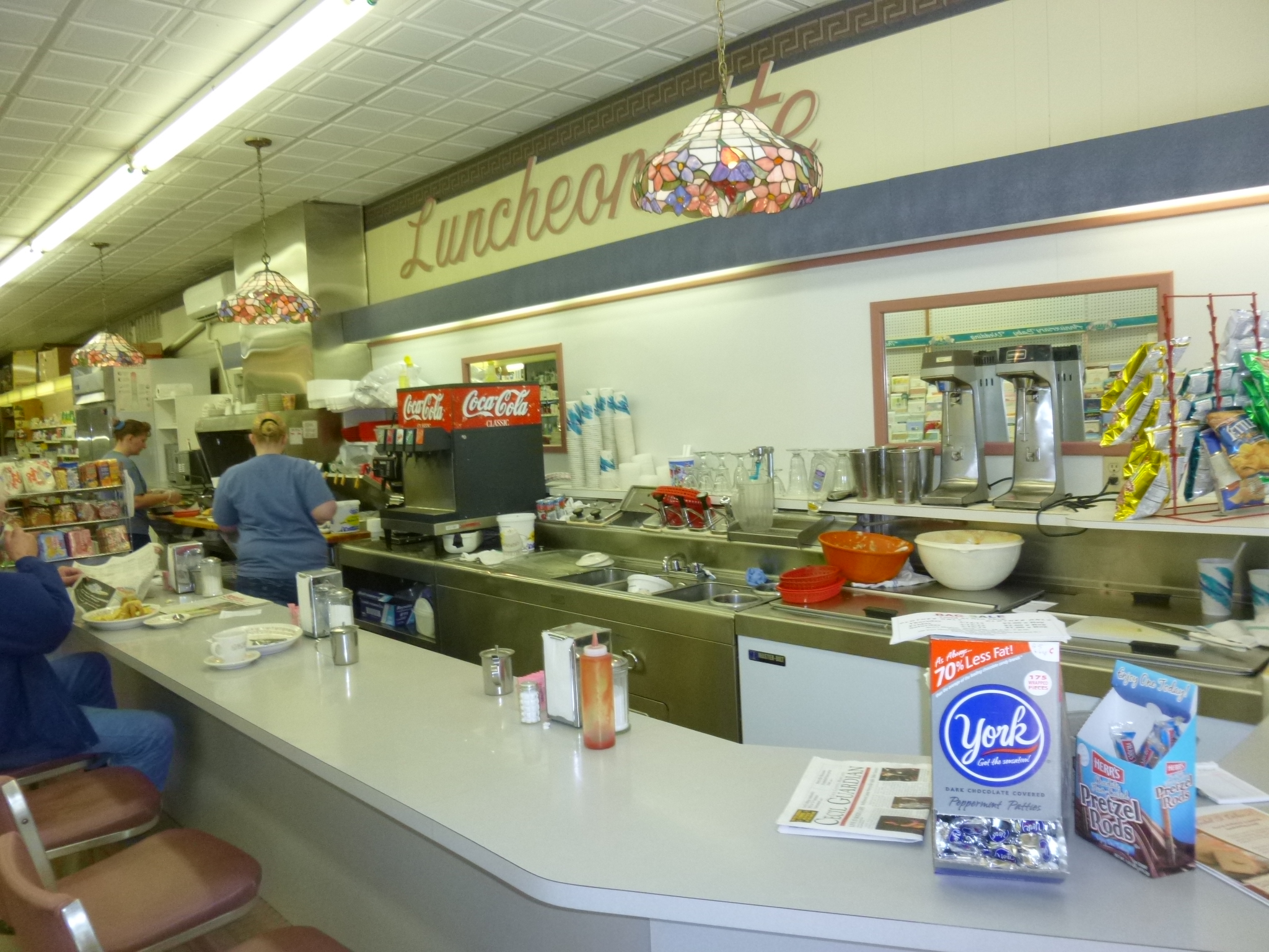
Elkton looked like a fun town to walk through, so Tula and I got almost 2 1/2 miles in. There are numerous elk sculptures all through town, many of which have been elaborately painted. This is a town that George Washington rode through, and the oldest building in town became a Civil War Hospital in the 1860s. And there was a historic little wedding chapel that has presided over countless weddings in the early 1900s. Back then, there were 15 wedding chapels in town – Elkton was known as the wedding capital of the east, and in 1936, the chapels issued 11,791 marriage licenses! Their popularity was due to the fact that they required no waiting period, no blood tests and no witnesses. Even after a 48-hour waiting period was required a couple years later, people still flocked to Elkton – 6000 couples got married every year through the 1970s, and people still get married there. There was also an old-style pharmacy across the street which has been serving breakfast and lunch since 1875, and I put Tula back in the car and enjoyed an early lunch on a stool at the old-fashioned lunch counter. Nearly every stool and table was taken, and it was obvious a lot of them were regulars.
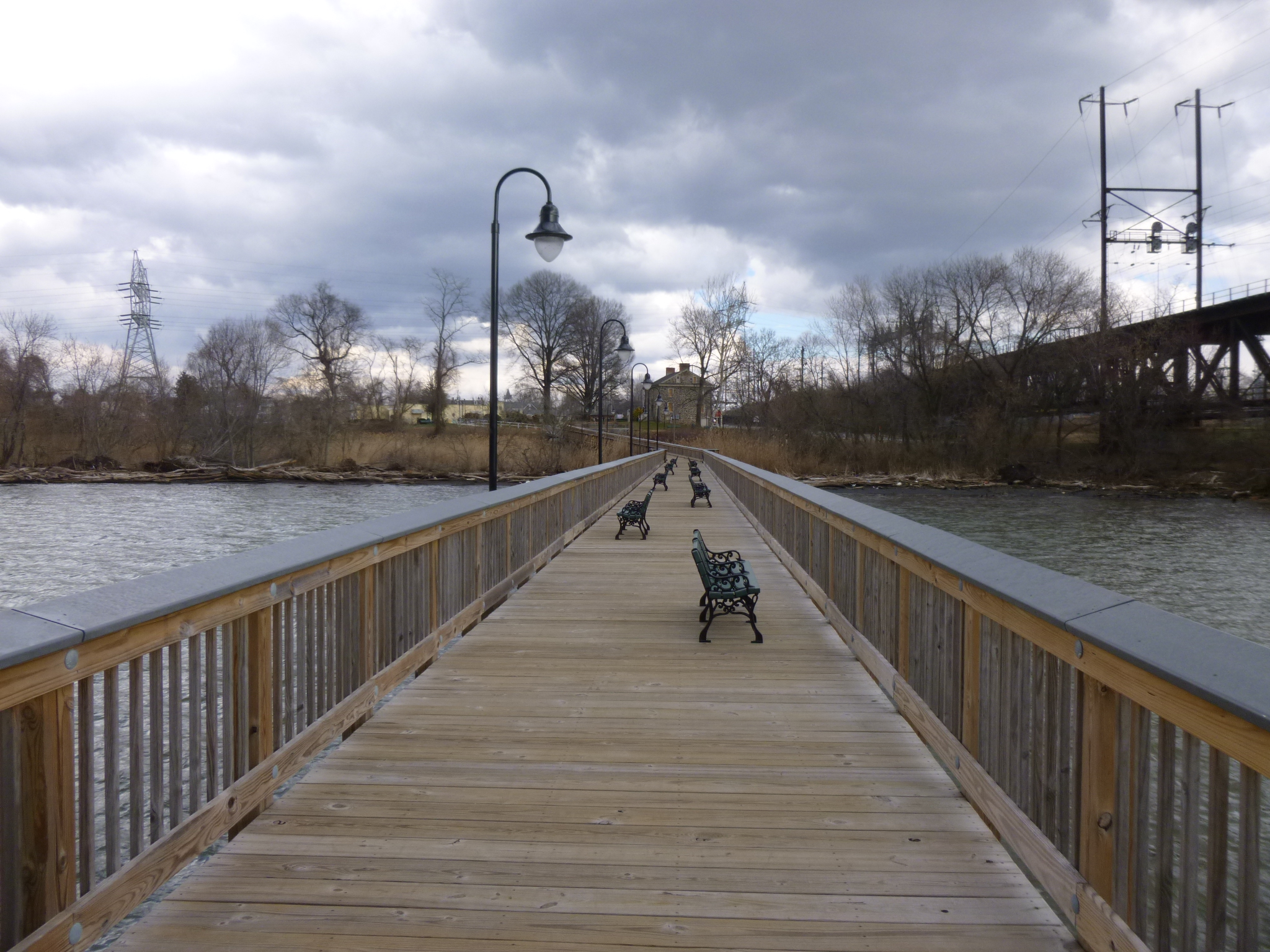
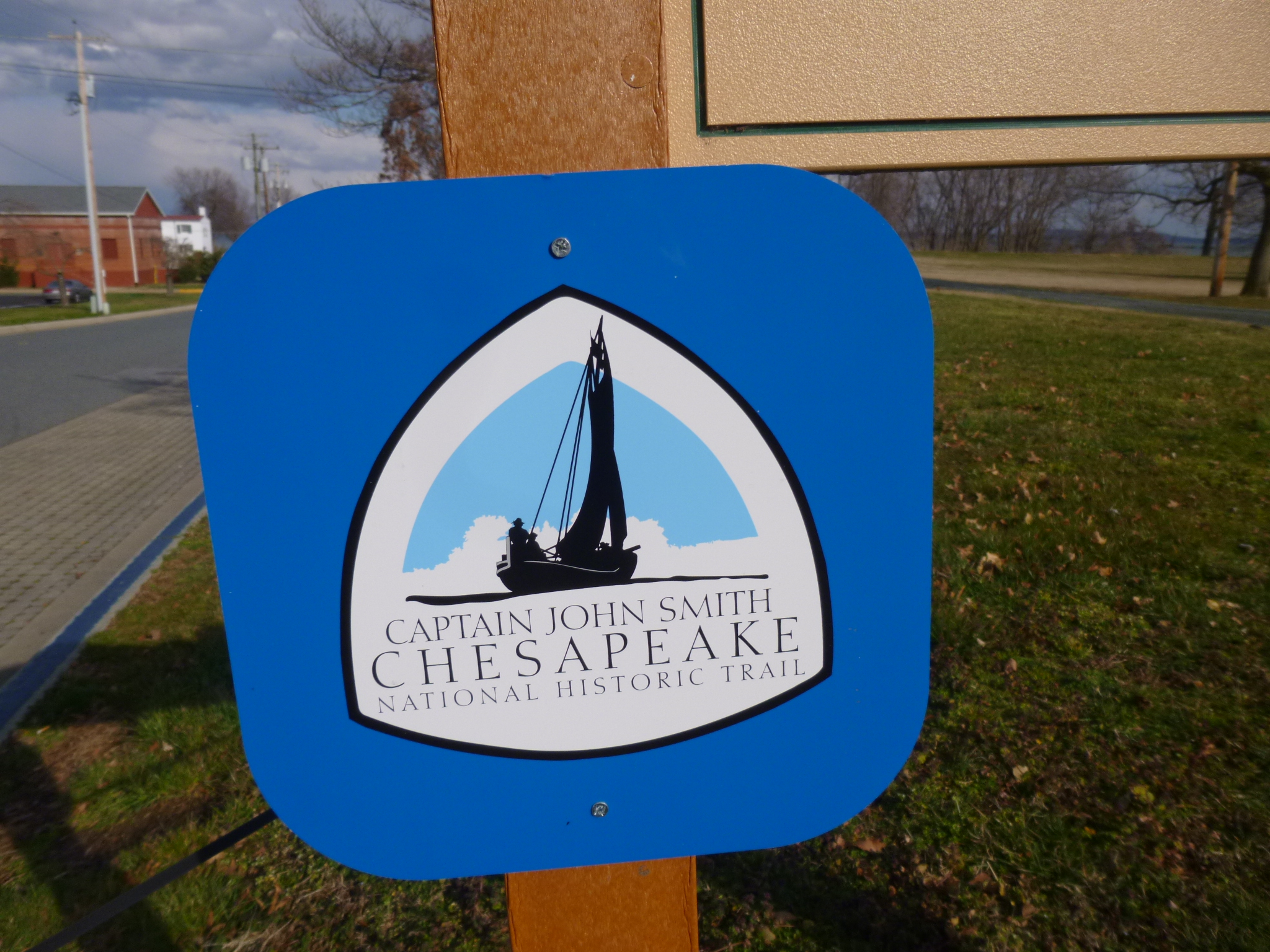
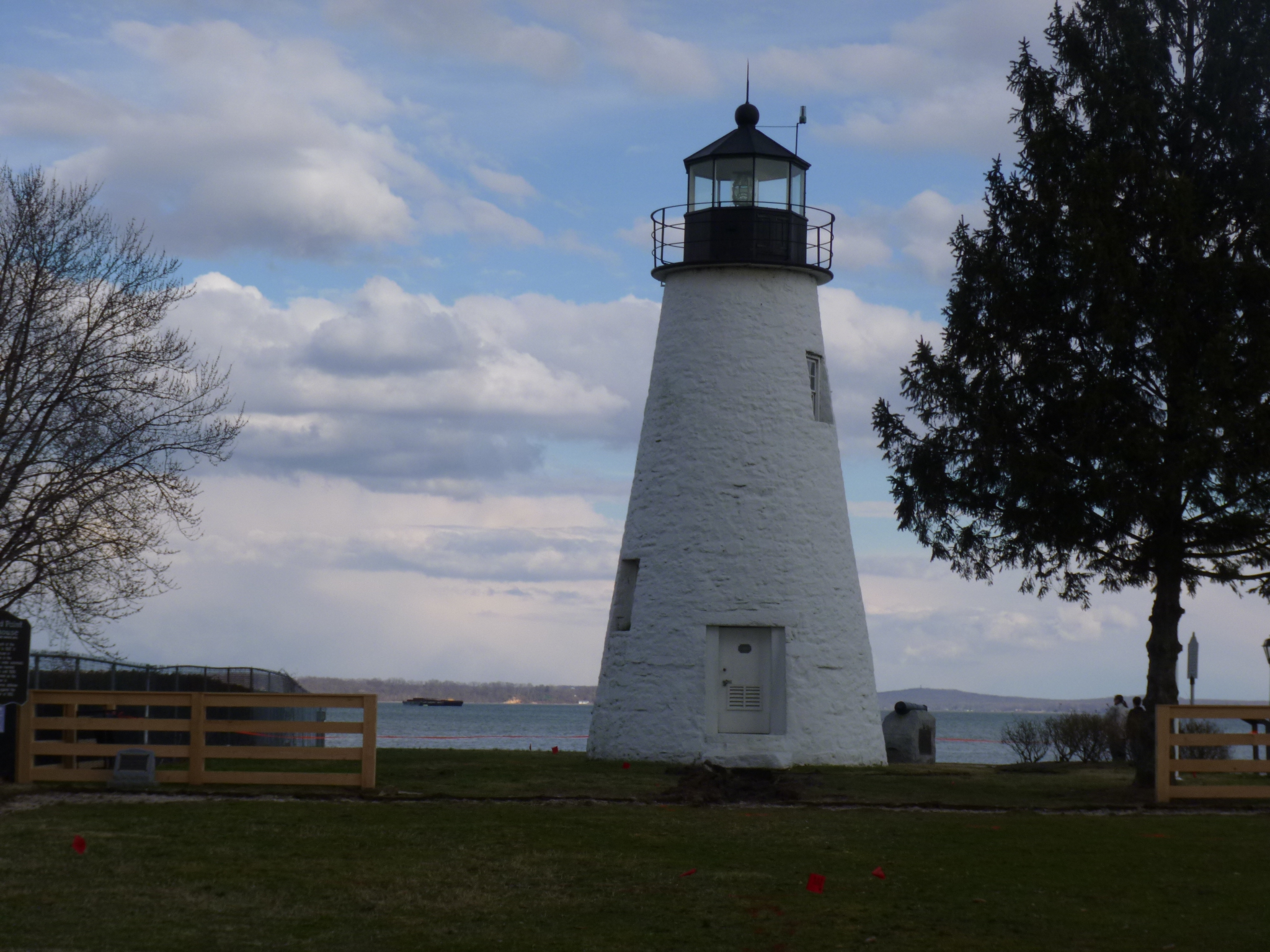
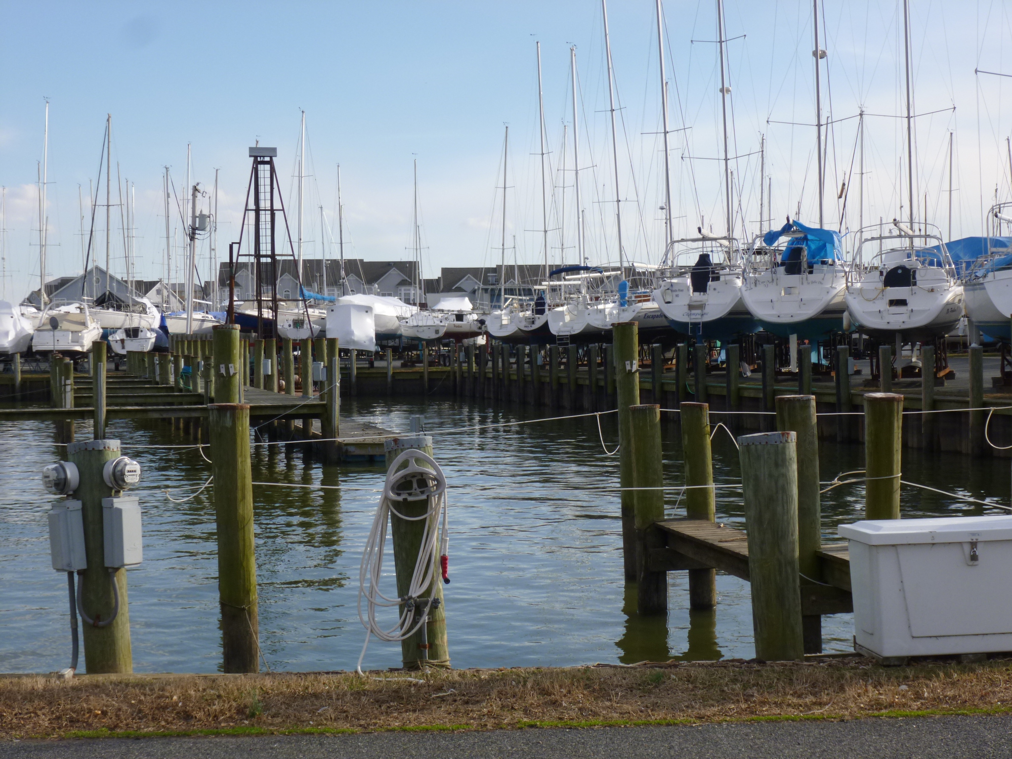
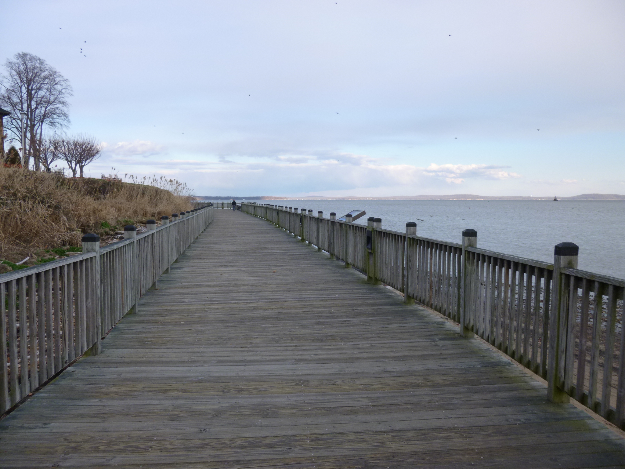
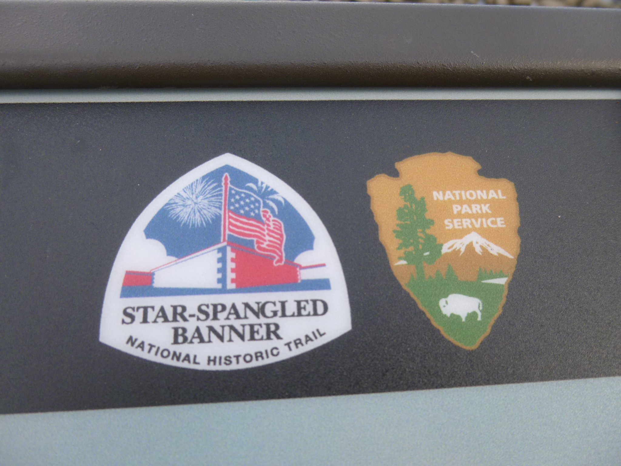
From there I drove a few miles over to the town of North East for some more walking. I love these little coastal towns and that’s why I don’t make too much progress around the bay – I stop in lots of them! After walking a bit in North East, I crossed the Susquehanna River and stopped in Havre de Grace, my favorite town of the day. Havre de Grace is at the very top of the Chesapeake Bay and was a big fun town to walk through with several walking paths, one of the oldest continuously working lighthouses on the east coast, and a long boardwalk around the top of the bay where I discovered a new national park thing called the Star Spangled Banner Trail. The trail only became a reality last year to commemorate the bicentennial of the War of 1812, and connects many historic sites in 3 different states that were somehow involved in the British invasions. I’m going to have to look into this more – there are apparently several national park “trails” that link together various sites of historical impact (uh-oh – yet another road trip idea!!) Tula and I finished our walking for the day, and since pets weren’t allowed on the boardwalk, I put Tula in the car and went out on the boardwalk for an extra mile or so. That’s when I learned more about the War of 1812, and how the British burned most of the Havre de Grace (along with many other places) during their invasion, and destroyed what they couldn’t burn. The “bombs” that the British used during this war gave off a red glow, and they’re what inspired Francis Scott Key to write the Star Spangled Banner, which was his poem set to music that already existed. I didn’t realize the battles that inspired him were the ones that took place in the Chesapeake Bay – I guess I thought he was farther south when he wrote this – don’t know why!
Then I drove down part of the west side of the bay during the twilight hour, and crossed the Francis Scott Key Memorial Bridge and stayed south of Baltimore for the night.


Maryland – Tuesday, March 12
It rained a lot last night, and was still raining this morning, but I was going to start my day off with a little driving, so that was okay for now! Last night I had the news on, and as I was working on the computer, I vaguely heard part of a story about a free dental clinic this weekend and that donations were still needed. My ears perked up when I heard a request for donations, and I heard something about a Mission of Mercy, but by then the story was nearly over and all I heard was that this dental clinic was going to happen this weekend in Salisbury, where I was staying, and I barely got the phone number. It was too late to call last night, so I called this morning and talked to a lady who’s involved in organizing the dental Mission of Mercy. This happens once a year in Salisbury and is a good opportunity for those who can’t afford dental care to come in for cleanings, tooth extractions, fillings etc. Many people volunteer their time and skill, but they still need to raise a lot of money for supplies, and they still had a ways to go, although they had raised a majority of the funds. She told me she had to be out of town today, but that I could drop my donation off at any of the branches of the bank in town, and the tellers were all familiar with the program and would get it to her, since she also worked at the bank. So I wrote a note and a check and set off in the rain to find the closest branch of the bank. I dropped it off and the teller knew where it needed to go, so that was accomplished.
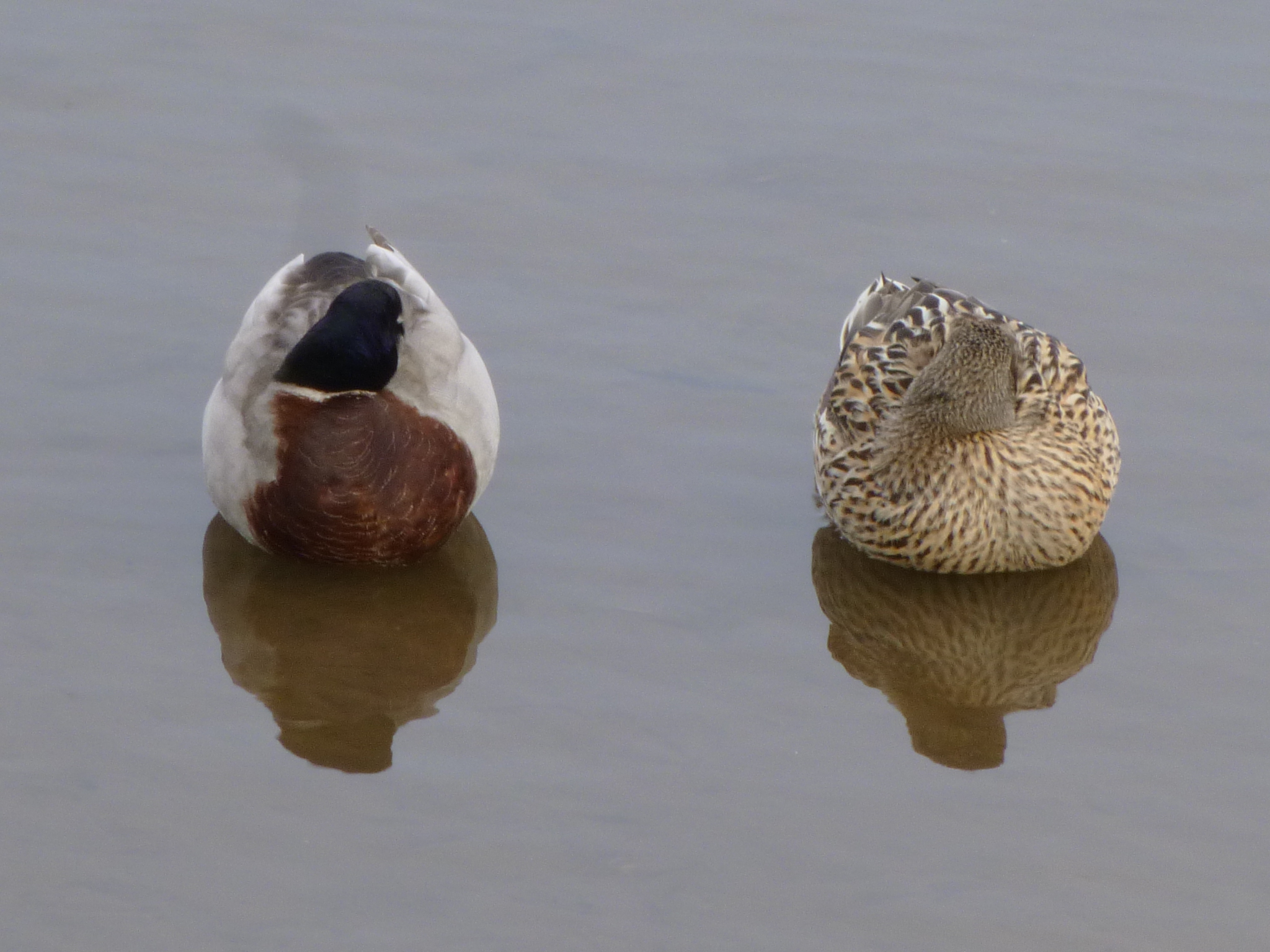
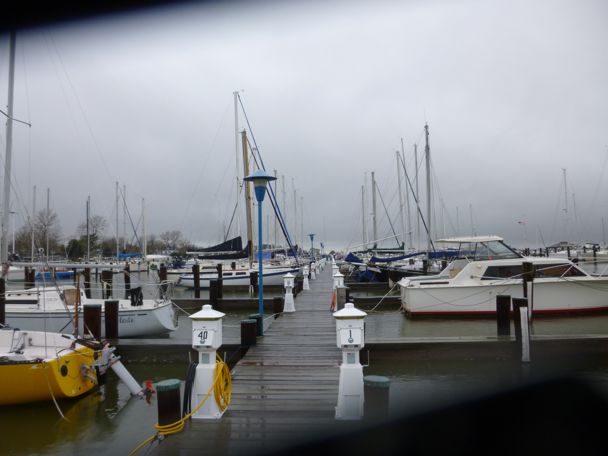
Then I drove west to the eastern shores of the Chesapeake Bay. It rained hard on the way over there, but began to let up a bit as we got closer, although it was still a gray day out. My plan was to meander north along the Chesapeake Bay, stopping in some of the little towns along the way. The first town I came to was Cambridge, founded in the late 1600s. Tula and I were able to get out for a soggy 2.5 mile walk, a bit through town, and a lot through old neighborhoods with big brick or wood houses built in the 1700s. There was a little park and marina with a river lighthouse, and I walked way out on the long docks by that. It started to rain again just as we got back to the car.
Lots of rivers feed into the Chesapeake Bay and we crossed a big one on a long causeway as I headed for Easton, where we got out for another 3 miles of walking. Easton was also settled in the late 1600s and was a big fun town to walk through with lots of antique shops and cafes and interesting buildings. The rain had stopped and the sky was clearing and there were a lot of people out.
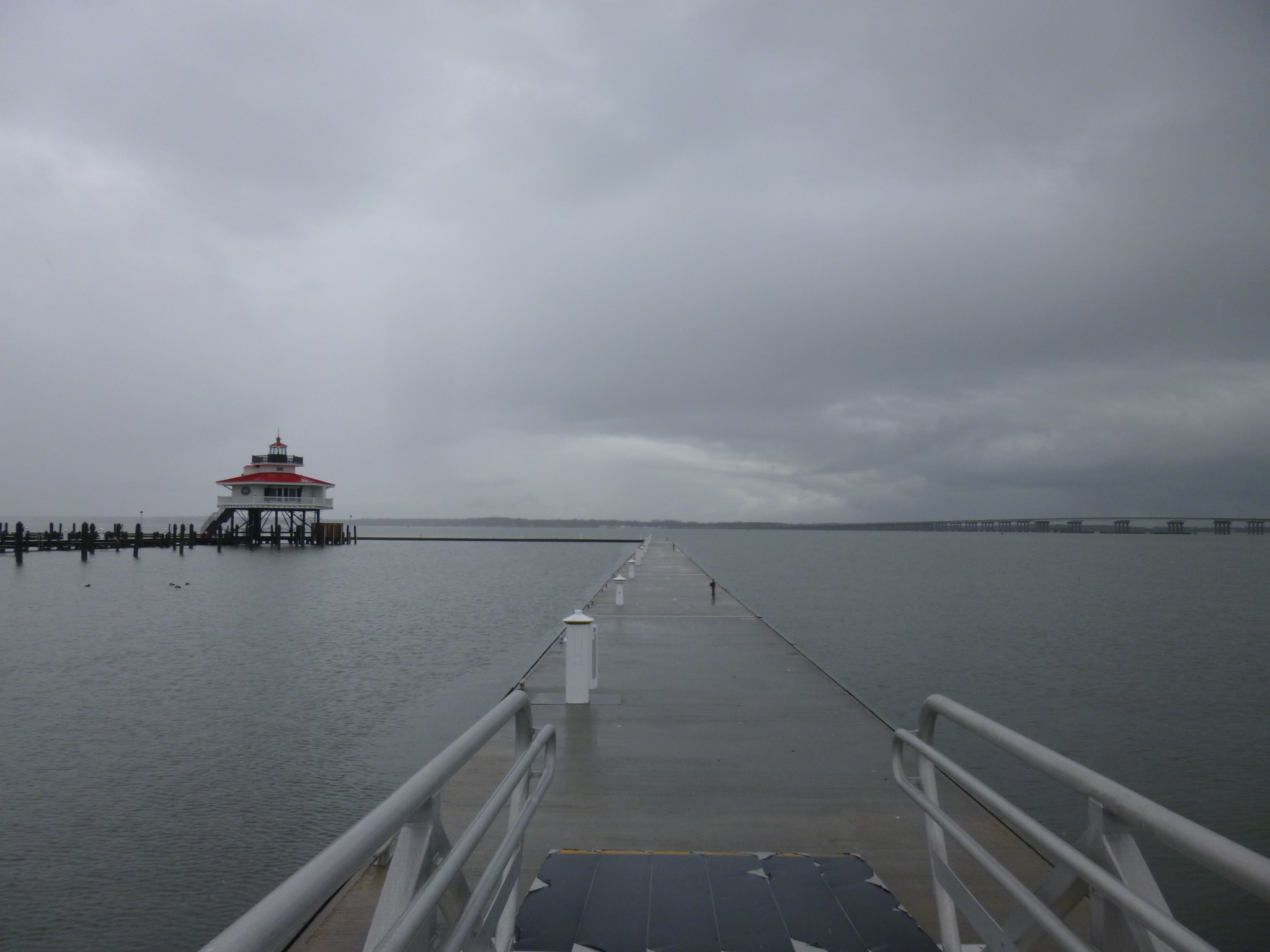
Then I drove west into the bay on a little peninsula to St. Michaels. With all the little rivers and tributaries there’s more water than land around, and it kind of made me think of the bayou country in Louisiana. St. Michaels was another old town, with a good downtown area and some little neighborhoods to walk in, but some of the streets by the water were a little flooded. St. Michaels started off as a shipbuilding center, and its nickname is “The Town That Fooled the British,” because during the War of 1812, the people in town put out all their lights and hung lanterns in the trees, which caused the British to shoot over the town instead of into it! And a lot of these towns depended on the Bay’s crabs and oysters for food too. When I was almost done walking, I came across a long bike trail, so we walked on some of that by the bay too, so I was able to walk 4 miles altogether, giving me an extra mile and a half for the day, when I was worried about getting it all in because of the rain! I really enjoy being able to walk through a variety of small towns.
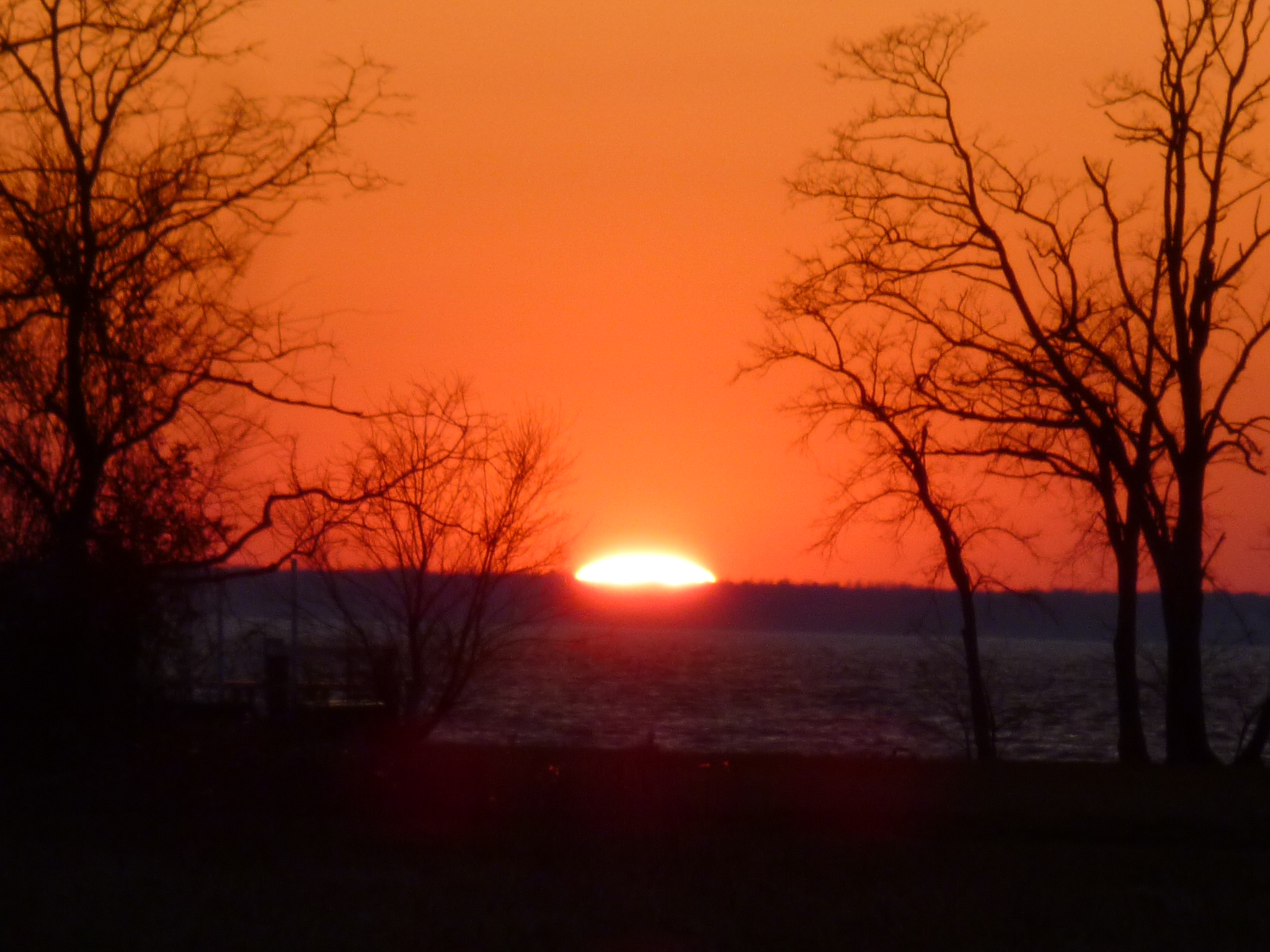
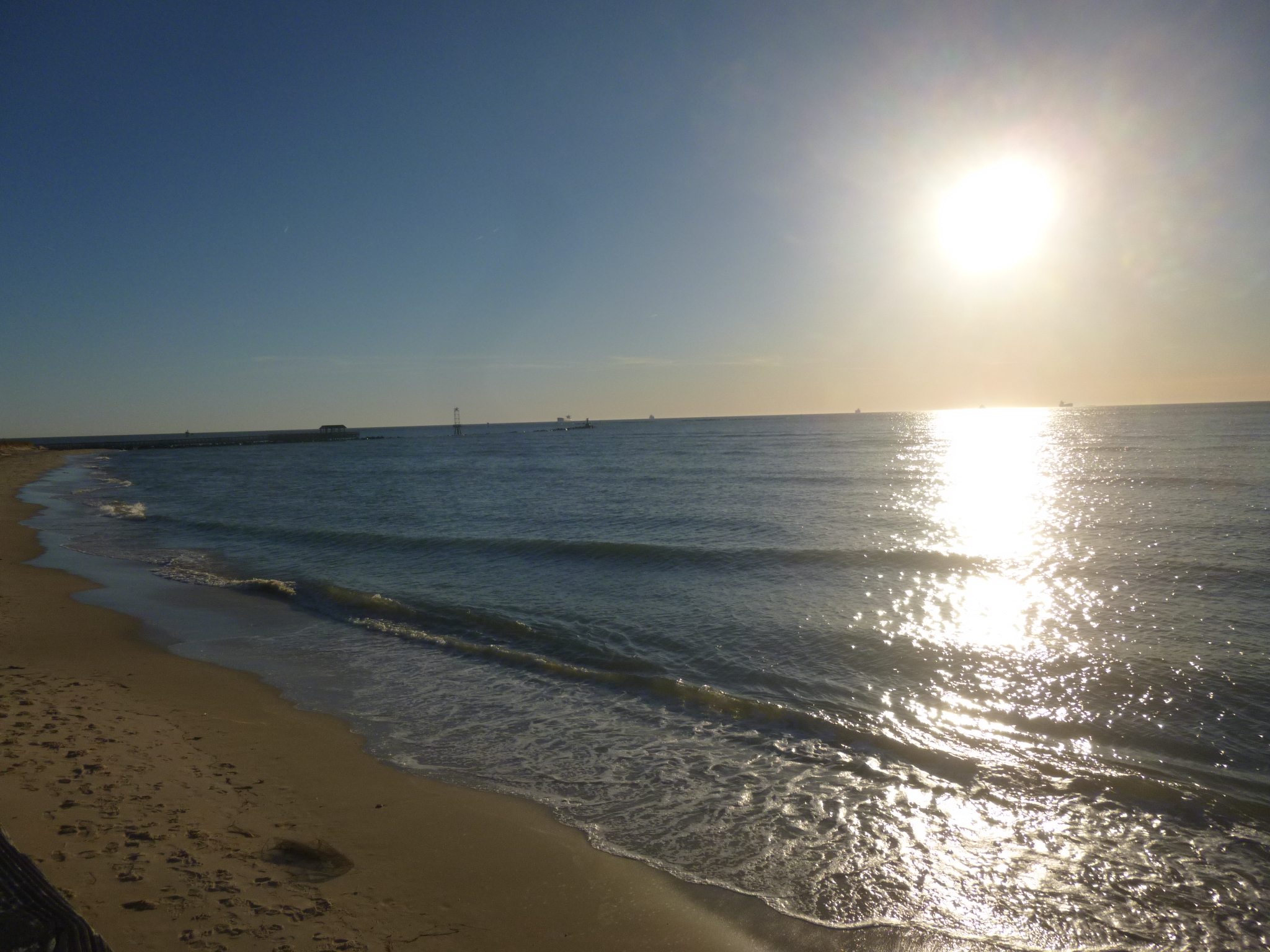
Then I just had to follow the road all the way out to its end on Tilghman Island which was almost in the middle of the Chesapeake Bay. I went through several tiny villages – they’re kind of isolated, and the little peninsula ended at a naval research station. I was able to see the sun set over the bay. As I drove back I saw a fox, but the picture is a little dark. I got back to the main road and continued to head north to Elkton for the night.


Maryland – Monday, March 11
On my way out to Assateague Island, I stopped in downtown Salisbury to walk along the river walk and saw lots of ducks and herons.
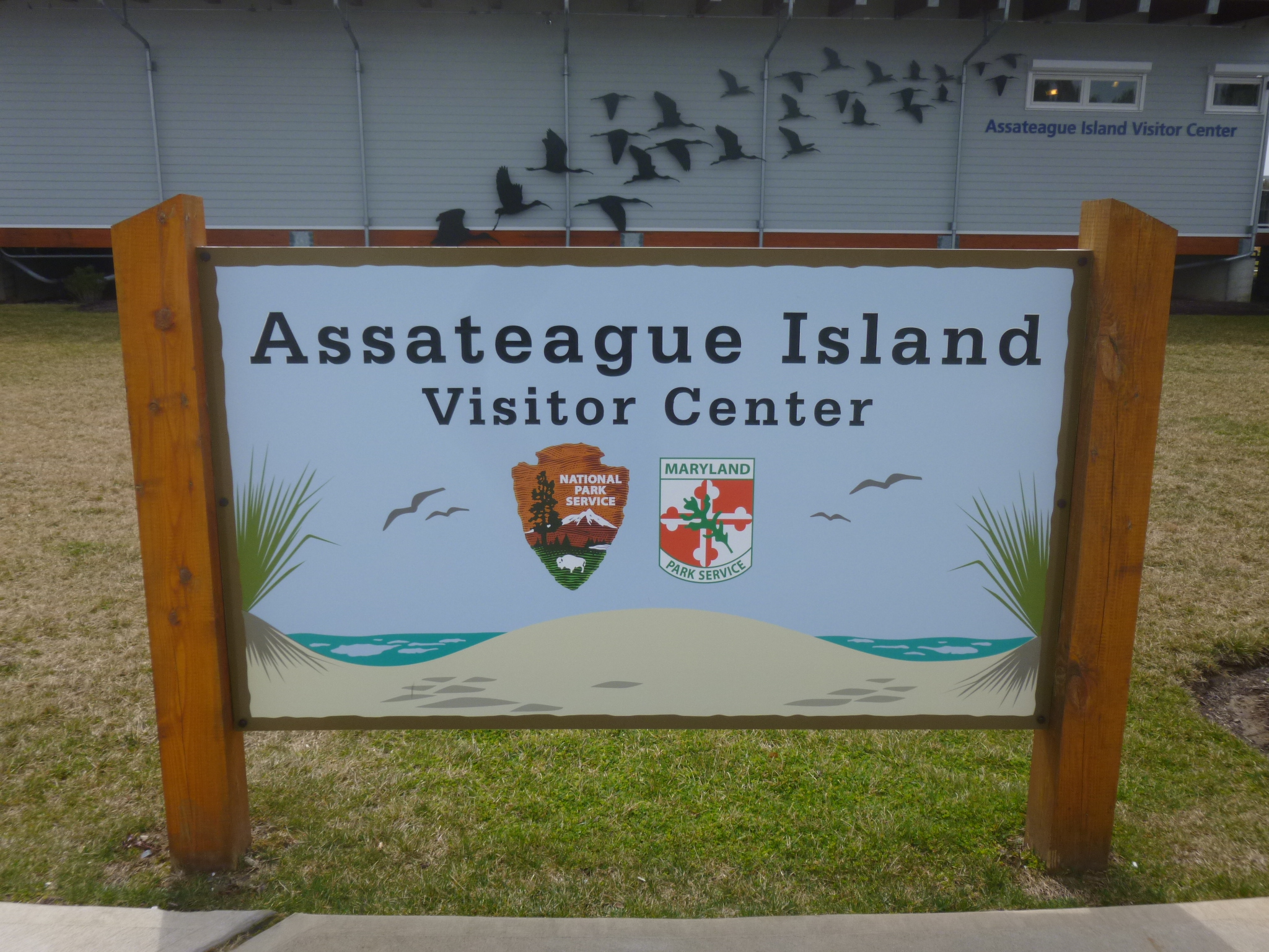
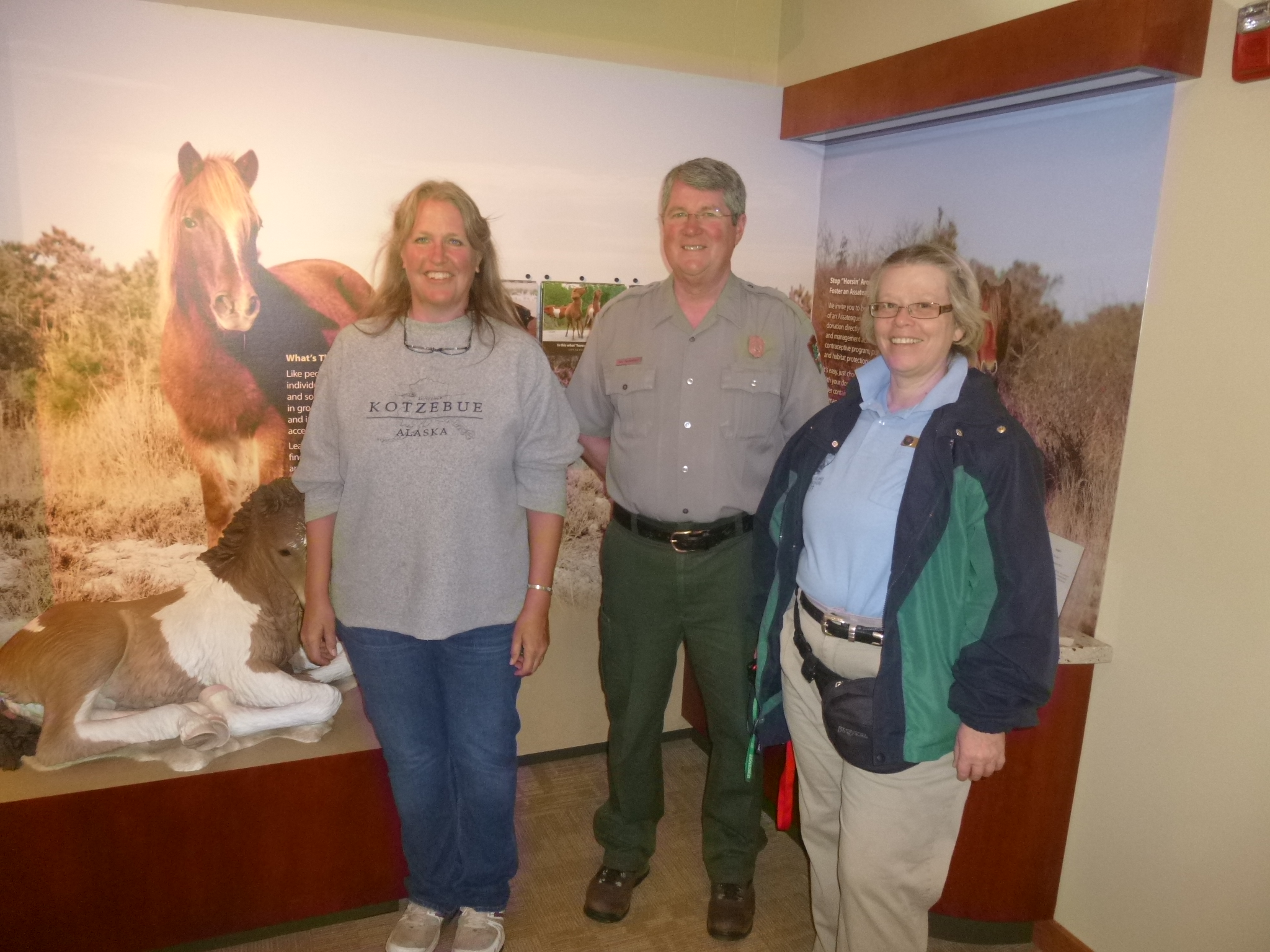
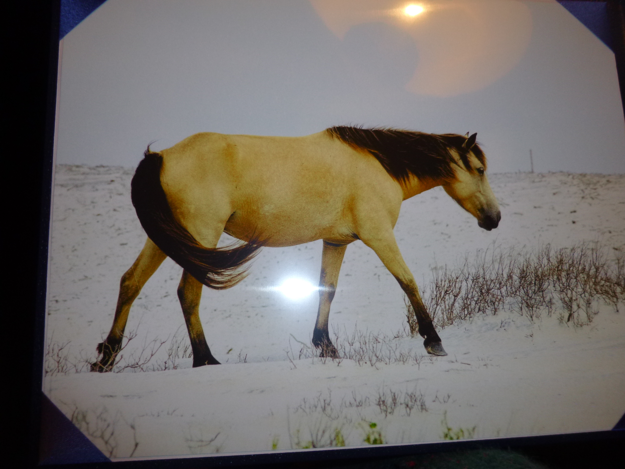
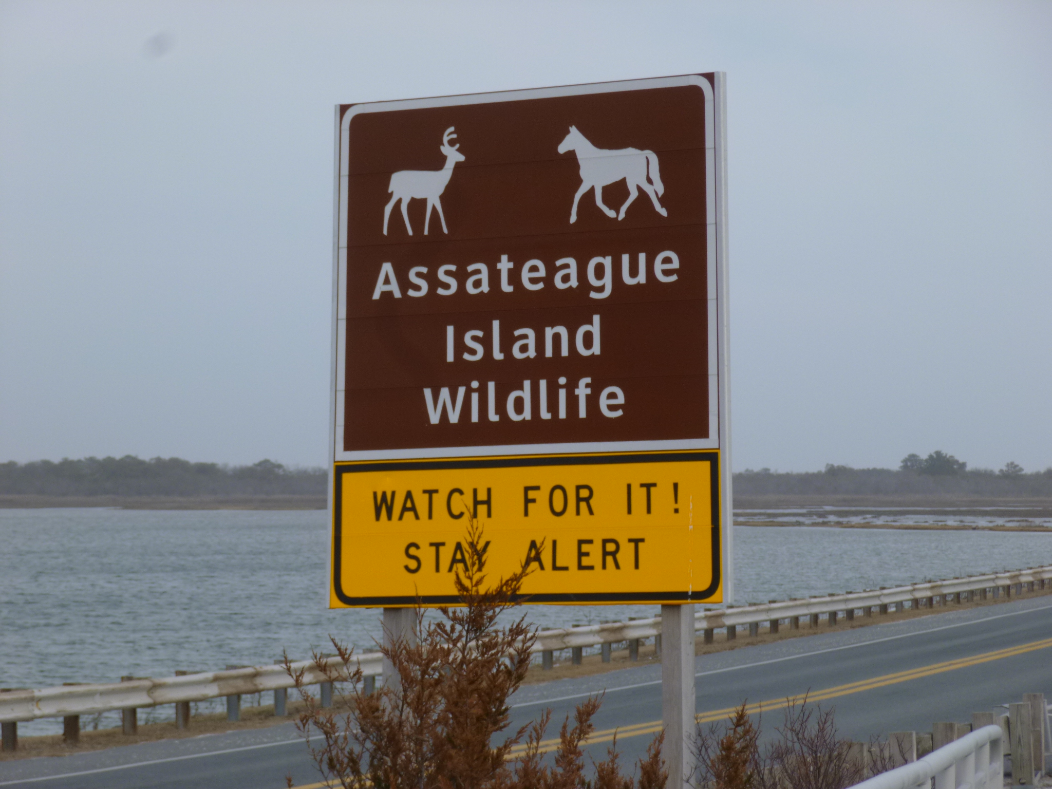
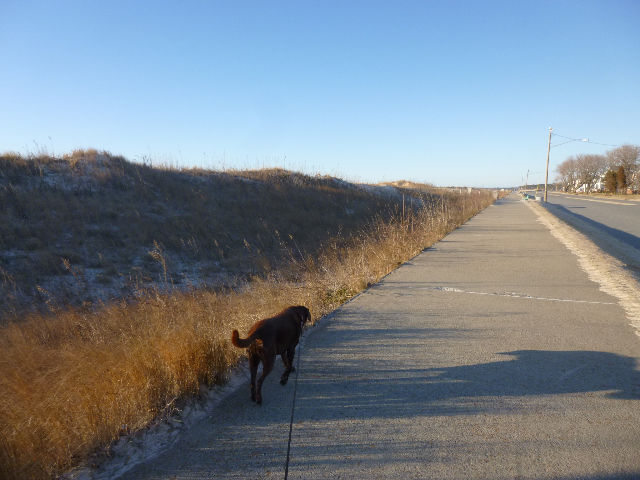
Then I drove out to Assateague Island, and stopped at the visitor center first. It was a good visitor center and I talked with the rangers quite a bit. They had a small aquarium with a pregnant male seahorse – baby seahorses must be really cute! There was a good video about the ponies, and the Maryland side of the island is managed differently than the Virginia side, since they do not participate in the annual swim/auction in Chincoteague. The Maryland side of the island can support about 80-100 horses, and there are currently 113. So they are using a contraceptive program that is working well enough that other groups are looking at it. Since mares can produce one foal a year, the goal is to limit the number of foals a mare can have in her lifetime. Once a year the rangers go out to the different bands of horses to fire contraceptive darts into the mares’ rumps to prevent pregnancy. They do this to all 2,3 and 4 year old fillies/mares. Mares who are older than 4 are allowed to have one healthy foal, and then the contraceptive darts are used for the rest of her life. This practice allows every mare to eventually have a foal, yet it keeps the island from becoming way over-populated, and it’s been a successful program. The ponies have been on the island for over 300 years, and have adapted well to their salty, marshy surroundings. They have short legs and sometimes look a little bloated, but that’s because they drink more fresh water than many other horses, because most everything they munch on has a salty film on it.
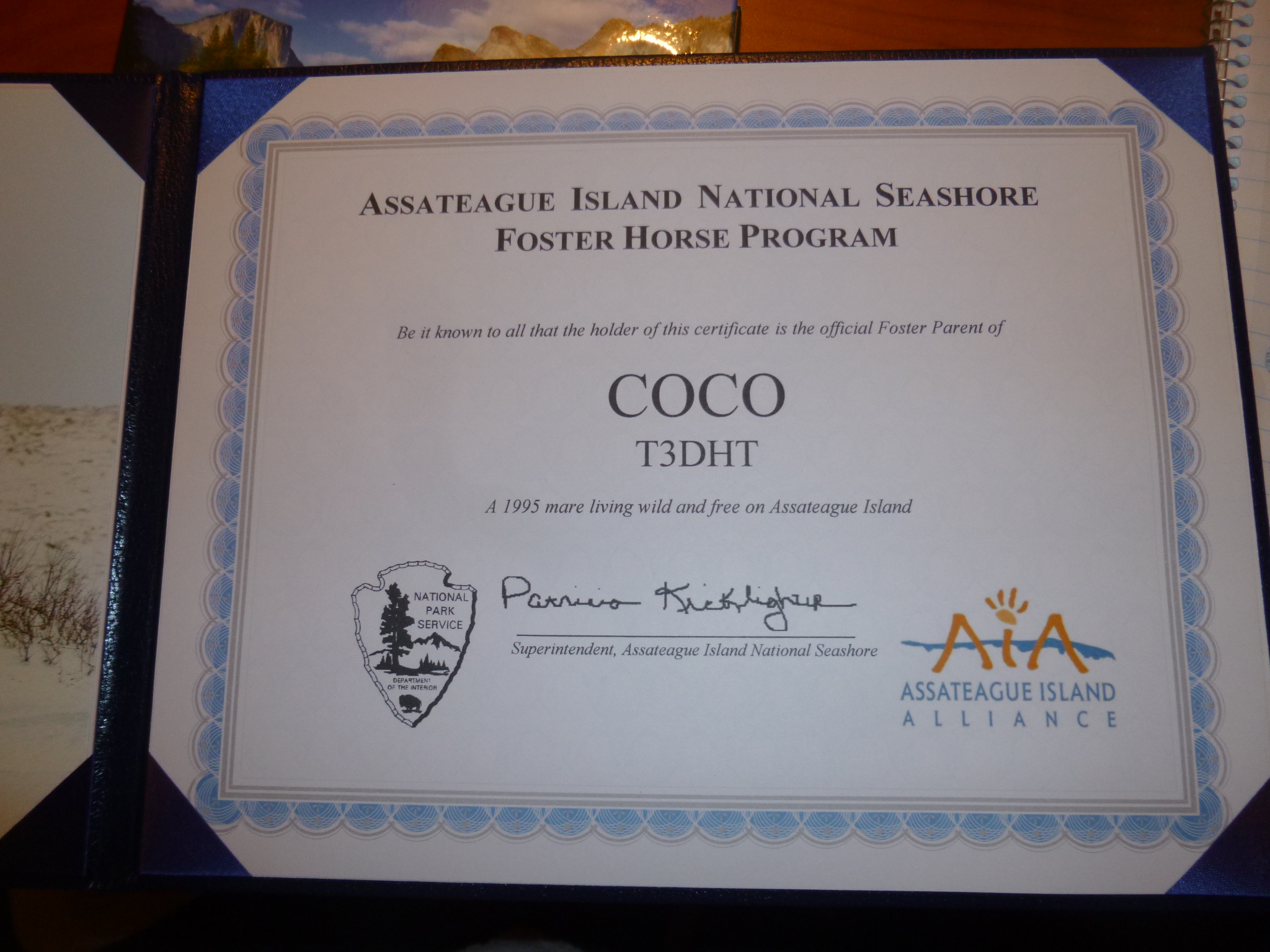
My donation today went to the Assateague Island Alliance, which helps the island and its ponies. The donation also allowed me to become the proud new “foster parent” of Coco – a buckskin mare who used to live in one of the island harems, but during the chaos and commotion of Hurricane Sandy, she was stolen away by another stallion and now lives in another stallion’s harem at the other end of the island! Coco is the only buckskin on the island – most of the ponies are pintos or chestnut colored, but there are a few other colors as well.
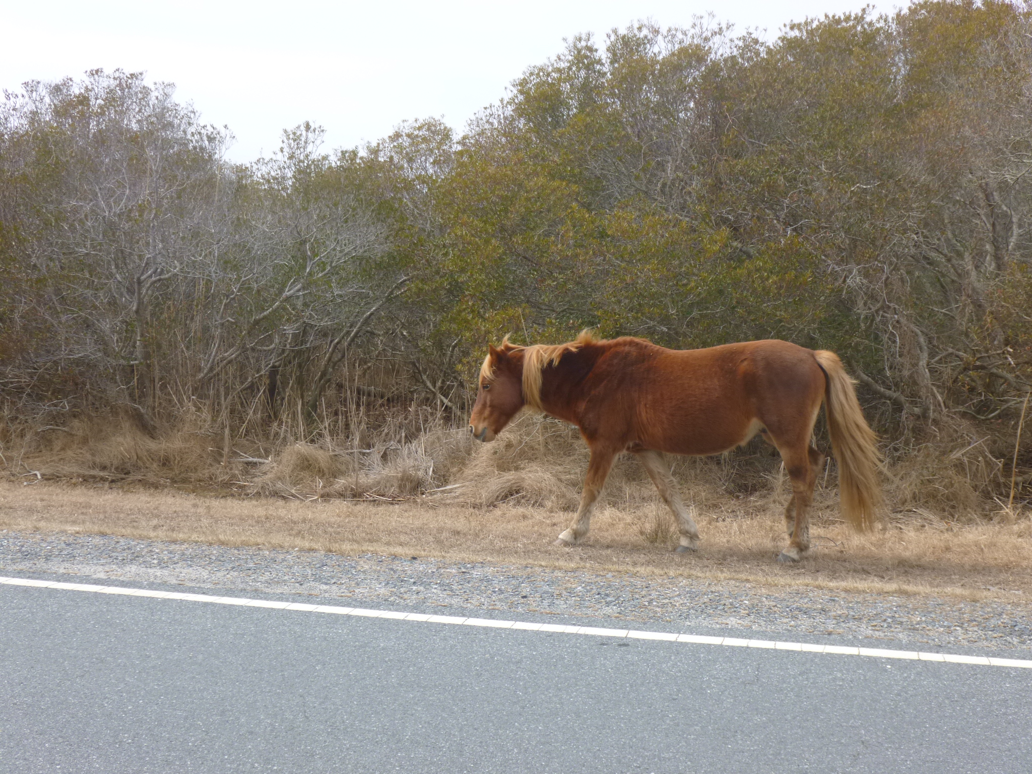
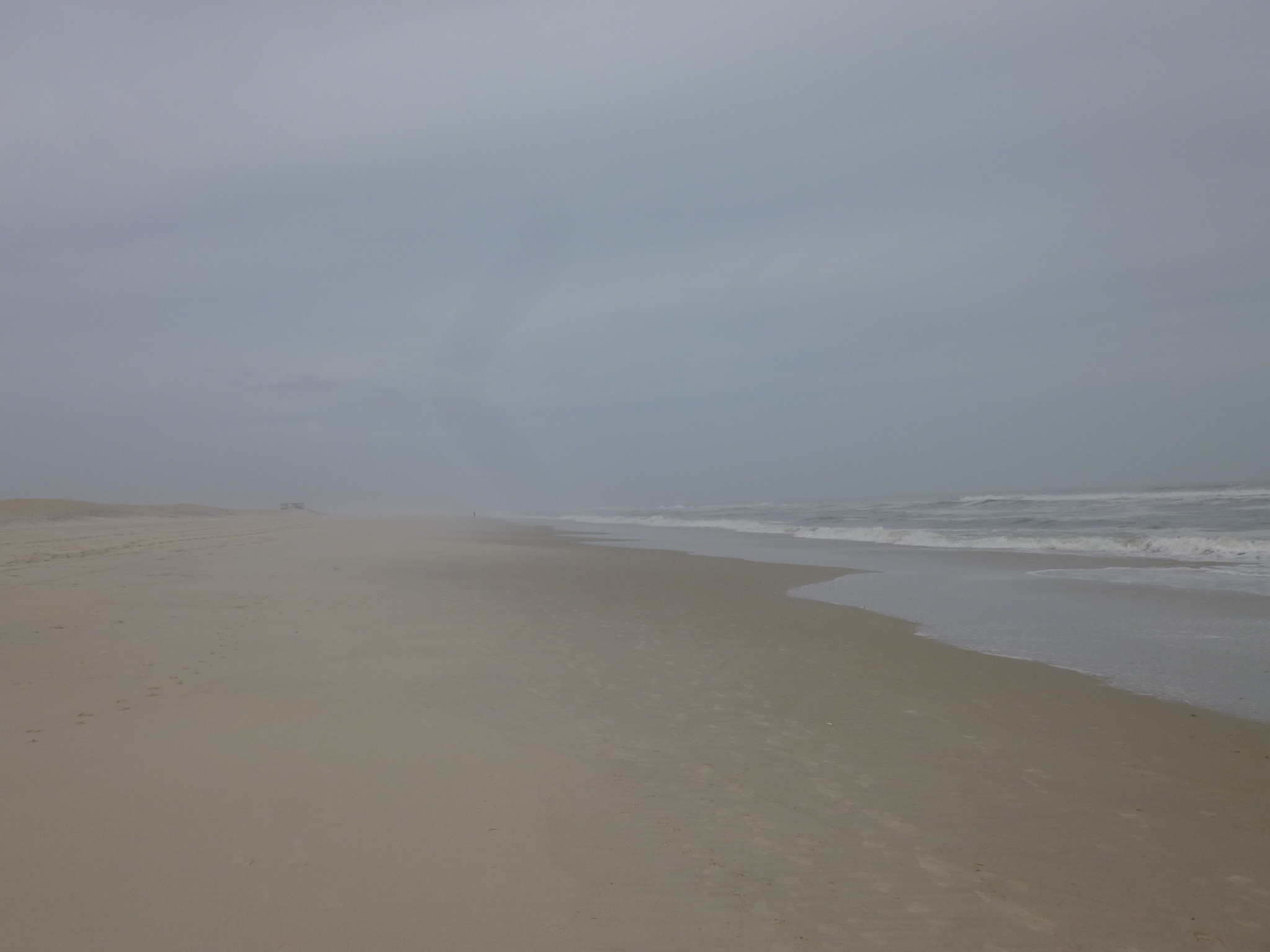
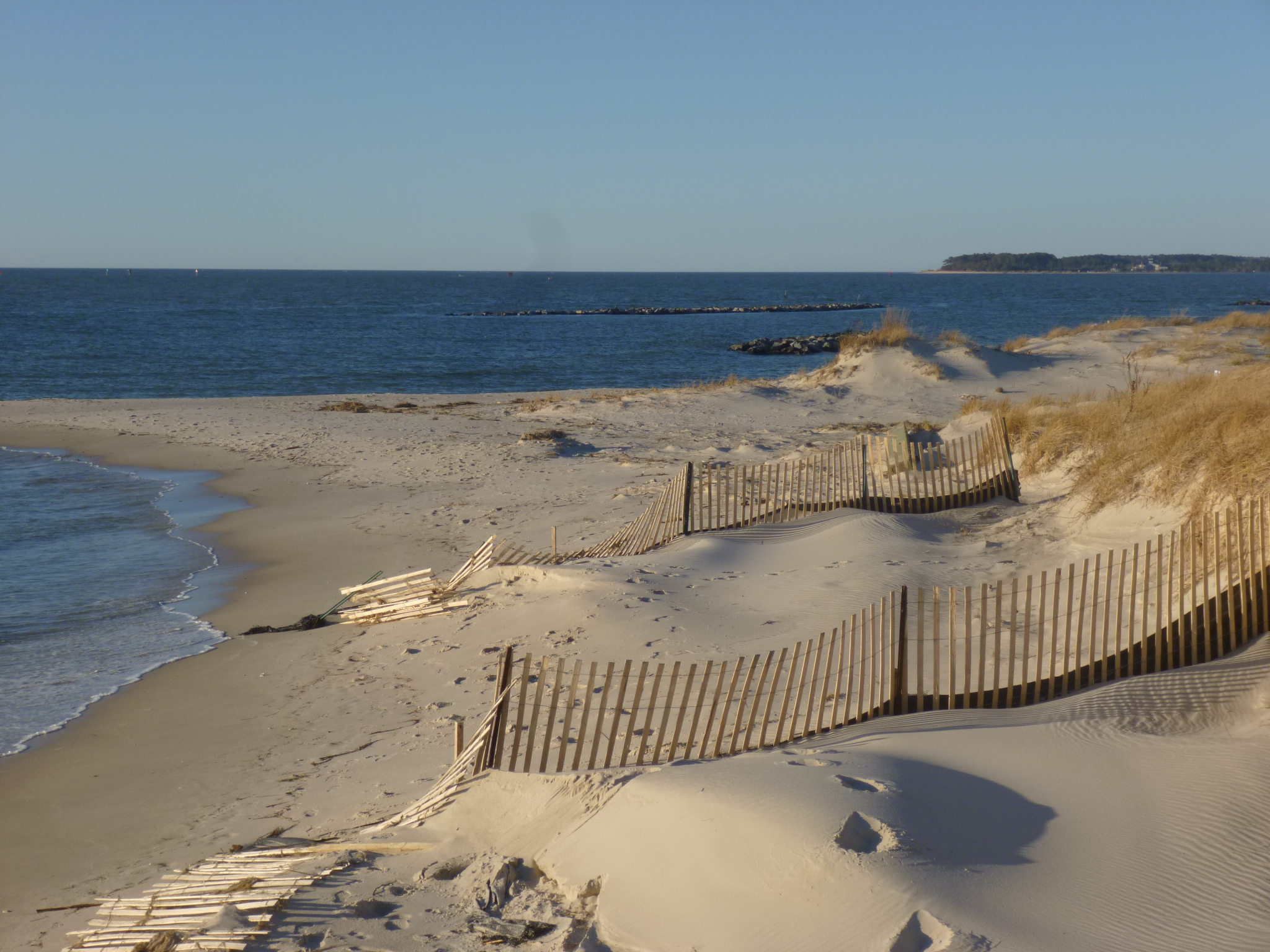
After the visitor center I drove across the bridge to the island and headed down the one road on the island. I saw a couple of the ponies nearly right away by the side of the road. There are signs reminding people that the ponies are wild, and they can kick, bite and charge, and there were actually a couple pictures of bite injuries in the visitor center. I stopped and walked on a couple short trails that Tula wasn’t allowed on. And the road and trails were closed about halfway down the island due to wet conditions. But there was a beautiful beach, and Tula and I walked a couple miles along the ocean, listening to the waves and gathering some shells. It was kind of misty out and the beach was absolutely deserted as far as I could see – it was beautiful. I could see 5-6 trails of hoof prints, and knew the horses had been walking the same beach earlier! But I didn’t see any on the beach. As I began to drive back out, I saw 8 ponies – all grazing on the roadside grasses. They totally ignore cars and people. most of the rest of the horses were out of sight, and many were probably on the inaccessible south end. I’m happy to have seen the ones that I did!
Then I drove back across the bridge to the visitor center and left the van there while Tula and I walked across the pedestrian bridge that was side-by-side with the vehicle bridge – I can’t resist walking on bridges when I’m able to! And I liked the fact that pedestrians and bikers had their own bridge – I don’t see that very often! We walked partway onto the island too, to get some more distance – but I didn’t want to go down far enough to where I’d seen the ponies. From all the manure and hoofprints around, it looks as though the ponies sometimes come right up to the bridge! Needless to say, motorists need to use a great deal of caution. Camping is allowed on the island (I only saw one motor home – the weather wasn’t great) and people have to respect the ponies and their space, even though the ponies do not respect campers’ belongings!
Once I saw everything I wanted to, I decided to drive along the narrow spit of land between Ocean City, which was nearby, and the border of Delaware. With water on both sides, I thought it would be a pretty drive with a pretty sunset, but the space was entirely filled with mile after mile of hotels, condos, rental properties, and shops – many of which were closed. It’s just hard to imagine the need for so many places to stay during a relatively short season.


I took a short break for a good family weekend and grandma time, and I’m babysitting today, and will get going again tomorrow 🙂
Maryland – Sunday, March 10
My plan today was to take a short drive around Chincoteague Island, which is a small island, and then cross the bridge onto the Virginia side of Assateague Island, which is s little bigger. One of my favorite childhood books was Misty of Chincoteague by Marguerite Henry (and my old horse at home is names Misty!) and I’ve always wanted to see the islands, and maybe the wild ponies. People live on Chincoteague, not the ponies. It’s pretty much the other way around for Assateague. The only time the ponies come to Chincoteague is during the annual round-up in July, and they swim across the channel to corrals where many of the foals are auctioned off. It’s the Virginia way to control the herd size, because the land on Assateague can only support a certain number of ponies, which do live in a wild state with no human interaction other than the round-up – they are not given any supplemental food or medical care or anything, and tourists are not allowed to approach them, attract their attention or feed them – and campers must be aware that the ponies do not respect belongings! There is a fence across the middle of Assateague Island at the state line, so there are 2 herds of ponies, and they are managed differently. In Chincoteague, they’re owned by the Chincoteague Volunteer Fire Department, and they’re in charge of the annual round-up and they get the proceeds of the auction.
In order to get to Assateague, I had to cross through a big national wildlife preserve in Chincoteague, which is a Top 10 spot for birdwatching. There were signs all over the place that pets are not allowed anywhere on the wildlife preserve or the Virginia end of Assateague, not even if they’re in a vehicle. They are allowed on the bigger Maryland side of Assateague. So I couldn’t go looking for ponies this morning, but definitely will on the Maryland side! I drove around the rest of Chincoteague Island, which didn’t take long, and it’s still quiet before the rush of tourist season.
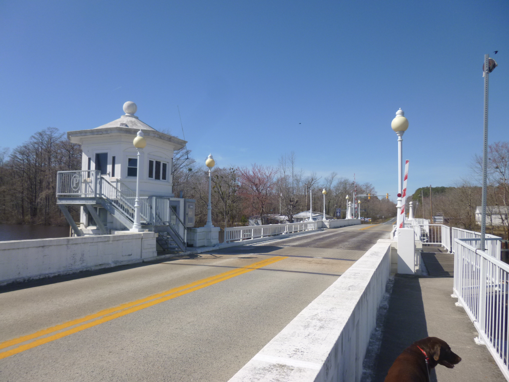
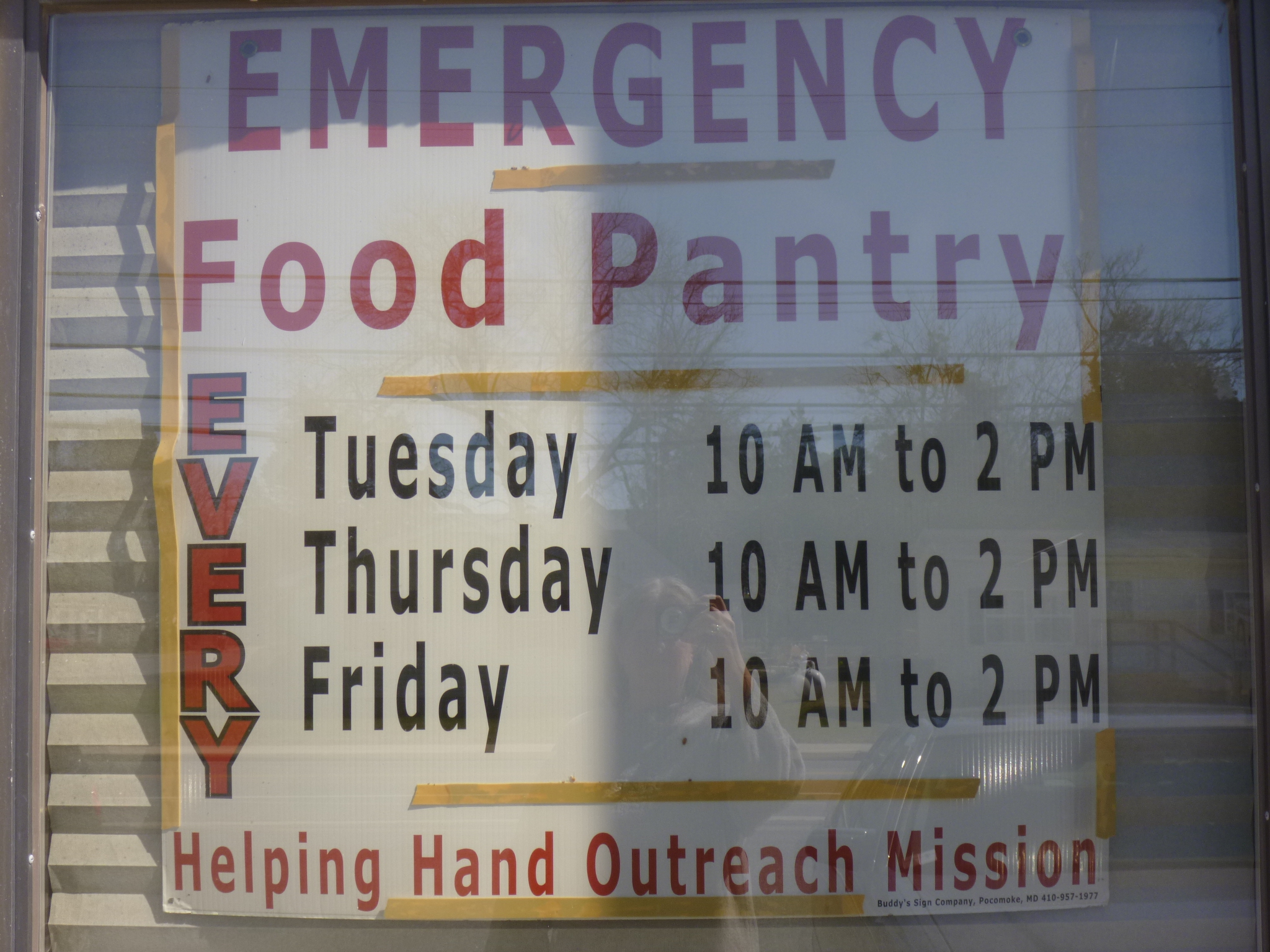
Then I was off to Maryland! I crossed the state line, and stopped in the first town I came to, which was Pocomoke City. I was going to skip it at first since we hadn’t been in the car very long, but then decided I may as well get out and start the first of the Maryland walking! There was a pretty little drawbridge over the town’s river and a path alongside the river, but we couldn’t go real far on it due to recent flooding. So we turned around and walked through town and one of the neighborhoods, and got a couple miles in. Then I decided to look up any food pantries in the area, but since it was Sunday I wasn’t hopeful about finding anything that would be open. But I did run across a big program called Making a Difference Together, which runs the Helping Hands outreach ministry and food pantry. It’s all part of the Miracle Deliverance Tabernacle and they have about a dozen different outreach programs, which seems to be organized by a very ambitious woman who also became a pastor. I wanted to make a donation to them, and read that the food pantry was located down the street from where I was parked – at a different location than the church. I figured since it was Sunday morning, the church would be in the middle of services and I didn’t want to bother them, so I just drove to the food pantry to take a picture, and then I was going to mail in the donation. So I got out a took a picture of the food pantry sign and the building, and then a man dressed in a suit stepped out – probably wondering why I was taking pictures of the building. I was unable to see inside the building. It turns out that I was there on the one day a YEAR that church services are held in the food pantry building, because it was their annual big church dinner after the service and movie. Once I told the man what I was doing, they asked me to come in, and I met several of the ladies – all dressed beautifully in dresses and matching hats (and there’s me in jeans and a sweatshirt!). I was very worried I was interrupting them, but they assured me it was movie time, and the ladies told me about their food pantry program, and we all marveled about my timing to show up when I did with a donation. It was a fun stop, and nice to meet other ladies with such big hearts. And to think I almost didn’t stop in town!
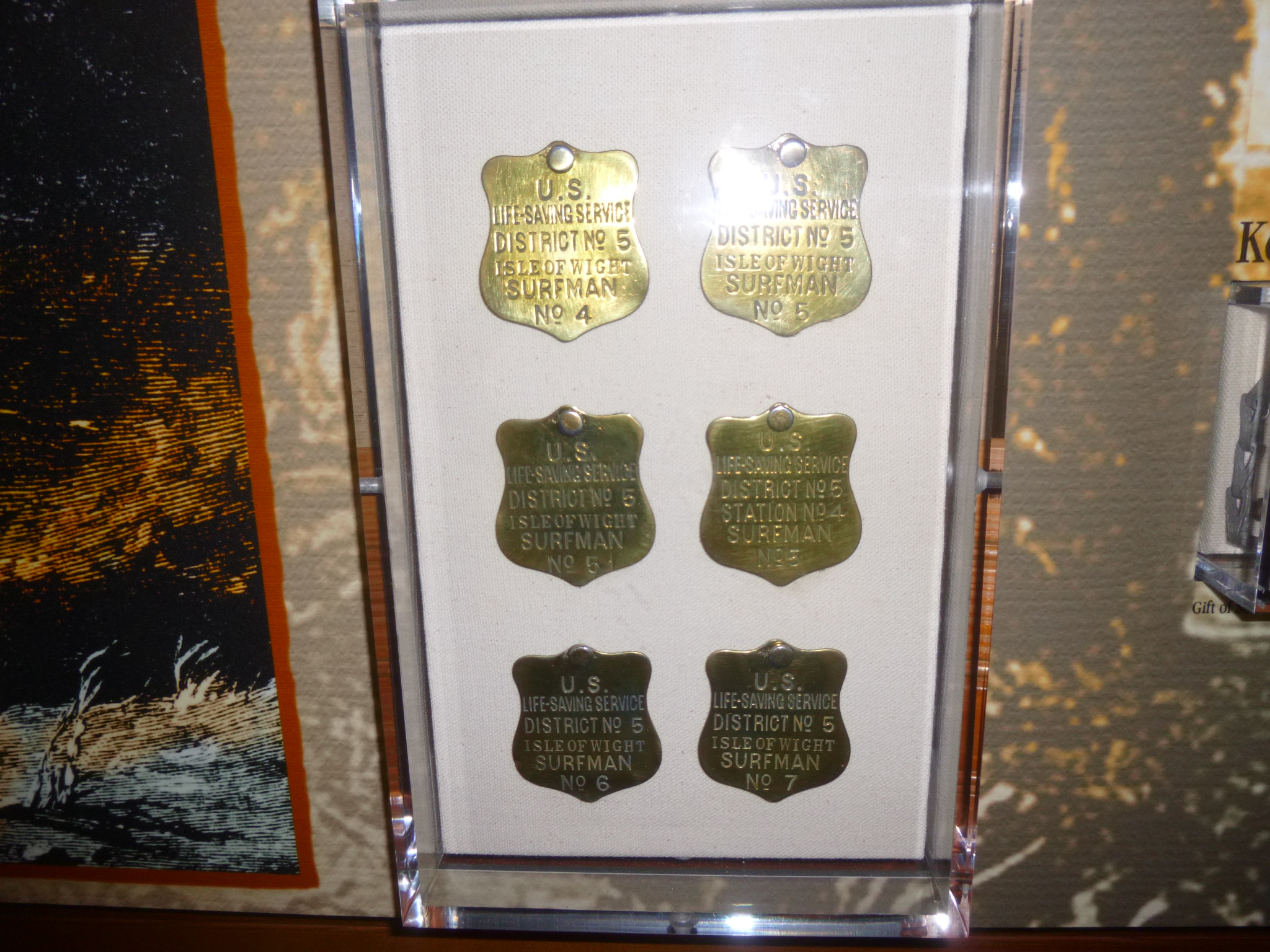
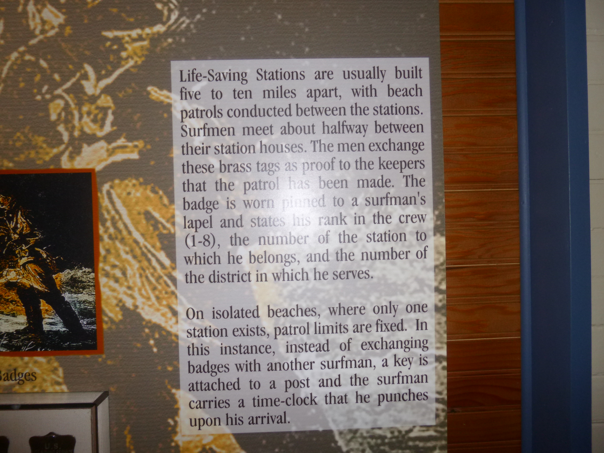
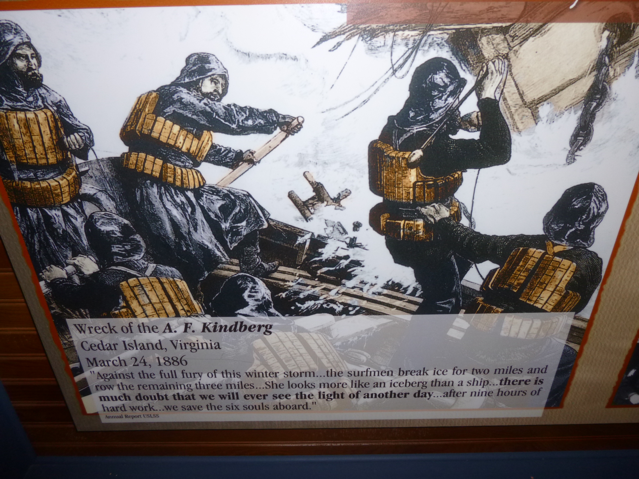
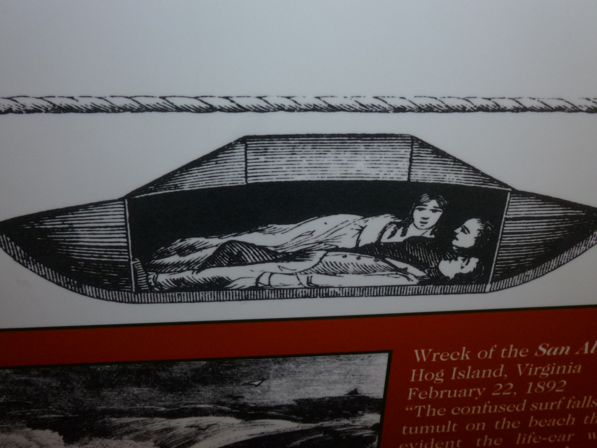
So after that unexpected visit, I continued heading north. I was aiming for the road to get onto Assateague Island at its northern end in Maryland, but then I decided to wait until tomorrow so I would have more time if I wanted to, because there was a visitor center and everything, and I didn’t want to be rushed. So I went to Ocean City instead, which is on the Atlantic Ocean, and that turned out to be a wonderful choice. There is a boardwalk that is over 2 miles long, and since it was the weekend, some of the little shops and food places were open, and there were lots of people out walking despite the fact it was kind of chilly and windy. At one end of the boardwalk there was a Life-Saving Station museum, and it was fascinating. Back around the turn of the century, life-saving stations were built along the outer banks areas in several states every 10 miles or so, since it was such a notorious place for shipwrecks. The men would work in shifts – usually a keeper and a crew of 6 “surf men”. They would patrol the beaches to look for trouble, or in bad weather, to listen for it. They would meet up with surf men from neighboring stations and exchange tags to prove to the keepers that the whole length of beach had been patrolled. There were about 19 life-saving stations, and over the years they saved over 7502 people from nearly 300 shipwrecks. The museum had their big boats, their torpedo devices for shooting a rope over the surf, a capsule that 2-3 people could get in to be dragged in to shore, and other stuff. It was really interesting – what a courageous group of men! And there was also a display of swimwear fashion over the years, and samples of sand from all over the world – the little bowls of sand on display looked like different spices.
Then I got Tula and we walked as much of the boardwalk as we could. There had been damage during Hurricane Sandy, and parts of the boardwalk were brand new, and the middle section was closed off because they were in the process of re-building it. So I drove to the other end, and we were able to walk another couple miles down there. The surf was really rough, and even if it was a hot day, I don’t think anyone could have been swimming in it. I walked until it got to be evening, and people started leaving, and shops were closed, and it’s funny how quickly the place takes on kind of an abandoned air. But I actually got in an extra mile or so, and then we headed out of Ocean City and found a place in a smaller town for the night.


Virginia – Saturday, March 9
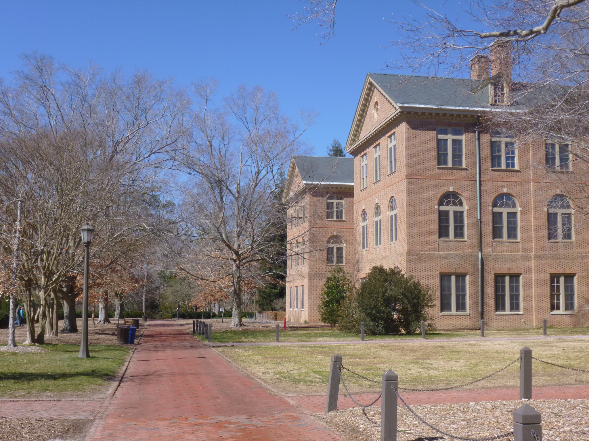
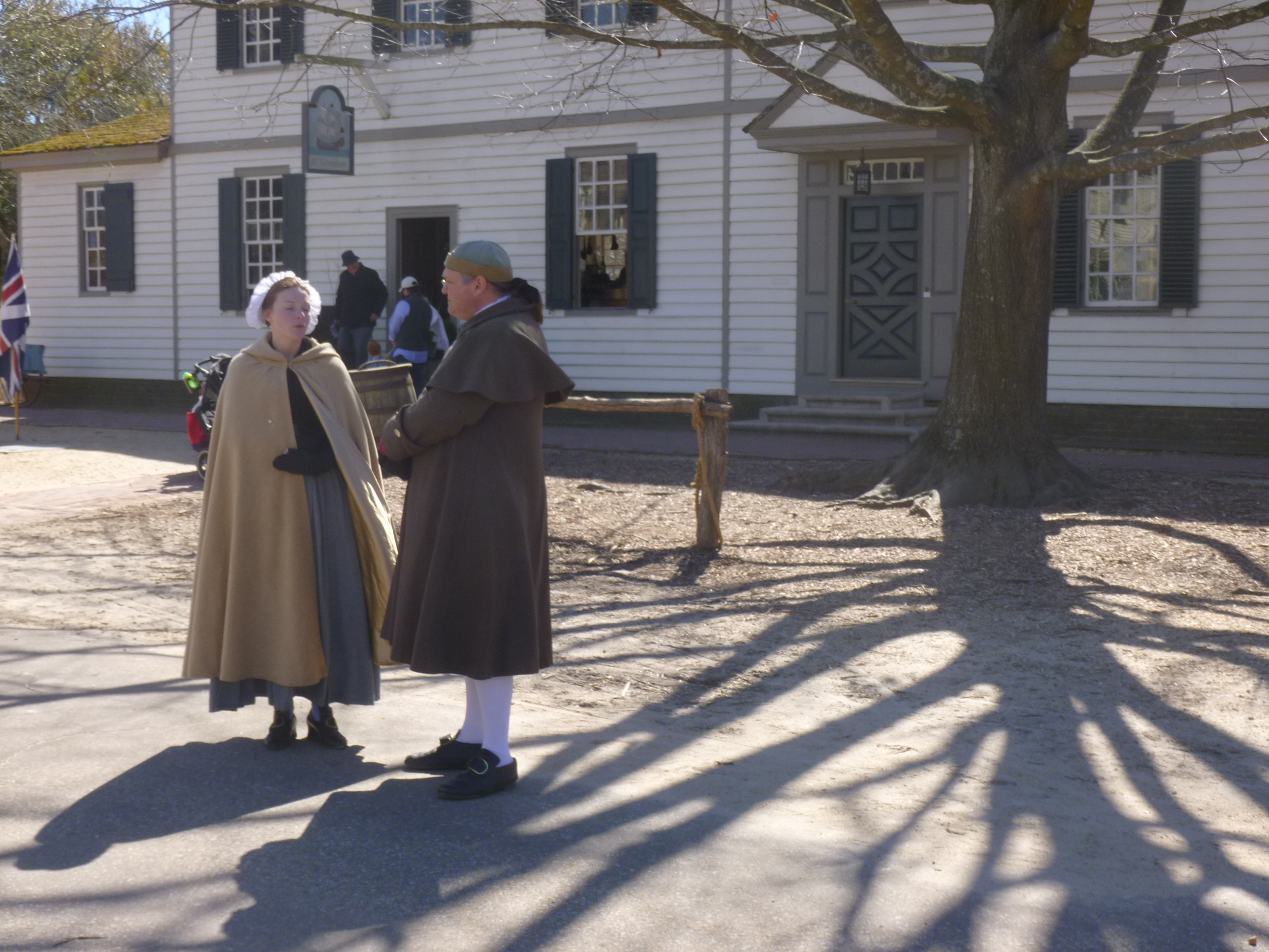
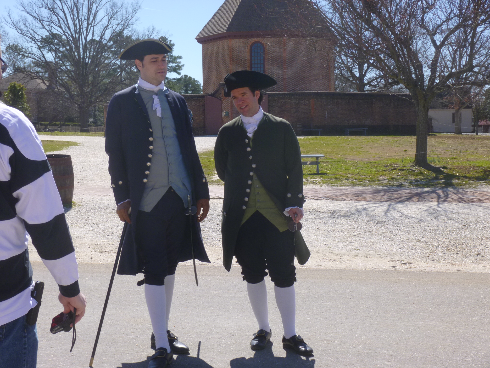
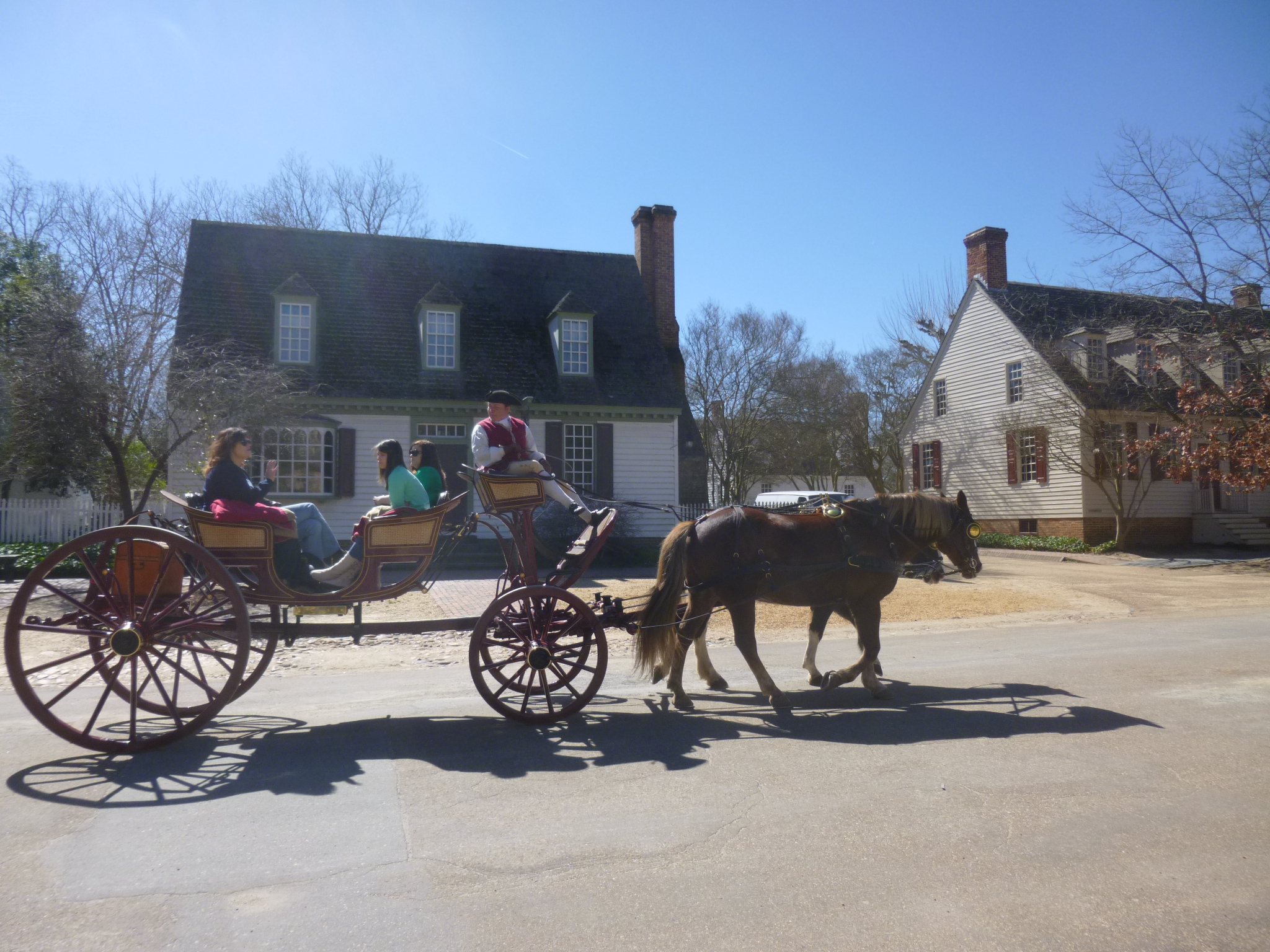
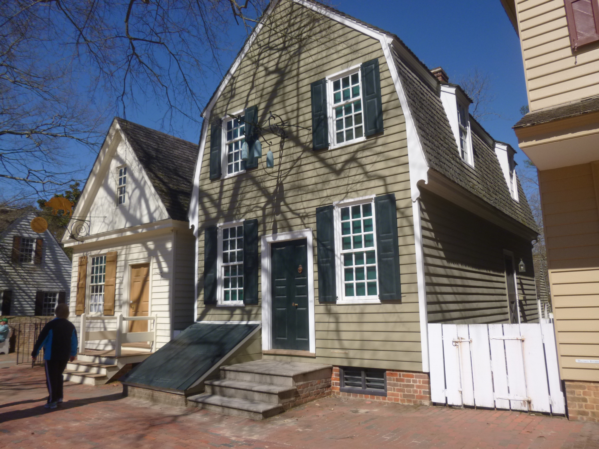
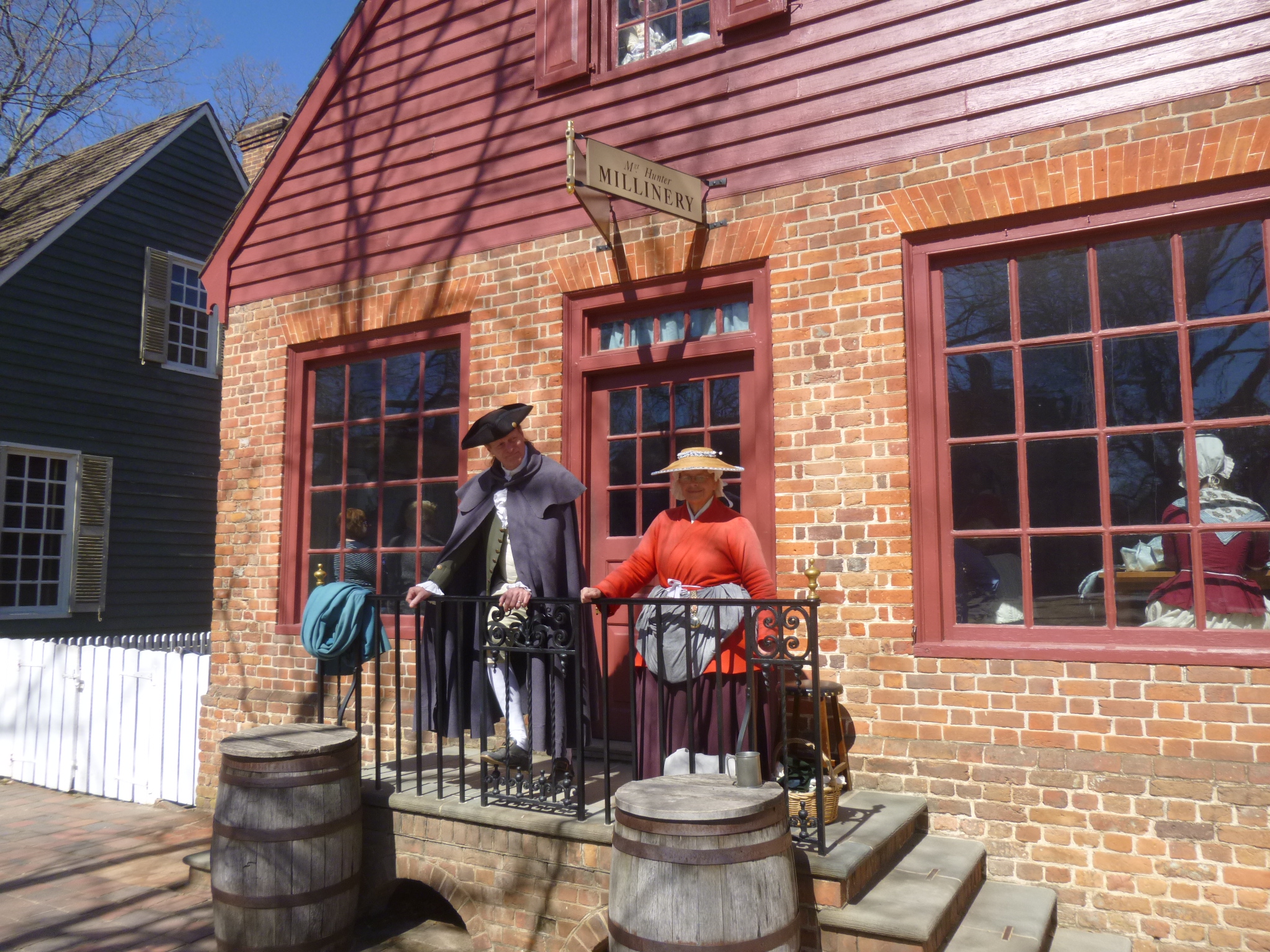
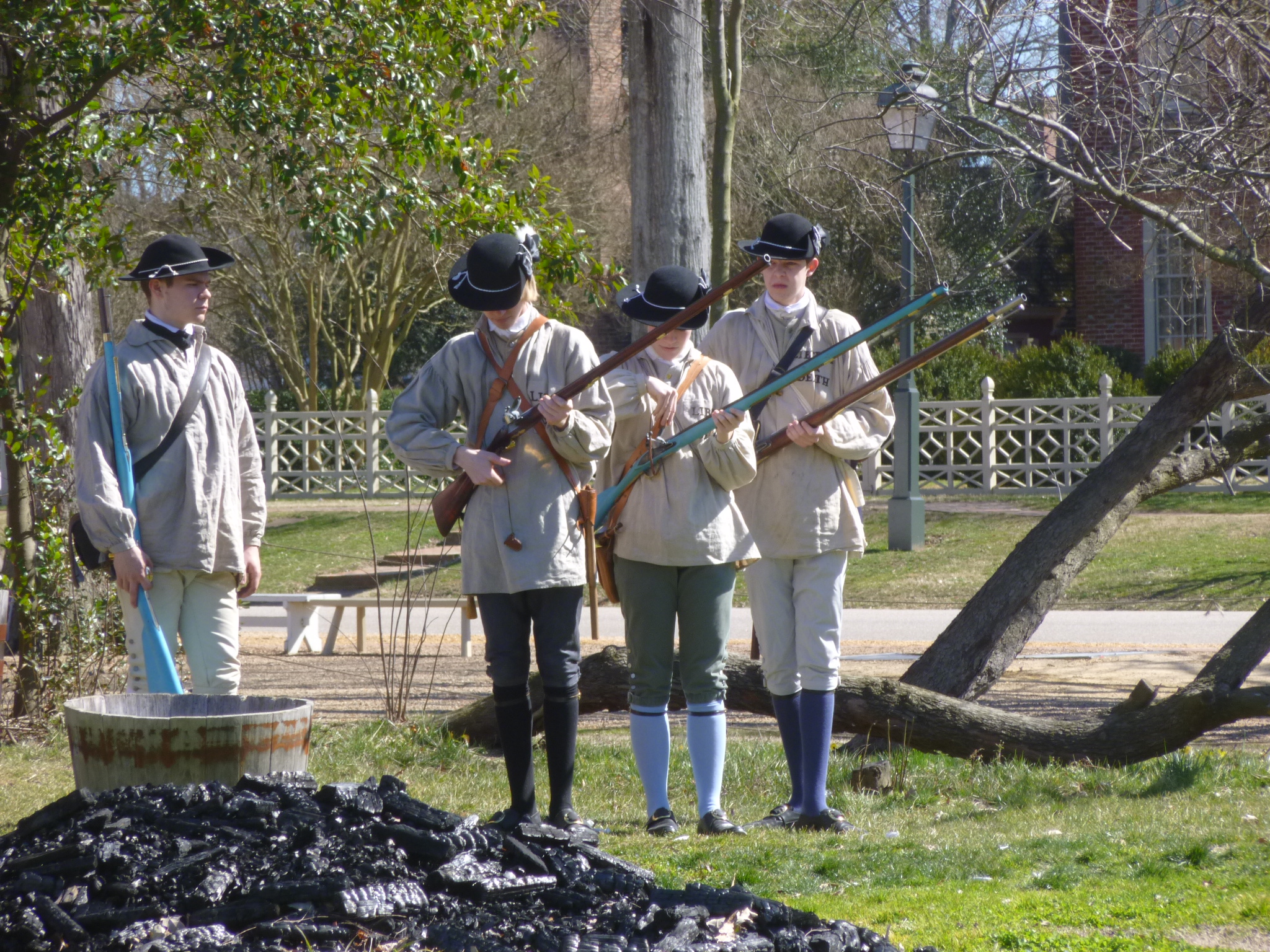
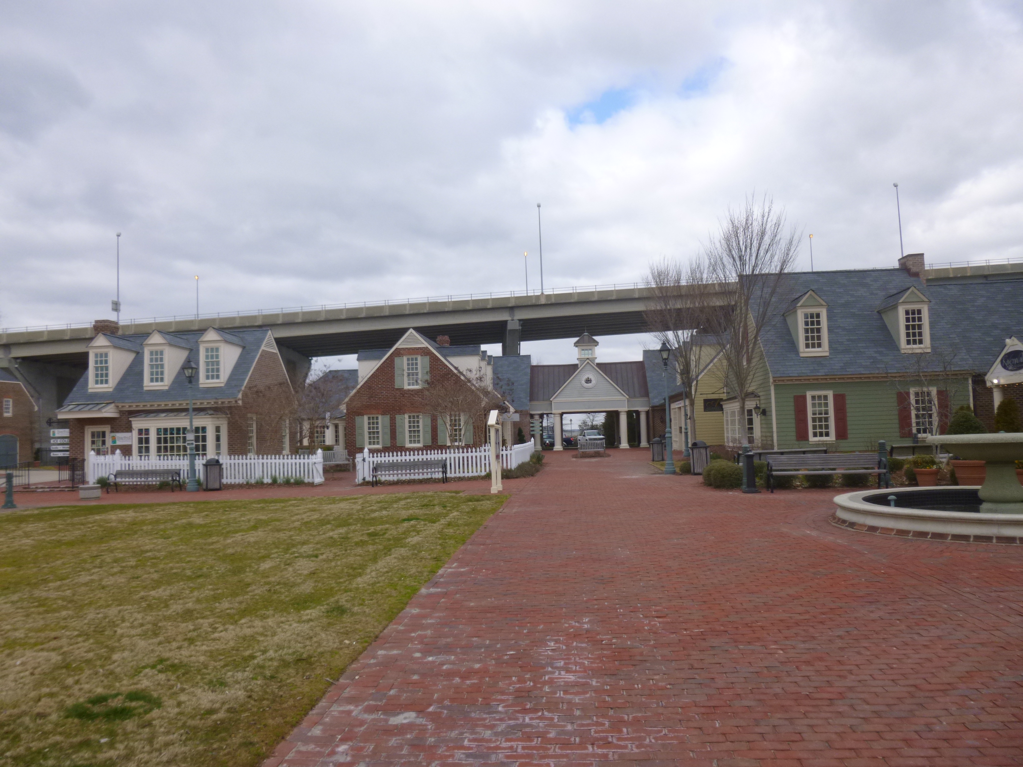
I headed back to Williamsburg after getting a little taste of it last night, and was surprised to see how many people there were for early March. The whole town of Williamsburg is basically an outdoor museum, and all the shopkeepers and other employees were dressed in period clothes. There was a farmer’s market going on down at one end of town, and horse drawn cart rides, and musket-firing, and people working in a garden. Tula and I walked nearly 5 miles all over the place, and even walked through part of the William and Mary College campus, which was nearby. The college also fits in with all the colonial era buildings – it’s a beautiful campus. I’m glad I was able to enjoy Williamsburg before peak tourist time when thousands of people are roaming around!
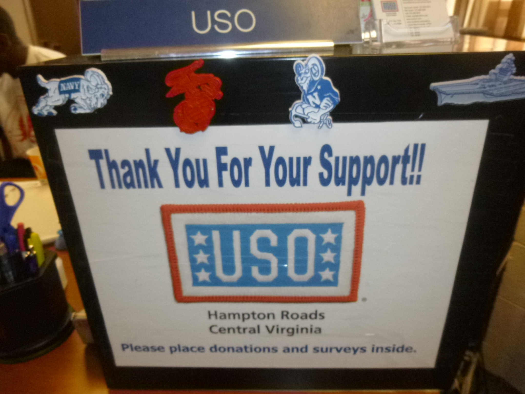
Then I had a short drive to the USO at Fort Eustis, which was going to be my final donation place for Virginia. Since I didn’t have any military ID at the checkpoint, I has to circle around to a different entry, where cars were searched. They took all the stuff out of the car ahead of me, and I thought if they were going to unload my whole van, this could take a while. I explained where I was going, and that I was on the road for a year so I was kind of loaded down, and that didn’t seem to bother them – he told me I’d be surprised at what they see in cars! I had to open all the doors and the back, and they kind of poked around, and then said I was clear to go in. The base is big – pretty much a self-contained town – and it was interesting to drive around. I found the USO building and soldiers were in there, and I met the volunteer at the front desk, and the new director Sarah, who had recently taken over. She told me a bit about the local USOs and some of what she hopes to accomplish, including getting some more computers for the troops to use, especially since they have some computer requirements – it sounds like there’s frequently a line of troops waiting to use them. I got a little turned around leaving the base, and exited out of a different gate, but was soon on my way again.
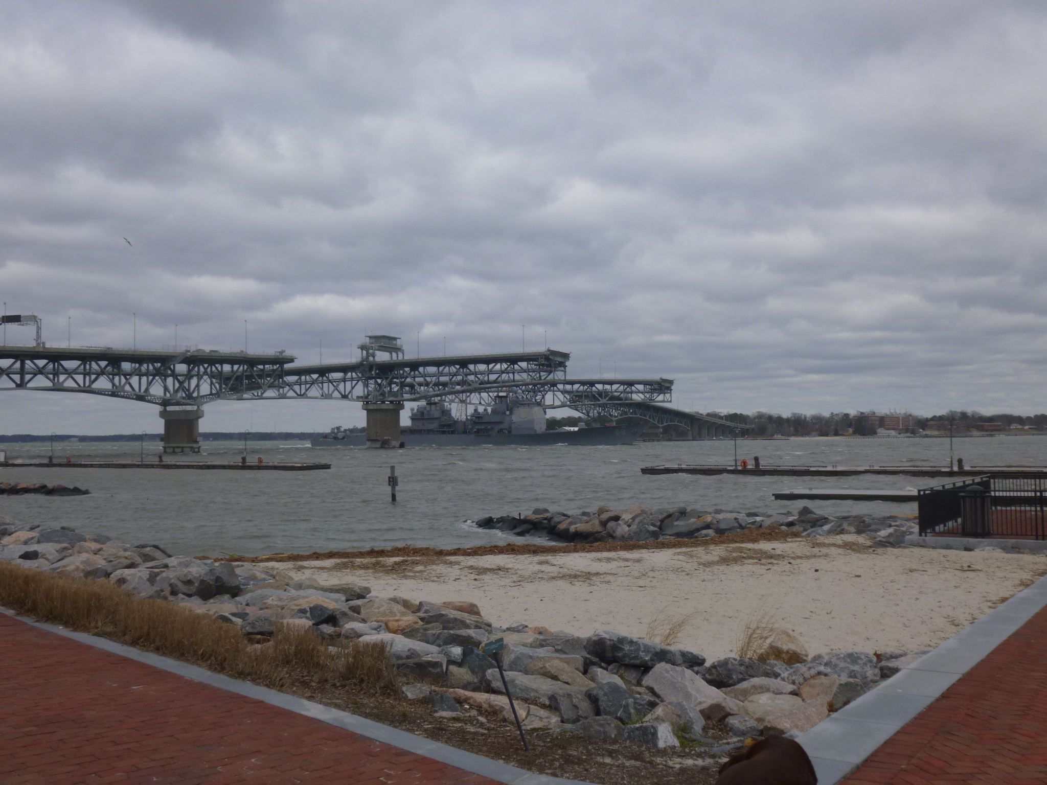
My time in Virginia was winding down – I only had a couple more miles to walk, and for those I was going to head across the Chesapeake Bay Bridge-Tunnel onto the little peninsula of land that is part of Virginia across the Chesapeake Bay. I was intrigued by the fact that a bridge turns into a tunnel and back again – one of my nephews, Sam, and girlfriend Sydney told me about it when they had taken a trip to this area. And it’s an interesting bridge – 20 miles long, mostly across a trestle sort of causeway, and then it descends into a tunnel 2 different times when it goes under 2 of the navigation channels, and then it goes up and over 2 other navigation channels like a normal bridge. If there wasn’t a $12 toll I would have driven across and back again! There were about a dozen freighters anchored off the east side of the bridge and it made me curious why they’re all sitting there – waiting for their turn to unload cargo? weather-related? break for crew? I’ve never seen so many freighters in one place and it makes me wonder how all that sort of stuff is scheduled.
Then I was in the quiet east shore side of Virginia – part of the Delmarva Peninsula because there’s part of Virginina, Maryland and Delaware there – geopgraphically it looks like it should be its own separate state, but I imagine each of the states wants to claim as much Chesapeake Bay shoreline as they can! After all the traffic in the cities and all the historical parks, this part of Virginia seemed very quiet and a little forgotten. I stopped in Cape Charles to finish my walking along the bay, and then enjoyed a pretty drive through the little peninsula. Since I was now done with Virginia, I was simply going to cross the border into Maryland, but I couldn’t resist stopping for the night on Chincoteague Island, right by the border.


Virginia – Friday, March 8
After seeing all those Coast Guard trainees last night, I was inspired to make a donation to them. I would like to have met them after their training exercise out on the cold water with hot coffee and hot chocolate, but since that wasn’t possible, I tried to read up about the training facilities a bit. There were no links for community help or donations or anything, so this morning I called them, and the security officer thought it sounded like a nice idea, and he transferred me to the gym area in the recreational building, which is part of their MWR program (for Morale, Well-Being and Recreation – and where special activities sometimes take place), so I was going to go through security and leave the donation in the gym. But when I got there and went into the security office, they told me they were unable to accept the donation after all, because there would be so much red tape with it – it would have to go to the company commander and on and on – and it just became too complicated. And that didn’t make sense to some of them either, but, no donation for the Coast Guard Training Center. I guess it’s the thought that counts!
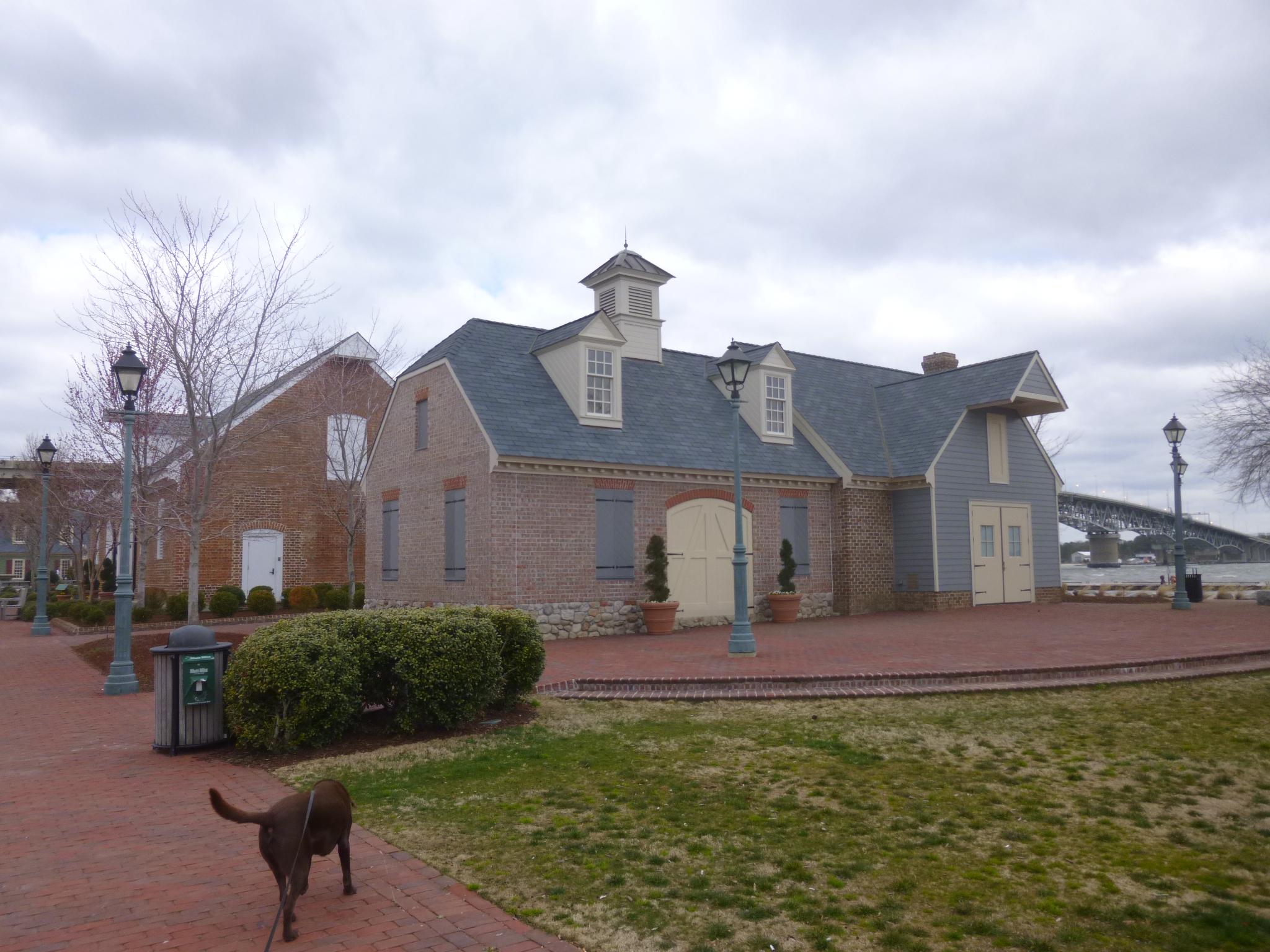
After that, Tula and I walked a couple miles around Yorktown by daylight – and watched a big ship come under the drawbridge, which had to be opened.
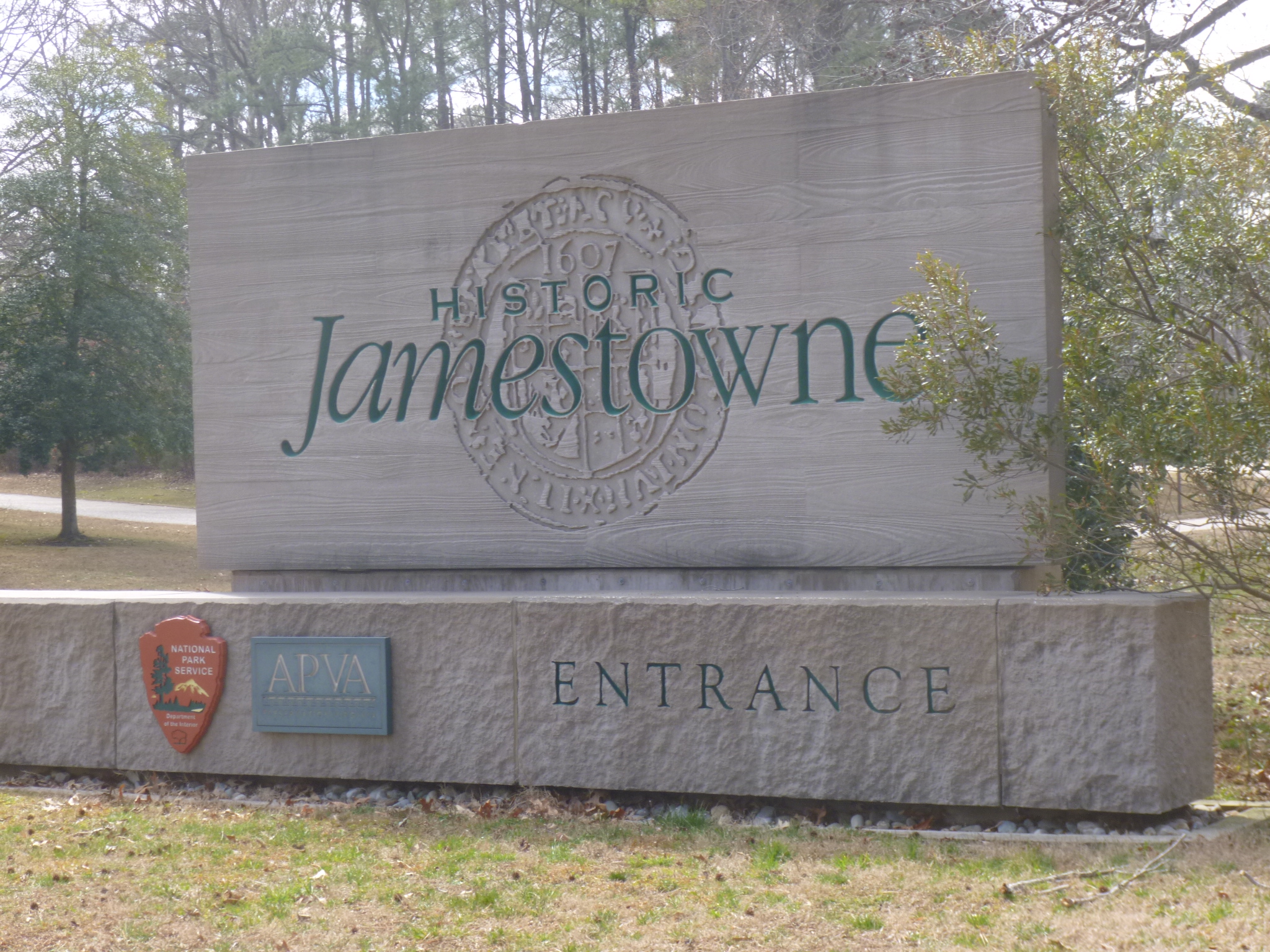
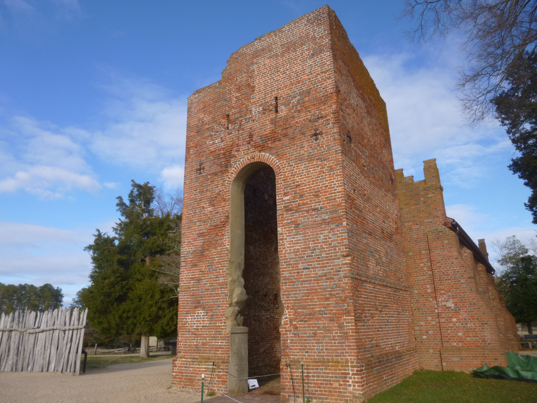
Then I headed for Jamestown. There are 2 Jamestown places to visit – one is Historic Jamestowne, which is the actual site of the fort and original colony, located on an island that is reached by crossing an isthmus. And the other is Jamestown Settlement, which is a recreation of the ships, and forts, and people dressed in 1700s clothes demonstrating life back then. I knew I wouldn’t have time to get to both, and I opted for Historic Jamestowne – being able to walk where America’s first settlers lived and walked was the big draw! Historic Jamestowne is a national park site, and after a quick stop in the visitor center, I scurried out to join a ranger-led tour that had just left. The ranger was very enthusiastic with his settlement story, and I really enjoyed the tour. When the settlers first arrived in 1607 (13 years before New England settlers), they apparently knew they wanted to settle on the James River, and it had also been suggested that they leave the “naturals” (their word for Native Americans) alone, and not take their space. But the “naturals” seemed to be living near all the desirable land on both sides of the river, so the new settlers stayed on their ships for a few days to figure things out. In the end, they decided to build their settlement on the only “vacant” ground they could find – an island in the middle of the river. Which, as they discovered later, had no fresh water and was bug-infested, causing a lot of illnesses. And, it happened to be the hunting grounds for all the Powhatan Indians. So there were many challenges and nearly half of the original settlers died. Originally the settlers lived in a small fort for protection; later they moved a few hundred yards down the island to New Town, and there are still foundations of the homes built in New Town. One of the original “roads” from the fort to the New Town is still there, and I enjoyed walking on a 400 year old road. The only original structure still standing is a church tower. But it’s big and still looks sturdy, which is pretty amazing considering how old it is. The nearby reconstructed church has the original foundation stones under glass by the pews. The ranger also talked about Captain John Smith, and debunked the myth that he and Pocahontas had a romantic relationship as suggested in the Disney movie – which I watched numerous times when the girls were young! When 27 yr. old Capt. John Smith was settling Jamestown, Pocahontas was a girl of 11 and there was no romantic attachment. When he returned to England years later, he left the colony in the care of John Rolfe, and he married Pocahontas, who by then was 18 or so. It is said to be America’s first interracial marriage.
I did quite a bit of walking on the park grounds, and Tula and I also walked around the 3 mile auto route on adjoining parts of the island, which in its natural state looked a lot like it did when the colonists first arrived – not very inviting! I went back to the park grounds for a little more walking, and then ran out of time to go to the “archearium” to see some of the 1 million artifacts that have been discovered since 1994, when the Jamestown site was rediscovered. Before the 1990s, it had been determined that the original ground that the Jamestown fort stood on was out in the middle of the river due to all the natural changes over 400 years. But a very determined scientist set out to prove them wrong, and sure enough, all the recent excavations have proved that the site is not under water and the original post ends for the fort were found, along with artifacts they continue to uncover.
Since I’m on an American journey, and Jamestown was the first American settlement, it was only logical to make a donation to Preservation Virginia, the organization which is overseeing the excavation of all the Jamestown artifacts!
By this time I only had a little over 1/2 hour to meet up with my cousin Sandra in Williamsburg, where we were going to have a light dinner at one of the old taverns. On the way there, Tara called and I was talking with her, and getting a little lost finding the restaurant I was heading for, so it was safer to just find a place to pull over while I talked. I pulled into a bank parking lot while we finished out phone conversation, and when we were done, I turned the corner at the bank to get back on the road, and saw some girl scouts with a table set up selling cookies! I knew it was Girl Scout Cookie Sale time again, and I had told myself that I would stop at the first group of girl scouts I saw, to buy one box of cookies, and make a donation. And that’s what I did! The girls, and the 2 moms with them, were really excited about the donation, and they had some questions about what I was doing, and we took some pictures. They have some fun plans for Troop 1231, and I’m happy they were the girl scout troop I ran into first. That was unexpected, and a fun stop even if it made me a little late for dinner! I hope you girls sell lots and lots of cookies – I would have bought more, but then I would have eaten them all and that’s not a good thing!!
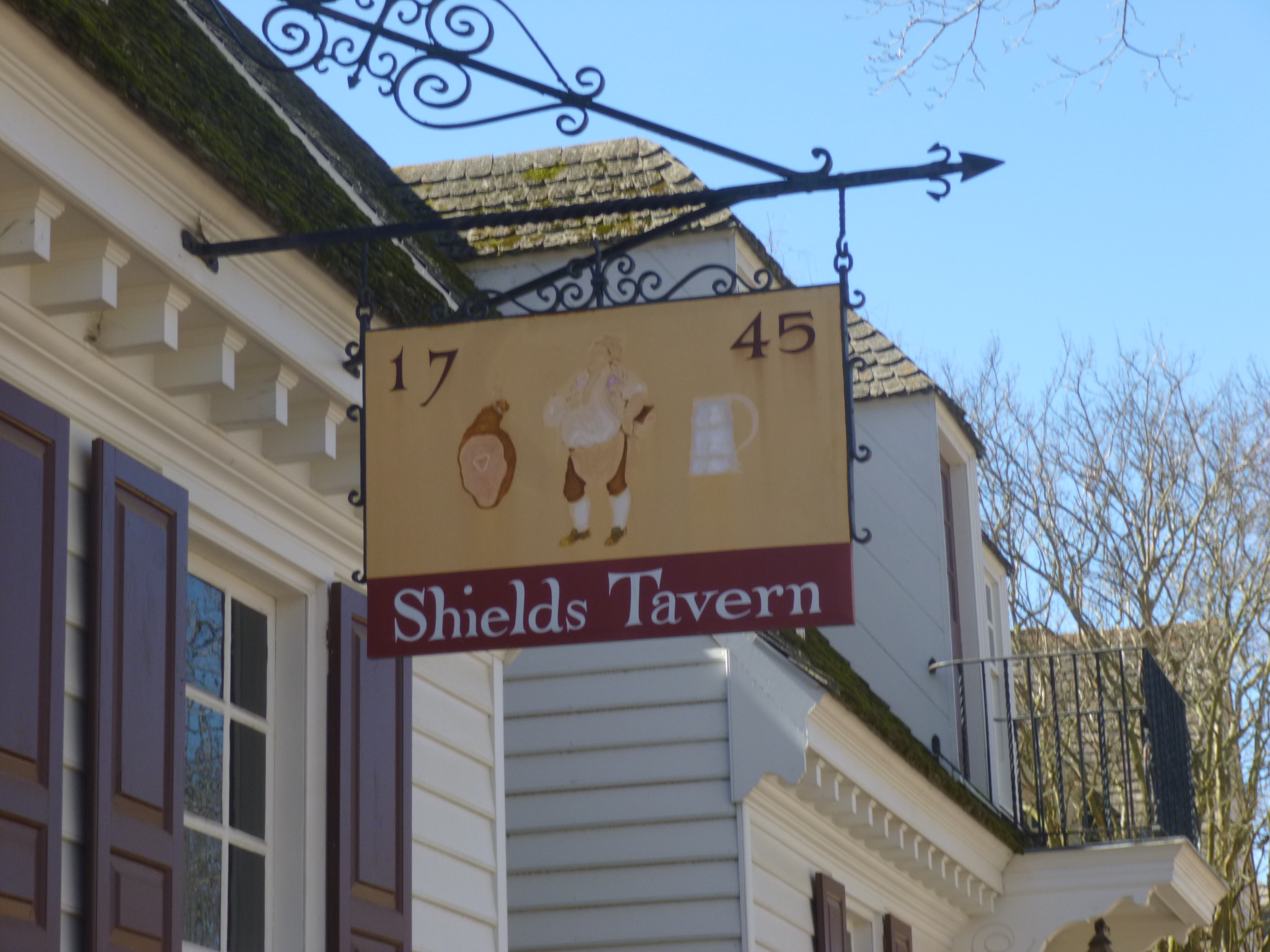
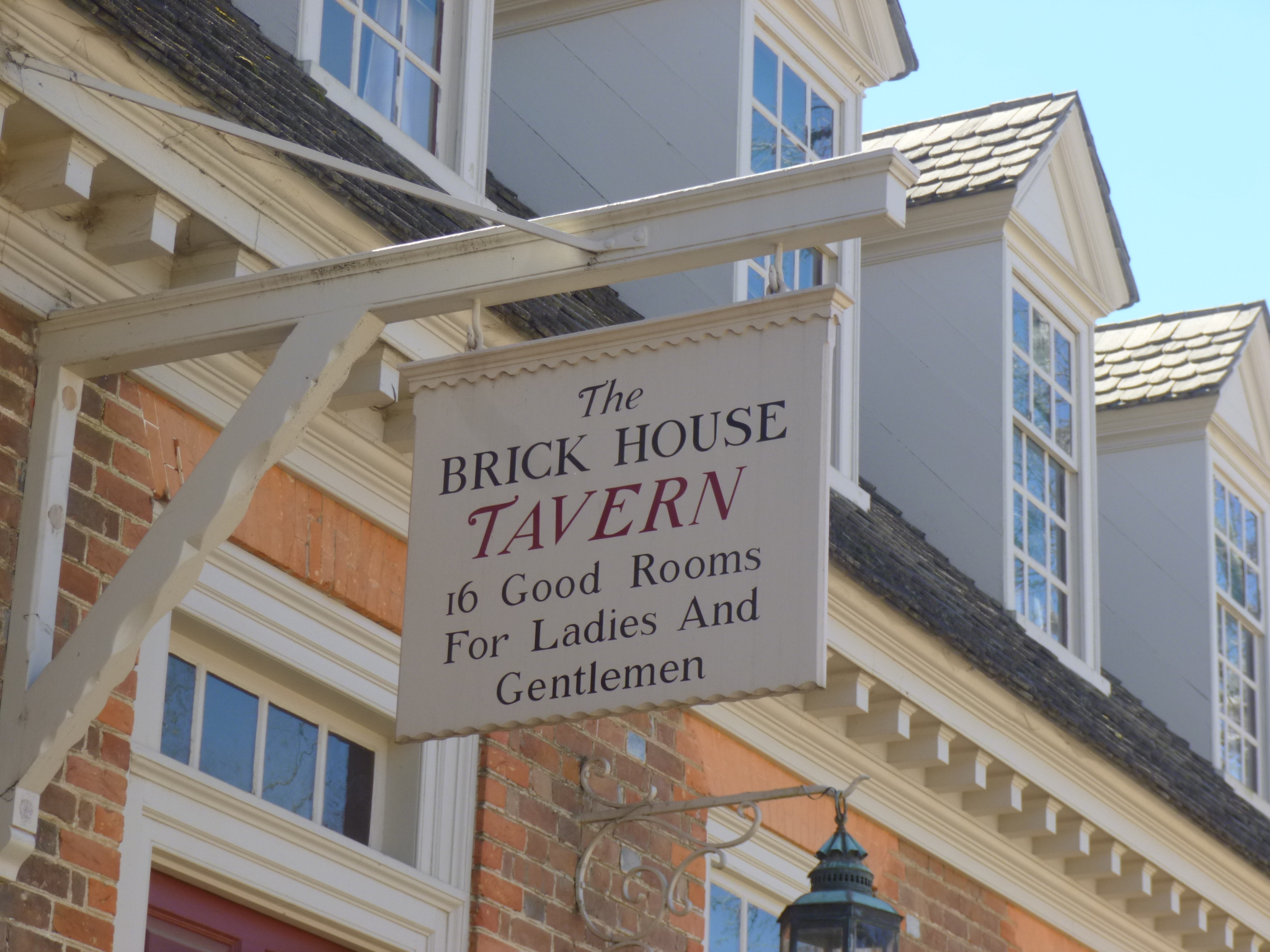
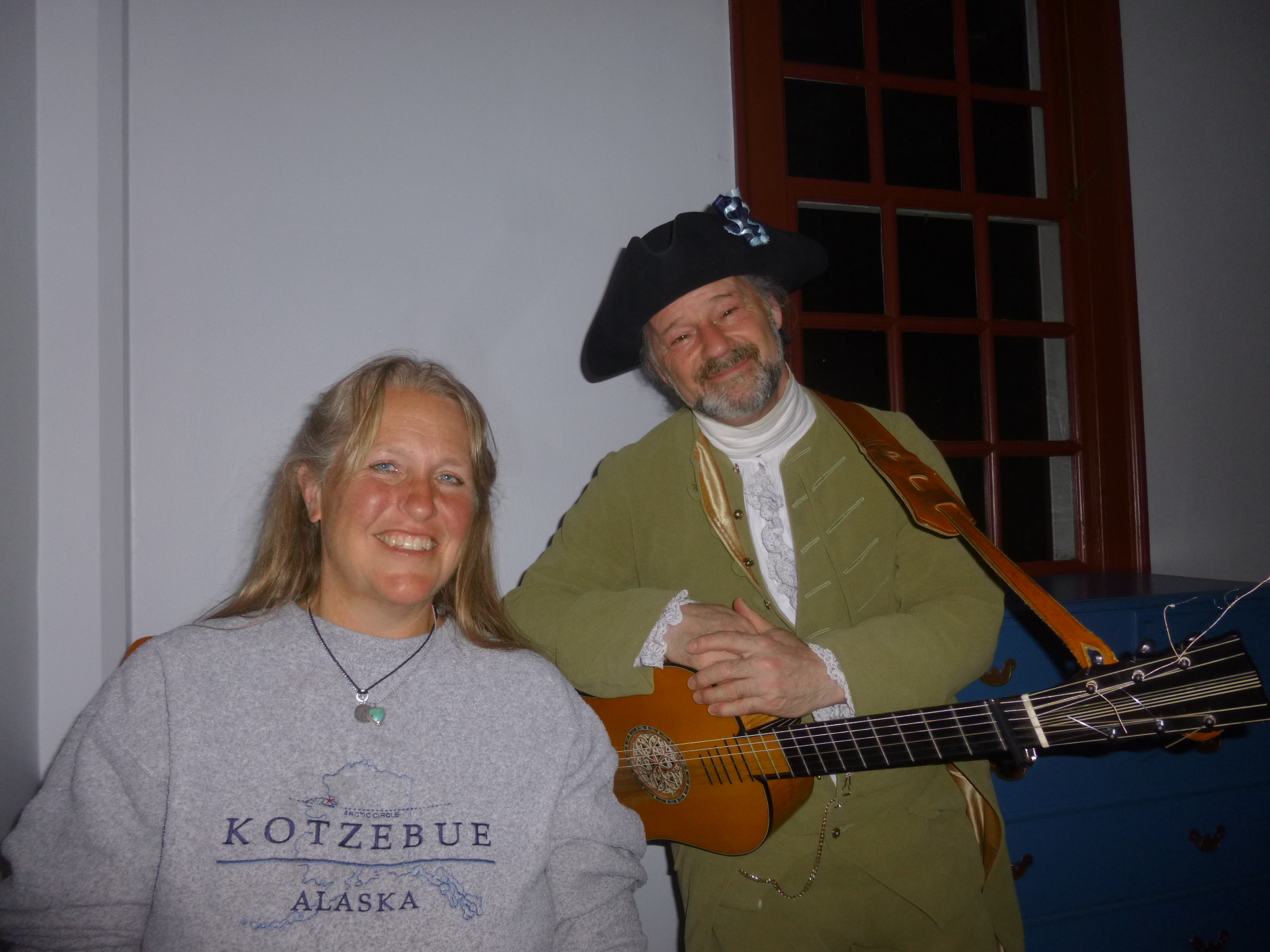
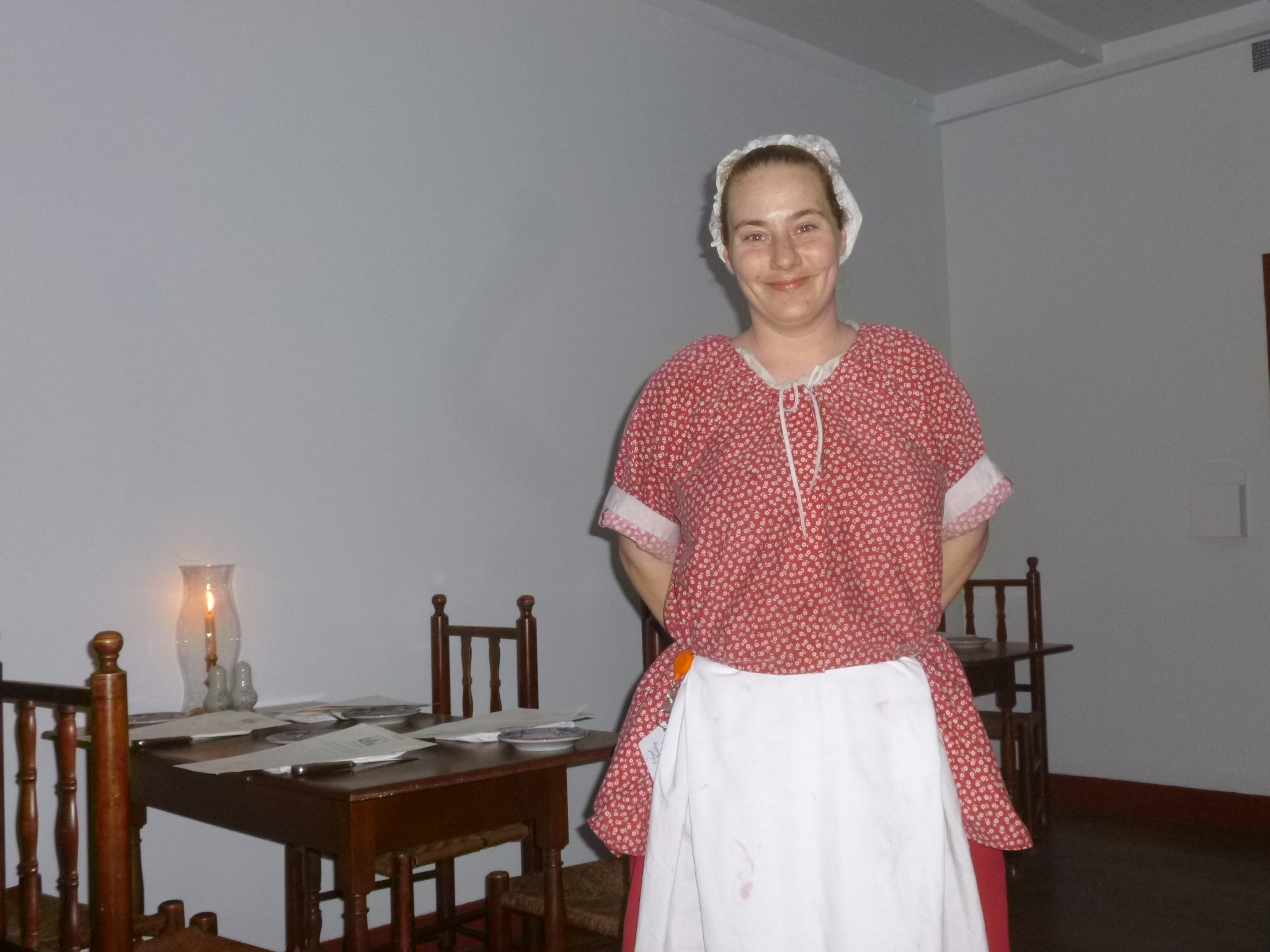
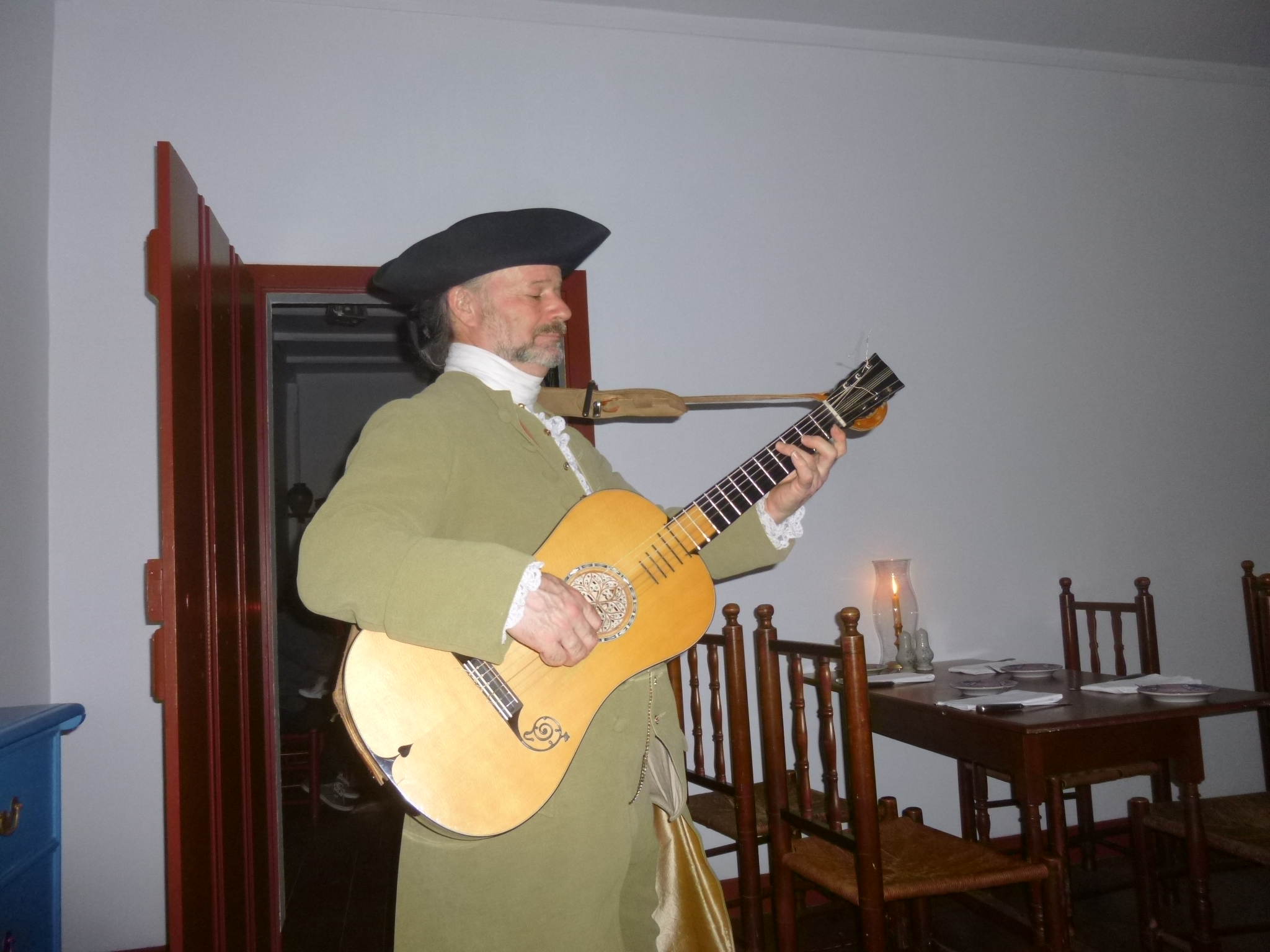
Sandra and I were able to get a table at Shields Tavern in historic Williamsburg, and they try to make the dining experience as authentic as possible for the mid-1700s. The tavern rooms were in an original building with a lot of small rooms and the only light was candlelight. All the servers were wearing 1700s clothing, and there was a guy playing an old Stradivarius guitar (I associate Stradivarius only with violins, but that isn’t the case) and singing songs from the 1700s – one of which was Shenandoah which started as a sea chantey before migrating to the mountains. We had some really good soup (actually a shrimp/crawfish stew but it was like a thick tomato soup) and bread and yummy fresh berry crisp for dessert. Our server told us the history of the rooms we were in, and it felt like we really were back in the old days! We had spent a lot of time in the restaurant and it had gotten late, and they were getting ready to close. It was great having dinner 2 nights in a row with a cousin I don’t see as often as I’d like to 🙂 I only saw a little of Williamsburg when I drove in, and I loved what I saw, so my plans for tomorrow abruptly changed!


Virginia – Thursday, March 7
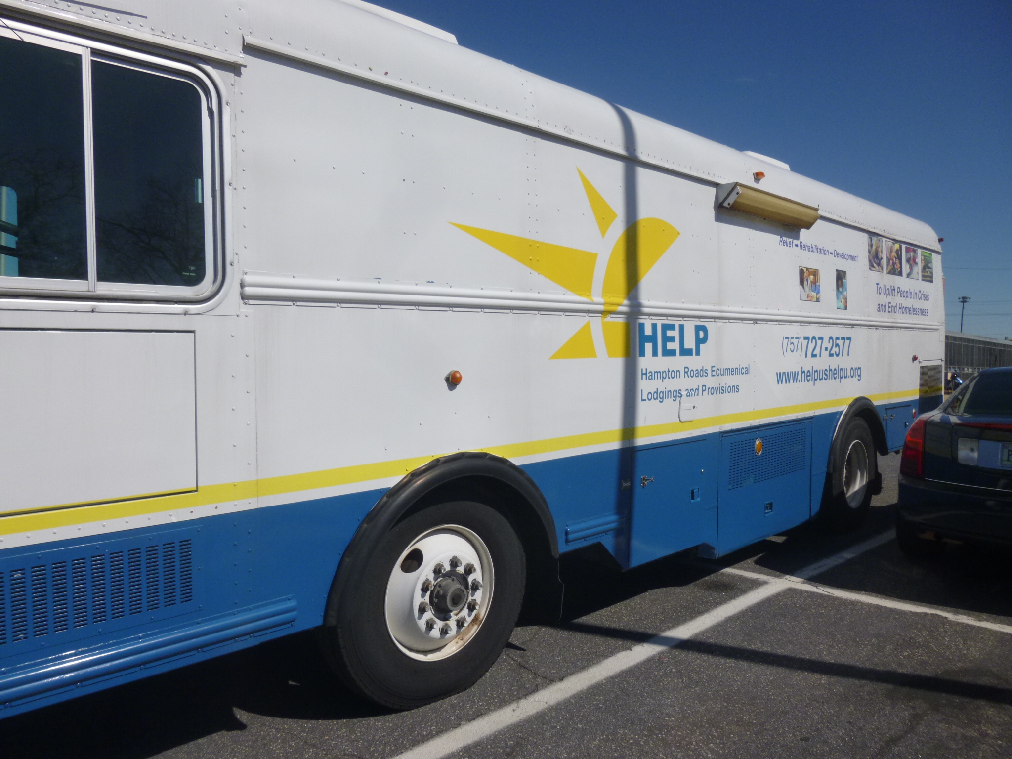
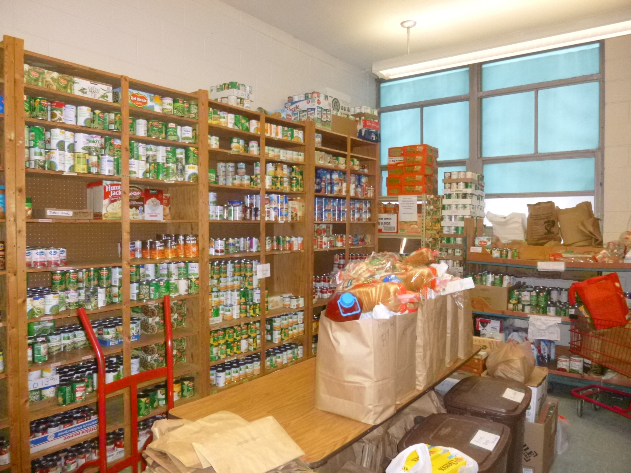
Last night I researched some donation possibilities in the area, and found one right close to where I ended up. It’s called HELP, which is an acronym for Hampton Roads Ecumenical Lodging and Provisions. They’ve been helping homeless people for over 30 years, and are located in the Department of Social Services Building, but they have a big space of their own. There’s a food pantry, and numerous medical and dental exam rooms for the 500 patients who are seen by volunteer doctors and nurse practitioners and other medical personnel. I met one of the directors of the program and she showed me all around. She also told me about a cooperative effort among 28 churches in the city, which each take a different week to provide sleeping space and food for the homeless people, to get them through the colder months. The community center provides sleeping mats and the church volunteers provide dinner and breakfast, so there’s a lot of nice teamwork going into that effort. HELP was a busy place, and I put my donation toward the medical/dental part of the program.
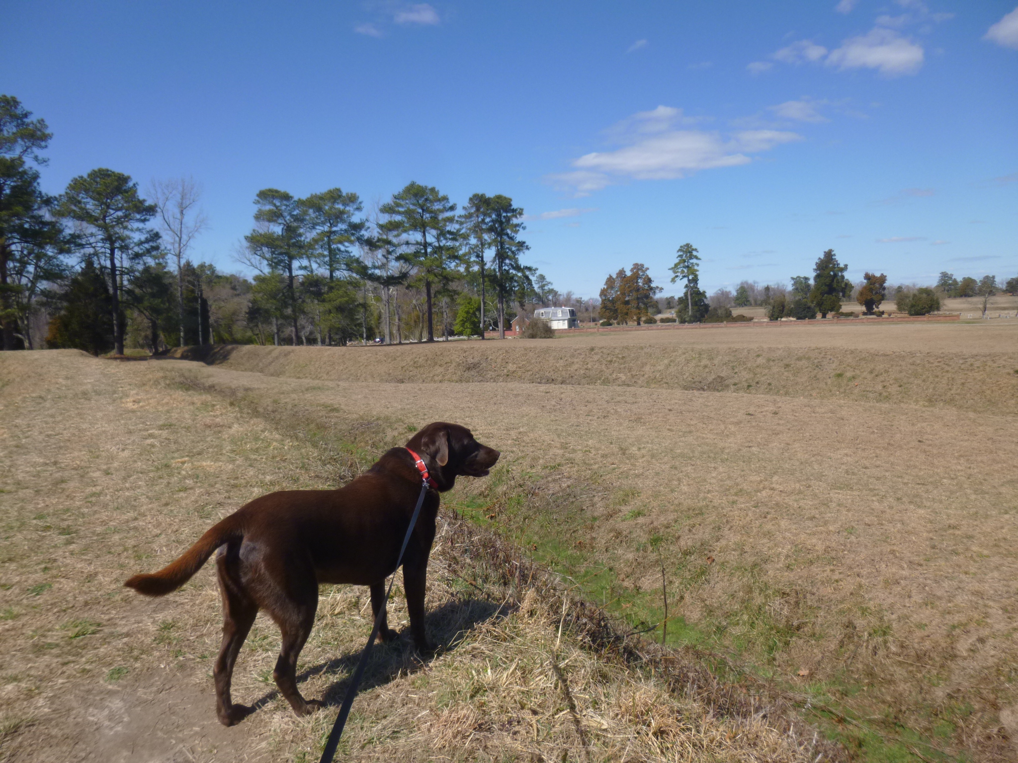
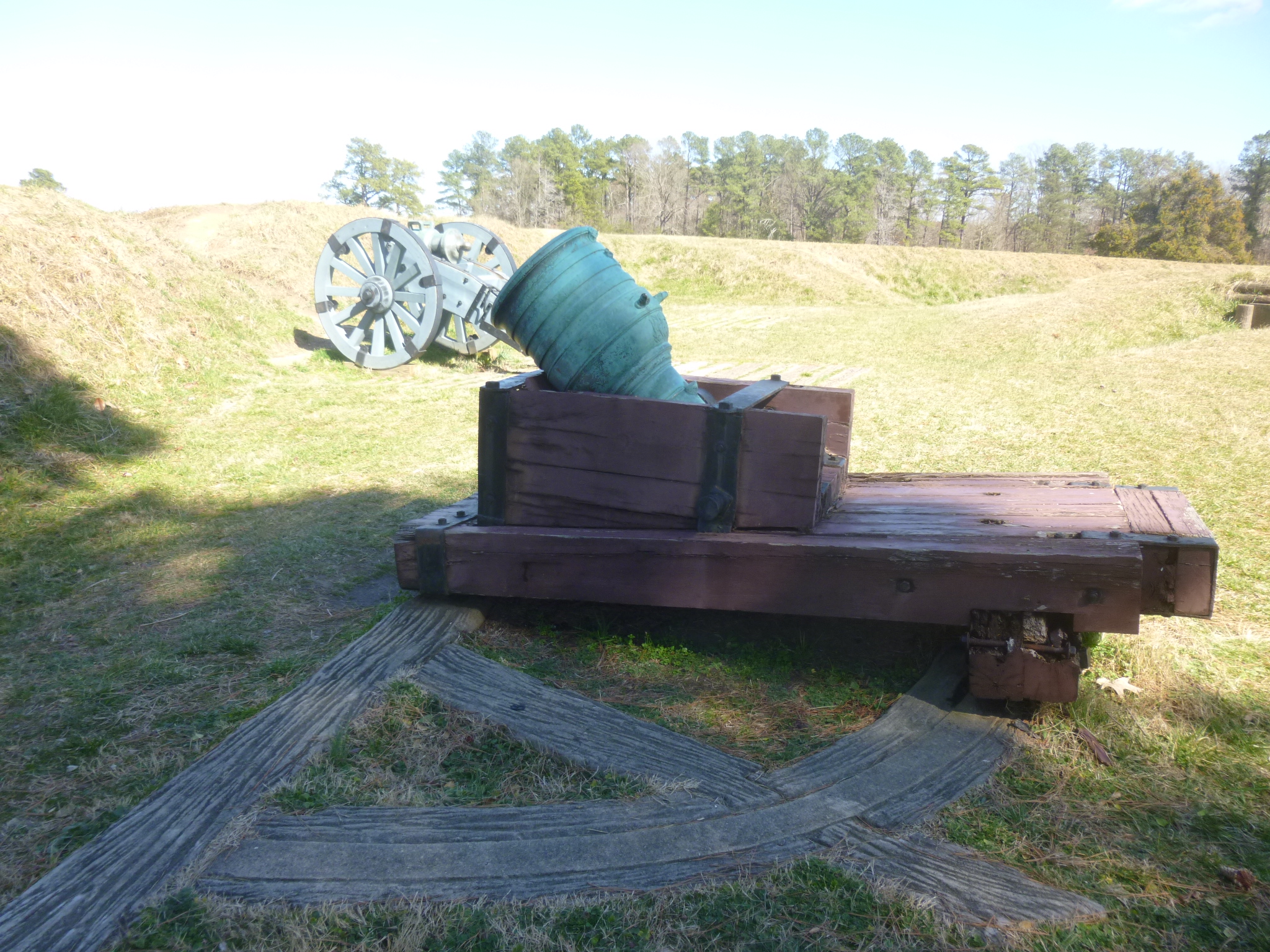
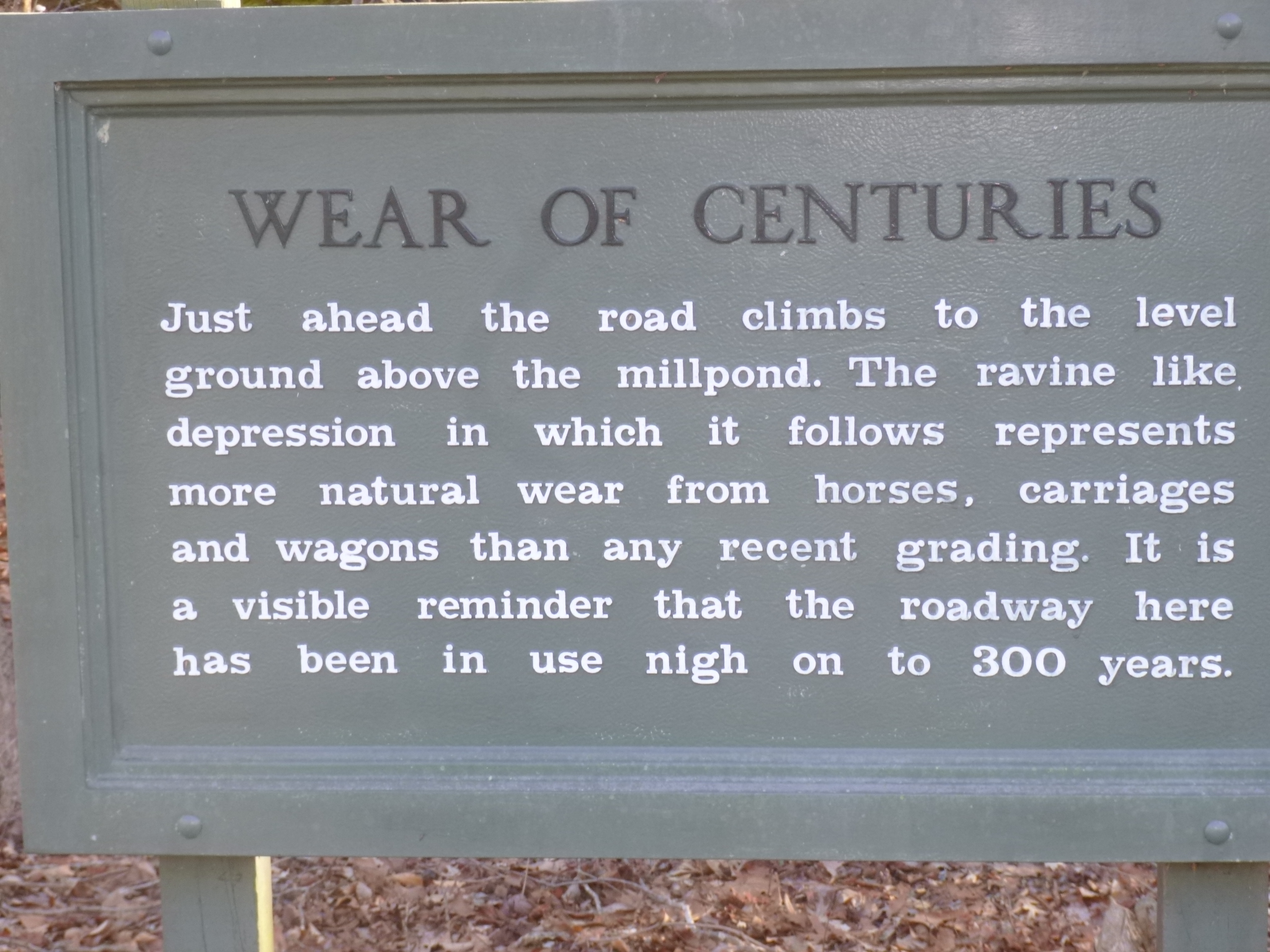
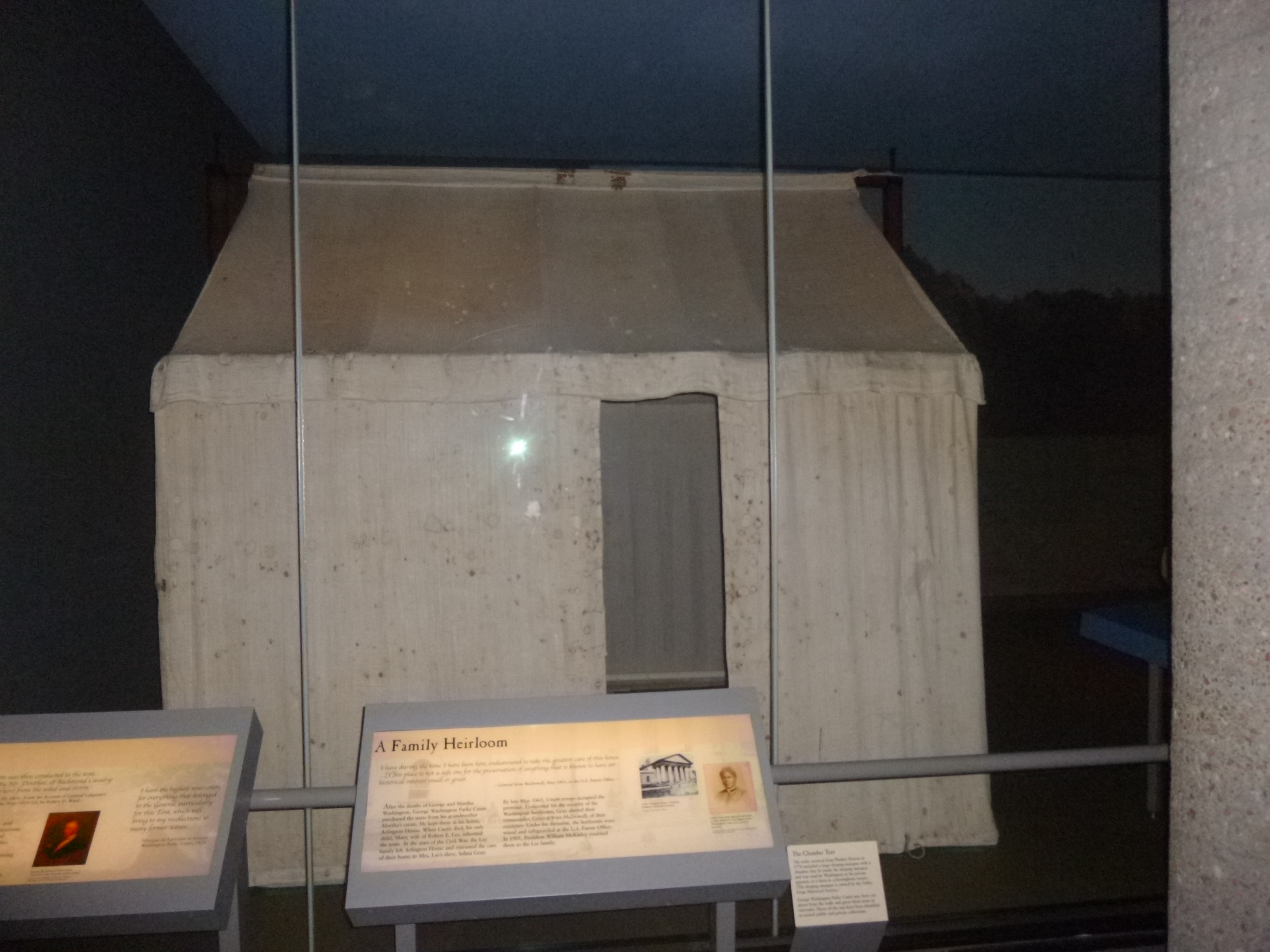
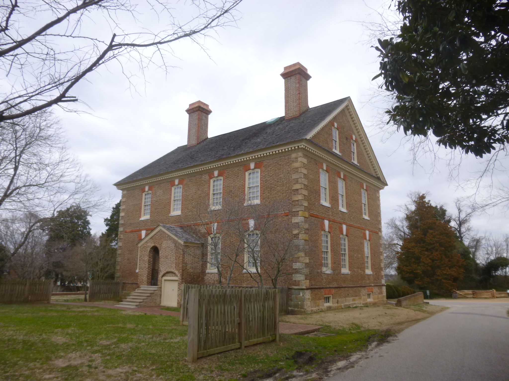
Then I drove toward Yorktown and stopped to get a map at the Yorktown National Battlefield. Tula and I did a lot of walking on the battlefields, and my brain had to switch gears from Civil War history to American Revolution history. Yorktown was the site of one of the last battles of the American Revolution. Again, trenches and siege lines were visible, and we walked by the encampment sites. George Washington brought his troops down from New York for this siege, and to be walking on battlegrounds that George Washington had walked on is a pretty amazing feeling of history. One of the little roads we walked on has been in continuous use for over 300 years – even before the American Revolution. I eventually made my way back to the Visitor Center so I could watch the video and look at the exhibits. The actual tents that George Washington used are set up and displayed under glass – somehow they survived despite use in the years following the war. I think they’re the only 18th century military tents in existence.
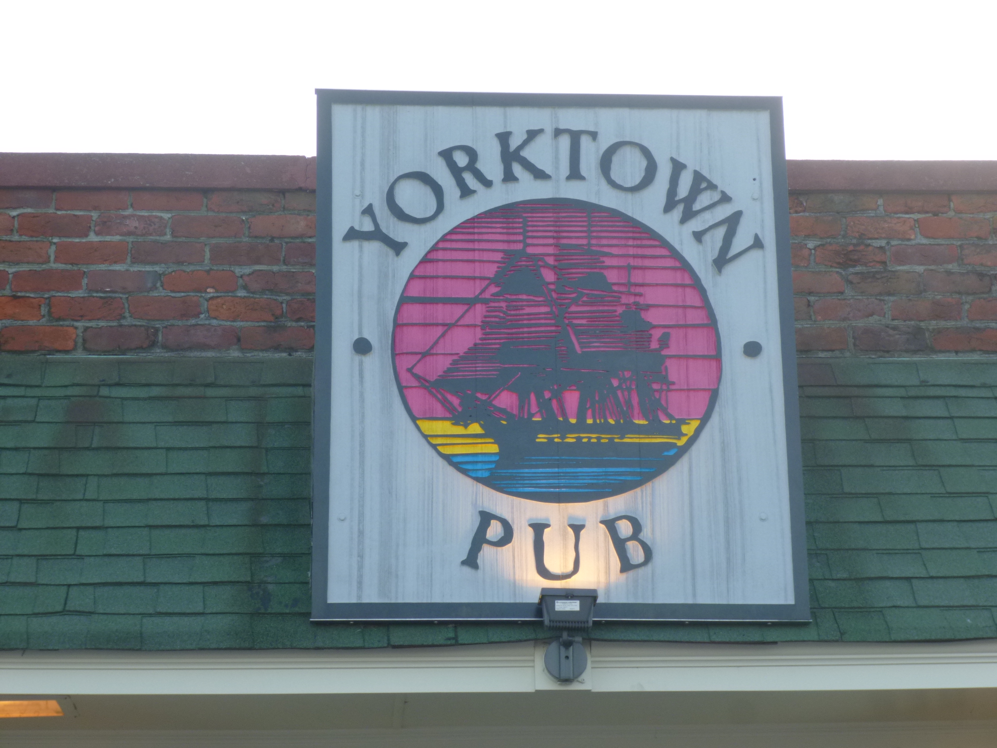
Then I headed for the actual town of Yorktown, a wonderful old historic place. One of my cousins, Sandra, lives just outside of Yorktown and we met up for dinner at the Yorktown Pub, which opened back in the 1940s as The Ancient Mariner’s Inn. We enjoyed some good food and getting caught up. While we were there, a large group of coast guard trainees came in for dinner all dressed in their foul weather gear. They left about the same time we did, and we could see them heading to 4-5 small patrol boats. One of them told us they were headed out for a nighttime training exercise, and it was not a nice night to be out on the water! It was only about 42 degrees out and windy, but that’s part of their training – gotta give them credit! Even though it was kind of dark and windy, Sandra showed me around town a bit, and it’s always nice to hear about things from a local person! Then we went back to her condo for ice cream and more visiting, and her son Matthew joined us too. It was a really nice evening.